Coille nam Fiadh

Downs, Moorland in Argyllshire

Scotland

Coille nam Fiadh

Toward Rubha nam Fear headland
Toward Rubha nam Fear headland Credit: Tony Page

The requested URL returned error: 429 Too Many Requests

If you have any feedback on the listing, please let us know in the comments section below.

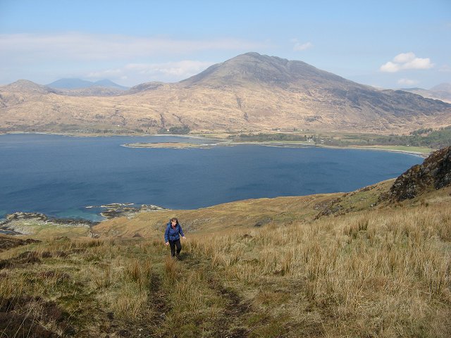
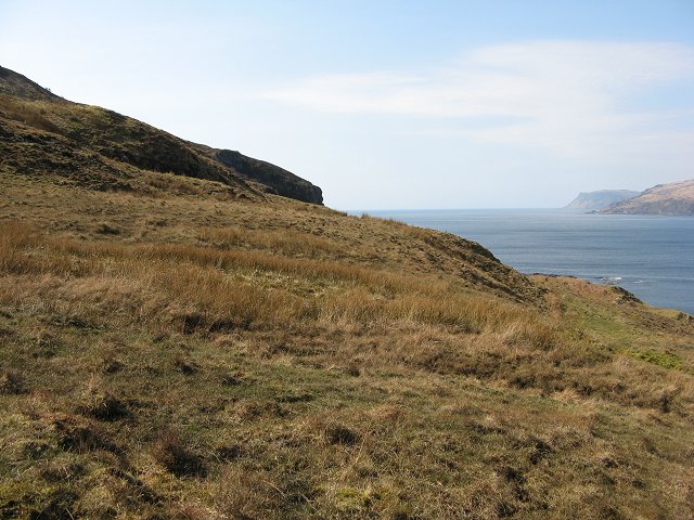
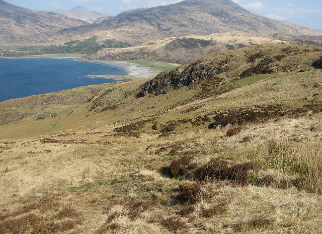
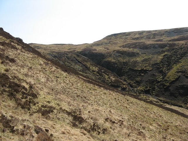
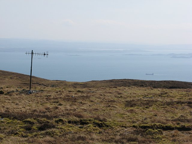
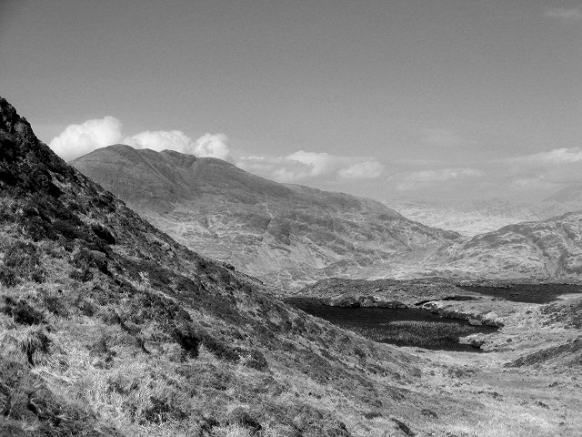
Coille nam Fiadh Images

Images are sourced within 2km of 56.329549/-5.8282748 or Grid Reference NM6321. Thanks to Geograph Open Source API. All images are credited.

Toward Rubha nam Fear headland
Mesozoic sediments on Rubha nan Fear The banded sedimentary rocks that form the lowest part of the cliffs of the southern tip of the Laggan peninsula, and Frank Lockwood's Island, predate the volcanic rocks which dominate most of Mull. These come from the Mesozoic era, and dip slightly northwards into the land. They had been uncovered and eroded before the great Tertiary volcanic eruptions which extended over much of the west of Scotland presaging the opening of the Atlantic Ocean. The overlying lava flows thus covered an uneven surface, basalt filling in dips and hollows in the original landscape. This unconformity sinks below sea level north of Rubha nan Fear, so all the more distant, grey, rock outcrops are basalt.
Mesozoic sediments on Rubha nan Fear
The banded sedimentary rocks that form the lowest part of the cliffs of the southern tip of the Laggan peninsula, and Frank Lockwood's Island, predate the volcanic rocks which dominate most of Mull. These come from the Mesozoic era, and dip slightly northwards into the land. They had been uncovered and eroded before the great Tertiary volcanic eruptions which extended over much of the west of Scotland presaging the opening of the Atlantic Ocean. The overlying lava flows thus covered an uneven surface, basalt filling in dips and hollows in the original landscape. This unconformity sinks below sea level north of Rubha nan Fear, so all the more distant, grey, rock outcrops are basalt.
West ridge of Druim Fada beyond trig point The ridge extending to the west from the cylindrical, 'Vanessa style', trig point.
Creach Beinn is the mountain in the distance.
West ridge of Druim Fada beyond trig point
The ridge extending to the west from the cylindrical, 'Vanessa style', trig point. Creach Beinn is the mountain in the distance.
Seascape off Rubha na Codha, Mull
Port Ohirnie, Mull
Port Ohirnie, Mull
Caibeal Mheamhair St Kenneth's Chapel has been used as a mausoleum by the MacLeans of Lochbuie since the start of the 18th Century. It has been much restored and features a very 1970's stained glass stars effect in the roof.
Caibeal Mheamhair
St Kenneth's Chapel has been used as a mausoleum by the MacLeans of Lochbuie since the start of the 18th Century. It has been much restored and features a very 1970's stained glass stars effect in the roof.
Breac Achadh A grassy strip allowing easy access to the hills of the Laggan Forest. Once arable land, with a common name meaning spotty fields. Ben More and Ben Buie in the background.
Breac Achadh
A grassy strip allowing easy access to the hills of the Laggan Forest. Once arable land, with a common name meaning spotty fields. Ben More and Ben Buie in the background.
Breac Achadh Grassland amongst the heather and rock of the Laggan Forest. View towards the cliff tops and Loch Buidhe.
Breac Achadh
Grassland amongst the heather and rock of the Laggan Forest. View towards the cliff tops and Loch Buidhe.
Maol Breac -achadh Rough grassland on the west side of Beinn a' Bhainne.
Maol Breac -achadh
Rough grassland on the west side of Beinn a' Bhainne.
Allt Shios Breac-achadh Burn about to plunge down a ravine towards Loch Buidhe.
Allt Shios Breac-achadh
Burn about to plunge down a ravine towards Loch Buidhe.
Beinn a' Bhainne The western slopes of Beinn a' Bhainne in the Laggan  Forest.
Beinn a' Bhainne
The western slopes of Beinn a' Bhainne in the Laggan Forest.
Allt Shios Breac-achadh Burn draining the south and west of Beinn a' Bhainne.
Allt Shios Breac-achadh
Burn draining the south and west of Beinn a' Bhainne.
Allt Shios Breac-achadh view of the burn from the slopes of Beinn a' Bhainne.
Allt Shios Breac-achadh
view of the burn from the slopes of Beinn a' Bhainne.
Beinn a' Bhainne The summit plateau and view to the south. There are an assortment of aerials up here including this television aerial with a long cable down to Laggan.
Beinn a' Bhainne
The summit plateau and view to the south. There are an assortment of aerials up here including this television aerial with a long cable down to Laggan.
Beinn a'  Bhainne, the summit Rock strewn summit of Beinn a' Bhainne - view eastwards towards Druim Fada.
Beinn a' Bhainne, the summit
Rock strewn summit of Beinn a' Bhainne - view eastwards towards Druim Fada.
Allt an Tiadhain The Allt an Tiadhain drains a glen on the south side of the Laggan Forest. The land is mostly grass covered.
Allt an Tiadhain
The Allt an Tiadhain drains a glen on the south side of the Laggan Forest. The land is mostly grass covered.
Lochan an Tobar Pair of lochans on Beinn a' Bhainne.
Lochan an Tobar
Pair of lochans on Beinn a' Bhainne.
Lochan an Tobar Ben Buie from the Laggan Forest.
Lochan an Tobar
Ben Buie from the Laggan Forest.
Show me another place!

Coille nam Fiadh is located at Grid Ref: NM6321 (Lat: 56.329549, Lng: -5.8282748)

Unitary Authority: Argyll and Bute

Police Authority: Argyll and West Dunbartonshire

What 3 Words

///roosters.amber.softly. Near Lochbuie, Argyll & Bute

Related Wikis

Moy Castle

Moy Castle is a ruined castle near Lochbuie on the Isle of Mull, Scotland. The site is now a scheduled monument. == History == The land upon which Moy...

Loch Buie

Loch Buie (Scottish Gaelic: Locha Buidhe, meaning "yellow loch") is a sea loch on the south coast of the Isle of Mull, off the west coast of Scotland....

Lochbuie, Mull

Lochbuie (Scottish Gaelic: Locha Buidhe, meaning "yellow loch") is a settlement on the Isle of Mull in Scotland about 22 kilometres (14 mi) west of Craignure...

Firth of Lorn

The Firth of Lorn or Lorne (Scottish Gaelic: An Linne Latharnach) is the inlet of the sea between the south-east coast of the Isle of Mull and the mainland...

Have you been to Coille nam Fiadh?

Leave your review of Coille nam Fiadh below (or comments, questions and feedback).