Gearraidh nan Annsgotan

Downs, Moorland in Ross-shire

Scotland

Gearraidh nan Annsgotan

Line of former dyke, Druim na Lige, Isle of Lewis The dyke is shown on the OS 1st edition six inch map published in 1852 and still appears on current (at the time of uploading) OS maps with a scale of 1:25,000 or larger.
Line of former dyke, Druim na Lige, Isle of Lewis Credit: Claire Pegrum

Gearraidh nan Annsgotan, located in Ross-shire, is a picturesque village nestled amidst the stunning Scottish Highlands. Situated in a region known for its rugged beauty, Gearraidh nan Annsgotan boasts a unique charm that attracts visitors from far and wide.

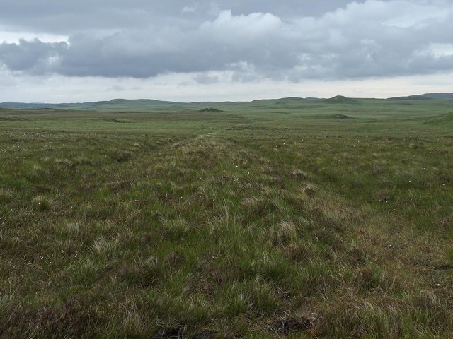
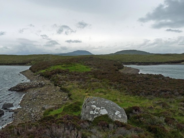
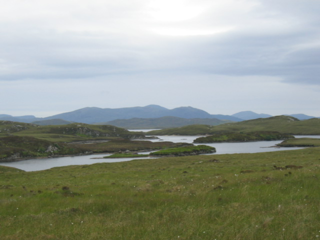
The village is renowned for its breathtaking downs and moorland landscapes. Rolling hills covered in heather and wildflowers stretch as far as the eye can see, providing a haven for outdoor enthusiasts and nature lovers. The diverse ecosystem supports a wide array of flora and fauna, making it a paradise for birdwatching and wildlife spotting.

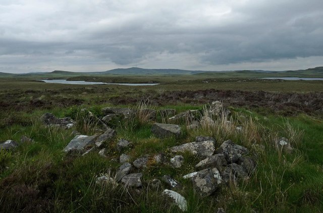
The area is also rich in history and cultural heritage. Ruins of ancient settlements and standing stones dot the landscape, offering glimpses into the village's past. The locals take great pride in preserving their heritage and often organize events and festivals to celebrate their traditions.

Despite its tranquil setting, Gearraidh nan Annsgotan is not entirely isolated. The village is well-connected, with nearby towns offering amenities such as shops, restaurants, and accommodation options. Visitors can indulge in traditional Scottish cuisine or explore local arts and crafts.

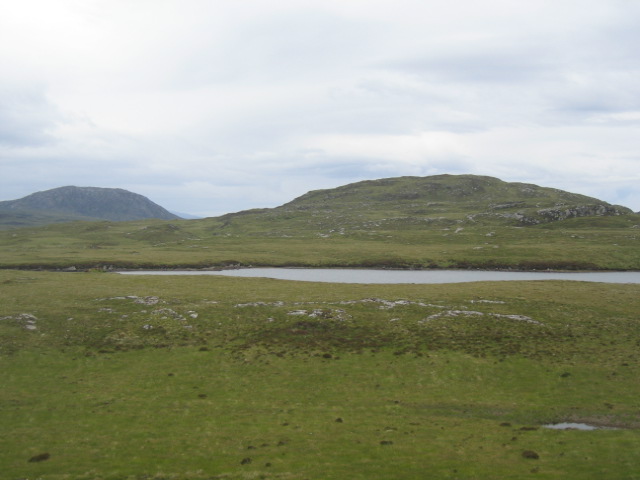
For those seeking adventure, the surrounding area provides ample opportunities for activities such as hiking, mountain biking, and fishing. The nearby lochs and rivers offer excellent fishing spots, while the trails winding through the moorland are perfect for exploring on foot or bike.

In summary, Gearraidh nan Annsgotan is a hidden gem in Ross-shire, offering breathtaking downs and moorland landscapes, rich history, and a welcoming community. Whether you are seeking tranquility or adventure, this village is a must-visit destination for nature enthusiasts and culture aficionados alike.

If you have any feedback on the listing, please let us know in the comments section below.

Gearraidh nan Annsgotan Images

Images are sourced within 2km of 58.124172/-6.6137658 or Grid Reference NB2824. Thanks to Geograph Open Source API. All images are credited.

Line of former dyke, Druim na Lige, Isle of Lewis The dyke is shown on the OS 1st edition six inch map published in 1852 and still appears on current (at the time of uploading) OS maps with a scale of 1:25,000 or larger.
Line of former dyke, Druim na Lige, Isle of Lewis
The dyke is shown on the OS 1st edition six inch map published in 1852 and still appears on current (at the time of uploading) OS maps with a scale of 1:25,000 or larger.
Stepping stones across the Abhainn Lacasaidh/River Laxay, Isle of Lewis The OS Name Book of 1848-1852 describes the Abhainn Lacasaidh as, "a large and rapid river which issues from Loch Threalabhall.  After a long course passing through Loch Bhaltois it empties itself into Loch Erisort".
Stepping stones across the Abhainn Lacasaidh/River Laxay, Isle of Lewis
The OS Name Book of 1848-1852 describes the Abhainn Lacasaidh as, "a large and rapid river which issues from Loch Threalabhall. After a long course passing through Loch Bhaltois it empties itself into Loch Erisort".
Shieling hut above Loch a' Phuill Chairistine, Isle of Lewis Shielings were moorland summer grazings for cattle.  Shieling huts (often also referred to as shielings) were dwellings located within the shieling.  They were usually occupied from May until the “flitting” in September.  In early May the men of a village would go onto the moor to check and repair the shieling huts.  They would be joined by the women and children for one night before the men returned to the village to tend to crops or to travel away for summer work such as fishing.  The women and children would spend the summer at the shielings tending the cattle and making cheese and butter, some of which was for immediate use but most was salted to preserve it for the winter.  Peat cutting for fuel would also be done.  Evenings would be spent making music and story telling.  Visits were made between the shielings of different villages.

The shieling huts were made from materials available in the immediate vicinity.  They usually had walls made of stone or turf, turf roofs and compacted earth or clay floors.  In coastal areas and on the islands rafters would be made from locally collected driftwood.  Usually there would be a single doorway, facing away from the prevailing wind (although some shieling huts have two doors opposite each other), and often no windows.  Furniture built into shieling huts included stone or turf beds covered with heather, turf seats and cupboards and niches built into the stone wall, often one above the door.  Other furniture would be carried out onto the moor for the season.  In places where the practice of using shielings continued into the 20th century, shieling huts can be found which are constructed making more extensive use of timber than in the traditional type, along with other materials such as tin and bitumen.  There are also examples of buses and caravans used as shieling huts.

The Clearances and ongoing changes in agricultural methods meant that the shieling tradition had generally ended by the close of the nineteenth century.  In places it continued for longer and, particularly on Lewis, some shieling huts are still used today during the peat cutting season and as summer retreats.

The remains of shieling huts can be seen as

changes in vegetation: <a href="https://www.geograph.org.uk/photo/1962348">ND1340 : Shieling site by the Allt a' Cheracher</a> ;
shieling mounds where successive shieling huts have been built on the same site: <a href="https://www.geograph.org.uk/photo/5238987">NB5059 : Shieling mounds by the Abhainn Dhail, Isle of Lewis</a> ;
footings: <a href="https://www.geograph.org.uk/photo/5027765">NB5357 : Shieling footings beside the Feadan Mòr, Isle of Lewis</a> ; and
more substantial remains: <a href="https://www.geograph.org.uk/photo/5238993">NB3040 : Shieling above Gleann Leitir, Isle of Lewis</a> .

Examples of modern shielings are shown at:

<a href="https://www.geograph.org.uk/photo/5238999">NB5458 : Shieling, Airigh A' Bhealaich, Isle of Lewis</a> and <a href="https://www.geograph.org.uk/photo/5048077">NB5458 : Disused shieling, Airigh A' Bhealaich, Isle of Lewis</a> .
Shieling hut above Loch a' Phuill Chairistine, Isle of Lewis
Shielings were moorland summer grazings for cattle. Shieling huts (often also referred to as shielings) were dwellings located within the shieling. They were usually occupied from May until the “flitting” in September. In early May the men of a village would go onto the moor to check and repair the shieling huts. They would be joined by the women and children for one night before the men returned to the village to tend to crops or to travel away for summer work such as fishing. The women and children would spend the summer at the shielings tending the cattle and making cheese and butter, some of which was for immediate use but most was salted to preserve it for the winter. Peat cutting for fuel would also be done. Evenings would be spent making music and story telling. Visits were made between the shielings of different villages. The shieling huts were made from materials available in the immediate vicinity. They usually had walls made of stone or turf, turf roofs and compacted earth or clay floors. In coastal areas and on the islands rafters would be made from locally collected driftwood. Usually there would be a single doorway, facing away from the prevailing wind (although some shieling huts have two doors opposite each other), and often no windows. Furniture built into shieling huts included stone or turf beds covered with heather, turf seats and cupboards and niches built into the stone wall, often one above the door. Other furniture would be carried out onto the moor for the season. In places where the practice of using shielings continued into the 20th century, shieling huts can be found which are constructed making more extensive use of timber than in the traditional type, along with other materials such as tin and bitumen. There are also examples of buses and caravans used as shieling huts. The Clearances and ongoing changes in agricultural methods meant that the shieling tradition had generally ended by the close of the nineteenth century. In places it continued for longer and, particularly on Lewis, some shieling huts are still used today during the peat cutting season and as summer retreats. The remains of shieling huts can be seen as changes in vegetation: ND1340 : Shieling site by the Allt a' Cheracher ; shieling mounds where successive shieling huts have been built on the same site: NB5059 : Shieling mounds by the Abhainn Dhail, Isle of Lewis ; footings: NB5357 : Shieling footings beside the Feadan Mòr, Isle of Lewis ; and more substantial remains: NB3040 : Shieling above Gleann Leitir, Isle of Lewis . Examples of modern shielings are shown at: NB5458 : Shieling, Airigh A' Bhealaich, Isle of Lewis and NB5458 : Disused shieling, Airigh A' Bhealaich, Isle of Lewis .
Isthmus between Loch nan Annsgotan and Loch Trealabhal, Isle of Lewis A stone dyke used to cross the isthmus, the remains of which can be seen on the shore of Loch nan Annsgotan to the left.
Isthmus between Loch nan Annsgotan and Loch Trealabhal, Isle of Lewis
A stone dyke used to cross the isthmus, the remains of which can be seen on the shore of Loch nan Annsgotan to the left.
Causeway between Loch Trealabhal and Loch nam Faoileag, Isle of Lewis Unfortunately, from my point of view, the causeway has a gap in the middle which requires wading through water approximately three feet deep to cross it.
Causeway between Loch Trealabhal and Loch nam Faoileag, Isle of Lewis
Unfortunately, from my point of view, the causeway has a gap in the middle which requires wading through water approximately three feet deep to cross it.
Gateway in fence above Loch Trealabhal, Isle of Lewis Looking towards Ceannmhuir Mhòr.
Gateway in fence above Loch Trealabhal, Isle of Lewis
Looking towards Ceannmhuir Mhòr.
Un-named Lochan Trealabhal Hill at 121m lies close to this small loch whilst Roineabhal Hill at 281m can be seen to the left of the frame. Some locals call it "Calum's Loch"
Un-named Lochan
Trealabhal Hill at 121m lies close to this small loch whilst Roineabhal Hill at 281m can be seen to the left of the frame. Some locals call it "Calum's Loch"
Loch Trealabhal This fresh water loch is the head of the Laxay River. The hill from which this image was taken carries the same name. Some of the Islands in it are particularly lush with vegetation on account of them being inaccessible to sheep.
Loch Trealabhal
This fresh water loch is the head of the Laxay River. The hill from which this image was taken carries the same name. Some of the Islands in it are particularly lush with vegetation on account of them being inaccessible to sheep.
Loch Trealabhal Image shows Northern End of Loch Trealabhal looking over to the Pairc Hills- some refer to this range of hills as "the sleeping beauty" when viewed from this angle.
Loch Trealabhal
Image shows Northern End of Loch Trealabhal looking over to the Pairc Hills- some refer to this range of hills as "the sleeping beauty" when viewed from this angle.
Loch Trealabhal Probably the biggest and certainly the greenest Island in this large loch which is the head waters of the Lacsaidh River. Pairc hills in distance.
Loch Trealabhal
Probably the biggest and certainly the greenest Island in this large loch which is the head waters of the Lacsaidh River. Pairc hills in distance.
Loch Airigh na Ceardaich The eastern end of the loch.
Loch Airigh na Ceardaich
The eastern end of the loch.
Show me another place!

Gearraidh nan Annsgotan is located at Grid Ref: NB2824 (Lat: 58.124172, Lng: -6.6137658)

Unitary Authority: Na h-Eileanan an Iar

Police Authority: Highlands and Islands

What 3 Words

///soon.relegate.aimless. Near Leurbost, Na h-Eileanan Siar

Related Wikis

Balallan

Balallan (Scottish Gaelic: Baile Ailein, Bail' Ailein), meaning "Allan's Town", is a crofting township on the Isle of Lewis, in the Outer Hebrides, Scotland...

Achmore, Lewis

Achmore (Scottish Gaelic: An t-Acha Mòr; marked on some maps as Acha Mòr) is a village in the Scottish Outer Hebrides, on the Isle of Lewis. The name means...

Loch Erisort

Loch Erisort (Scottish Gaelic: Èireasort) is an 8-mile-long narrow sea inlet on the east coast of the Isle of Lewis in the Outer Hebrides off the west...

Eilean Mòr, Loch Langavat

Eilean Mòr is an island in Loch Langavat on the Isle of Lewis in the Outer Hebrides of Scotland. == Footnotes ==

Have you been to Gearraidh nan Annsgotan?

Leave your review of Gearraidh nan Annsgotan below (or comments, questions and feedback).