Hallin Park

Downs, Moorland in Inverness-shire

Scotland

Hallin Park

Knockbreack Primary School There is currently a proposal to build a new community school in Dunvegan, which will replace four existing north Skye schools; Dunvegan, Edinbane, Struan and this one at Knockbreck.
Knockbreack Primary School Credit: John Allan

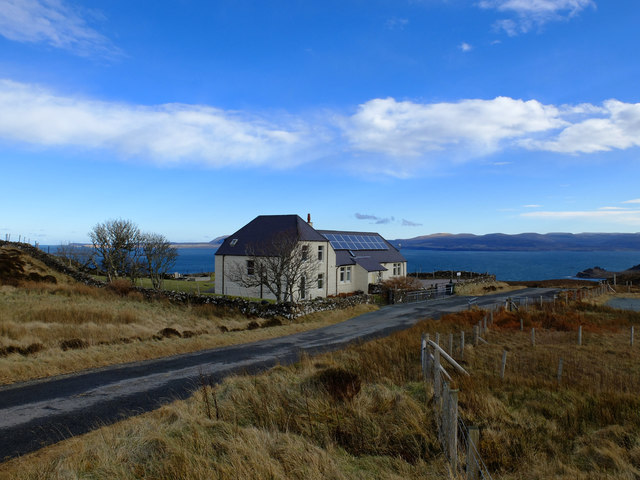
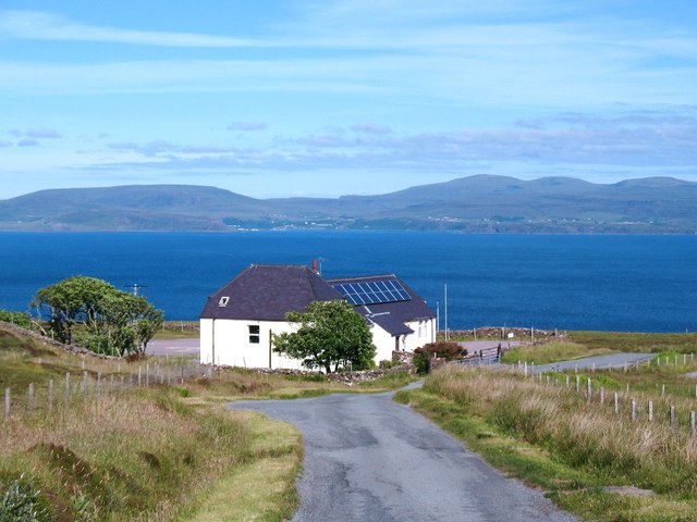
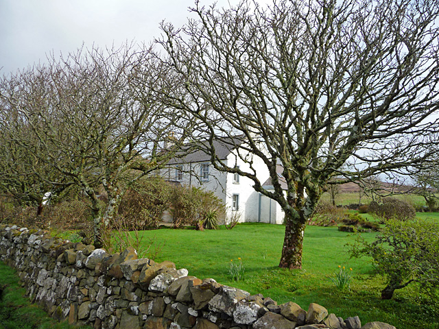
Hallin Park is a picturesque natural area located in Inverness-shire, Scotland. Situated amidst the stunning landscape of the Highlands, this park offers visitors a unique experience of the region's diverse ecosystems, including downs and moorland.

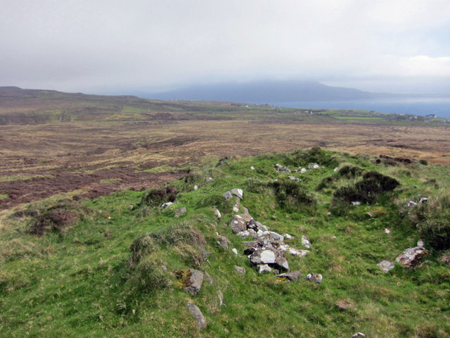
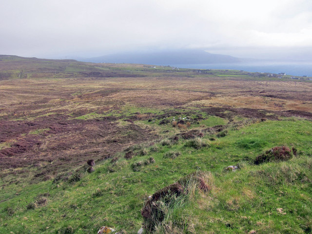
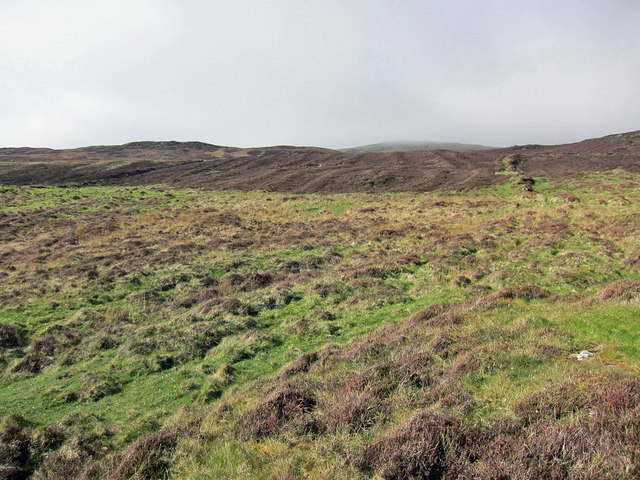
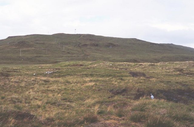
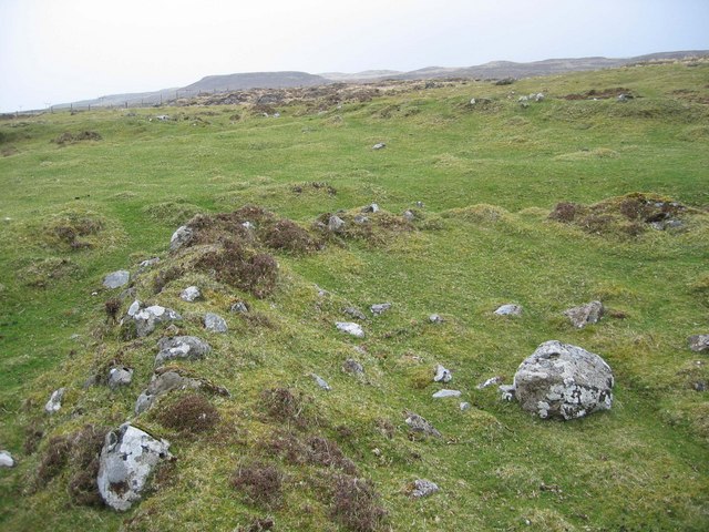
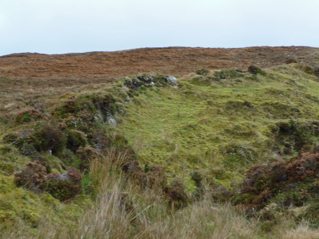
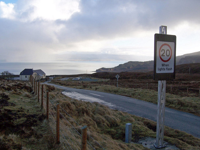
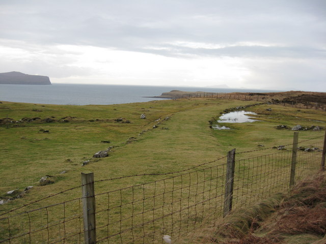
Covering an expansive area of land, Hallin Park is characterized by rolling hills, open grasslands, and vast stretches of heather-covered moorland. The downs, with their gently sloping hills, provide visitors with breathtaking panoramic views of the surrounding countryside. These areas are adorned with a variety of wildflowers, creating a vibrant tapestry of colors during the spring and summer months.

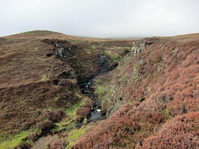
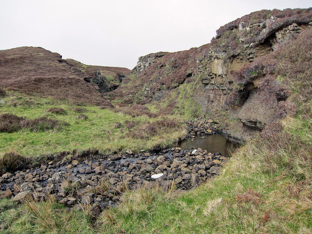
The moorland within Hallin Park is a remarkable feature, with its vast expanse of heather-dominated vegetation. Visitors can explore the winding paths that traverse the moorland, immersing themselves in the tranquility of this unique habitat. The moors are home to a diverse array of wildlife, including birds of prey such as golden eagles, merlins, and kestrels. Rare species such as the black grouse and red deer can also be spotted in these areas, making it an ideal destination for nature enthusiasts and wildlife photographers.

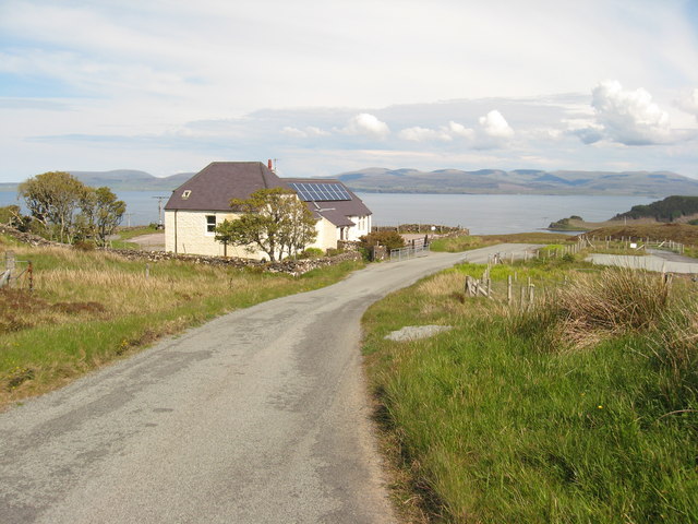
In addition to its natural beauty, Hallin Park offers a range of recreational activities for visitors. Hiking and walking trails provide opportunities for exploration, while picnic areas and designated camping sites allow visitors to relax and enjoy the surroundings. The park is also a popular destination for birdwatching, with various species making their homes within its boundaries.

Overall, Hallin Park in Inverness-shire is an idyllic location that showcases the natural beauty and diverse ecosystems of the Scottish Highlands. With its downs, moorland, and abundant wildlife, it offers visitors a memorable and enriching experience in one of the country's most stunning natural settings.

If you have any feedback on the listing, please let us know in the comments section below.

Hallin Park Images

Images are sourced within 2km of 57.535243/-6.5987996 or Grid Reference NG2458. Thanks to Geograph Open Source API. All images are credited.

Knockbreack Primary School There is currently a proposal to build a new community school in Dunvegan, which will replace four existing north Skye schools; Dunvegan, Edinbane, Struan and this one at Knockbreck.
Knockbreack Primary School
There is currently a proposal to build a new community school in Dunvegan, which will replace four existing north Skye schools; Dunvegan, Edinbane, Struan and this one at Knockbreck.
One of many ruins Halistra was at one time very much more populated than is the case today. The Highland Council Historic Environment Record shows more than 18 farmsteads in the area, and 99 buildings plus a number of enclosures. A vast area of land was cultivated in broad lazybeds which has now reverted to heather moorland.
One of many ruins
Halistra was at one time very much more populated than is the case today. The Highland Council Historic Environment Record shows more than 18 farmsteads in the area, and 99 buildings plus a number of enclosures. A vast area of land was cultivated in broad lazybeds which has now reverted to heather moorland.
Once cultivated land This view is from one of many ruined buildings on the lower south-west facing slope of Ben Halistra. In the late 1700s, almost all of the heather moorland in the image was cultivated in broad lazybeds, 4 to 5 metres in width. The patterns of the beds do not show up well in photographs taken from the ground, though aerial photographs show the beds quite clearly.
Once cultivated land
This view is from one of many ruined buildings on the lower south-west facing slope of Ben Halistra. In the late 1700s, almost all of the heather moorland in the image was cultivated in broad lazybeds, 4 to 5 metres in width. The patterns of the beds do not show up well in photographs taken from the ground, though aerial photographs show the beds quite clearly.
Allt na Claise Moire The small river flows through a steep sided gorge here, as it flows down the south facing slope of Ben Halistra
Allt na Claise Moire
The small river flows through a steep sided gorge here, as it flows down the south facing slope of Ben Halistra
Allt na Claise Moire Looking up the river into a gorge on the hillside of Ben Halistra.
Allt na Claise Moire
Looking up the river into a gorge on the hillside of Ben Halistra.
Lazybeds on Ben Halistra There is a vast area of hand-dug once-cultivated land on the south facing slope of Ben Halistra, just north of the modern township of Upper Halistra. The land was being farmed in the late 1700s, but was abandoned in the mid-1800s, and has now reverted to heather moorland. The land still shows the distinctive pattern of broad stripes. The stripes show up well in aerial photographs. 
See also <a href="https://www.geograph.org.uk/photo/4956661">NG2459 : The Farm of Halistra</a>.
Lazybeds on Ben Halistra
There is a vast area of hand-dug once-cultivated land on the south facing slope of Ben Halistra, just north of the modern township of Upper Halistra. The land was being farmed in the late 1700s, but was abandoned in the mid-1800s, and has now reverted to heather moorland. The land still shows the distinctive pattern of broad stripes. The stripes show up well in aerial photographs. See also NG2459 : The Farm of Halistra.
Knockbreck Primary School
Dramatic Sky over Halistra Taken near the junction of the Trumpan road branches. View toward Halistra beneath a dramatic skyscape.
Dramatic Sky over Halistra
Taken near the junction of the Trumpan road branches. View toward Halistra beneath a dramatic skyscape.
Knockbreck school Primary school serving the communities on the Waternish peninsula. In the distance can be seen Uig Bay on Trotternish
Knockbreck school
Primary school serving the communities on the Waternish peninsula. In the distance can be seen Uig Bay on Trotternish
Ben Halistra Looking towards Ben Geary, Skye bog churned up by the dreaded mobile phone mast builders.
Ben Halistra
Looking towards Ben Geary, Skye bog churned up by the dreaded mobile phone mast builders.
Old Settlement at Halistra The remains of long abandoned houses and field divisions are visible on the moorland above the present day community at Halistra.
Old Settlement at Halistra
The remains of long abandoned houses and field divisions are visible on the moorland above the present day community at Halistra.
Old wall on Ben Halistra
Burn at Halistra Flowing towards Loch Bay.
Burn at Halistra
Flowing towards Loch Bay.
Road towards Knockbreck The building on the left is the primary school.
There is currently one multi-composite class in the school. There are presently 10 pupils in P1 – 7 with a further 6 pupils attending Nursery. The school has one teaching member of staff. It is currently part of a two school cluster group with a shared Headteacher.
However small the school and however remote the location, the Highland Council think it is worth installing electrically illuminated speed limit signs to warn the local sheep when there may be children on the road.
Road towards Knockbreck
The building on the left is the primary school. There is currently one multi-composite class in the school. There are presently 10 pupils in P1 – 7 with a further 6 pupils attending Nursery. The school has one teaching member of staff. It is currently part of a two school cluster group with a shared Headteacher. However small the school and however remote the location, the Highland Council think it is worth installing electrically illuminated speed limit signs to warn the local sheep when there may be children on the road.
To where? One minute you are walking down the road, when all of a sudden the more recent route for the road diverges away from the old route. At least,that is what it looks like with this path lined on both sides with boulders, and slightly raised above the level of the surrounding field.Follow it though and it just disappears into the common grazings. Wonder where it used to go?
To where?
One minute you are walking down the road, when all of a sudden the more recent route for the road diverges away from the old route. At least,that is what it looks like with this path lined on both sides with boulders, and slightly raised above the level of the surrounding field.Follow it though and it just disappears into the common grazings. Wonder where it used to go?
Waternish Free Church in Halistra John Gifford's Pevsner guide of 1992 notes that this late 19th-century building is "very simple, with segmental-arched windows". There are only two of these windows on the far side wall, and the one on the gable end which lights a gallery covering about a third of the floor space. In late summer 2021 the church has just reopened for worship after a major renovation including repositioning of the entrance - compare with Anthony O'Neil's 2010 view <a href="https://www.geograph.org.uk/photo/1917018">NG2459 : Waternish Church, Upper Halistra, Skye</a>. The new windows on the lean-to extension are still to be installed.
Waternish Free Church in Halistra
John Gifford's Pevsner guide of 1992 notes that this late 19th-century building is "very simple, with segmental-arched windows". There are only two of these windows on the far side wall, and the one on the gable end which lights a gallery covering about a third of the floor space. In late summer 2021 the church has just reopened for worship after a major renovation including repositioning of the entrance - compare with Anthony O'Neil's 2010 view NG2459 : Waternish Church, Upper Halistra, Skye. The new windows on the lean-to extension are still to be installed.
Duirinish Free Church (continuing) The building is of the Free Presbyterian Church of Scotland. The congregation is of the Free Church (continuing).
Duirinish Free Church (continuing)
The building is of the Free Presbyterian Church of Scotland. The congregation is of the Free Church (continuing).
Parliamentary Manse at Hallin By Joseph Mitchell, 1828/29.
Parliamentary Manse at Hallin
By Joseph Mitchell, 1828/29.
Show me another place!

Hallin Park is located at Grid Ref: NG2458 (Lat: 57.535243, Lng: -6.5987996)

Unitary Authority: Highland

Police Authority: Highlands and Islands

What 3 Words

///moment.eclipses.trying. Near Dunvegan, Highland

Nearby Locations

Port na Cagain Hallin Park

Related Wikis

Halistra

Halistra (Scottish Gaelic: Halastra), is a small crofting township located on the west coast of the Waternish peninsula, overlooking Loch Bay, on the island...

Dun Hallin

Dun Hallin is an Iron Age broch located near the northwest coast of the island of Skye, in Scotland (grid reference NG25665927). == Location == Dun Hallin...

Waternish

Waternish or Vaternish (Scottish Gaelic: Bhàtairnis) is a peninsula approximately 12 kilometres (7+1⁄2 miles) long on the island of Skye, Scotland, situated...

Gillen, Skye

Gillen (Scottish Gaelic: Gilean) is a hamlet on the Waternish peninsula of the island of Skye in the Scottish council area of Highland. == References ==

Nearby Amenities

Located within 500m of 57.535243,-6.5987996
Source: PGS
Lat/Long: 57.5367693/-6.6059185
Source: PGS
Lat/Long: 57.536553/-6.6051099
Source: PGS
Lat/Long: 57.5361806/-6.6042599
Source: PGS
Lat/Long: 57.5358815/-6.6036671
Source: PGS
Lat/Long: 57.5356441/-6.6033985
Source: PGS
Lat/Long: 57.5352626/-6.6030714
Source: PGS
Lat/Long: 57.5347578/-6.6027785
Created By: dmgroom_coastlines
Source: PGS
Lat/Long: 57.53326/-6.60236
Source: PGS
Lat/Long: 57.5328857/-6.6017427
Source: PGS
Lat/Long: 57.5327494/-6.6013327
Source: PGS
Lat/Long: 57.5324726/-6.6010472
Source: PGS
Lat/Long: 57.5322424/-6.6000855
Source: PGS
Lat/Long: 57.5320723/-6.5996313
Source: PGS
Lat/Long: 57.5318788/-6.5990775
Source: PGS
Lat/Long: 57.5316289/-6.5984613
Source: PGS
Lat/Long: 57.5314321/-6.5979946
Source: PGS
Lat/Long: 57.5311828/-6.5975015
Source: PGS
Lat/Long: 57.5309593/-6.5966021
Hallin
Name En: Hallin
Name Gd: Hàllainn
Place: village
Lat/Long: 57.5371544/-6.5970653
Turning Circle
Lat/Long: 57.5385743/-6.5942079
Parking
Access: private
Fee: no
Lat/Long: 57.5397086/-6.5994376
Board Title: none
Board Type: community;notice
Information: board
Lit: no
Tourism: information
Lat/Long: 57.5396428/-6.5996012
Hallin Park
Place: locality
Lat/Long: 57.5332736/-6.5965623
Power: pole
Lat/Long: 57.5365678/-6.5911845
Power: pole
Lat/Long: 57.5359789/-6.5914744
Power: pole
Lat/Long: 57.5355111/-6.5923641
Power: pole
Lat/Long: 57.5351685/-6.592976
Power: pole
Lat/Long: 57.5347515/-6.5940167
Power: pole
Lat/Long: 57.5343592/-6.5946327
Passing Place
Lat/Long: 57.5396418/-6.5995234
The data included in this document is from www.openstreetmap.org. The data is made available under ODbL.

Have you been to Hallin Park?

Leave your review of Hallin Park below (or comments, questions and feedback).