Mòineach Loch Portain

Downs, Moorland in Inverness-shire

Scotland

Mòineach Loch Portain

Peaty pool by the roadside Cotton grass by the roadside, looking south east towards the hills beyond Lochmaddy.
Peaty pool by the roadside Credit: Gordon Hatton

Mòineach Loch Portain is a picturesque area located in Inverness-shire, Scotland. This region is characterized by its distinctive downs and moorland landscape, offering breathtaking views and a serene environment for visitors and locals alike.

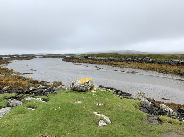
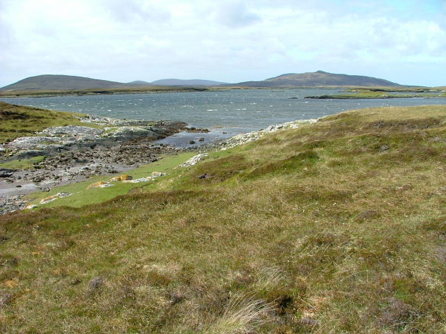
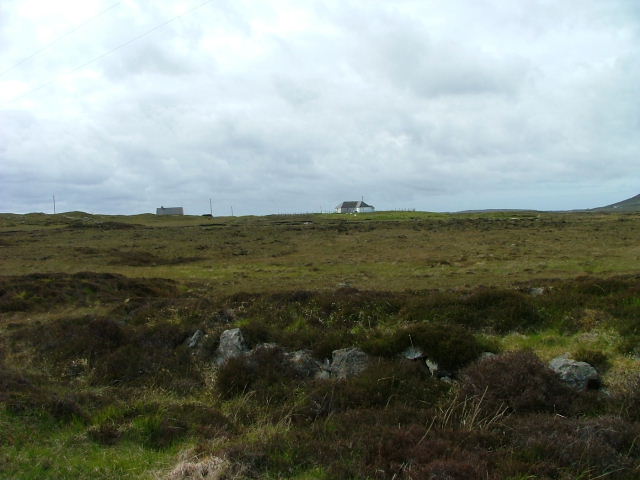
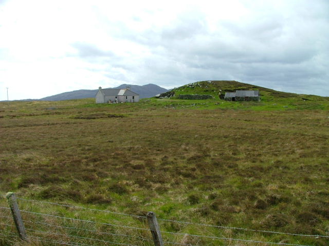
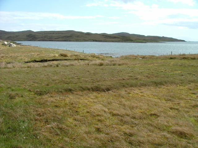
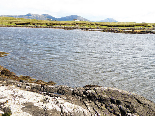
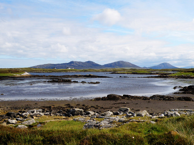
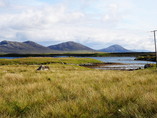
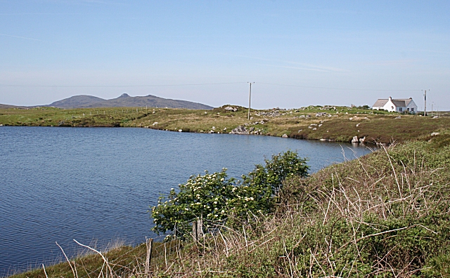
The downs of Mòineach Loch Portain are rolling hills covered in lush green grass, dotted with wildflowers during the summer months. These gentle slopes provide an ideal spot for leisurely walks or picnics, where one can immerse themselves in the tranquility of the surrounding nature. The downs also offer stunning panoramic vistas of the surrounding countryside, with rolling hills and distant mountains adding to the beauty of the area.

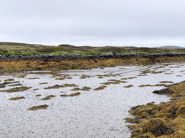
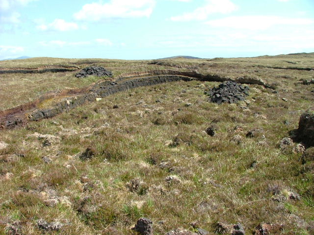
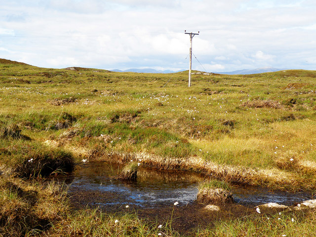
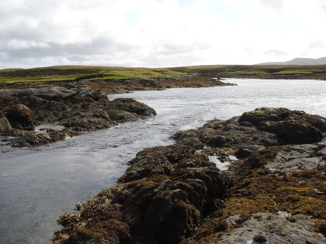
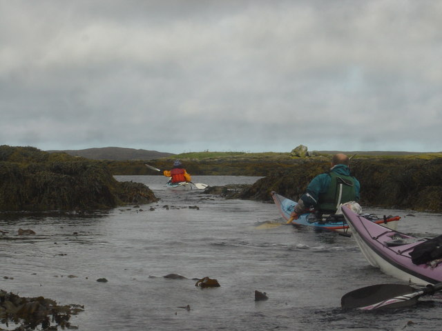
The moorland of Mòineach Loch Portain is a vast expanse of open land, covered in heather and peat. This unique ecosystem supports a diverse range of plant and animal species, making it a popular destination for nature enthusiasts and birdwatchers. The moorland is home to several rare species, including the golden eagle and the black grouse, which can often be spotted soaring through the sky or displaying their elaborate courtship rituals.

Visitors to Mòineach Loch Portain can enjoy a variety of outdoor activities, such as hiking, birdwatching, or simply taking in the stunning scenery. The area is also rich in history, with ancient ruins and archaeological sites scattered throughout the landscape, offering a glimpse into the region's past.

Overall, Mòineach Loch Portain is a truly remarkable destination, where visitors can experience the beauty of Scotland's downs and moorland, and immerse themselves in the rich natural and cultural heritage of Inverness-shire.

If you have any feedback on the listing, please let us know in the comments section below.

Mòineach Loch Portain Images

Images are sourced within 2km of 57.638929/-7.1567374 or Grid Reference NF9272. Thanks to Geograph Open Source API. All images are credited.

Peaty pool by the roadside Cotton grass by the roadside, looking south east towards the hills beyond Lochmaddy.
Peaty pool by the roadside
Cotton grass by the roadside, looking south east towards the hills beyond Lochmaddy.
Peat stacks at Stolie Moorland dropping gently to a tidal channel, with Beinn Mhor in the distance.
Peat stacks at Stolie
Moorland dropping gently to a tidal channel, with Beinn Mhor in the distance.
Tidal channels and mud flats Having squeezed into a corner of this square, further progress across the tidal mud flats would appear to be a foolish move. The unnamed islet some 150m away is, according to the OS map, surrounded by sand. In reality it appears to be a rather sicky mud.
Tidal channels and mud flats
Having squeezed into a corner of this square, further progress across the tidal mud flats would appear to be a foolish move. The unnamed islet some 150m away is, according to the OS map, surrounded by sand. In reality it appears to be a rather sicky mud.
A maze of muddy channels Looking east from the Rubha Dubh promontory across a maze of muddy channels, exposed rocks and little islands.
A maze of muddy channels
Looking east from the Rubha Dubh promontory across a maze of muddy channels, exposed rocks and little islands.
Tidal channel between Aird Innis and Aird nan Laogh Seen close to low tide. Aird Innis, almost a separate island is on the far side of the mud.
Tidal channel between Aird Innis and Aird nan Laogh
Seen close to low tide. Aird Innis, almost a separate island is on the far side of the mud.
Tidal channel between Aird Innis and Aird nan Laogh Seen close to low tide. Aird Innis, almost a separate island is on the far side of the mud.
Tidal channel between Aird Innis and Aird nan Laogh
Seen close to low tide. Aird Innis, almost a separate island is on the far side of the mud.
Peat Bank By the Lochportain road.
Peat Bank
By the Lochportain road.
Loch Dheoir From the Lochportain road.
Loch Dheoir
From the Lochportain road.
Open Moorland Looking towards houses at Braigh Chalasaigh.
Open Moorland
Looking towards houses at Braigh Chalasaigh.
Croft at Greanacleit By the Lochportain road.
Croft at Greanacleit
By the Lochportain road.
Loch Portain Looking towards Rubha nan Gall.
Loch Portain
Looking towards Rubha nan Gall.
Loch Dheoir In the distance can be seen Li a Tuath (250m), Li a Deas (281m) and Eabhal (347m)
Loch Dheoir
In the distance can be seen Li a Tuath (250m), Li a Deas (281m) and Eabhal (347m)
Loch Dheoir In the distance can be seen Li a Tuath (250m), Li a Deas (281m) and Eabhal (347m)
Loch Dheoir
In the distance can be seen Li a Tuath (250m), Li a Deas (281m) and Eabhal (347m)
Loch Siginis In the distance can be seen Li a Tuath (250m), Li a Deas (281m), Eabhal (347m) and, on South Uist, Thacla (606m)
Loch Siginis
In the distance can be seen Li a Tuath (250m), Li a Deas (281m), Eabhal (347m) and, on South Uist, Thacla (606m)
Electricity Pole Crossing the soggy peat, as seen at the forefront of the photograph
Electricity Pole
Crossing the soggy peat, as seen at the forefront of the photograph
Tidal rapid draining Loch Dheoir Behind Lochmaddy is an area of shallow lagoons filled and drained by the tides each day. Where the tide runs between the rocks, tidal rapids are formed like this one in a narrows which drains Loch Dheoir towards Loch Blathaisbhal during the ebb.
Tidal rapid draining Loch Dheoir
Behind Lochmaddy is an area of shallow lagoons filled and drained by the tides each day. Where the tide runs between the rocks, tidal rapids are formed like this one in a narrows which drains Loch Dheoir towards Loch Blathaisbhal during the ebb.
Paddling hard to ascend tidal rapid in Loch Blathaisbhal The Lochs behind Lochmaddy are tidal lagoons, connected by narrow channels. As the ebb tide drains the upper lochs, tidal rapids form, opposing progress by sea kayakers. There are three channels up from Loch Blathaisbhal towards the northwest, of which this was the narrowest, shallowest but least fast-flowing, so with a bit of a struggle we managed to paddle up this one. Had we managed to coincide our trip with the flood, we would have been helped on our way, and could have used to ebb to speed us on the way back.
Paddling hard to ascend tidal rapid in Loch Blathaisbhal
The Lochs behind Lochmaddy are tidal lagoons, connected by narrow channels. As the ebb tide drains the upper lochs, tidal rapids form, opposing progress by sea kayakers. There are three channels up from Loch Blathaisbhal towards the northwest, of which this was the narrowest, shallowest but least fast-flowing, so with a bit of a struggle we managed to paddle up this one. Had we managed to coincide our trip with the flood, we would have been helped on our way, and could have used to ebb to speed us on the way back.
Greanacleit Elder flowers are a fairly unusual sight here; these are on the shore of an unnamed lochan at Greanacleit. The distinctive shape of Crògearraidh Mòr is in the distance.
Greanacleit
Elder flowers are a fairly unusual sight here; these are on the shore of an unnamed lochan at Greanacleit. The distinctive shape of Crògearraidh Mòr is in the distance.
Show me another place!

Mòineach Loch Portain is located at Grid Ref: NF9272 (Lat: 57.638929, Lng: -7.1567374)

Unitary Authority: Na h-Eileanan an Iar

Police Authority: Highlands and Islands

What 3 Words

///intruders.replayed.making. Near Lochmaddy, Na h-Eileanan Siar

Related Wikis

Ceallasaigh Mòr

Ceallasaigh Mòr (or Keallasay More) is a low-lying island in Loch Maddy off North Uist in the Outer Hebrides of Scotland. This an area of shallow lagoons...

Ceallasaigh Beag

Ceallasaigh Beag (or Keallasay Beg) is a low-lying island in Loch Maddy off North Uist in the Outer Hebrides of Scotland. This an area of shallow lagoons...

Loch an Duin

Loch an Duin is a complex system of freshwater, brackish and sea lochs, tidal channels and islands, on and close to North Uist off the west coast of Scotland...

Stromay

Stromay (Scottish Gaelic: Sròmaigh) is a tidal island off North Uist in the Sound of Harris, Scotland. The low island of Stromay lies between two wide...

Na Fir Bhrèige

Na Fir Bhrèige (pronounced [nə fiɾʲ ˈvɾʲeːkʲə]; can be translated from Gaelic into English as "The False Men") is a set of three standing stones on the...

Lochmaddy

Lochmaddy (Scottish Gaelic: Loch nam Madadh [l̪ˠɔx nə ˈmat̪əɣ], "Loch of the Hounds") is the administrative centre of North Uist in the Outer Hebrides...

Taigh Chearsabhagh

Taigh Chearsabhagh is an arts centre and museum in Lochmaddy on the island of North Uist, Scotland.Taigh Chearsabhagh was built in 1741 and originally...

Weavers Point

Weavers Point (Scottish Gaelic: Rubha an Fhigheadair) is a headland to the north of the entrance to Loch Maddy, on the north eastern coastline of North...

Nearby Amenities

Located within 500m of 57.638929,-7.1567374
Passing Place
Lat/Long: 57.6370292/-7.1588683
Turning Circle
Turning Circle: hammer
Lat/Long: 57.6362818/-7.1629948
Barrier: cattle_grid
Lat/Long: 57.6362645/-7.1586496
Passing Place
Lat/Long: 57.6404366/-7.1622921
Braigh Chalasaigh
Place: locality
Lat/Long: 57.6352825/-7.1601248
Passing Place
Lat/Long: 57.639878/-7.1617397
Passing Place
Lat/Long: 57.6387194/-7.1605727
Passing Place
Lat/Long: 57.6355942/-7.1590128
Passing Place
Lat/Long: 57.6363593/-7.1586308
Power: pole
Lat/Long: 57.6362946/-7.1616754
Power: pole
Lat/Long: 57.6359909/-7.1598796
Power: pole
Lat/Long: 57.6357971/-7.1592399
Power: pole
Lat/Long: 57.6356923/-7.1588644
Power: pole
Lat/Long: 57.6354625/-7.1597147
Power: pole
Lat/Long: 57.6364503/-7.1626101
Power: pole
Lat/Long: 57.6420019/-7.1623309
Power: pole
Lat/Long: 57.6415836/-7.1619965
Power: pole
Lat/Long: 57.641263/-7.1616607
Power: pole
Lat/Long: 57.6409468/-7.1614808
Power: pole
Lat/Long: 57.6403265/-7.1612673
Power: pole
Lat/Long: 57.6397658/-7.1610833
Power: pole
Lat/Long: 57.6391943/-7.1608912
Power: pole
Lat/Long: 57.6387451/-7.1607556
Power: pole
Lat/Long: 57.6380521/-7.16053
Power: pole
Lat/Long: 57.6368252/-7.1601375
Passing Place
Lat/Long: 57.6414885/-7.1630367
Power: pole
Lat/Long: 57.6366262/-7.1636336
The data included in this document is from www.openstreetmap.org. The data is made available under ODbL.

Have you been to Mòineach Loch Portain?

Leave your review of Mòineach Loch Portain below (or comments, questions and feedback).