Baffins

Settlement in Hampshire

England

Baffins

Fratton station
Fratton station Credit: Roy Hughes

Baffins is a residential area located in the city of Portsmouth, Hampshire, England. It is situated in the northern part of the city, bordered by Copnor and Hilsea. Baffins is primarily a suburban area, known for its quiet streets and family-friendly atmosphere.

The area is predominantly residential, with a mix of housing styles including detached and semi-detached houses, as well as some apartment complexes. Baffins is considered a desirable place to live, attracting families and professionals alike.

Baffins is well-served by amenities and facilities. The area has a number of shops, including convenience stores, supermarkets, and local businesses. There are also several pubs, cafes, and restaurants in the vicinity, providing residents with a variety of options for dining and entertainment.

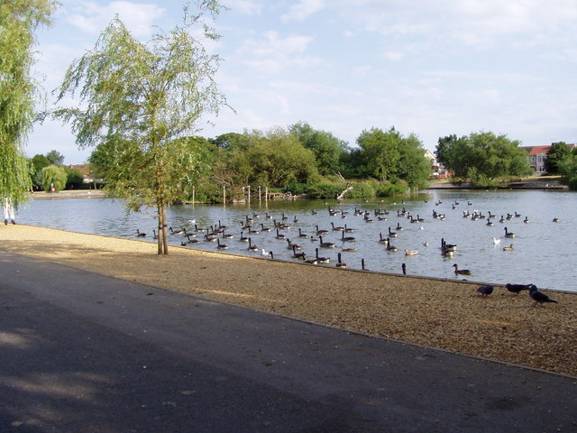
There are several green spaces in and around Baffins, such as Baffins Pond and Tangier Field. These areas offer opportunities for outdoor activities, including walking, jogging, and picnicking. Baffins also benefits from its proximity to the picturesque Eastern Road Recreation Ground, which features sports facilities, a playground, and open spaces.

Transportation in Baffins is convenient, with several bus routes passing through the area, providing easy access to other parts of Portsmouth. The area is also well-connected to major road networks, including the A27 and M27 motorway, allowing for easy commuting to nearby towns and cities.

In summary, Baffins is a pleasant residential area in Portsmouth, Hampshire, offering a peaceful atmosphere, a range of amenities, and convenient transportation links.

If you have any feedback on the listing, please let us know in the comments section below.
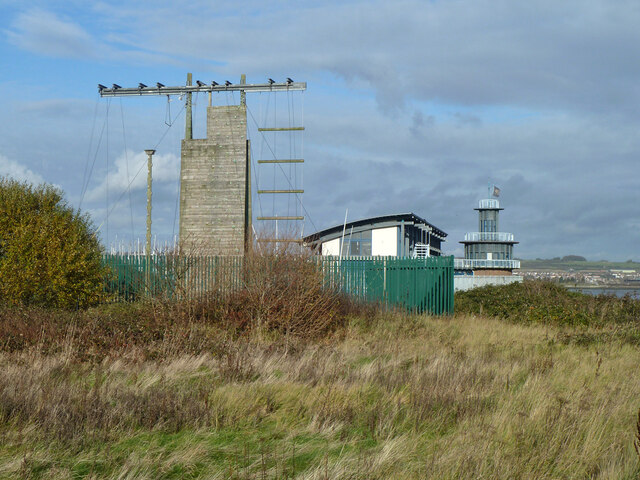
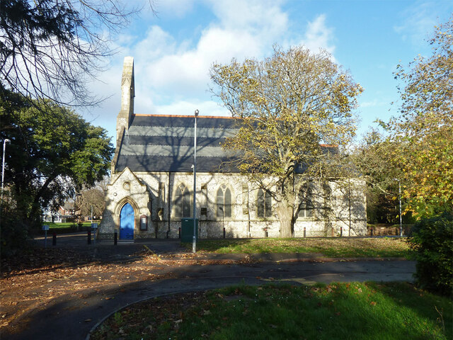
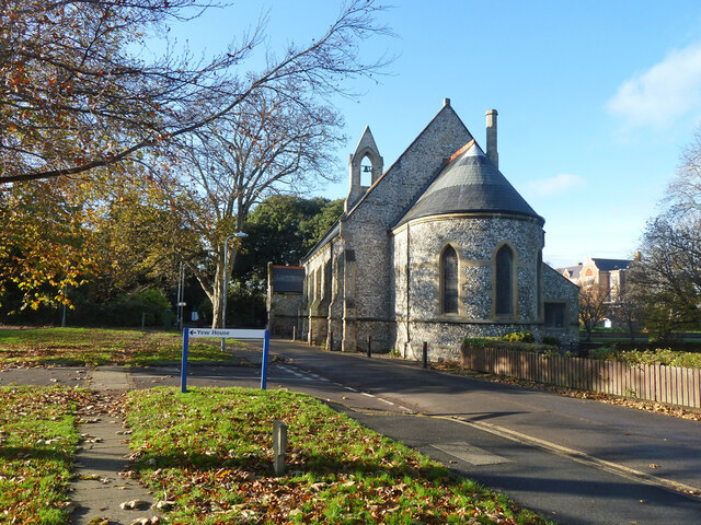
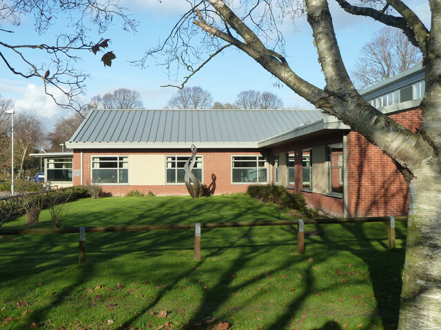
Baffins Images

Images are sourced within 2km of 50.807532/-1.054035 or Grid Reference SU6601. Thanks to Geograph Open Source API. All images are credited.

Fratton station
Fratton station
Another chance goes begging Pompey managing to lose 0-2 to Sutton United in an insipid Papa John's Trophy match in October 2021
Another chance goes begging
Pompey managing to lose 0-2 to Sutton United in an insipid Papa John's Trophy match in October 2021
Parked cars in Maylands Avenue
Defiant plaque on the former Pompey pub Fratton Park is a football stadium in Portsmouth. It has been the home of professional club Portsmouth F.C. since its construction in 1898.
Wikipedia: <span class="nowrap"><a title="http://en.wikipedia.org/wiki/Fratton_Park" rel="nofollow ugc noopener" href="http://en.wikipedia.org/wiki/Fratton_Park">Link</a><img style="margin-left:2px;" alt="External link" title="External link - shift click to open in new window" src="https://s1.geograph.org.uk/img/external.png" width="10" height="10"/></span>
Defiant plaque on the former Pompey pub
Fratton Park is a football stadium in Portsmouth. It has been the home of professional club Portsmouth F.C. since its construction in 1898. Wikipedia: LinkExternal link
Action from the 1st round FA Cup tie between Portsmouth and Harrow Borough Fratton Park is a football stadium in Portsmouth. It has been the home of professional club Portsmouth F.C. since its construction in 1898.
Wikipedia: <span class="nowrap"><a title="http://en.wikipedia.org/wiki/Fratton_Park" rel="nofollow ugc noopener" href="http://en.wikipedia.org/wiki/Fratton_Park">Link</a><img style="margin-left:2px;" alt="External link" title="External link - shift click to open in new window" src="https://s1.geograph.org.uk/img/external.png" width="10" height="10"/></span>
Action from the 1st round FA Cup tie between Portsmouth and Harrow Borough
Fratton Park is a football stadium in Portsmouth. It has been the home of professional club Portsmouth F.C. since its construction in 1898. Wikipedia: LinkExternal link
View from Fratton Foot Bridge down into the station Fratton station is a railway station in Portsmouth, located near Fratton Park, the stadium of  football club Portsmouth F.C..
It is located on the Portsmouth Direct Line which runs between London (London Waterloo) and Portsmouth (Portsmouth Harbour). The station opened in 1885.
Wikipedia: <span class="nowrap"><a title="http://en.wikipedia.org/wiki/Fratton_railway_station" rel="nofollow ugc noopener" href="http://en.wikipedia.org/wiki/Fratton_railway_station">Link</a><img style="margin-left:2px;" alt="External link" title="External link - shift click to open in new window" src="https://s1.geograph.org.uk/img/external.png" width="10" height="10"/></span>
View from Fratton Foot Bridge down into the station
Fratton station is a railway station in Portsmouth, located near Fratton Park, the stadium of football club Portsmouth F.C.. It is located on the Portsmouth Direct Line which runs between London (London Waterloo) and Portsmouth (Portsmouth Harbour). The station opened in 1885. Wikipedia: LinkExternal link
Pompey fans heading along Fratton Way
Going to the match- 2021 style Contrast and compare, as my old English teacher used to say, this scene from Fratton with the more famous painting by LS Lowry <span class="nowrap"><a title="https://www.youtube.com/watch?v=_M1372Z1Ldg" rel="nofollow ugc noopener" href="https://www.youtube.com/watch?v=_M1372Z1Ldg">Link</a><img style="margin-left:2px;" alt="External link" title="External link - shift click to open in new window" src="https://s1.geograph.org.uk/img/external.png" width="10" height="10"/></span>
Going to the match- 2021 style
Contrast and compare, as my old English teacher used to say, this scene from Fratton with the more famous painting by LS Lowry LinkExternal link
Harrogate Town coach at Fratton Park Also note the 1970's pub sign that was moved from its original site in Frogmore Road <span class="nowrap"><a title="https://www.portsmouth.co.uk/sport/football/portsmouth-fc/revealed-are-fans-going-to-see-the-return-of-portsmouths-famous-pub-2876296" rel="nofollow ugc noopener" href="https://www.portsmouth.co.uk/sport/football/portsmouth-fc/revealed-are-fans-going-to-see-the-return-of-portsmouths-famous-pub-2876296">Link</a><img style="margin-left:2px;" alt="External link" title="External link - shift click to open in new window" src="https://s1.geograph.org.uk/img/external.png" width="10" height="10"/></span>
Harrogate Town coach at Fratton Park
Also note the 1970's pub sign that was moved from its original site in Frogmore Road LinkExternal link
Spot the ball! Older viewers might remember the 'Spot the ball' competitions in the Saturday evening sports papers. Sadly, that modern tactic (seen here in the FA Cup 2nd Round tie between Portsmouth and Harrogate Town) the shirt pull is what draws the eye here ...
Spot the ball!
Older viewers might remember the 'Spot the ball' competitions in the Saturday evening sports papers. Sadly, that modern tactic (seen here in the FA Cup 2nd Round tie between Portsmouth and Harrogate Town) the shirt pull is what draws the eye here ...
Climbing apparatus, watersports centre, Portsmouth This appears to have, in part, tasks simulating boat rigging.
Climbing apparatus, watersports centre, Portsmouth
This appears to have, in part, tasks simulating boat rigging.
Hollam Road, Milton, Portsmouth
The Meon Valley (pub) Later renamed The Meon.
The Meon Valley (pub)
Later renamed The Meon.
Principal buildings, St. James Hospital There is quite an extensive campus with scattered buildings, but these are the older.
Principal buildings, St. James Hospital
There is quite an extensive campus with scattered buildings, but these are the older.
A south-eastern wing of St James Hospital
St James Hospital chapel A grade II listed building, 1879.
St James Hospital chapel
A grade II listed building, 1879.
St James Hospital chapel A grade II listed building, 1879.
St James Hospital chapel
A grade II listed building, 1879.
The Limes An NHS establishment for mental health inpatients.
The Limes
An NHS establishment for mental health inpatients.
Show me another place!

Baffins is located at Grid Ref: SU6601 (Lat: 50.807532, Lng: -1.054035)

Unitary Authority: Portsmouth

Police Authority: Hampshire

What 3 Words

///manliness.prom.richer. Near Portsmouth, Hampshire

Related Wikis

Baffins

Baffins is an administrative district of Portsmouth, England, located on the eastern side of Portsea Island. The district is mainly composed of 1930s housing...
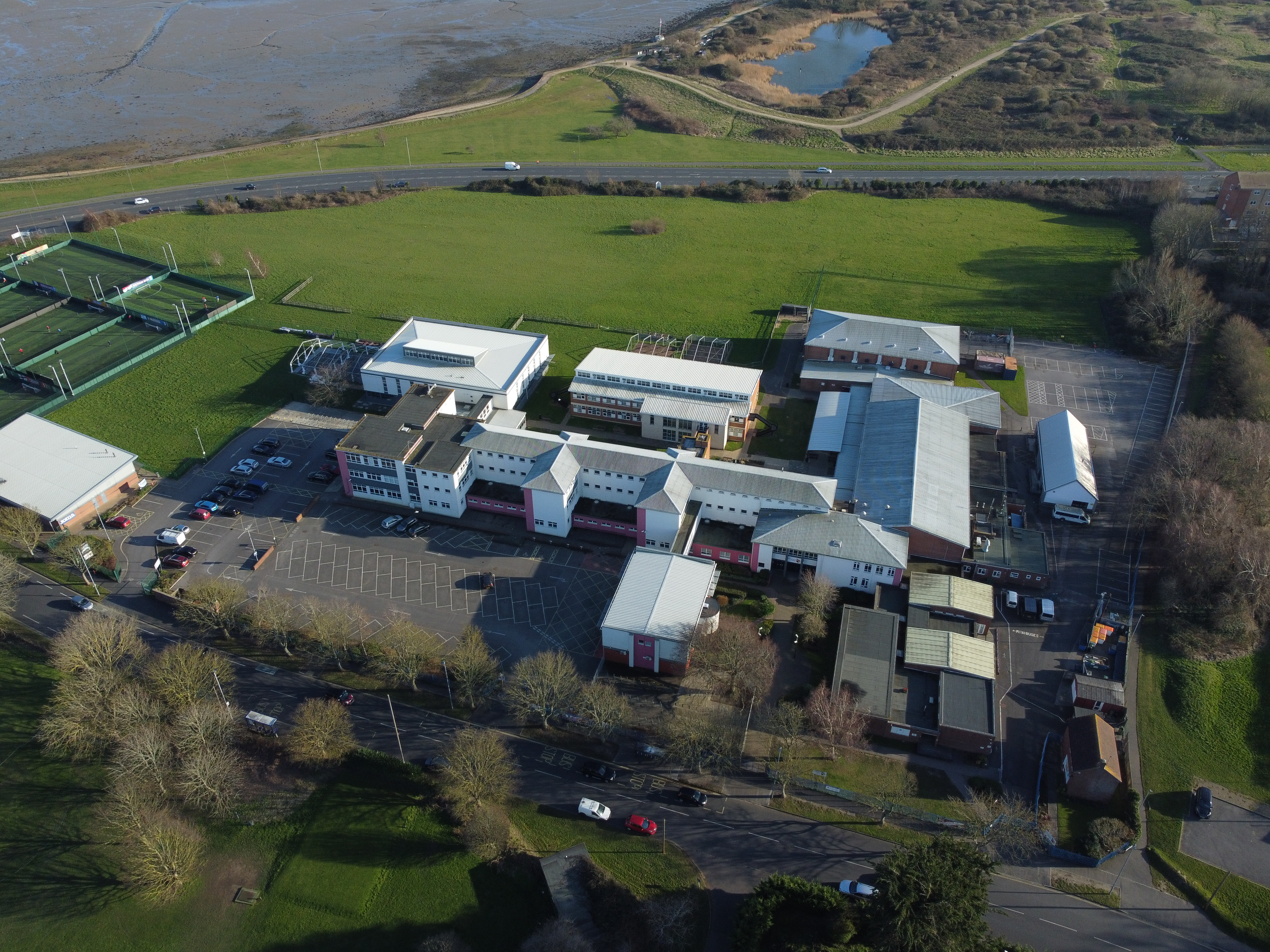
Portsmouth College

Portsmouth College is a sixth form college on Tangier Road, Baffins, in the city of Portsmouth, England. == Admissions == The principal at Portsmouth College...
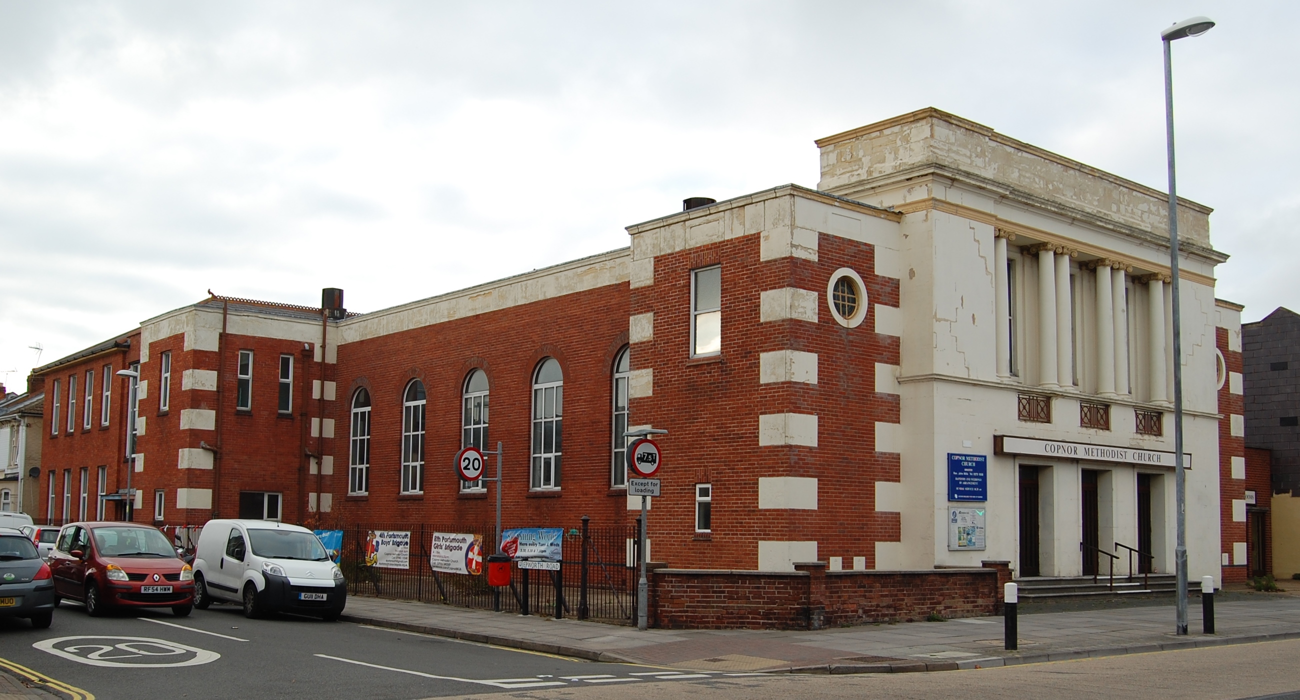
Copnor

Copnor is an area of Portsmouth, England, located on the eastern side of Portsea Island. The population of Copnor Ward at the 2011 Census was 13,608. As...

Miltoncross Academy

Miltoncross Academy (formerly Miltoncross School) is a coeducational secondary school located in the Milton area of Portsmouth in the English county of...

Moneyfields F.C.

Moneyfields Football Club is a football club based in Portsmouth, England. Affiliated to the Hampshire FA, they were founded in 1987 as Portsmouth Civil...

HM Prison Kingston

HM Prison Kingston is a former Category B/C men's prison, located in the Kingston area of Portsmouth, in Hampshire, England. Prior to closure, the prison...

Kingston, Hampshire

Kingston is a residential area of the city of Portsmouth in the English county of Hampshire, lying between Buckland, Fratton, Milton and North End. It...

St Mary's Hospital, Portsmouth

St Mary's Hospital is a health facility in Milton Road, Portsmouth, Hampshire, England. It is managed by Solent NHS Trust. == History == The facility...

Nearby Amenities

Located within 500m of 50.807532,-1.054035
Library
Alderman Lacey Library
Created By: Potlatch alpha
Wikidata: Q55183859
Lat/Long: 50.808014/-1.0578159
Bus Stop
Marina Grove
Naptan AtcoCode: 1990HAA13611
Naptan Bearing: E
Naptan CommonName: Marina Grove
Naptan Crossing: Opp Marina Grove
Naptan NaptanCode: pordtpa
Naptan PlusbusZoneRef: PSEA
Naptan Street: Hayling Avenue
Naptan Verified: no
Source: naptan_import
Lat/Long: 50.8063384/-1.0542962
Bus Stop
Stride Avenue
Bus: yes
Naptan AtcoCode: 1990PH130282
Naptan Bearing: NE
Naptan CommonName: Stride Avenue
Naptan Crossing: Stride Avenue
Naptan NaptanCode: poratmj
Naptan PlusbusZoneRef: PSEA
Naptan Street: Eastern Road
Naptan Verified: no
Public Transport: platform
Source: naptan_import
Lat/Long: 50.8039637/-1.0509097
Bus Stop
Stride Avenue
Bus: yes
Naptan AtcoCode: 1990PH130283
Naptan Bearing: SW
Naptan CommonName: Stride Avenue
Naptan Crossing: Opp Stride Avenue
Naptan NaptanCode: poratmp
Naptan PlusbusZoneRef: PSEA
Naptan Street: Eastern Road
Naptan Verified: no
Public Transport: platform
Source: naptan_import
Lat/Long: 50.8038549/-1.0507984
Bus Stop
Stanley Avenue
Bus: yes
Naptan AtcoCode: 1990PH130287
Naptan Bearing: W
Naptan CommonName: Stanley Avenue
Naptan Crossing: Opp Stanley Avenue
Naptan NaptanCode: poratpa
Naptan PlusbusZoneRef: PSEA
Naptan Street: Tangier Road
Naptan Verified: no
Public Transport: platform
Source: naptan_import
Lat/Long: 50.808911/-1.0499437
Bus Stop
Highgrove Road
Naptan AtcoCode: 1990PH130288
Naptan Bearing: SW
Naptan CommonName: Highgrove Road
Naptan Crossing: Opp Algiers Road
Naptan NaptanCode: poratpd
Naptan PlusbusZoneRef: PSEA
Naptan Street: Tangier Road
Naptan Verified: no
Source: naptan_import
Lat/Long: 50.8087681/-1.0533813
Bus Stop
Baffins Library
Naptan AtcoCode: 1990PH130289
Naptan Bearing: S
Naptan CommonName: Baffins Library
Naptan Crossing: Tangier Road
Naptan Landmark: Library
Naptan NaptanCode: poratpg
Naptan PlusbusZoneRef: PSEA
Naptan Street: Neville Road
Naptan Verified: no
Source: naptan_import
Lat/Long: 50.8079416/-1.0579398
Bus Stop
Hayling Avenue
Naptan AtcoCode: 1990PH130290
Naptan Bearing: N
Naptan CommonName: Hayling Avenue
Naptan Crossing: Hayling Avenue
Naptan NaptanCode: poratpj
Naptan PlusbusZoneRef: PSEA
Naptan Street: Neville Road
Naptan Verified: no
Source: naptan_import
Lat/Long: 50.8066305/-1.0581649
Bus Stop
Hayling Avenue
Naptan AtcoCode: 1990PH130291
Naptan Bearing: S
Naptan CommonName: Hayling Avenue
Naptan Crossing: Neville Road
Naptan NaptanCode: poratpm
Naptan PlusbusZoneRef: PSEA
Naptan Street: Hayling Avenue
Naptan Verified: no
Source: naptan_import
Lat/Long: 50.8065397/-1.0580674
Bus Stop
Marina Grove
Naptan AtcoCode: 1990PH130293
Naptan Bearing: W
Naptan CommonName: Marina Grove
Naptan Crossing: Marina Grove
Naptan NaptanCode: poratpw
Naptan PlusbusZoneRef: PSEA
Naptan Street: Hayling Avenue
Naptan Verified: no
Source: naptan_import
Lat/Long: 50.8062527/-1.053716
Bus Stop
Ebery Grove
Bus: yes
Naptan AtcoCode: 1990PH130297
Naptan Bearing: W
Naptan CommonName: Ebery Grove
Naptan Crossing: Ebery Grove
Naptan NaptanCode: poratwd
Naptan PlusbusZoneRef: PSEA
Naptan Street: Hayling Avenue
Naptan Verified: no
Public Transport: platform
Source: naptan_import
Lat/Long: 50.8060775/-1.0487522
Bus Stop
Idsworth Road
Naptan AtcoCode: 1990PH130299
Naptan Bearing: N
Naptan CommonName: Idsworth Road
Naptan Crossing: Tangier Road
Naptan NaptanCode: poratwj
Naptan PlusbusZoneRef: PSEA
Naptan Street: Idsworth Road
Naptan Verified: no
Source: naptan_import
Lat/Long: 50.8084259/-1.0577739
Bus Stop
Baffins Library
Naptan AtcoCode: 1990PH130300
Naptan Bearing: NW
Naptan CommonName: Baffins Library
Naptan Crossing: Neville Road
Naptan NaptanCode: poratwm
Naptan PlusbusZoneRef: PSEA
Naptan Street: Tangier Road
Naptan Verified: no
Source: naptan_import
Lat/Long: 50.8084122/-1.0582994
Bus Stop
Folkestone Road
Naptan AtcoCode: 1990PH130301
Naptan Bearing: E
Naptan CommonName: Folkestone Road
Naptan Crossing: Chesterfield Road
Naptan Landmark: The Tangiers Ph
Naptan NaptanCode: poratwp
Naptan PlusbusZoneRef: PSEA
Naptan Street: Tangier Road
Naptan Verified: no
Source: naptan_import
Lat/Long: 50.8087553/-1.0607053
Idsworth Road
Disused Highway: bus_stop
Naptan AtcoCode: 1990PH130303
Naptan Bearing: S
Naptan CommonName: Idsworth Road
Naptan Crossing: Cobden Avenue
Naptan NaptanCode: porawad
Naptan PlusbusZoneRef: PSEA
Naptan Street: Idsworth Road
Naptan Verified: no
Source: naptan_import
Lat/Long: 50.8107367/-1.0577275
Cobden Avenue
Disused Highway: bus_stop
Naptan AtcoCode: 1990PH130304
Naptan Bearing: W
Naptan CommonName: Cobden Avenue
Naptan Crossing: Idsworth Road
Naptan NaptanCode: porawag
Naptan PlusbusZoneRef: PSEA
Naptan Street: Cobden Avenue
Naptan Verified: no
Source: naptan_import
Lat/Long: 50.8109641/-1.0580352
Bus Stop
Idsworth Road
Naptan AtcoCode: 1990PHA10046
Naptan Bearing: S
Naptan CommonName: Idsworth Road
Naptan Crossing: Tangier Road
Naptan Landmark: Baffins Pond
Naptan NaptanCode: pordwpw
Naptan Street: Idsworth Road
Naptan Verified: no
Source: naptan_import
Lat/Long: 50.8083117/-1.0576219
Post Box
Collection Plate: CP1D
Collection Times: Mo-Fr 09:00; Sa 07:00
Operator: Royal Mail
Post Box Type: pillar
Ref: PO3 251
Royal Cypher: GR
Royal Cypher Wikidata: Q33102273
Lat/Long: 50.8063203/-1.0561823
Post Box
Collection Plate: CP1
Collection Times: Mo-Fr 17:15; Sa 12:00
Operator: Royal Mail
Post Box Type: pillar
Ref: PO3 156
Royal Cypher: GR
Royal Cypher Wikidata: Q33102273
Lat/Long: 50.8084858/-1.0586509
Post Box
Collection Plate: CP1D
Collection Times: Mo-Fr 09:00; Sa 07:00
Operator: Royal Mail
Post Box Type: pillar
Ref: PO3 137
Royal Cypher: GR
Royal Cypher Wikidata: Q33102273
Lat/Long: 50.8083592/-1.0553164
Bicycle Parking
Capacity: 2
Covered: no
Lat/Long: 50.8088051/-1.0601218
Atm
Fee: no
Opening Hours: 24/7
Operator: Cash Zone
Lat/Long: 50.808617/-1.0609155
Bicycle Parking
Bicycle Parking: wall_loops
Capacity: 6
Covered: no
Lat/Long: 50.8086565/-1.0603412
Atm
Fee: no
Opening Hours: 24/7
Operator: Cash Zone
Lat/Long: 50.808625/-1.0602121
Recycling
Lat/Long: 50.8079965/-1.057552
Toilets
Wheelchair: yes
Lat/Long: 50.8079914/-1.0576673
Post Office
Tangier Road Post Office
Addr City: Portsmouth
Addr Country: GB
Addr Housenumber: 30
Addr Postcode: PO3 6JN
Addr Street: Tangier Road
Opening Hours: Mo-Sa 07:00-23:00; Su 07:00-21:00
Operator: Post Office Ltd
Ref Pol Id: 1867
Lat/Long: 50.8085406/-1.0608457
Post Box
Collection Times: Mo-Fr 09:00; Sa 07:00
Post Box Type: pillar
Ref: PO3 242
Royal Cypher: GR
Royal Cypher Wikidata: Q33102273
Lat/Long: 50.8043059/-1.0519221
Barrier: cycle_barrier
Lat/Long: 50.8038189/-1.0564569
Barrier: bollard
Lat/Long: 50.8040228/-1.0542521
Copperfields Hair Studio
Shop: hairdresser
Lat/Long: 50.8063929/-1.0600327
Baffins
Place: suburb
Lat/Long: 50.8075949/-1.0557586
Addr City: Portsmouth
Addr Postcode: PO3 6PB
Addr Street: Tangier Road
Old Phone: +44 23 9266 3236
Removed Amenity: telephone
Lat/Long: 50.8081892/-1.0575105
Leisure: playground
Lat/Long: 50.8073993/-1.0545551
Noexit: yes
Lat/Long: 50.808668/-1.0545191
Noexit: yes
Lat/Long: 50.8087729/-1.054306
McColl's
Addr City: Portsmouth
Addr Country: GB
Addr Housenumber: 46,48
Addr Postcode: PO3 6JN
Addr Street: Tangier Road
Brand Wikidata: Q16997477
Fhrs Id: 89184
Opening Hours: Mo-Sa 06:00-22:00; Su 07:00-22:00
Shop: convenience
Source Addr: FHRS Open Data
Lat/Long: 50.8085993/-1.0601967
Jesters
Addr City: Portsmouth
Addr Street: Tangier Road
Note: This store also has a dry cleaning & laundry service.
Opening Hours: Mo 11:00-18:00; Tu 10:00-17:00; We closed; Th 10:00-17:00; Fr 11:00-18:00; Sa 10:00-17:00; Su closed
Phone: +44 2392 690295
Shop: fancy_dress
Lat/Long: 50.8086065/-1.0600666
Mon Cherie Hair Design
Addr City: Portsmouth
Addr Street: Tangier Road
Phone: +44 2392 661515
Shop: hairdresser
Lat/Long: 50.8086044/-1.0604173
Penny's Sweets / Sweet Memories
Addr City: Portsmouth
Addr Housenumber: 34
Addr Street: Tangier Road
Shop: confectionery
Lat/Long: 50.8085995/-1.0605243
The Cooperative Funeralcare
Opening Hours: Mo-Fr 10:00-16:00
Phone: +44 2392 698362
Shop: funeral_directors
Website: https://www.funeralcare.co.uk/
Lat/Long: 50.8088388/-1.0603066
Penelope Ann PA Contract Sales Ltd
Addr City: Portsmouth
Addr Housenumber: 34-36
Addr Postcode: PO3 6JN
Addr Street: Tangier Road
Note: This store does school outfitting, embroidery and printing, corporate workwear, Portsmouth Football Club merchandise and dry cleaning
Opening Hours: Mo-Sa 09:15-17:00
Phone: +44 2392 666142
Shop: yes
Lat/Long: 50.8085827/-1.0606187
Recycling
Recycling Clothes: yes
Recycling Glass: yes
Recycling Shoes: yes
Recycling Type: container
Lat/Long: 50.8060022/-1.0473744
Recycling
Recycling Books: yes
Recycling Music: yes
Recycling Type: container
Lat/Long: 50.8060658/-1.0474817
Cafe
Harpers Sandwich Bar
Addr City: Portsmouth
Addr Country: GB
Addr Housenumber: 94
Addr Postcode: PO3 6HU
Addr Street: Tangier Road
Fhrs Id: 98290
Source Addr: FHRS Open Data
Lat/Long: 50.8082562/-1.0582107
Fast Food
Sunny
Addr City: Portsmouth
Addr Country: GB
Addr Housenumber: 84
Addr Postcode: PO3 6HU
Addr Street: Tangier Road
Cuisine: fish_and_chips;chicken;pies;burger
Drive Through: no
Fhrs Id: 70091
Opening Hours: Tu-Th 11:30-13:30,17:00-21:00; Fr 11:30-13:30,16:30-21:00; Sa 11:30-13:30,17:00-20:00
Source Addr: FHRS Open Data
Takeaway: only
Lat/Long: 50.808314/-1.0583753
Fast Food
China Garden
Addr City: Portsmouth
Addr Country: GB
Addr County: Hampshire
Addr Housenumber: 78
Addr Postcode: PO3 6HU
Addr Street: Tangier Road
Cuisine: chinese
Delivery: yes
Drive Through: no
Fhrs Id: 1290082
Note 1: Telephone orders welcome.
Opening Hours: Tu-Sa 17:00-23:00; Su,PH 17:00-22:30
Phone: +44 2392 660411
Takeaway: yes
Lat/Long: 50.8084712/-1.0586773
Defibrillator
Defibrillator Location: outside Alderman Lacey Library, Baffins
Emergency: defibrillator
Indoor: no
Lat/Long: 50.8080631/-1.0577529
Golden Scissors 2
Shop: hairdresser
Lat/Long: 50.8085543/-1.0590675
Pharmacy
Bobat Pharmacy
Addr City: Portsmouth
Addr Housenumber: 92
Addr Postcode: PO3 6HU
Addr Street: Tangier Road
Opening Hours: Mo-Fr 09:00-18:00; Sa 09:00-13:00; PH off
Website: https://www.bobatpharmacy.co.uk/
Lat/Long: 50.8082899/-1.0582817
Bicycle Parking
Bicycle Parking: stands
Capacity: 2
Covered: no
Lat/Long: 50.8083068/-1.058102
Cafe
Beeny's Coffee
Addr City: Portsmouth
Addr Housenumber: 103A
Addr Postcode: PO3 6PB
Addr Street: Tangier Road
Fhrs Id: 971558
Lat/Long: 50.808395/-1.0578699
Waste Basket
Colour: red
Source: survey
Survey Date: 2022-05-21
Waste: dog_excrement
Lat/Long: 50.8038626/-1.0512156
Crossing
Crossing: uncontrolled
Lat/Long: 50.8079978/-1.0571359
Make Make
Addr City: Portsmouth
Addr Street: Kirpal Road
Addr Unit: 2.1
Craft: brewery
Note: Opening hours is a guestimation
Opening Hours: Fr-Sa 15:00-22:00; Su 12:00-18:00
Operator: Make Make Brewing Company
Lat/Long: 50.803265/-1.0528207
The data included in this document is from www.openstreetmap.org. The data is made available under ODbL.

Have you been to Baffins?

Leave your review of Baffins below (or comments, questions and feedback).