East Cliff

Cliff, Slope in Kent Shepway

England

East Cliff

Low tide, Folkestone Harbour The two tiny houses are called Holiday Home, two of six one-third size ‘homes’ identical except in their colourways. They were constructed by sculptor Richard Woods as part of Folkestone's 2017 Triennial.
Low tide, Folkestone Harbour Credit: pam fray

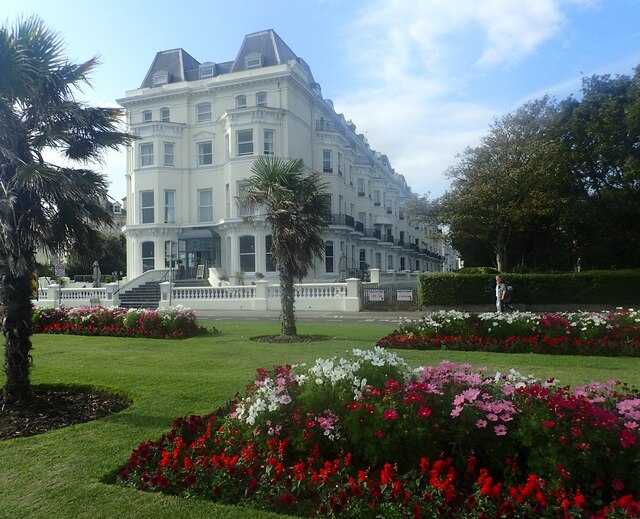
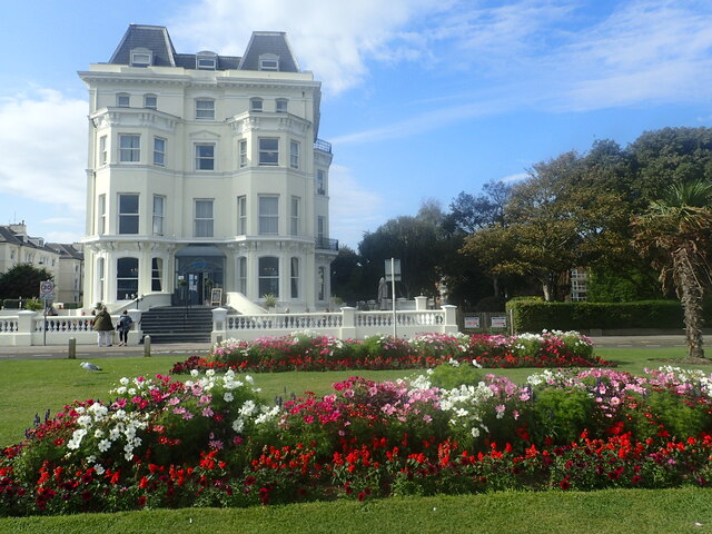
East Cliff, located in Kent, England, is a prominent geographical feature known for its stunning cliffs and slopes. Situated on the eastern coast of Kent, overlooking the English Channel, East Cliff offers breathtaking views and is a popular destination for locals and tourists alike.

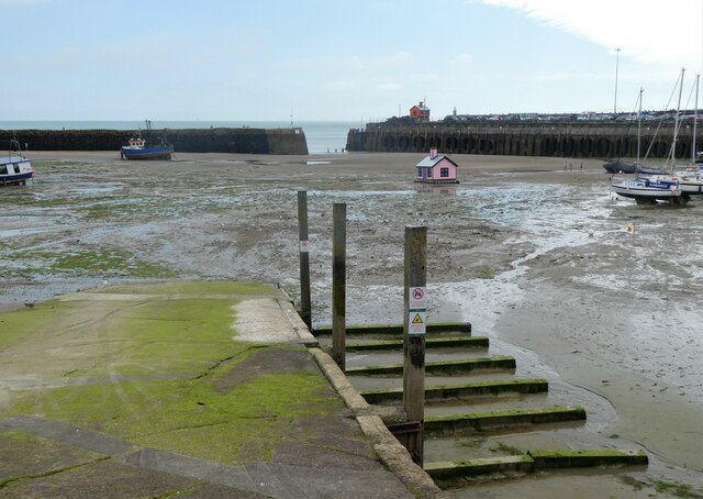
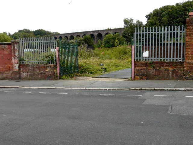
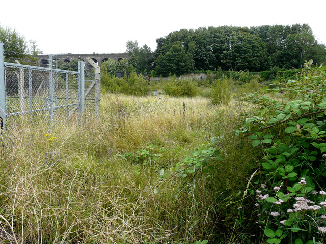
The cliff itself stretches for approximately 10 kilometers, reaching heights of up to 100 meters in some areas. Composed mainly of chalk, the cliffs have been shaped over thousands of years by natural erosion processes, resulting in their distinct white appearance. This unique geological formation has made East Cliff an important site for scientific research and geological studies.

The slopes of East Cliff are covered in lush vegetation, including various species of grasses, shrubs, and wildflowers. These plants provide habitat for a diverse range of wildlife, such as birds, butterflies, and small mammals. Additionally, the cliff is home to several species of nesting birds, including gulls and fulmars, which can often be seen soaring above the cliffs.

East Cliff is not only valued for its natural beauty but also for its historical significance. The area is dotted with remnants of ancient settlements and structures, including Roman forts and medieval castles, offering a glimpse into the region's rich heritage.

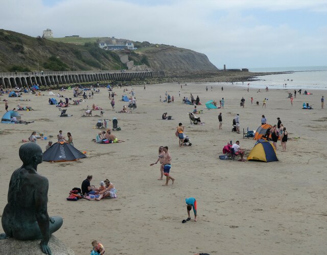
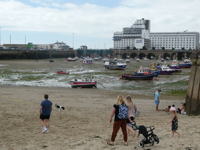
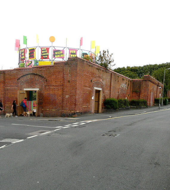
Due to its popularity, East Cliff has become a hub for outdoor activities. Visitors can enjoy leisurely walks along the cliff-top footpaths, hike down to the beach below, or participate in various water sports, such as swimming, surfing, and fishing.

In conclusion, East Cliff, Kent, is a remarkable location that captivates visitors with its majestic cliffs, scenic slopes, and rich history. It is an ideal destination for nature enthusiasts, history buffs, and anyone seeking a serene coastal experience.

If you have any feedback on the listing, please let us know in the comments section below.
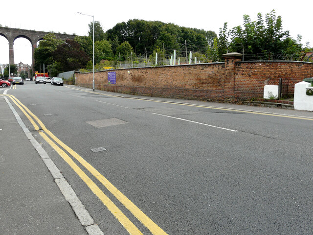
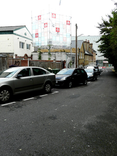
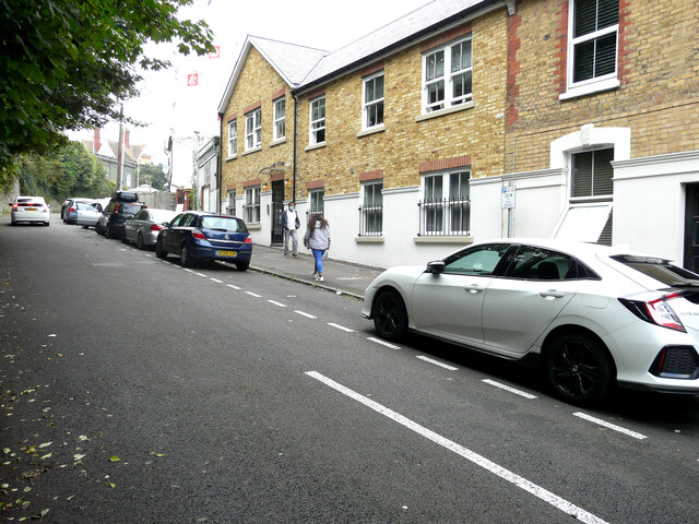
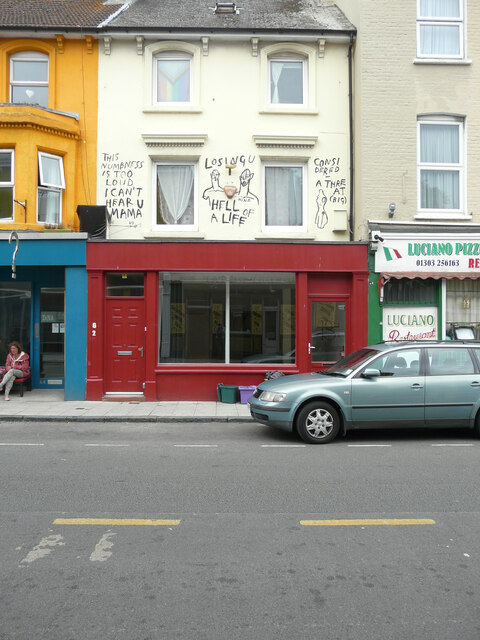
East Cliff Images

Images are sourced within 2km of 51.082525/1.1923211 or Grid Reference TR2336. Thanks to Geograph Open Source API. All images are credited.

Low tide, Folkestone Harbour The two tiny houses are called Holiday Home, two of six one-third size ‘homes’ identical except in their colourways. They were constructed by sculptor Richard Woods as part of Folkestone's 2017 Triennial.
Low tide, Folkestone Harbour
The two tiny houses are called Holiday Home, two of six one-third size ‘homes’ identical except in their colourways. They were constructed by sculptor Richard Woods as part of Folkestone's 2017 Triennial.
Sunny Sands, Folkestone Families enjoy the sandy beach at low tide, watched over by the Folkestone Mermaid. For the Folkestone Triennial in 2011, Cornelia Parker created a Folkestone version of Copenhagen's 'Little Mermaid'. It is a permanent work for the town. In the distance is East Cliff and Copt Point.
Sunny Sands, Folkestone
Families enjoy the sandy beach at low tide, watched over by the Folkestone Mermaid. For the Folkestone Triennial in 2011, Cornelia Parker created a Folkestone version of Copenhagen's 'Little Mermaid'. It is a permanent work for the town. In the distance is East Cliff and Copt Point.
Low tide, Folkestone Harbour People taking advantage of the exposed stretch of sand. In the background is the Grand Burstin Hotel on Marine Parade.
Low tide, Folkestone Harbour
People taking advantage of the exposed stretch of sand. In the background is the Grand Burstin Hotel on Marine Parade.
The bandstand at Folkestone One of the things that was most missed over the last two years was live music. This was the Sevenoaks & Tonbridge Concert Band playing on the bandstand at Folkestone on a Sunday afternoon in August.

Folkestone had been a resort for the wealthy since Victorian times with large villas and hotels being built to take advantage of the magnificent sea views. People promenaded and took the sea air on The Leas but a bandstand was missing. However, it took over 40 years to agree the funding for building a bandstand. Many people objected to the idea complaining that it would ruin the views of the sea. The Borough Council eventually decided to levy a one penny rate which also caused much anger as working class residents were barred from The Leas and would never be able to enjoy what they had helped pay for.

Despite the complaints, building started in 1894, with the cast iron structure being made at the Elmbank Foundry in Glasgow. It opened in 1895. By 2006 the bandstand had deteriorated substantially but with funding from Shepway District Council and Kent County Council, it has now been totally rebuilt.
The bandstand at Folkestone
One of the things that was most missed over the last two years was live music. This was the Sevenoaks & Tonbridge Concert Band playing on the bandstand at Folkestone on a Sunday afternoon in August. Folkestone had been a resort for the wealthy since Victorian times with large villas and hotels being built to take advantage of the magnificent sea views. People promenaded and took the sea air on The Leas but a bandstand was missing. However, it took over 40 years to agree the funding for building a bandstand. Many people objected to the idea complaining that it would ruin the views of the sea. The Borough Council eventually decided to levy a one penny rate which also caused much anger as working class residents were barred from The Leas and would never be able to enjoy what they had helped pay for. Despite the complaints, building started in 1894, with the cast iron structure being made at the Elmbank Foundry in Glasgow. It opened in 1895. By 2006 the bandstand had deteriorated substantially but with funding from Shepway District Council and Kent County Council, it has now been totally rebuilt.
The View Hotel, The Leas, Folkestone Folkestone had been a resort for the wealthy since Victorian times with large villas and hotels being built to take advantage of the magnificent sea views. People promenaded and took the sea air on The Leas, which was the most impressive and wealthy part of Folkestone. The Leas was designed in the mid 19th century by Decimus Burton, who also worked on buildings and gardens at London Zoo and Kew Gardens

There is still much of the air of a fashionable resort when on The Leas. This fine hotel, next to The Leas, is just west of the bandstand. See also <span class="nowrap"><a title="http://www.warrenpress.net/FolkestoneThenNow/FolkestoneTheLeas.html" rel="nofollow ugc noopener" href="http://www.warrenpress.net/FolkestoneThenNow/FolkestoneTheLeas.html">Link</a><img style="margin-left:2px;" alt="External link" title="External link - shift click to open in new window" src="https://s1.geograph.org.uk/img/external.png" width="10" height="10"/></span>
The View Hotel, The Leas, Folkestone
Folkestone had been a resort for the wealthy since Victorian times with large villas and hotels being built to take advantage of the magnificent sea views. People promenaded and took the sea air on The Leas, which was the most impressive and wealthy part of Folkestone. The Leas was designed in the mid 19th century by Decimus Burton, who also worked on buildings and gardens at London Zoo and Kew Gardens There is still much of the air of a fashionable resort when on The Leas. This fine hotel, next to The Leas, is just west of the bandstand. See also LinkExternal link
Royal Victoria Hospital, Radnor Park Avenue The hospital opened on Rendezvous Street in Folkestone as the Folkestone Dispensary in 1846.The name was expanded to Folkestone Dispensary and Infirmary and it relocated to a site on Dover Road in Folkestone in 1863. The current general hospital buildings were constructed on Radnor Park Avenue, and opened in 1890, when the name was again changed, this time to the Victoria Hospital. The prefix Royal was added in 1910. 

In the 1970s, services were scaled down, with the focusing of regional hospital care in East Kent on the town of Ashford, Kent. In 1973 maternity services were moved to Ashford's Willesborough Hospital. In 1979 the new William Harvey Hospital opened in Ashford (ironically, named after Folkestone's William Harvey), and many other services were transferred here over the following years. The accident and emergency department at Royal Victoria Hospital was closed at that time, leaving it with a minor injuries service <span class="nowrap"><a title="https://en.wikipedia.org/wiki/Royal_Victoria_Hospital,_Folkestone" rel="nofollow ugc noopener" href="https://en.wikipedia.org/wiki/Royal_Victoria_Hospital,_Folkestone">Link</a><img style="margin-left:2px;" alt="External link" title="External link - shift click to open in new window" src="https://s1.geograph.org.uk/img/external.png" width="10" height="10"/></span> 

Planning permission has been approved by Folkestone and Hythe District Council under application number Y19/0424/FH for the “demolition of former Royal Victoria Hospital outbuildings, together with the demolition of side and rear extensions to main Royal Victoria Hospital building”.

This view of the <a href="https://www.geograph.org.uk/photo/6332951">TR2236 : Royal Victoria Hospital, Radnor Park Avenue</a> was taken in November 2019. 

As there is security fencing to the right of the main entrance, it appears that the work is still ongoing.
Royal Victoria Hospital, Radnor Park Avenue
The hospital opened on Rendezvous Street in Folkestone as the Folkestone Dispensary in 1846.The name was expanded to Folkestone Dispensary and Infirmary and it relocated to a site on Dover Road in Folkestone in 1863. The current general hospital buildings were constructed on Radnor Park Avenue, and opened in 1890, when the name was again changed, this time to the Victoria Hospital. The prefix Royal was added in 1910. In the 1970s, services were scaled down, with the focusing of regional hospital care in East Kent on the town of Ashford, Kent. In 1973 maternity services were moved to Ashford's Willesborough Hospital. In 1979 the new William Harvey Hospital opened in Ashford (ironically, named after Folkestone's William Harvey), and many other services were transferred here over the following years. The accident and emergency department at Royal Victoria Hospital was closed at that time, leaving it with a minor injuries service LinkExternal link Planning permission has been approved by Folkestone and Hythe District Council under application number Y19/0424/FH for the “demolition of former Royal Victoria Hospital outbuildings, together with the demolition of side and rear extensions to main Royal Victoria Hospital building”. This view of the TR2236 : Royal Victoria Hospital, Radnor Park Avenue was taken in November 2019. As there is security fencing to the right of the main entrance, it appears that the work is still ongoing.
Royal Victoria Hospital site, Radnor Park Road Planning permission has been approved, with conditions, by Folkestone and Hythe District Council under application number 20/0532/FH for “residential development at Royal Victoria Hospital site consisting of 19, 4 & 5 bed houses and 19, 1 & 2 bed apartments including associated external works”. 

This view of the <a href="https://www.geograph.org.uk/photo/6294687">TR2236 : Royal Victoria Hospital, Radnor Park Avenue</a> shows the right hand side of the building, before it was demolished, and where the development is taking place.
Royal Victoria Hospital site, Radnor Park Road
Planning permission has been approved, with conditions, by Folkestone and Hythe District Council under application number 20/0532/FH for “residential development at Royal Victoria Hospital site consisting of 19, 4 & 5 bed houses and 19, 1 & 2 bed apartments including associated external works”. This view of the TR2236 : Royal Victoria Hospital, Radnor Park Avenue shows the right hand side of the building, before it was demolished, and where the development is taking place.
Folkestone’s former gasworks, Ship Street Home to Folkestone Triennial 2021 to display a sculptural installation by the artist Jacqueline Donachie entitled Beautiful Sunday.   

The notice affixed to the fence, is identified as The Plot C7 and bears the following information, “The production of gas at the Ship Street Gasworks ceased in 1959 but the social club for workers and local residents remained active on the derelict site for many years after. This story inspired the artist to make a sculpture to ‘celebrate all the dance floors in Folkestone’ past and present, which you will find marked out in the surface of the stage. The accompanying film documents line dance indigenous to Glasgow, the artist’s home town, called the Slosh. Beautiful Sunday is the title of the 1972 hit single by Daniel Boone”.
Folkestone’s former gasworks, Ship Street
Home to Folkestone Triennial 2021 to display a sculptural installation by the artist Jacqueline Donachie entitled Beautiful Sunday. The notice affixed to the fence, is identified as The Plot C7 and bears the following information, “The production of gas at the Ship Street Gasworks ceased in 1959 but the social club for workers and local residents remained active on the derelict site for many years after. This story inspired the artist to make a sculpture to ‘celebrate all the dance floors in Folkestone’ past and present, which you will find marked out in the surface of the stage. The accompanying film documents line dance indigenous to Glasgow, the artist’s home town, called the Slosh. Beautiful Sunday is the title of the 1972 hit single by Daniel Boone”.
Folkestone’s former gasworks, Ship Street Home to Folkestone Triennial 2021 to display a sculptural installation by the artist Jacqueline Donachie entitled Beautiful Sunday.   

The view of <a href="https://www.geograph.org.uk/photo/6956206">TR2236 : Folkestone’s former gasworks, Ship Street</a> shows a notice affixed to the fence, which mentions all the dance floors in Folkestone past and present. I presume this sculpture represents one of them.
Folkestone’s former gasworks, Ship Street
Home to Folkestone Triennial 2021 to display a sculptural installation by the artist Jacqueline Donachie entitled Beautiful Sunday. The view of TR2236 : Folkestone’s former gasworks, Ship Street shows a notice affixed to the fence, which mentions all the dance floors in Folkestone past and present. I presume this sculpture represents one of them.
Folkestone’s former gasworks site, Ship Street Folkestone and Hythe District Council has bought the derelict site and is proposing to build 100 new mixed tenure homes, including affordable properties, to help meet the needs of local people.
Folkestone’s former gasworks site, Ship Street
Folkestone and Hythe District Council has bought the derelict site and is proposing to build 100 new mixed tenure homes, including affordable properties, to help meet the needs of local people.
Ship Street The wall forms part of the former gasworks site.
Ship Street
The wall forms part of the former gasworks site.
Foord Road North The wall forms part of the former gasworks site. The view also includes the top of the sculpture <a href="https://www.geograph.org.uk/photo/4131391">TR2236 : ‘Green/Light’, Foord Road North</a>.
Foord Road North
The wall forms part of the former gasworks site. The view also includes the top of the sculpture TR2236 : ‘Green/Light’, Foord Road North.
8, Foord Road South Home to Folkestone Triennial 2021 to display a sculptural installation by the artists HayCheong, Simon Davenport and Shahed Saleem Nūr.  

A notice affixed to the brick gatepost in <a href="https://www.geograph.org.uk/photo/6224815">TR2236 : Foord Road South</a> shows a better view of the derelict building; it reads: The building in front of you, now occupied by the Islamic Cultural Centre, was two storeys taller until the 1940s. For a couple of centuries before that, it was one of the most important industrial buildings in Folkestone, incorporating a huge water wheel to drive its mill. The artists have worked with the Centre’s organising committee to present proposals for how the building might be developed to better serve the needs of the community in the future. The designs for the artwork were evolved through workshops with the Madrasa and the wider Islamic community.
8, Foord Road South
Home to Folkestone Triennial 2021 to display a sculptural installation by the artists HayCheong, Simon Davenport and Shahed Saleem Nūr. A notice affixed to the brick gatepost in TR2236 : Foord Road South shows a better view of the derelict building; it reads: The building in front of you, now occupied by the Islamic Cultural Centre, was two storeys taller until the 1940s. For a couple of centuries before that, it was one of the most important industrial buildings in Folkestone, incorporating a huge water wheel to drive its mill. The artists have worked with the Centre’s organising committee to present proposals for how the building might be developed to better serve the needs of the community in the future. The designs for the artwork were evolved through workshops with the Madrasa and the wider Islamic community.
Rose Court, 6, Foord Road South This view of <a href="https://www.geograph.org.uk/photo/6224815">TR2236 : Foord Road South</a> shows Rose Court during its construction and <a href="https://www.geograph.org.uk/photo/6958751">TR2236 : 8, Foord Road South</a> with its sculptural installation relating to Folkestone Triennial 2021.
Rose Court, 6, Foord Road South
This view of TR2236 : Foord Road South shows Rose Court during its construction and TR2236 : 8, Foord Road South with its sculptural installation relating to Folkestone Triennial 2021.
62, Tontine Street Someone has added messages to the wall above the disused shop.
62, Tontine Street
Someone has added messages to the wall above the disused shop.
68, Tontine Street The owner, M W Fitch, used to deal in antiques.
68, Tontine Street
The owner, M W Fitch, used to deal in antiques.
Pick Up Pintxos, 2-4, South Street The premises are next to <a href="https://www.geograph.org.uk/photo/6773148">TR2336 : 73, The Old High Street</a>.
Pick Up Pintxos, 2-4, South Street
The premises are next to TR2336 : 73, The Old High Street.
Show me another place!

East Cliff is located at Grid Ref: TR2336 (Lat: 51.082525, Lng: 1.1923211)

Administrative County: Kent

District: Shepway

Police Authority: Kent

What 3 Words

///emulating.forever.serious. Near Folkestone, Kent

Related Wikis

Folkestone Harbour

Folkestone Harbour is the main harbour of the town of Folkestone in Kent, England. == History == In 1541, King Henry VIII of England was about to wage...

Folkestone East railway station

Folkestone East is a former railway station in Folkestone, England. Opened by the South Eastern Railway in 1843 as part of its main line from London, it...

Folkestone Harbour railway station

Folkestone Harbour station was one of four railway stations in Folkestone, Kent. It served Folkestone Harbour with connecting boat train services across...

Art Buff

Art Buff is a graffiti artwork by Banksy which was created in Folkestone in 2014, Banksy announcing it as "part of the Folkestone triennial. Kind of"....

Folkestone Roman Villa

Folkestone Roman Villa, also referred to as the East Bay Site, is a villa built during the Roman Occupation of Britain, and is located in East Wear Bay...

Folkestone Priory

Folkestone Priory was a pre-Reformation Benedictine monastery at Folkestone in the English county of Kent. The priory church survives as the present parish...

St Mary and St Eanswythe's Church, Folkestone

St Mary and St Eanswythe's Church is a Grade II* listed Anglican church in Folkestone, Kent, situated not far from cliffs overlooking the English Channel...

Folkestone Town Hall

Folkestone Town Hall, also known as The Guildhall, is a municipal building in Guildhall Street, Folkestone, Kent, England. The town hall, which was the...

Nearby Amenities

Located within 500m of 51.082525,1.1923211
Source: PGS
Lat/Long: 51.0790386/1.1899944
Source: PGS
Lat/Long: 51.0798961/1.1865499
Source: PGS
Lat/Long: 51.0808499/1.1897816
Source: PGS
Lat/Long: 51.0802723/1.1899538
Source: PGS
Lat/Long: 51.0794328/1.1895698
Turning Circle
Source: Bing
Lat/Long: 51.0820879/1.1852558
Post Box
Postal Code: CT19
Ref: CT19 32
Source: survey
Lat/Long: 51.0825798/1.1889459
Post Box
Collection Times: Mo-Fr 09:00; Sa 07:00
Postal Code: CT19
Ref: CT19 52
Royal Cypher: EIIR
Royal Cypher Wikidata: Q33102113
Source: survey
Lat/Long: 51.0838723/1.1959066
Turning Circle
Lat/Long: 51.0838895/1.1937229
Turning Circle
Lat/Long: 51.082361/1.1853014
Entrance: yes
Lat/Long: 51.0863084/1.1938575
Noexit: yes
Lat/Long: 51.084973/1.1891872
Turning Circle
Lat/Long: 51.0842231/1.1899367
Post Box
Postal Code: CT19
Ref: CT19 48
Lat/Long: 51.0860979/1.1911612
Shop: alcohol
Lat/Long: 51.0860763/1.1911148
Fountain
Lat/Long: 51.0829348/1.1919517
Bus Stop
St Clements Court
Bench: yes
Bus: yes
Local Ref: opp
Naptan AtcoCode: 240099253
Naptan Bearing: SW
Naptan BusStopType: MKD
Naptan CommonName: St Clements Court
Naptan Indicator: opp
Naptan Landmark: St Clements Court
Naptan NaptanCode: kntgmwda
Naptan PlusbusZoneRef: FLKSTNC
Naptan RevisionNumber: 2
Naptan Status: act
Naptan Street: Wear Bay Crescent
Naptan Verified: no
Public Transport: platform
Ref: kntgmwda
Shelter: yes
Source: naptan_import
Source Date: 2018-04-11
Lat/Long: 51.0828942/1.1917039
Bus Stop
St Clements Court
Bench: no
Bin: no
Bus: yes
Lit: yes
Local Ref: adj
Naptan AtcoCode: 240099255
Naptan Bearing: NE
Naptan BusStopType: MKD
Naptan CommonName: St Clements Court
Naptan Indicator: adj
Naptan Landmark: St Clements Court
Naptan NaptanCode: kntgmtwt
Naptan PlusbusZoneRef: FLKSTNC
Naptan RevisionNumber: 2
Naptan Status: act
Naptan Street: Wear Bay Crescent
Naptan Verified: no
Public Transport: platform
Ref: kntgmtwt
Shelter: no
Source: naptan_import
Source Date: 2014-02-18
Tactile Paving: no
Lat/Long: 51.0831951/1.1918818
Bus Stop
Seagrave Crescent
Bench: no
Bin: no
Bus: yes
Lit: yes
Local Ref: adj
Naptan AtcoCode: 240099257
Naptan Bearing: N
Naptan BusStopType: MKD
Naptan CommonName: Seagrave Crescent
Naptan Indicator: adj
Naptan Landmark: Seagrave Crescent
Naptan NaptanCode: kntgmtwj
Naptan PlusbusZoneRef: FLKSTNC
Naptan RevisionNumber: 1
Naptan Status: act
Naptan Street: Wear Bay Crescent
Naptan Verified: no
Public Transport: platform
Ref: kntgmtwj
Shelter: no
Source: naptan_import
Source Date: 2018-04-11
Tactile Paving: no
Lat/Long: 51.08544/1.1926402
Bus Stop
Seagrave Crescent
Bench: no
Bin: no
Bus: yes
Lit: yes
Local Ref: opp
Naptan AtcoCode: 240099259
Naptan Bearing: S
Naptan BusStopType: MKD
Naptan CommonName: Seagrave Crescent
Naptan Indicator: opp
Naptan Landmark: Seagrave Crescent
Naptan NaptanCode: kntgmtjp
Naptan PlusbusZoneRef: FLKSTNC
Naptan RevisionNumber: 4
Naptan Status: act
Naptan Street: Wear Bay Crescent
Naptan Verified: no
Public Transport: platform
Ref: kntgmtjp
Shelter: no
Source: naptan_import
Source Date: 2018-04-11
Tactile Paving: no
Lat/Long: 51.0849194/1.1929717
Bus Stop
Ryland Place
Bus: yes
Local Ref: E-bound
Naptan AtcoCode: 2400A029390A
Naptan Bearing: E
Naptan BusStopType: MKD
Naptan CommonName: Ryland Place
Naptan Indicator: E-bound
Naptan Landmark: Lennard Road
Naptan NaptanCode: kntdgtga
Naptan PlusbusZoneRef: FLKSTNC
Naptan RevisionNumber: 4
Naptan Status: act
Naptan Street: Ryland Place
Naptan Verified: no
Public Transport: platform
Ref: kntdgtga
Source: naptan_import
Source Date: 2018-04-16
Lat/Long: 51.0835463/1.1870093
Bus Stop
Radnor Bridge
Bus: yes
Layer: 1
Local Ref: NW-bound
Naptan AtcoCode: 2400A030290A
Naptan Bearing: NW
Naptan BusStopType: MKD
Naptan CommonName: Radnor Bridge
Naptan Indicator: NW-bound
Naptan Landmark: Radnor Bridge
Naptan NaptanCode: kntdjadw
Naptan PlusbusZoneRef: FLKSTNC
Naptan RevisionNumber: 6
Naptan Status: act
Naptan Street: Radnor Bridge Road
Naptan Verified: no
Public Transport: platform
Ref: kntdjadw
Source: naptan_import
Source Date: 2018-04-16
Lat/Long: 51.0829359/1.1878328
Bus Stop
Radnor Bridge
Bus: yes
Layer: 1
Local Ref: SE-bound
Naptan AtcoCode: 2400A030300A
Naptan Bearing: SE
Naptan BusStopType: MKD
Naptan CommonName: Radnor Bridge
Naptan Indicator: SE-bound
Naptan Landmark: Radnor Bridge
Naptan NaptanCode: kntdjaga
Naptan PlusbusZoneRef: FLKSTNC
Naptan RevisionNumber: 3
Naptan Status: act
Naptan Street: Radnor Bridge Road
Naptan Verified: no
Public Transport: platform
Ref: kntdjaga
Source: naptan_import
Source Date: 2018-04-16
Lat/Long: 51.0831979/1.1873897
Post Box
Brand: Royal Mail
Brand Wikidata: Q638098
Collection Times: Mo-Fr 09:00; Sa 07:00
Operator: Royal Mail
Operator Wikidata: Q638098
Postal Code: CT19
Ref: CT19 183
Royal Cypher: EIIR
Royal Cypher Wikidata: Q33102113
Source: survey
Lat/Long: 51.0807372/1.1884833
Pub
The Mariner
Lat/Long: 51.08075/1.188425
St. Andrews
Building: residential
Lat/Long: 51.0817041/1.1882428
Crossing
Crossing: marked
Crossing Island: no
Crossing Markings: yes
Crossing Ref: zebra
Kerb: lowered
Tactile Paving: yes
Lat/Long: 51.0835191/1.1878212
Railway: crossing
Lat/Long: 51.083464/1.1878646
Bicycle Parking
Access: yes
Bicycle Parking: stands
Capacity: 10
Colour: blue
Covered: no
Cyclestreets Id: 195622
Fee: no
Lit: yes
Opening Hours: 24/7
Source: survey
Surface: asphalt
Lat/Long: 51.0810427/1.1899756
Post Box
Collection Times: Mo-Fr 09:00; Sa 07:00
Postal Code: CT19
Ref: CT19 60
Royal Cypher: GR
Royal Cypher Wikidata: Q33102273
Source: survey
Lat/Long: 51.0831788/1.1918815
Seamark Light Character: Fl
Seamark Light Colour: green
Seamark Light Range: 22
Seamark Light Reference: A 0896
Seamark Type: light_minor
Lat/Long: 51.0793333/1.1895333
Restaurant
Lat/Long: 51.0802804/1.1864711
Fixme: actual location unknown
Lat/Long: 51.082732/1.1988993
Restaurant
Rocksalt
Addr City: Folkestone
Addr Housenumber: 4-5
Addr Postcode: CT19 6AA
Addr Street: Fish Market
Fhrs Id: 289742
Opening Hours: We-Sa 12:00-15:00, We,Th 18:00-21:00, Fr,Sa 18:00-21:30, Su 12:00-16:00, PH 12:00-17:00
Source Addr: FHRS Open Data
Website: https://www.rocksaltfolkestone.co.uk/
Lat/Long: 51.0801372/1.1866135
Toilets
Access: yes
Fee: no
Female: yes
Male: yes
Note: Open Easter to September according to sign
Opening Hours: easter-Sep 30
Toilets Disposal: flush
Toilets Position: seated;urinal
Wheelchair: no
Lat/Long: 51.0818525/1.1905658
Crossing
Crossing: unmarked
Crossing Markings: no
Kerb: lowered
Tactile Paving: yes
Lat/Long: 51.0861083/1.1895301
Crossing
Crossing: unmarked
Crossing Markings: no
Kerb: lowered
Tactile Paving: yes
Lat/Long: 51.0833871/1.1876171
Railway: crossing
Lat/Long: 51.0834652/1.187932
Crossing
Crossing: unmarked
Crossing Markings: no
Kerb: lowered
Tactile Paving: yes
Lat/Long: 51.0861012/1.1896575
Pub
The Lifeboat
Addr City: Folkestone
Addr Housenumber: 42
Addr Postcode: CT19 6AF
Addr Street: North Street
Fhrs Id: 511409
Source Addr: FHRS Open Data
Wikidata: Q26627882
Lat/Long: 51.0815333/1.1867606
Pub
The Ship Inn
Lat/Long: 51.0806406/1.1877597
Crossing
Crossing: uncontrolled
Crossing Island: no
Crossing Ref: zebra
Tactile Paving: yes
Lat/Long: 51.0803928/1.1860595
Give Way
Direction: forward
Lat/Long: 51.0827486/1.1913514
Camera Angle: 15
Camera Direction: 20
Camera Mount: wall
Camera Type: fixed
Height: 2.5
Man Made: surveillance
Note: with infrared light
Surveillance: public
Surveillance Type: camera
Surveillance Zone: town
Lat/Long: 51.0809/1.1897121
Man Made: tower
Source: Bing
Lat/Long: 51.0833136/1.1989215
Fixme: actual location unknown
Lat/Long: 51.0823979/1.1987252
Fixme: actual location unknown
Lat/Long: 51.0830235/1.1989476
Fixme: actual location unknown
Lat/Long: 51.0833151/1.1991894
Fuel
Tram Road Filling Station
Addr City: Folkestone
Addr Postcode: CT20 1TE
Addr Street: The Tram Road
Fhrs Id: 289382
Source Addr: FHRS Open Data
Lat/Long: 51.0818529/1.1861857
Scissorbox
Shop: hairdresser
Lat/Long: 51.0862283/1.1903756
Restaurant
Smokehouse
Addr City: Folkestone
Addr Housenumber: 1
Addr Postcode: CT19 6NN
Addr Street: Back Street
Fhrs Id: 289647
Source Addr: FHRS Open Data
Lat/Long: 51.0805131/1.1872373
Cafe
Captains Table
Addr City: Folkestone
Addr Housenumber: 26
Addr Postcode: CT19 6AE
Addr Street: The Stade
Fhrs Id: 666451
Source Addr: FHRS Open Data
Lat/Long: 51.0805657/1.187411
Crossing
Crossing: unmarked
Crossing Markings: no
Lat/Long: 51.082506/1.1890384
Information: map
Tourism: information
Lat/Long: 51.0810242/1.1898807
Toilets
Access: yes
Check Date: 2024-05-05
Fee: no
Female: yes
Male: yes
Toilets Disposal: flush
Wheelchair: yes
Lat/Long: 51.0803196/1.1867462
Cafe
The Pavilion
Lat/Long: 51.0836532/1.1965448
Siren
Artist Name: Marc Schmitz;Dolgor Ser-Od
Artwork Type: sculpture
Direction: SSW
Start Date: 2017-09-02
Tourism: artwork
Url: http://www.folkestonetriennial.org.uk/artist/marc-schmitz-dolgor-ser-od/
Website: https://www.marcschmitz.net/_817
Lat/Long: 51.0835112/1.1970489
Folkestone
Description: Bathing water quality monitoring point at Folkestone
Man Made: monitoring_station
Monitoring Bathing Water: yes
Operator: Environment Agency
Ref: 13300
Ref EU Bwid: ukj4208-13300
Source: Environment Agency Open Data
Website: http://environment.data.gov.uk/bwq/profiles/profile.html?site=ukj4208-13300
Lat/Long: 51.0819705/1.1912712
Toilets
Wheelchair: yes
Lat/Long: 51.0819474/1.1908995
Entrance: main
Lat/Long: 51.0818264/1.1905083
Railway: buffer_stop
Lat/Long: 51.0864945/1.1900873
Generator Method: photovoltaic
Generator Output Electricity: yes
Generator Source: solar
Generator Type: solar_photovoltaic_panel
Location: roof
Power: generator
Lat/Long: 51.0848033/1.1925933
Generator Method: photovoltaic
Generator Output Electricity: yes
Generator Source: solar
Generator Type: solar_photovoltaic_panel
Location: roof
Power: generator
Lat/Long: 51.0834579/1.1939384
Generator Method: photovoltaic
Generator Output Electricity: yes
Generator Source: solar
Generator Type: solar_photovoltaic_panel
Location: roof
Power: generator
Lat/Long: 51.0826652/1.1895221
Generator Method: photovoltaic
Generator Output Electricity: yes
Generator Source: solar
Generator Type: solar_photovoltaic_panel
Location: roof
Power: generator
Lat/Long: 51.0839558/1.1902919
Generator Method: photovoltaic
Generator Output Electricity: yes
Generator Source: solar
Generator Type: solar_photovoltaic_panel
Location: roof
Power: generator
Lat/Long: 51.0839693/1.1903563
Generator Method: photovoltaic
Generator Output Electricity: yes
Generator Source: solar
Generator Type: solar_photovoltaic_panel
Location: roof
Power: generator
Lat/Long: 51.0840788/1.1867917
Generator Method: photovoltaic
Generator Output Electricity: yes
Generator Source: solar
Generator Type: solar_photovoltaic_panel
Location: roof
Power: generator
Lat/Long: 51.0830308/1.1911556
Generator Method: photovoltaic
Generator Output Electricity: yes
Generator Source: solar
Generator Type: solar_photovoltaic_panel
Location: roof
Power: generator
Lat/Long: 51.086036/1.1927312
Historic Railway: level_crossing
Lat/Long: 51.0861547/1.1898007
Historic Railway: level_crossing
Lat/Long: 51.0861541/1.1898556
Inscription: C. E. G. B. and E. D. F. cables
Note: Position from GPS
Sign: yes
Wikimedia Commons: File:HVDC position sign.jpg
Lat/Long: 51.0827606/1.1966572
Depth: 2m
Note: Pair 3, 30m from sign
Lat/Long: 51.0824872/1.1966796
Fixme: actual location unknown
Lat/Long: 51.0826544/1.1945204
Fixme: actual location unknown
Lat/Long: 51.0826379/1.1944248
Depth: 2m
Note: Pair 4, 20m from sign
Lat/Long: 51.0825775/1.1966763
Depth: 2m
Note: Pair 1, 50m from sign
Lat/Long: 51.0823017/1.1966771
Fixme: actual location unknown
Lat/Long: 51.0826444/1.1944644
Depth: 2m
Note: Pair 2, 40m from sign
Lat/Long: 51.0823913/1.196675
Fixme: actual location unknown
Lat/Long: 51.0826599/1.1945654
Information: map
Map Size: site
Map Type: street
Tourism: information
Lat/Long: 51.0842087/1.1963504
Recycling
Recycling Clothes: yes
Recycling Type: container
Lat/Long: 51.0841026/1.1963922
Recycling
Recycling Shoes: yes
Recycling Type: container
Lat/Long: 51.0840829/1.1963939
East Cliff Pavilion
Power: substation
Ref: 362172
Lat/Long: 51.0839524/1.1964939
Vending Machine
Opening Hours: 08:00-18:00 1.00 GBP/hour; 8.00 GBP/6 hours
Ref: 7537
Vending: parking_tickets
Lat/Long: 51.0841891/1.1963528
Waste Basket
Waste: trash
Lat/Long: 51.0839558/1.1962572
Camera Angle: 20
Camera Direction: 300
Camera Mount: wall
Camera Type: fixed
Height: 3
Man Made: surveillance
Note: with IR light
Surveillance: public
Surveillance Type: camera
Surveillance Zone: town
Lat/Long: 51.0860739/1.1912408
Crossing Island: yes
Lat/Long: 51.0861064/1.1895715
Life Ring
Emergency: life_ring
Lat/Long: 51.0805912/1.1888201
Waste Basket
Waste: trash
Lat/Long: 51.0806686/1.1888044
Barrier: bollard
Lat/Long: 51.0806492/1.1888123
Man Made: monitoring_station
Monitoring Weather: yes
Lat/Long: 51.080987/1.1895372
Bench
Direction: SES
Lat/Long: 51.0827592/1.1921233
Bench
Direction: SES
Lat/Long: 51.0827515/1.1920787
Crossing
Crossing: unmarked
Crossing Island: no
Crossing Markings: no
Tactile Paving: no
Lat/Long: 51.0850075/1.1962057
Bus Stop
London Street
Bus: yes
Local Ref: adj
Naptan AtcoCode: 2400107598
Naptan Bearing: NE
Naptan BusStopType: MKD
Naptan CommonName: London Street
Naptan Indicator: adj
Naptan Landmark: London Street
Naptan NaptanCode: kntjwjma
Naptan RevisionNumber: 2
Naptan Status: act
Naptan Street: The Tram Road
Naptan Verified: no
Public Transport: platform
Ref: kntjwjma
Source: naptan_import
Source Date: 2018-04-16
Lat/Long: 51.0829488/1.1872736
Baker's Gap
Place: locality
Ref: SY01
Ref Note: give location code SY01 when calling 999
Lat/Long: 51.0827162/1.194458
Bench
Backrest: yes
Direction: SSE
Material: wood
Lat/Long: 51.0833112/1.1958556
The Folkestone Mermaid
Artist Name: Cornelia Parker
Artwork Type: sculpture
Material: bronze
Start Date: 2011
Tourism: artwork
Lat/Long: 51.0810926/1.1902053
Waste Basket
Lat/Long: 51.0819197/1.190965
Life Ring
Emergency: life_ring
Operator: Folkestone & Hythe District Council
Ref: 13
Lat/Long: 51.0825644/1.1938073
Bench
Backrest: yes
Direction: SSE
Material: wood
Lat/Long: 51.0834004/1.1961648
Bench
Lat/Long: 51.0805449/1.1881928
Bench
Backrest: yes
Lat/Long: 51.0805228/1.1880731
Bench
Backrest: yes
Direction: SSE
Material: wood
Lat/Long: 51.0832866/1.1957104
Waste Basket
Lat/Long: 51.0822667/1.1922938
Bench
Backrest: yes
Direction: SSE
Material: wood
Lat/Long: 51.0832744/1.1956305
Bench
Direction: SSW
Lat/Long: 51.0835319/1.1971802
Waste Basket
Lat/Long: 51.0805589/1.1882588
Waste Basket
Lat/Long: 51.0816645/1.1904736
Bench
Lat/Long: 51.0831706/1.195084
Waste Basket
Lat/Long: 51.0810002/1.1898124
Bench
Lat/Long: 51.0804845/1.1879988
Bench
Lat/Long: 51.080416/1.1874043
Description: Info about danger and about the Coronation Parade
Information: guidepost
Lat/Long: 51.0827355/1.1943189
Waste Disposal
Lat/Long: 51.0804808/1.1879307
Waste Basket
Lat/Long: 51.0827516/1.1944269
Waste Basket
Lat/Long: 51.0824736/1.1933597
Bench
Backrest: yes
Direction: SSE
Material: wood
Lat/Long: 51.0835769/1.1970248
Bench
Lat/Long: 51.0804768/1.187889
Waste Basket
Lat/Long: 51.0812586/1.1899329
Folkestone's Fishing Heritage And History Museum
Fee: no
Opening Hours: Mo-Su 10:30-16:00
Tourism: museum
Lat/Long: 51.0804122/1.1864338
Grit Bin
Lat/Long: 51.0827506/1.1944369
Bench
Backrest: yes
Direction: SSE
Material: wood
Lat/Long: 51.0833817/1.1960518
Waste Basket
Lat/Long: 51.0813383/1.1899237
Bench
Direction: WSW
Lat/Long: 51.0834984/1.1972168
Life Ring
Emergency: life_ring
Operator: Folkestone & Hythe District Council
Ref: 14
Lat/Long: 51.0821428/1.1916565
Waste Basket
Lat/Long: 51.0815248/1.1901049
Bench
Backrest: yes
Direction: SSE
Material: wood
Lat/Long: 51.0834389/1.1963993
Cube circumsbribed by tetrahedron - tetrahedron circumscribed by cube
Artist Name: Gary Woodley
Start Date: 2017
Tourism: artwork
Lat/Long: 51.0816199/1.1902352
Bench
Backrest: yes
Lat/Long: 51.0805678/1.1883204
Bench
Backrest: yes
Direction: SSE
Material: wood
Lat/Long: 51.0834092/1.196221
Waste Basket
Lat/Long: 51.0809468/1.1893466
Waste Basket
Lat/Long: 51.0833364/1.1959289
Life Ring
Emergency: life_ring
Operator: Folkestone & Hythe District Council
Ref: 15
Lat/Long: 51.0815423/1.1903072
Bench
Backrest: yes
Direction: SSE
Material: wood
Lat/Long: 51.0834335/1.1963588
Bench
Backrest: yes
Direction: SSE
Material: wood
Lat/Long: 51.0832991/1.195782
Waste Basket
Lat/Long: 51.0804566/1.1877449
Bench
Backrest: yes
Direction: SSE
Material: wood
Lat/Long: 51.0832609/1.1955572
Bench
Backrest: yes
Direction: SSE
Material: wood
Lat/Long: 51.0834182/1.1962759
Waste Basket
Lat/Long: 51.0811327/1.1900632
Waste Basket
Lat/Long: 51.080813/1.1893945
Waste Basket
Lat/Long: 51.0828167/1.1943822
Bench
Backrest: yes
Lat/Long: 51.0829334/1.1947367
Waste Basket
Lat/Long: 51.0827773/1.1943727
Waste Basket
Lat/Long: 51.0829543/1.1949126
Copt Point
Place: locality
Lat/Long: 51.0836531/1.1988962
Bench
Backrest: yes
Colour: brown;blue
Direction: SWS
Material: plastic;metal
Lat/Long: 51.0814576/1.1890927
Waste Basket
Lat/Long: 51.0814517/1.1889728
Source: PGS
Lat/Long: 51.0809803/1.189826
Folkestone creative
Information: map
Map Type: street
Tourism: information
Lat/Long: 51.0800846/1.1863488
Barrier: bollard
Motor Vehicle: no
Lat/Long: 51.0801995/1.1864316
Shell Shop
Level: 0
Shop: gift
Lat/Long: 51.0802586/1.1865371
Bench
Lat/Long: 51.0830814/1.1945451
Bench
Backrest: yes
Lat/Long: 51.0831009/1.1947404
Janus Fortress: Folkestone
Artwork Type: statue
Tourism: artwork
Lat/Long: 51.0816742/1.1892355
Crossing
Crossing: unmarked
Crossing Markings: no
Lat/Long: 51.0809135/1.1859621
Barrier: bollard
Motor Vehicle: no
Lat/Long: 51.0801743/1.1863241
Seamark Small Craft Facility Category: fuel_station
Seamark Type: small_craft_facility
Waterway: fuel
Lat/Long: 51.0804363/1.1876611
Crossing
Lat/Long: 51.0802051/1.1868226
Description: A sign says that an artist once buried 30 pieces of gold here
Tourism: artwork
Lat/Long: 51.0809414/1.1899557
Description: an artificial young child's shoe
Tourism: artwork
Lat/Long: 51.0818209/1.190892
Description: white rooster on the roof
Tourism: artwork
Lat/Long: 51.0801059/1.1865863
Camera Angle: 30
Camera Direction: 230
Camera Mount: wall
Camera Type: fixed
Height: 2.5
Man Made: surveillance
Surveillance: public
Surveillance Type: camera
Surveillance Zone: town
Lat/Long: 51.0802998/1.1868086
Camera Angle: 40
Camera Direction: 45
Camera Mount: wall
Camera Type: fixed
Height: 2.5
Man Made: surveillance
Surveillance: public
Surveillance Type: camera
Surveillance Zone: traffic
Lat/Long: 51.0803716/1.1867751
Man Made: surveillance
Surveillance Type: camera
Lat/Long: 51.0809128/1.1863689
Give Way
Direction: forward
Lat/Long: 51.0806321/1.1864912
Noexit: yes
Lat/Long: 51.0809048/1.1869058
Give Way
Direction: backward
Lat/Long: 51.0825424/1.1890714
Shower
Access: yes
Fee: no
Lat/Long: 51.0810436/1.1900099
Crossing
Crossing: unmarked
Crossing Island: no
Crossing Markings: no
Tactile Paving: yes
Lat/Long: 51.0860071/1.1924602
Crossing
Crossing: unmarked
Crossing Markings: no
Lat/Long: 51.0825954/1.1889766
Crossing
Crossing: unmarked
Crossing Markings: no
Lat/Long: 51.0827656/1.1871046
Crossing
Crossing: unmarked
Crossing Markings: no
Lat/Long: 51.0862002/1.1902391
Crossing
Crossing: unmarked
Crossing Markings: no
Lat/Long: 51.0853836/1.1890792
Crossing
Crossing: unmarked
Crossing Markings: no
Lat/Long: 51.0822895/1.186696
Crossing
Crossing: unmarked
Crossing Markings: no
Lat/Long: 51.081495/1.1860826
Crossing
Crossing: unmarked
Crossing Markings: no
Lat/Long: 51.0825267/1.189202
Life Ring
Emergency: life_ring
Lat/Long: 51.0803306/1.1875959
Life Ring
Emergency: life_ring
Lat/Long: 51.0789696/1.1894229
Bench
Lat/Long: 51.0822751/1.1922187
Bench
Lat/Long: 51.0824352/1.193029
Bench
Lat/Long: 51.0820744/1.1913561
Bench
Lat/Long: 51.0819517/1.1910151
Bench
Lat/Long: 51.0821953/1.1918156
Bench
Lat/Long: 51.0815973/1.1903211
Bench
Lat/Long: 51.082592/1.193832
Bench
Lat/Long: 51.082509/1.1934166
Bench
Lat/Long: 51.0816528/1.1904283
Bench
Lat/Long: 51.082345/1.1925917
Crossing
Crossing: unmarked
Crossing Markings: no
Lat/Long: 51.0847668/1.1945103
Colour: blue
Inscription: WO
Marker: plate
Lat/Long: 51.0844975/1.1931472
Addr Housenumber: 18
Addr Street: The Stade
Lat/Long: 51.0807064/1.1880939
Addr Housenumber: 17
Addr Street: The Stade
Lat/Long: 51.0807249/1.1882105
Camera Angle: 45
Camera Direction: 140
Camera Mount: wall
Camera Type: fixed
Height: 3
Man Made: surveillance
Surveillance: public
Surveillance Type: camera
Surveillance Zone: town
Lat/Long: 51.0805551/1.187212
Camera Mount: ceiling
Height: 4
Man Made: surveillance
Surveillance: public
Surveillance Type: camera
Surveillance Zone: traffic
Lat/Long: 51.0808616/1.1865541
Note: end of maxweight=7.5 zone
Lat/Long: 51.0824602/1.1892071
Artwork Type: stone
Material: concrete
Start Date: 2021
Tourism: artwork
Lat/Long: 51.081334/1.188882
Waste Basket
Lat/Long: 51.0836073/1.1971505
Waste Basket
Lat/Long: 51.082523/1.1905979
Waste Basket
Lat/Long: 51.0826694/1.1915463
Camera Features: webcam
Camera Type: panning
Contact Webcam: https://camsecure.uk/HLS/folkestone.m3u8
Contact Webcam Resolution: 1920x1080
Contact Webcam Type: stream
Man Made: surveillance
Surveillance: public
Surveillance Type: camera
Website: https://www.folkestoneseafront.com/livestream/
Lat/Long: 51.0789818/1.1895512
The Stade Wastewater Pumping Station
Emergency Telephone Code: 0330 303 0368
Man Made: pumping_station
Operator: Southern Water
Pumping Station: wastewater
Ref: 103626
Lat/Long: 51.0819087/1.1907278
Fast Food
Sandy's Fish and Chips
Cuisine: fish_and_chips
Takeaway: yes
Lat/Long: 51.080427/1.1868192
Man Made: street_cabinet
Operator: Southern Water
Ref: 107962
Lat/Long: 51.0834039/1.1947822
Waste Basket
Lat/Long: 51.086302/1.1928498
Height: 3
Man Made: surveillance
Note: camera panning public
Lat/Long: 51.0830137/1.1853901
Man Made: street_cabinet
Note: for charging points, built 2022
Lat/Long: 51.0839404/1.1963383
Charging Station
Authentication App: yes
Capacity: 2
Fee: yes
Motorcar: yes
Operator: Connected Kerb
Operator Wikidata: Q113579669
Socket Type2: 2
Lat/Long: 51.0808652/1.1856743
Charging Station
Authentication App: yes
Capacity: 2
Fee: yes
Motorcar: yes
Operator: Connected Kerb
Operator Wikidata: Q113579669
Socket Type2: 2
Lat/Long: 51.0808664/1.1857089
Height: 2
Man Made: surveillance
Note: direction 225, incline 30, public
Surveillance: camera
Lat/Long: 51.0805932/1.1876742
Height: 3
Man Made: surveillance
Note: public, 25°NE, incline 30
Surveillance: camera
Lat/Long: 51.0808415/1.1882653
Capacity: 4
Construction Amenity: charging_station
Lat/Long: 51.0840134/1.1962826
Infrared Light: yes
Man Made: surveillance
Surveillance: camera
Lat/Long: 51.0818008/1.190662
Ice Cream
Herbert's
Addr Street: Fish Market
Check Date: 2024-05-05
Diet Vegan: yes
Outdoor Seating: yes
Payment American Express: yes
Payment Cash: yes
Payment Mastercard: yes
Payment Visa: yes
Payment Visa Debit: yes
Takeaway: yes
Wheelchair: limited
Lat/Long: 51.0802657/1.1866026
Marker: post
Material: plastic
Note: bipole 2
Source Position: gps
Utility: power
Lat/Long: 51.083422/1.1957955
Marker: post
Material: plastic
Note: bipole 1
Source Position: gps
Utility: power
Lat/Long: 51.0834196/1.1957759
Information: board
Source: survey
Tourism: information
Lat/Long: 51.0829811/1.1945499
Defibrillator
Access: yes
Booth: K6
Covered: booth
Defibrillator Location: inside old red phone box by Folkestone Harbour
Disused Amenity: telephone
Emergency: defibrillator
Man Made: telephone_box
Ref GB The Circuit: 71E23FB7-734B-4461-BA22-B04600913018
Lat/Long: 51.0804102/1.1876568
Source: PGS
Lat/Long: 51.0804762/1.189661
Source: PGS
Lat/Long: 51.0793172/1.1894912
Source: PGS
Lat/Long: 51.0794328/1.1895698
The data included in this document is from www.openstreetmap.org. The data is made available under ODbL.

Have you been to East Cliff?

Leave your review of East Cliff below (or comments, questions and feedback).