Radnor Cliff

Cliff, Slope in Kent Shepway

England

Radnor Cliff

The bandstand at Folkestone One of the things that was most missed over the last two years was live music. This was the Sevenoaks & Tonbridge Concert Band playing on the bandstand at Folkestone on a Sunday afternoon in August.

Folkestone had been a resort for the wealthy since Victorian times with large villas and hotels being built to take advantage of the magnificent sea views. People promenaded and took the sea air on The Leas but a bandstand was missing. However, it took over 40 years to agree the funding for building a bandstand. Many people objected to the idea complaining that it would ruin the views of the sea. The Borough Council eventually decided to levy a one penny rate which also caused much anger as working class residents were barred from The Leas and would never be able to enjoy what they had helped pay for.

Despite the complaints, building started in 1894, with the cast iron structure being made at the Elmbank Foundry in Glasgow. It opened in 1895. By 2006 the bandstand had deteriorated substantially but with funding from Shepway District Council and Kent County Council, it has now been totally rebuilt.
The bandstand at Folkestone Credit: Marathon

Radnor Cliff is a prominent geological feature located in the town of Folkestone, Kent, England. It is a steep and rugged cliff face that stretches for approximately one kilometer along the eastern edge of the town. The cliff is made up of layers of chalk and is part of the larger geological formation known as the White Cliffs of Dover.

The cliff is characterized by its impressive height, reaching up to 30 meters in some areas, and its distinctive white color, which is a result of the chalk composition. It is a popular tourist attraction, offering breathtaking panoramic views of the English Channel and the French coastline on clear days.

Radnor Cliff is also known for its historical significance. During World War II, it served as a key defensive position for the British army, with various military installations and fortifications strategically placed along its edge. Today, remnants of these wartime structures can still be seen, adding to the charm and historical appeal of the area.

The cliff is easily accessible, with several footpaths and trails allowing visitors to explore its beauty. It is a haven for wildlife, with a variety of bird species, butterflies, and wildflowers thriving in its chalky environment. The area is also popular among rock climbers, who are drawn to the challenging routes and stunning views.

In summary, Radnor Cliff is a striking geological feature in Folkestone, Kent, offering stunning views, historical significance, and a unique habitat for wildlife. It is a must-visit destination for nature enthusiasts, history buffs, and those seeking an exhilarating outdoor experience.

If you have any feedback on the listing, please let us know in the comments section below.
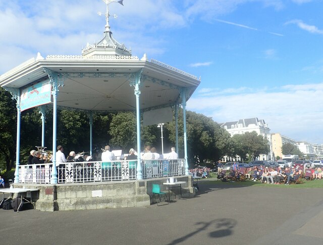
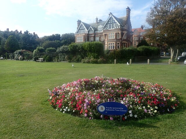
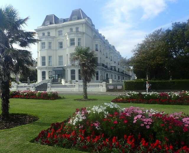
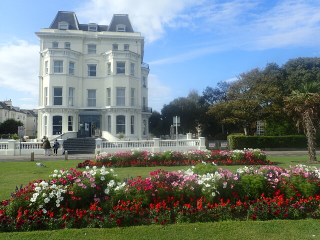
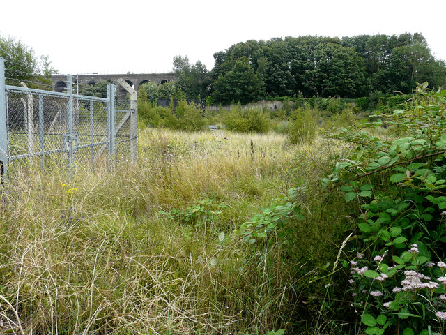
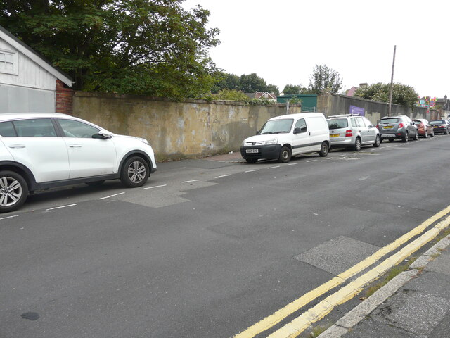
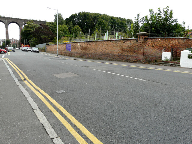
Radnor Cliff Images

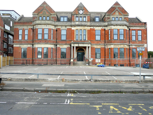
Images are sourced within 2km of 51.074218/1.1597374 or Grid Reference TR2135. Thanks to Geograph Open Source API. All images are credited.

The bandstand at Folkestone One of the things that was most missed over the last two years was live music. This was the Sevenoaks & Tonbridge Concert Band playing on the bandstand at Folkestone on a Sunday afternoon in August.

Folkestone had been a resort for the wealthy since Victorian times with large villas and hotels being built to take advantage of the magnificent sea views. People promenaded and took the sea air on The Leas but a bandstand was missing. However, it took over 40 years to agree the funding for building a bandstand. Many people objected to the idea complaining that it would ruin the views of the sea. The Borough Council eventually decided to levy a one penny rate which also caused much anger as working class residents were barred from The Leas and would never be able to enjoy what they had helped pay for.

Despite the complaints, building started in 1894, with the cast iron structure being made at the Elmbank Foundry in Glasgow. It opened in 1895. By 2006 the bandstand had deteriorated substantially but with funding from Shepway District Council and Kent County Council, it has now been totally rebuilt.
The bandstand at Folkestone
One of the things that was most missed over the last two years was live music. This was the Sevenoaks & Tonbridge Concert Band playing on the bandstand at Folkestone on a Sunday afternoon in August. Folkestone had been a resort for the wealthy since Victorian times with large villas and hotels being built to take advantage of the magnificent sea views. People promenaded and took the sea air on The Leas but a bandstand was missing. However, it took over 40 years to agree the funding for building a bandstand. Many people objected to the idea complaining that it would ruin the views of the sea. The Borough Council eventually decided to levy a one penny rate which also caused much anger as working class residents were barred from The Leas and would never be able to enjoy what they had helped pay for. Despite the complaints, building started in 1894, with the cast iron structure being made at the Elmbank Foundry in Glasgow. It opened in 1895. By 2006 the bandstand had deteriorated substantially but with funding from Shepway District Council and Kent County Council, it has now been totally rebuilt.
The Grand Hotel, The Leas, Folkestone Folkestone had been a resort for the wealthy since Victorian times with large villas and hotels being built to take advantage of the magnificent sea views. People promenaded and took the sea air on The Leas, which was the most impressive and wealthy part of Folkestone. The Leas was designed in the mid 19th century by Decimus Burton, who also worked on buildings and gardens at London Zoo and Kew Gardens. 

The Grand Hotel was built between 1899 and 1903 and, although it has many private apartments, it is still a hotel and restaurant. See also <a title="https://www.geograph.org.uk/photo/5794815" href="https://www.geograph.org.uk/photo/5794815">Link</a>

See <span class="nowrap"><a title="http://www.kentonline.co.uk/kent-business/county-news/love-affair-with-hotel-survives-39436/" rel="nofollow ugc noopener" href="http://www.kentonline.co.uk/kent-business/county-news/love-affair-with-hotel-survives-39436/">Link</a><img style="margin-left:2px;" alt="External link" title="External link - shift click to open in new window" src="https://s1.geograph.org.uk/img/external.png" width="10" height="10"/></span>  and <span class="nowrap"><a title="http://www.warrenpress.net/FolkestoneThenNow/FolkestoneTheLeas.html" rel="nofollow ugc noopener" href="http://www.warrenpress.net/FolkestoneThenNow/FolkestoneTheLeas.html">Link</a><img style="margin-left:2px;" alt="External link" title="External link - shift click to open in new window" src="https://s1.geograph.org.uk/img/external.png" width="10" height="10"/></span>
The Grand Hotel, The Leas, Folkestone
Folkestone had been a resort for the wealthy since Victorian times with large villas and hotels being built to take advantage of the magnificent sea views. People promenaded and took the sea air on The Leas, which was the most impressive and wealthy part of Folkestone. The Leas was designed in the mid 19th century by Decimus Burton, who also worked on buildings and gardens at London Zoo and Kew Gardens. The Grand Hotel was built between 1899 and 1903 and, although it has many private apartments, it is still a hotel and restaurant. See also Link See LinkExternal link and LinkExternal link
The Metropole and Grand Hotels on The Leas Folkestone had been a resort for the wealthy since Victorian times with large villas and hotels being built to take advantage of the magnificent sea views. People promenaded and took the sea air on The Leas, which was the most impressive and wealthy part of Folkestone. The Leas was designed in the mid 19th century by Decimus Burton, who also worked on buildings and gardens at London Zoo and Kew Gardens. 

The Grand Hotel seen here on the right was built between 1899 and 1903 while the Metropole was built between 1895 and 1897. The two hotels spent much of their time trying to outdo each other and rivalry between the two became intense. The Metropole closed in 1959 and is now apartments - see also <a title="https://www.geograph.org.uk/photo/5795726" href="https://www.geograph.org.uk/photo/5795726">Link</a> The Grand, although it has many private apartments it is still a hotel and restaurant.

See <span class="nowrap"><a title="http://www.kentonline.co.uk/kent-business/county-news/love-affair-with-hotel-survives-39436/" rel="nofollow ugc noopener" href="http://www.kentonline.co.uk/kent-business/county-news/love-affair-with-hotel-survives-39436/">Link</a><img style="margin-left:2px;" alt="External link" title="External link - shift click to open in new window" src="https://s1.geograph.org.uk/img/external.png" width="10" height="10"/></span>  and <span class="nowrap"><a title="http://www.warrenpress.net/FolkestoneThenNow/FolkestoneTheLeas.html" rel="nofollow ugc noopener" href="http://www.warrenpress.net/FolkestoneThenNow/FolkestoneTheLeas.html">Link</a><img style="margin-left:2px;" alt="External link" title="External link - shift click to open in new window" src="https://s1.geograph.org.uk/img/external.png" width="10" height="10"/></span>
The Metropole and Grand Hotels on The Leas
Folkestone had been a resort for the wealthy since Victorian times with large villas and hotels being built to take advantage of the magnificent sea views. People promenaded and took the sea air on The Leas, which was the most impressive and wealthy part of Folkestone. The Leas was designed in the mid 19th century by Decimus Burton, who also worked on buildings and gardens at London Zoo and Kew Gardens. The Grand Hotel seen here on the right was built between 1899 and 1903 while the Metropole was built between 1895 and 1897. The two hotels spent much of their time trying to outdo each other and rivalry between the two became intense. The Metropole closed in 1959 and is now apartments - see also Link The Grand, although it has many private apartments it is still a hotel and restaurant. See LinkExternal link and LinkExternal link
The Metropole on The Leas Folkestone had been a resort for the wealthy since Victorian times with large villas and hotels being built to take advantage of the magnificent sea views. People promenaded and took the sea air on The Leas, which was the most impressive and wealthy part of Folkestone. The Leas was designed in the mid-19th century by Decimus Burton, who also worked on buildings and gardens at London Zoo and Kew Gardens. 

The Metropole was built between 1895 and 1897. It closed in 1959 and is now apartments. Its great rival, The Grand Hotel, is immediately to the east and was built between 1899 and 1903. Although it has many private apartments, it is still a hotel and restaurant. See <a title="https://www.geograph.org.uk/photo/5794815" href="https://www.geograph.org.uk/photo/5794815">Link</a>  Also see <span class="nowrap"><a title="http://www.warrenpress.net/FolkestoneThenNow/FolkestoneTheLeas.html" rel="nofollow ugc noopener" href="http://www.warrenpress.net/FolkestoneThenNow/FolkestoneTheLeas.html">Link</a><img style="margin-left:2px;" alt="External link" title="External link - shift click to open in new window" src="https://s1.geograph.org.uk/img/external.png" width="10" height="10"/></span>
The Metropole on The Leas
Folkestone had been a resort for the wealthy since Victorian times with large villas and hotels being built to take advantage of the magnificent sea views. People promenaded and took the sea air on The Leas, which was the most impressive and wealthy part of Folkestone. The Leas was designed in the mid-19th century by Decimus Burton, who also worked on buildings and gardens at London Zoo and Kew Gardens. The Metropole was built between 1895 and 1897. It closed in 1959 and is now apartments. Its great rival, The Grand Hotel, is immediately to the east and was built between 1899 and 1903. Although it has many private apartments, it is still a hotel and restaurant. See Link Also see LinkExternal link
On The Leas at Folkestone Folkestone had been a resort for the wealthy since Victorian times with large villas and hotels being built to take advantage of the magnificent sea views. People promenaded and took the sea air on The Leas, which was the most impressive and wealthy part of Folkestone. The Leas was designed in the mid-19th century by Decimus Burton, who also worked on buildings and gardens at London Zoo and Kew Gardens. 

France was fairly clear on this day as was the view down the coast to Dungeness, and beyond to Fairlight Hills near Hastings.

See <span class="nowrap"><a title="http://www.warrenpress.net/FolkestoneThenNow/FolkestoneTheLeas.html" rel="nofollow ugc noopener" href="http://www.warrenpress.net/FolkestoneThenNow/FolkestoneTheLeas.html">Link</a><img style="margin-left:2px;" alt="External link" title="External link - shift click to open in new window" src="https://s1.geograph.org.uk/img/external.png" width="10" height="10"/></span>
On The Leas at Folkestone
Folkestone had been a resort for the wealthy since Victorian times with large villas and hotels being built to take advantage of the magnificent sea views. People promenaded and took the sea air on The Leas, which was the most impressive and wealthy part of Folkestone. The Leas was designed in the mid-19th century by Decimus Burton, who also worked on buildings and gardens at London Zoo and Kew Gardens. France was fairly clear on this day as was the view down the coast to Dungeness, and beyond to Fairlight Hills near Hastings. See LinkExternal link
House on The Leas, Folkestone Folkestone had been a resort for the wealthy since Victorian times with large villas and hotels being built to take advantage of the magnificent sea views. People promenaded and took the sea air on The Leas, which was the most impressive and wealthy part of Folkestone. The Leas was designed in the mid 19th century by Decimus Burton, who also worked on buildings and gardens at London Zoo and Kew Gardens

There is still much of the air of a fashionable resort when on The Leas. This fine house, next to The Leas, is just east of The Grand Hotel and before Clifton Crescent is reached. See also <span class="nowrap"><a title="http://www.warrenpress.net/FolkestoneThenNow/FolkestoneTheLeas.html" rel="nofollow ugc noopener" href="http://www.warrenpress.net/FolkestoneThenNow/FolkestoneTheLeas.html">Link</a><img style="margin-left:2px;" alt="External link" title="External link - shift click to open in new window" src="https://s1.geograph.org.uk/img/external.png" width="10" height="10"/></span>
House on The Leas, Folkestone
Folkestone had been a resort for the wealthy since Victorian times with large villas and hotels being built to take advantage of the magnificent sea views. People promenaded and took the sea air on The Leas, which was the most impressive and wealthy part of Folkestone. The Leas was designed in the mid 19th century by Decimus Burton, who also worked on buildings and gardens at London Zoo and Kew Gardens There is still much of the air of a fashionable resort when on The Leas. This fine house, next to The Leas, is just east of The Grand Hotel and before Clifton Crescent is reached. See also LinkExternal link
The View Hotel, The Leas, Folkestone Folkestone had been a resort for the wealthy since Victorian times with large villas and hotels being built to take advantage of the magnificent sea views. People promenaded and took the sea air on The Leas, which was the most impressive and wealthy part of Folkestone. The Leas was designed in the mid 19th century by Decimus Burton, who also worked on buildings and gardens at London Zoo and Kew Gardens

There is still much of the air of a fashionable resort when on The Leas. This fine hotel, next to The Leas, is just west of the bandstand. See also <span class="nowrap"><a title="http://www.warrenpress.net/FolkestoneThenNow/FolkestoneTheLeas.html" rel="nofollow ugc noopener" href="http://www.warrenpress.net/FolkestoneThenNow/FolkestoneTheLeas.html">Link</a><img style="margin-left:2px;" alt="External link" title="External link - shift click to open in new window" src="https://s1.geograph.org.uk/img/external.png" width="10" height="10"/></span>
The View Hotel, The Leas, Folkestone
Folkestone had been a resort for the wealthy since Victorian times with large villas and hotels being built to take advantage of the magnificent sea views. People promenaded and took the sea air on The Leas, which was the most impressive and wealthy part of Folkestone. The Leas was designed in the mid 19th century by Decimus Burton, who also worked on buildings and gardens at London Zoo and Kew Gardens There is still much of the air of a fashionable resort when on The Leas. This fine hotel, next to The Leas, is just west of the bandstand. See also LinkExternal link
Looking along The Leas Folkestone had been a resort for the wealthy since Victorian times with large villas and hotels being built to take advantage of the magnificent sea views. People promenaded and took the sea air on The Leas, which was the most impressive and wealthy part of Folkestone. The Leas was designed in the mid 19th century by Decimus Burton, who also worked on buildings and gardens at London Zoo and Kew Gardens.

For a close up of the information board here see <a title="https://www.geograph.org.uk/photo/7063640" href="https://www.geograph.org.uk/photo/7063640">Link</a>

There is still much of the air of a fashionable resort when on The Leas. This is the view from the far western end. See also <span class="nowrap"><a title="http://www.warrenpress.net/FolkestoneThenNow/FolkestoneTheLeas.html" rel="nofollow ugc noopener" href="http://www.warrenpress.net/FolkestoneThenNow/FolkestoneTheLeas.html">Link</a><img style="margin-left:2px;" alt="External link" title="External link - shift click to open in new window" src="https://s1.geograph.org.uk/img/external.png" width="10" height="10"/></span>
Looking along The Leas
Folkestone had been a resort for the wealthy since Victorian times with large villas and hotels being built to take advantage of the magnificent sea views. People promenaded and took the sea air on The Leas, which was the most impressive and wealthy part of Folkestone. The Leas was designed in the mid 19th century by Decimus Burton, who also worked on buildings and gardens at London Zoo and Kew Gardens. For a close up of the information board here see Link There is still much of the air of a fashionable resort when on The Leas. This is the view from the far western end. See also LinkExternal link
View from The Leas Folkestone had been a resort for the wealthy since Victorian times with large villas and hotels being built to take advantage of the magnificent sea views. People promenaded and took the sea air on The Leas, which was the most impressive and wealthy part of Folkestone. The Leas was designed in the mid 19th century by Decimus Burton, who also worked on buildings and gardens at London Zoo and Kew Gardens

There is still much of the air of a fashionable resort when on The Leas. This is the view from the far western end looking towards Dungeness. See also <span class="nowrap"><a title="http://www.warrenpress.net/FolkestoneThenNow/FolkestoneTheLeas.html" rel="nofollow ugc noopener" href="http://www.warrenpress.net/FolkestoneThenNow/FolkestoneTheLeas.html">Link</a><img style="margin-left:2px;" alt="External link" title="External link - shift click to open in new window" src="https://s1.geograph.org.uk/img/external.png" width="10" height="10"/></span>
View from The Leas
Folkestone had been a resort for the wealthy since Victorian times with large villas and hotels being built to take advantage of the magnificent sea views. People promenaded and took the sea air on The Leas, which was the most impressive and wealthy part of Folkestone. The Leas was designed in the mid 19th century by Decimus Burton, who also worked on buildings and gardens at London Zoo and Kew Gardens There is still much of the air of a fashionable resort when on The Leas. This is the view from the far western end looking towards Dungeness. See also LinkExternal link
Royal Victoria Hospital, Radnor Park Avenue The hospital opened on Rendezvous Street in Folkestone as the Folkestone Dispensary in 1846.The name was expanded to Folkestone Dispensary and Infirmary and it relocated to a site on Dover Road in Folkestone in 1863. The current general hospital buildings were constructed on Radnor Park Avenue, and opened in 1890, when the name was again changed, this time to the Victoria Hospital. The prefix Royal was added in 1910. 

In the 1970s, services were scaled down, with the focusing of regional hospital care in East Kent on the town of Ashford, Kent. In 1973 maternity services were moved to Ashford's Willesborough Hospital. In 1979 the new William Harvey Hospital opened in Ashford (ironically, named after Folkestone's William Harvey), and many other services were transferred here over the following years. The accident and emergency department at Royal Victoria Hospital was closed at that time, leaving it with a minor injuries service <span class="nowrap"><a title="https://en.wikipedia.org/wiki/Royal_Victoria_Hospital,_Folkestone" rel="nofollow ugc noopener" href="https://en.wikipedia.org/wiki/Royal_Victoria_Hospital,_Folkestone">Link</a><img style="margin-left:2px;" alt="External link" title="External link - shift click to open in new window" src="https://s1.geograph.org.uk/img/external.png" width="10" height="10"/></span> 

Planning permission has been approved by Folkestone and Hythe District Council under application number Y19/0424/FH for the “demolition of former Royal Victoria Hospital outbuildings, together with the demolition of side and rear extensions to main Royal Victoria Hospital building”.

This view of the <a href="https://www.geograph.org.uk/photo/6332951">TR2236 : Royal Victoria Hospital, Radnor Park Avenue</a> was taken in November 2019. 

As there is security fencing to the right of the main entrance, it appears that the work is still ongoing.
Royal Victoria Hospital, Radnor Park Avenue
The hospital opened on Rendezvous Street in Folkestone as the Folkestone Dispensary in 1846.The name was expanded to Folkestone Dispensary and Infirmary and it relocated to a site on Dover Road in Folkestone in 1863. The current general hospital buildings were constructed on Radnor Park Avenue, and opened in 1890, when the name was again changed, this time to the Victoria Hospital. The prefix Royal was added in 1910. In the 1970s, services were scaled down, with the focusing of regional hospital care in East Kent on the town of Ashford, Kent. In 1973 maternity services were moved to Ashford's Willesborough Hospital. In 1979 the new William Harvey Hospital opened in Ashford (ironically, named after Folkestone's William Harvey), and many other services were transferred here over the following years. The accident and emergency department at Royal Victoria Hospital was closed at that time, leaving it with a minor injuries service LinkExternal link Planning permission has been approved by Folkestone and Hythe District Council under application number Y19/0424/FH for the “demolition of former Royal Victoria Hospital outbuildings, together with the demolition of side and rear extensions to main Royal Victoria Hospital building”. This view of the TR2236 : Royal Victoria Hospital, Radnor Park Avenue was taken in November 2019. As there is security fencing to the right of the main entrance, it appears that the work is still ongoing.
Royal Victoria Hospital site, Radnor Park Road Planning permission has been approved, with conditions, by Folkestone and Hythe District Council under application number 20/0532/FH for “residential development at Royal Victoria Hospital site consisting of 19, 4 & 5 bed houses and 19, 1 & 2 bed apartments including associated external works”. 

This view of the <a href="https://www.geograph.org.uk/photo/6294687">TR2236 : Royal Victoria Hospital, Radnor Park Avenue</a> shows the right hand side of the building, before it was demolished, and where the development is taking place.
Royal Victoria Hospital site, Radnor Park Road
Planning permission has been approved, with conditions, by Folkestone and Hythe District Council under application number 20/0532/FH for “residential development at Royal Victoria Hospital site consisting of 19, 4 & 5 bed houses and 19, 1 & 2 bed apartments including associated external works”. This view of the TR2236 : Royal Victoria Hospital, Radnor Park Avenue shows the right hand side of the building, before it was demolished, and where the development is taking place.
Folkestone’s former gasworks, Ship Street Home to Folkestone Triennial 2021 to display a sculptural installation by the artist Jacqueline Donachie entitled Beautiful Sunday.   

The notice affixed to the fence, is identified as The Plot C7 and bears the following information, “The production of gas at the Ship Street Gasworks ceased in 1959 but the social club for workers and local residents remained active on the derelict site for many years after. This story inspired the artist to make a sculpture to ‘celebrate all the dance floors in Folkestone’ past and present, which you will find marked out in the surface of the stage. The accompanying film documents line dance indigenous to Glasgow, the artist’s home town, called the Slosh. Beautiful Sunday is the title of the 1972 hit single by Daniel Boone”.
Folkestone’s former gasworks, Ship Street
Home to Folkestone Triennial 2021 to display a sculptural installation by the artist Jacqueline Donachie entitled Beautiful Sunday. The notice affixed to the fence, is identified as The Plot C7 and bears the following information, “The production of gas at the Ship Street Gasworks ceased in 1959 but the social club for workers and local residents remained active on the derelict site for many years after. This story inspired the artist to make a sculpture to ‘celebrate all the dance floors in Folkestone’ past and present, which you will find marked out in the surface of the stage. The accompanying film documents line dance indigenous to Glasgow, the artist’s home town, called the Slosh. Beautiful Sunday is the title of the 1972 hit single by Daniel Boone”.
Folkestone’s former gasworks, Ship Street Home to Folkestone Triennial 2021 to display a sculptural installation by the artist Jacqueline Donachie entitled Beautiful Sunday.   

The view of <a href="https://www.geograph.org.uk/photo/6956206">TR2236 : Folkestone’s former gasworks, Ship Street</a> shows a notice affixed to the fence, which mentions all the dance floors in Folkestone past and present. I presume this sculpture represents one of them.
Folkestone’s former gasworks, Ship Street
Home to Folkestone Triennial 2021 to display a sculptural installation by the artist Jacqueline Donachie entitled Beautiful Sunday. The view of TR2236 : Folkestone’s former gasworks, Ship Street shows a notice affixed to the fence, which mentions all the dance floors in Folkestone past and present. I presume this sculpture represents one of them.
Folkestone’s former gasworks site, Ship Street Folkestone and Hythe District Council has bought the derelict site and is proposing to build 100 new mixed tenure homes, including affordable properties, to help meet the needs of local people.
Folkestone’s former gasworks site, Ship Street
Folkestone and Hythe District Council has bought the derelict site and is proposing to build 100 new mixed tenure homes, including affordable properties, to help meet the needs of local people.
Ship Street The wall forms part of the former gasworks site.
Ship Street
The wall forms part of the former gasworks site.
Foord Road North The wall forms part of the former gasworks site. The view also includes the top of the sculpture <a href="https://www.geograph.org.uk/photo/4131391">TR2236 : ‘Green/Light’, Foord Road North</a>.
Foord Road North
The wall forms part of the former gasworks site. The view also includes the top of the sculpture TR2236 : ‘Green/Light’, Foord Road North.
Show me another place!

Radnor Cliff is located at Grid Ref: TR2135 (Lat: 51.074218, Lng: 1.1597374)

Administrative County: Kent

District: Shepway

Police Authority: Kent

What 3 Words

///informed.dent.situation. Near Folkestone, Kent

Nearby Locations

Radnor Cliff

Related Wikis

Sandgate Plain

Sandgate Plain was a cricket ground in Folkestone in Kent. The ground was situated on the Folkestone Leas, an area along the coast to the west of the town...
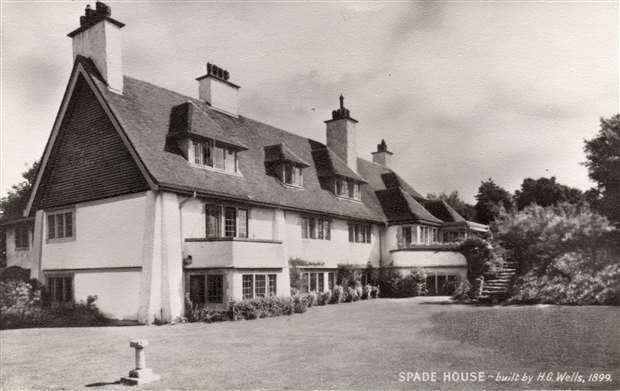
Spade House

Spade House was the home of the science fiction writer H. G. Wells from 1901 to 1909. It is a large mansion overlooking Sandgate, near Folkestone, in southeast...

History of Folkestone

The history of Folkestone stretches back to ancient times, with evidence of human habitation dating to the Mesolithic and Paleolithic ages over 12,000...

Folkestone School for Girls

The Folkestone School for Girls (FSG) is an all-girls grammar school with academy status in Folkestone, Kent, England, next to Sandgate Primary School...

Nearby Amenities

Located within 500m of 51.074218,1.1597374
Source: PGS
Lat/Long: 51.0731323/1.1550876
Source: PGS
Lat/Long: 51.0732365/1.1653392
Crossing
Crossing: unmarked
Crossing Island: yes
Kerb: lowered
Tactile Paving: yes
Lat/Long: 51.0764927/1.1554977
Source: Bing
Lat/Long: 51.076204/1.1619461
Turning Circle
Source: Bing
Lat/Long: 51.0767497/1.1560165
Check Date: 2022-01-11
Traffic Calming: bump
Lat/Long: 51.0736595/1.1616478
Turning Circle
Source: Bing
Lat/Long: 51.0750089/1.155852
Turning Circle
Source: Bing
Lat/Long: 51.0759226/1.1562272
Post Box
Collection Times: Mo-Fr 09:00; Sa 07:00
Postal Code: CT20
Ref: CT20 8
Source: survey
Lat/Long: 51.0739887/1.1571092
Millennium Milepost Radnor Cliff
Description: 1) Rye 28.5 2) Folkestone 1.5
Image: https://www.cyclestreets.net/location/185611/cyclestreets185611.jpg
Information: guidepost
Ncn Milepost: mills
Source: survey
Sustrans Ref: MP 292
Tourism: information
Lat/Long: 51.0736581/1.1614313
Barrier: bollard
Bicycle: yes
Bollard: removable
Foot: yes
Material: metal
Lat/Long: 51.0747131/1.1659849
Post Box
Collection Times: Mo-Fr 17:45; Sa 12:15
Postal Code: CT20
Ref: CT20 143
Lat/Long: 51.0777118/1.1584081
Post Box
Collection Times: Mo-Fr 17:45; Sa 12:15
Post Box Type: pillar
Postal Code: CT20
Ref: CT20 59
Royal Cypher: VR
Royal Cypher Wikidata: Q33102356
Lat/Long: 51.0763384/1.1624988
Bus Stop
The Metropole
Bench: yes
Bin: no
Bus: yes
Lit: yes
Local Ref: opp
Naptan AtcoCode: 2400A030350A
Naptan Bearing: E
Naptan BusStopType: MKD
Naptan CommonName: The Metropole
Naptan Indicator: opp
Naptan Landmark: Metropole Hotel
Naptan NaptanCode: kntdjagt
Naptan PlusbusZoneRef: FLKSTNC
Naptan RevisionNumber: 3
Naptan Status: act
Naptan Street: Sandgate Road
Naptan Verified: no
Public Transport: platform
Ref: kntdjagt
Shelter: yes
Source: naptan_import
Source Date: 2014-02-03
Tactile Paving: no
Lat/Long: 51.0763468/1.1638948
Bus Stop
Dixwell Road
Bench: yes
Bin: no
Bus: yes
Lit: yes
Local Ref: E-bound
Naptan AtcoCode: 2400A030340A
Naptan Bearing: E
Naptan BusStopType: MKD
Naptan CommonName: Dixwell Road
Naptan Indicator: E-bound
Naptan Landmark: Dixwell Road
Naptan NaptanCode: kntdjagp
Naptan PlusbusZoneRef: FLKSTNC
Naptan RevisionNumber: 5
Naptan Status: act
Naptan Street: Sandgate Road
Naptan Verified: no
Public Transport: platform
Ref: kntdjagp
Shelter: yes
Source: naptan_import
Source Date: 2018-04-13
Tactile Paving: no
Lat/Long: 51.0763932/1.1595552
Bus Stop
Coolinge Lane
Bench: yes
Bin: yes
Bus: yes
Lit: yes
Local Ref: adj
Naptan AtcoCode: 2400A027520A
Naptan Bearing: E
Naptan BusStopType: MKD
Naptan CommonName: Coolinge Lane
Naptan Indicator: adj
Naptan Landmark: Coolinge Lane
Naptan NaptanCode: kntdgdmg
Naptan PlusbusZoneRef: FLKSTNC
Naptan RevisionNumber: 3
Naptan Status: act
Naptan Street: Sandgate Hill
Naptan Verified: no
Public Transport: platform
Ref: kntdgdmg
Shelter: yes
Source: naptan_import
Source Date: 2018-04-13
Tactile Paving: no
Lat/Long: 51.0765719/1.1549916
Bus Stop
Coolinge Lane
Bench: yes
Bin: yes
Bus: yes
Lit: yes
Local Ref: opp
Naptan AtcoCode: 240099283
Naptan Bearing: W
Naptan BusStopType: MKD
Naptan CommonName: Coolinge Lane
Naptan Indicator: opp
Naptan Landmark: Radnor Cliff Crescent
Naptan NaptanCode: kntgpgmd
Naptan PlusbusZoneRef: FLKSTNC
Naptan RevisionNumber: 2
Naptan Status: act
Naptan Street: Sandgate Hill
Naptan Verified: no
Public Transport: platform
Ref: kntgpgmd
Shelter: yes
Source: naptan_import
Source Date: 2018-04-13
Tactile Paving: no
Lat/Long: 51.0764001/1.1557383
Bus Stop
Dixwell Road
Bench: no
Bin: no
Bus: yes
Lit: yes
Local Ref: W-bound
Naptan AtcoCode: 240099235
Naptan Bearing: W
Naptan BusStopType: MKD
Naptan CommonName: Dixwell Road
Naptan Indicator: W-bound
Naptan Landmark: Dixwell Road
Naptan NaptanCode: kntgmwja
Naptan PlusbusZoneRef: FLKSTNC
Naptan RevisionNumber: 3
Naptan Status: act
Naptan Street: Sandgate Road
Naptan Verified: no
Public Transport: platform
Ref: kntgmwja
Shelter: no
Source: naptan_import
Source Date: 2018-04-13
Tactile Paving: no
Lat/Long: 51.0762096/1.1580605
Bus Stop
The Metropole
Bench: yes
Bin: yes
Bus: yes
Lit: yes
Local Ref: adj
Naptan AtcoCode: 2400A030330A
Naptan Bearing: W
Naptan BusStopType: MKD
Naptan CommonName: The Metropole
Naptan Indicator: adj
Naptan Landmark: Metropole Hotel
Naptan NaptanCode: kntdjagm
Naptan PlusbusZoneRef: FLKSTNC
Naptan RevisionNumber: 1
Naptan Status: act
Naptan Street: Sandgate Road
Naptan Verified: no
Public Transport: platform
Ref: kntdjagm
Shelter: yes
Source: naptan_import
Source Date: 2007-02-27
Tactile Paving: no
Lat/Long: 51.0761393/1.1619245
Taxi
Sandgate Road Surgery
Capacity: 2
Naptan AtcoCode: 2400A063260R
Naptan CommonName: Sandgate Road Surgery
Naptan Indicator: taxi rank
Naptan Landmark: Doctor's Surgery
Naptan PlusbusZoneRef: FLKSTNC
Naptan RevisionNumber: 3
Naptan Status: act
Naptan Street: Sandgate Road
Naptan Verified: no
Source: naptan_import
Source Date: 2013-11-29
Lat/Long: 51.0763792/1.1590423
Laburnham Court
Building: residential
Lat/Long: 51.0771969/1.1634435
Post Box
Collection Times: Mo-Fr 09:00; Sa 07:00
Operator: Royal Mail
Operator Wikidata: Q638098
Ref: CT20 169D
Lat/Long: 51.075396/1.1582825
Folkestone Physiotherapy and Sports Injury Clinic
Addr Housenumber: 11b
Addr Street: Earls Avenue
Healthcare: physiotherapist
Lat/Long: 51.0762221/1.1652759
Dentist
Earlsgate Dental Practice
Addr Housenumber: 11
Addr Street: Earls Avenue
Healthcare: dentist
Phone: +44 1303 850234
Source: photo
Lat/Long: 51.0761709/1.1653488
Kindergarten
Radnor Park Kindergarten
Source: survey
Lat/Long: 51.0767727/1.1645391
Telephone
Booth: KX100
Charge: 0.60 GBP/min
Covered: booth
Source: survey
Lat/Long: 51.0761058/1.1622619
Turning Circle
Source: Bing
Lat/Long: 51.0748145/1.1588199
Traffic Calming: bump
Lat/Long: 51.0738302/1.164821
Crossing
Crossing: unmarked
Crossing Island: no
Kerb: lowered
Tactile Paving: yes
Lat/Long: 51.0761963/1.1588145
Attraction: maze
Lat/Long: 51.073523/1.1624413
Doctors
Sandgate Road Surgery
Healthcare: doctor
Lat/Long: 51.0765499/1.1590111
Pharmacy
Lloyds Pharmacy
Brand: Lloyds Pharmacy
Brand Wikidata: Q6662870
Brand Wikipedia: en:LloydsPharmacy
Dispensing: yes
Drive Through: no
Healthcare: pharmacy
Level: 0
Lat/Long: 51.0765475/1.1591536
Crossing
Crossing: unmarked
Tactile Paving: yes
Lat/Long: 51.0762943/1.1547632
Camera Angle: 30
Camera Direction: 315
Camera Mount: wall
Camera Type: fixed
Height: 2
Infrared Light: yes
Man Made: surveillance
Surveillance: public
Surveillance Type: camera
Surveillance Zone: town
Lat/Long: 51.0735644/1.1555847
Crossing
Bicycle: yes
Crossing: unmarked
Crossing Island: yes
Crossing Markings: no
Kerb: lowered
Tactile Paving: yes
Lat/Long: 51.0764098/1.1658975
Addr Housenumber: 20
Addr Street: Clifton Crescent
Lat/Long: 51.0754023/1.1665819
Addr Housenumber: 22
Addr Street: Clifton Crescent
Lat/Long: 51.0753151/1.1663974
Crossing
Crossing: unmarked
Crossing Island: yes
Kerb: lowered
Tactile Paving: yes
Lat/Long: 51.0762964/1.1590095
Addr Housenumber: 6
Addr Street: Sandgate Hill
Lat/Long: 51.0761973/1.1536955
Addr Housename: Richard Court
Addr Housenumber: 170
Addr Street: Sandgate Road
Lat/Long: 51.0765295/1.1601986
Addr Housename: Westbourne Mansions
Lat/Long: 51.0765252/1.1647305
Bench
Backrest: yes
Colour: green
Material: wood
Seats: 2
Lat/Long: 51.0752634/1.1528523
Crossing
Crossing: unmarked
Crossing Island: yes
Kerb: lowered
Tactile Paving: yes
Lat/Long: 51.0762645/1.1585927
Waste Basket
Waste: trash;dog_excrement
Lat/Long: 51.0765904/1.1550146
Waste Basket
Waste: trash
Lat/Long: 51.0763979/1.1557604
Crossing
Crossing: unmarked
Crossing Island: no
Kerb: lowered
Tactile Paving: yes
Lat/Long: 51.0763392/1.1587803
Addr Housenumber: 18
Addr Street: Sandgate Hill
Lat/Long: 51.0758541/1.1532247
Waste Basket
Waste: trash
Lat/Long: 51.0744686/1.160129
Bench
Backrest: yes
Colour: gray
Material: wood
Seats: 3
Lat/Long: 51.074286/1.1637078
Bench
Backrest: yes
Colour: brown
Material: wood
Seats: 3
Lat/Long: 51.0744781/1.165337
Bench
Backrest: yes
Colour: brown
Material: wood
Seats: 3
Lat/Long: 51.0744044/1.1647207
Bench
Backrest: yes
Colour: gray
Material: wood
Seats: 3
Lat/Long: 51.0743162/1.1612747
Street Lamp
Lat/Long: 51.0742617/1.1632118
Bench
Backrest: yes
Colour: brown
Material: wood
Seats: 3
Lat/Long: 51.0743553/1.1643498
Bench
Backrest: yes
Colour: gray
Material: wood
Seats: 3
Lat/Long: 51.0745179/1.1656471
Bench
Backrest: yes
Colour: brown
Material: wood
Seats: 3
Lat/Long: 51.0743023/1.1638575
Street Lamp
Lat/Long: 51.0745077/1.1655985
Street Lamp
Lat/Long: 51.0744065/1.1647874
Street Lamp
Lat/Long: 51.0747296/1.157261
Street Lamp
Lat/Long: 51.0745104/1.1596598
Street Lamp
Lat/Long: 51.0743158/1.1639719
Bench
Backrest: yes
Colour: brown
Material: wood
Seats: 3
Lat/Long: 51.074326/1.1640998
Board Type: history
Information: board
Tourism: information
Lat/Long: 51.0742032/1.163069
Bench
Backrest: yes
Colour: brown
Material: wood
Seats: 3
Lat/Long: 51.074271/1.1621123
Bench
Backrest: yes
Colour: gray
Material: wood
Seats: 3
Lat/Long: 51.0743379/1.1642278
Bench
Backrest: yes
Colour: gray
Material: wood
Seats: 3
Lat/Long: 51.0743551/1.1609813
Street Lamp
Lat/Long: 51.074263/1.1622834
Waste Basket
Waste: trash
Lat/Long: 51.0742811/1.1619794
Street Lamp
Lat/Long: 51.0743128/1.1613899
Street Lamp
Lat/Long: 51.074432/1.1605252
Board Type: history
Information: board
Tourism: information
Lat/Long: 51.0747976/1.1557392
Bench
Backrest: yes
Colour: gray
Material: wood
Seats: 3
Lat/Long: 51.074268/1.1624141
Waste Basket
Waste: trash
Lat/Long: 51.0742655/1.1628022
Bench
Backrest: yes
Colour: gray
Material: wood
Seats: 3
Lat/Long: 51.0742712/1.1635448
Bench
Backrest: yes
Colour: gray
Direction: S
Material: wood
Seats: 3
Lat/Long: 51.0746142/1.1576813
Bench
Backrest: yes
Colour: brown
Material: wood
Seats: 3
Lat/Long: 51.0742638/1.1626702
Bench
Backrest: yes
Colour: brown
Material: wood
Seats: 3
Lat/Long: 51.0744964/1.1654537
Stop
Direction: backward
Lat/Long: 51.076355/1.165697
Bench
Backrest: yes
Colour: brown
Material: wood
Seats: 3
Lat/Long: 51.0742675/1.1632637
Bench
Backrest: yes
Colour: gray
Material: wood
Seats: 3
Lat/Long: 51.074527/1.1657388
Bench
Backrest: yes
Colour: brown
Material: wood
Seats: 3
Lat/Long: 51.0745479/1.1658837
Bench
Backrest: yes
Material: wood
Seats: 3
Lat/Long: 51.0744592/1.1651821
Street Lamp
Lat/Long: 51.074602/1.1587692
Bench
Backrest: yes
Colour: brown
Material: wood
Seats: 3
Lat/Long: 51.0742824/1.1618507
Bench
Backrest: yes
Colour: brown
Direction: S
Material: wood
Seats: 3
Lat/Long: 51.0746819/1.156707
Stop
Direction: backward
Lat/Long: 51.0764511/1.1656798
Bench
Backrest: yes
Colour: gray
Material: wood
Seats: 3
Lat/Long: 51.0742647/1.162941
Camera Mount: pole
Camera Type: panning
Height: 10
Man Made: surveillance
Surveillance: public
Surveillance Type: camera
Surveillance Zone: town
Lat/Long: 51.0732281/1.1634193
Vending Machine
Vending: parking_tickets
Lat/Long: 51.0739735/1.1667173
Street Lamp
Lat/Long: 51.0734951/1.1658408
Street Lamp
Lat/Long: 51.0734287/1.1651681
Waste Basket
Waste: trash
Lat/Long: 51.0733287/1.1603751
Recycling
Recycling Cans: yes
Recycling Glass Bottles: yes
Recycling Paper: yes
Recycling Plastic Bottles: yes
Recycling Type: container
Lat/Long: 51.0739887/1.1660979
Life Ring
Emergency: life_ring
Operator: Folkestone & Hythe District Council
Ref: 21
Lat/Long: 51.0733505/1.1643726
Waste Basket
Waste: trash
Lat/Long: 51.0732351/1.1630727
Street Lamp
Direction: 10
Lat/Long: 51.0739135/1.1662047
Street Lamp
Direction: 180
Lamp Mount: pole
Lat/Long: 51.0739351/1.1656947
Recycling
Recycling Waste: yes
Recycling Type: container
Lat/Long: 51.073991/1.1660462
Camera Mount: wall
Height: 7
Man Made: surveillance
Surveillance: public
Surveillance Type: camera
Surveillance Zone: park
Lat/Long: 51.0739028/1.1668402
Street Lamp
Direction: 190
Lat/Long: 51.0739707/1.1666811
Addr Housenumber: 2
Lat/Long: 51.0739939/1.1526277
Waste Basket
Waste: trash
Lat/Long: 51.0734327/1.1560248
Bench
Backrest: yes
Colour: brown
Direction: S
Material: wood
Seats: 3
Lat/Long: 51.0749089/1.1567414
Bench
Backrest: yes
Colour: brown
Direction: S
Material: wood
Seats: 3
Lat/Long: 51.0747423/1.1560407
Bench
Backrest: no
Material: plastic
Seats: 3
Lat/Long: 51.0741357/1.1632123
Bicycle Rental
Brand: click2cycle
Capacity: 8
Operator: CLICK2(UK) LTD
Website: https://www.click2cycle.com/
Lat/Long: 51.0757004/1.1655168
Bench
Backrest: no
Material: plastic
Seats: 3
Lat/Long: 51.0741543/1.1625647
Bench
Backrest: yes
Colour: brown
Direction: S
Material: wood
Seats: 3
Lat/Long: 51.0747168/1.1564491
Bench
Backrest: no
Material: plastic
Seats: 3
Lat/Long: 51.0741525/1.1628699
Addr Housenumber: 5
Addr Street: Cliff Road
Fixme: which of the two houses?
Lat/Long: 51.0754172/1.1565898
Bench
Backrest: yes
Material: wood
Seats: 3
Lat/Long: 51.0762504/1.159246
Waste Basket
Waste: trash;cigarettes
Lat/Long: 51.0761624/1.1620318
Give Way
Direction: forward
Lat/Long: 51.0765101/1.1547097
Crossing
Crossing: unmarked
Tactile Paving: yes
Lat/Long: 51.0762739/1.1546188
Give Way
Direction: backward
Lat/Long: 51.0762373/1.1588106
Addr Housename: Maryland
Addr Street: Radnor Cliff Crescent
Lat/Long: 51.0756757/1.1537865
Man Made: street_cabinet
Ref: P0060
Street Cabinet: power
Lat/Long: 51.0759941/1.1545557
Addr Housename: Sea Breeze
Addr Housenumber: 5
Addr Street: Radnor Cliff Crescent
Lat/Long: 51.0742121/1.1534114
Addr Housename: East Cliff House
Addr Housenumber: 3
Addr Street: Radnor Cliff Crescent
Lat/Long: 51.0744818/1.1529909
Man Made: street_cabinet
Ref: P005
Street Cabinet: power
Voltage: 230
Lat/Long: 51.0760225/1.1545747
Street Lamp
Lat/Long: 51.075106/1.15323
Man Made: street_cabinet
Street Cabinet: power
Voltage: 230
Lat/Long: 51.0760087/1.1545657
Addr Housename: Greenhills
Addr Street: Radnor Cliff Crescent
Lat/Long: 51.075098/1.1530184
Addr Housename: Radnor House
Addr Street: Radnor Cliff Crescent
Lat/Long: 51.0757446/1.1538959
Direction: S
Tourism: viewpoint
Lat/Long: 51.0739466/1.162489
Crossing
Crossing: unmarked
Crossing Island: yes
Kerb: lowered
Tactile Paving: no
Lat/Long: 51.0752608/1.1657375
Crossing
Crossing: unmarked
Crossing Island: yes
Crossing Markings: no
Kerb: lowered
Tactile Paving: yes
Lat/Long: 51.0763237/1.1657017
Crossing
Crossing: unmarked
Crossing Island: yes
Kerb: lowered
Tactile Paving: yes
Lat/Long: 51.0764975/1.1656721
Crossing
Crossing: unmarked
Crossing Island: yes
Kerb: lowered
Tactile Paving: yes
Lat/Long: 51.0763833/1.165426
Man Made: street_cabinet
Ref: P0030
Lat/Long: 51.0761969/1.1654939
Crossing
Crossing: unmarked
Crossing Island: no
Tactile Paving: yes
Lat/Long: 51.0762821/1.1624006
Crossing
Crossing: unmarked
Crossing Island: yes
Tactile Paving: yes
Lat/Long: 51.0761435/1.1624243
Crossing
Crossing: unmarked
Crossing Island: no
Lat/Long: 51.076344/1.1634783
Crossing
Crossing: unmarked
Tactile Paving: no
Lat/Long: 51.0763304/1.1610188
Crossing
Crossing: unmarked
Tactile Paving: no
Lat/Long: 51.0764045/1.1592291
Crossing
Crossing: unmarked
Crossing Island: no
Tactile Paving: yes
Lat/Long: 51.0763889/1.1644725
Source: PGS
Lat/Long: 51.073274/1.1551325
Crossing
Crossing: unmarked
Crossing Island: no
Tactile Paving: no
Lat/Long: 51.0776749/1.1579623
Bench
Backrest: yes
Colour: green
Direction: SW
Material: wood
Seats: 3
Lat/Long: 51.0764923/1.1658622
The Colour Of Water
Artist Name: Spencer Finch
Artwork Type: installation
Start Date: 2011
Tourism: artwork
Website: https://www.creativefolkestone.org.uk/artists/spencer-finch-artworks/
Lat/Long: 51.0744124/1.1656235
Bicycle: yes
Information: guidepost
Note: to the south: Coastal Park(NCR2); to the west: Eurotunnel, Folkestone West; to the east: Town Centre
Tourism: information
Lat/Long: 51.0777114/1.1584332
Bicycle: yes
Information: guidepost
Note: to the north: Eurotunnel and Folkestone West; to the east:Town Centre (NCR2)
Tourism: information
Lat/Long: 51.0775526/1.1579556
Folkestone Cycle Network
Bicycle: yes
Information: guidepost
Note: to the west: Eurotunnel and Folkestone West; to the south:Town Centre (NCR2)
Tourism: information
Lat/Long: 51.0784206/1.1578876
Fixme: building?
Lat/Long: 51.0773025/1.1545581
Bench
Backrest: yes
Lat/Long: 51.0745295/1.1668362
Bench
Backrest: yes
Lat/Long: 51.0745526/1.1661542
Waste Basket
Waste: dog_excrement
Lat/Long: 51.074556/1.1661008
Crossing
Crossing: unmarked
Crossing Island: no
Tactile Paving: no
Lat/Long: 51.0775825/1.1584016
Camera Mount: pole
Camera Type: panning
Man Made: surveillance
Surveillance: public
Surveillance Type: camera
Surveillance Zone: parking
Lat/Long: 51.0738181/1.1649189
Waste Basket
Waste: dog_excrement
Lat/Long: 51.0746257/1.1611952
Inscription: H 75 3
Marker: plate
Utility: gas
Lat/Long: 51.0775784/1.1622488
Inscription: H 75 3
Marker: plate
Utility: gas
Lat/Long: 51.0753403/1.1656029
Inscription: H 4 13
Marker: plate
Lat/Long: 51.0777806/1.1602826
Inscription: GAS V
Marker: plate
Utility: gas
Lat/Long: 51.0764123/1.1646508
Inscription: H 125 9
Marker: plate
Utility: gas
Lat/Long: 51.0770319/1.1639515
Inscription: H 3 18
Marker: plate
Utility: gas
Lat/Long: 51.0757347/1.1659896
Inscription: H
Marker: plate
Lat/Long: 51.0786683/1.1587865
Bench
Backrest: yes
Direction: S
Material: wood
Lat/Long: 51.0777774/1.1608676
Waste Basket
Waste: dog_excrement
Lat/Long: 51.0747867/1.1587825
Addr Housenumber: 1a
Addr Street: Grimston Avenue
Lat/Long: 51.076502/1.1620714
Addr Housenumber: 4
Addr Street: Hardwick Road
Lat/Long: 51.0784677/1.1574242
Addr Housenumber: 1b
Addr Street: Grimston Avenue
Lat/Long: 51.0764101/1.1620901
Crossing
Crossing: unmarked
Crossing Island: yes
Tactile Paving: yes
Lat/Long: 51.0762316/1.1626086
Crossing
Tactile Paving: yes
Lat/Long: 51.0762093/1.1622234
Man Made: street_cabinet
Ref: 58
Lat/Long: 51.0765542/1.1658306
Man Made: street_cabinet
Ref: p003
Lat/Long: 51.0765675/1.1658296
Crossing
Crossing: unmarked
Crossing Island: yes
Tactile Paving: yes
Lat/Long: 51.0761804/1.1541536
Fixme: exact_position, details
Man Made: surveillance
Surveillance Type: camera
Lat/Long: 51.0735938/1.1622484
Bench
Backrest: no
Material: plastic
Seats: 3
Lat/Long: 51.0744068/1.1654645
Addr Housename: Sandgate Point
Lat/Long: 51.0747813/1.1548025
Bench
Backrest: no
Material: plastic
Seats: 3
Lat/Long: 51.0744512/1.1667119
Bench
Backrest: no
Material: plastic
Seats: 3
Lat/Long: 51.0741529/1.1639396
Bench
Backrest: no
Material: plastic
Seats: 3
Lat/Long: 51.0743471/1.1650933
Bench
Backrest: no
Material: plastic
Seats: 3
Lat/Long: 51.0744698/1.1663775
Fire Hydrant
Emergency: fire_hydrant
Fire Hydrant Type: underground
Lat/Long: 51.0776745/1.1628994
Give Way
Direction: forward
Lat/Long: 51.0752647/1.1658013
Give Way
Direction: backward
Lat/Long: 51.0783161/1.1579204
Life Ring
Emergency: life_ring
Operator: Folkestone & Hythe District Council
Ref: 22
Lat/Long: 51.0732871/1.1614948
Camera Angle: 20
Camera Direction: 225
Camera Mount: wall
Camera Type: fixed
Height: 4
Infrared Light: yes
Man Made: surveillance
Surveillance: public
Surveillance Type: camera
Lat/Long: 51.0734618/1.1583476
Bench
Backrest: yes
Direction: S
Lat/Long: 51.0765945/1.1548171
Give Way
Direction: forward
Lat/Long: 51.0763244/1.1587856
Waste Basket
Waste: trash
Lat/Long: 51.0745524/1.1660605
Bar
Bay Tree
Indoor Seating: yes
Outdoor Seating: yes
Lat/Long: 51.0754783/1.1651221
Addr Housenumber: 14
Addr Street: Plain Road
Lat/Long: 51.0771303/1.1605445
Addr Housenumber: 19
Addr Street: Plain Road
Lat/Long: 51.0768966/1.1604655
Addr Housenumber: 164
Addr Street: Sandgate Road
Lat/Long: 51.0765131/1.16081
Street Lamp
Lat/Long: 51.0769802/1.1550374
Inscription: H 63L 0.7
Marker: plate
Utility: hydrant
Lat/Long: 51.0768889/1.1653548
Inscription: H 6 7
Marker: plate
Utility: hydrant
Lat/Long: 51.0762572/1.164526
Inscription: Gas V
Marker: plate
Utility: gas
Lat/Long: 51.0764455/1.1647407
Fire Hydrant
Emergency: fire_hydrant
Lat/Long: 51.076457/1.1654387
Man Made: street_cabinet
Ref: p0008
Lat/Long: 51.0778522/1.1636155
Fire Hydrant
Emergency: fire_hydrant
Lat/Long: 51.0777642/1.1603706
Man Made: street_cabinet
Ref: AF08059
Lat/Long: 51.0777414/1.1599238
Man Made: street_cabinet
Ref: p004
Lat/Long: 51.0777401/1.1599574
Man Made: street_cabinet
Ref: p0007
Lat/Long: 51.0777042/1.1640316
Fire Hydrant
Emergency: fire_hydrant
Lat/Long: 51.0777419/1.1619773
Man Made: street_cabinet
Ref: 35
Lat/Long: 51.0777649/1.1619227
Man Made: street_cabinet
Ref: p0052
Lat/Long: 51.0771526/1.1640534
Fire Hydrant
Emergency: fire_hydrant
Fire Hydrant Type: underground
Lat/Long: 51.0770425/1.1623043
Fire Hydrant
Emergency: fire_hydrant
Fire Hydrant Type: underground
Lat/Long: 51.0771206/1.1637898
Man Made: street_cabinet
Lat/Long: 51.0773519/1.1620428
Parking
Access: private
Lat/Long: 51.0773936/1.164558
Man Made: street_cabinet
Ref: p0049
Lat/Long: 51.0771246/1.1632258
Man Made: street_cabinet
Lat/Long: 51.0748189/1.1661694
Construction Amenity: charging_station
Lat/Long: 51.0735352/1.1619131
Man Made: street_cabinet
Utility: power
Lat/Long: 51.0735291/1.1618558
Source Location: gps
Lat/Long: 51.076442/1.1657805
The Metropole Steps
Board Type: history
Information: board
Tourism: information
Lat/Long: 51.0736628/1.1619592
Waste Basket
Touchless: yes
Lat/Long: 51.0735137/1.161765
The Seashore
Information: board
Tourism: information
Lat/Long: 51.0735169/1.1617033
Bench
Backrest: yes
Direction: S
Material: wood
Seats: 3
Lat/Long: 51.0736667/1.1645183
Addr Housename: Bramble Hill
Addr Street: Radnor Cliff Crescent
Lat/Long: 51.0750054/1.153479
Addr Housenumber: 1
Addr Street: Radnor Cliff Crescent
Note: housenumber 1 is at the same building as housenumber 3
Lat/Long: 51.0744019/1.1530295
Addr Housename: Leemost House
Addr Street: Radnor Cliff Crescent
Lat/Long: 51.0745421/1.1536198
Addr Housename: Fernleas
Addr Street: Radnor Cliff Crescent
Lat/Long: 51.07438/1.1539648
Stop
Direction: forward
Lat/Long: 51.0762684/1.1624032
Waste Basket
Lat/Long: 51.0738686/1.1652888
Leisure: picnic_table
Lit: no
Material: wood
Lat/Long: 51.0740481/1.1655687
Leisure: picnic_table
Lit: no
Material: wood
Lat/Long: 51.0740907/1.1660473
Leisure: picnic_table
Lit: no
Material: wood
Lat/Long: 51.0738245/1.1652086
Bench
Backrest: yes
Direction: 140
Material: wood
Lat/Long: 51.0737798/1.165031
Street Lamp
Direction: 170
Lamp Mount: pole
Lat/Long: 51.0739259/1.1651653
Direction: 165
Information: board
Tourism: information
Lat/Long: 51.0739204/1.1652244
Leisure: picnic_table
Lit: no
Material: wood
Lat/Long: 51.0739204/1.1644617
Bench
Backrest: yes
Direction: 150
Material: wood
Lat/Long: 51.0739159/1.1643183
Bench
Backrest: yes
Direction: 150
Material: wood
Lat/Long: 51.0737452/1.1648884
Direction: 300
Information: board
Tourism: information
Lat/Long: 51.0737609/1.1646068
Waste Basket
Lat/Long: 51.073672/1.1640586
Bench
Backrest: yes
Direction: 160
Material: wood
Lat/Long: 51.0735538/1.1642128
Leisure: picnic_table
Lit: no
Material: wood
Lat/Long: 51.0735942/1.164017
Bench
Backrest: yes
Direction: 160
Material: wood
Lat/Long: 51.0735521/1.1636213
Waste Basket
Waste: mixed
Lat/Long: 51.0736075/1.1636167
Waste Basket
Waste: recycling
Lat/Long: 51.0736292/1.1635943
Street Lamp
Direction: 350
Lamp Mount: pole
Lat/Long: 51.0736426/1.1636755
Bench
Backrest: yes
Direction: 190
Material: wood
Lat/Long: 51.0734375/1.1625018
Street Lamp
Direction: 5
Lamp Mount: pole
Lat/Long: 51.0735764/1.1627924
Street Lamp
Direction: 355
Lamp Mount: pole
Lat/Long: 51.0735997/1.1632317
Bench: yes
Leisure: picnic_table
Lit: no
Material: wood
Lat/Long: 51.0735899/1.1618057
Bench: yes
Leisure: picnic_table
Lit: no
Material: wood
Lat/Long: 51.0735955/1.1616933
Welcome To The Lower Leas Coastal Park
Board Type: welcome_sign
Direction: 310
Information: board
Tourism: information
Lat/Long: 51.0736268/1.1615972
Street Lamp
Direction: 10
Lamp Mount: pole
Lat/Long: 51.0736221/1.1618241
Bench
Backrest: no
Direction: 160
Material: wood
Seats: 5
Lat/Long: 51.0736/1.1612519
Bench
Backrest: no
Direction: 210
Material: wood
Seats: 5
Lat/Long: 51.0735962/1.161319
Bench
Backrest: yes
Direction: 140
Material: wood
Lat/Long: 51.07353/1.1615171
Vending Machine
Operator: Folkestone & Hythe District Council
Vending: parking_tickets
Lat/Long: 51.0736569/1.1622241
Street Lamp
Direction: 180
Lamp Mount: pole
Lat/Long: 51.0736653/1.1621933
Street Lamp
Direction: 0
Lamp Mount: pole
Lat/Long: 51.0735893/1.1625551
The data included in this document is from www.openstreetmap.org. The data is made available under ODbL.

Have you been to Radnor Cliff?

Leave your review of Radnor Cliff below (or comments, questions and feedback).