South Cliff

Cliff, Slope in Yorkshire

England

South Cliff

South Cliff Views The view across the North Sea towards Bridlington.
South Cliff Views Credit: Scott Robinson

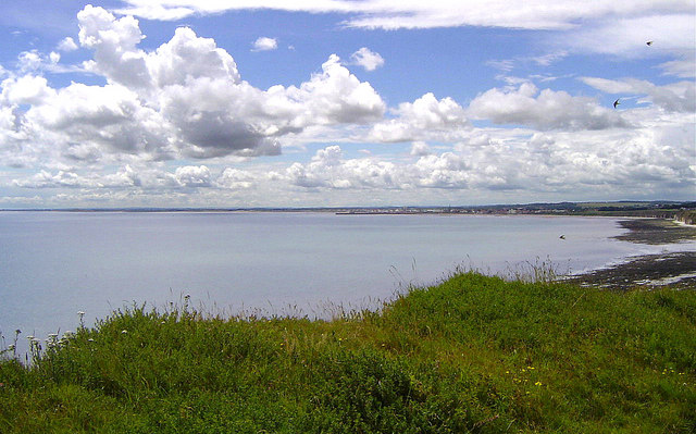
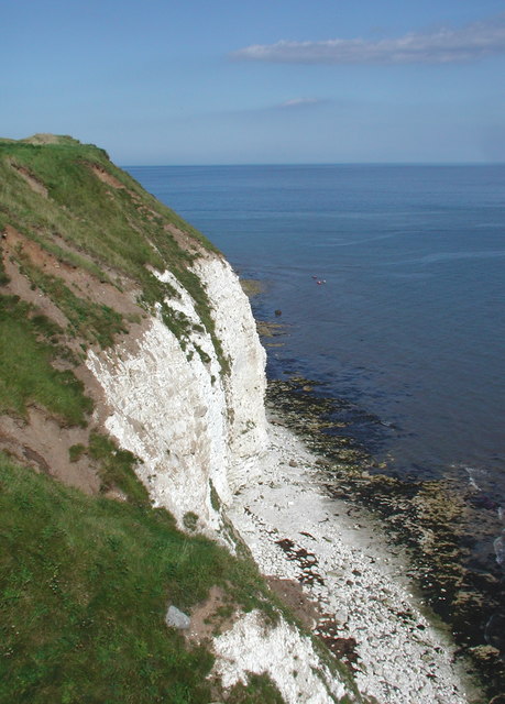
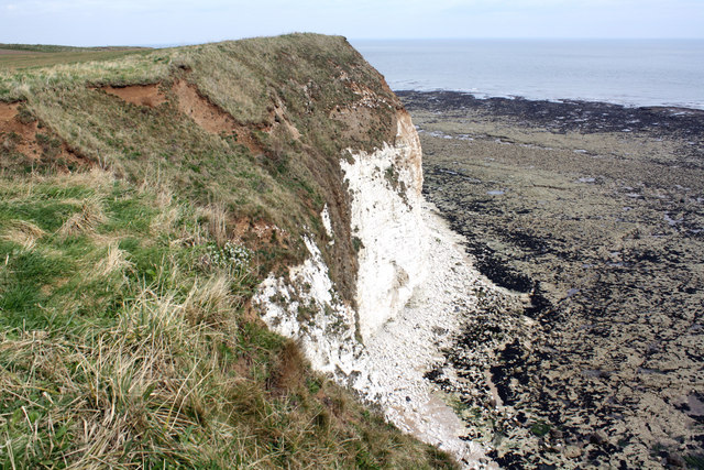
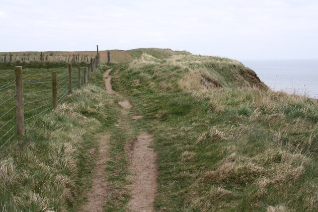
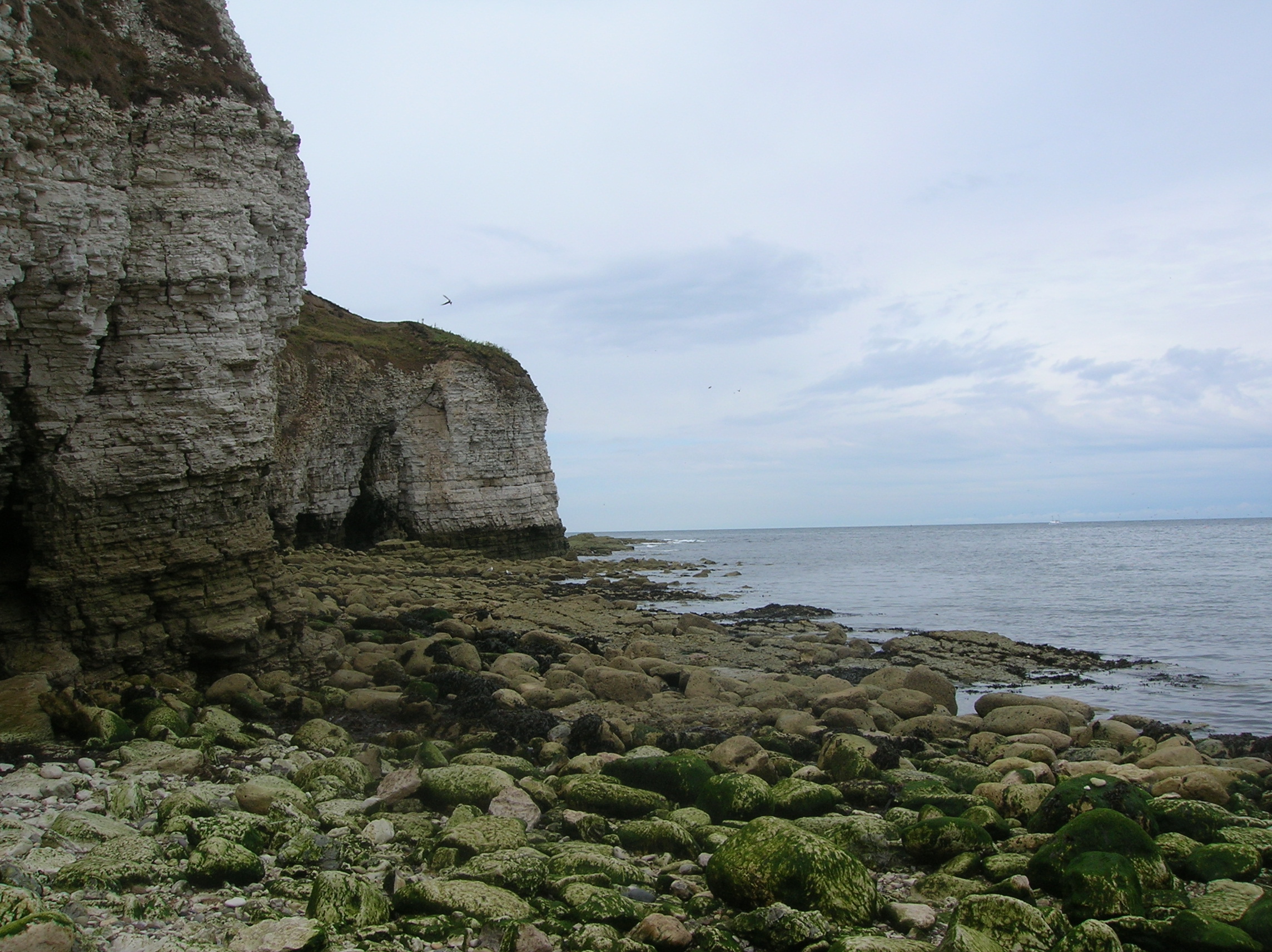
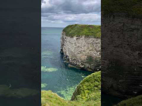
South Cliff in Scarborough, Yorkshire is a picturesque area known for its stunning views of the North Sea and the surrounding coastline. The cliff rises up from the sea, offering visitors a dramatic vantage point to observe the crashing waves below.

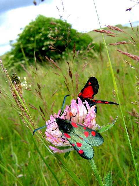
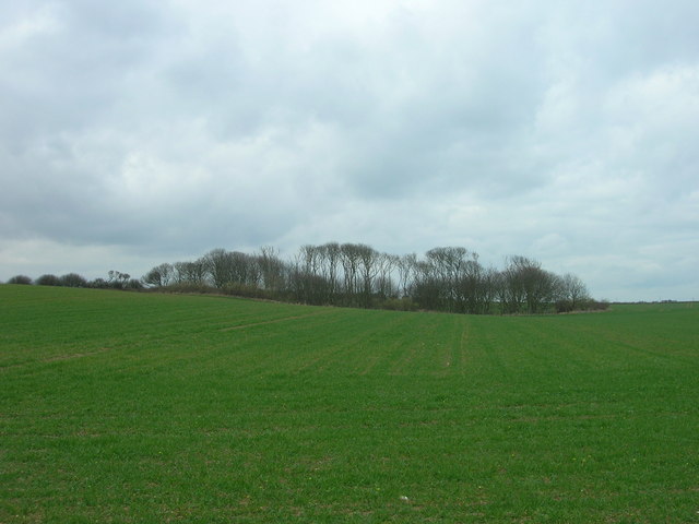
The cliff is characterized by its steep slope, which is covered in lush greenery and dotted with colorful wildflowers during the warmer months. Visitors can take a leisurely stroll along the cliff top, enjoying the fresh sea air and panoramic vistas that stretch out to the horizon.

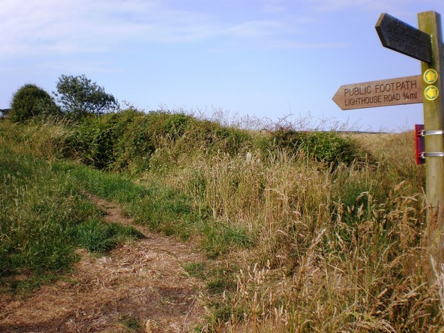
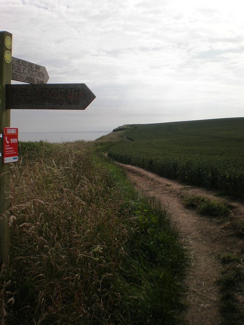
South Cliff is a popular destination for outdoor enthusiasts, with many hiking trails and paths that wind their way through the rugged landscape. The area is also home to several historic landmarks, including the South Cliff Gardens, which offer a tranquil oasis of greenery and flowers for visitors to explore.

Overall, South Cliff in Yorkshire is a beautiful and serene spot where visitors can immerse themselves in nature and marvel at the breathtaking views of the North Sea.

If you have any feedback on the listing, please let us know in the comments section below.

South Cliff Images

Images are sourced within 2km of 54.110446/-0.083883311 or Grid Reference TA2569. Thanks to Geograph Open Source API. All images are credited.

South Cliff Views The view across the North Sea towards Bridlington.
South Cliff Views
The view across the North Sea towards Bridlington.
Flamborough Wildlife Six-Spot Burnet Moths (Zygaena Filipendulae) found on the cliff top paths south of  Flamborough Head. More about the moths can be found here.
<span class="nowrap"><a title="http://www.arkive.org/species/ARK/invertebrates_terrestrial_and_freshwater/Zygaena_filipendulae_stephensi/more_info.html" rel="nofollow ugc noopener" href="http://www.arkive.org/species/ARK/invertebrates_terrestrial_and_freshwater/Zygaena_filipendulae_stephensi/more_info.html">Link</a><img style="margin-left:2px;" alt="External link" title="External link - shift click to open in new window" src="https://s1.geograph.org.uk/img/external.png" width="10" height="10"/></span>
Flamborough Wildlife
Six-Spot Burnet Moths (Zygaena Filipendulae) found on the cliff top paths south of Flamborough Head. More about the moths can be found here. LinkExternal link
Old Fall Plantation Looking northwards from the cliff top path towards Old fall Plantation.
Old Fall Plantation
Looking northwards from the cliff top path towards Old fall Plantation.
Avenue of Trees
Avenue of Trees
Wooden Sculpture
Wooden Sculpture
Old Fall, Flamborough The chalk cliffs at Flamborough, looking northeast from just off the clifftop footpath between South Landing and Flamborough Head.
Old Fall, Flamborough
The chalk cliffs at Flamborough, looking northeast from just off the clifftop footpath between South Landing and Flamborough Head.
South Cliff, Flamborough The cliff top above Two Stones, east of Flamborough South Landing, looking northeast towards Craikewells and Cross Bow Hill.
South Cliff, Flamborough
The cliff top above Two Stones, east of Flamborough South Landing, looking northeast towards Craikewells and Cross Bow Hill.
Looking inland to Highcliffe Manor
Flamborough Head - South Landing sculpture This is a totem pole.
Flamborough Head - South Landing sculpture
This is a totem pole.
Flamborough Cliffs
Flamborough Cliffs
Coastal Path Headland Way heading in the direction of Flamborough Head.
Coastal Path
Headland Way heading in the direction of Flamborough Head.
Old Fall Plantation Taken from the Headland Way coastal path
Old Fall Plantation
Taken from the Headland Way coastal path
Coastal Path Heading West Headland Way over the South Cliffs heading in the direction of South Landing.
Coastal Path Heading West
Headland Way over the South Cliffs heading in the direction of South Landing.
South Cliff Foreshore Looking down on the rocky bed below the South Cliff.
South Cliff Foreshore
Looking down on the rocky bed below the South Cliff.
Footpath junction along the Headland Way This photo, taken at New Fall, shows the junction of the coastal path (Headland Way) with the public footpath to Lighthouse Road (the B1259), 0.75 miles away.
Footpath junction along the Headland Way
This photo, taken at New Fall, shows the junction of the coastal path (Headland Way) with the public footpath to Lighthouse Road (the B1259), 0.75 miles away.
Cross Bow Hill Taken from the coastal path, this photo shows Cross Bow Hill, planted up with wheat, and Old Fall Plantation. The top of the old beacon light tower can just be seen (centre left) with the modern lighthouse clearly seen on the right.
Cross Bow Hill
Taken from the coastal path, this photo shows Cross Bow Hill, planted up with wheat, and Old Fall Plantation. The top of the old beacon light tower can just be seen (centre left) with the modern lighthouse clearly seen on the right.
Footpath junction This shows the junction of the footpath from Lighthouse Road (the B1259) with the Headland Way at New Fall. The photo is taken looking along the coastal path towards Flamborough's South Landing, 1.5 miles away.
Footpath junction
This shows the junction of the footpath from Lighthouse Road (the B1259) with the Headland Way at New Fall. The photo is taken looking along the coastal path towards Flamborough's South Landing, 1.5 miles away.
Show me another place!

South Cliff is located at Grid Ref: TA2569 (Lat: 54.110446, Lng: -0.083883311)

Division: East Riding

Unitary Authority: East Riding of Yorkshire

Police Authority: Humberside

What 3 Words

///prowling.episodes.purple. Near Flamborough, East Yorkshire

Related Wikis

Flamborough Head

Flamborough Head () is a promontory, 8 miles (13 km) long on the Yorkshire coast of England, between the Filey and Bridlington bays of the North Sea. It...

Flamborough Lifeboat Station

Flamborough Lifeboat Station is a Royal National Lifeboat Institution (RNLI) lifeboat station located at Flamborough in the East Riding of Yorkshire, England...

Flamborough

Flamborough is a village and civil parish in the East Riding of Yorkshire, England. It is situated approximately 4 miles (6 km) north-east of Bridlington...

Sewerby Hall

Sewerby Hall (also known as Sewerby House) is a Grade I listed Georgian country house set in 50 acres (20 ha) of landscaped gardens in the village of Sewerby...

Related Videos

OUR THORNWICK BAY CAMPING HOLIDAY!!!

OUR THORNWICK BAY CAMPING HOLIDAY!!! | THORNWICK BAY 2022 VLOG..! Hello and welcome to this special holiday vlog.

Nearby Amenities

Located within 500m of 54.110446,-0.083883311
Bench
Source: survey
Lat/Long: 54.1103922/-0.0907518
Building: yes
Lat/Long: 54.1136787/-0.0871679
The data included in this document is from www.openstreetmap.org. The data is made available under ODbL.

Have you been to South Cliff?

Leave your review of South Cliff below (or comments, questions and feedback).