Red Shale

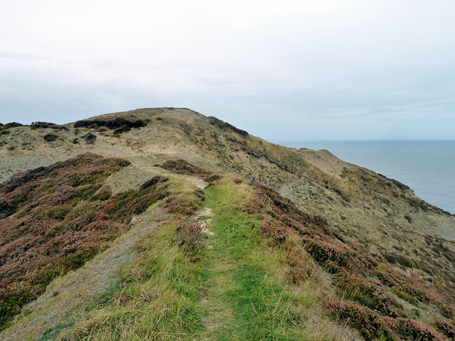
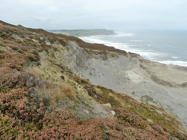
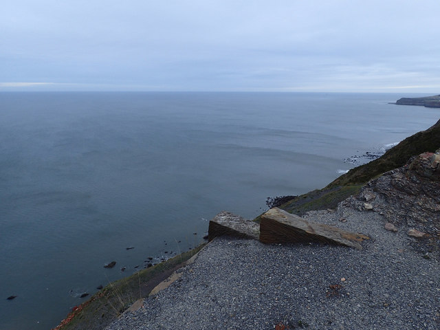
Cliff, Slope in Yorkshire

England

Red Shale

Alum shale - a sterile landscape This undercliff area was quarried for alum shale in the past. After many years the shale still has very little vegetation.
Alum shale - a sterile landscape Credit: Robin Webster

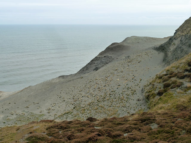
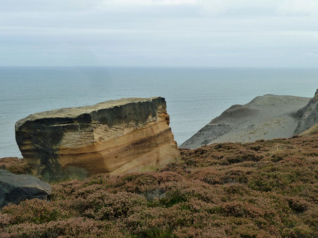
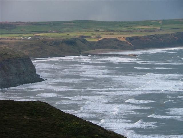
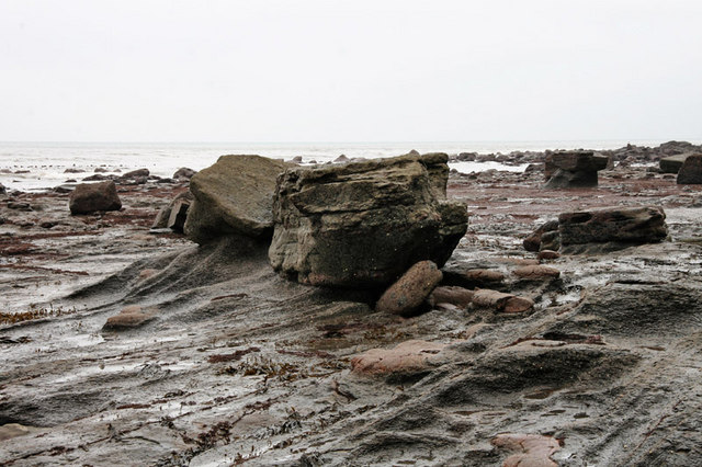
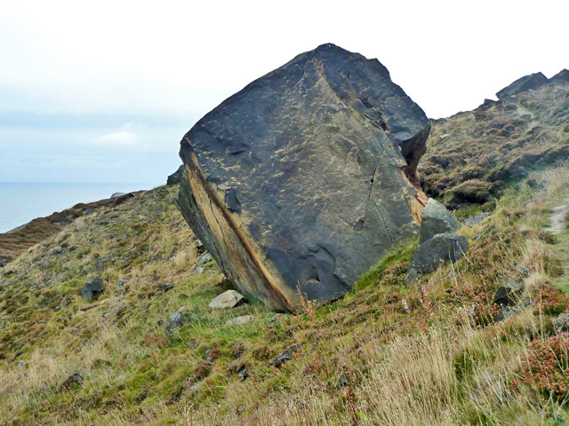
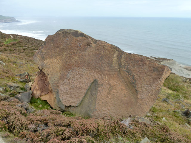
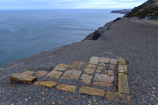
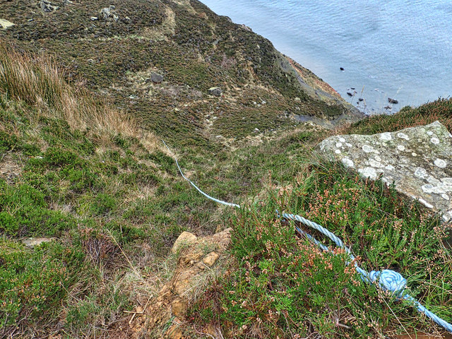
Red Shale, Yorkshire, is a prominent geological formation located in the northern region of England. It is specifically found along the cliffs and slopes of Yorkshire, offering a striking visual display of vibrant red-colored rock layers. This formation is predominantly composed of shale, a fine-grained sedimentary rock formed from the accumulation of clay and silt particles over millions of years.

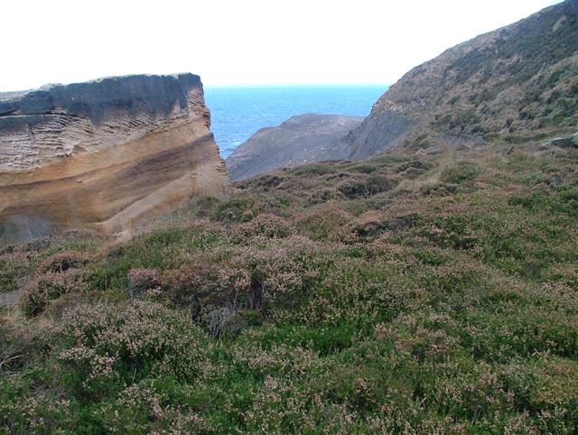
The distinct red hue of the shale in this area can be attributed to the presence of iron oxide minerals, particularly hematite, which oxidize and give the rock its characteristic coloration. The layers of red shale can be observed in various thicknesses, often displaying vertical or slightly inclined orientations.

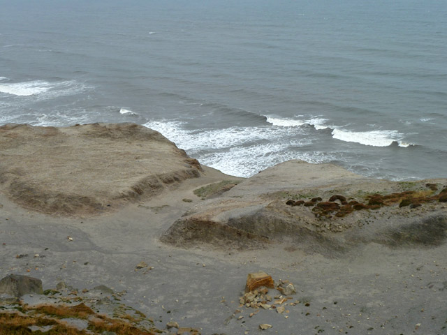
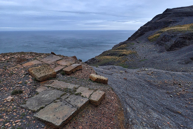
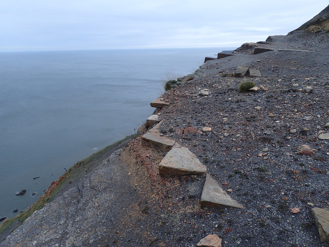
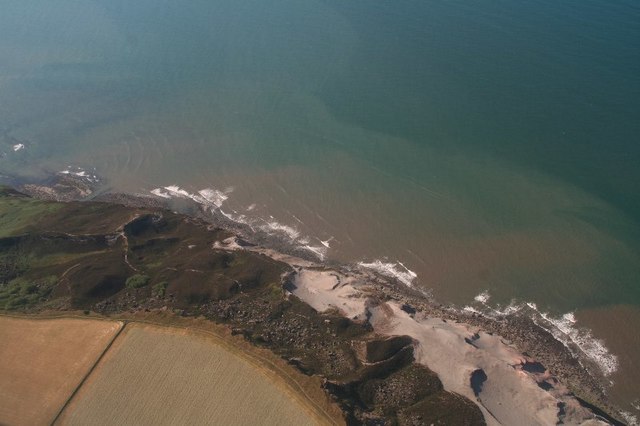
The geographic location of Red Shale, Yorkshire, provides a unique opportunity for geologists and nature enthusiasts to study and appreciate the geological history of the region. These rock formations offer valuable insights into the ancient environments and processes that shaped the landscape over time.

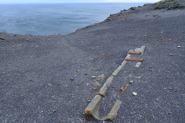
The cliffs and slopes formed by the red shale are not only visually captivating but also serve as important habitats for various plant and animal species. The distinct rock layers provide nesting sites for cliff-dwelling birds such as peregrine falcons and rock doves. The shale also acts as a natural barrier, protecting the surrounding areas from erosion and providing stability to the landscape.

Overall, Red Shale, Yorkshire, is a remarkable geological feature that showcases the rich natural history of the region. Its vibrant red color, unique composition, and ecological significance make it a renowned site for both scientific research and tourism.

If you have any feedback on the listing, please let us know in the comments section below.

Red Shale Images

Images are sourced within 2km of 54.565799/-0.83325785 or Grid Reference NZ7519. Thanks to Geograph Open Source API. All images are credited.

Alum shale - a sterile landscape This undercliff area was quarried for alum shale in the past. After many years the shale still has very little vegetation.
Alum shale - a sterile landscape
This undercliff area was quarried for alum shale in the past. After many years the shale still has very little vegetation.
Old jet workings So the map describes this delved area of undercliff.
Old jet workings
So the map describes this delved area of undercliff.
Rock block and old alum workings This is an undercliff, and the rock has fallen or been quarried from the cliff material. Its very regular shape suggests the latter. Quarrying may have been to expose more alum shale, seen on the headland beyond.
Rock block and old alum workings
This is an undercliff, and the rock has fallen or been quarried from the cliff material. Its very regular shape suggests the latter. Quarrying may have been to expose more alum shale, seen on the headland beyond.
Loftus Alum Workings This image was taken below upper sandstone cliff looking east to the area mapped as Lintycock Stone. The area is owned by the National Trust. The large boulder would have been deposited due to a collapse as a result of undermining of the sandstone to access the alum shale.
Loftus Alum Workings
This image was taken below upper sandstone cliff looking east to the area mapped as Lintycock Stone. The area is owned by the National Trust. The large boulder would have been deposited due to a collapse as a result of undermining of the sandstone to access the alum shale.
View West From Just North East of The Warren The jetty at Skinningrove is prominent.
View West From Just North East of The Warren
The jetty at Skinningrove is prominent.
Wave-cut platform Boulders on the wave-cut platform at the foot of cliffs near Boulby.
Wave-cut platform
Boulders on the wave-cut platform at the foot of cliffs near Boulby.
Old Loftus alum workings Between Skinningrove and Boulby.
Old Loftus alum workings
Between Skinningrove and Boulby.
Old Loftus alum workings In the bottom is supposed to be a 'set of six steeping pits with surrounds' but they were not too obvious.
Old Loftus alum workings
In the bottom is supposed to be a 'set of six steeping pits with surrounds' but they were not too obvious.
Boulder, old Loftus quarries A sandstone boulder, probably quarried from the sandstone of the cliffs above, which has rolled down the undercliff.
Boulder, old Loftus quarries
A sandstone boulder, probably quarried from the sandstone of the cliffs above, which has rolled down the undercliff.
Boulder, old Loftus quarries A sandstone boulder, probably quarried from the sandstone of the cliffs above, which has rolled down the undercliff.
Boulder, old Loftus quarries
A sandstone boulder, probably quarried from the sandstone of the cliffs above, which has rolled down the undercliff.
Loftus Alum Quarries Probably a seeping pit.
Loftus Alum Quarries
Probably a seeping pit.
Loftus Alum Quarries Probably a seeping pit.
Loftus Alum Quarries
Probably a seeping pit.
Loftus Alum Quarries Probably a seeping pit.
Loftus Alum Quarries
Probably a seeping pit.
Loftus Alum Quarries Probably a seeping pit.
Loftus Alum Quarries
Probably a seeping pit.
Loftus Alum Quarries A channel used to transfer the liquor between seeping pits.
Loftus Alum Quarries
A channel used to transfer the liquor between seeping pits.
Graffiti, Lingberry Hill Obviously carved by someone who has lost someone dearest to him but that does not excuse the desecration of the rock face. No better than common graffiti

The inscription says:
"PAULINE
IN SPRING I SAW YOU
YOUR EYES SHONE LIKE DEW
IN SUMMER WE SHARED
A LOVE WE HAD SO TRUE
IN AUTUMN THEY TOLD US
THERE IS NOTHING WE CAN DO
IT BECAME WINTER WHEN YOU LEFT
TED"
Graffiti, Lingberry Hill
Obviously carved by someone who has lost someone dearest to him but that does not excuse the desecration of the rock face. No better than common graffiti The inscription says: "PAULINE IN SPRING I SAW YOU YOUR EYES SHONE LIKE DEW IN SUMMER WE SHARED A LOVE WE HAD SO TRUE IN AUTUMN THEY TOLD US THERE IS NOTHING WE CAN DO IT BECAME WINTER WHEN YOU LEFT TED"
Access to the beach Top secret way down to the beach created by fishermen to get to their mark, their secret fishing spots. The way is near vertical using a cheese grater polypropylene rope as a handrail. I came up from about half way. The dog nearly bottled out. I wouldn't like to attempt it in Wellingtons and carrying a fishing rod.
Access to the beach
Top secret way down to the beach created by fishermen to get to their mark, their secret fishing spots. The way is near vertical using a cheese grater polypropylene rope as a handrail. I came up from about half way. The dog nearly bottled out. I wouldn't like to attempt it in Wellingtons and carrying a fishing rod.
Loftus Alum Quarries: aerial 2018 (1)
Show me another place!

Red Shale is located at Grid Ref: NZ7519 (Lat: 54.565799, Lng: -0.83325785)

Division: North Riding

Unitary Authority: Redcar and Cleveland

Police Authority: Cleveland

What 3 Words

///thinking.spreading.data. Near Loftus, North Yorkshire

Related Wikis

Boulby

Boulby is a hamlet in the Loftus parish, located within the North York Moors National Park. It is in the borough of Redcar and Cleveland, North Yorkshire...

Boulby Quarries

Boulby Quarries (grid reference NZ745200) is a 40.3 hectare geological Site of Special Scientific Interest in Redcar and Cleveland, North Yorkshire, England...
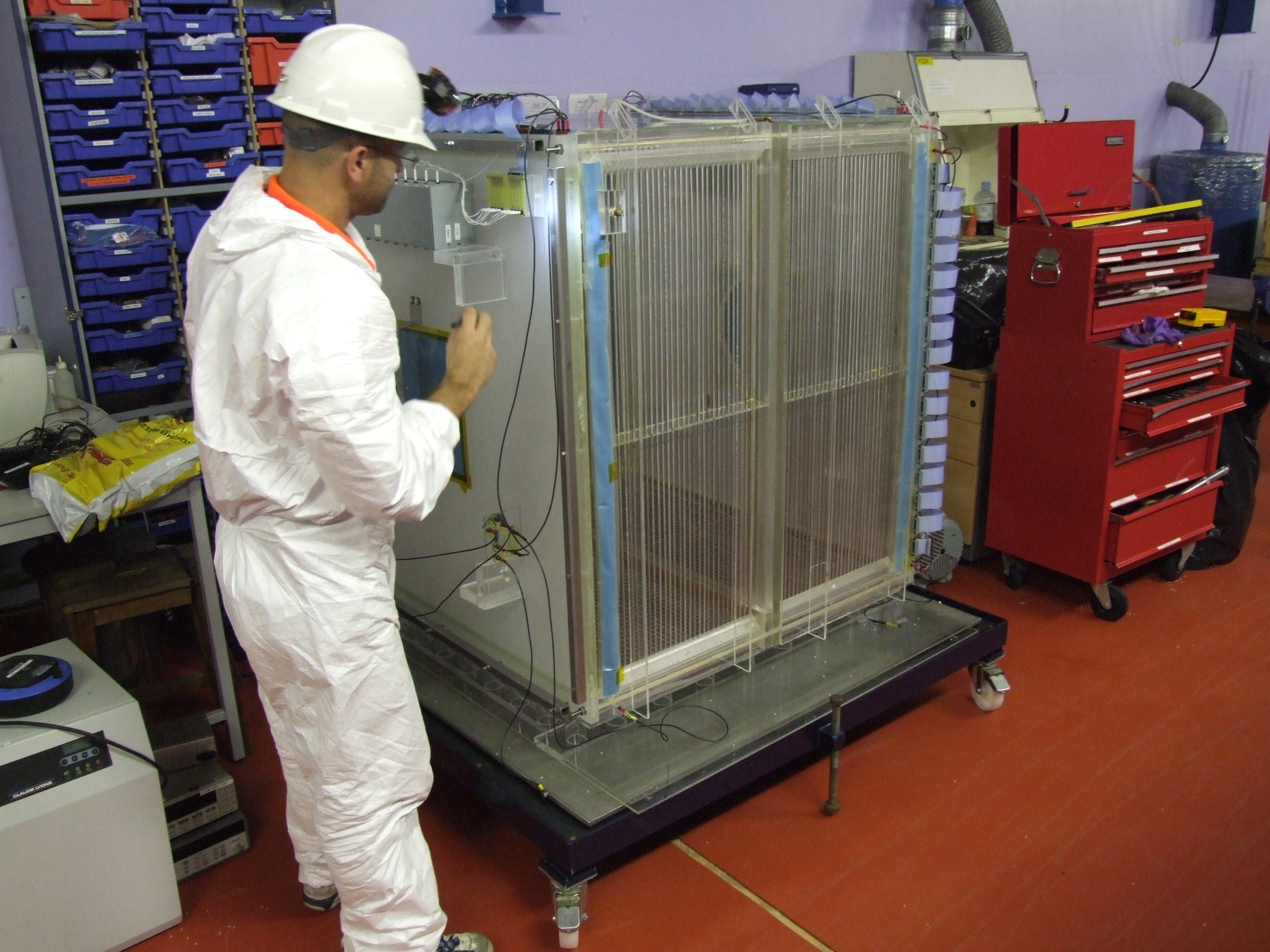
ZEPLIN-III

The ZEPLIN-III dark matter experiment attempted to detect galactic WIMPs using a 12 kg liquid xenon target. It operated from 2006 to 2011 at the Boulby...

Directional Recoil Identification from Tracks

The Directional Recoil Identification from Tracks (DRIFT) detector is a low pressure negative ion time projection chamber (NITPC) designed to detect weakly...

UK Dark Matter Collaboration

The UK Dark Matter Collaboration (UKDMC) (1987–2007) was an experiment to search for Weakly interacting massive particles (WIMPs). The consortium consisted...

Boulby Mine

Boulby Mine is a 200-hectare (490-acre) site located just south-east of the village of Boulby, on the north-east coast of the North York Moors in Loftus...

Street House Anglo-Saxon cemetery

The Street House Anglo-Saxon cemetery is an Anglo-Saxon burial ground, dating to the second half of the 7th century AD, that was discovered at Street House...

Easington, North Yorkshire

Easington is a village in the civil parish of Loftus, in the Redcar and Cleveland district, in the ceremonial county of North Yorkshire, England and is...

Nearby Amenities

Located within 500m of 54.565799,-0.83325785
Source: PGS
Lat/Long: 54.5636337/-0.8270323
Source: PGS
Lat/Long: 54.5639012/-0.8273649
Source: PGS
Lat/Long: 54.5643179/-0.8279228
Source: PGS
Lat/Long: 54.5646787/-0.8284485
Source: PGS
Lat/Long: 54.5651888/-0.8289743
Source: PGS
Lat/Long: 54.5655371/-0.8292103
Source: PGS
Lat/Long: 54.5658419/-0.8299828
Source: PGS
Lat/Long: 54.5657362/-0.830648
Source: PGS
Lat/Long: 54.566128/-0.8323646
Source: PGS
Lat/Long: 54.566439/-0.8333087
Source: PGS
Lat/Long: 54.5668869/-0.8341348
Source: PGS
Lat/Long: 54.5672539/-0.8352399
Source: PGS
Lat/Long: 54.5678448/-0.8369565
Source: PGS
Lat/Long: 54.5681869/-0.8391881
The data included in this document is from www.openstreetmap.org. The data is made available under ODbL.

Have you been to Red Shale?

Leave your review of Red Shale below (or comments, questions and feedback).