Mills of the Ord
Cliff, Slope in Shetland
Scotland
Mills of the Ord
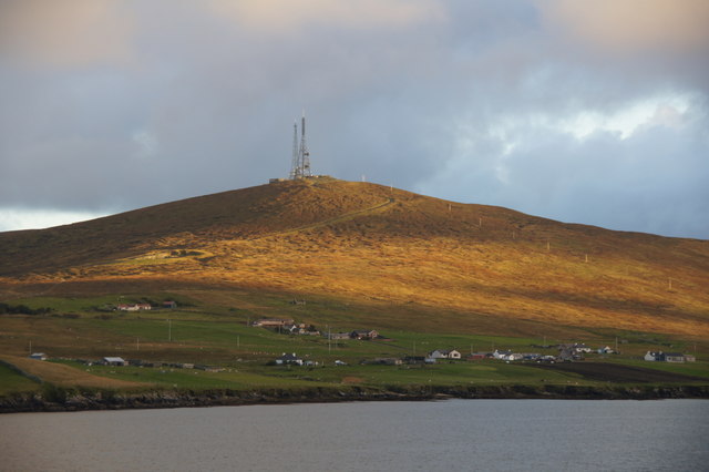
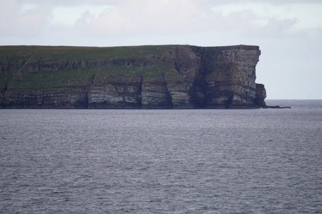
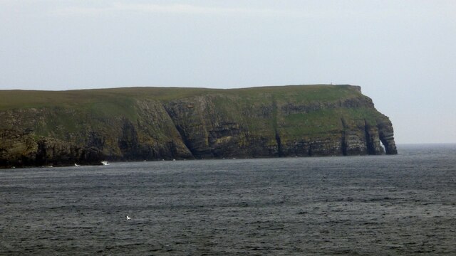
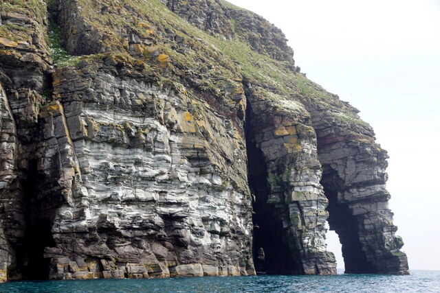
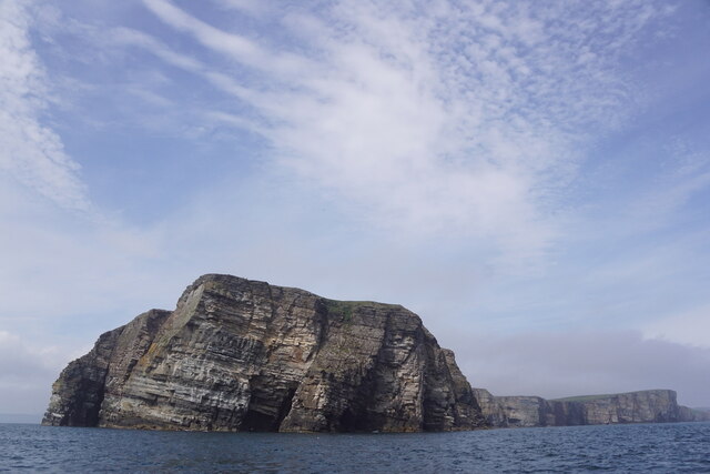
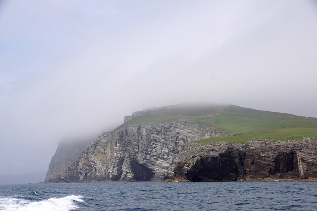
Mills of the Ord is a breathtaking cliff and slope located in the scenic Shetland Islands, off the northeast coast of Scotland. This natural wonder is renowned for its dramatic landscape, offering visitors a mesmerizing view of towering cliffs, rugged slopes, and crashing waves.
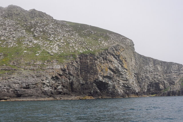
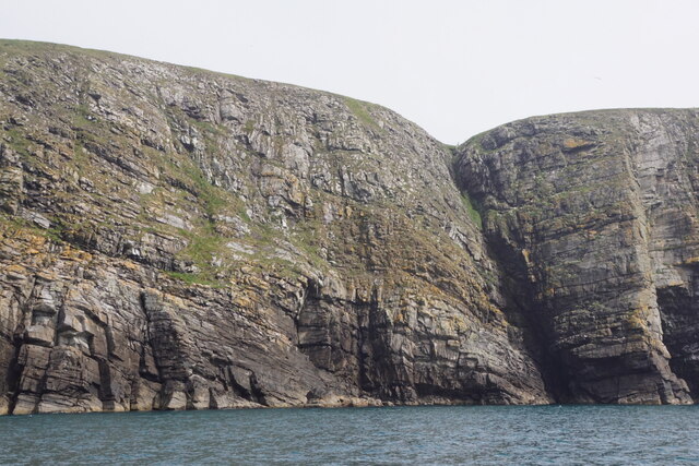
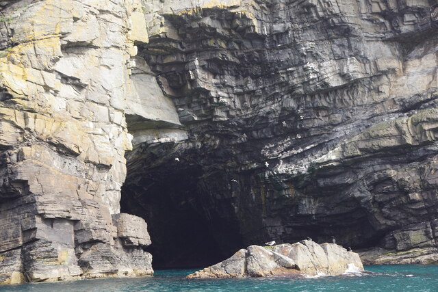
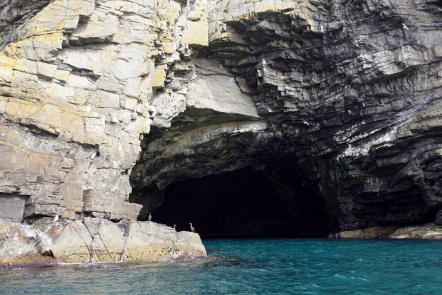
The cliff at Mills of the Ord stands tall and imposing, rising to an impressive height that provides an awe-inspiring panorama of the surrounding area. With its sheer rock faces and jagged edges, the cliff offers a striking contrast to the calm waters of the North Sea below. The vibrant hues of the cliffs, ranging from earthy tones to vibrant greens and yellows, create a visually stunning sight.
Adjacent to the cliff, a steep slope offers adventurous hikers the opportunity to explore this remarkable terrain. The slope is covered in a lush carpet of grass, dotted with wildflowers during the summer months. As visitors make their way up the slope, they are rewarded with breathtaking views of the coastline and the vast expanse of the North Sea.
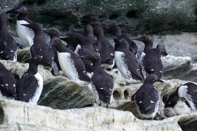
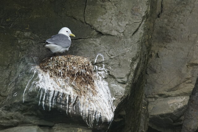
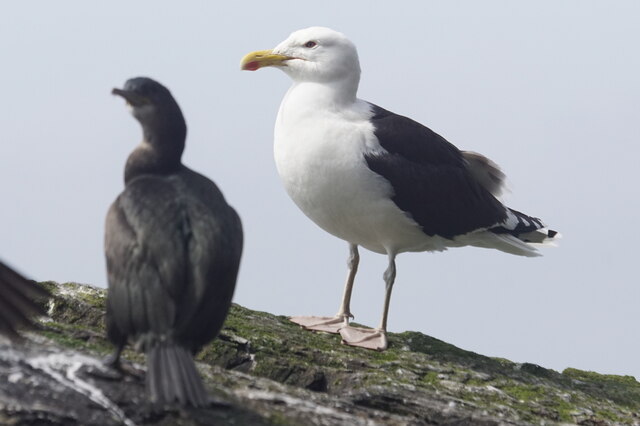
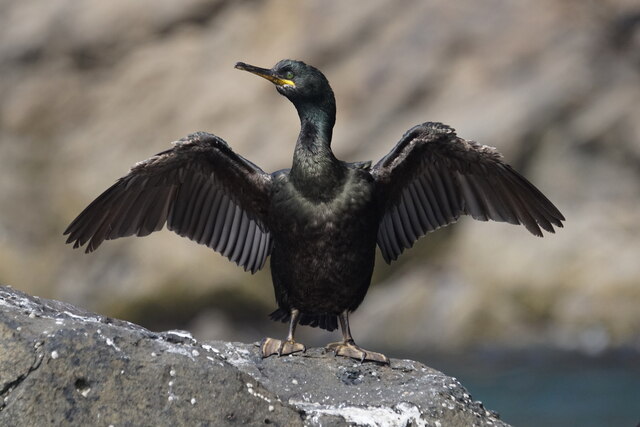
The Mills of the Ord is not only a haven for nature enthusiasts but also a sanctuary for various bird species. The cliffs provide nesting sites for seabirds such as puffins, guillemots, and fulmars, making it a popular spot for birdwatchers.
Whether it's the sheer beauty of the cliff, the challenging slope, or the diverse wildlife, Mills of the Ord offers a captivating experience for all who visit.
If you have any feedback on the listing, please let us know in the comments section below.
Mills of the Ord Images
Images are sourced within 2km of 60.112623/-1.1019225 or Grid Reference HU5036. Thanks to Geograph Open Source API. All images are credited.

Mills of the Ord is located at Grid Ref: HU5036 (Lat: 60.112623, Lng: -1.1019225)
Unitary Authority: Shetland Islands
Police Authority: Highlands and Islands
What 3 Words
///finely.regarding.hype. Near Lerwick, Shetland Islands
Nearby Locations
Related Wikis

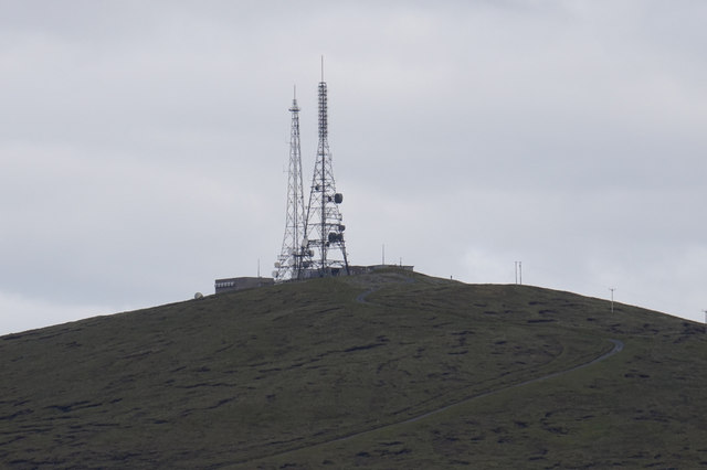
Bressay transmitting station
Bressay transmitting station is a broadcasting transmission facility for the Shetland Islands, located on the isle of Bressay, owned and operated by Arqiva...

Bressay
Bressay (Scots: Bressa) is a populated island in the Shetland archipelago of Scotland. == Geography and geology == Bressay lies due south of Whalsay, west...
Lerwick and Bressay Parish Church
Lerwick and Bressay Parish Church is the largest Church of Scotland congregation in Shetland, serving the islands' capital Lerwick and the surrounding...

Shetland Library
Shetland Library is the public library service of Shetland, with its main branch based in Lerwick. Membership is open to both residents of and visitors...

Gilbert Bain Hospital
The Gilbert Bain Hospital is a rural general hospital in the burgh of Lerwick, Shetland, Scotland. It is managed by NHS Shetland. == History == The hospital...

Lerwick Town Hall
Lerwick Town Hall is a municipal building located on Hillhead in Lerwick, Shetland, Scotland. It is used as an events venue and registrar's office. The...
Lerwick Observatory
Lerwick Observatory (also known as Lerwick Magnetic Observatory) is a British meteorological observatory located near the port at Lerwick, Shetland Islands...

Lerwick
Lerwick ( or ; Old Norse: Leirvik; Norn: Larvik) is the main town and port of the Shetland archipelago, Scotland. Shetland's only burgh, Lerwick had a...
Nearby Amenities
Located within 500m of 60.112623,-1.1019225Have you been to Mills of the Ord?
Leave your review of Mills of the Ord below (or comments, questions and feedback).