West Cliff

Cliff, Slope in Hampshire

England

West Cliff

Groyne at Branksome Dene Chine, Bournemouth A wooden groyne reflected in the water at Branksome Dene Chine, in Bournemouth.

Just visible in the distance are the white chalk cliffs of The Needles, on the Isle of Wight.
Groyne at Branksome Dene Chine, Bournemouth Credit: Malc McDonald

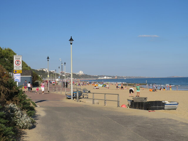
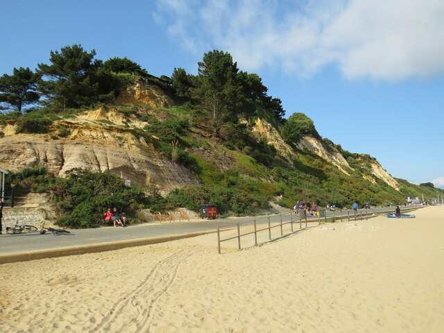
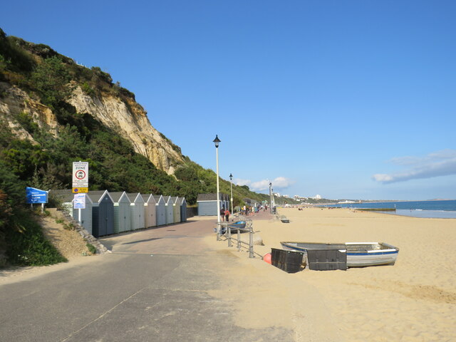
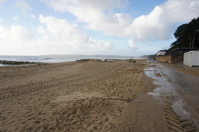
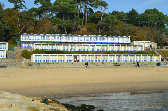
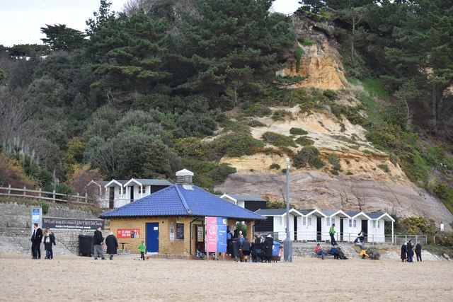
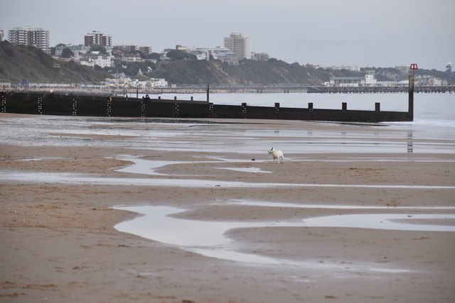
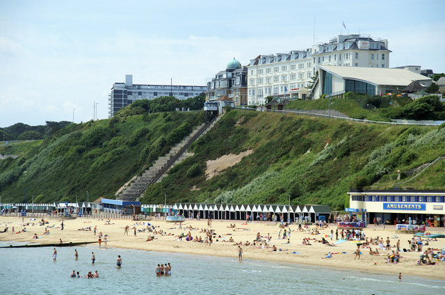
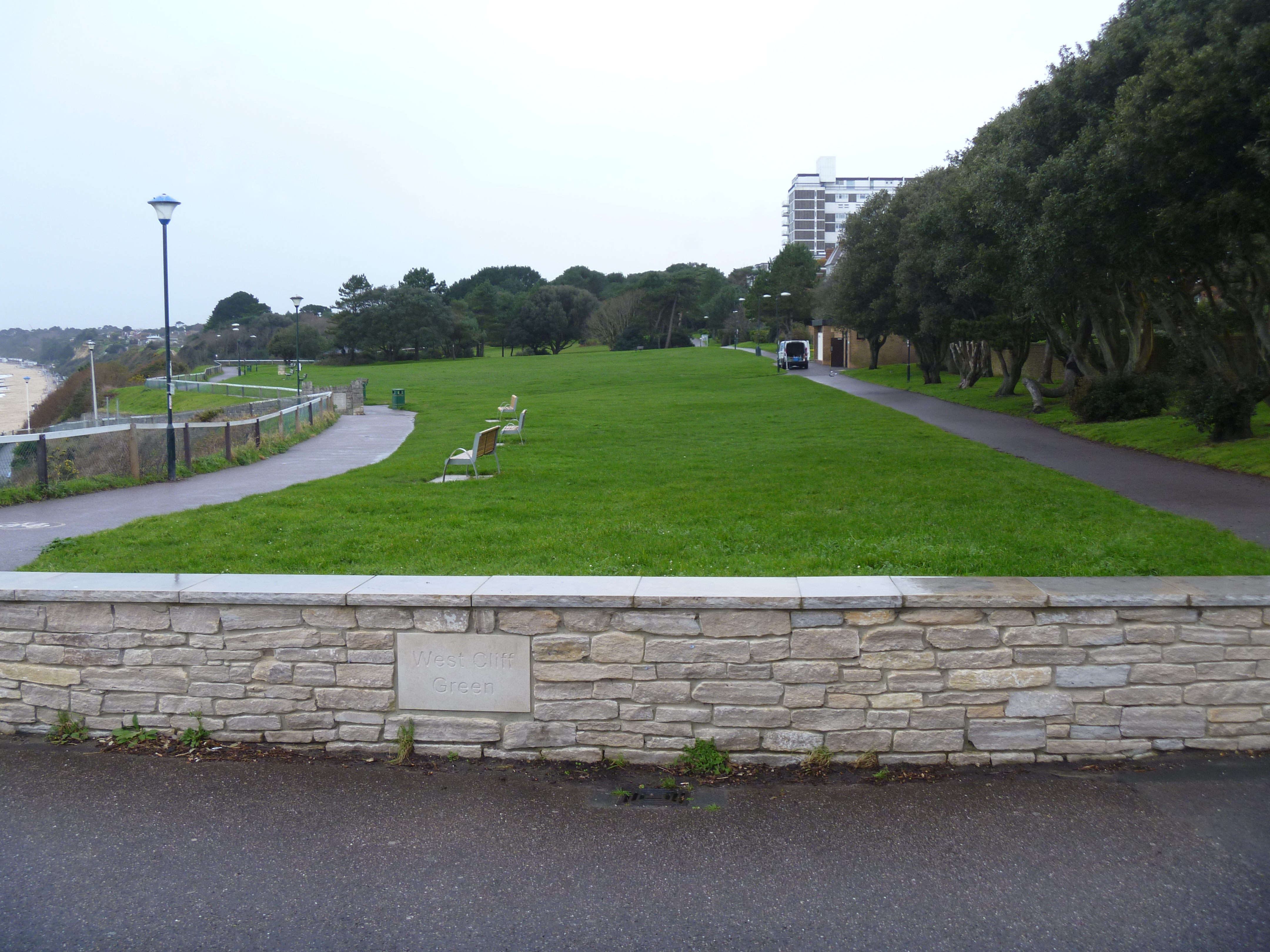
West Cliff is a prominent geographical feature located in the county of Hampshire, England. Situated on the western edge of the picturesque town of Hampshire, it is known for its stunning views and dramatic landscape. Rising above the surrounding area, West Cliff is a steep and imposing cliff that overlooks the English Channel.

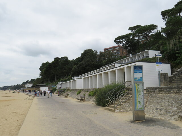
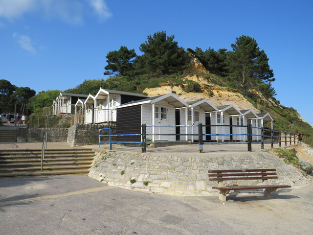
Covered in lush greenery and vegetation, the cliff provides a picturesque backdrop to the town. Its steep slopes offer a challenging terrain for hikers and adventurers, attracting outdoor enthusiasts from near and far. The top of West Cliff offers breathtaking panoramic views of the coastline and the sparkling waters of the English Channel.

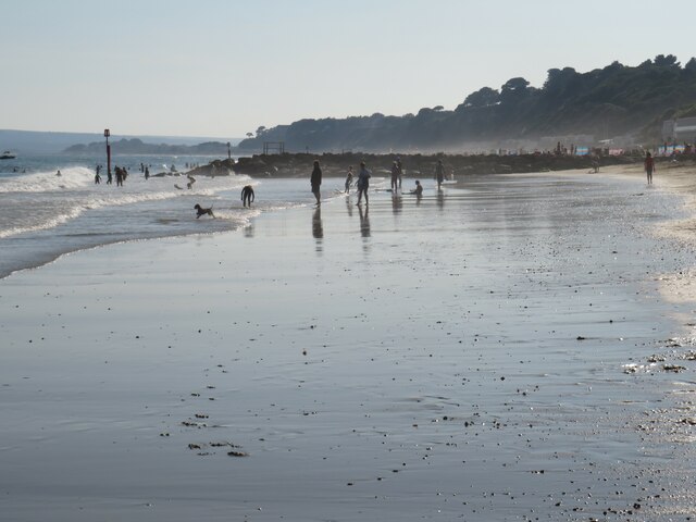
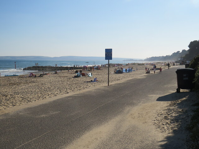
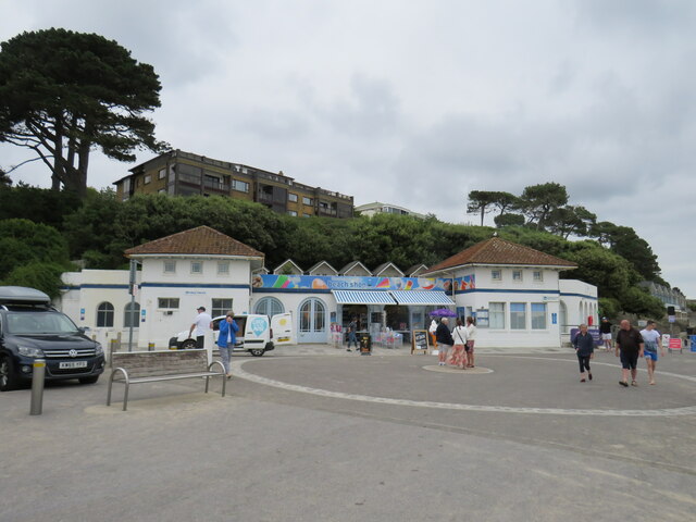
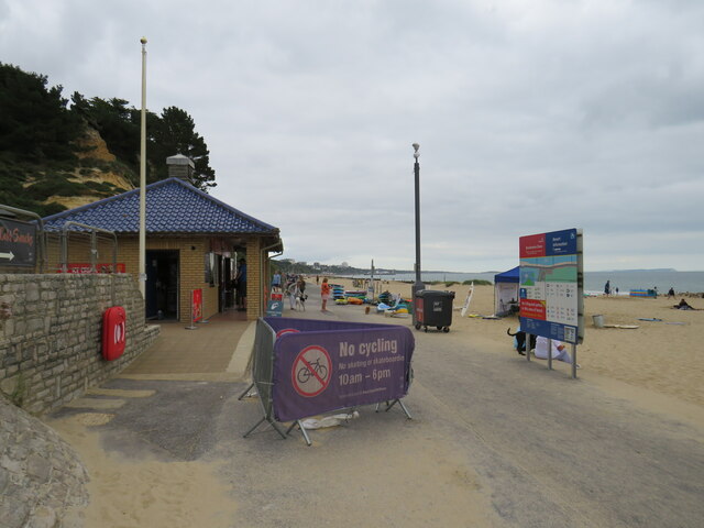
The cliff is a popular destination for tourists and locals alike. Visitors can enjoy leisurely walks along the cliff-top paths, taking in the stunning views and enjoying the fresh sea breeze. It also serves as an excellent vantage point for birdwatchers, who can spot various seabirds and migratory species in the area.

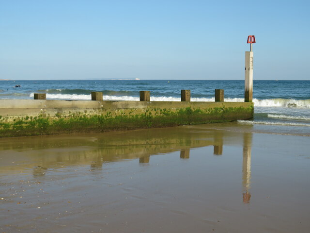
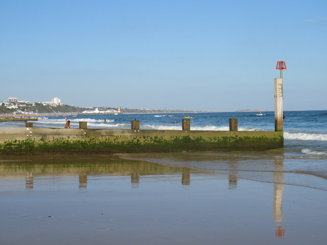
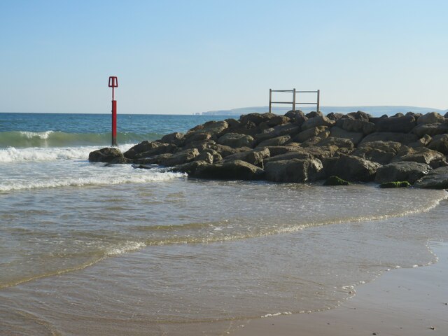
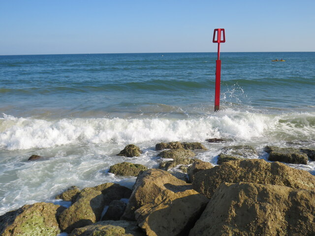
West Cliff also plays an important role in coastal erosion management. It acts as a natural buffer, protecting the town from the erosive forces of the sea. Efforts have been made to maintain and stabilize the cliff face to ensure its long-term preservation.

Overall, West Cliff in Hampshire is a captivating natural landmark, offering visitors a unique combination of breathtaking views, challenging terrain, and ecological significance.

If you have any feedback on the listing, please let us know in the comments section below.

West Cliff Images

Images are sourced within 2km of 50.714775/-1.8839154 or Grid Reference SZ0890. Thanks to Geograph Open Source API. All images are credited.

Groyne at Branksome Dene Chine, Bournemouth A wooden groyne reflected in the water at Branksome Dene Chine, in Bournemouth.

Just visible in the distance are the white chalk cliffs of The Needles, on the Isle of Wight.
Groyne at Branksome Dene Chine, Bournemouth
A wooden groyne reflected in the water at Branksome Dene Chine, in Bournemouth. Just visible in the distance are the white chalk cliffs of The Needles, on the Isle of Wight.
Groyne at Branksome Dene Chine, Bournemouth A wooden groyne on the beach at Branksome Dene Chine, in Bournemouth.  In the background, the view of Bournemouth's coastline stretched to Bournemouth Pier and along to Hengistbury Head, visible just to the left of the white marker post.
Groyne at Branksome Dene Chine, Bournemouth
A wooden groyne on the beach at Branksome Dene Chine, in Bournemouth. In the background, the view of Bournemouth's coastline stretched to Bournemouth Pier and along to Hengistbury Head, visible just to the left of the white marker post.
Receding tide at Branksome Dene Chine The beach at Branksome Dene Chine, on the border between Bournemouth and Poole, photographed on a sunny afternoon in August 2021.  The tide was receding when this image was taken, leaving wet sand.
Receding tide at Branksome Dene Chine
The beach at Branksome Dene Chine, on the border between Bournemouth and Poole, photographed on a sunny afternoon in August 2021. The tide was receding when this image was taken, leaving wet sand.
Promenade at Branksome Dene Chine, near Bournemouth A promenade runs for around 10 miles along the seafront at Bournemouth, stretching to Southbourne in the east and Sandbanks in the west.  The last few miles to Sandbanks are in the Borough of Poole, rather than in Bournemouth.

The promenade forms part of the route of National Cycle Network route 2, which stretches along England's south coast. However, during the peak summer holiday months of July and August, cycling is prohibited on the promenade between 10:00 and 18:00.  Between those times, cyclists must use an alternative route.

This image was taken just beyond the Bournemouth/Poole boundary, looking westwards on a fine and sunny afternoon in August 2021.
Promenade at Branksome Dene Chine, near Bournemouth
A promenade runs for around 10 miles along the seafront at Bournemouth, stretching to Southbourne in the east and Sandbanks in the west. The last few miles to Sandbanks are in the Borough of Poole, rather than in Bournemouth. The promenade forms part of the route of National Cycle Network route 2, which stretches along England's south coast. However, during the peak summer holiday months of July and August, cycling is prohibited on the promenade between 10:00 and 18:00. Between those times, cyclists must use an alternative route. This image was taken just beyond the Bournemouth/Poole boundary, looking westwards on a fine and sunny afternoon in August 2021.
Seafront at Branksome Dene Chine, near Bournemouth A promenade runs for approximately 10 miles along Bournemouth's seafront, from Sandbanks in the west to Southbourne in the east.  The first section from Sandbanks is in the Borough of Poole.  Here at Branksome Dene Chine the promenade crosses the boundary into the Borough of Bournemouth, at the point where the path surface changes from grey to dark red.

The promenade forms part of the route of National Cycle Network route 2, which stretches along England's south coast. However, during the peak summer holiday months of July and August, cycling is prohibited on the promenade between 10:00 and 18:00.  Between those times, cyclists must use an alternative route.

In the distance in the centre of the image is Bournemouth Pier and to the right, further around the coastline, is Hengistbury Head.
Seafront at Branksome Dene Chine, near Bournemouth
A promenade runs for approximately 10 miles along Bournemouth's seafront, from Sandbanks in the west to Southbourne in the east. The first section from Sandbanks is in the Borough of Poole. Here at Branksome Dene Chine the promenade crosses the boundary into the Borough of Bournemouth, at the point where the path surface changes from grey to dark red. The promenade forms part of the route of National Cycle Network route 2, which stretches along England's south coast. However, during the peak summer holiday months of July and August, cycling is prohibited on the promenade between 10:00 and 18:00. Between those times, cyclists must use an alternative route. In the distance in the centre of the image is Bournemouth Pier and to the right, further around the coastline, is Hengistbury Head.
Groyne at Branksome Dene Chine, Bournemouth A rock groyne and marker on the beach at Branksome Dene Chine, near Bournemouth.  Visible in the distance are Old Harry Rocks and the Purbeck Hills.
Groyne at Branksome Dene Chine, Bournemouth
A rock groyne and marker on the beach at Branksome Dene Chine, near Bournemouth. Visible in the distance are Old Harry Rocks and the Purbeck Hills.
Groyne marker at Branksome Dene Chine, Bournemouth The red post marks the end of a groyne on the beach at Branksome Dene Chine, near Bournemouth.
Groyne marker at Branksome Dene Chine, Bournemouth
The red post marks the end of a groyne on the beach at Branksome Dene Chine, near Bournemouth.
Beachfront café at Branksome Chine, near Poole A café on the beachfront at Branksome Chine, near Poole.
Beachfront café at Branksome Chine, near Poole
A café on the beachfront at Branksome Chine, near Poole.
Toilets and shop at Branksome Chine Beach, near Poole This building on the beachfront at Branksome Chine contains public toilets along with a shop selling beach accessories.
Toilets and shop at Branksome Chine Beach, near Poole
This building on the beachfront at Branksome Chine contains public toilets along with a shop selling beach accessories.
Promenade at Branksome Dene Chine, near Bournemouth The seafront promenade stretches for around 10 miles along the coastline through Bournemouth.

The promenade forms part of the route of National Cycle Network route 2. However, during the peak summer holiday months of July and August when the beaches and seafront are at their busiest, cycling is prohibited between 10:00 and 18:00. During those times, cyclists must use an alternative route.
Promenade at Branksome Dene Chine, near Bournemouth
The seafront promenade stretches for around 10 miles along the coastline through Bournemouth. The promenade forms part of the route of National Cycle Network route 2. However, during the peak summer holiday months of July and August when the beaches and seafront are at their busiest, cycling is prohibited between 10:00 and 18:00. During those times, cyclists must use an alternative route.
Branksome Dene Chine beach, near Bournemouth The sandy beach at Branksome Dene Chine, near Bourneouth.

The seafront promenade stretches for around 10 miles along the coastline through Bournemouth.

The promenade forms part of the route of National Cycle Network route 2. However, during the peak summer holiday months of July and August when the beaches and seafront are at their busiest, cycling is prohibited between 10:00 and 18:00. During those times, cyclists must use an alternative route.
Branksome Dene Chine beach, near Bournemouth
The sandy beach at Branksome Dene Chine, near Bourneouth. The seafront promenade stretches for around 10 miles along the coastline through Bournemouth. The promenade forms part of the route of National Cycle Network route 2. However, during the peak summer holiday months of July and August when the beaches and seafront are at their busiest, cycling is prohibited between 10:00 and 18:00. During those times, cyclists must use an alternative route.
Beach huts at Branksome Dene Chine, near Bournemouth A beach hut is a small, usually wooden and often brightly coloured, box or structure above the high tide mark on popular bathing beaches. They are generally used as a shelter from the sun or wind, changing into and out of swimming costumes and for the safe storing of some personal belongings. Some beach huts incorporate simple facilities for preparing food and hot drinks by either bottled gas or occasionally mains electricity.
Wikipedia: <span class="nowrap"><a title="http://en.wikipedia.org/wiki/Beach_hut" rel="nofollow ugc noopener" href="http://en.wikipedia.org/wiki/Beach_hut">Link</a><img style="margin-left:2px;" alt="External link" title="External link - shift click to open in new window" src="https://s1.geograph.org.uk/img/external.png" width="10" height="10"/></span>
Beach huts at Branksome Dene Chine, near Bournemouth
A beach hut is a small, usually wooden and often brightly coloured, box or structure above the high tide mark on popular bathing beaches. They are generally used as a shelter from the sun or wind, changing into and out of swimming costumes and for the safe storing of some personal belongings. Some beach huts incorporate simple facilities for preparing food and hot drinks by either bottled gas or occasionally mains electricity. Wikipedia: LinkExternal link
Promenade at the Bournemouth/Poole boundary The seafront promenade stretches for around 10 miles along the coastline through Bournemouth.  It starts at Sandbanks, in the Borough of Poole.  This image shows the point at which the promenade crosses the boundary into the Borough of Bournemouth.  Note the change in the path surface, and the blue sign to the left of the image which welcomes people into Bournemouth.

The promenade forms part of the route of National Cycle Network route 2. However, during the peak summer holiday months of July and August when the beaches and seafront are at their busiest, cycling is prohibited between 10:00 and 18:00. During those times, cyclists must use an alternative route.
Promenade at the Bournemouth/Poole boundary
The seafront promenade stretches for around 10 miles along the coastline through Bournemouth. It starts at Sandbanks, in the Borough of Poole. This image shows the point at which the promenade crosses the boundary into the Borough of Bournemouth. Note the change in the path surface, and the blue sign to the left of the image which welcomes people into Bournemouth. The promenade forms part of the route of National Cycle Network route 2. However, during the peak summer holiday months of July and August when the beaches and seafront are at their busiest, cycling is prohibited between 10:00 and 18:00. During those times, cyclists must use an alternative route.
Turf Zone "Branksome" At Branksome Chine Promenade, Bournemouth.
Turf Zone "Branksome"
At Branksome Chine Promenade, Bournemouth.
Beach huts on Branksome Chine beach Poole Solidly built beach huts, contrasting with the usual beach huts made of wood. In the background are coniferous trees characteristic of the area.
Beach huts on Branksome Chine beach Poole
Solidly built beach huts, contrasting with the usual beach huts made of wood. In the background are coniferous trees characteristic of the area.
Beach at the bottom of Branksome Dene Chine The soft cliff structure is clearly visible above the beach huts.
Beach at the bottom of Branksome Dene Chine
The soft cliff structure is clearly visible above the beach huts.
Below the high water line near Branksome Dene Chine An uncharacteristically empty section of the beach on a day busy with <a href="https://www.geograph.org.uk/photo/7676888">SZ0689 : Boxing Day walkers on the beach at Branksome</a>. This little dog has sole possession.
Below the high water line near Branksome Dene Chine
An uncharacteristically empty section of the beach on a day busy with SZ0689 : Boxing Day walkers on the beach at Branksome. This little dog has sole possession.
Show me another place!

West Cliff is located at Grid Ref: SZ0890 (Lat: 50.714775, Lng: -1.8839154)

Unitary Authority: Bournemouth, Christchurch and Poole

Police Authority: Dorset

What 3 Words

///crass.origin.fuels. Near Bournemouth, Dorset

Nearby Locations

West Cliff

Related Wikis

Bournemouth Highcliff Marriott Hotel

The Bournemouth Highcliff Marriott Hotel is located in St. Michael's Road, Bournemouth, Dorset. Formerly four large mansions in 1873 and part of the Coastguard...

West Cliff Railway

The West Cliff Railway, or West Cliff Lift, is a funicular railway located on West Cliff in the English seaside resort of Bournemouth. The line serves...

Bournemouth Borough Council

Bournemouth Borough Council was the local authority of Bournemouth in Dorset, England and ceased to exist on 1 April 2019. It was a unitary authority,...

West Cliff, Bournemouth

West Cliff is a suburb of Bournemouth, Dorset, England. West Cliff is south of Westbourne and east of Branksome in Poole. == Politics == West Cliff is...

Nearby Amenities

Located within 500m of 50.714775,-1.8839154
Traffic Signals
Traffic Signals Direction: forward
Lat/Long: 50.7173697/-1.8787188
Traffic Signals
Button Operated: yes
Crossing: traffic_signals
Tactile Paving: yes
Traffic Signals Sound: yes
Traffic Signals Vibration: yes
Lat/Long: 50.716642/-1.8838313
Barrier: bollard
Lat/Long: 50.7189852/-1.8857681
Post Box
Brand: Royal Mail
Brand Wikidata: Q638098
Brand Wikipedia: en:Royal Mail
Collection Times: Mo-Fr 09:00; Sa 07:00
Operator: Royal Mail
Operator Wikidata: Q638098
Post Box Type: pillar
Ref: BH2 87
Ref GB Uprn: 10015469142
Royal Cypher: EVIIR
Royal Cypher Wikidata: Q33102324
Lat/Long: 50.7181022/-1.883115
Post Box
Collection Times: Mo-Fr 17:15; Sa 11:45
Operator: Royal Mail
Operator Wikidata: Q638098
Post Box Design: type_k
Post Box Type: pillar
Ref: BH2 8
Ref GB Uprn: 10015394407
Royal Cypher: EIIR
Royal Cypher Wikidata: Q33102113
Source: survey
Lat/Long: 50.716976/-1.878405
Post Box
Collection Times: Mo-Fr 09:00, Sa 07:00
Operator: Royal Mail
Operator Wikidata: Q638098
Post Box Design: type_b
Post Box Type: pillar
Ref: BH2 14
Ref GB Uprn: 10015466627
Royal Cypher: GVIR
Royal Cypher Wikidata: Q33102169
Source: survey
Lat/Long: 50.7163907/-1.8878009
Post Box
Collection Times: Mo-Fr 09:00; Sa 07:00
Description: Victorian
Operator: Royal Mail
Operator Wikidata: Q638098
Post Box Design: type_b
Post Box Type: pillar
Ref: BH2 66
Ref GB Uprn: 10015469313
Royal Cypher: VR
Royal Cypher Wikidata: Q33102356
Source: survey
Lat/Long: 50.7189761/-1.8850138
Post Box
Collection Times: Mo-Fr 09:00, Sa 07:00
Operator: Royal Mail
Operator Wikidata: Q638098
Post Box Design: type_a
Post Box Type: pillar
Ref: BH2 28
Ref GB Uprn: 10015279967
Royal Cypher: VR
Royal Cypher Wikidata: Q33102356
Source: survey
Lat/Long: 50.7166561/-1.8833066
Crossing
Crossing: uncontrolled
Crossing Ref: zebra
Lat/Long: 50.7165387/-1.8797008
Bench
Backrest: yes
Lat/Long: 50.7146908/-1.885707
Crossing
Crossing: unmarked
Crossing Ref: zebra
Tactile Paving: no
Lat/Long: 50.7169069/-1.879328
Bench
Backrest: yes
Lat/Long: 50.7147942/-1.885174
Telephone
Booth: KX100
Covered: booth
Lat/Long: 50.7151994/-1.8825222
Bench
Backrest: yes
Lat/Long: 50.7146003/-1.8861042
Vending Machine
Vending: parking_tickets
Lat/Long: 50.7136138/-1.889463
Vending Machine
Vending: parking_tickets
Lat/Long: 50.7142337/-1.8905898
Durley Chine
Hiking: yes
Information: map
Map Size: region
Map Type: scheme
Tourism: information
Lat/Long: 50.7135994/-1.8893923
Turning Circle
Lat/Long: 50.7157147/-1.8796766
Crossing
Crossing: unmarked
Crossing Ref: zebra
Tactile Paving: no
Lat/Long: 50.7158465/-1.8799175
Bench
Backrest: yes
Lat/Long: 50.7148554/-1.8850353
Bench
Backrest: yes
Colour: brown
Material: wood
Lat/Long: 50.714339/-1.890511
Tourism: viewpoint
Lat/Long: 50.7153871/-1.8812093
Atm
Check Date: 2021-08-15
Operator: HSBC
Lat/Long: 50.7167821/-1.8780943
Toilets
Lat/Long: 50.7151447/-1.8852654
Winter Dene
Addr Housenumber: 11
Addr Postcode: BH2 5JH
Addr Street: Durley Road South
Fhrs Id: 342561
Source Addr: FHRS Open Data
Tourism: guest_house
Lat/Long: 50.7169075/-1.8878674
Cafe
Chineside
Lat/Long: 50.7133005/-1.8892582
Atm
Fee: £1.25
Source: local_knowledge
Lat/Long: 50.7135535/-1.8890409
Crossing
Button Operated: yes
Crossing: traffic_signals
Crossing Island: no
Crossing Ref: pelican
Kerb: lowered
Tactile Paving: yes
Traffic Signals Sound: yes
Traffic Signals Vibration: yes
Lat/Long: 50.717351/-1.8786672
Crossing
Crossing: unmarked
Crossing Island: yes
Kerb: lowered
Tactile Paving: yes
Lat/Long: 50.7172729/-1.8791664
Bicycle Parking
Bournemouth International Centre cycle parking
Bicycle Parking: stands
Capacity: 24
Covered: no
Lat/Long: 50.7170686/-1.8786729
Bench
Backrest: yes
Check Date: 2021-08-15
Lat/Long: 50.7171678/-1.8786246
Traffic Signals
Traffic Signals Direction: backward
Lat/Long: 50.7173265/-1.8786129
Bournemouth International Centre entrance
Entrance: main
Lat/Long: 50.716894/-1.8781971
Crossing
Crossing: unmarked
Crossing Island: yes
Kerb: lowered
Tactile Paving: yes
Lat/Long: 50.7172721/-1.8792836
Entrance: main
Lat/Long: 50.7168989/-1.8817282
West Cliff
Place: suburb
Wikidata: Q104860940
Lat/Long: 50.7154655/-1.884365
Bench
Backrest: yes
Lat/Long: 50.7147434/-1.8853773
Bench
Backrest: yes
Lat/Long: 50.7143504/-1.8879426
Durley Dean Hotel
Addr City: Bournemouth
Addr Housenumber: 28
Addr Postcode: BH2 5HE
Addr Street: West Cliff Road
Fhrs Id: 342252
Internet Access: wlan
Name En: Durley Dean Hotel
Source Addr: FHRS Open Data
Tourism: hotel
Lat/Long: 50.7161491/-1.8876779
Generator Method: photovoltaic
Generator Output Electricity: yes
Generator Source: solar
Generator Type: solar_photovoltaic_panel
Location: roof
Power: generator
Lat/Long: 50.7186968/-1.8806777
Parking Entrance
Parking: underground
Lat/Long: 50.7172938/-1.8821623
Bicycle Rental
Durley Chine
Bicycle Rental: dropoff_point
Capacity: 10
Email: support@beryl.cc
Fee: yes
Name Signed: no
Network: Beryl - Bournemouth Poole Christchurch
Official Name: Durley Chine
Operator: Beryl
Operator Wikidata: Q106575369
Payment App: yes
Payment App Android: cc.beryl.basis
Payment App Ios: 1386768364
Payment Cash: no
Payment Credit Cards: no
Payment Cryptocurrencies: no
Payment Debit Cards: no
Payment Electronic Purses: no
Phone: +44 20 3003 5044
Ref Gbfs: beryl_bcp:147
Rental: city_bike
Website: https://beryl.cc/scheme/bournemouth-christchurch-and-poole
Lat/Long: 50.7135048/-1.889467
Bus Stop
Beacon Road
Bench: no
Bin: no
Bus: yes
Lit: no
Naptan AtcoCode: 1290BOA05736
Naptan Bearing: E
Naptan CommonName: Beacon Road
Naptan Indicator: opp
Naptan NaptanCode: bougtdg
Naptan PlusbusZoneRef: BOMO
Naptan Street: Priory Road
Naptan Verified: no
Public Transport: platform
Shelter: no
Tactile Paving: no
Lat/Long: 50.7168394/-1.8819961
Bus Stop
Savoy Hotel
Bench: yes
Bin: no
Bus: yes
Lit: yes
Naptan AtcoCode: 1290BOB20576
Naptan Bearing: E
Naptan CommonName: Savoy Hotel
Naptan Indicator: E-bound
Naptan NaptanCode: bouawdp
Naptan PlusbusZoneRef: BOMO
Naptan Street: West Cliff Road
Naptan Verified: no
Public Transport: platform
Shelter: yes
Tactile Paving: no
Lat/Long: 50.7165625/-1.8850605
Bus Stop
Admirals Walk
Bench: yes
Bin: no
Bus: yes
Lit: no
Naptan AtcoCode: 1290BOB20574
Naptan Bearing: E
Naptan CommonName: Admirals Walk
Naptan Indicator: E-bound
Naptan NaptanCode: bouatmj
Naptan PlusbusZoneRef: BOMO
Naptan Street: West Cliff Road
Naptan Verified: no
Public Transport: platform
Shelter: no
Tactile Paving: no
Lat/Long: 50.7163825/-1.8889967
Bus Stop
Admirals Walk
Bench: yes
Bin: no
Bus: yes
Lit: no
Naptan AtcoCode: 1290BOB20575
Naptan Bearing: W
Naptan CommonName: Admirals Walk
Naptan Indicator: W-bound
Naptan NaptanCode: bouatmp
Naptan PlusbusZoneRef: BOMO
Naptan Street: West Cliff Road
Naptan Verified: no
Public Transport: platform
Shelter: no
Tactile Paving: no
Lat/Long: 50.7163256/-1.8889725
Bus Stop
Savoy Hotel
Bench: no
Bin: no
Bus: yes
Lit: yes
Naptan AtcoCode: 1290BOB20577
Naptan Bearing: W
Naptan CommonName: Savoy Hotel
Naptan Indicator: W-bound
Naptan NaptanCode: bouawgp
Naptan PlusbusZoneRef: BOMO
Naptan Street: West Cliff Road
Naptan Verified: no
Public Transport: platform
Shelter: yes
Tactile Paving: no
Lat/Long: 50.7164853/-1.8847581
Bus Stop
Beacon Road
Bench: no
Bin: no
Bus: yes
Lit: yes
Local Ref: K
Naptan AtcoCode: 1290BOA05737
Naptan Bearing: W
Naptan CommonName: Beacon Road
Naptan Indicator: W-bound
Naptan NaptanCode: bougtdj
Naptan PlusbusZoneRef: BOMO
Naptan Street: Priory Road
Naptan Verified: no
Public Transport: platform
Shelter: no
Tactile Paving: no
Lat/Long: 50.7167629/-1.881803
West Hill Road
Bus: yes
Naptan AtcoCode: 1290BOB20579
Naptan Bearing: SE
Naptan CommonName: West Hill Road
Naptan Indicator: SE-bound
Naptan NaptanCode: bouatwt
Naptan PlusbusZoneRef: BOMO
Naptan Street: West Hill Road
Naptan Verified: no
Public Transport: platform
Lat/Long: 50.718783/-1.886926
West Hill Road
Bus: yes
Naptan AtcoCode: 1290BOB20578
Naptan Bearing: NW
Naptan CommonName: West Hill Road
Naptan Indicator: NW-bound
Naptan NaptanCode: bouawaw
Naptan PlusbusZoneRef: BOMO
Naptan Street: West Hill Road
Naptan Verified: no
Public Transport: platform
Lat/Long: 50.7184119/-1.8864284
Crossing
Crossing: marked
Crossing Island: no
Crossing Ref: zebra
Tactile Paving: yes
Lat/Long: 50.7164921/-1.8856052
Restaurant
Charlie's Chicken
Addr Housenumber: 21
Addr Postcode: BH2 5AF
Addr Street: Exeter Road
Fhrs Id: 1065821
Source Addr: FHRS Open Data
Lat/Long: 50.7182156/-1.8796986
Fast Food
Snoopy's Pizza
Addr Housenumber: 33
Addr Postcode: BH2 5AF
Addr Street: Exeter Road
Cuisine: pizza
Fhrs Id: 342329
Source Addr: FHRS Open Data
Lat/Long: 50.7181761/-1.879643
Fast Food
Blue Mango
Addr Housenumber: 37
Addr Postcode: BH2 5AF
Addr Street: Exeter Road
Cuisine: thai
Fhrs Id: 430816
Opening Hours: Tu-Su 12:00-14:30,17:30-22:30
Source Addr: FHRS Open Data
Lat/Long: 50.718141/-1.8795875
Fast Food
Noodle Bar
Lat/Long: 50.7181037/-1.8795308
Fast Food
Sea Star
Addr Housenumber: 53
Addr Postcode: BH2 5AF
Addr Street: Exeter Road
Cuisine: fish_and_chips
Fhrs Id: 342491
Source Addr: FHRS Open Data
Lat/Long: 50.7180498/-1.8794855
Restaurant
The Croft
Addr Housenumber: 55
Addr Postcode: BH2 5AF
Addr Street: Exeter Road
Fhrs Id: 342492
Source Addr: FHRS Open Data
Lat/Long: 50.7180132/-1.8794493
The Central
Shop: alcohol
Lat/Long: 50.7179853/-1.8794096
Telephone
Booth: ST6
Operator: BT
Lat/Long: 50.7178931/-1.8793633
Bicycle Rental
Hotel Collingwood
Bicycle Rental: dropoff_point
Capacity: 6
Email: support@beryl.cc
Fee: yes
Name Signed: no
Network: Beryl - Bournemouth Poole Christchurch
Official Name: Hotel Collingwood
Operator: Beryl
Operator Wikidata: Q106575369
Payment App: yes
Payment App Android: cc.beryl.basis
Payment App Ios: 1386768364
Payment Cash: no
Payment Credit Cards: no
Payment Cryptocurrencies: no
Payment Debit Cards: no
Payment Electronic Purses: no
Phone: +44 20 3003 5044
Ref Gbfs: beryl_bcp:3901
Rental: city_bike
Website: https://beryl.cc/scheme/bournemouth-christchurch-and-poole
Lat/Long: 50.716948/-1.88241
Bicycle Rental
West Cliff
Capacity: 10
Email: support@beryl.cc
Fee: yes
Network: Beryl - Bournemouth Poole Christchurch
Operator: Beryl
Operator Wikidata: Q106575369
Payment App: yes
Payment Cash: no
Payment Credit Cards: no
Payment Cryptocurrencies: no
Payment Debit Cards: no
Payment Electronic Purses: no
Phone: +44 20 3003 5044
Ref Gbfs: beryl_bcp:4037
Rental: city_bike
Website: https://beryl.cc/scheme/bournemouth-christchurch-and-poole
Lat/Long: 50.716434/-1.886948
Power: substation
Ref GB Uprn: 10024889030
Lat/Long: 50.7167243/-1.8872788
Harry's Tennis Court
Access: yes
Leisure: pitch
Sport: tennis
Lat/Long: 50.715699/-1.8804051
The data included in this document is from www.openstreetmap.org. The data is made available under ODbL.

Have you been to West Cliff?

Leave your review of West Cliff below (or comments, questions and feedback).