Houns-tout Cliff
Cliff, Slope in Dorset
England
Houns-tout Cliff
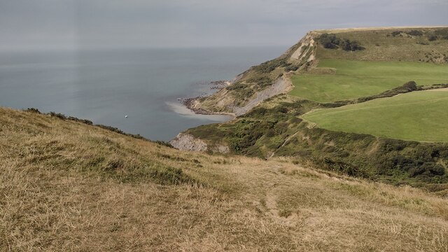
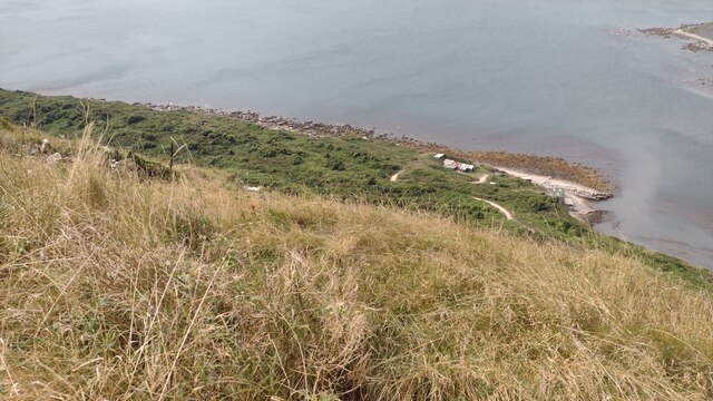
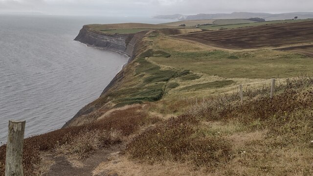
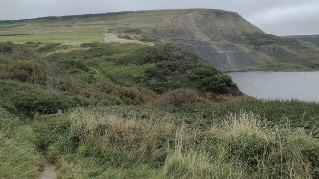
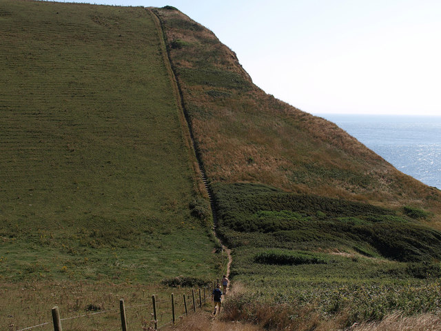
Houns-tout Cliff is a prominent natural landmark located in Dorset, England. Situated along the Jurassic Coast, this cliff is known for its stunning beauty and geological significance. Rising to a height of approximately 100 meters (328 feet), Houns-tout Cliff offers breathtaking views of the surrounding landscape and the English Channel.
The cliff is composed mainly of chalk, which is characteristic of the area's geology. The chalk formation provides a striking white appearance, adding to the visual appeal of the cliff. Over millions of years, erosion has shaped the cliff, resulting in its current steep and rugged slope.
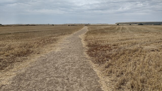
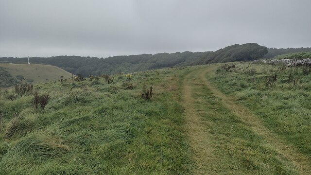
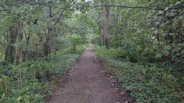
Houns-tout Cliff is a popular destination for hikers and nature enthusiasts. Several walking trails traverse the area, allowing visitors to explore the cliff and its surroundings. The cliff is also home to a diverse range of flora and fauna, including various species of birds and wildflowers.
In addition to its natural beauty, Houns-tout Cliff holds historical significance. It is believed to have been used as a lookout point during World War II, as it provided an advantageous vantage point for monitoring the English Channel for potential enemy activities.
Visitors to Houns-tout Cliff are advised to exercise caution, as the cliff's steep slope can be dangerous. It is important to follow designated paths and stay away from cliff edges to ensure personal safety.
Overall, Houns-tout Cliff is a must-visit destination for those seeking awe-inspiring natural landscapes, geological wonders, and a glimpse into the area's rich history.
If you have any feedback on the listing, please let us know in the comments section below.
Houns-tout Cliff Images
Images are sourced within 2km of 50.595286/-2.0727217 or Grid Reference SY9477. Thanks to Geograph Open Source API. All images are credited.


Houns-tout Cliff is located at Grid Ref: SY9477 (Lat: 50.595286, Lng: -2.0727217)
Unitary Authority: Dorset
Police Authority: Dorset
What 3 Words
///squirts.glorified.compound. Near Corfe Castle, Dorset
Nearby Locations
Related Wikis

Egmont Bight
Egmont Bight is a shallow embayment at the southern end of the Encombe valley in Dorset, England. It is part of the Jurassic Coast. == Geology == The bay...

Chapman's Pool
Chapman's Pool is a small cove to the west of Worth Matravers on the Isle of Purbeck, in Dorset, England. == Geology == The rocks that form the cove are...

Encombe House
Encombe House is a privately owned, Grade II* listed country house built in 1735 on the Encombe Estate near the village of Kingston and about 1-mile (1...

Swyre Head
Swyre Head is the highest point of the Isle of Purbeck in Dorset, on the south coast of England. The hill Swyre Head lies about 2 kilometres (1 mi) southwest...
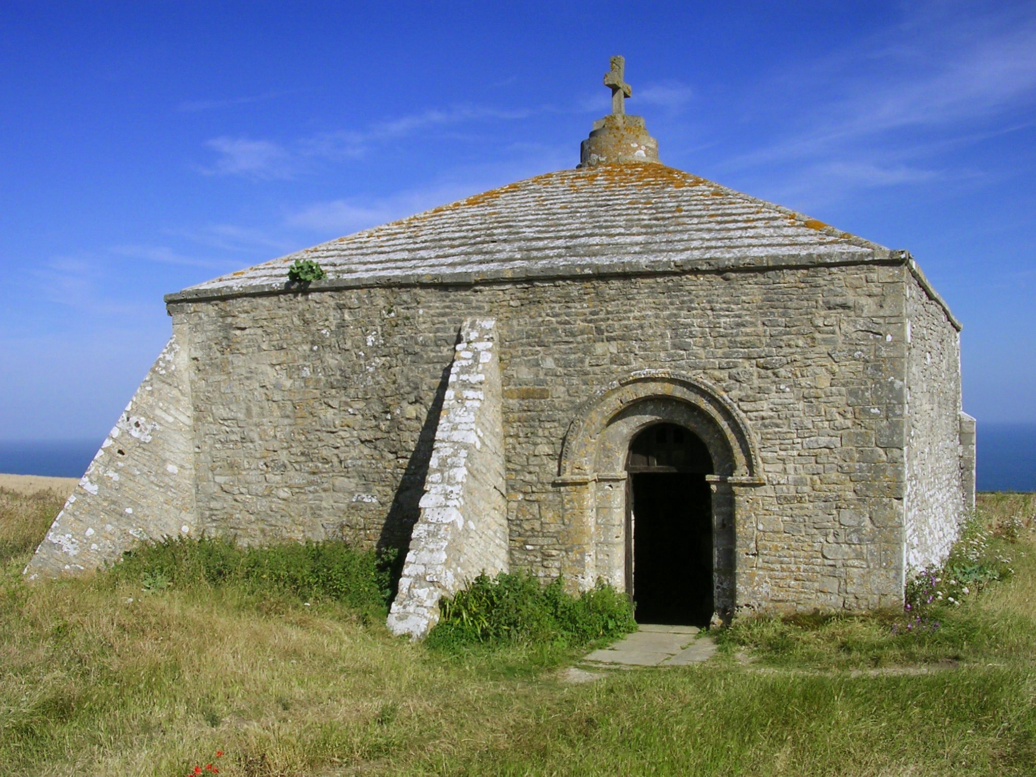
St. Aldhelm's Chapel, St. Aldhelm's Head
St Aldhelm's Chapel is a Norman chapel on St Aldhelm's Head in the parish of Worth Matravers, Swanage, Dorset. It stands close to the cliffs, 108 metres...

St Alban's Head
St Alban's Head (corruption of St Aldhelms Head) is a headland located 5 kilometres (3.1 mi) southwest of Swanage, on the coast of Dorset, England. It...

Kingston, Purbeck
Kingston is a small village on the Isle of Purbeck in the county of Dorset in southern England. == Location == Kingston is situated about two miles south...

Worth Matravers
Worth Matravers () is a village and civil parish in the English county of Dorset. The village is situated on the cliffs west of Swanage. It comprises limestone...
Nearby Amenities
Located within 500m of 50.595286,-2.0727217Have you been to Houns-tout Cliff?
Leave your review of Houns-tout Cliff below (or comments, questions and feedback).