Fowls Heugh

Cliff, Slope in Kincardineshire

Scotland

Fowls Heugh

Looking down into Trollochy Trollochy is a short, cliff girt inlet below Crawton.
Looking down into Trollochy Credit: Gordon Hatton

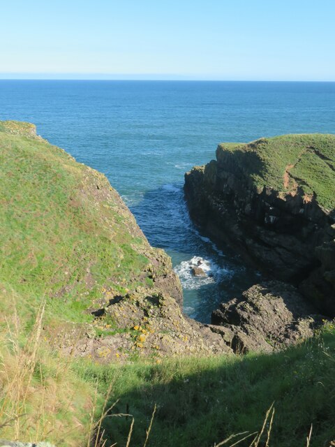
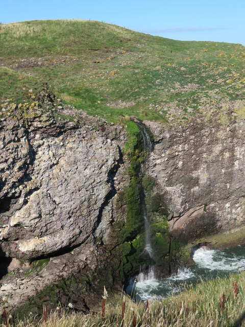
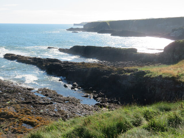
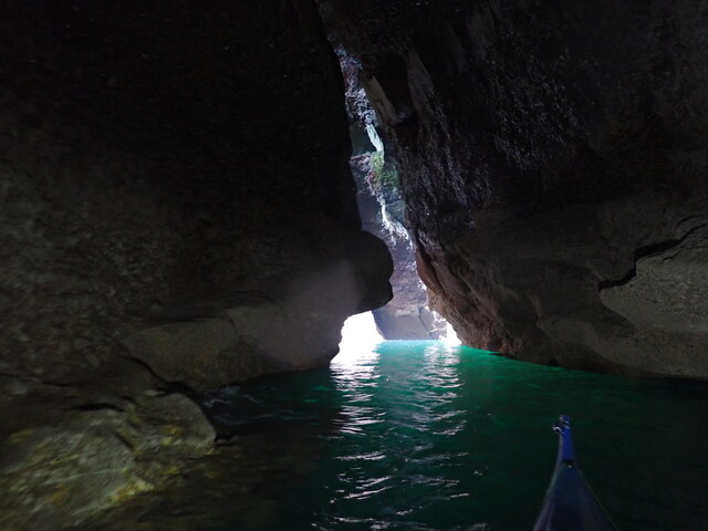
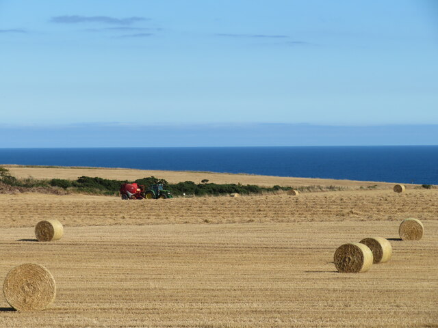
Fowls Heugh is a prominent coastal cliff located in Kincardineshire, Scotland. It stretches along the North Sea coast, offering stunning views of the surrounding landscape. The cliff is composed mainly of sedimentary rocks, including sandstone and shale, which have been gradually eroded over millions of years by the relentless action of the sea.

Standing at approximately 60 meters in height, Fowls Heugh is a striking feature that can be seen from miles away. The cliff face is characterized by its vertical or near-vertical slopes, which give it a dramatic and rugged appearance. The upper part of the cliff is covered in vegetation, including grasses and shrubs, while the lower sections are often exposed rock faces.

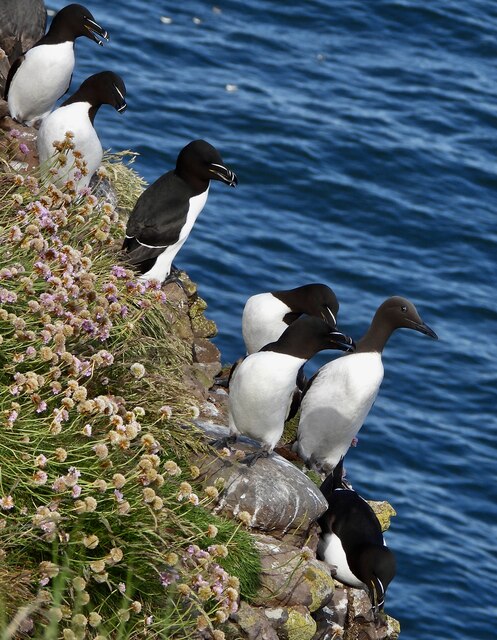
One of the most notable aspects of Fowls Heugh is the presence of several nesting colonies of seabirds. The cliff offers ideal nesting conditions for a variety of species, including fulmars, kittiwakes, and guillemots. These birds can be observed during the breeding season, with their colonies providing a lively and noisy spectacle.

Access to Fowls Heugh is possible via a footpath that runs along the cliff top, offering panoramic views of the coastline and the North Sea. The path is well-maintained and provides a safe route for visitors to explore the area. However, caution should be exercised near the cliff edge, as it can be unstable and dangerous.

Overall, Fowls Heugh is a significant geological and ecological site, attracting visitors who appreciate its natural beauty and the diverse wildlife that call it home.

If you have any feedback on the listing, please let us know in the comments section below.

Fowls Heugh Images

Images are sourced within 2km of 56.916498/-2.1986161 or Grid Reference NO8880. Thanks to Geograph Open Source API. All images are credited.

Looking down into Trollochy Trollochy is a short, cliff girt inlet below Crawton.
Looking down into Trollochy
Trollochy is a short, cliff girt inlet below Crawton.
Waterfall into the sea at Crawton A wee burn makes a dramatic plunge into the cliff bound inlet of Trollochy at Crawton.
Waterfall into the sea at Crawton
A wee burn makes a dramatic plunge into the cliff bound inlet of Trollochy at Crawton.
Rock ribs extending out into the sea at Crawton The view south from the small headland at Crawton where rocky reefs defy the waves. The view extends along Crawton Bay.
Rock ribs extending out into the sea at Crawton
The view south from the small headland at Crawton where rocky reefs defy the waves. The view extends along Crawton Bay.
Caravan site, Cloak And cloaked in haar.
Caravan site, Cloak
And cloaked in haar.
A minor road near Catterline You can just see the foglights through the haar. There is a conifer shelter belt on the left, and the trees have thinned the fog enough to get a shot off.
A minor road near Catterline
You can just see the foglights through the haar. There is a conifer shelter belt on the left, and the trees have thinned the fog enough to get a shot off.
Farmland near Mill of Uras
Cotbank of Hilton
Cotbank of Hilton
New house, Cotbank of Hilton
National Cycle Route 1  Heading south near Cotbank of Hilton.
National Cycle Route 1
Heading south near Cotbank of Hilton.
National Cycle Route 1 Heading south.
National Cycle Route 1
Heading south.
Caravan site, Cloak
Caravan site, Cloak
National Cycle Route 1 heading south At Cloak.
National Cycle Route 1 heading south
At Cloak.
Farmland, Mains of Hilton Towards the sea.
Farmland, Mains of Hilton
Towards the sea.
Track to Mains of Hilton Heading east.
Track to Mains of Hilton
Heading east.
Trelong Bay. Just North of Catterline.
Trelong Bay.
Just North of Catterline.
Inside Wallace Bridge North Cave Looking towards the entrance with the tide level about 1.1 m above chart datum. The cave is quite wide at this tide level, but narrows when it is higher. The tunnel goes on at least another 50 m inward from this point. It is used by seals.
Inside Wallace Bridge North Cave
Looking towards the entrance with the tide level about 1.1 m above chart datum. The cave is quite wide at this tide level, but narrows when it is higher. The tunnel goes on at least another 50 m inward from this point. It is used by seals.
Baler at work Tractor with baler working a harvested field near Cowieswells Farm.
Baler at work
Tractor with baler working a harvested field near Cowieswells Farm.
Razorbills and Guillemots Lives most of the year at sea, coming to land to breed. Both birds depends on the health of the marine environment. Fishing nets, pollution at sea and declining fish stocks all threaten these birds.
Razorbills and Guillemots
Lives most of the year at sea, coming to land to breed. Both birds depends on the health of the marine environment. Fishing nets, pollution at sea and declining fish stocks all threaten these birds.
Show me another place!

Fowls Heugh is located at Grid Ref: NO8880 (Lat: 56.916498, Lng: -2.1986161)

Unitary Authority: Aberdeenshire

Police Authority: North East

What 3 Words

///enrolling.homework.bunks. Near Stonehaven, Aberdeenshire

Related Wikis

Fowlsheugh

Fowlsheugh is a coastal nature reserve in Kincardineshire, northeast Scotland, known for its 70-metre-high (230 ft) cliff formations and habitat supporting...

Craiglethy

Craiglethy (Scottish Gaelic: Creag Liathach - meaning grey rock) is a small island/skerry off Fowlsheugh on the east coast of Aberdeenshire, Scotland in...

Crawton

Crawton is a former fishing community on the southeast Aberdeenshire coast in Scotland, deserted since 1927. Approximately three miles south of Stonehaven...

Thornyhive Bay

Thornyhive Bay is an embayment along the North Sea coast in Aberdeenshire, Scotland. This bay is situated approximately 2.5 miles south of the town of...

Catterline

Catterline is a coastal village on the North Sea in Aberdeenshire, Scotland. It is situated about 5 miles (8.0 km) south of Stonehaven; nearby to the...

Dunnottar Castle

Dunnottar Castle (Scottish Gaelic: Dùn Fhoithear, "fort on the shelving slope") is a ruined medieval fortress located upon a rocky headland on the north...

Bowdun Head

Bowdun Head is a headland landform on the North Sea coast approximately one kilometre south of Stonehaven, Scotland.(Ordnance Survey, 2004) Slightly to...

Dunnicaer

Dunnicaer, or Dun-na-caer, is a precipitous sea stack just off the coast of Aberdeenshire, Scotland, between Dunnottar Castle and Stonehaven. Despite the...

Nearby Amenities

Located within 500m of 56.916498,-2.1986161
Source: PGS
Lat/Long: 56.9165863/-2.1985334
Source: PGS
Lat/Long: 56.9168773/-2.198731
Source: PGS
Lat/Long: 56.9169993/-2.1988134
Source: PGS
Lat/Long: 56.9173195/-2.1988099
Source: PGS
Lat/Long: 56.9175592/-2.1989966
Source: PGS
Lat/Long: 56.9186519/-2.1998452
Source: PGS
Lat/Long: 56.9199427/-2.200158
Source: PGS
Lat/Long: 56.9123284/-2.1969122
Source: PGS
Lat/Long: 56.9134229/-2.1976842
Source: PGS
Lat/Long: 56.9136432/-2.1979993
Source: PGS
Lat/Long: 56.9138388/-2.1982491
Source: PGS
Lat/Long: 56.9140013/-2.1976582
Source: PGS
Lat/Long: 56.9139452/-2.1976461
Source: PGS
Lat/Long: 56.9140066/-2.1973905
Source: PGS
Lat/Long: 56.9149643/-2.1974162
Source: PGS
Lat/Long: 56.9155721/-2.1976839
Source: PGS
Lat/Long: 56.9160347/-2.1980586
Give Way
Direction: forward
Lat/Long: 56.9160425/-2.2046846
Uras Knaps
Place: locality
Lat/Long: 56.9192203/-2.2043937
Valehead
Place: isolated_dwelling
Lat/Long: 56.9158558/-2.2029614
Power: pole
Lat/Long: 56.9159504/-2.2035149
Power: pole
Lat/Long: 56.9157406/-2.2044712
Power: pole
Lat/Long: 56.9156319/-2.2056214
The data included in this document is from www.openstreetmap.org. The data is made available under ODbL.

Have you been to Fowls Heugh?

Leave your review of Fowls Heugh below (or comments, questions and feedback).