Church Brae
Cliff, Slope in Banffshire
Scotland
Church Brae

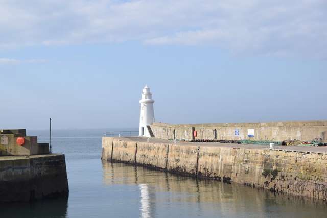
Church Brae is a picturesque cliff located in the coastal town of Banffshire, Scotland. It is situated on the eastern coast of the country, overlooking the North Sea. The brae, meaning slope or hill in Scottish dialect, is renowned for its stunning natural beauty and panoramic views.
Rising majestically from the sea, Church Brae offers a breathtaking vista of the surrounding landscape. The cliff stands at an impressive height, providing visitors with a remarkable viewpoint to admire the rugged coastline and the vast expanse of the ocean. The brae is known for its steep incline and is often frequented by adventurous hikers and nature enthusiasts seeking a challenging climb.
At the top of Church Brae, a historic church dating back to the 18th century can be found. The church adds a touch of charm to the already captivating scenery, making it a popular spot for photography and sightseeing. The peaceful ambiance and tranquil atmosphere around the church make it an idyllic setting for relaxation and reflection.
The surrounding area of Church Brae is rich in natural diversity, with lush greenery, wildflowers, and an abundance of wildlife. Seabirds can often be spotted soaring above the cliff, while seals can occasionally be seen basking on the rocks below. The constant crashing of waves against the cliffs adds a dramatic element to the experience and further enhances the natural allure of this remarkable location.
Overall, Church Brae in Banffshire is a must-visit destination for those seeking breathtaking views, a touch of history, and a serene escape into nature.
If you have any feedback on the listing, please let us know in the comments section below.
Church Brae Images
Images are sourced within 2km of 57.668505/-2.5026189 or Grid Reference NJ7064. Thanks to Geograph Open Source API. All images are credited.


Church Brae is located at Grid Ref: NJ7064 (Lat: 57.668505, Lng: -2.5026189)
Unitary Authority: Aberdeenshire
Police Authority: North East
What 3 Words
///siblings.regulator.remarked. Near Macduff, Aberdeenshire
Nearby Locations
Related Wikis

Macduff railway station
Macduff railway station was a railway station serving the settlements of Banff and Macduff, Aberdeenshire, Scotland. It was the terminus of a branch line...

Macduff Town Hall
Macduff Town Hall is a municipal building in Shore Street, Macduff, Aberdeenshire, Scotland. The structure, which was the meeting place of Macduff Burgh...

Macduff, Aberdeenshire
Macduff (Scottish Gaelic: An Dùn) is a town in the Banff and Buchan area of Aberdeenshire, Scotland. It is situated on Banff Bay and faces the town of...

Macduff Lifeboat Station
Macduff Lifeboat Station is a Royal National Lifeboat Institution (RNLI) marine-rescue facility in Macduff, Aberdeenshire, Scotland, United Kingdom. The...

Macduff Marine Aquarium
Macduff Marine Aquarium is an aquarium in Macduff, Scotland. == History == Macduff Marine Aquarium opened in 1997.In 2017, the aquarium closed to allow...
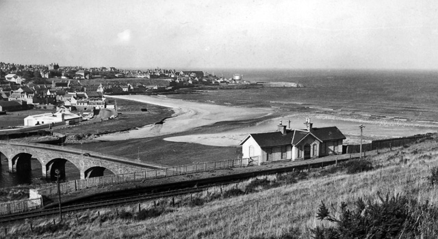
Banff Bridge railway station
Banff Bridge railway station was a railway station in Banff Bridge, Banff, Aberdeenshire. It was the penultimate stop on a branch line from Inveramsay...
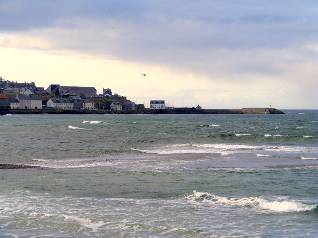
Banff Bay
Banff Bay (Scottish Gaelic: Bàgh Bhanbh) is a coastal embayment in Scotland situated between the towns of Banff, Aberdeenshire and Macduff, Aberdeenshire...

River Deveron
The River Deveron (Scottish Gaelic: Uisge Dubh Èireann) is a river in the north east of Scotland. The river has a length of 60 miles (97 km), and has a...
Nearby Amenities
Located within 500m of 57.668505,-2.5026189Have you been to Church Brae?
Leave your review of Church Brae below (or comments, questions and feedback).