Gart Banks

Cliff, Slope in Orkney

Scotland

Gart Banks

Stronsay: arriving at Mill Bay beach A very short track from the road arrives at this splendid sandy beach, backed by low dunes.
Stronsay: arriving at Mill Bay beach Credit: Chris Downer

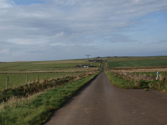
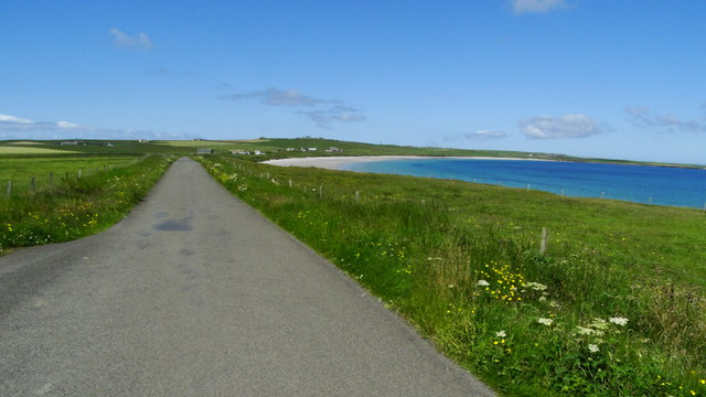
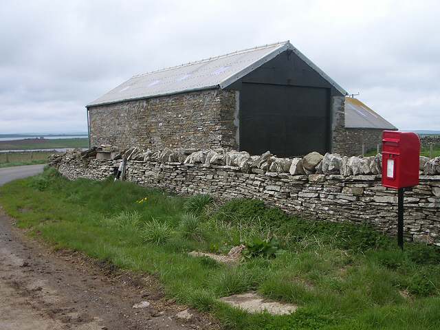
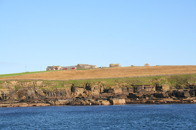
Gart Banks is a prominent geological feature located on the island of Orkney, off the northeastern coast of Scotland. It is a significant cliff and slope formation that stretches along the coastline, offering stunning views of the North Sea. The area is known for its rugged beauty and is a popular destination for nature enthusiasts and geology enthusiasts alike.

The cliffs at Gart Banks are composed of sandstone and are known to reach heights of around 100 meters (328 feet) in some places. The layers of sandstone reveal a fascinating geological history, showcasing the ancient sedimentary deposits that formed over millions of years. These formations are a result of the movement and erosion of glaciers during the last ice age.

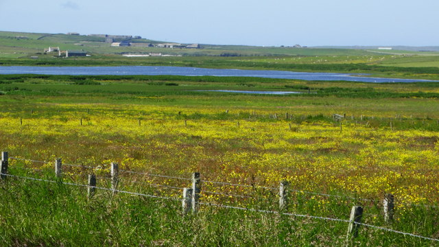
The slopes leading down from the cliffs are covered in a variety of vegetation, including grasses, heather, and wildflowers. This creates a visually striking contrast against the backdrop of the sea. Visitors can often spot a diverse range of bird species nesting on the cliffs, such as fulmars, gulls, and puffins, making it a haven for birdwatchers.

Gart Banks is also known for its geological significance. Fossils and various rock formations can be found in the area, providing valuable insights into the region's ancient history. The cliffs and slopes are a testament to the dynamic natural processes that have shaped the landscape over time.

Overall, Gart Banks in Orkney offers a unique blend of natural beauty, geological wonders, and diverse wildlife. Whether it's exploring the cliffs and slopes or observing the rich birdlife, it is a place that captivates and inspires visitors from all walks of life.

If you have any feedback on the listing, please let us know in the comments section below.

Gart Banks Images

Images are sourced within 2km of 59.118205/-2.5730143 or Grid Reference HY6725. Thanks to Geograph Open Source API. All images are credited.

Stronsay: arriving at Mill Bay beach A very short track from the road arrives at this splendid sandy beach, backed by low dunes.
Stronsay: arriving at Mill Bay beach
A very short track from the road arrives at this splendid sandy beach, backed by low dunes.
Stronsay: looking out across Mill Bay A picture with not many features, but a splendid spot on a lovely sunny afternoon.
Stronsay: looking out across Mill Bay
A picture with not many features, but a splendid spot on a lovely sunny afternoon.
Stronsay: postbox № KW17 53, Everbay This postbox is of a modern design, constructed of pressed steel and designed to be more robust, rustproof and theft-proof than the traditional cast iron box that it will have replaced in the last couple of years.

This particular style of box is becoming quite commonplace in these remote, exposed parts.
Stronsay: postbox № KW17 53, Everbay
This postbox is of a modern design, constructed of pressed steel and designed to be more robust, rustproof and theft-proof than the traditional cast iron box that it will have replaced in the last couple of years. This particular style of box is becoming quite commonplace in these remote, exposed parts.
Stronsay: the blue water of Mill Bay Looking along the beach during a paddle.
Stronsay: the blue water of Mill Bay
Looking along the beach during a paddle.
Stronsay: landward view at Mill Bay beach A stripy view consisting of blue sky, some distant clouds, dunes, sand and a cold but beautiful sea.
Stronsay: landward view at Mill Bay beach
A stripy view consisting of blue sky, some distant clouds, dunes, sand and a cold but beautiful sea.
Sunset beyond Odin Ness, Stronsay Taken from the Shetland ferry several km to the SW.
Sunset beyond Odin Ness, Stronsay
Taken from the Shetland ferry several km to the SW.
Road to Kirbuster On the island of Stronsay, one of the Orkney north isles, this minor road leads to the farm of Kirbuster and the small car parking space used by people exploring the coastal cliffs, geos, rock arch, etc.
Road to Kirbuster
On the island of Stronsay, one of the Orkney north isles, this minor road leads to the farm of Kirbuster and the small car parking space used by people exploring the coastal cliffs, geos, rock arch, etc.
On Stronsay - Beach at Mill Bay from lane by Linksquoy
On Stronsay - View towards Meikle Water from near Eastbank
On Stronsay - Gories, Everbay
On Stronsay - Walking towards Odiness
Everbay, Stronsay The junction of two minor roads at Everbay is marked with a post box next to a substantial barn
Everbay, Stronsay
The junction of two minor roads at Everbay is marked with a post box next to a substantial barn
Bullocks near Hescombe We had to speak very sharply to these young bullocks before they would move away from the gate to let us onto this section of path. They then galloped round the field to block our way out at the top gate, where more sharp words were required. At this time of year many farms had young bullocks in their fields, looking like fairly recent arrivals.
Bullocks near Hescombe
We had to speak very sharply to these young bullocks before they would move away from the gate to let us onto this section of path. They then galloped round the field to block our way out at the top gate, where more sharp words were required. At this time of year many farms had young bullocks in their fields, looking like fairly recent arrivals.
Airy Loch, Stronsay Airy Loch is a coastal lagoon which is only shown as a boggy area on the 1940s map. No footpath to it appears on the map, but there is a clear signposted path from the roadside near Odiness.
Airy Loch, Stronsay
Airy Loch is a coastal lagoon which is only shown as a boggy area on the 1940s map. No footpath to it appears on the map, but there is a clear signposted path from the roadside near Odiness.
Coast near Odness, Stronsay Looking up the coast in the direction of the Holm of Odness.
Coast near Odness, Stronsay
Looking up the coast in the direction of the Holm of Odness.
New fencing on Stronsay Green-coated barbed wire is being used to make a new fence.
New fencing on Stronsay
Green-coated barbed wire is being used to make a new fence.
Young bullocks on Stronsay One of many fields containing young bullocks who were inquisitive about everything that happened nearby. Having made sure they all got a good view of the two people walking past on the road, they then kept pace with us till we were past the top of their field.
Young bullocks on Stronsay
One of many fields containing young bullocks who were inquisitive about everything that happened nearby. Having made sure they all got a good view of the two people walking past on the road, they then kept pace with us till we were past the top of their field.
Show me another place!

Gart Banks is located at Grid Ref: HY6725 (Lat: 59.118205, Lng: -2.5730143)

Unitary Authority: Orkney Islands

Police Authority: Highlands and Islands

What 3 Words

///awoke.alone.panic. Near Whitehall, Orkney Islands

Related Wikis

Stronsay

Stronsay () is an island in Orkney, Scotland. It is known as Orkney's 'Island of Bays', owing to an irregular shape with miles of coastline, with three...

Odness

Odness is a peninsula and headland on the island of Stronsay, in Orkney, Scotland. The Odness peninsula contains the farm of Odiness. Odness is also within...

Whitehall, Orkney

Whitehall is the village on the island of Stronsay, in the Orkney Islands of Scotland. It is a small village with about 50 houses. It also has a shop...

Papa Stronsay

Papa Stronsay (Scots: Papa Stronsee; Old Norse: Papey Minni) is a small island in Orkney, Scotland, lying north east of Stronsay. It is 74 hectares (183...

Sons of the Most Holy Redeemer

The Congregation of the Sons of the Most Holy Redeemer (Latin: Filii Sanctissimi Redemptoris; FSSR), commonly known as the Transalpine Redemptorists or...

Linga Sound, Orkney

Linga Sound is the strait between the islands of Linga Holm and Stronsay in the Orkney islands of Scotland. It leads into St. Catherines Bay from the north...

Stronsay Airport

Stronsay Airport (IATA: SOY, ICAO: EGER) is located 15 nautical miles (28 km; 17 mi) northeast by north of Kirkwall Airport on Stronsay, Orkney Islands...

Linga Holm

Linga Holm, commonly known as Linga, Midgarth and the Holm of Midgarth is an uninhabited Scottish island extending to approximately 57 hectares (0.22...

Nearby Amenities

Located within 500m of 59.118205,-2.5730143
Crossing
Crossing: marked
Lat/Long: 59.1159633/-2.5751049
Power: pole
Lat/Long: 59.1152258/-2.5666496
Power: pole
Lat/Long: 59.1159782/-2.5679462
Power: pole
Lat/Long: 59.1150226/-2.5694854
Power: pole
Lat/Long: 59.1139636/-2.5711811
Orkney Star Island Soap & Textiles
Craft: handicraft
Lat/Long: 59.1176992/-2.5703203
The data included in this document is from www.openstreetmap.org. The data is made available under ODbL.

Have you been to Gart Banks?

Leave your review of Gart Banks below (or comments, questions and feedback).