Bean Well Bank

Cliff, Slope in Lancashire South Lakeland

England

Bean Well Bank

A5087 Coast Road The A5087 Coast Road in Sea Wood.
A5087 Coast Road Credit: Peter McDermott

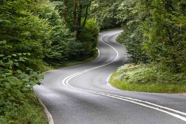
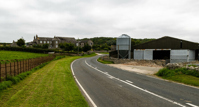
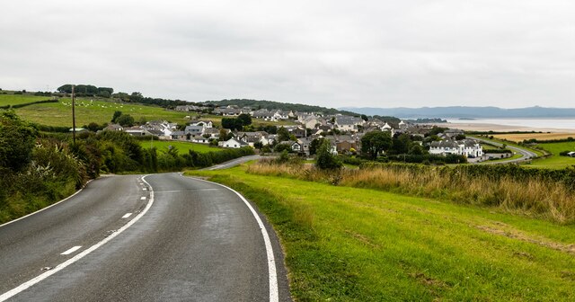
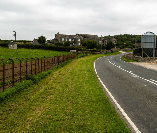
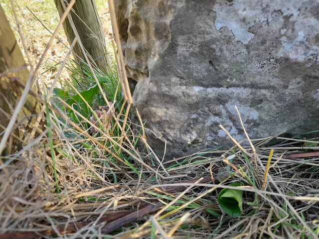
Bean Well Bank is a natural geographical feature located in Lancashire, England. It is a prominent cliff slope that stretches along the coastline, offering stunning views of the surrounding area. The bank is situated near the town of Lancashire, making it easily accessible for both locals and tourists.

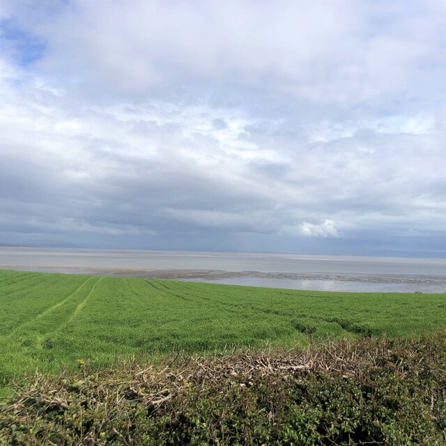
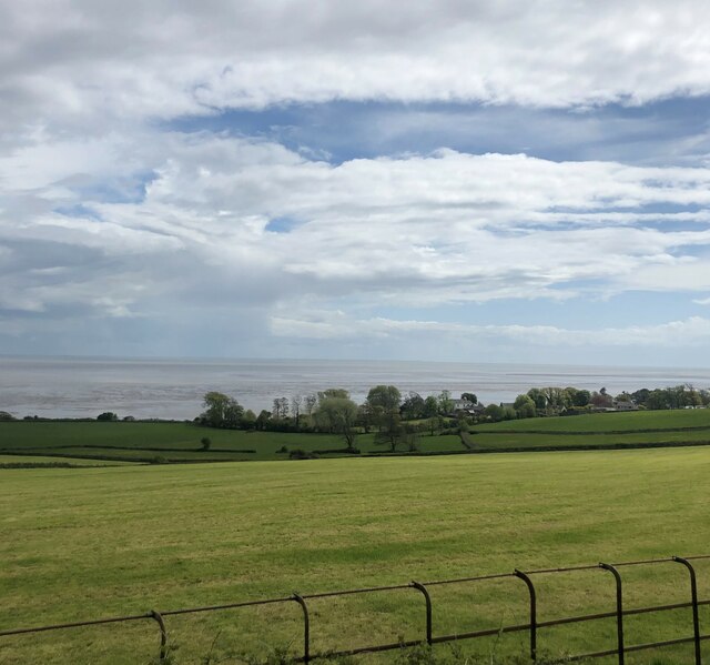
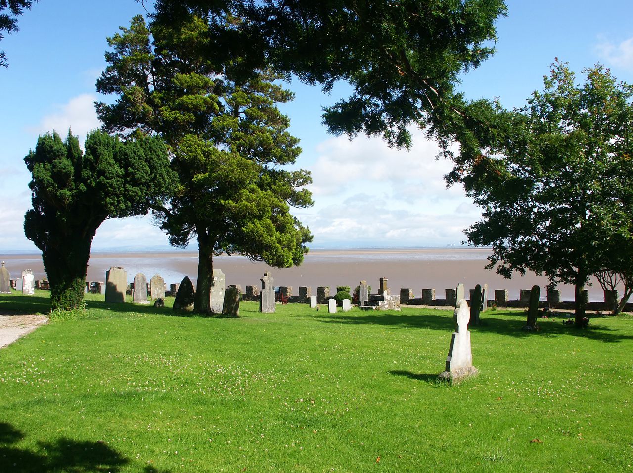
With its picturesque landscape and unique geological formations, Bean Well Bank has become a popular destination for nature enthusiasts and outdoor adventurers. The bank rises steeply from the shoreline, providing a challenging terrain for hikers and climbers. Its rugged cliffs offer breathtaking panoramas of the sea and the countryside, making it a favorite spot for photographers and nature lovers.

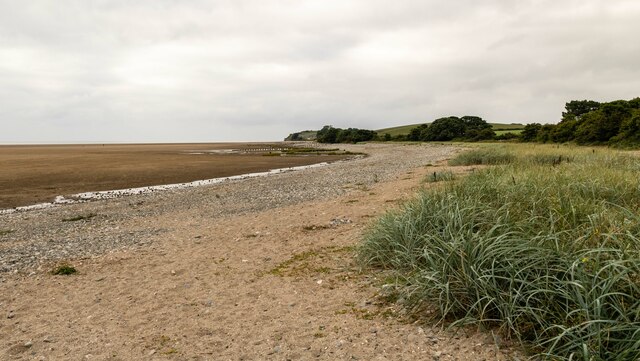
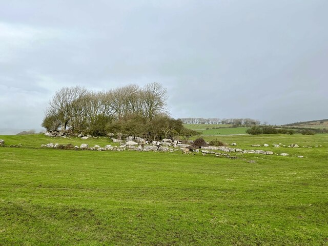
The bank is known for its rich biodiversity. It is home to a variety of plant species, including vibrant wildflowers and grasses that thrive in the coastal environment. The surrounding waters also support a diverse marine ecosystem, attracting bird species and other wildlife.

Visitors to Bean Well Bank can engage in a range of activities. The cliff slope provides ample opportunities for rock climbing and abseiling, catering to both beginners and experienced climbers. Hiking trails wind through the area, allowing visitors to explore the bank's natural beauty at their own pace. Additionally, the bank's proximity to the coast makes it an ideal spot for fishing, boating, and beachcombing.

Overall, Bean Well Bank offers a captivating blend of natural beauty, adventure, and ecological diversity. Its rugged cliffs, stunning views, and recreational opportunities make it a must-visit destination for anyone seeking an outdoor experience in Lancashire.

If you have any feedback on the listing, please let us know in the comments section below.

Bean Well Bank Images

Images are sourced within 2km of 54.140873/-3.0860412 or Grid Reference SD2972. Thanks to Geograph Open Source API. All images are credited.

A5087 Coast Road The A5087 Coast Road in Sea Wood.
A5087 Coast Road
The A5087 Coast Road in Sea Wood.
A5087 Coast Road The A5087 Coast Road at Seawood Farm.
A5087 Coast Road
The A5087 Coast Road at Seawood Farm.
Aldingham Nursing Home
Aldingham Hall
Aldingham Hall
Elbow Scar
Elbow Scar
Seawood Farm
Seawood Farm
Grass for Silage near Baycliff
View to Aldingham From the A5087
View to Aldingham
From the A5087
Limestone outcrop near Green Slacks A cluster of wind shaped trees have gained a foothold in the grikes in the outcropping limestone. 
Part of the outcrop was incorporated into defensive wall around what is probably an Iron Age farmstead; some of the earthworks are discernible to the right of the trees.
Limestone outcrop near Green Slacks
A cluster of wind shaped trees have gained a foothold in the grikes in the outcropping limestone. Part of the outcrop was incorporated into defensive wall around what is probably an Iron Age farmstead; some of the earthworks are discernible to the right of the trees.
Ordnance Survey Cut Mark This OS cut mark can be found on the west angle of St Cuthbert's Church. It marks a point 12.779m above mean sea level.
Ordnance Survey Cut Mark
This OS cut mark can be found on the west angle of St Cuthbert's Church. It marks a point 12.779m above mean sea level.
Ordnance Survey Cut Mark This OS cut mark can be found on the gatepost east side of the road. It marks a point 83.558m above mean sea level.
Ordnance Survey Cut Mark
This OS cut mark can be found on the gatepost east side of the road. It marks a point 83.558m above mean sea level.
Standing Stone near Scales and Aldingham As close as I could get.
Standing Stone near Scales and Aldingham
As close as I could get.
Birkrigg Common In the background is Bardsea church
Birkrigg Common
In the background is Bardsea church
Decaying breakwater at Elbow Scar, Aldingham, Furness Looking NNE to Aldingham Village. The tides in Morecambe Bay come in very rapidly and together with the quicksands make the bay a dangerous place for the careless
Decaying breakwater at Elbow Scar, Aldingham, Furness
Looking NNE to Aldingham Village. The tides in Morecambe Bay come in very rapidly and together with the quicksands make the bay a dangerous place for the careless
Old Mill at Bardsea
Old Mill at Bardsea
Aldingham Church
Aldingham Church
Fishermans Arms Hotel, Baycliff This photo was taken at the entrance of the Car Park.
Update August 2010: The establishment is now closed.
Fishermans Arms Hotel, Baycliff
This photo was taken at the entrance of the Car Park. Update August 2010: The establishment is now closed.
Show me another place!

Bean Well Bank is located at Grid Ref: SD2972 (Lat: 54.140873, Lng: -3.0860412)

Administrative County: Cumbria

District: South Lakeland

Police Authority: Cumbria

What 3 Words

///headlight.tributes.reserved. Near Swarthmoor, Cumbria

Nearby Locations

Bean Well Bank

Related Wikis

Baycliff

Baycliff is a seaside village in the South Lakeland District of Cumbria in England. Historically in Lancashire, it lies 3 miles (4.8 km) south of Ulverston...

Aldingham

Aldingham is a village and civil parish in the South Lakeland district of Cumbria, England. Historically in Lancashire, it is situated on the east coast...

Birkrigg stone circle

The Birkrigg stone circle (also known as the Druid's Temple or Druids' Circle) is a Bronze Age stone circle on Birkrigg Common, two miles south of Ulverston...

Scales, Aldingham

Scales is a small village in Westmorland and Furness, Cumbria, England. The town of Ulverston is around 3.5 miles south of the village. The name Scales...

Nearby Amenities

Located within 500m of 54.140873,-3.0860412
Source: PGS
Lat/Long: 54.136809/-3.0876915
Source: PGS
Lat/Long: 54.137327/-3.0876626
Source: PGS
Lat/Long: 54.1379065/-3.0876423
Source: PGS
Lat/Long: 54.1383844/-3.0876902
Source: PGS
Lat/Long: 54.1390563/-3.0870814
Source: PGS
Lat/Long: 54.1395141/-3.086483
Source: PGS
Lat/Long: 54.1400214/-3.0861572
Source: PGS
Lat/Long: 54.140894/-3.0854844
Source: PGS
Lat/Long: 54.1413795/-3.0852849
Source: PGS
Lat/Long: 54.1416957/-3.0852212
Source: PGS
Lat/Long: 54.1422964/-3.0849729
Source: PGS
Lat/Long: 54.142627/-3.0847242
Source: PGS
Lat/Long: 54.1429113/-3.0844836
Source: PGS
Lat/Long: 54.1430708/-3.0842796
Source: PGS
Lat/Long: 54.1434623/-3.0839342
Baycliff
Place: village
Source: npe
Wikidata: Q4874404
Lat/Long: 54.1421236/-3.09164
Bus Stop
Shawfield Road junction
Bench: yes
Bus: yes
Covered: yes
Local Ref: AT
Naptan AtcoCode: 090079010698
Naptan Bearing: N
Naptan CommonName: Shawfield Road junction
Naptan Indicator: at
Naptan Landmark: junction with Shawfield Road
Naptan NaptanCode: cumdgmdw
Naptan Street: B5087
Naptan Verified: no
Public Transport: platform
Shelter: yes
Source: naptan_import
Lat/Long: 54.1430911/-3.0893328
Bus Stop
Swinestead Lane end
Bus: yes
Local Ref: AT
Naptan AtcoCode: 090079010699
Naptan Bearing: S
Naptan CommonName: Swinestead Lane end
Naptan Indicator: at
Naptan Landmark: junction with Swinestead Lane
Naptan NaptanCode: cumdgmga
Naptan Street: B5087
Naptan Verified: no
Public Transport: platform
Source: naptan_import
Lat/Long: 54.1428547/-3.0892667
Bus Stop
Fishermans Arms (E bound)
Bus: yes
Naptan AtcoCode: 090079011197
Naptan Bearing: E
Naptan CommonName: Fishermans Arms (E bound)
Naptan Indicator: o/s
Naptan Landmark: Fishermans Arms
Naptan NaptanCode: cumdgmja
Naptan Street: B5087
Naptan Verified: no
Public Transport: platform
Source: naptan_import
Lat/Long: 54.1408559/-3.0916329
Fishermans Arms (W bound)
Naptan AtcoCode: 090079014281
Naptan Bearing: S
Naptan BusStopType: CUS
Naptan CommonName: Fishermans Arms (W bound)
Naptan Indicator: o/s
Naptan Landmark: Fishermans Arms
Naptan NaptanCode: cumdtapd
Naptan Street: Coast Road
Naptan Verified: no
Source: naptan_import
Lat/Long: 54.1407457/-3.0918903
The Farm Shop
Addr City: Baycliff
Shop: convenience
Lat/Long: 54.1417413/-3.0926342
Bench
Backrest: yes
Lat/Long: 54.1430057/-3.0893905
Post Box
Ref: LA12 98
Lat/Long: 54.143166/-3.0894281
Give Way
Direction: forward
Lat/Long: 54.1416066/-3.0926493
Post Office
Baycliff Post Office
Addr City: Baycliff
Addr Housename: Fishermans Arms Hotel
Addr Postcode: LA12 9RJ
Addr Street: Coast Road
Opening Hours: We 12:30-14:30
Ref Pol Id: 145197
Lat/Long: 54.1411164/-3.0913509
Barrier: stile
Lat/Long: 54.1407066/-3.0919397
Direction: SSE
Generator Method: photovoltaic
Generator Output Electricity: yes
Generator Solar Modules: 16
Generator Source: solar
Generator Type: solar_photovoltaic_panel
Location: roof
Power: generator
Lat/Long: 54.1425461/-3.0901678
Direction: ESE
Generator Method: photovoltaic
Generator Output Electricity: yes
Generator Solar Modules: 14
Generator Source: solar
Generator Type: solar_photovoltaic_panel
Location: roof
Power: generator
Lat/Long: 54.1424811/-3.0899087
Turning Circle
Lat/Long: 54.1442973/-3.0852204
Grit Bin
Lat/Long: 54.1437879/-3.0918317
Direction: SSW
Generator Method: photovoltaic
Generator Output Electricity: yes
Generator Source: solar
Generator Type: solar_photovoltaic_panel
Power: generator
Lat/Long: 54.1435882/-3.090032
Telephone
Booth: KX100
Covered: booth
Lat/Long: 54.1415426/-3.0922385
Power: pole
Lat/Long: 54.1388178/-3.088992
Power: pole
Lat/Long: 54.1391463/-3.0881453
Power: pole
Lat/Long: 54.1386117/-3.0883565
Power: pole
Lat/Long: 54.138984/-3.0897485
Power: pole
Lat/Long: 54.1391206/-3.0903906
Power: pole
Lat/Long: 54.1393383/-3.0911053
Power: pole
Lat/Long: 54.1396578/-3.0917541
Power: pole
Lat/Long: 54.1405235/-3.0928052
Power: pole
Lat/Long: 54.1407437/-3.0932846
The data included in this document is from www.openstreetmap.org. The data is made available under ODbL.

Have you been to Bean Well Bank?

Leave your review of Bean Well Bank below (or comments, questions and feedback).