Maynard's Cliff

Cliff, Slope in Devon East Devon

England

Maynard's Cliff

Military Boundary Stone Salcombe Hill, by the junction of the coastal path and one to Salcombe Hill Road. This is a remnant from the days of Semaphore Transmission stations. One was located here. The date predates Benchmarks by about 10 years. The stone can be discerned in the middle of another image see <a href="https://www.geograph.org.uk/photo/2738701">SY1387 : South West Coast Path on Salcombe Hill Cliff</a>

Inscription: 1826 (and War Dept arrow)

Milestone Society National ID: DV_ADSIDM01em
Military Boundary Stone Credit: Mr Red

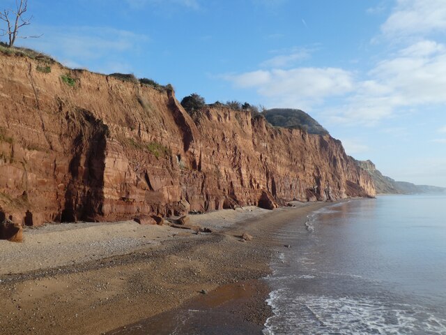
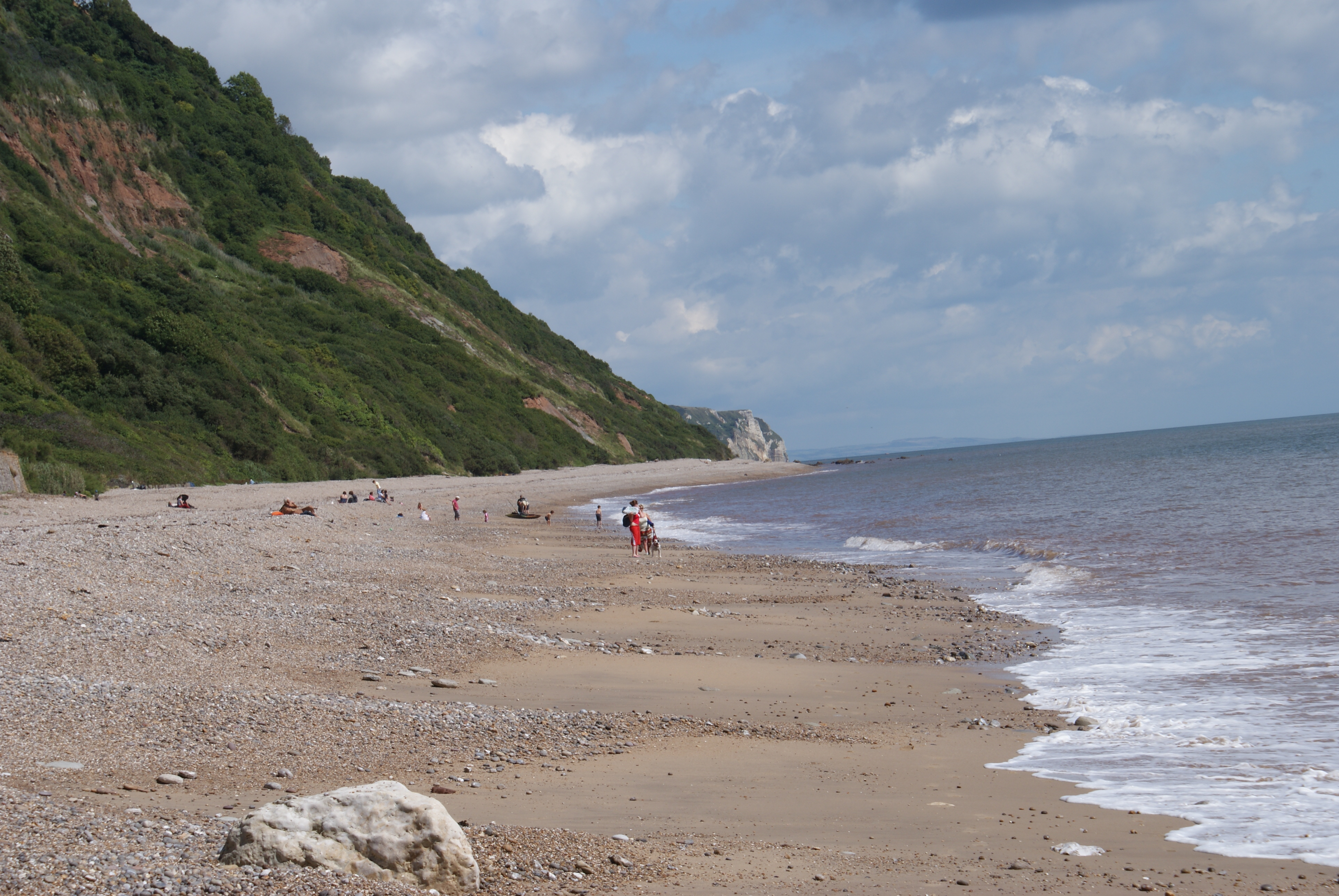
Maynard's Cliff is a prominent geological feature located in Devon, a county in southwestern England. Situated along the picturesque coastline, this cliff is known for its stunning views and unique geological formations.

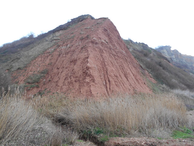
Rising approximately 100 meters above sea level, Maynard's Cliff offers a dramatic backdrop to the surrounding landscape. The cliff is composed primarily of sedimentary rock layers, displaying notable characteristics of the region's geology. These layers date back millions of years and provide valuable insights into the Earth's history.

The cliff face showcases a variety of sedimentary rock types, including sandstone, limestone, and shale. Over time, natural weathering processes, such as erosion and coastal erosion, have shaped the cliff's distinct features. Visitors to Maynard's Cliff can observe the intricate patterns and textures formed by these processes, which add to its visual appeal.

The slope of Maynard's Cliff varies along its length, creating contrasting sections with different angles and formations. This diversity adds to the cliff's allure and attracts geology enthusiasts, nature lovers, and photographers alike.

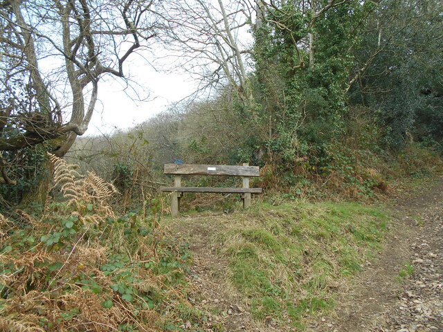
In addition to its geological significance, Maynard's Cliff is also home to a rich array of flora and fauna. The cliff face provides nesting sites for various seabirds, including gulls and cormorants. The surrounding area boasts a diverse ecosystem, with plants adapted to the rugged coastal environment.

Overall, Maynard's Cliff is a remarkable geological feature that showcases the natural beauty and scientific significance of Devon's coastline. Its breathtaking vistas and geological diversity make it a popular destination for both locals and tourists seeking to explore the region's natural wonders.

If you have any feedback on the listing, please let us know in the comments section below.

Maynard's Cliff Images

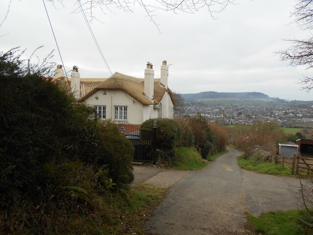
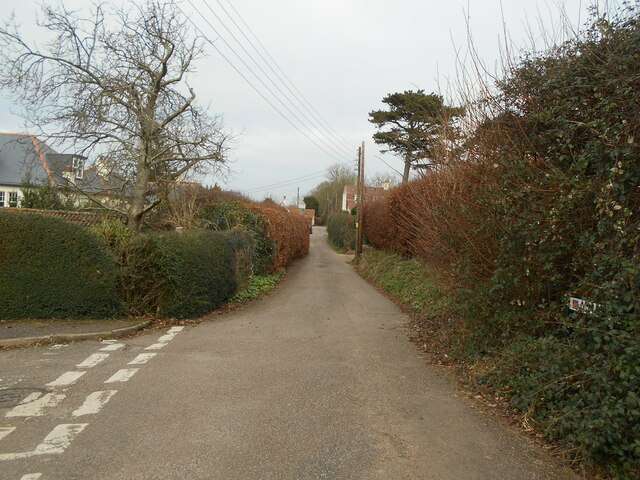
Images are sourced within 2km of 50.683125/-3.2023962 or Grid Reference SY1587. Thanks to Geograph Open Source API. All images are credited.

Military Boundary Stone Salcombe Hill, by the junction of the coastal path and one to Salcombe Hill Road. This is a remnant from the days of Semaphore Transmission stations. One was located here. The date predates Benchmarks by about 10 years. The stone can be discerned in the middle of another image see <a href="https://www.geograph.org.uk/photo/2738701">SY1387 : South West Coast Path on Salcombe Hill Cliff</a>

Inscription: 1826 (and War Dept arrow)

Milestone Society National ID: DV_ADSIDM01em
Military Boundary Stone
Salcombe Hill, by the junction of the coastal path and one to Salcombe Hill Road. This is a remnant from the days of Semaphore Transmission stations. One was located here. The date predates Benchmarks by about 10 years. The stone can be discerned in the middle of another image see SY1387 : South West Coast Path on Salcombe Hill Cliff Inscription: 1826 (and War Dept arrow) Milestone Society National ID: DV_ADSIDM01em
Old Boundary Marker on Salcombe Hill, Sidmouth Admiralty Boundary Marker on the South West Coast Path on Salcombe Hill. Sidmouth parish. It is unclear exactly what military use was made of this area of ground. A list of signal stations during the Napoleonic Wars does not include Salcombe Hill <span class="nowrap"><a title="https://sites.rootsweb.com/~pbtyc/18-1900/Misc/Signal_Stations.html" rel="nofollow ugc noopener" href="https://sites.rootsweb.com/~pbtyc/18-1900/Misc/Signal_Stations.html">Link</a><img style="margin-left:2px;" alt="External link" title="External link - shift click to open in new window" src="https://s1.geograph.org.uk/img/external.png" width="10" height="10"/></span>. See also <span class="nowrap"><a title="https://www.heritagegateway.org.uk/Gateway/Results_Single.aspx?uid=MDV63219&resourceID=104" rel="nofollow ugc noopener" href="https://www.heritagegateway.org.uk/Gateway/Results_Single.aspx?uid=MDV63219&resourceID=104">Link</a><img style="margin-left:2px;" alt="External link" title="External link - shift click to open in new window" src="https://s1.geograph.org.uk/img/external.png" width="10" height="10"/></span>.

Milestone Society National ID: DV_ADSIDM01em
Old Boundary Marker on Salcombe Hill, Sidmouth
Admiralty Boundary Marker on the South West Coast Path on Salcombe Hill. Sidmouth parish. It is unclear exactly what military use was made of this area of ground. A list of signal stations during the Napoleonic Wars does not include Salcombe Hill LinkExternal link. See also LinkExternal link. Milestone Society National ID: DV_ADSIDM01em
Casting a long shadow An early morning view of part of the donkey sanctuary.
the building on the right is a hand washing point.
Casting a long shadow
An early morning view of part of the donkey sanctuary. the building on the right is a hand washing point.
Quest  Griggs Lane.
A property with a panoramic view over the Sid valley.
Quest
Griggs Lane. A property with a panoramic view over the Sid valley.
Alma Lane Named after a battle in the Crimean offensive.1853 - 1856.
Alma Lane
Named after a battle in the Crimean offensive.1853 - 1856.
Soldiers Hill water tank, Salcombe Regis A racecourse once occupied this site at the top of the hill.
Soldiers Hill water tank, Salcombe Regis
A racecourse once occupied this site at the top of the hill.
Salcombe Hill Cliff, east of Sidmouth The same view as in <a href="https://www.geograph.org.uk/photo/6697279">SY1387 : Salcombe Hill Cliff, east of Sidmouth</a> but 13 months later.  Yet more cliff falls and erosion of the cliff
Salcombe Hill Cliff, east of Sidmouth
The same view as in SY1387 : Salcombe Hill Cliff, east of Sidmouth but 13 months later. Yet more cliff falls and erosion of the cliff
Cliffs east of Sidmouth
Remembering a good doctor A memorial bench in memory of Dr Rickard Michelmore who was a local GP for a number of years in Sidmouth.
He lived in the house called Quest a short distance downhill.
Remembering a good doctor
A memorial bench in memory of Dr Rickard Michelmore who was a local GP for a number of years in Sidmouth. He lived in the house called Quest a short distance downhill.
Cliff's edge Typical red sandstone cliffs at Salcombe Mouth.
note the gullies formed by water run off.
Cliff's edge
Typical red sandstone cliffs at Salcombe Mouth. note the gullies formed by water run off.
Entering the sea A small stream crosses the beach at an area known as the Glen at Weston Mouth.
The South West Coast Path climbs up from the beach on its route to Sidmouth.
Entering the sea
A small stream crosses the beach at an area known as the Glen at Weston Mouth. The South West Coast Path climbs up from the beach on its route to Sidmouth.
The Linhay A small shelter built for labourers  growing potatoes on the nearby area known locally as the Plats.
The Linhay
A small shelter built for labourers growing potatoes on the nearby area known locally as the Plats.
Dunscombe Manor farm Now the reception building of a caravan park.
Dunscombe Manor farm
Now the reception building of a caravan park.
Playground area, Donkey Sanctuary, Salcombe Regis
A field of donkeys grazing, Donkey Sanctuary, Salcombe Regis
Footpath between hedge and fence, Donkey Sanctuary,  Salcombe Regis
Footpath between hedge and fence, Donkey Sanctuary, Salcombe Regis
Stile and dog door,  Salcombe Regis
Stile and dog door, Salcombe Regis
Garden of marine souvenirs,  Salcombe Regis
Garden of marine souvenirs, Salcombe Regis
Show me another place!

Maynard's Cliff is located at Grid Ref: SY1587 (Lat: 50.683125, Lng: -3.2023962)

Administrative County: Devon

District: East Devon

Police Authority: Devon and Cornwall

What 3 Words

///rashers.mavericks.shell. Near Sidmouth, Devon

Related Wikis

Salcombe Regis

Salcombe Regis is a coastal village and former civil parish, now in the parish of Sidmouth, in the East Devon district, in the county of Devon, England...

Weston Mouth

Weston Mouth is an isolated beach on the East Devon coast between Sidmouth and Seaton in England. It can be reached only by footpath, either along the...

Norman Lockyer Observatory

The Norman Lockyer Observatory, the Lockyer Technology Centre, and the Planetarium (jointly NLO), is a public access optical observatory 1 mile (1.6 km...

The Donkey Sanctuary

The Donkey Sanctuary is a British charitable organisation devoted to the welfare of donkeys. The charity, which is based near Sidmouth in Devon, England...

Nearby Amenities

Located within 500m of 50.683125,-3.2023962
Source: PGS
Lat/Long: 50.6819266/-3.2076619
Source: PGS
Lat/Long: 50.6820024/-3.206757
Source: PGS
Lat/Long: 50.6820129/-3.2061843
Source: PGS
Lat/Long: 50.6819974/-3.2055632
Source: PGS
Lat/Long: 50.6819809/-3.2051022
Source: PGS
Lat/Long: 50.6819656/-3.2044469
Source: PGS
Lat/Long: 50.6817247/-3.1994723
Source: PGS
Lat/Long: 50.6817798/-3.199262
Source: PGS
Lat/Long: 50.6820384/-3.1984877
Source: PGS
Lat/Long: 50.6820808/-3.1981975
Source: PGS
Lat/Long: 50.6822552/-3.197854
Source: PGS
Lat/Long: 50.6825055/-3.1969724
Source: PGS
Lat/Long: 50.6826126/-3.1964426
Barrier: kissing_gate
Lat/Long: 50.6844895/-3.1975384
Source: PGS
Lat/Long: 50.6821334/-3.204913
Bench
Backrest: no
Lat/Long: 50.6848138/-3.1962468
Bench
Backrest: no
Survey Date: 2023-04-07
Lat/Long: 50.6836011/-3.2056604
Direction: 90
Tourism: viewpoint
Lat/Long: 50.6848485/-3.1962413
The data included in this document is from www.openstreetmap.org. The data is made available under ODbL.

Have you been to Maynard's Cliff?

Leave your review of Maynard's Cliff below (or comments, questions and feedback).