Screadan

Cliff, Slope in Caithness

Scotland

Screadan

Coastal view from the A9
Coastal view from the A9 Credit: Jo and Steve Turner

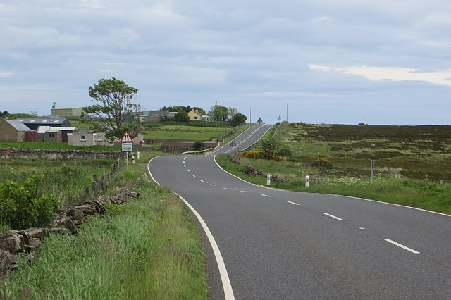
Screadan is a prominent cliff located in the county of Caithness, in the northernmost part of mainland Scotland. Rising majestically from the North Sea, it is known for its stunning geological features and dramatic coastal landscape. The cliff is situated near the small village of John O'Groats and is a popular destination for tourists and outdoor enthusiasts.

Standing at approximately 100 meters in height, Screadan offers breathtaking panoramic views of the surrounding area, including the Orkney Islands on clear days. Its rugged and imposing facade is composed of layers of sedimentary rock, showcasing the region's geological history.

The cliff itself is part of a larger coastal area known as the Caithness Slopes, characterized by its steep gradients and distinctive rock formations. These slopes are the result of centuries of erosion caused by the relentless pounding of the North Sea waves against the coastline. The constant action of wind and water has sculpted the cliffs, creating deep crevices, caves, and natural arches that add to the area's allure.

Screadan is not only a sight to behold but also a habitat for various seabird species, including fulmars, guillemots, and puffins. The cliff provides nesting sites for these birds, which can be observed during the breeding season.

Visitors to Screadan can enjoy the stunning views, take leisurely walks along the coastal path, or partake in adventurous activities such as rock climbing or birdwatching. The area surrounding the cliff is also rich in flora, with heather, gorse, and wildflowers adding a colorful touch to the landscape.

If you have any feedback on the listing, please let us know in the comments section below.

Screadan Images

Images are sourced within 2km of 58.202523/-3.4753372 or Grid Reference ND1324. Thanks to Geograph Open Source API. All images are credited.

Coastal view from the A9
Kirkyard, Berriedale Beside the church on the north bound climb of Berriedale Braes.
Kirkyard, Berriedale
Beside the church on the north bound climb of Berriedale Braes.
A9, Newport At the northern edge of the notorious Berriedale Braes.
A9, Newport
At the northern edge of the notorious Berriedale Braes.
Newport, Caithness A view from the A9 which sweeps beneath the line of houses.
Newport, Caithness
A view from the A9 which sweeps beneath the line of houses.
Gates off the A9, Newport Field access: there are many narrow fields between Newport and the sea.
Gates off the A9, Newport
Field access: there are many narrow fields between Newport and the sea.
Coastal view, Newport The Caithness coast is crying out for a path. It is well worth taking a boat trip along (and through) it.
Coastal view, Newport
The Caithness coast is crying out for a path. It is well worth taking a boat trip along (and through) it.
Ruin, Borgue Lichen encrusted stones beside the A9. The field was being grazed by Simmental cattle, a popular breed in Caithness.
Ruin, Borgue
Lichen encrusted stones beside the A9. The field was being grazed by Simmental cattle, a popular breed in Caithness.
A9, Borgue A bend in the long gentle northbound descent from the top of the Berriedale Braes at Newport. Sea views are very fine from this road.
A9, Borgue
A bend in the long gentle northbound descent from the top of the Berriedale Braes at Newport. Sea views are very fine from this road.
A9, Ramscraigs Northbound view. The road was very quiet this morning.
A9, Ramscraigs
Northbound view. The road was very quiet this morning.
Road to Rockhead Land between the A9 and sea, by Borgue and Ramscraigs, Caithness.
Road to Rockhead
Land between the A9 and sea, by Borgue and Ramscraigs, Caithness.
Coastline from the A9
Dunbeath ROC Post Locked up.
Dunbeath ROC Post
Locked up.
Borgie Houses at the side of the A9 near Berriedale.
Borgie
Houses at the side of the A9 near Berriedale.
Southbound A9 towards Berriedale The A9 is a strategic link between the Highlands of Scotland and the Central Belt. Running for 273 miles, it is the longest road in Scotland and the fifth-longest A-road in the United Kingdom. Historically it was the main road between Edinburgh and John o' Groats but its importance has been eclipsed somewhat in the south by the A90 across the Forth Road Bridge and the M90 motorway, which now links Edinburgh more directly with Perth, and the M9, which is now the main road between Edinburgh and Bridge of Allan.
Southbound A9 towards Berriedale
The A9 is a strategic link between the Highlands of Scotland and the Central Belt. Running for 273 miles, it is the longest road in Scotland and the fifth-longest A-road in the United Kingdom. Historically it was the main road between Edinburgh and John o' Groats but its importance has been eclipsed somewhat in the south by the A90 across the Forth Road Bridge and the M90 motorway, which now links Edinburgh more directly with Perth, and the M9, which is now the main road between Edinburgh and Bridge of Allan.
Bus Stop on the Southbound A9 at Newport The A9 is a strategic link between the Highlands of Scotland and the Central Belt. Running for 273 miles, it is the longest road in Scotland and the fifth-longest A-road in the United Kingdom. Historically it was the main road between Edinburgh and John o' Groats but its importance has been eclipsed somewhat in the south by the A90 across the Forth Road Bridge and the M90 motorway, which now links Edinburgh more directly with Perth, and the M9, which is now the main road between Edinburgh and Bridge of Allan.
Bus Stop on the Southbound A9 at Newport
The A9 is a strategic link between the Highlands of Scotland and the Central Belt. Running for 273 miles, it is the longest road in Scotland and the fifth-longest A-road in the United Kingdom. Historically it was the main road between Edinburgh and John o' Groats but its importance has been eclipsed somewhat in the south by the A90 across the Forth Road Bridge and the M90 motorway, which now links Edinburgh more directly with Perth, and the M9, which is now the main road between Edinburgh and Bridge of Allan.
Northbound A9 near Newton The A9 is a strategic link between the Highlands of Scotland and the Central Belt. Running for 273 miles, it is the longest road in Scotland and the fifth-longest A-road in the United Kingdom. Historically it was the main road between Edinburgh and John o' Groats but its importance has been eclipsed somewhat in the south by the A90 across the Forth Road Bridge and the M90 motorway, which now links Edinburgh more directly with Perth, and the M9, which is now the main road between Edinburgh and Bridge of Allan.
Northbound A9 near Newton
The A9 is a strategic link between the Highlands of Scotland and the Central Belt. Running for 273 miles, it is the longest road in Scotland and the fifth-longest A-road in the United Kingdom. Historically it was the main road between Edinburgh and John o' Groats but its importance has been eclipsed somewhat in the south by the A90 across the Forth Road Bridge and the M90 motorway, which now links Edinburgh more directly with Perth, and the M9, which is now the main road between Edinburgh and Bridge of Allan.
Bends on the A9 near Newport The A9 is a strategic link between the Highlands of Scotland and the Central Belt. Running for 273 miles, it is the longest road in Scotland and the fifth-longest A-road in the United Kingdom. Historically it was the main road between Edinburgh and John o' Groats but its importance has been eclipsed somewhat in the south by the A90 across the Forth Road Bridge and the M90 motorway, which now links Edinburgh more directly with Perth, and the M9, which is now the main road between Edinburgh and Bridge of Allan.
Bends on the A9 near Newport
The A9 is a strategic link between the Highlands of Scotland and the Central Belt. Running for 273 miles, it is the longest road in Scotland and the fifth-longest A-road in the United Kingdom. Historically it was the main road between Edinburgh and John o' Groats but its importance has been eclipsed somewhat in the south by the A90 across the Forth Road Bridge and the M90 motorway, which now links Edinburgh more directly with Perth, and the M9, which is now the main road between Edinburgh and Bridge of Allan.
A9, Borgue The A9 is a strategic link between the Highlands of Scotland and the Central Belt. Running for 273 miles, it is the longest road in Scotland and the fifth-longest A-road in the United Kingdom. Historically it was the main road between Edinburgh and John o' Groats but its importance has been eclipsed somewhat in the south by the A90 across the Forth Road Bridge and the M90 motorway, which now links Edinburgh more directly with Perth, and the M9, which is now the main road between Edinburgh and Bridge of Allan.
A9, Borgue
The A9 is a strategic link between the Highlands of Scotland and the Central Belt. Running for 273 miles, it is the longest road in Scotland and the fifth-longest A-road in the United Kingdom. Historically it was the main road between Edinburgh and John o' Groats but its importance has been eclipsed somewhat in the south by the A90 across the Forth Road Bridge and the M90 motorway, which now links Edinburgh more directly with Perth, and the M9, which is now the main road between Edinburgh and Bridge of Allan.
Show me another place!

Screadan is located at Grid Ref: ND1324 (Lat: 58.202523, Lng: -3.4753372)

Unitary Authority: Highland

Police Authority: Highlands and Islands

What 3 Words

///gets.reactions.geologist. Near Dunbeath, Highland

Nearby Locations

Screadan TrĂ igh Tuill

Related Wikis

Newport, Caithness

Newport is a small remote village on the eastern shore of Caithness, Scottish Highlands and is in the Scottish council area of Highland.Ramscraig lies...

Borgue, Highland

Borgue is a village in the historical county of Caithness, 3 miles (5 km) south of Dunbeath in the local authority are of Highland, Scotland.Rev Samuel...

Berriedale, Highland

Berriedale (Scottish Gaelic: Bearghdal) is a small estate village on the northern east coast of Caithness, Scotland, on the A9 road between Helmsdale and...

Berriedale Church

Berriedale Church is a former church in the parish of Latheron, in Berriedale, Caithness, Scotland. Built in 1826, the T-plan building was closed as a...

Nearby Amenities

Located within 500m of 58.202523,-3.4753372
Natural: arch
Lat/Long: 58.2016689/-3.4737819
Post Box
Operator: Royal Mail
Post Box Mounting: pier
Post Box Type: lamp
Ref: KW7 37
Royal Cypher: scottish_crown
Lat/Long: 58.2031337/-3.478946
Power: pole
Lat/Long: 58.2010404/-3.4832776
Power: pole
Lat/Long: 58.20189/-3.4825454
Power: pole
Lat/Long: 58.2027683/-3.4817926
Power: pole
Lat/Long: 58.2034896/-3.4811783
Power: pole
Lat/Long: 58.2042878/-3.4812083
Power: pole
Lat/Long: 58.2051127/-3.4812345
Power: pole
Lat/Long: 58.2022502/-3.480079
Power: pole
Lat/Long: 58.2024831/-3.4808506
The data included in this document is from www.openstreetmap.org. The data is made available under ODbL.

Have you been to Screadan?

Leave your review of Screadan below (or comments, questions and feedback).