Annaside Banks

Cliff, Slope in Cumberland Copeland

England

Annaside Banks

Barn at High Kiskin Built prodominantly of river washed or glaciallyy rounded cobbles with a few squared quoins at the corners which must have been transported several miles from there quarry of origin.
Barn at High Kiskin Credit: Matthew Hatton

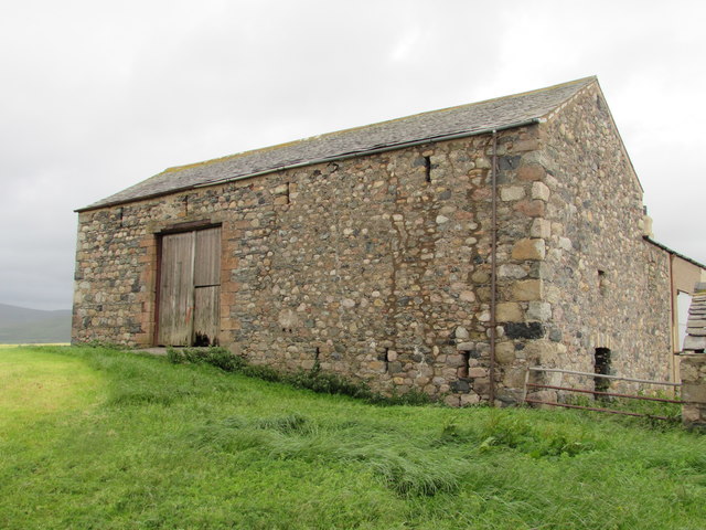
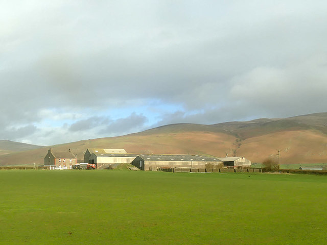
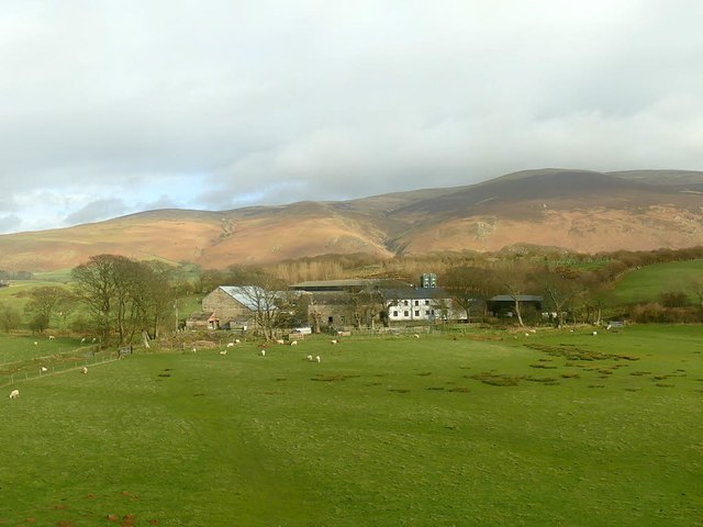
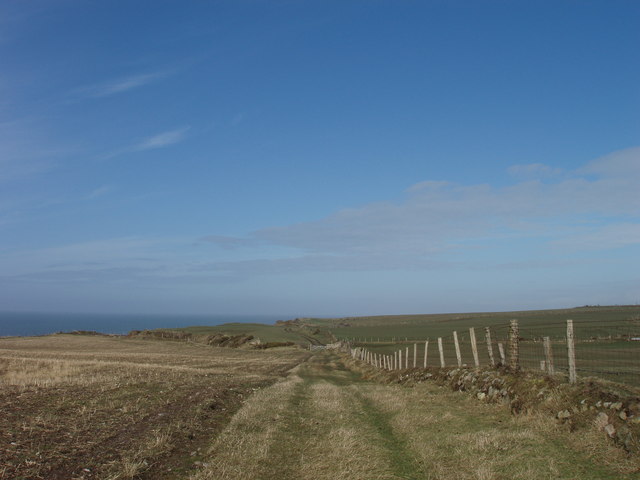
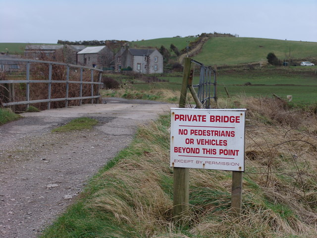
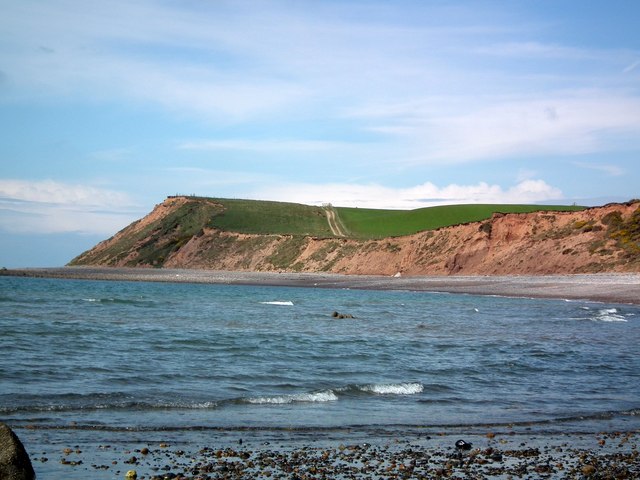
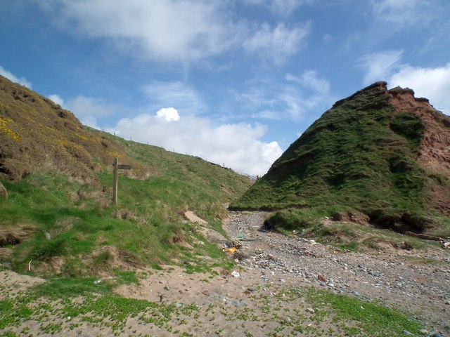
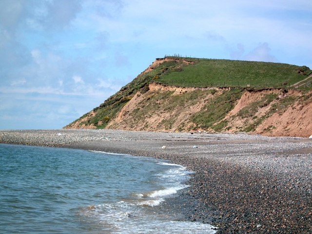
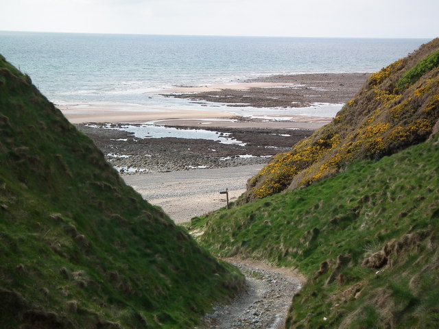
Annaside Banks is a prominent coastal feature located in Cumberland, England. Situated on the western edge of the Solway Firth, it is characterized by its imposing cliffs and steep slopes, making it a popular destination for nature enthusiasts and hikers alike.

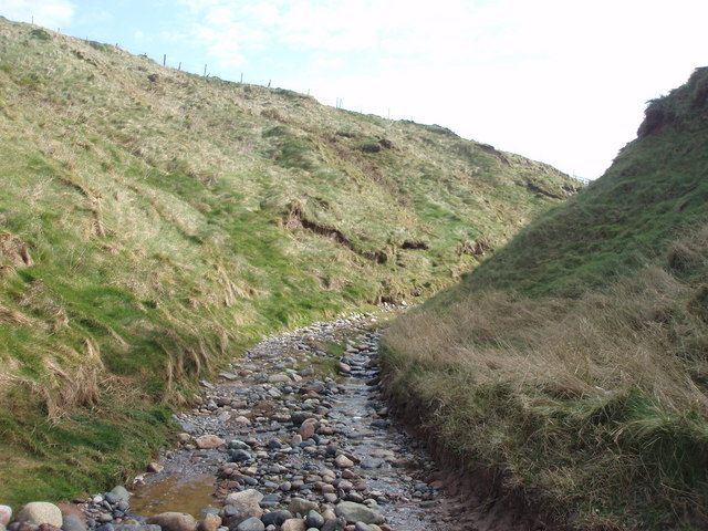
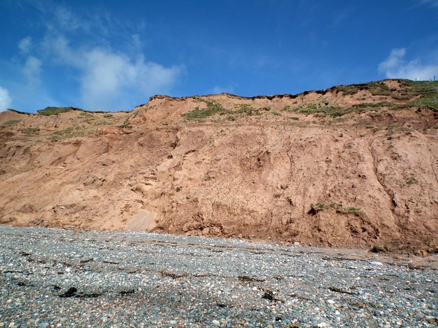
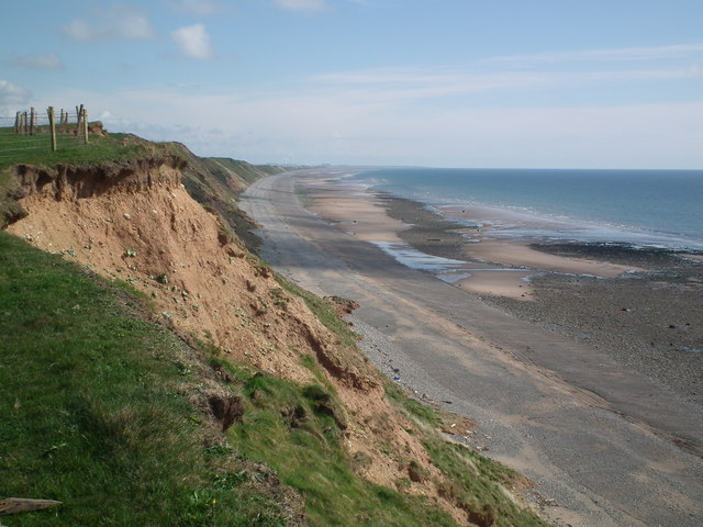
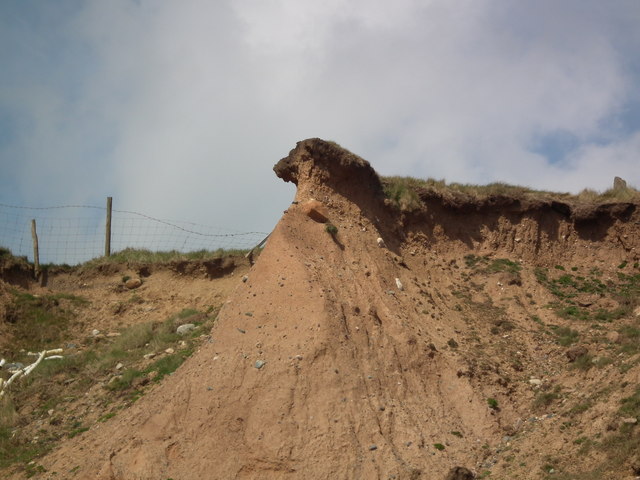
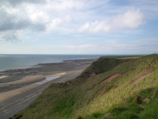
The cliffs of Annaside Banks are composed of layers of sedimentary rock, primarily sandstone and shale, which have been gradually eroded by the relentless action of the sea over millions of years. This erosion has given rise to the impressive vertical cliffs that line the coast, reaching heights of up to 30 meters in some areas.

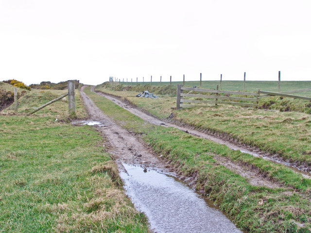
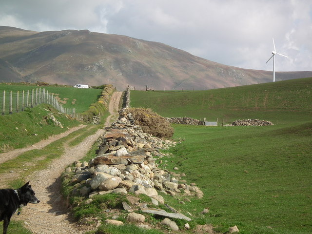
The slopes of Annaside Banks, on the other hand, offer a gentler gradient, making them more accessible to visitors. Covered in lush grasses and scattered with wildflowers, these slopes provide a picturesque backdrop against the expansive views of the Solway Firth and the surrounding countryside.

The area is also home to a diverse array of wildlife, with numerous species of birds, such as fulmars, kittiwakes, and cormorants, nesting along the cliffs. The rocky shore below the cliffs supports a variety of marine life, including barnacles, limpets, and small fish, while occasional sightings of seals and dolphins add to the area's natural charm.

Annaside Banks is a designated Site of Special Scientific Interest (SSSI), recognizing its ecological importance and geological significance. It offers visitors the opportunity to experience the beauty of the Cumbrian coastline, with its rugged cliffs, stunning views, and rich biodiversity. Whether it's a leisurely stroll along the slopes or an adventurous hike along the cliff edge, Annaside Banks is sure to captivate all who visit.

If you have any feedback on the listing, please let us know in the comments section below.

Annaside Banks Images

Images are sourced within 2km of 54.25544/-3.3944323 or Grid Reference SD0985. Thanks to Geograph Open Source API. All images are credited.

Barn at High Kiskin Built prodominantly of river washed or glaciallyy rounded cobbles with a few squared quoins at the corners which must have been transported several miles from there quarry of origin.
Barn at High Kiskin
Built prodominantly of river washed or glaciallyy rounded cobbles with a few squared quoins at the corners which must have been transported several miles from there quarry of origin.
Old Hyton Farm The western fells of the Lake District form the backdrop to this view from a train on the Cumbrian Coast line.
Old Hyton Farm
The western fells of the Lake District form the backdrop to this view from a train on the Cumbrian Coast line.
Holmegate Farm The western fells of the Lake District form the backdrop to this view from a train on the Cumbrian Coast line.
Holmegate Farm
The western fells of the Lake District form the backdrop to this view from a train on the Cumbrian Coast line.
Track to Gutterby from beach This track cuts into the dunes in the top right of the grid square  and is clearly identifiable and indeed is part of the Cumbria Coastal Way!
Track to Gutterby from beach
This track cuts into the dunes in the top right of the grid square and is clearly identifiable and indeed is part of the Cumbria Coastal Way!
Track along top of Annaside banks
Funky painted slabs on beach These random painted slabs appear to be discarded pieces of concrete which some artist has adopted - they do brighten up a rather dull piece of beach and are found where the cumbria coastal way makes way back to the beach at SD 086867
Funky painted slabs on beach
These random painted slabs appear to be discarded pieces of concrete which some artist has adopted - they do brighten up a rather dull piece of beach and are found where the cumbria coastal way makes way back to the beach at SD 086867
Bridge over river Annas Annaside farm in the background.
Bridge over river Annas
Annaside farm in the background.
Annaside Banks on Cumbria Coastal Way A windy, wet  March day in the coastal Lake District.
Annaside Banks on Cumbria Coastal Way
A windy, wet March day in the coastal Lake District.
Cliffs near Bog Hole The pebbles section of the Cumbria Coastal way will shortly end. The picture shows the Way continuing over the cliffs along a farm track.
Cliffs near Bog Hole
The pebbles section of the Cumbria Coastal way will shortly end. The picture shows the Way continuing over the cliffs along a farm track.
Cumbria Coastal Way finally leaves the beach After miles of pebbles the CCW heads inland. Gutterby is straight ahead. CCW is to the left over the cliffs.
Cumbria Coastal Way finally leaves the beach
After miles of pebbles the CCW heads inland. Gutterby is straight ahead. CCW is to the left over the cliffs.
A closer view of the cliffs near Bog Hole The erosion of the cliffs on this stretch of the Cumbria Coastal Way makes any attempt at climbing them a very dangerous proposition.
A closer view of the cliffs near Bog Hole
The erosion of the cliffs on this stretch of the Cumbria Coastal Way makes any attempt at climbing them a very dangerous proposition.
Badly eroded cliffs The footpath is over the cliffs.
Badly eroded cliffs
The footpath is over the cliffs.
The Cumbria Coastal Way Looking down from the cliff top to the beach.
The Cumbria Coastal Way
Looking down from the cliff top to the beach.
Public Footpath at Gutterby From the junction with the Cumbria Coastal Way the footpath follows a farm track to Gutterby. Black Combe is in the background.
Public Footpath at Gutterby
From the junction with the Cumbria Coastal Way the footpath follows a farm track to Gutterby. Black Combe is in the background.
Cliff top view looking South Erosion and barbed wire fencing (sheep are grazed on the more accessible cliff sections) means that a cliff top walk is not advisable.
Cliff top view looking South
Erosion and barbed wire fencing (sheep are grazed on the more accessible cliff sections) means that a cliff top walk is not advisable.
Large rock off Annaside Banks Shags or Cormorants? Your call!
Large rock off Annaside Banks
Shags or Cormorants? Your call!
Precarious cliffs The cliffs here are little more than large sand hills and all are subject to erosion. This one is about to fall into the sea.
Precarious cliffs
The cliffs here are little more than large sand hills and all are subject to erosion. This one is about to fall into the sea.
Cliff at Gutterby looking North From the top of the cliffs looking down to the coast.
Cliff at Gutterby looking North
From the top of the cliffs looking down to the coast.
Show me another place!

Annaside Banks is located at Grid Ref: SD0985 (Lat: 54.25544, Lng: -3.3944323)

Administrative County: Cumbria

District: Copeland

Police Authority: Cumbria

What 3 Words

///frog.fixated.storeroom. Near Haverigg, Cumbria

Nearby Locations

Annaside Banks

Related Wikis

Annaside

Annaside is a hamlet in Cumbria, England. It is located on the coast by the Irish Sea, about a 1+1⁄2 miles (2+1⁄2 km) south-west of Bootle and 7 miles...

River Annas

The River Annas is a minor river in Cumbria in northwest England. It is formed as the Kinmont Beck and Crookley Beck which drain the southwestern fells...
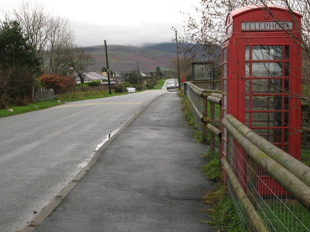
Whitbeck, Cumbria

Whitbeck is a hamlet and former civil parish, now in the parish of Whicham, in the Copeland district, in the county of Cumbria, England. It was called...

Bootle, Cumbria

Bootle (oo as in boot) is a village and civil parish in the Borough of Copeland in Cumbria, England. The parish had a population of 745 in the 2001 census...

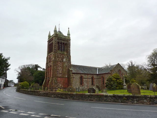
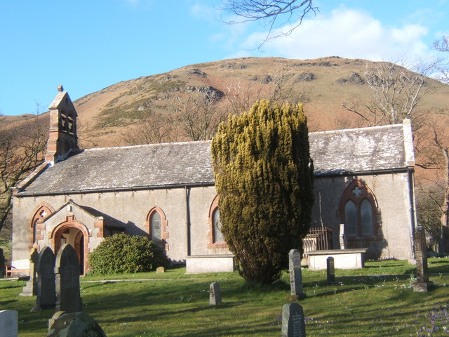
St Michael's Church, Bootle

St Michael's Church is in the village of Bootle, Cumbria, England. It is an active Anglican parish church in the deanery of Calder, the archdeaconry of...

Hycemoor

Hycemoor is a hamlet in Copeland borough of the county of Cumbria, in North west England. == Location == It is located on a minor road about a mile away...

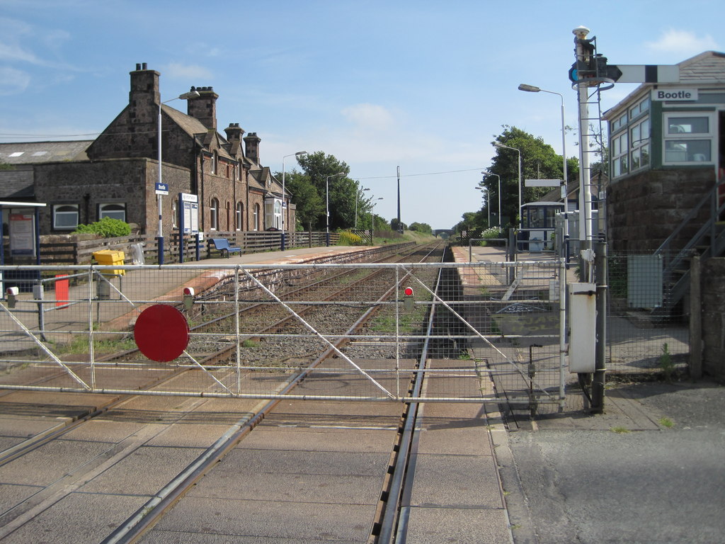
Bootle railway station

Bootle is a railway station on the Cumbrian Coast Line, which runs between Carlisle and Barrow-in-Furness. The station, situated 24 miles (39 km) north...

Whicham

Whicham is a hamlet and civil parish in Copeland, Cumbria, England. At the 2011 census the parish had a population of 382. The parish includes the villages...

Nearby Amenities

Located within 500m of 54.25544,-3.3944323
Source: PGS
Lat/Long: 54.2586935/-3.3984527
Source: PGS
Lat/Long: 54.2582392/-3.3979096
Source: PGS
Lat/Long: 54.2577248/-3.397411
Source: PGS
Lat/Long: 54.257209/-3.3969075
Source: PGS
Lat/Long: 54.2567055/-3.3964056
Source: PGS
Lat/Long: 54.2561139/-3.3957673
Source: PGS
Lat/Long: 54.2556495/-3.3952409
Source: PGS
Lat/Long: 54.255323/-3.3948907
Source: PGS
Lat/Long: 54.2550305/-3.3945244
Source: PGS
Lat/Long: 54.2545945/-3.394013
Source: PGS
Lat/Long: 54.254282/-3.3936714
The data included in this document is from www.openstreetmap.org. The data is made available under ODbL.

Have you been to Annaside Banks?

Leave your review of Annaside Banks below (or comments, questions and feedback).