Barcloy Heugh

Cliff, Slope in Kirkcudbrightshire

Scotland

Barcloy Heugh

Granite outcrop shore The shore here comprises solid granite outcrop, albeit fissured and jointed. Where the rock is clean and free of colourful lichen, the granite has a pronounced red tint which is characteristic of the southern, marginal part of the large intrusive mass.
Granite outcrop shore Credit: Jonathan Wilkins

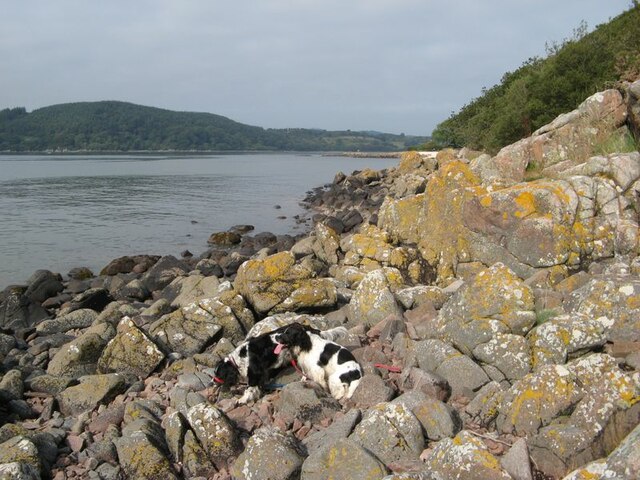
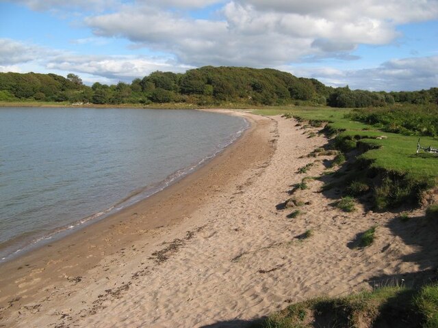
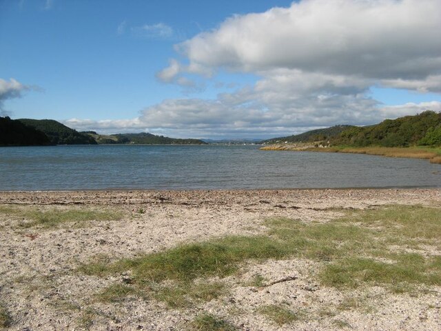
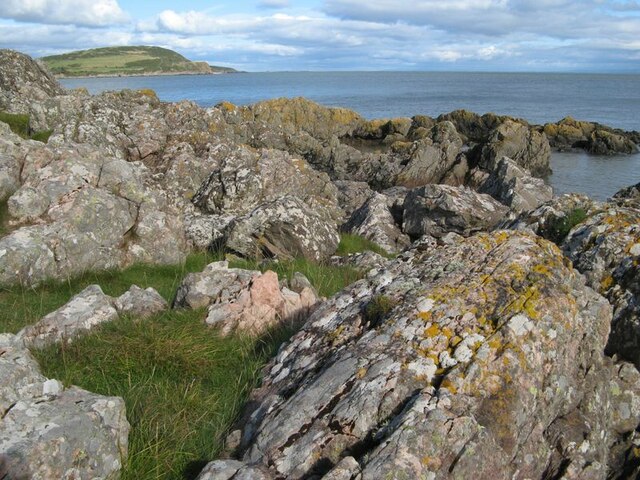
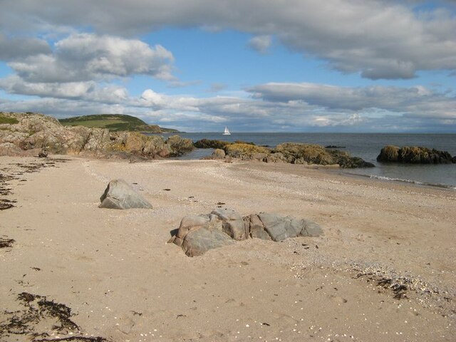
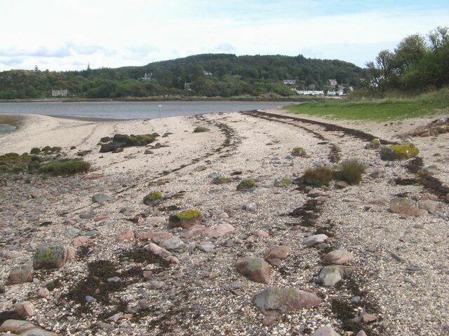
Barcloy Heugh is an impressive cliff located in Kirkcudbrightshire, Scotland. Rising majestically above the picturesque Solway Firth, it offers breathtaking views of the surrounding area. This natural wonder has become a popular destination for both locals and tourists seeking stunning vistas and a tranquil atmosphere.

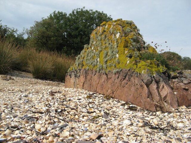
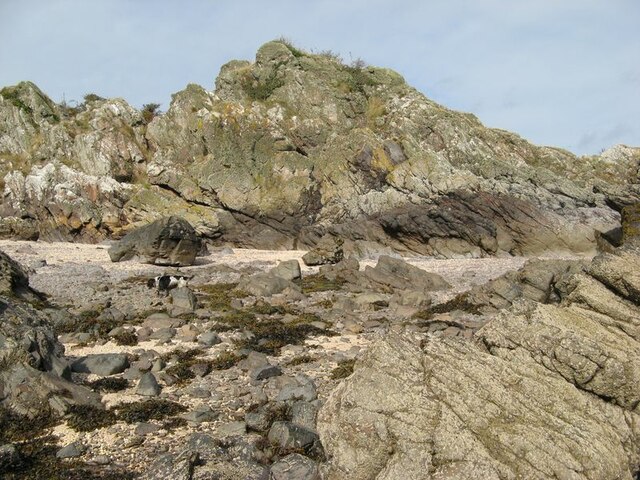
Standing at approximately 50 meters high, Barcloy Heugh showcases the rugged beauty of the Scottish coastline. The cliff is formed from layers of sandstone that have been shaped over millions of years by the powerful forces of wind and water. This geological feature provides a fascinating insight into the region's ancient history.

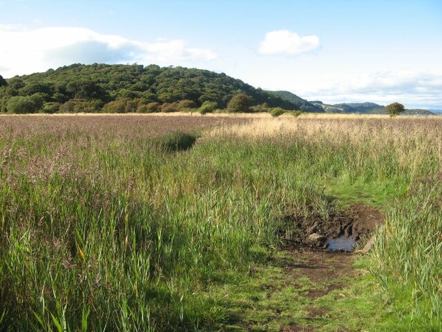
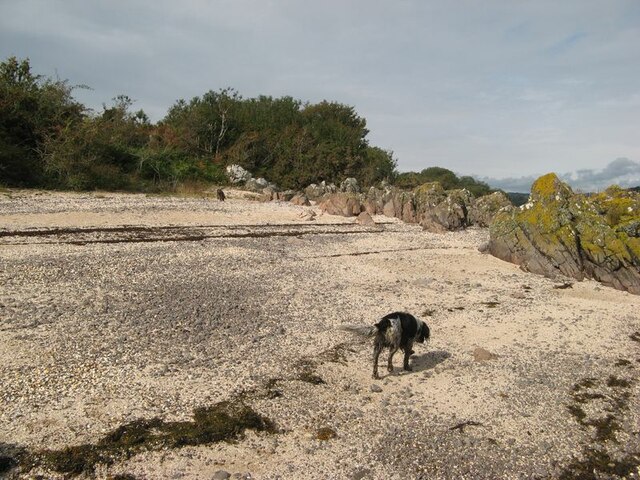
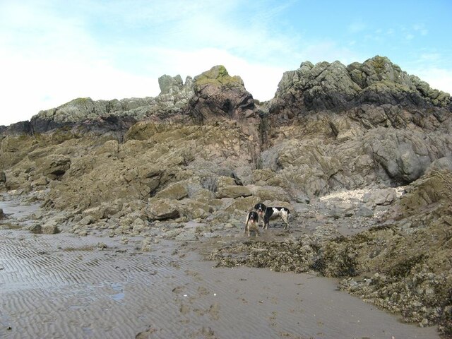
The slope leading up to the cliff is covered in lush vegetation, including grasses, heather, and wildflowers, creating a vibrant and colorful landscape. It is home to a variety of wildlife, such as birds, rabbits, and even the occasional deer.

Barcloy Heugh is a popular spot for outdoor enthusiasts, offering opportunities for hiking, birdwatching, and photography. A well-maintained path leads visitors to the top of the cliff, where they can enjoy panoramic views of the Solway Firth and the surrounding countryside.

In addition to its natural beauty, Barcloy Heugh holds cultural significance. It has been the inspiration for many artists and writers throughout the years, who have sought to capture its grandeur on canvas or in literature.

Overall, Barcloy Heugh is a remarkable natural landmark that combines stunning scenery, diverse wildlife, and a rich cultural heritage. Its accessibility and beauty make it an ideal destination for those seeking a peaceful escape into nature.

If you have any feedback on the listing, please let us know in the comments section below.

Barcloy Heugh Images

Images are sourced within 2km of 54.853925/-3.7859434 or Grid Reference NX8552. Thanks to Geograph Open Source API. All images are credited.

Granite outcrop shore The shore here comprises solid granite outcrop, albeit fissured and jointed. Where the rock is clean and free of colourful lichen, the granite has a pronounced red tint which is characteristic of the southern, marginal part of the large intrusive mass.
Granite outcrop shore
The shore here comprises solid granite outcrop, albeit fissured and jointed. Where the rock is clean and free of colourful lichen, the granite has a pronounced red tint which is characteristic of the southern, marginal part of the large intrusive mass.
Horse Isles Bay A surprising and secluded bay on the east side of Almorness.
Horse Isles Bay
A surprising and secluded bay on the east side of Almorness.
Rough Firth from Horse Isles Bay Looking northwards across the bay and onto Rough Firth.
Rough Firth from Horse Isles Bay
Looking northwards across the bay and onto Rough Firth.
Reed bed The marshy area of the merse is occupied by a wonderful reed bed.
Reed bed
The marshy area of the merse is occupied by a wonderful reed bed.
Rocks on Almorness Lichen-encrusted rocks form the shore to west of White Port. Pink-coloured granitic veins give variety to an otherwise rather grey area.
Rocks on Almorness
Lichen-encrusted rocks form the shore to west of White Port. Pink-coloured granitic veins give variety to an otherwise rather grey area.
White Port A view of the east end of the pretty beach of White Port.
White Port
A view of the east end of the pretty beach of White Port.
Shell beach Lines of stranded seaweed make a contrast with the brightly-coloured shells on the east side of Rough Island.
Shell beach
Lines of stranded seaweed make a contrast with the brightly-coloured shells on the east side of Rough Island.
Samphire bed A patch of muddy sand near to the causeway has a fine growth of samphire.
Samphire bed
A patch of muddy sand near to the causeway has a fine growth of samphire.
Shore by the causeway The shelly beach near to the causeway, which appears to be a form of tombolo.
Shore by the causeway
The shelly beach near to the causeway, which appears to be a form of tombolo.
Granite outcrop An isolated rock outcrop on the shell beach is a fine example of a pink, granitic vein. Many such veins appear to be associated with the intrusion of the nearby Criffel-Dalbeattie pluton, with fingers reaching out into the greywackes of Silurian age. Prominent exposures of such rocks can also be found nearby on the mainland at Rockcliffe. Wave action and abrasion has kept the lower part clear of encrustation, but the top has a delightfully thick growth of lichens.
Granite outcrop
An isolated rock outcrop on the shell beach is a fine example of a pink, granitic vein. Many such veins appear to be associated with the intrusion of the nearby Criffel-Dalbeattie pluton, with fingers reaching out into the greywackes of Silurian age. Prominent exposures of such rocks can also be found nearby on the mainland at Rockcliffe. Wave action and abrasion has kept the lower part clear of encrustation, but the top has a delightfully thick growth of lichens.
Rough Island shore This is rough terrain, with chaotic exposures of fractured and deformed rock. Is it the origin of the name Rough Island?
Rough Island shore
This is rough terrain, with chaotic exposures of fractured and deformed rock. Is it the origin of the name Rough Island?
Intertidal rocks Rocks exposed in the intertidal zone at the south end of Rough Island.
Intertidal rocks
Rocks exposed in the intertidal zone at the south end of Rough Island.
Island mudscape A view against the light of the expanse of water, mud and sand that makes up the outer end of Rough Firth. The Spring Stones are to the left, while Hestan Island is on the right of the river running out to clear water.
Island mudscape
A view against the light of the expanse of water, mud and sand that makes up the outer end of Rough Firth. The Spring Stones are to the left, while Hestan Island is on the right of the river running out to clear water.
Drainage channel Water draining from the area to the east of the causeway runs across the sand, but swings in to the southern end of Rough Island before dispersing towards the river channel. My assistants were encouraged to splash around in the relatively clean water after their muddy trek around the west side of the island.
Drainage channel
Water draining from the area to the east of the causeway runs across the sand, but swings in to the southern end of Rough Island before dispersing towards the river channel. My assistants were encouraged to splash around in the relatively clean water after their muddy trek around the west side of the island.
Looking across the bay at Rockcliffe To the houses at Port Donnel.
Looking across the bay at Rockcliffe
To the houses at Port Donnel.
Challenging site with development potential! Solid foundations and close to the sea.
Challenging site with development potential!
Solid foundations and close to the sea.
View from Rockcliffe Past Rough Island to Hestan Island on the horizon.
View from Rockcliffe
Past Rough Island to Hestan Island on the horizon.
Mote Cottage  On the track between Kippford and Rockcliffe.
Mote Cottage
On the track between Kippford and Rockcliffe.
Show me another place!

Barcloy Heugh is located at Grid Ref: NX8552 (Lat: 54.853925, Lng: -3.7859434)

Unitary Authority: Dumfries and Galloway

Police Authority: Dumfries and Galloway

What 3 Words

///detail.policy.lightbulb. Near Dalbeattie, Dumfries & Galloway

Related Wikis

Rough Island, Scotland

"Rough Island" is also used as a translation of "Garbh Eilean", a common Scottish name for islandsRough Island is a 20-acre (8 ha) uninhabited tidal island...

Colvend and Southwick

Colvend and Southwick is a community council area and civil parish within the Stewartry area of Dumfries and Galloway, Scotland. It is also part of the...

Rough Firth

Rough Firth is an inlet on the northern coast of the Solway Firth in the Stewartry area of Dumfries and Galloway, Scotland. The firth lies between Almorness...

Rockcliffe, Dumfries and Galloway

Rockcliffe is a small, coastal village in Kirkcudbrightshire, Dumfries and Galloway in Scotland, with a view of Rough Island, Hestan Island, the Solway...

Kippford

Kippford (/ˈkɪpfəd/; otherwise Scaur) is a small village along the Solway coast, in the historic county of Kirkcudbrightshire in Dumfries and Galloway...

Hestan Island

Hestan Island is a small coastal island at the southern foot of the River Urr estuary in the Solway Firth, in the historical county of Kirkcudbrightshire...

Urr Water

Urr Water or River Urr (arc. River Orr) is a river in which flows through the counties of Dumfriesshire and Kirkcudbrightshire in southwest Scotland....

Orchardton Castle

Orchardton Castle overlooks the Solway Coast. Built in the 1880s, this is a Grade B listed property formerly known as Orchardton House. Built around a...

Nearby Amenities

Located within 500m of 54.853925,-3.7859434
Source: PGS
Lat/Long: 54.857964/-3.7889229
Source: PGS
Lat/Long: 54.8573754/-3.7892925
Source: PGS
Lat/Long: 54.8570404/-3.7895929
Source: PGS
Lat/Long: 54.8568113/-3.7894658
Source: PGS
Lat/Long: 54.8565155/-3.7890527
Source: PGS
Lat/Long: 54.8561455/-3.7889685
Source: PGS
Lat/Long: 54.855686/-3.7890216
Source: PGS
Lat/Long: 54.8550197/-3.7891933
Source: PGS
Lat/Long: 54.8540759/-3.7890506
Source: PGS
Lat/Long: 54.8531841/-3.7884176
Source: PGS
Lat/Long: 54.8529599/-3.7878119
Source: PGS
Lat/Long: 54.8531411/-3.7876282
Source: PGS
Lat/Long: 54.8531897/-3.7855299
Source: PGS
Lat/Long: 54.8534429/-3.785155
Source: PGS
Lat/Long: 54.8539695/-3.7858254
Source: PGS
Lat/Long: 54.8542197/-3.785775
Source: PGS
Lat/Long: 54.8543031/-3.7853748
Source: PGS
Lat/Long: 54.8543358/-3.784274
Source: PGS
Lat/Long: 54.8544655/-3.7833631
Source: PGS
Lat/Long: 54.8544686/-3.7819405
Source: PGS
Lat/Long: 54.8544544/-3.7811551
Source: PGS
Lat/Long: 54.854308/-3.7804685
Source: PGS
Lat/Long: 54.8542611/-3.7798505
Source: PGS
Lat/Long: 54.854211/-3.7792604
Source: PGS
Lat/Long: 54.8543685/-3.7788624
Tourism: viewpoint
Lat/Long: 54.8533216/-3.7859087
Joseph Nelson’s Grave
Historic: tomb
Lat/Long: 54.8552504/-3.7888849
Power: pole
Lat/Long: 54.8583162/-3.7870721
Power: pole
Lat/Long: 54.8576323/-3.7872567
Power: pole
Lat/Long: 54.8573258/-3.7873437
The data included in this document is from www.openstreetmap.org. The data is made available under ODbL.

Have you been to Barcloy Heugh?

Leave your review of Barcloy Heugh below (or comments, questions and feedback).