Bwlch y Llwynog
Cliff, Slope in Caernarfonshire
Wales
Bwlch y Llwynog

Bwlch y Llwynog, located in Caernarfonshire, Wales, is a prominent cliff and slope that offers breathtaking natural beauty and a haven for outdoor enthusiasts. This stunning geographical feature is situated in the Snowdonia National Park, renowned for its rugged landscapes and diverse flora and fauna.
Rising to an impressive height of approximately 200 meters, Bwlch y Llwynog presents a striking spectacle with its steep and craggy cliffs. The rock formations, composed of sedimentary layers, provide a glimpse into the geological history of the region.
The cliff face is home to a variety of plant species, which thrive in its sheltered crevices and ledges. Mosses, ferns, and lichens adorn the rock surface, adding to the area's natural charm. The slope leading up to the cliff is covered in grasses and heather, creating a picturesque contrast against the ruggedness of the cliff.
The site offers numerous opportunities for outdoor activities such as hiking, rock climbing, and birdwatching. Adventurous climbers can test their skills on the challenging rock faces, while hikers can explore the network of trails meandering through the surrounding landscape. The cliff and slope also provide a habitat for various bird species, including peregrine falcons, kestrels, and ravens, making it an ideal spot for birdwatchers.
Bwlch y Llwynog's dramatic scenery and ecological diversity make it a popular destination for nature enthusiasts and photographers alike. Its accessibility from nearby towns and the presence of well-maintained trails ensure that visitors can immerse themselves in the splendor of this natural wonder while respecting its fragile ecosystem.
If you have any feedback on the listing, please let us know in the comments section below.
Bwlch y Llwynog Images
Images are sourced within 2km of 53.336539/-3.8322951 or Grid Reference SH7883. Thanks to Geograph Open Source API. All images are credited.


Bwlch y Llwynog is located at Grid Ref: SH7883 (Lat: 53.336539, Lng: -3.8322951)
Unitary Authority: Conwy
Police Authority: North Wales
What 3 Words
///kings.swung.poets. Near Llandudno, Conwy
Nearby Locations
Related Wikis
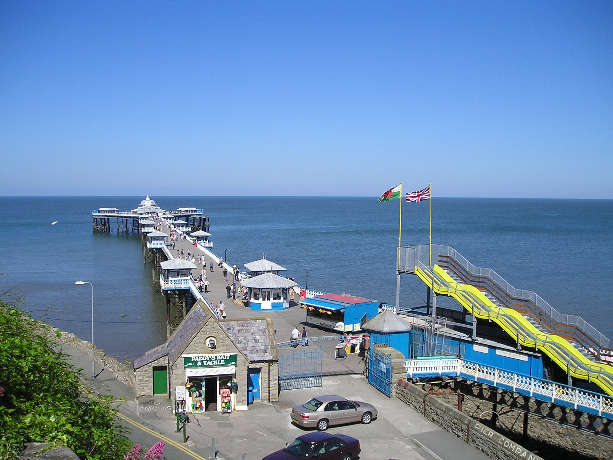
Llandudno Pier
Llandudno Pier is a Grade II* listed pier in the seaside resort of Llandudno, North Wales, United Kingdom. At 2,295 feet (700 m), the pier is the longest...

Llandudno Cable Car
The Llandudno Cable Car is an attraction in the seaside resort of Llandudno in Conwy County Borough, Wales. The cable car runs along the Great Orme spanning...
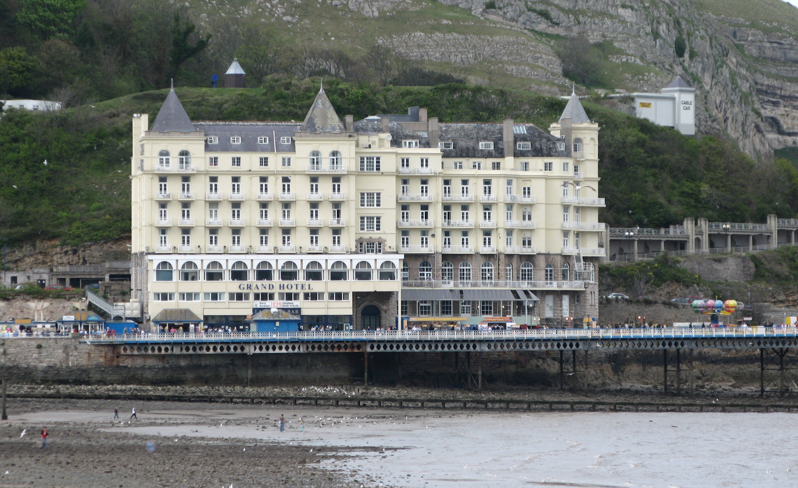
Grand Hotel (Llandudno)
The Grand Hotel is a large hotel in Llandudno, Wales, overlooking the Promenade on the North Shore. It is owned by Britannia Hotels. == History == The...
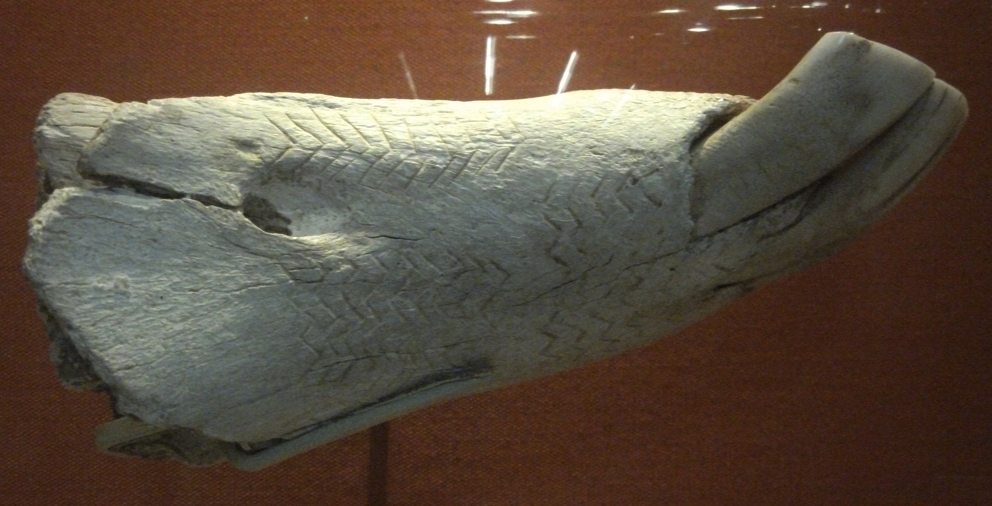
Kendrick's Cave
Kendrick's Cave on the Great Orme, Llandudno, Wales, was the site of important archaeological finds by Thomas Kendrick in 1880. The site is a small natural...
Nearby Amenities
Located within 500m of 53.336539,-3.8322951Have you been to Bwlch y Llwynog?
Leave your review of Bwlch y Llwynog below (or comments, questions and feedback).