Barlocco Heugh

Cliff, Slope in Kirkcudbrightshire

Scotland

Barlocco Heugh

Rerrick churchyard The rough stone arch in the centre of the graveyard is presumably the slight remains of the old church, which may have been medieval, but was demolished in 1865.
Rerrick churchyard Credit: Gordon Hatton

Barlocco Heugh is a prominent cliff located in Kirkcudbrightshire, Scotland. Rising majestically above the surrounding landscape, it is a natural wonder that offers stunning views and attracts visitors from far and wide.

Situated on the southern coast of Scotland, Barlocco Heugh is known for its rugged beauty and dramatic cliffs. Standing at an impressive height, it overlooks the Irish Sea, providing breathtaking vistas of the water and the surrounding countryside.

The cliff face is composed of layers of sedimentary rock, showcasing the rich geological history of the area. Fossils can sometimes be found embedded within the rock, offering a glimpse into the ancient marine life that once inhabited these shores.

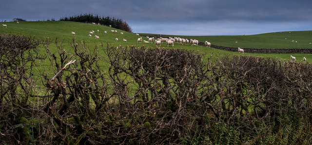
Barlocco Heugh is also known for its diverse wildlife. Seabirds such as gannets, puffins, and fulmars can often be spotted nesting on the cliff ledges, creating a vibrant and bustling ecosystem. The area is a designated Site of Special Scientific Interest due to its importance for bird conservation.

Visitors to Barlocco Heugh can enjoy a variety of activities. Hiking along the cliff-top paths provides an exhilarating experience, with panoramic views stretching out in all directions. Photography enthusiasts will find endless opportunities to capture the natural beauty of the area, while birdwatchers can indulge in observing the fascinating avian life.

In summary, Barlocco Heugh is a remarkable cliff in Kirkcudbrightshire, Scotland, offering breathtaking views, unique geological features, and a thriving ecosystem. It is a place of natural beauty and a haven for outdoor enthusiasts and nature lovers alike.

If you have any feedback on the listing, please let us know in the comments section below.

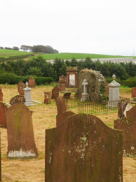
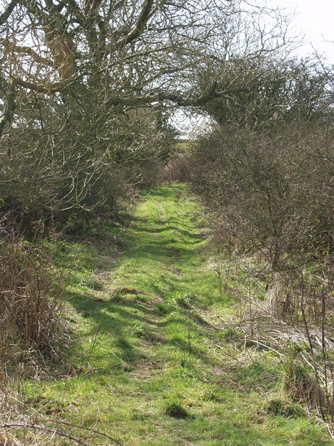
Barlocco Heugh Images

Images are sourced within 2km of 54.798542/-3.9018114 or Grid Reference NX7746. Thanks to Geograph Open Source API. All images are credited.

Rerrick churchyard The rough stone arch in the centre of the graveyard is presumably the slight remains of the old church, which may have been medieval, but was demolished in 1865.
Rerrick churchyard
The rough stone arch in the centre of the graveyard is presumably the slight remains of the old church, which may have been medieval, but was demolished in 1865.
Rerrick Low Row
Rerrick Low Row
High anxiety Worried sheep and a fine example of a hedge no longer cut but flailed into submission
High anxiety
Worried sheep and a fine example of a hedge no longer cut but flailed into submission
Rerrick Kirk Rerrick Kirk was originally built in the ninth century. It was probably rebuilt when the nearby abbey was founded at Dundrennan, just over the hill; and was abandoned in the nineteenth century when new kirks were built in the villages of Dundrennan and Auchencairn.
Rerrick Kirk
Rerrick Kirk was originally built in the ninth century. It was probably rebuilt when the nearby abbey was founded at Dundrennan, just over the hill; and was abandoned in the nineteenth century when new kirks were built in the villages of Dundrennan and Auchencairn.
Abandoned Dons Knowe This track forms part of the old coast road from Balcary through to Rerrick. Prior to 1860 this would form part of the route the villagers from Auchencairn would follow to the parish church which was then at Rerrick. In my childhood it was still easily passable by motor vehicle, and is I believe still a vehicular right of way; but it's no longer passable by motor vehicle.
Abandoned Dons Knowe
This track forms part of the old coast road from Balcary through to Rerrick. Prior to 1860 this would form part of the route the villagers from Auchencairn would follow to the parish church which was then at Rerrick. In my childhood it was still easily passable by motor vehicle, and is I believe still a vehicular right of way; but it's no longer passable by motor vehicle.
Don's Knowe House
Don's Knowe House
Kirkhill, Rerrick View from the E side of Rerrick Cemetery across the fields of Kirkhill.
In the faint distance, over the Solway Firth, are the Cumbrian Mountains of the Lake District.
Kirkhill, Rerrick
View from the E side of Rerrick Cemetery across the fields of Kirkhill. In the faint distance, over the Solway Firth, are the Cumbrian Mountains of the Lake District.
Rerrick Cemetery (East side) Old Rerrick Kirkyard, first recorded in 1536. It contains the ruin (W gable) of Rerrick Parish Church (demolished 1865) and several C18 table stones & headstones. The church and parish were first recorded in 1351.The site may have been in use from C12th if not earlier.
Rerrick Cemetery (East side)
Old Rerrick Kirkyard, first recorded in 1536. It contains the ruin (W gable) of Rerrick Parish Church (demolished 1865) and several C18 table stones & headstones. The church and parish were first recorded in 1351.The site may have been in use from C12th if not earlier.
Rerrick Cemetery: Civilian War Grave The civilian war grave of the Hamiltons. A Bristol Beaufighter crashed on their house 18 July 1944, killing family of 4, also the crew of 2. One member of the family survived. A garden now stands on the site of their house in Dundrennan.
Rerrick Cemetery: Civilian War Grave
The civilian war grave of the Hamiltons. A Bristol Beaufighter crashed on their house 18 July 1944, killing family of 4, also the crew of 2. One member of the family survived. A garden now stands on the site of their house in Dundrennan.
Rerrick Lane, Gallows Hill The lane from Stockmoss Smithy to Rerrick Graveyard skirts the slopes of Gallows Hill (left). The hillock on the right has natural springs which flow into a small reservoir.
Rerrick Lane, Gallows Hill
The lane from Stockmoss Smithy to Rerrick Graveyard skirts the slopes of Gallows Hill (left). The hillock on the right has natural springs which flow into a small reservoir.
Rerrick Cemetery (West side) Rerrick Cemetery or Graveyard dates from c.1743. View S toward Rerrick Park and Port Mary with Rerrick Low Row cottages on right.
Rerrick Cemetery (West side)
Rerrick Cemetery or Graveyard dates from c.1743. View S toward Rerrick Park and Port Mary with Rerrick Low Row cottages on right.
Stockmoss Smithy The rear of Stockmoss Smithy.
Stockmoss Smithy
The rear of Stockmoss Smithy.
Stockmoss Smithy Stockmoss Smithy which ceased as a working smithy in 1967.
Stockmoss Smithy
Stockmoss Smithy which ceased as a working smithy in 1967.
Barlocco Farm Barlocco Farm.
Barlocco Farm
Barlocco Farm.
Track to Don's Knowe The start of the track to Don's Knowe.
Track to Don's Knowe
The start of the track to Don's Knowe.
Heart Moss Heart Moss.
Heart Moss
Heart Moss.
Rerrick Cemetery The entrance to Rerrick Cemetery.
Rerrick Cemetery
The entrance to Rerrick Cemetery.
Road to Stockmoss Smithy The road to Stockmoss Smithy which is to the centre of photograph.
Road to Stockmoss Smithy
The road to Stockmoss Smithy which is to the centre of photograph.
Show me another place!

Barlocco Heugh is located at Grid Ref: NX7746 (Lat: 54.798542, Lng: -3.9018114)

Unitary Authority: Dumfries and Galloway

Police Authority: Dumfries and Galloway

What 3 Words

///fearfully.cleansed.exhale. Near Kirkcudbright, Dumfries & Galloway

Nearby Locations

Barlocco Heugh

Related Wikis

Wickerman Festival

The Wickerman Festival was an annual music festival held near Auchencairn in Dumfries and Galloway, Scotland. Dubbed "Scotland's Alternative Music festival...

Dundrennan Abbey

Dundrennan Abbey, in Dundrennan, Scotland, near to Kirkcudbright, was a Cistercian monastery in the Romanesque architectural style, established in 1142...

Dundrennan

Dundrennan (Gaelic: Dun Droighnein) is a village Dumfries and Galloway, Scotland, about 5 miles (8 km) east of Kirkcudbright. Its population is around...

Abbey Head

Abbey Head is a headland on the Solway Firth coast of Dumfries and Galloway. == References ==

Nearby Amenities

Located within 500m of 54.798542,-3.9018114
Source: PGS
Lat/Long: 54.7957342/-3.906512
Source: PGS
Lat/Long: 54.7963418/-3.9058219
Source: PGS
Lat/Long: 54.796667/-3.905061
Source: PGS
Lat/Long: 54.7970327/-3.9038247
Source: PGS
Lat/Long: 54.7973518/-3.9023232
Source: PGS
Lat/Long: 54.7975732/-3.9014392
Source: PGS
Lat/Long: 54.797719/-3.9009006
Source: PGS
Lat/Long: 54.7977718/-3.9005041
Source: PGS
Lat/Long: 54.7979022/-3.8997462
Source: PGS
Lat/Long: 54.7982073/-3.8984407
Source: PGS
Lat/Long: 54.7981928/-3.8979441
Source: PGS
Lat/Long: 54.7984568/-3.897365
Source: PGS
Lat/Long: 54.7985342/-3.8967273
Source: PGS
Lat/Long: 54.7985005/-3.8959916
Source: PGS
Lat/Long: 54.7984227/-3.8959626
Source: PGS
Lat/Long: 54.7984241/-3.8955704
Source: PGS
Lat/Long: 54.7984603/-3.8951135
Source: PGS
Lat/Long: 54.7985416/-3.8944999
Power: pole
Lat/Long: 54.8012679/-3.9080081
Power: pole
Lat/Long: 54.8004768/-3.9080867
Power: pole
Lat/Long: 54.7997825/-3.9081759
Power: pole
Lat/Long: 54.7989179/-3.9082928
Power: pole
Lat/Long: 54.7981794/-3.9081271
Power: pole
Lat/Long: 54.7974471/-3.907972
Power: pole
Lat/Long: 54.7999674/-3.9075046
Power: pole
Lat/Long: 54.8003274/-3.9062576
Power: pole
Lat/Long: 54.8005907/-3.9052442
Power: pole
Lat/Long: 54.8009214/-3.9041522
Power: pole
Lat/Long: 54.8012961/-3.9030687
Power: pole
Lat/Long: 54.8016549/-3.9020108
Power: pole
Lat/Long: 54.8020173/-3.9009804
Power: pole
Lat/Long: 54.8023712/-3.8999862
The data included in this document is from www.openstreetmap.org. The data is made available under ODbL.

Have you been to Barlocco Heugh?

Leave your review of Barlocco Heugh below (or comments, questions and feedback).