Battern Cliffs

Cliff, Slope in Cornwall

England

Battern Cliffs

Downderry - Beach and view to Rame Head Downderry's shingly beach is similar to that at nearby Seaton - if you want sand you have to travel a few miles further east to Whitsand Bay. Guarding the end of that bay is the peninsula of Rame Head, seen in the distance in this image. It has a little abandoned chapel on top which can be seen as a pimple in this image.
(see <a href="https://www.geograph.org.uk/photo/3250122">SX4148 : Chapel, Rame Head</a>)
Downderry - Beach and view to Rame Head Credit: Rob Farrow

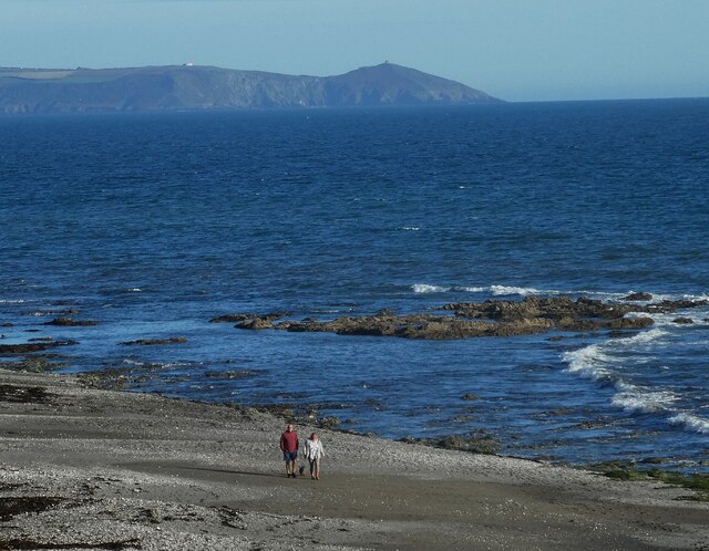
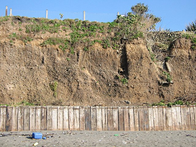
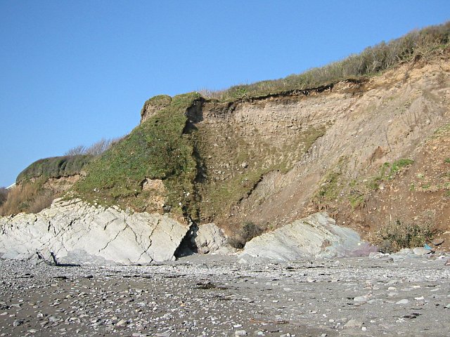
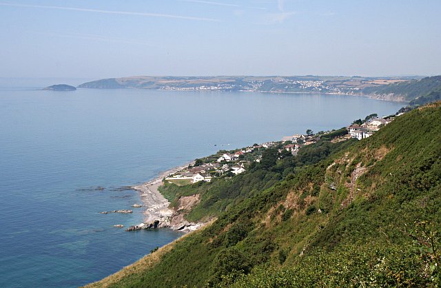
Battern Cliffs, located in Cornwall, England, is a prominent natural feature that stretches along the coastline of the county. Rising majestically from the azure waters of the Atlantic Ocean, these cliffs are renowned for their breathtaking beauty and geological significance.

With its sheer vertical drop, Battern Cliffs offer a dramatic view that attracts visitors from far and wide. The cliffs are composed of a variety of rock formations, including granite and slate, which have been shaped over millions of years by the forces of erosion and tectonic activity.

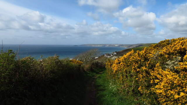
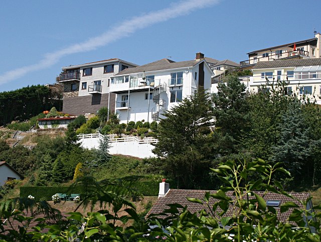
Standing at an impressive height, the cliffs create a stunning backdrop against the clear blue sky. Their rugged appearance is complemented by the vibrant greenery that adorns the top, forming a stark contrast against the rugged rocks. This striking combination of colors makes Battern Cliffs a favorite spot for photographers and nature enthusiasts.

The cliffs also provide a habitat for various species of birds, including peregrine falcons and fulmars, which nest in the crevices. Additionally, the surrounding waters are home to a diverse range of marine life, making Battern Cliffs a popular destination for birdwatchers and marine enthusiasts.

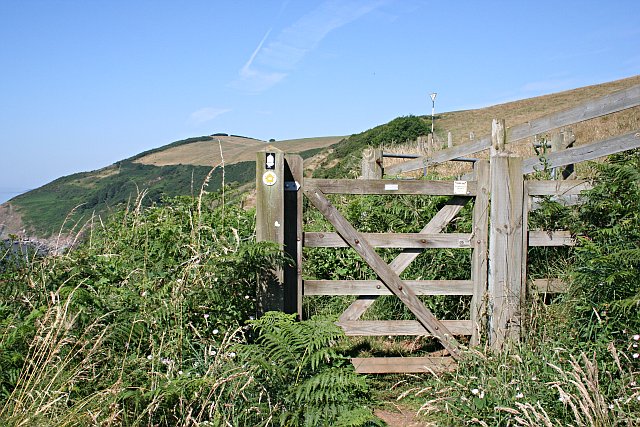
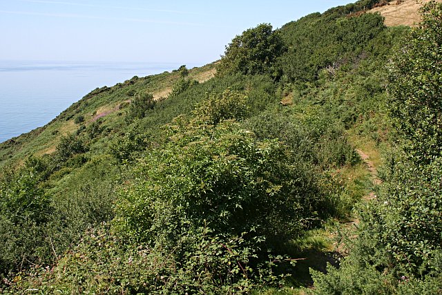
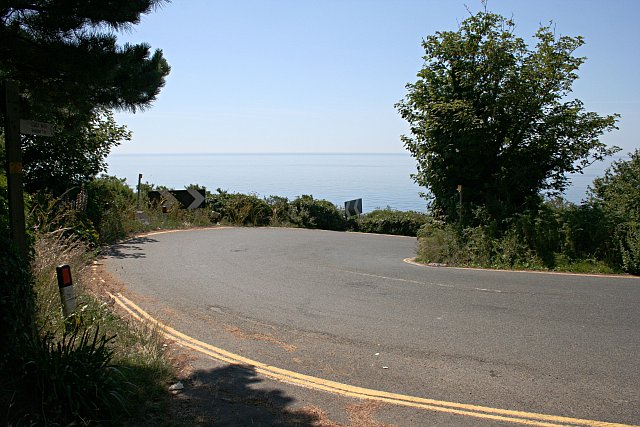
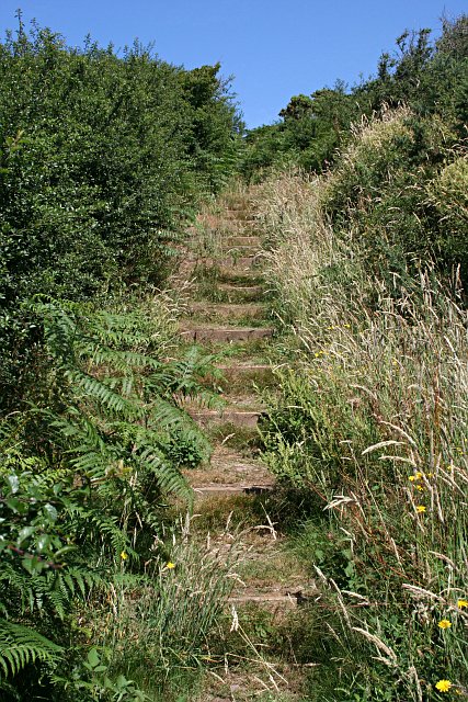
Visitors to Battern Cliffs can enjoy various activities, such as hiking along the coastal path that runs adjacent to the cliffs. This path offers panoramic views of the coastline and allows visitors to appreciate the cliffs' grandeur up close. However, caution is advised, as the cliffs can be unstable in certain areas, and it is important to stay on designated paths and observe any safety warnings.

In conclusion, Battern Cliffs in Cornwall is a natural wonder that showcases the raw beauty of nature. Its towering presence, rich geological history, and diverse wildlife make it a must-visit destination for those seeking a memorable experience on the British coastline.

If you have any feedback on the listing, please let us know in the comments section below.

Battern Cliffs Images

Images are sourced within 2km of 50.362017/-4.3515242 or Grid Reference SX3253. Thanks to Geograph Open Source API. All images are credited.

Downderry - Beach and view to Rame Head Downderry's shingly beach is similar to that at nearby Seaton - if you want sand you have to travel a few miles further east to Whitsand Bay. Guarding the end of that bay is the peninsula of Rame Head, seen in the distance in this image. It has a little abandoned chapel on top which can be seen as a pimple in this image.
(see <a href="https://www.geograph.org.uk/photo/3250122">SX4148 : Chapel, Rame Head</a>)
Downderry - Beach and view to Rame Head
Downderry's shingly beach is similar to that at nearby Seaton - if you want sand you have to travel a few miles further east to Whitsand Bay. Guarding the end of that bay is the peninsula of Rame Head, seen in the distance in this image. It has a little abandoned chapel on top which can be seen as a pimple in this image. (see SX4148 : Chapel, Rame Head)
On coastal path, E of Downderry
Downderry - east side, from Battern Cliffs A zoomed shot from an adjacent grid square gives a view of Downderry which emphasises its location on a precarious platform of soft rock above the sea.
Downderry - east side, from Battern Cliffs
A zoomed shot from an adjacent grid square gives a view of Downderry which emphasises its location on a precarious platform of soft rock above the sea.
Whitsand Bay Portwrinkle to Rame Head. Taken from a point close by the B3247 road to the west of Portwrinkle
Whitsand Bay
Portwrinkle to Rame Head. Taken from a point close by the B3247 road to the west of Portwrinkle
Farmhouse B&B, Downderry, Cornwall On the road between Downderry and Trellidon. Marked with camp site symbol on the map
Farmhouse B&B, Downderry, Cornwall
On the road between Downderry and Trellidon. Marked with camp site symbol on the map
Red sails on a misty morning, Downderry Taken from the Coastguard Cottages, now converted into homes and holiday homes, on top of the low cliffs at Downderry. The foreshore lies below sandy cliffs near the slipway - flat rocks covered with seaweed. Looking south, out to sea. An old one, but the atmosphere is unchanged when the tourists are away.
Red sails on a misty morning, Downderry
Taken from the Coastguard Cottages, now converted into homes and holiday homes, on top of the low cliffs at Downderry. The foreshore lies below sandy cliffs near the slipway - flat rocks covered with seaweed. Looking south, out to sea. An old one, but the atmosphere is unchanged when the tourists are away.
Sea Cliffs at Downderry The problem with Downderry village is that much of it is built on this stuff.  This cliff is made of 'Glacial Head Deposits'.  During the ice age when the sea level dropped considerably and the shoreline retreated several kilometres, the high sea cliffs here were subject to a lot of erosion by repeated freeze-thaw action.  The resulting rubble piled up at the bottom of the cliff and eventually slumped further down to form a nice fertile sloping plain in front of the cliff.  A good place to put a village like Downderry.  This deposit is very easily eroded by the sea and this low cliff at Downderry shows that it is in the process of being eroded.  The only reason there is any of this left here at all is because the underlying hard rock platform over which the tide washes is slightly higher here and moderates the effects of the sea.  Global warming however is slowly increasing sea levels making it more likely that winter storms will start to take much more of this land and put houses in danger.
Sea Cliffs at Downderry
The problem with Downderry village is that much of it is built on this stuff. This cliff is made of 'Glacial Head Deposits'. During the ice age when the sea level dropped considerably and the shoreline retreated several kilometres, the high sea cliffs here were subject to a lot of erosion by repeated freeze-thaw action. The resulting rubble piled up at the bottom of the cliff and eventually slumped further down to form a nice fertile sloping plain in front of the cliff. A good place to put a village like Downderry. This deposit is very easily eroded by the sea and this low cliff at Downderry shows that it is in the process of being eroded. The only reason there is any of this left here at all is because the underlying hard rock platform over which the tide washes is slightly higher here and moderates the effects of the sea. Global warming however is slowly increasing sea levels making it more likely that winter storms will start to take much more of this land and put houses in danger.
Sea Cliffs at Downderry See <a href="https://www.geograph.org.uk/photo/201512">SX3153 : Sea Cliffs at Downderry</a> for more information about these cliffs.
Sea Cliffs at Downderry
See SX3153 : Sea Cliffs at Downderry for more information about these cliffs.
Cobland Hill and a Gate On the South West Coast Path looking towards Cobland Hill at the western side of this grid square.  This section of the Coast Path is relatively new, previously walkers had to take the road at the top of the hill.  The lack of a good path can probably be explained by the steep unfriendly cliffs hereabouts.  The coast path has its origins in paths used by Revenue officers to check on smuggling activities.  Where the cliffs were too steep to get goods ashore there was no need to watch them, hence no footpath.
Cobland Hill and a Gate
On the South West Coast Path looking towards Cobland Hill at the western side of this grid square. This section of the Coast Path is relatively new, previously walkers had to take the road at the top of the hill. The lack of a good path can probably be explained by the steep unfriendly cliffs hereabouts. The coast path has its origins in paths used by Revenue officers to check on smuggling activities. Where the cliffs were too steep to get goods ashore there was no need to watch them, hence no footpath.
The Coastal Slope Periglacial weathering processes in the ice age have left many cliff faces in south-east Cornwall with a steep high slope before plunging down into a steep cliff face.  This high slope is of little use to modern farmers and so is left to scrub and heathland with lots of gorse, blackthorn and bracken which harbours a lot of wildlife.
The Coastal Slope
Periglacial weathering processes in the ice age have left many cliff faces in south-east Cornwall with a steep high slope before plunging down into a steep cliff face. This high slope is of little use to modern farmers and so is left to scrub and heathland with lots of gorse, blackthorn and bracken which harbours a lot of wildlife.
Hilltop Pasture The high land here behind the slope of the cliff face is some 120 metres high and is usually used as pasture.  Inland, from here the land drops away into a steep valley draining into the Lynher River.
Hilltop Pasture
The high land here behind the slope of the cliff face is some 120 metres high and is usually used as pasture. Inland, from here the land drops away into a steep valley draining into the Lynher River.
View from Batten Cliffs, Looe Bay Downderry is in the foreground, from there the view takes in the sweep of the bay round to Looe Island.
View from Batten Cliffs, Looe Bay
Downderry is in the foreground, from there the view takes in the sweep of the bay round to Looe Island.
New Houses at Downderry These houses have been built high above the village on the steep cliff slope.  Here the foundations are of hard Devonian slates and not the soft glacial head deposits found lower in the village.
New Houses at Downderry
These houses have been built high above the village on the steep cliff slope. Here the foundations are of hard Devonian slates and not the soft glacial head deposits found lower in the village.
Hairpin Bend Near the bottom of Tregunnus Lane the road doubles back on itself as it looses height rapidly before entering Downderry.  This is not a place to come off the road, there is nothing but a cliff beyond the edge.
Hairpin Bend
Near the bottom of Tregunnus Lane the road doubles back on itself as it looses height rapidly before entering Downderry. This is not a place to come off the road, there is nothing but a cliff beyond the edge.
Downderry The village of Downderry is strung out along a road which parallels the coast. Here the road is quite wide but in many places it is a narrow single track road causing some traffic problems.
Downderry
The village of Downderry is strung out along a road which parallels the coast. Here the road is quite wide but in many places it is a narrow single track road causing some traffic problems.
Steps With the temperature climbing into the upper 20s and not a hint yet of a sea breeze, walking the coast path here is getting to be very hot work indeed.
Steps
With the temperature climbing into the upper 20s and not a hint yet of a sea breeze, walking the coast path here is getting to be very hot work indeed.
Downderry Church The Church of St Nicolas Downderry began as a mission church to service the growing population of the village.  The building dates from 1905.  The bent-over shape of the tree in front of the church is interesting as it may indicate a response by the tree to being battered by strong southwesterly gales in the winter in this exposed coastal location.
Downderry Church
The Church of St Nicolas Downderry began as a mission church to service the growing population of the village. The building dates from 1905. The bent-over shape of the tree in front of the church is interesting as it may indicate a response by the tree to being battered by strong southwesterly gales in the winter in this exposed coastal location.
Downderry Housing on the steep hillside seen from the main road through the village.
Downderry
Housing on the steep hillside seen from the main road through the village.
Show me another place!

Battern Cliffs is located at Grid Ref: SX3253 (Lat: 50.362017, Lng: -4.3515242)

Unitary Authority: Cornwall

Police Authority: Devon and Cornwall

What 3 Words

///doses.commuted.summer. Near Looe, Cornwall

Related Wikis

Narkurs

Narkurs is a hamlet in the south east of Cornwall, England. It is part of the civil parish of Deviock. It is about 2 km southeast of Hessenford. Historically...

Downderry

Downderry (Cornish: Downderri) is a coastal village in southeast Cornwall, England, United Kingdom. It is situated 12 miles (19 km) west of Plymouth and...

Seaton, Cornwall

Seaton (Cornish: Sethyn, meaning little arrow after the river) is a village on the south coast of Cornwall, England, at the mouth of the River Seaton...

River Seaton

The River Seaton is a river in east Cornwall, England, UK which flows southwards for 11 miles (17 km) into the English Channel. The river rises near Caradon...

Nearby Amenities

Located within 500m of 50.362017,-4.3515242
The data included in this document is from www.openstreetmap.org. The data is made available under ODbL.

Have you been to Battern Cliffs?

Leave your review of Battern Cliffs below (or comments, questions and feedback).