Stac an Fhion

Cliff, Slope in Buteshire

Scotland

Stac an Fhion

View of the coast below Imachar Point
View of the coast below Imachar Point Credit: Mick Garratt

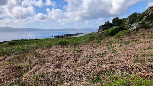
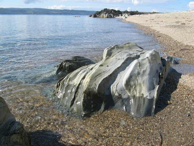
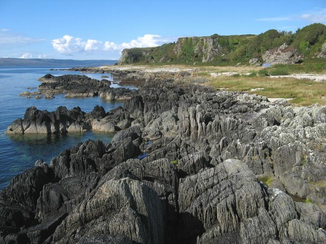
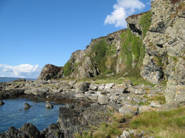
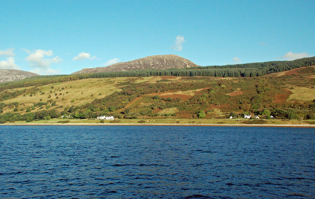
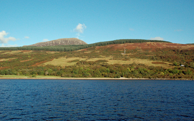
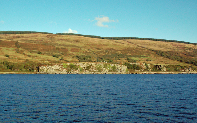
Stac an Fhion, also known as the "Stack of Fionn," is a prominent cliff located in the Buteshire region of Scotland. Rising majestically from the Atlantic Ocean, this remarkable geological formation stands at an impressive height of approximately 140 meters (460 feet). It is situated on the southern coast of the Isle of Jura, providing breathtaking views of the surrounding landscape.

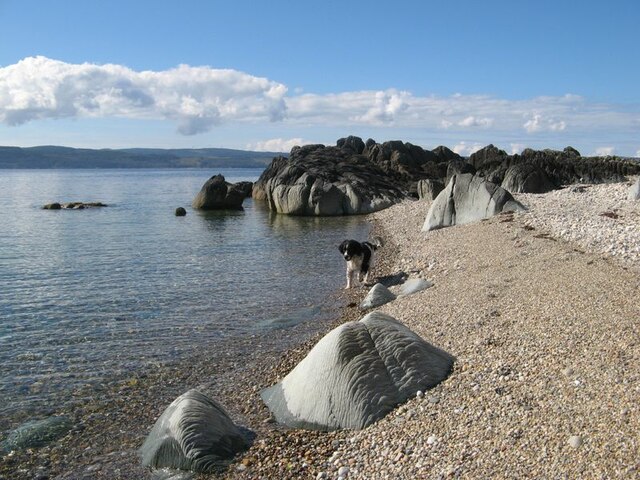
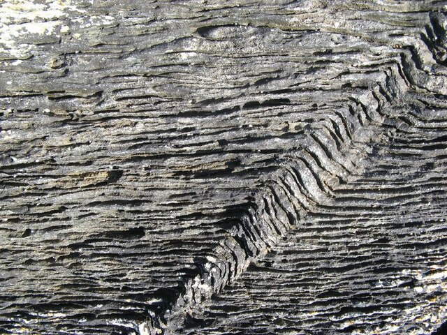
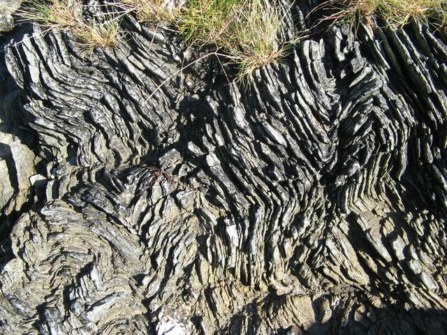
The cliff is composed of rugged, weathered rock, primarily consisting of granite and gneiss. Its sheer vertical face creates a dramatic backdrop against the crashing waves and the azure waters below. Stac an Fhion is a popular destination for climbers and adventure enthusiasts due to its challenging terrain and awe-inspiring vistas.

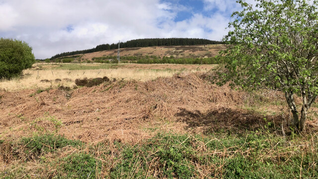
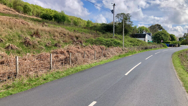
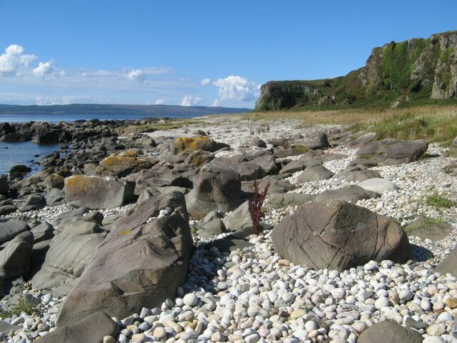
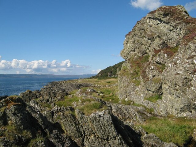
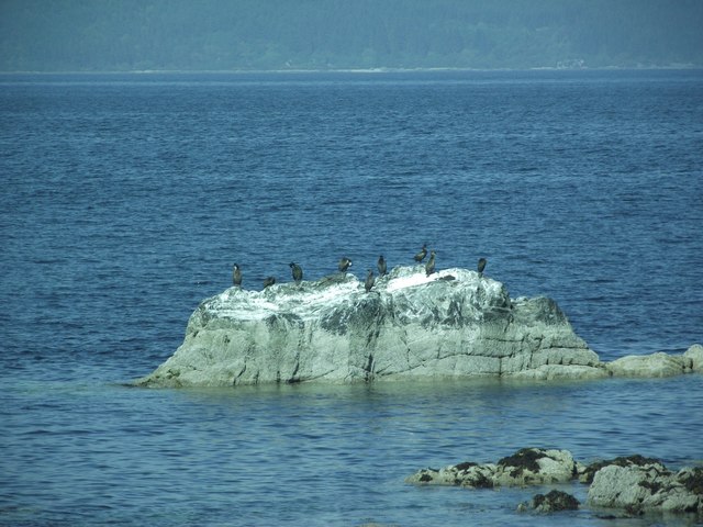
The slope leading up to the cliff is characterized by steep gradients and uneven terrain. It is covered in a variety of vegetation, including hardy grasses, heather, and mosses, providing a vibrant splash of color against the rocky landscape. The area surrounding Stac an Fhion is also home to an array of wildlife, including seabirds such as gannets, kittiwakes, and fulmars, which nest on the cliff face.

Visitors can access Stac an Fhion by boat or by embarking on a scenic coastal hike. The cliff offers an unparalleled opportunity to witness the power of nature and immerse oneself in the rugged beauty of the Scottish coastline. Whether one is seeking adventure or simply yearning for a peaceful retreat, Stac an Fhion is a remarkable destination that captivates all who encounter it.

If you have any feedback on the listing, please let us know in the comments section below.

Stac an Fhion Images

Images are sourced within 2km of 55.610344/-5.3922219 or Grid Reference NR8640. Thanks to Geograph Open Source API. All images are credited.

View of the coast below Imachar Point
Telecoms Tower above High Whitefarland
Cnoc a' Chaibeil
Cnoc a' Chaibeil
Beach with rocks By Stac an Fhion, a promontory of rocks juts out above a shingle shore. Isolated outcrops of sea-washed, Dalradian schists make a beautiful feature with their steeply-dipping foliation planes.
Beach with rocks
By Stac an Fhion, a promontory of rocks juts out above a shingle shore. Isolated outcrops of sea-washed, Dalradian schists make a beautiful feature with their steeply-dipping foliation planes.
Wave-washed outcrop Water-worn, and washed clean near the high-tide mark, this rock outcrop is inhospitable to clinging life and presents its true form and composition. The Dalradian schist is a metamorphosed sedimentary rock whose fabric depends as much upon the original sediment as the heating and deformation which it has endured. Fine, muddy sediment has developed a strongly cleaved fabric (left) while fine sands with occasional hard layers are compact with upstanding ribs. A rock of beauty, especially on a fine day.
Wave-washed outcrop
Water-worn, and washed clean near the high-tide mark, this rock outcrop is inhospitable to clinging life and presents its true form and composition. The Dalradian schist is a metamorphosed sedimentary rock whose fabric depends as much upon the original sediment as the heating and deformation which it has endured. Fine, muddy sediment has developed a strongly cleaved fabric (left) while fine sands with occasional hard layers are compact with upstanding ribs. A rock of beauty, especially on a fine day.
Perfect kink-band Detail of an outcrop of Dalradian schist, here attributed to the North Sannox Grits Formation. Muddy sediments have developed a very strong schistose fabric comprising laminations approximately 5mm thick. Such competent structures are very strong, but when subjected to shear forces will develop a peculiar pattern of localised, brittle deformation known as a kink-band. In this example, the kink-band itself dies out at the bottom of the image, and becomes progressively less distinct further away from that point. I was captivated by the regularity of the structure developed, even though the layers are themselves imperfect. Fabulous!
Perfect kink-band
Detail of an outcrop of Dalradian schist, here attributed to the North Sannox Grits Formation. Muddy sediments have developed a very strong schistose fabric comprising laminations approximately 5mm thick. Such competent structures are very strong, but when subjected to shear forces will develop a peculiar pattern of localised, brittle deformation known as a kink-band. In this example, the kink-band itself dies out at the bottom of the image, and becomes progressively less distinct further away from that point. I was captivated by the regularity of the structure developed, even though the layers are themselves imperfect. Fabulous!
Coastal geology There are some locations that simply abound with geological interest - and this one is fabulous. The sea is lapping onto extensive outcrop of Dalradian metasedimentary rock, whose schistosity is vertical and variable according to grain size in the rock mass. See also <a href="https://www.geograph.org.uk/photo/7317788">NR8640 : Perfect kink-band</a> for detail of deformation features. The schist outcrop is eroded at a former, higher relative sea-level to form a perfect expression of the Main Rock Platform, a reflection of a former and higher relative sea level during the Lateglacial (Younger Dryas or Loch Lomond) Stadial with its attendant stranded cliff-line with 'fossil' sea-stacks. A raised beach is also developed upon the platform. And the sun was shining for my visit!
Coastal geology
There are some locations that simply abound with geological interest - and this one is fabulous. The sea is lapping onto extensive outcrop of Dalradian metasedimentary rock, whose schistosity is vertical and variable according to grain size in the rock mass. See also NR8640 : Perfect kink-band for detail of deformation features. The schist outcrop is eroded at a former, higher relative sea-level to form a perfect expression of the Main Rock Platform, a reflection of a former and higher relative sea level during the Lateglacial (Younger Dryas or Loch Lomond) Stadial with its attendant stranded cliff-line with 'fossil' sea-stacks. A raised beach is also developed upon the platform. And the sun was shining for my visit!
Raised beach with boulders Boulders resulting from the erosion of a nearby basaltic dyke are lying on the raised beach near to Imachar Point.
Raised beach with boulders
Boulders resulting from the erosion of a nearby basaltic dyke are lying on the raised beach near to Imachar Point.
Fossil cliffs Fine cliffs standing back from the sea belong to the erosion of the Main Rock Platform during the Lateglacial Stadial (10,000-12,000 years BP) , during which the relative sea level was higher than today. Since that time, isostatic rebound has outstripped any sea level increase to leave the structures high and dry. Boulders on the shore here are apparently of local origin.
Reference: Stone et al, Geology; August 1996; v.24; no.8; p.707–710.
Fossil cliffs
Fine cliffs standing back from the sea belong to the erosion of the Main Rock Platform during the Lateglacial Stadial (10,000-12,000 years BP) , during which the relative sea level was higher than today. Since that time, isostatic rebound has outstripped any sea level increase to leave the structures high and dry. Boulders on the shore here are apparently of local origin. Reference: Stone et al, Geology; August 1996; v.24; no.8; p.707–710.
Eroded Dalradian schist Erosion has removed softer material from a layered sequence of muddy and sandy sedimentary rocks, which have been metamorphosed and contorted by folding and faulting. Wonderful textures! See also <a href="https://www.geograph.org.uk/photo/7317788">NR8640 : Perfect kink-band</a>.
Eroded Dalradian schist
Erosion has removed softer material from a layered sequence of muddy and sandy sedimentary rocks, which have been metamorphosed and contorted by folding and faulting. Wonderful textures! See also NR8640 : Perfect kink-band.
Fossil sea-stack A former sea-stack standing on the Main Rock Platform developed in Dalradian Schists by marine erosion in the Lateglacial Stadial. See <a href="https://www.geograph.org.uk/photo/7317846">NR8640 : Fossil cliffs</a> for discussion.
Fossil sea-stack
A former sea-stack standing on the Main Rock Platform developed in Dalradian Schists by marine erosion in the Lateglacial Stadial. See NR8640 : Fossil cliffs for discussion.
Shags on a rock in Kilbrannan Sound
Old Milestone by the A841, Balliekine, Kilmory parish Milestone on Arran by the A841, in parish of Kilmory (Arran District), on shore roadside.

Inscription reads:-
34
(To Brodick Old Quay)

Surveyed

Milestone Society National ID: AYN_ARR34
Old Milestone by the A841, Balliekine, Kilmory parish
Milestone on Arran by the A841, in parish of Kilmory (Arran District), on shore roadside. Inscription reads:- 34 (To Brodick Old Quay) Surveyed Milestone Society National ID: AYN_ARR34
View from Carradale Golf Course Looking out over Kilbrannan Sound over to Arran in the distance
View from Carradale Golf Course
Looking out over Kilbrannan Sound over to Arran in the distance
Old milestone Milestone 34 is one of very few Arran milestones that are on the shore side of the road.  It was displaced from its original site when the shore was eroded by a storm.  It was found, face down, almost under gravel and reset.  On the back is inscribed IJS 21.11.57  24.12.92.
Old milestone
Milestone 34 is one of very few Arran milestones that are on the shore side of the road. It was displaced from its original site when the shore was eroded by a storm. It was found, face down, almost under gravel and reset. On the back is inscribed IJS 21.11.57 24.12.92.
Whitefarland View The road and buildings use the post-glacial raised beach along Arran's west coast. Viewed from outside the square on a fine September afternoon from the MV "Balmoral" in the Kilbrannan Sound.
Whitefarland View
The road and buildings use the post-glacial raised beach along Arran's west coast. Viewed from outside the square on a fine September afternoon from the MV "Balmoral" in the Kilbrannan Sound.
High Whitefarland View The post-glacial raised beach peters out here, leaving a rocky shoreline to the south. Viewed from well outside the square from the MV "Balmoral" on a beautiful September afternoon.
High Whitefarland View
The post-glacial raised beach peters out here, leaving a rocky shoreline to the south. Viewed from well outside the square from the MV "Balmoral" on a beautiful September afternoon.
Imachar Point View A September view of this prominent landmark on Arran's west coast viewed from outside the square on the MV "Balmoral".
Imachar Point View
A September view of this prominent landmark on Arran's west coast viewed from outside the square on the MV "Balmoral".
Show me another place!

Stac an Fhion is located at Grid Ref: NR8640 (Lat: 55.610344, Lng: -5.3922219)

Unitary Authority: North Ayrshire

Police Authority: Ayrshire

What 3 Words

///shortens.scoop.exhaled. Near Lochranza, North Ayrshire

Related Wikis

Whitefarland

Whitefarland (Scottish Gaelic: An Aoirinn) is a clachan on the Isle of Arran in the Firth of Clyde, Scotland. It is located approximately 1 mile (2 kilometres...

Kilbrannan Sound

Kilbrannan Sound (Scottish Gaelic: An Caolas Branndanach) is a marine water body that separates the Kintyre Peninsula of Scotland from the island of Arran...

Pirnmill

Pirnmill (Scottish Gaelic: Muileann nam Piùirneachan) is a small village on the north-west coast of the Isle of Arran, Scotland. The village is situated...

Beinn Bharrain

Beinn Bharrain (721 m) is a mountain on the Isle of Arran, Scotland, located in the far northwest of the Island. Despite being less frequently visited...

Nearby Amenities

Located within 500m of 55.610344,-5.3922219
Source: PGS
Lat/Long: 55.6116015/-5.3952308
Source: PGS
Lat/Long: 55.6122869/-5.3957941
Source: PGS
Lat/Long: 55.6128595/-5.3963466
Source: PGS
Lat/Long: 55.6140235/-5.3960891
Post Box
Collection Times: Mo-Fr 12:45, Sa 10:00
Operator: Royal Mail
Post Box Type: lamp
Ref: KA27 102
Royal Cypher: scottish_crown
Lat/Long: 55.611481/-5.3919462
Imachar
Name Gd: An t-Iomachar
Place: hamlet
Lat/Long: 55.6113603/-5.3909673
The data included in this document is from www.openstreetmap.org. The data is made available under ODbL.

Have you been to Stac an Fhion?

Leave your review of Stac an Fhion below (or comments, questions and feedback).