Aoineadh Tràigh Gheal

Cliff, Slope in Argyllshire

Scotland

Aoineadh Tràigh Gheal

Aoineadh Traigh Gheal A cliff edge on the south east coast of Mull.
Viewed from the Oban to Colonsay ferry while looking for eagles!
Aoineadh Traigh Gheal Credit: Russel Wills

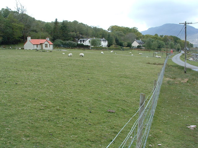
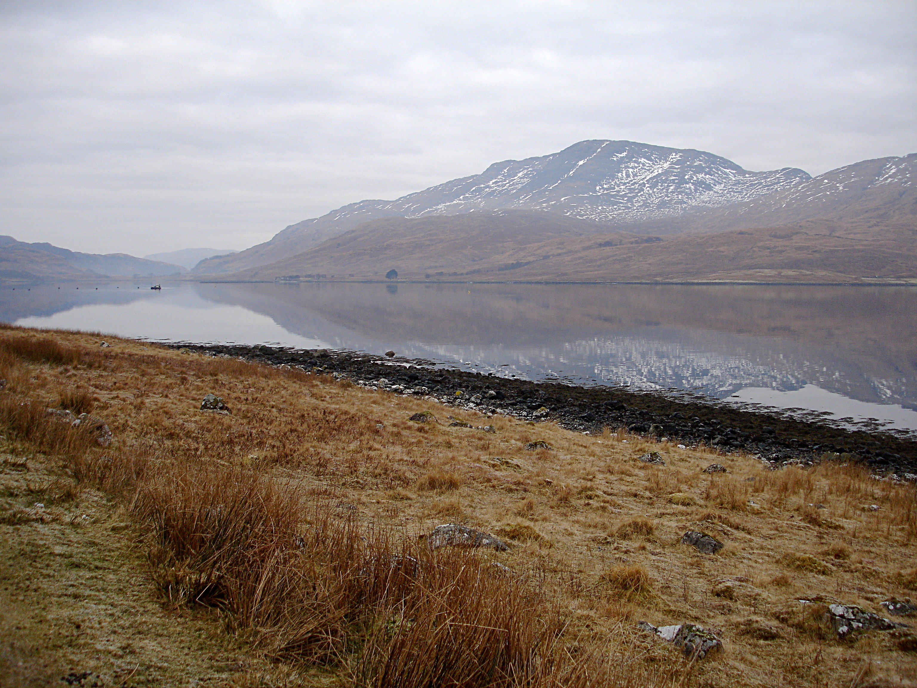
Aoineadh Tràigh Gheal, located in Argyllshire, Scotland, is a mesmerizing cliff and slope formation that exhibits stunning natural beauty. This geographical feature is renowned for its picturesque landscapes and unique geological characteristics.

Situated along the western coast of Scotland, Aoineadh Tràigh Gheal offers breathtaking views of the surrounding area. The cliff, rising several meters above sea level, provides an awe-inspiring vantage point to observe the vast expanse of the Atlantic Ocean. Its rugged and dramatic structure is a testament to the forces of erosion that have shaped it over thousands of years.

The slope of Aoineadh Tràigh Gheal, covered in lush vegetation, descends gradually towards the shoreline. This slope is home to a diverse ecosystem, supporting a wide array of plant and animal species. The flora found here includes hardy grasses, heather, and gorse, while seabirds such as gannets and puffins are commonly spotted soaring above the cliff face.

The area surrounding Aoineadh Tràigh Gheal is rich in cultural heritage, with ancient ruins and historical sites scattered throughout. Visitors can explore nearby castles, burial mounds, and archaeological remains, providing a glimpse into the region's past.

Aoineadh Tràigh Gheal is a popular destination for hikers, nature enthusiasts, and photographers, who are captivated by its natural beauty and tranquility. With its breathtaking views, diverse wildlife, and historical significance, this cliff and slope formation in Argyllshire continues to be a cherished gem in Scotland's natural landscape.

If you have any feedback on the listing, please let us know in the comments section below.

Aoineadh Tràigh Gheal Images

Images are sourced within 2km of 56.343336/-5.7462263 or Grid Reference NM6823. Thanks to Geograph Open Source API. All images are credited.

Aoineadh Traigh Gheal A cliff edge on the south east coast of Mull.
Viewed from the Oban to Colonsay ferry while looking for eagles!
Aoineadh Traigh Gheal
A cliff edge on the south east coast of Mull. Viewed from the Oban to Colonsay ferry while looking for eagles!
Cliffs on south east coast of Mull Near Leum na Muice Duibhe.
Viewed from the Oban to Colonsay ferry.
Cliffs on south east coast of Mull
Near Leum na Muice Duibhe. Viewed from the Oban to Colonsay ferry.
Sea cliffs of Beinn na Sroine, Mull
Maol Ban Summit The trig point on the high point of Maol Ban, with Creach Beinn in the background.
Maol Ban Summit
The trig point on the high point of Maol Ban, with Creach Beinn in the background.
Boat at Loch A fishing boat on Loch an t-sidhein.
Boat at Loch
A fishing boat on Loch an t-sidhein.
Port na Muice Duibhe A tiny and steep shingle beach, which offers a landing for a sea kayak only in a sea with little or no swell, but is probably the best chance of getting off the water for a couple of kilometres either side. There might be room to camp, but really you wouldn't want to get trapped here by a deterioration in the conditions.
Port na Muice Duibhe
A tiny and steep shingle beach, which offers a landing for a sea kayak only in a sea with little or no swell, but is probably the best chance of getting off the water for a couple of kilometres either side. There might be room to camp, but really you wouldn't want to get trapped here by a deterioration in the conditions.
Cliffs at Lag a' Chomhaich The cliffs at this point rise about 190m above the fossil wave-cut platform which stands just above current sea level, making any landing from the sea difficult for a long stretch of this coast, even in calm conditions. This is a remote and committing bit of coast to paddle by sea kayak, offering few landings and no easy escape on foot.

The rocks are cut by intrusions such as the prominent dike seen on the left of this view, standing proud from the cliffs because it is a harder and less easily eroded rock.
Cliffs at Lag a' Chomhaich
The cliffs at this point rise about 190m above the fossil wave-cut platform which stands just above current sea level, making any landing from the sea difficult for a long stretch of this coast, even in calm conditions. This is a remote and committing bit of coast to paddle by sea kayak, offering few landings and no easy escape on foot. The rocks are cut by intrusions such as the prominent dike seen on the left of this view, standing proud from the cliffs because it is a harder and less easily eroded rock.
Stream cuts through dike, below Maol Bàn One of many small streams falling from the cliffs of this stretch of coast on the south of Mull, this one is interesting in that it cuts through a basalt dike (turned reddish by weathering). The dike, being of a harder rock than its surroundings, is less easily eroded, and stands out on the hillside to the left of the stream, but can also be seen in the foreground right of centre. In between the two outcrops, it is buried beneath the alluvial fan of the small stream.
Stream cuts through dike, below Maol Bàn
One of many small streams falling from the cliffs of this stretch of coast on the south of Mull, this one is interesting in that it cuts through a basalt dike (turned reddish by weathering). The dike, being of a harder rock than its surroundings, is less easily eroded, and stands out on the hillside to the left of the stream, but can also be seen in the foreground right of centre. In between the two outcrops, it is buried beneath the alluvial fan of the small stream.
Allt a' Chràdh-leathaid The Allt a' Chràdh-leathaid flows into the Firth of Lorn, like many streams on this inaccessible stretch of coast, over a waterfall and through deep fissures in the fossil wave-cut platform. The cliffs here are not high, and the stream flows through a valley wooded with birch, but the coast offers very few landings for a boat, not even a small one such as a sea kayak, so this is a committing piece of coast to paddle.
Allt a' Chràdh-leathaid
The Allt a' Chràdh-leathaid flows into the Firth of Lorn, like many streams on this inaccessible stretch of coast, over a waterfall and through deep fissures in the fossil wave-cut platform. The cliffs here are not high, and the stream flows through a valley wooded with birch, but the coast offers very few landings for a boat, not even a small one such as a sea kayak, so this is a committing piece of coast to paddle.
Aoineadh Beinn na Sroine The cliffs of Beinn na Sroine fall 150m to the coast with a narrow wave-cut platform and some scree below. The crags fall back a little in the middle distance, but a buttress reasserts itself this side of the big gap formed by the <a href="https://www.geograph.org.uk/photo/1750205">NM6822 : Allt a' Chràdh-leathaid</a>. Beyond, the furthest cliffs are Aoineadh Traigh Gheal with the small headland of Rubha Tràigh Gheal formed by a widening of the wave-cut platform.
Aoineadh Beinn na Sroine
The cliffs of Beinn na Sroine fall 150m to the coast with a narrow wave-cut platform and some scree below. The crags fall back a little in the middle distance, but a buttress reasserts itself this side of the big gap formed by the NM6822 : Allt a' Chràdh-leathaid. Beyond, the furthest cliffs are Aoineadh Traigh Gheal with the small headland of Rubha Tràigh Gheal formed by a widening of the wave-cut platform.
Lochan na Clòidheig This small lochan lies just SW of the broad col between Allt a'Chorrain and Allt na Muice Duibhe on the main ridge of the Lagan peninsula. The photo looks towards Maol Ban.
Lochan na Clòidheig
This small lochan lies just SW of the broad col between Allt a'Chorrain and Allt na Muice Duibhe on the main ridge of the Lagan peninsula. The photo looks towards Maol Ban.
Gullies in Aoineadh Beinn na Sroine The cliffs of Aoineadh Beinn na Sroine rise 220m above the sea, and are riven by gullies, offering no escape route for the sea kayaker, even if he could effect a landing. There is a narrow wave-cut platform between the cliffs and the sea and, though very rough, this could provide an avenue of escape to one of the small number of valleys that cut to the coast at a climbable gradient. The shore is much used by feral goats, but they laugh in the face of rough terrain.... For the sea kayaker it is a committing stretch of coast with no real alternative but to paddle the full distance along the coast of the Laggan peninsula.
Gullies in Aoineadh Beinn na Sroine
The cliffs of Aoineadh Beinn na Sroine rise 220m above the sea, and are riven by gullies, offering no escape route for the sea kayaker, even if he could effect a landing. There is a narrow wave-cut platform between the cliffs and the sea and, though very rough, this could provide an avenue of escape to one of the small number of valleys that cut to the coast at a climbable gradient. The shore is much used by feral goats, but they laugh in the face of rough terrain.... For the sea kayaker it is a committing stretch of coast with no real alternative but to paddle the full distance along the coast of the Laggan peninsula.
Moorland, Laggan Deer Forest Rough grassland near the summit of Maol Bàn. The rocky ridge is a long feature made of a more resistant igneous rock than the main bulk of the hill.
Moorland, Laggan Deer Forest
Rough grassland near the summit of Maol Bàn. The rocky ridge is a long feature made of a more resistant igneous rock than the main bulk of the hill.
Triangulation pillar, Maol Bàn Triangulation pillar just below the summit of Maol Bàn. View towards Scarba, and the Garvellachs.
Triangulation pillar, Maol Bàn
Triangulation pillar just below the summit of Maol Bàn. View towards Scarba, and the Garvellachs.
Bog, Maol Bàn A short distance west of the summit of Maol Bàn in the Laggan Deer Forest. View towards Beinn na Sròine.
Bog, Maol Bàn
A short distance west of the summit of Maol Bàn in the Laggan Deer Forest. View towards Beinn na Sròine.
Coire nan Guinnich Moorland hollow in the Laggan Deer Forest. The moorgrass gives heavy going.  View towards Beinn Bhuidhe.
Coire nan Guinnich
Moorland hollow in the Laggan Deer Forest. The moorgrass gives heavy going. View towards Beinn Bhuidhe.
Moorland, Laggan Deer Forest Rocky ground on hillside below the plateau holding Loch an t-Sidhein.
Moorland, Laggan Deer Forest
Rocky ground on hillside below the plateau holding Loch an t-Sidhein.
Bog near Loch an t-Sidhein Wet ground on a plateau within the Laggan Deer Forest. View towards Maol Bàn.
Bog near Loch an t-Sidhein
Wet ground on a plateau within the Laggan Deer Forest. View towards Maol Bàn.
Show me another place!

Aoineadh Tràigh Gheal is located at Grid Ref: NM6823 (Lat: 56.343336, Lng: -5.7462263)

Unitary Authority: Argyll and Bute

Police Authority: Argyll and West Dunbartonshire

What 3 Words

///tricky.overtones.response. Near Lochbuie, Argyll & Bute

Related Wikis

Firth of Lorn

The Firth of Lorn or Lorne (Scottish Gaelic: An Linne Latharnach) is the inlet of the sea between the south-east coast of the Isle of Mull and the mainland...

Croggan

Croggan is a small scattered settlement on the Loch Spelve sea loch, in the south of the Isle of Mull, Argyll and Bute, Scotland. It is located in the...

Loch Spelve

Loch Spelve is a sea loch on the southeast coast of the Isle of Mull, off the west coast of Scotland. It is almost landlocked with a relatively narrow...

Creach-Beinn (Mull)

Creach-Beinn (698 m) is a mountain in the south of the Isle of Mull, Scotland. It rises above the northern shore of Loch Spelve. A rocky mountain with...

Moy Castle

Moy Castle is a ruined castle near Lochbuie on the Isle of Mull, Scotland. The site is now a scheduled monument. == History == The land upon which Moy...

Lochbuie, Mull

Lochbuie (Scottish Gaelic: Locha Buidhe, meaning "yellow loch") is a settlement on the Isle of Mull in Scotland about 22 kilometres (14 mi) west of Craignure...

Easdale

Easdale (Scottish Gaelic: Eilean Èisdeal) is one of the Slate Islands, in the Firth of Lorn, Scotland. Once the centre of the Scottish slate industry,...

Ellenabeich

Ellenabeich (Scottish Gaelic: Eilean nam Beitheach, meaning "island of the birchwoods.") is a small village on the isle of Seil (Scottish Gaelic: Saoil...

Nearby Amenities

Located within 500m of 56.343336,-5.7462263
Created By: dmgroom_coastlines
Source: PGS
Lat/Long: 56.346058/-5.740856
Created By: dmgroom_coastlines
Source: PGS
Lat/Long: 56.345926/-5.741078
Created By: dmgroom_coastlines
Source: PGS
Lat/Long: 56.34567/-5.74106
Source: PGS
Lat/Long: 56.3455704/-5.7415634
Created By: dmgroom_coastlines
Source: PGS
Lat/Long: 56.345389/-5.742192
Source: PGS
Lat/Long: 56.3448563/-5.7425242
Created By: dmgroom_coastlines
Source: PGS
Lat/Long: 56.344601/-5.743058
Created By: dmgroom_coastlines
Source: PGS
Lat/Long: 56.343829/-5.743234
Created By: dmgroom_coastlines
Source: PGS
Lat/Long: 56.343051/-5.74364
Created By: dmgroom_coastlines
Source: PGS
Lat/Long: 56.342918/-5.74386
Created By: dmgroom_coastlines
Source: PGS
Lat/Long: 56.342785/-5.744082
Created By: dmgroom_coastlines
Source: PGS
Lat/Long: 56.342652/-5.744302
Created By: dmgroom_coastlines
Source: PGS
Lat/Long: 56.342519/-5.744524
Created By: dmgroom_coastlines
Source: PGS
Lat/Long: 56.342386/-5.744744
Created By: dmgroom_coastlines
Source: PGS
Lat/Long: 56.342253/-5.744966
Created By: dmgroom_coastlines
Source: PGS
Lat/Long: 56.34212/-5.745186
Created By: dmgroom_coastlines
Source: PGS
Lat/Long: 56.341972/-5.746098
Source: PGS
Lat/Long: 56.3414964/-5.746955
Created By: dmgroom_coastlines
Source: PGS
Lat/Long: 56.341036/-5.747876
Created By: dmgroom_coastlines
Source: PGS
Lat/Long: 56.340903/-5.748098
Source: PGS
Lat/Long: 56.3408949/-5.748715
Created By: dmgroom_coastlines
Source: PGS
Lat/Long: 56.340473/-5.750141
Source: PGS
Lat/Long: 56.3402972/-5.7508166
The data included in this document is from www.openstreetmap.org. The data is made available under ODbL.

Have you been to Aoineadh Tràigh Gheal?

Leave your review of Aoineadh Tràigh Gheal below (or comments, questions and feedback).