Am Biod

Cliff, Slope in Argyllshire

Scotland

Am Biod

The Garvellachs Seen from around 3,000ft altitude.
The Garvellachs Credit: John Allan

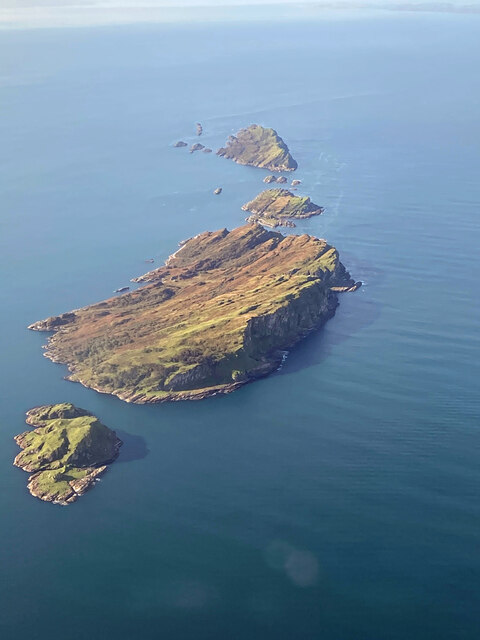
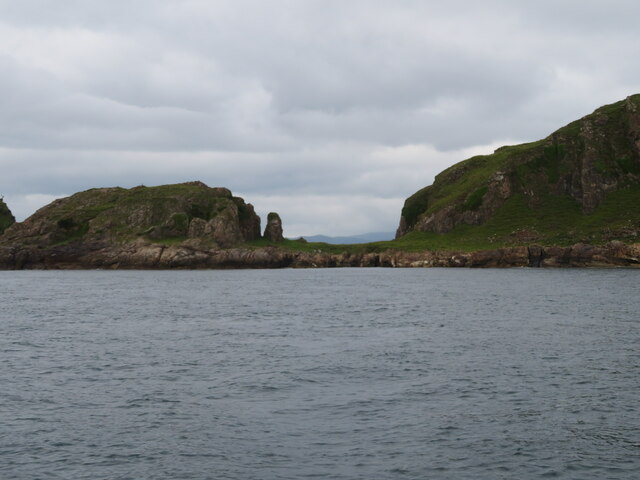
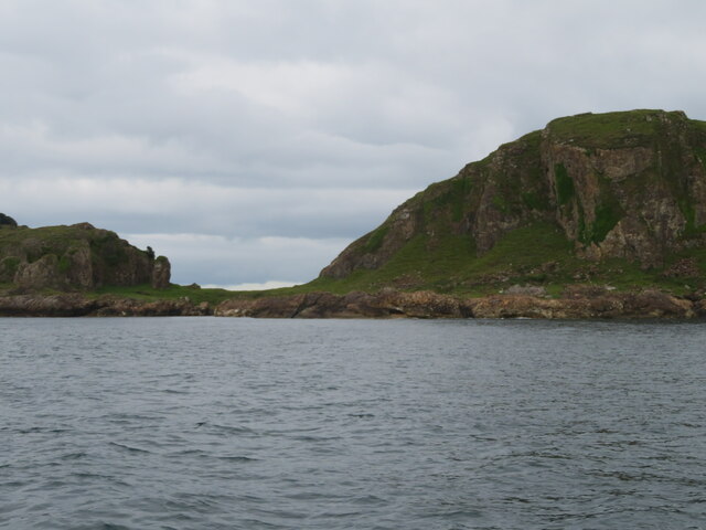
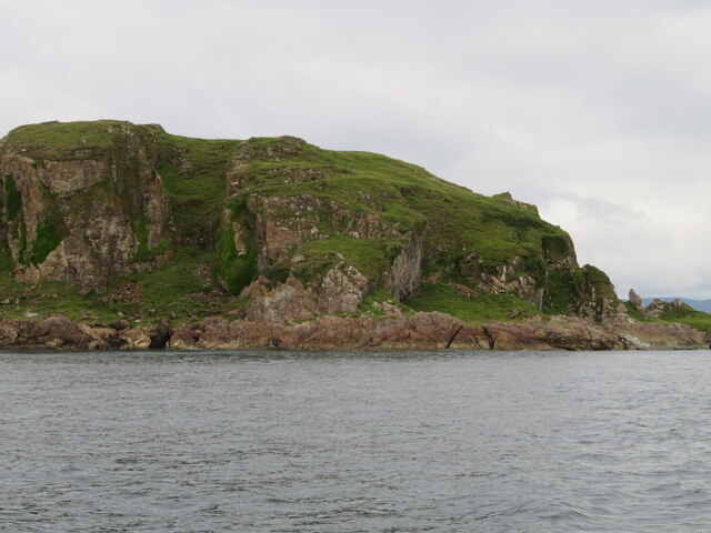
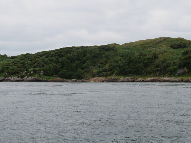
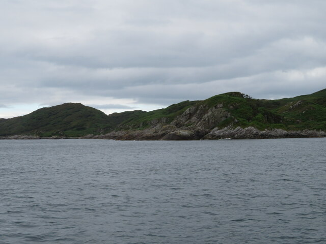
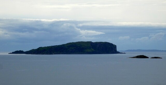
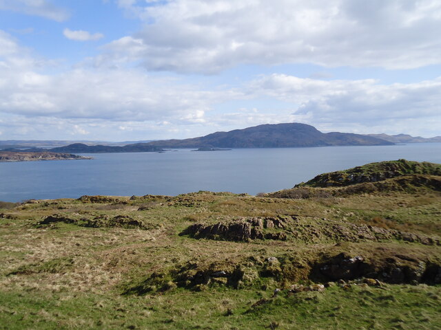
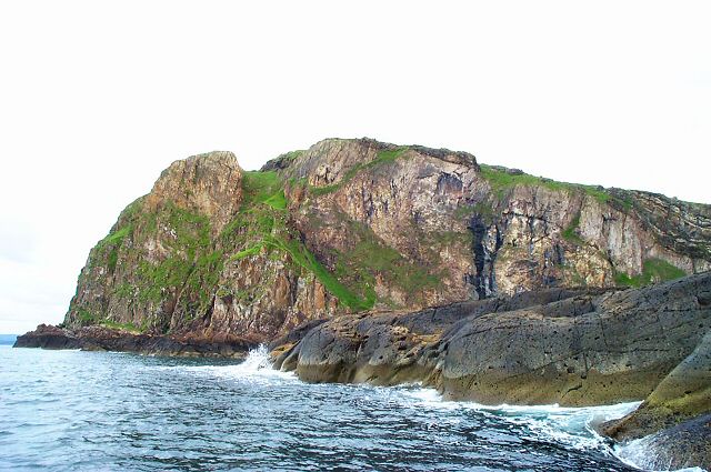
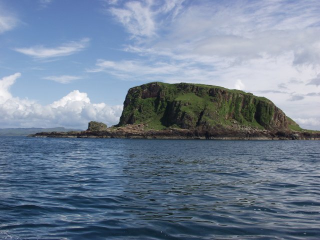
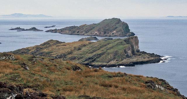
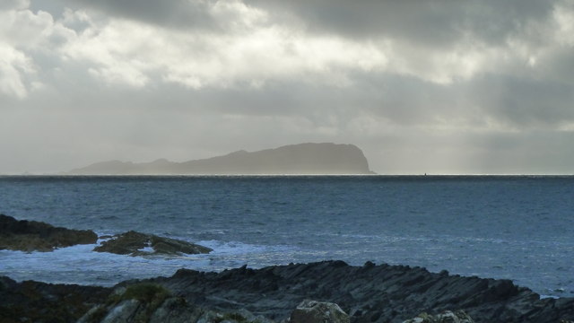
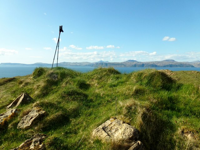
Am Biod is a stunning cliff located in Argyllshire, Scotland. It is known for its dramatic slopes and breathtaking views of the surrounding landscape. The cliff is situated in a remote and rugged area, offering visitors a true sense of wilderness and tranquility.

With its towering height and steep incline, Am Biod provides an ideal spot for rock climbing enthusiasts. Its challenging terrain and diverse rock formations attract climbers from all over the world seeking an adrenaline-fueled adventure. The cliff offers both traditional and sport climbing routes, catering to climbers of different skill levels.

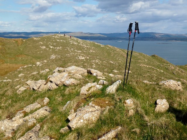
Aside from its climbing opportunities, Am Biod is also a popular destination for hikers and nature enthusiasts. The surrounding slopes are covered in lush vegetation, including heather, grasses, and wildflowers, creating a picturesque backdrop for outdoor activities. The cliff overlooks a vast expanse of rolling hills and sparkling lochs, providing breathtaking panoramic views that are sure to leave visitors in awe.

Am Biod is also home to a wide variety of wildlife, including birds of prey such as golden eagles and peregrine falcons, which can often be spotted soaring above the cliff. The area is also known for its diverse flora, with rare and protected plant species finding refuge in its rugged terrain.

Due to its remote location, Am Biod offers a peaceful and secluded experience for those seeking a break from the hustle and bustle of everyday life. The cliff's natural beauty and challenging landscape make it a must-visit destination for outdoor enthusiasts and nature lovers alike.

If you have any feedback on the listing, please let us know in the comments section below.
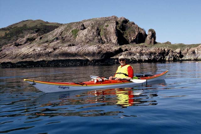
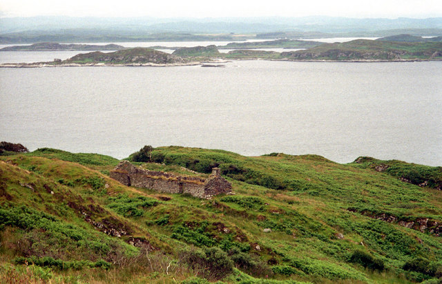
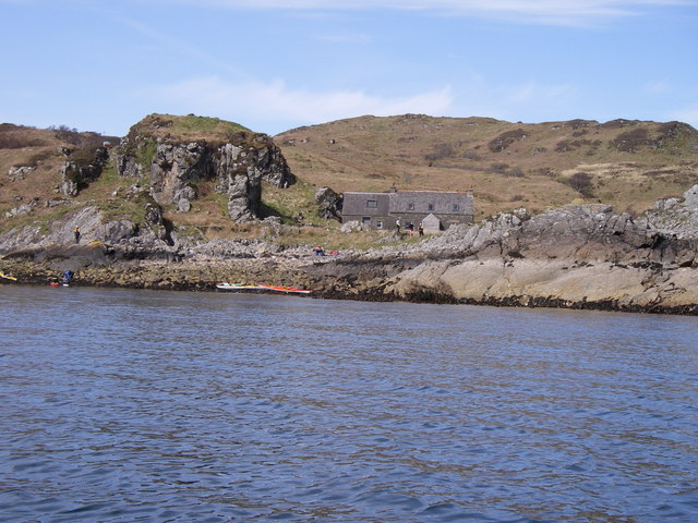
Am Biod Images

Images are sourced within 2km of 56.248749/-5.7582091 or Grid Reference NM6712. Thanks to Geograph Open Source API. All images are credited.

The Garvellachs Seen from around 3,000ft altitude.
The Garvellachs
Seen from around 3,000ft altitude.
Dùn Chonnuill A small island just north of Garbh Eileach, the largest of the Garvellachs.
Dùn Chonnuill
A small island just north of Garbh Eileach, the largest of the Garvellachs.
Dùn Chonnuill Approaching this small island just off Garbh Eileach.
Dùn Chonnuill
Approaching this small island just off Garbh Eileach.
Dùn Chonnuill The northern tip of the Garvellachs.
Dùn Chonnuill
The northern tip of the Garvellachs.
Deciduous woodland on Garbh Eileach A rare patch of woodland on the Garvellachs in the Firth of Lorn.
Deciduous woodland on Garbh Eileach
A rare patch of woodland on the Garvellachs in the Firth of Lorn.
Deciduous woodland on Garbh Eileach A rare patch of woodland on the Garvellachs in the Firth of Lorn.
Deciduous woodland on Garbh Eileach
A rare patch of woodland on the Garvellachs in the Firth of Lorn.
Garbh Eileach from Easdale The island of Garbh Eileach, the largest of the Garvellachs as seen from the top of the hill on Easdale. The two little rocks to the right of the image are <a href="https://www.geograph.org.uk/photo/7259874">NM7014 : Dubh-fhèith islets from Easdale</a>
Garbh Eileach is a reasonably large island at 142ha (351 acres = 0.55 mile²) its highest point is 110m (361') near the north coast. It is an uninhabited island but the presence of a burial ground attests to its former population.
Garbh Eileach from Easdale
The island of Garbh Eileach, the largest of the Garvellachs as seen from the top of the hill on Easdale. The two little rocks to the right of the image are NM7014 : Dubh-fhèith islets from Easdale Garbh Eileach is a reasonably large island at 142ha (351 acres = 0.55 mile²) its highest point is 110m (361') near the north coast. It is an uninhabited island but the presence of a burial ground attests to its former population.
The summit region of Garbh Eileach Looking just east of south across the Firth of Lorn.

To the left (in shadow) is Lunga, with the small island of Guirasdeal on its right. The large island dominating the photo is Scarba, and part of north Jura can be seen on the right.
The summit region of Garbh Eileach
Looking just east of south across the Firth of Lorn. To the left (in shadow) is Lunga, with the small island of Guirasdeal on its right. The large island dominating the photo is Scarba, and part of north Jura can be seen on the right.
Garvellachs The northern face of this group of islands.
Garvellachs
The northern face of this group of islands.
The Garvellachs
The Garvellachs
Garvellachs shepherd's Bothy
Garbh Eileach On the low hill on Garbh Eileach.
Garbh Eileach
On the low hill on Garbh Eileach.
Dun Chonnuill Dun Chonnuill (Connel's Castle) the eastern most island of the Garvellachs
Dun Chonnuill
Dun Chonnuill (Connel's Castle) the eastern most island of the Garvellachs
Dùn Chonnuill Sea kayaking around the Garvellachs.
Dùn Chonnuill
Sea kayaking around the Garvellachs.
Croft House ruin on Garbh Eileach A deserted croft house on the northeast slopes of Garbh Eileach. It has a glorious view out over the Slate Isles. A view now only enjoyed by deer - and the occasional tourist.
Croft House ruin on Garbh Eileach
A deserted croft house on the northeast slopes of Garbh Eileach. It has a glorious view out over the Slate Isles. A view now only enjoyed by deer - and the occasional tourist.
Dun Chonnuill Dun Chonnuill, the most northerly of the chain of islands forming the Garvellachs, viewed from the shore  on the south coast of Seil, west  of Cuan.
Dun Chonnuill
Dun Chonnuill, the most northerly of the chain of islands forming the Garvellachs, viewed from the shore on the south coast of Seil, west of Cuan.
Garbh Eileach South and Probable Summit Lovely island with deer and trees, again there are a few choices for the top. Jim Bloomer took some abney readings with the true summit found eventually as this one to the south looking at the northern top and Mull beyond and what a view. Third top is towards the far west of the island.

Name: Garbh Eileach
Hill number: 4872
Height: 110m / 361ft
Area: 20A: Jura, Scarba and Colonsay
Class: Hu
Grid ref: NM 67326 12486
Summit feature: no feature
Drop: 110m
Col: Sea
Garbh Eileach South and Probable Summit
Lovely island with deer and trees, again there are a few choices for the top. Jim Bloomer took some abney readings with the true summit found eventually as this one to the south looking at the northern top and Mull beyond and what a view. Third top is towards the far west of the island. Name: Garbh Eileach Hill number: 4872 Height: 110m / 361ft Area: 20A: Jura, Scarba and Colonsay Class: Hu Grid ref: NM 67326 12486 Summit feature: no feature Drop: 110m Col: Sea
Garbh Eileach W Summit This was going to be a quick grab because the summit was said to be unambiguous. However, not to be - another festive round of multiple lumps to guess which one could be it. Never mind, the view and weather were unambiguously good.
W top at NM 66860 12319 is probably just lower than ground 70m NW at NM 67273 12530 is as high true southern top at NM 67326 12486.
Garbh Eileach W Summit
This was going to be a quick grab because the summit was said to be unambiguous. However, not to be - another festive round of multiple lumps to guess which one could be it. Never mind, the view and weather were unambiguously good. W top at NM 66860 12319 is probably just lower than ground 70m NW at NM 67273 12530 is as high true southern top at NM 67326 12486.
Show me another place!

Am Biod is located at Grid Ref: NM6712 (Lat: 56.248749, Lng: -5.7582091)

Unitary Authority: Argyll and Bute

Police Authority: Argyll and West Dunbartonshire

What 3 Words

///tweeted.bead.fluid. Near Lochbuie, Argyll & Bute

Related Wikis

Garbh Eileach

Garbh Eileach is an uninhabited island in the Inner Hebrides of the west coast of Scotland. It is the largest of the Garvellachs and lies in the Firth...

Dùn Chonnuill

Dùn Chonnuill is a small island in the Garvellachs in the Firth of Lorn, Scotland. Dùn Chonnuill lies north east of Garbh Eileach, the largest of the archipelago...

Garvellachs

The Garvellachs (Scottish Gaelic: Garbh Eileaich) or Isles of the Sea form a small archipelago in the Inner Hebrides of Scotland. Part of the Argyll and...

Eilean Dubh Mòr

Eilean Dubh Mòr (Scottish Gaelic: big black island) is an uninhabited island in the Inner Hebrides of Scotland. It lies at the mouth of the Firth of Lorn...

Nearby Amenities

Located within 500m of 56.248749,-5.7582091
Created By: dmgroom_coastlines
Source: PGS
Lat/Long: 56.247139/-5.765528
Created By: dmgroom_coastlines
Source: PGS
Lat/Long: 56.247405/-5.765087
Created By: dmgroom_coastlines
Source: PGS
Lat/Long: 56.247702/-5.763268
Created By: dmgroom_coastlines
Source: PGS
Lat/Long: 56.247979/-5.762368
Created By: dmgroom_coastlines
Source: PGS
Lat/Long: 56.248306/-5.75917
Created By: dmgroom_coastlines
Source: PGS
Lat/Long: 56.248572/-5.758729
Created By: dmgroom_coastlines
Source: PGS
Lat/Long: 56.248582/-5.75827
Created By: dmgroom_coastlines
Source: PGS
Lat/Long: 56.248593/-5.757811
Created By: dmgroom_coastlines
Source: PGS
Lat/Long: 56.248869/-5.75691
Created By: dmgroom_coastlines
Source: PGS
Lat/Long: 56.249135/-5.756469
Created By: dmgroom_coastlines
Source: PGS
Lat/Long: 56.249401/-5.756028
Created By: dmgroom_coastlines
Source: PGS
Lat/Long: 56.249483/-5.752353
Created By: dmgroom_coastlines
Source: PGS
Lat/Long: 56.249376/-5.751425
Created By: dmgroom_coastlines
Source: PGS
Lat/Long: 56.248869/-5.751159
Created By: dmgroom_coastlines
Source: PGS
Lat/Long: 56.248624/-5.750682
Created By: dmgroom_coastlines
Source: PGS
Lat/Long: 56.248378/-5.750204
The data included in this document is from www.openstreetmap.org. The data is made available under ODbL.

Have you been to Am Biod?

Leave your review of Am Biod below (or comments, questions and feedback).