Aoineadh nan Laogh

Cliff, Slope in Argyllshire

Scotland

Aoineadh nan Laogh

Natural arch at Glentrosdale Bay The west coast of Jura abounds with raised coastal features.
Natural arch at Glentrosdale Bay Credit: Alan Reid

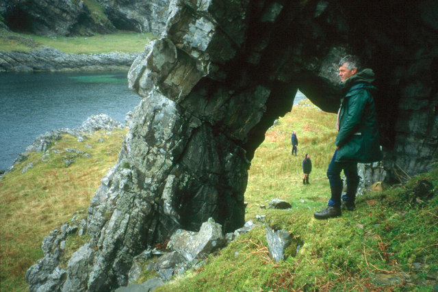
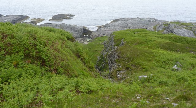
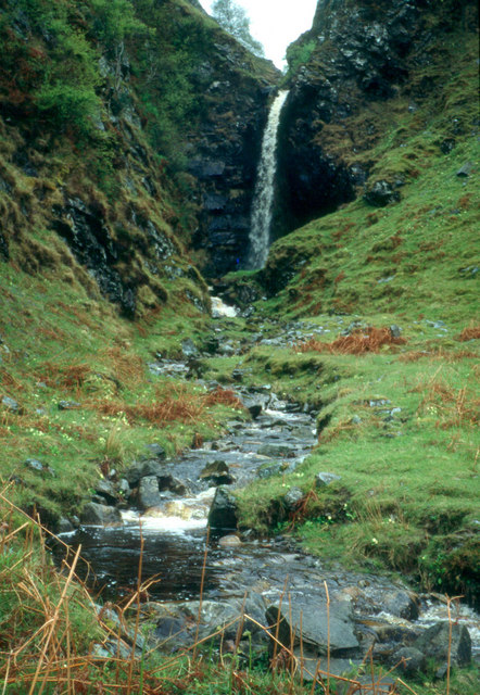
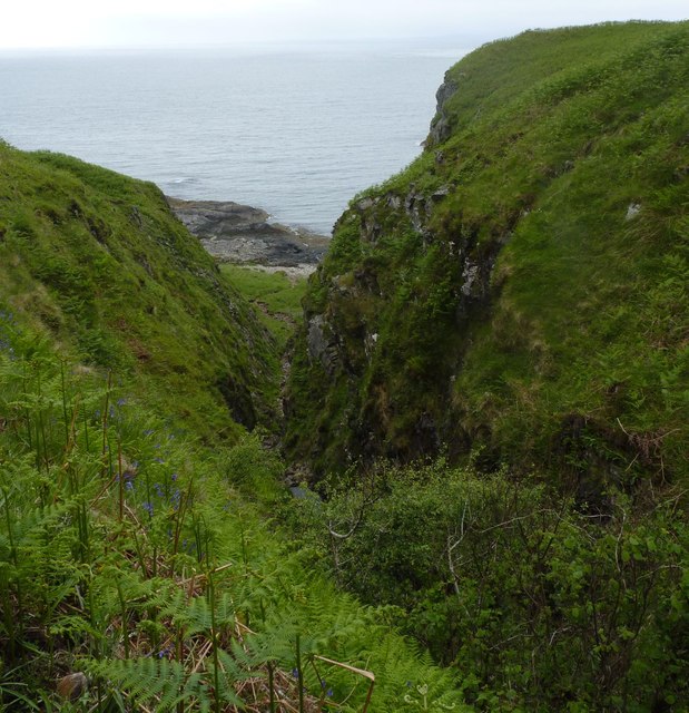
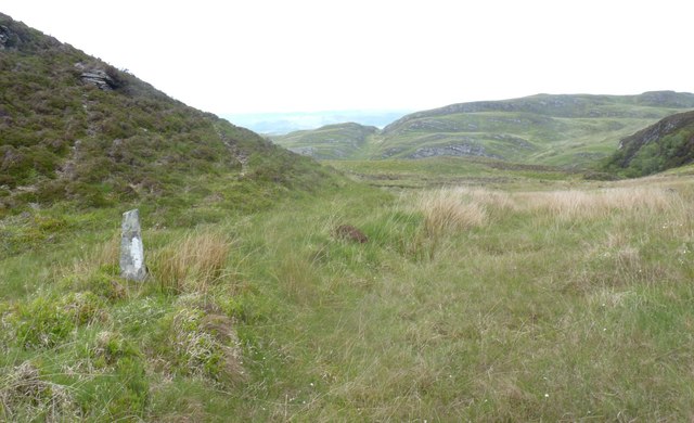
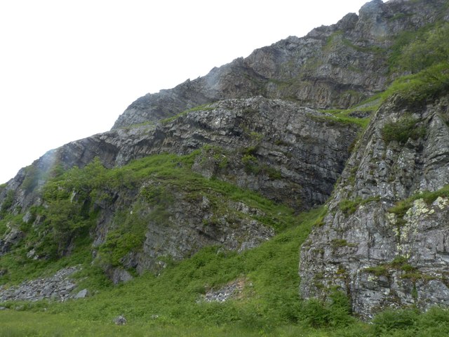
Aoineadh nan Laogh, also known as Cliff Slope, is a remarkable geographical feature located in Argyllshire, Scotland. This rugged cliff slope is situated in a remote and picturesque area, making it a popular attraction for nature enthusiasts and outdoor adventurers.

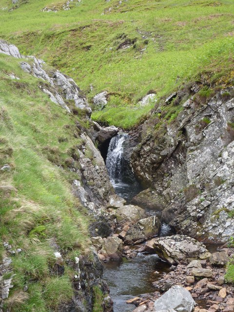
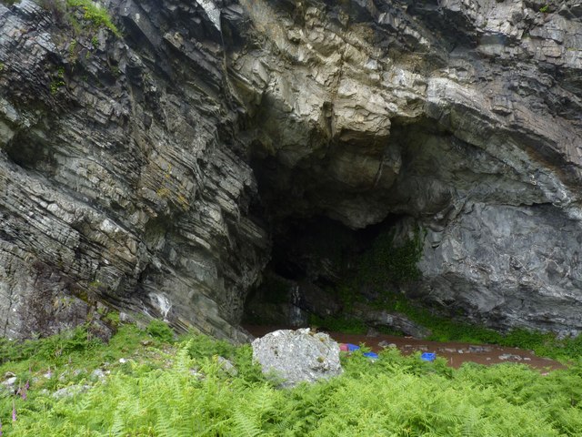
With a height of approximately 300 feet, Aoineadh nan Laogh offers breathtaking views of the surrounding landscape. The cliff slope is composed of layers of sedimentary rock, showcasing the region's geological history. These rock formations have been shaped over millions of years by natural forces such as erosion and weathering.

The unique ecosystem found on Aoineadh nan Laogh is home to a diverse range of plant and animal species. Hardy vegetation, including mosses, grasses, and heather, cling to the cliff face, providing a habitat for insects and small mammals. Birdwatchers can often spot various species of birds, such as peregrine falcons and golden eagles, soaring above the cliff.

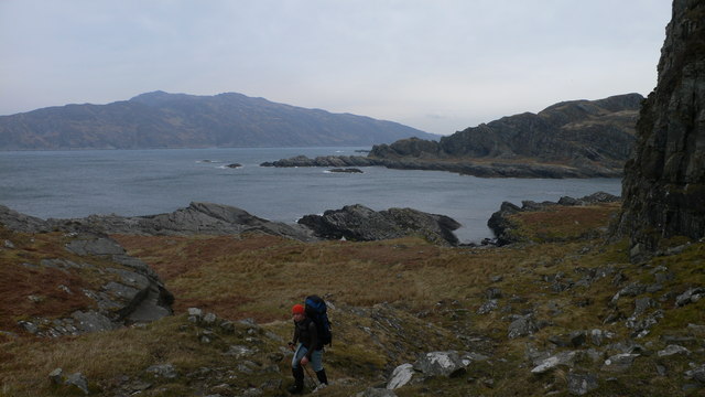
Visitors to Aoineadh nan Laogh can partake in a variety of outdoor activities. Hiking and rock climbing are popular pursuits, allowing adventurers to explore the cliff slope and enjoy the stunning panoramic views from the top. The area also offers opportunities for photography, with its dramatic scenery and ever-changing lighting conditions.

Due to its remote location, Aoineadh nan Laogh is a peaceful and tranquil destination. It offers visitors a chance to immerse themselves in the beauty of nature and escape the hustle and bustle of everyday life. Whether it's for a leisurely hike or a thrilling rock climbing adventure, Aoineadh nan Laogh is a must-visit destination for nature lovers seeking a truly awe-inspiring experience.

If you have any feedback on the listing, please let us know in the comments section below.

Aoineadh nan Laogh Images

Images are sourced within 2km of 56.126992/-5.7531526 or Grid Reference NR6699. Thanks to Geograph Open Source API. All images are credited.

Natural arch at Glentrosdale Bay The west coast of Jura abounds with raised coastal features.
Natural arch at Glentrosdale Bay
The west coast of Jura abounds with raised coastal features.
Waterfall near mouth of Glen Trosdale River, Jura
Glen Trosdale Bay, Jura A welcome sight after hours of traipsing through thick tussocks! The Hebridean Princess can just be seen in the distance - the more luxurious way to travel!
Glen Trosdale Bay, Jura
A welcome sight after hours of traipsing through thick tussocks! The Hebridean Princess can just be seen in the distance - the more luxurious way to travel!
Glen Trosdale Bay, Jura Taken from the cave at the north of the bay and therefore in a different square.
Glen Trosdale Bay, Jura
Taken from the cave at the north of the bay and therefore in a different square.
Ravine near Glen Trosdale, north Jura
Kayakers arriving at Glen Trosdale Bay, Jura Just when you think you've got the place to yourself . . .
Kayakers arriving at Glen Trosdale Bay, Jura
Just when you think you've got the place to yourself . . .
Glentrosdale Bay
Glentrosdale Bay
Shoreline Beneath Beinn nan Capull Looking northeast, across Glentrosdale Bay to Aird Bhrecain (to the right) and Scarba (to the left).
Shoreline Beneath Beinn nan Capull
Looking northeast, across Glentrosdale Bay to Aird Bhrecain (to the right) and Scarba (to the left).
The last drop to sea level, Jura's Northwest cliffs At Bagh Uamh Mhor.
The last drop to sea level, Jura's Northwest cliffs
At Bagh Uamh Mhor.
Glen Trosdale with Cruach na Seilcheig above Taken from deck of PS Waverley in Gulf of Corryvreckan.

Glen Trosdale is the very obvious gash in the hillside
Glen Trosdale with Cruach na Seilcheig above
Taken from deck of PS Waverley in Gulf of Corryvreckan. Glen Trosdale is the very obvious gash in the hillside
Moorland with rock outcrops north from Cruach na Seilcheig The northern end of the Isle of Jura is a mass of low hills with rock outcrops set among moorland. The view here is to the north from the highest point among those hills out over the Gulf of Corryvreckan to the island of Scarba.
Moorland with rock outcrops north from Cruach na Seilcheig
The northern end of the Isle of Jura is a mass of low hills with rock outcrops set among moorland. The view here is to the north from the highest point among those hills out over the Gulf of Corryvreckan to the island of Scarba.
Moorland north of Cruach na Seilcheig Cruach na Seilcheig is the highest of the low hills occupying the northern end of Jura. The view here is not from the summit of the hill but a rise to the south-east a few metres lower where there's a trig point. The island of Scarba off the north coast of Jura is seen beyond the Gulf of Corryvreckan.
Moorland north of Cruach na Seilcheig
Cruach na Seilcheig is the highest of the low hills occupying the northern end of Jura. The view here is not from the summit of the hill but a rise to the south-east a few metres lower where there's a trig point. The island of Scarba off the north coast of Jura is seen beyond the Gulf of Corryvreckan.
An Eag, Jura The nick, notch or gap. Looking down on Bàgh Uamh Mhòr (Bay of the Big Cave).
An Eag, Jura
The nick, notch or gap. Looking down on Bàgh Uamh Mhòr (Bay of the Big Cave).
Small standing stone on saddle between Beinn nan Capull and Cruach na Seilcheig, Jura Beinn nan Capull = Mountain of the horses and Cruach na Seilcheig apparently translates as 'Hip-shaped Hill of the Snails' which is rather intriguing! The standing stone is probably simply a waymarker used by gamekeepers and gillies.
Small standing stone on saddle between Beinn nan Capull and Cruach na Seilcheig, Jura
Beinn nan Capull = Mountain of the horses and Cruach na Seilcheig apparently translates as 'Hip-shaped Hill of the Snails' which is rather intriguing! The standing stone is probably simply a waymarker used by gamekeepers and gillies.
Cave at Bàgh Uamh Mhòr, Jura The 'big cave' after which this bay is named. Viewed after a steep and scary descent to this gothic-like bay, surrounded by stark, sheer, jaggy cliffs.
Cave at Bàgh Uamh Mhòr, Jura
The 'big cave' after which this bay is named. Viewed after a steep and scary descent to this gothic-like bay, surrounded by stark, sheer, jaggy cliffs.
Trigpoint, Cruach na Seilcheig, Jura Cruach na Seilcheig translates intriguingly as 'Hip-shaped hill of the snails', a name that even with my most imaginative cap on would not have occurred to me!
Looking north towards Scarba. The Corryvreckan whirlpool, when active, is in the stretch of water visible in the photo.
Trigpoint, Cruach na Seilcheig, Jura
Cruach na Seilcheig translates intriguingly as 'Hip-shaped hill of the snails', a name that even with my most imaginative cap on would not have occurred to me! Looking north towards Scarba. The Corryvreckan whirlpool, when active, is in the stretch of water visible in the photo.
Caigeann Mòr, Jura 'Big, rough mountain pass'. Situated between Glen Trosdale Bay and Bàgh Uamh Mhòr on Jura's north-west coast. Although we came via this pass it is most definitely not to be recommended!
Caigeann Mòr, Jura
'Big, rough mountain pass'. Situated between Glen Trosdale Bay and Bàgh Uamh Mhòr on Jura's north-west coast. Although we came via this pass it is most definitely not to be recommended!
Caigeann Mòr, Jura 'Big, rough mountain pass' and the way we came between Glen Trosdale Bay and Bàgh Uamh Mhòr on Jura's north-west coast. Not to be recommended; it's very steep and treacherous!
Caigeann Mòr, Jura
'Big, rough mountain pass' and the way we came between Glen Trosdale Bay and Bàgh Uamh Mhòr on Jura's north-west coast. Not to be recommended; it's very steep and treacherous!
Show me another place!

Aoineadh nan Laogh is located at Grid Ref: NR6699 (Lat: 56.126992, Lng: -5.7531526)

Unitary Authority: Argyll and Bute

Police Authority: Argyll and West Dunbartonshire

What 3 Words

///somewhere.vowel.skirting. Near Lochgilphead, Argyll & Bute

Nearby Locations

Aoineadh nan Laogh

Related Wikis

Kinuachdrachd

Kinuachdrachd or Kinuachdrach is a place about 22 miles from Craighouse on the island of Jura, in the council area of Argyll and Bute, Scotland. It comprises...

Gulf of Corryvreckan

The Gulf of Corryvreckan (from the Gaelic Coire Bhreacain, meaning 'cauldron of the speckled seas' or 'cauldron of the plaid'), also called the Strait...

Barnhill, Jura

Barnhill is a farmhouse in the north of the island of Jura in the Scottish Inner Hebrides overlooking the Sound of Jura. It stands on the site of a larger...

Jura, Scotland

Jura ( JOOR-ə; Scottish Gaelic: Diùra) is an island in the Inner Hebrides of Scotland, adjacent to and northeast of Islay. With an area of 36,692 hectares...

Nearby Amenities

Located within 500m of 56.126992,-5.7531526
Source: PGS
Lat/Long: 56.124117/-5.754546
Source: PGS
Lat/Long: 56.1240017/-5.7545193
Bagh Uamh Mhor Beinn nan Capull
Natural: bay
Source: OS_OpenData_StreetView
Lat/Long: 56.1301544/-5.7489783
Bagh Uamh nan Giall
Natural: bay
Source: OS_OpenData_StreetView
Lat/Long: 56.1243912/-5.7579492
Natural Arch
Place: locality
Source: OS_OpenData_StreetView
Lat/Long: 56.1228746/-5.7551116
Rubha na Garbh-airde
Natural: cape
Source: OS_OpenData_StreetView
Lat/Long: 56.1251258/-5.7596055
Sloc Slaobain
Natural: bay
Source: OS_OpenData_StreetView
Lat/Long: 56.1241523/-5.7554453
Uamh nan Giall
Natural: cave_entrance
Source: OS_OpenData_StreetView
Lat/Long: 56.1233466/-5.7544508
The data included in this document is from www.openstreetmap.org. The data is made available under ODbL.

Have you been to Aoineadh nan Laogh?

Leave your review of Aoineadh nan Laogh below (or comments, questions and feedback).