Aignish

Cliff, Slope in Argyllshire

Scotland

Aignish

Sandy Cove below Innean Glen A great camping spot - on a good day
Sandy Cove below Innean Glen Credit: ian lee

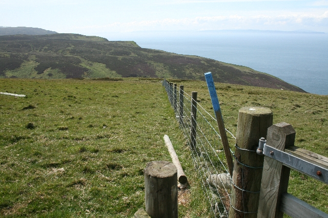
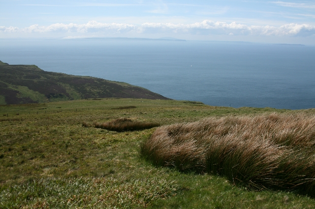
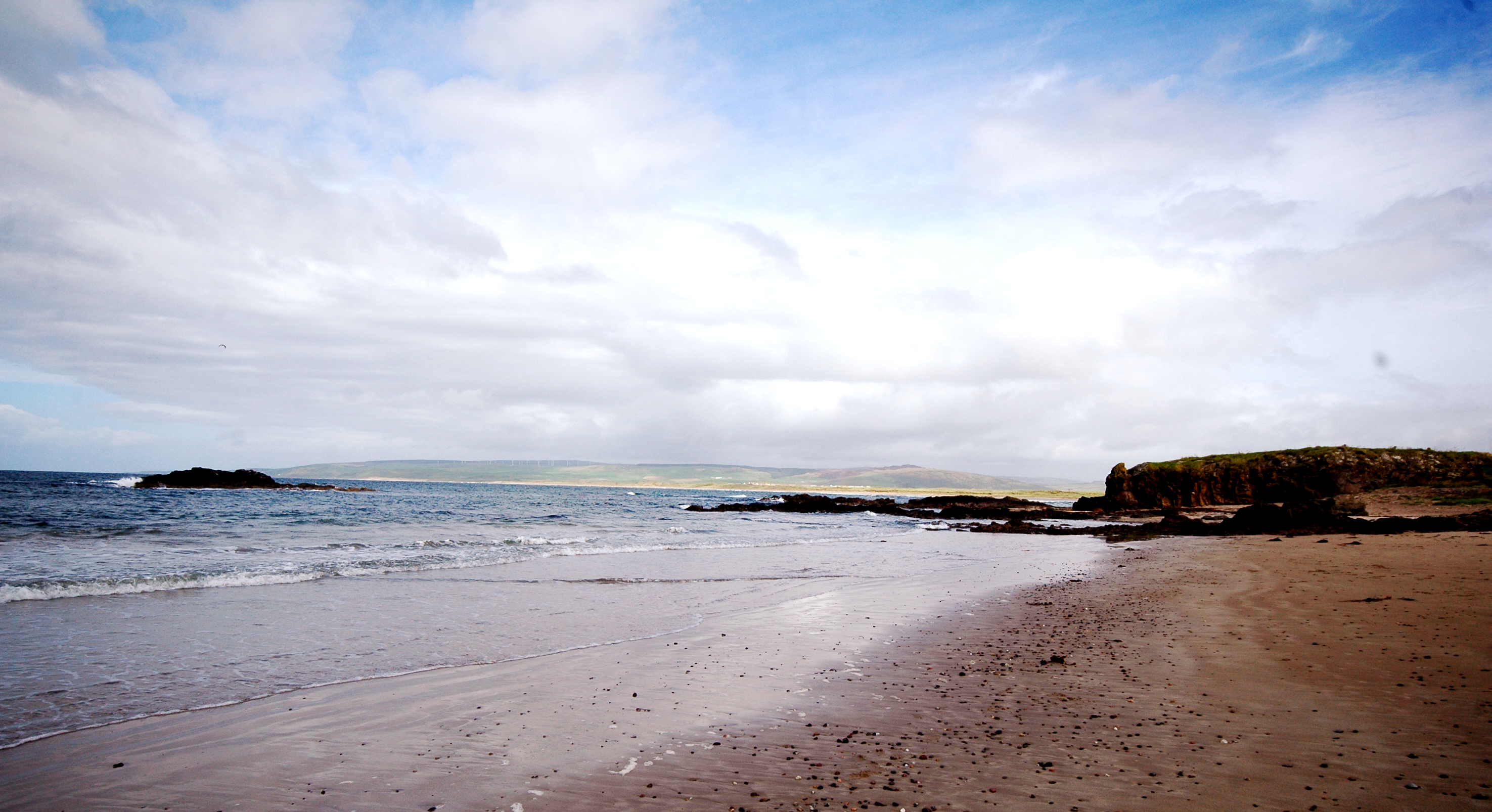
Aignish is a small village located in Argyllshire, in the western region of Scotland. Situated on a cliff overlooking the stunning coastal landscape, Aignish offers breathtaking views of the surrounding area. The village is nestled between rolling hills and the vast expanse of the Atlantic Ocean, providing a picturesque setting for residents and visitors alike.

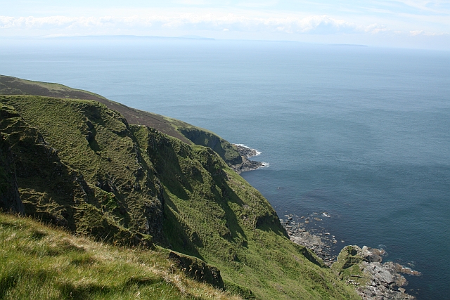
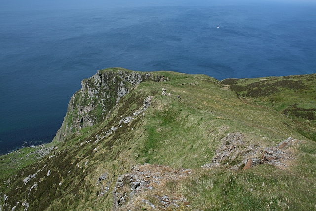
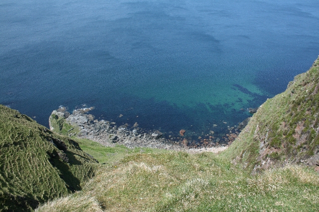
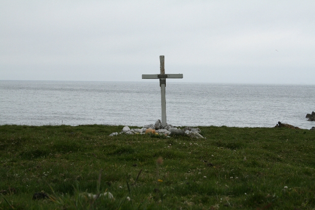
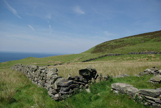
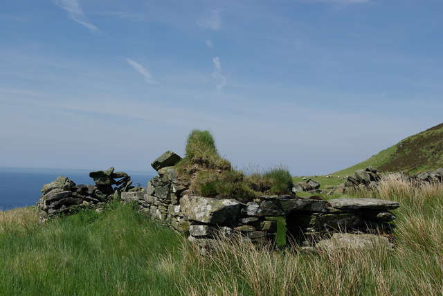
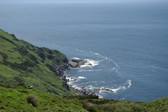
One of the standout features of Aignish is its dramatic cliff, which serves as a prominent landmark in the area. The cliff offers a striking backdrop against the clear blue sky and crashing waves below. The slope leading down from the cliff to the shoreline adds to the village's charm and natural beauty.

Aignish is known for its rugged and wild landscape, attracting outdoor enthusiasts and nature lovers. The cliff and slope provide opportunities for hiking, climbing, and birdwatching, with various species of seabirds often seen nesting along the coastline.

Despite its remote location, Aignish is not far from the nearby town of Oban, known as the gateway to the Hebridean islands. This proximity allows residents and visitors to access amenities and services easily while still enjoying the tranquility and seclusion of village life.

In summary, Aignish in Argyllshire is a captivating village perched on a cliff overlooking the Atlantic Ocean. Its rugged landscape, including the distinctive slope, offers stunning views and outdoor activities for those seeking a getaway in the Scottish countryside.

If you have any feedback on the listing, please let us know in the comments section below.

Aignish Images

Images are sourced within 2km of 55.372631/-5.7937014 or Grid Reference NR5915. Thanks to Geograph Open Source API. All images are credited.

Sandy Cove below Innean Glen A great camping spot - on a good day
Sandy Cove below Innean Glen
A great camping spot - on a good day
Innean Bay, north of Mull of Kintyre Lighthouse. Favourite picnic area for hikers, site of the grave of the unknown mariner on the west side of the Mull of Kintyre.
Innean Bay, north of Mull of Kintyre Lighthouse.
Favourite picnic area for hikers, site of the grave of the unknown mariner on the west side of the Mull of Kintyre.
Sailor grave Innean Bay, Mull of Kintyre. Mariners grave in this secluded bay at the bottom of Innean Glen.This unknown sailors grave is attended to by hikers over the years who replace the stones, paint or renew the cross as weather takes its toll.
Sailor grave Innean Bay, Mull of Kintyre.
Mariners grave in this secluded bay at the bottom of Innean Glen.This unknown sailors grave is attended to by hikers over the years who replace the stones, paint or renew the cross as weather takes its toll.
Rubha Duin Bhain. Looking across Grianan Ardrie from Bealach Ghillean Duibh with Rathlin Island and the coast of Northern Ireland in the distance.
Rubha Duin Bhain.
Looking across Grianan Ardrie from Bealach Ghillean Duibh with Rathlin Island and the coast of Northern Ireland in the distance.
Aignish. Some sections of the coast are impassible even at low tide, so the best way to photograph them, other than using a boat, is from above.
Aignish.
Some sections of the coast are impassible even at low tide, so the best way to photograph them, other than using a boat, is from above.
Fence and Waymarker on Leac a Chreachainn. The blue stick is a Kintyre Way marker (Mk I).  The land visible top right is the Irish coast.
Fence and Waymarker on Leac a Chreachainn.
The blue stick is a Kintyre Way marker (Mk I). The land visible top right is the Irish coast.
Grianan Ardrie. Looking down from Bealach Ghillean Duibh.
Grianan Ardrie.
Looking down from Bealach Ghillean Duibh.
Bealach Ghillean Duibh. A part of the Kintyre Way.  Looking towards Rathlin Island and Northern Ireland.
Bealach Ghillean Duibh.
A part of the Kintyre Way. Looking towards Rathlin Island and Northern Ireland.
Sailors Grave. This white cross at the bottom of Innean Glen marks the final resting place of an unknown mariner.  There are two plaques on the cross.  The first says 'God Knows' and the second bears the date 16th May 1917.
Sailors Grave.
This white cross at the bottom of Innean Glen marks the final resting place of an unknown mariner. There are two plaques on the cross. The first says 'God Knows' and the second bears the date 16th May 1917.
Close up of Plaques on the Sailors Grave. A white cross marks the resting place of an unknown sailor at the bottom of Innean Glen.
Close up of Plaques on the Sailors Grave.
A white cross marks the resting place of an unknown sailor at the bottom of Innean Glen.
Limpets on a Rock. At the bottom of Innean Glen.
Limpets on a Rock.
At the bottom of Innean Glen.
Bottom of Innean Glen. The sailors grave can be seen at the centre of the picture.
Bottom of Innean Glen.
The sailors grave can be seen at the centre of the picture.
Flotsam and Jetsam. Innean Glen.  This whole area is littered with mainly fishing related debris.
Flotsam and Jetsam.
Innean Glen. This whole area is littered with mainly fishing related debris.
Sailors Grave, Innean Glen. An unknown mariners final resting place.  The cross carries two plaques.  One says 'God Knows' and the other has the date 16th May 1917 on it.
Sailors Grave, Innean Glen.
An unknown mariners final resting place. The cross carries two plaques. One says 'God Knows' and the other has the date 16th May 1917 on it.
Sheepfold at Innean Gaothach
Ruin at Innean Gaothach
Port na h-Olainn
Port na h-Olainn
Cnoc Moy From minor road to SE via forest farm track with Alison Fox, Bob Taylor and Richard Spiers. Sunny initially then cloudy on top with rain on way back to car.
Name: Cnoc Moy
Hill number: 1411
Height: 446m / 1463ft
Area: 19B: Knapdale and Kintyre
Class: Ma
Grid ref: NR 61156 15225
Summit feature: no feature 8m E of trig point
Drop: 431m
Col: 15m  NR698217
Cnoc Moy
From minor road to SE via forest farm track with Alison Fox, Bob Taylor and Richard Spiers. Sunny initially then cloudy on top with rain on way back to car. Name: Cnoc Moy Hill number: 1411 Height: 446m / 1463ft Area: 19B: Knapdale and Kintyre Class: Ma Grid ref: NR 61156 15225 Summit feature: no feature 8m E of trig point Drop: 431m Col: 15m NR698217
Show me another place!

Aignish is located at Grid Ref: NR5915 (Lat: 55.372631, Lng: -5.7937014)

Unitary Authority: Argyll and Bute

Police Authority: Argyll and West Dunbartonshire

What 3 Words

///reputable.divider.dummy. Near Campbeltown, Argyll & Bute

Nearby Locations

Aignish

Related Wikis

The Gauldrons

The Gauldrons (Scottish Gaelic: Innean nan Gailleann meaning "Bay of Storms" is a bay facing the Atlantic Ocean in the village of Machrihanish in Argyll...

Lossit House

Lossit House is a 19th-century house, located just to the south of Machrihanish on the Kintyre peninsula, Argyll and Bute, Scotland. The house is the seat...

Machrihanish Coalfield

The Machrihanish Coalfield is a coalfield on the Kintyre peninsula in southwest Scotland. It is one of the smallest British coalfields. With the exception...

1994 Mull of Kintyre Chinook crash

On 2 June 1994, a Chinook helicopter of the Royal Air Force (RAF), serial number ZD576, crashed on the Mull of Kintyre, Scotland, in foggy conditions....

Machrihanish

Machrihanish (Scottish Gaelic: Machaire Shanais, pronounced [ˈmaxɪɾʲə ˈhanɪʃ]) is a village in Argyll, on the west coast of Scotland. It is a short distance...

Machrihanish railway station

Machrihanish was a railway station in the village of Machrihanish, Argyll and Bute, serving the town. The Campbeltown and Machrihanish Light Railway was...

Mull of Kintyre

The Mull of Kintyre is the southwesternmost tip of the Kintyre Peninsula (formerly Cantyre) in southwest Scotland. From here, the Antrim coast of Northern...

Tirfergus House

Tirfergus House was a mansion house south of Drumlemble, Kintyre, Argyll and Bute, Scotland. The house has been demolished. Blockwork incorporated into...

Nearby Amenities

Located within 500m of 55.372631,-5.7937014
Binnein Fithich
Ele: 361
Natural: peak
Lat/Long: 55.3703967/-5.7876797
The data included in this document is from www.openstreetmap.org. The data is made available under ODbL.

Have you been to Aignish?

Leave your review of Aignish below (or comments, questions and feedback).