Creag na Bruaich

Cliff, Slope in Inverness-shire

Scotland

Creag na Bruaich

Eaglais Breige Eaglais Breige is a large rock on the East coast of Raasay.
Eaglais Breige Credit: David Tyers

Creag na Bruaich is a prominent cliff located in Inverness-shire, Scotland. It is situated in a remote and picturesque area, surrounded by stunning natural beauty. The cliff is known for its steep slope and imposing height, making it a popular destination for adventure seekers and nature enthusiasts alike.

Rising to an impressive height of approximately 300 meters, Creag na Bruaich offers breathtaking panoramic views of the surrounding landscape. From the top, visitors can enjoy sweeping vistas of rolling hills, dense forests, and the sparkling waters of nearby Loch Ness. On clear days, it is even possible to catch a glimpse of the snow-capped peaks of the Scottish Highlands in the distance.

The cliff is composed of rugged rock formations, boasting a variety of colors and textures. Its sheer face is a testament to the power of natural erosion over millions of years. The slope is covered in lush vegetation, including heather, ferns, and mosses, adding to the overall beauty and tranquility of the area.

Creag na Bruaich is also home to a diverse range of wildlife, providing a haven for numerous bird species, such as eagles and peregrine falcons. The surrounding forests and fields are inhabited by deer, foxes, and other small mammals, adding to the area's natural charm.

Access to Creag na Bruaich can be challenging, as it is situated in a remote location. However, for those willing to make the journey, the cliff offers a unique opportunity to immerse oneself in the raw beauty of the Scottish countryside.

If you have any feedback on the listing, please let us know in the comments section below.

Creag na Bruaich Images

Images are sourced within 2km of 57.419431/-6.0274434 or Grid Reference NG5843. Thanks to Geograph Open Source API. All images are credited.

Eaglais Breige Eaglais Breige is a large rock on the East coast of Raasay.
Eaglais Breige
Eaglais Breige is a large rock on the East coast of Raasay.
South Screapadal The remains of South Screapadal in the foreground, with North Screapadal in the distance on the left hand side of the picture.
South Screapadal
The remains of South Screapadal in the foreground, with North Screapadal in the distance on the left hand side of the picture.
Footbridge over a ravine
Heather Moor The road in the northern part of the island passes through miles of relatively featureless heather moor.
Heather Moor
The road in the northern part of the island passes through miles of relatively featureless heather moor.
Cliff Line The cliffs are an outcrop of Torridonian Sandstone.
Cliff Line
The cliffs are an outcrop of Torridonian Sandstone.
Sandstone Scree The tumbled blocks have fallen from the Torridonian Sandstone cliffs.
Sandstone Scree
The tumbled blocks have fallen from the Torridonian Sandstone cliffs.
Torridonian Sandstone This cliff is part of the Leac-Stearnan Member of the Applecross Formation. The waving lines on the rock face are sedimentary layers which have been deformed, perhaps by a process like the shaking of quicksand, before they had become properly lithified.
Torridonian Sandstone
This cliff is part of the Leac-Stearnan Member of the Applecross Formation. The waving lines on the rock face are sedimentary layers which have been deformed, perhaps by a process like the shaking of quicksand, before they had become properly lithified.
Torridonian Sandstone This sloping rock is the surface of a bed of Torridonian Sandstone which has been tilted from the horizontal by tectonic forces. The swirling lines on the surface are the result of the sediments being gently deformed, perhaps by a process like shaking of quicksand, before they solidified to rock.
Torridonian Sandstone
This sloping rock is the surface of a bed of Torridonian Sandstone which has been tilted from the horizontal by tectonic forces. The swirling lines on the surface are the result of the sediments being gently deformed, perhaps by a process like shaking of quicksand, before they solidified to rock.
Torridonian Sandstone The swirling lines on the surfaces of these boulders are the result of the sediments being gently deformed, perhaps by a process like shaking of quicksand, before they solidified to rock.
Torridonian Sandstone
The swirling lines on the surfaces of these boulders are the result of the sediments being gently deformed, perhaps by a process like shaking of quicksand, before they solidified to rock.
Torridonian Sandstone This crag is compsoed of Torridonian Sandstone, laid down by rivers in an arid environment some 1000 million years ago.
Torridonian Sandstone
This crag is compsoed of Torridonian Sandstone, laid down by rivers in an arid environment some 1000 million years ago.
Crag Line To the east of the road is a line of crags. The prominent gap carved by a nameless burn can easily be identified on the maps.
Crag Line
To the east of the road is a line of crags. The prominent gap carved by a nameless burn can easily be identified on the maps.
South Screapadal
South Screapadal
South Screapadal, Raasay The cleared township of Screapadal on the east coast of Raasay. Sorley MacLean, poet, wrote:
"Screapadal in the morning
facing Applecross and the sun,
Screapadal that is so beautiful,
quite as beautiful as Hallaig..."
South Screapadal, Raasay
The cleared township of Screapadal on the east coast of Raasay. Sorley MacLean, poet, wrote: "Screapadal in the morning facing Applecross and the sun, Screapadal that is so beautiful, quite as beautiful as Hallaig..."
Creag na Bruaich, Raasay Dramatic cliffs on the east coast of Raasay beyond the cleared township of Screapadal.
Creag na Bruaich, Raasay
Dramatic cliffs on the east coast of Raasay beyond the cleared township of Screapadal.
Timber Barge The easiest way to get logs off an island like Raasay is by barge.  These forestry works are in Raasay Forest.
Timber Barge
The easiest way to get logs off an island like Raasay is by barge. These forestry works are in Raasay Forest.
From Raasay towards the Cuillin
Looking to the north of Raasay
Show me another place!

Creag na Bruaich is located at Grid Ref: NG5843 (Lat: 57.419431, Lng: -6.0274434)

Unitary Authority: Highland

Police Authority: Highlands and Islands

What 3 Words

///hound.bedding.fishnet. Near Portree, Highland

Related Wikis

Raasay

Raasay (; Scottish Gaelic: Ratharsair) or the Isle of Raasay is an island between the Isle of Skye and the mainland of Scotland. It is separated from Skye...
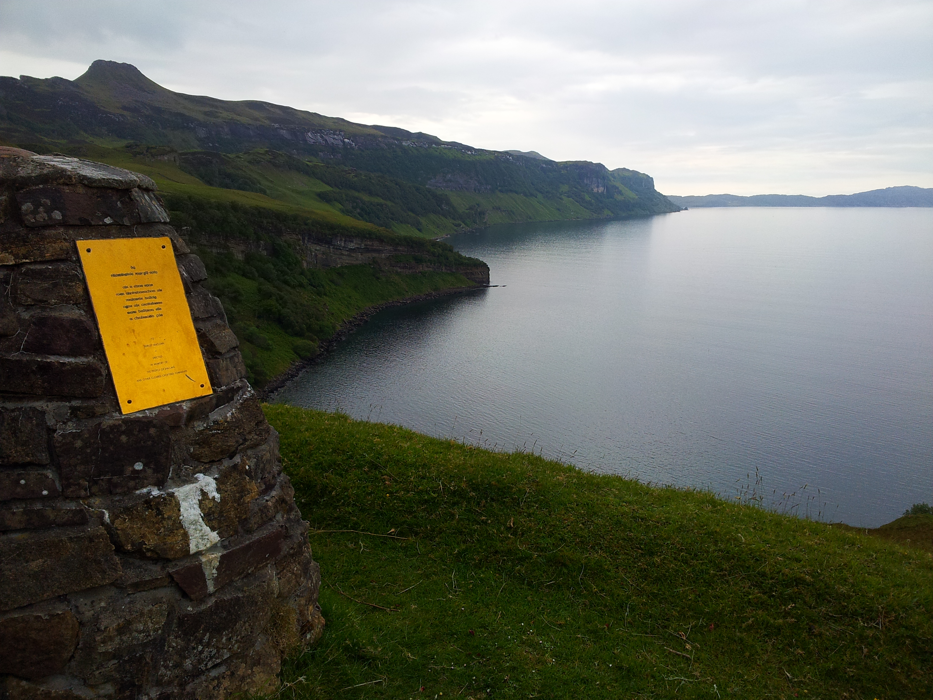
Hallaig

Hallaig is the most recognized poem of Sorley MacLean, an important Scottish poet of the 20th century. After writing it, MacLean rose to fame in the English...

Inner Sound, Scotland

The Inner Sound (Scottish Gaelic: An Lighe Rathairseach) is a strait separating the Inner Hebridean islands of Skye, Raasay and South Rona from the Applecross...

Eilean Fladday

Eilean Fladday (also Fladda; Scottish Gaelic: Eilean Fladaigh) is a previously populated tidal island off Raasay, near the Isle of Skye, Scotland. ��2...

Nearby Amenities

Located within 500m of 57.419431,-6.0274434
Source: PGS
Lat/Long: 57.4235782/-6.0259767
Source: PGS
Lat/Long: 57.4233496/-6.0257267
Created By: dmgroom_coastlines
Source: PGS
Lat/Long: 57.42287/-6.02538
Created By: dmgroom_coastlines
Source: PGS
Lat/Long: 57.42261/-6.0254
Created By: dmgroom_coastlines
Source: PGS
Lat/Long: 57.42236/-6.02542
Source: PGS
Lat/Long: 57.4218209/-6.0247951
Source: PGS
Lat/Long: 57.4216092/-6.0246699
Source: PGS
Lat/Long: 57.4213223/-6.02411
Source: PGS
Lat/Long: 57.4211466/-6.0234134
Source: PGS
Lat/Long: 57.4203839/-6.0235617
Source: PGS
Lat/Long: 57.4187465/-6.0234604
Source: PGS
Lat/Long: 57.4184378/-6.0227022
Source: PGS
Lat/Long: 57.4182613/-6.0221612
Source: PGS
Lat/Long: 57.4173646/-6.021681
Source: PGS
Lat/Long: 57.4169267/-6.0219778
Created By: dmgroom_coastlines
Source: PGS
Lat/Long: 57.41664/-6.02209
The data included in this document is from www.openstreetmap.org. The data is made available under ODbL.

Have you been to Creag na Bruaich?

Leave your review of Creag na Bruaich below (or comments, questions and feedback).