Trewey Cliff

Cliff, Slope in Cornwall

England

Trewey Cliff

Coastal views near Zennor in the fading light
Coastal views near Zennor in the fading light Credit: thejackrustles

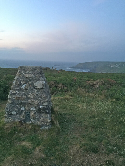
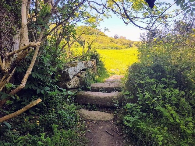
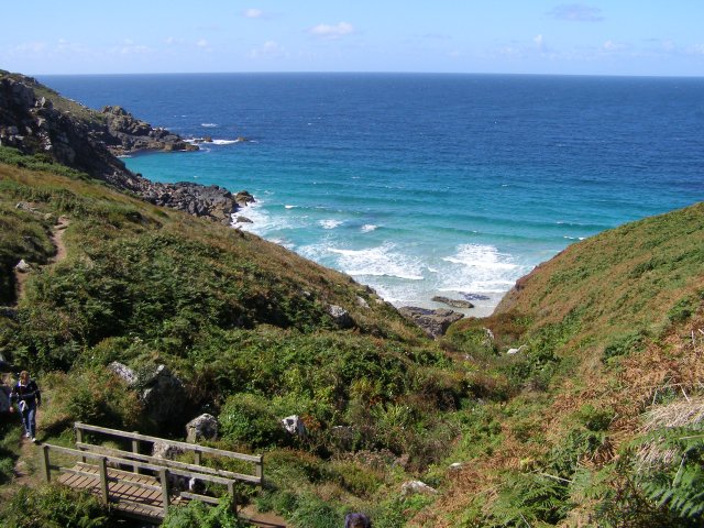
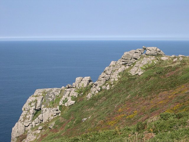
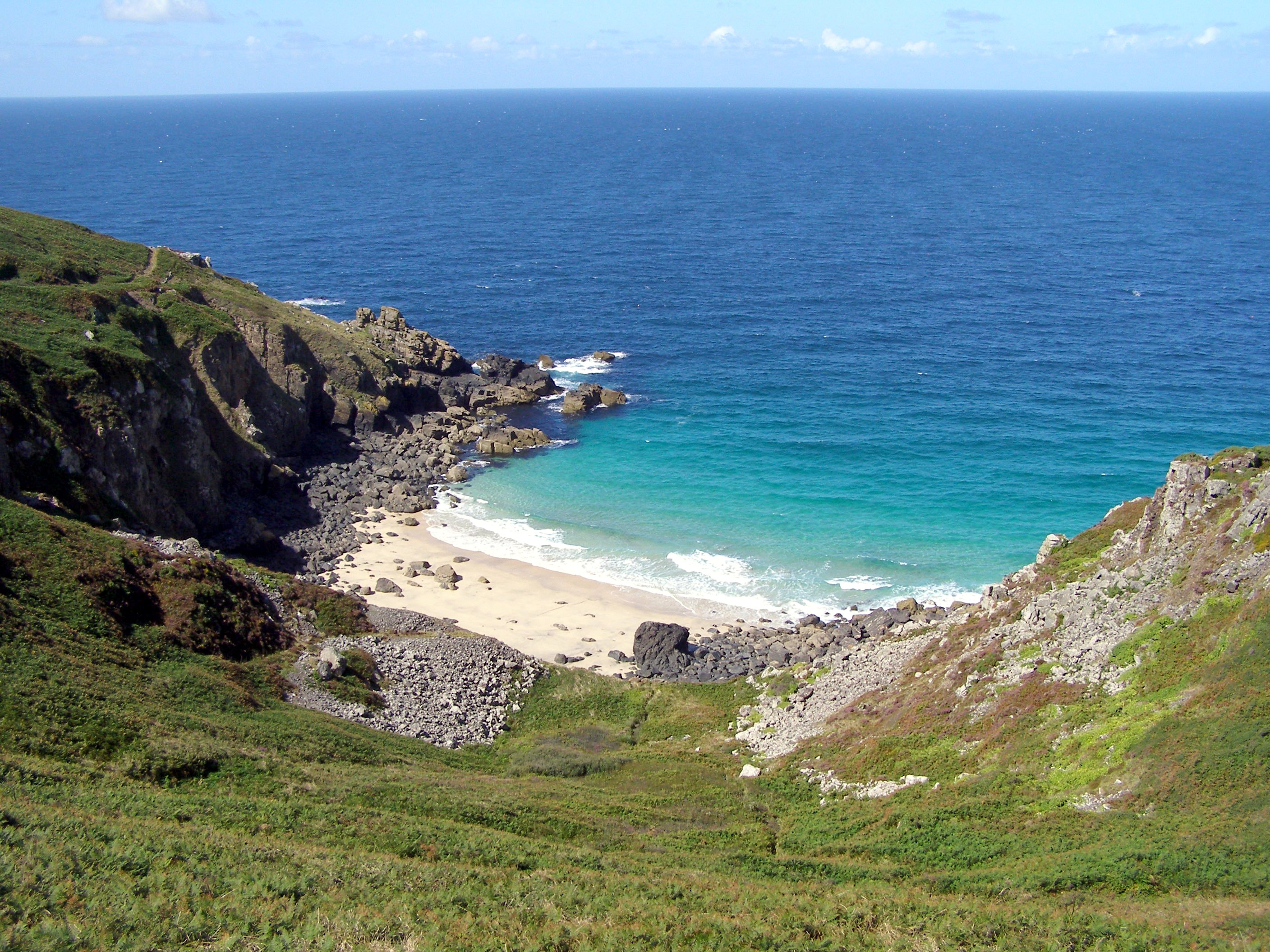
Trewey Cliff is a remarkable natural formation located in Cornwall, England. This stunning cliff is situated near the village of Zennor, on the rugged and picturesque coastline of the county. Rising approximately 200 feet above sea level, Trewey Cliff offers breathtaking views of the Atlantic Ocean and the surrounding landscape.

The cliff's distinctive geological features make it an attractive destination for both nature enthusiasts and hikers. Its rugged slopes are composed of ancient rocks, predominantly granite, that have been shaped by millions of years of erosion. The cliff's formation is further accentuated by the presence of unique rock formations, such as sea stacks and caves, which add to its allure.

The area surrounding Trewey Cliff is home to a rich variety of flora and fauna. The cliff's exposed position makes it an ideal habitat for numerous seabird species, including gulls and fulmars, who nest and hunt along its sheer face. The cliff's vegetation is adapted to the harsh coastal conditions, with hardy plants such as thrift and sea campion adding splashes of color to the landscape.

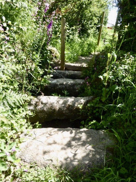
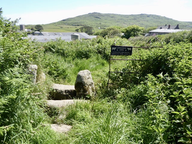
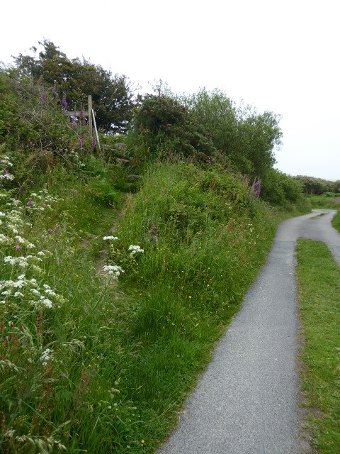
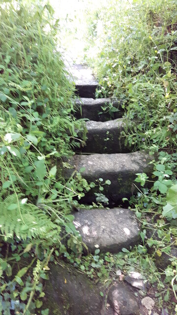
Trewey Cliff is a popular spot for outdoor activities such as hiking and birdwatching. The South West Coast Path, a long-distance trail that stretches along the entire Cornish coastline, passes by the cliff, providing visitors with an opportunity to explore the area's natural beauty. Additionally, the cliff's proximity to Zennor allows for easy access to amenities and accommodations, making it a convenient destination for tourists.

In conclusion, Trewey Cliff is an awe-inspiring natural wonder in Cornwall, offering stunning views, unique geological formations, and a diverse array of wildlife. Whether you are seeking a peaceful hike, an opportunity to observe seabirds in their natural habitat, or simply a chance to marvel at the beauty of the Cornish coast, Trewey Cliff promises an unforgettable experience.

If you have any feedback on the listing, please let us know in the comments section below.

Trewey Cliff Images

Images are sourced within 2km of 50.195006/-5.5768288 or Grid Reference SW4438. Thanks to Geograph Open Source API. All images are credited.

Coastal views near Zennor in the fading light
Footpath to Zennor Head
Zennor Cliff Trig Point Flush Bracket S8143
Stone Stile Sw4337a Zennor A cattle stile with two steps each side situated at the commencement of a footpath heading off the B3306. There is a small stream here. Public footpath 120/9/1 B3306 to Treen.
Stone Stile Sw4337a Zennor
A cattle stile with two steps each side situated at the commencement of a footpath heading off the B3306. There is a small stream here. Public footpath 120/9/1 B3306 to Treen.
Stone Stile SW4337a Zennor Cattle stile with two steps each side, situated at the commencement of a footpath heading off the B3306. There is a small stream here. Looking west, the yellow-painted Gurnard's Head inn can be seen, approximately a quarter of a mile away at Treen. Public footpath 120/9/1 B3306 to Treen
Stone Stile SW4337a Zennor
Cattle stile with two steps each side, situated at the commencement of a footpath heading off the B3306. There is a small stream here. Looking west, the yellow-painted Gurnard's Head inn can be seen, approximately a quarter of a mile away at Treen. Public footpath 120/9/1 B3306 to Treen
Stone Stile SW4438a One of several stiles on a footpath across fields in a westerly direction to Poniou. 
A simple coffen-type stile of granite slabs.
Public footpath 120/6/1 gold Trewey to Poniou.
Stone Stile SW4438a
One of several stiles on a footpath across fields in a westerly direction to Poniou. A simple coffen-type stile of granite slabs. Public footpath 120/6/1 gold Trewey to Poniou.
Stone Stile SW4438c One of several stiles on a footpath across fields in a westerly direction to Poniou. 
A coffen-type, which seems to be quite common in the area. As with other stiles, electric fencing could be in use here so take care.
Public footpath 120/6/1 gold Trewey to Poniou.
Stone Stile SW4438c
One of several stiles on a footpath across fields in a westerly direction to Poniou. A coffen-type, which seems to be quite common in the area. As with other stiles, electric fencing could be in use here so take care. Public footpath 120/6/1 gold Trewey to Poniou.
Stone Stile SW4438d One of several stiles on a footpath across fields in a westerly direction to Poniou. 
A coffen-type Situated by a metal gate, this is a small stile which at the time of recording could have done with digging out, as some of the cross-stones were buried in the grass.
Public footpath 120/7/1 gold Trewey to Poniou.
Stone Stile SW4438d
One of several stiles on a footpath across fields in a westerly direction to Poniou. A coffen-type Situated by a metal gate, this is a small stile which at the time of recording could have done with digging out, as some of the cross-stones were buried in the grass. Public footpath 120/7/1 gold Trewey to Poniou.
Stone Stile SW4438e One of several stiles on a footpath across fields in a westerly direction to Poniou.  The path exits onto a drive serving Carnelloe Farm to the right and Poniou to the left.
A coffen-type with five large steps. The stile has a pole structure on the field (east) side, with a hook and loop handle for passing through the electric fence.
Public footpath 120/7/1 gold Trewey to Poniou.
Stone Stile SW4438e
One of several stiles on a footpath across fields in a westerly direction to Poniou. The path exits onto a drive serving Carnelloe Farm to the right and Poniou to the left. A coffen-type with five large steps. The stile has a pole structure on the field (east) side, with a hook and loop handle for passing through the electric fence. Public footpath 120/7/1 gold Trewey to Poniou.
Stone Stile SW4438e On the coast path next to an information plaque about Carnelloe historic mining activity. Large stones, (not granite) presumably from the near vicinity. A simple step-over stile. 
Cattle stile with one step each side.
Public footpath 120/23/9 gold CP Carnelloe Cliff.
Stone Stile SW4438e
On the coast path next to an information plaque about Carnelloe historic mining activity. Large stones, (not granite) presumably from the near vicinity. A simple step-over stile. Cattle stile with one step each side. Public footpath 120/23/9 gold CP Carnelloe Cliff.
Stone Stile SW4438g One of several stiles on a field path heading west to Poniou.
A very well defined coffen-type stile with five steps. The wall it cuts through is of sound build.
Public footpath 120/6/1 gold Zennor to Poniou.
Stone Stile SW4438g
One of several stiles on a field path heading west to Poniou. A very well defined coffen-type stile with five steps. The wall it cuts through is of sound build. Public footpath 120/6/1 gold Zennor to Poniou.
Stone Stile SW4538a One of several stiles on a footpath across fields in a westerly direction to Poniou. 
This one is situated behind farm buildings at Trewey. 
Cattle stile with massive granite steps and no central raised slab.
Public footpath 120/6/1 gold Trewey to Poniou.
Stone Stile SW4538a
One of several stiles on a footpath across fields in a westerly direction to Poniou. This one is situated behind farm buildings at Trewey. Cattle stile with massive granite steps and no central raised slab. Public footpath 120/6/1 gold Trewey to Poniou.
Stone Stile SW4538b One of several stiles on a footpath across fields in a westerly direction to Poniou. Field wall is not in good condition but stile is sound.
Cattle stile with massive granite steps and no central raised slab.
Public footpath 120/6/1 gold Trewey to Poniou.
Stone Stile SW4538b
One of several stiles on a footpath across fields in a westerly direction to Poniou. Field wall is not in good condition but stile is sound. Cattle stile with massive granite steps and no central raised slab. Public footpath 120/6/1 gold Trewey to Poniou.
Stone Stile SW4538c One of several stiles on a footpath across fields in a westerly direction to Poniou. This stile may have electric fencing here if stock is in the field. 
Cattle stile with massive granite steps. Large granite slabs make up the build, but field wall is not in good condition.
Public footpath 120/6/1 gold Trewey to Poniou.
Stone Stile SW4538c
One of several stiles on a footpath across fields in a westerly direction to Poniou. This stile may have electric fencing here if stock is in the field. Cattle stile with massive granite steps. Large granite slabs make up the build, but field wall is not in good condition. Public footpath 120/6/1 gold Trewey to Poniou.
Stone Stile SW4538d This stile can be found where the cliff path splits. To the northwest is Zennor Head, (National Trust marker), to the southeast the path heads inland towards Zennor village. 
Low cattle stile. The upright granite post has a piece of ironmongery in it, presumably from a former gate. Was the gate removed and an extra block added, by-passing the older upright block stile alongside?
Public footpath 120/23/9 gold CP Carnelloe Cliff to Zennor Head
Stone Stile SW4538d
This stile can be found where the cliff path splits. To the northwest is Zennor Head, (National Trust marker), to the southeast the path heads inland towards Zennor village. Low cattle stile. The upright granite post has a piece of ironmongery in it, presumably from a former gate. Was the gate removed and an extra block added, by-passing the older upright block stile alongside? Public footpath 120/23/9 gold CP Carnelloe Cliff to Zennor Head
Stone Stile SW4637b On an access drive to Rosemorran and Foage Farm, from its junction with the B3306 at Zennor. About halfway between the two properties a footpath rises left from the drive, heading steeply north to Zennor Hill. A marker stone indicates the path leads to Zennor Hill and the quoit. 
Granite steps.
Footpath from access drive to public footpath 120/4/1 gold.
Stone Stile SW4637b
On an access drive to Rosemorran and Foage Farm, from its junction with the B3306 at Zennor. About halfway between the two properties a footpath rises left from the drive, heading steeply north to Zennor Hill. A marker stone indicates the path leads to Zennor Hill and the quoit. Granite steps. Footpath from access drive to public footpath 120/4/1 gold.
Stone Stile SW4639a Tregerthen farm, off the B3306 between Zennor and St Ives. Tregerthen side of stream which forms the boundary between Wicca and Tregerthen farms.
Coffen stile with four steps. The ‘T’ mark on one of the central stones may be a quarrying mark or ‘T’ for Tregerthen.
Public footpath 120/1/2 gold from Zennor to Trowan and thence St Ives.
Grade II listed no. 1265007
Surveyed by Linda Camidge
Stone Stile SW4639a
Tregerthen farm, off the B3306 between Zennor and St Ives. Tregerthen side of stream which forms the boundary between Wicca and Tregerthen farms. Coffen stile with four steps. The ‘T’ mark on one of the central stones may be a quarrying mark or ‘T’ for Tregerthen. Public footpath 120/1/2 gold from Zennor to Trowan and thence St Ives. Grade II listed no. 1265007 Surveyed by Linda Camidge
Stone Stile SW4639b Boundary of Tregerthen/Wicca farms, off the B3306 between Zennor and St Ives.
Coffen stile with five steps. Note quarrying mark or an abraded ‘T’ for ‘Tregerthen’.
Public footpath 120/1/2 gold from Zennor to Trowan and thence St Ives
Stone Stile SW4639b
Boundary of Tregerthen/Wicca farms, off the B3306 between Zennor and St Ives. Coffen stile with five steps. Note quarrying mark or an abraded ‘T’ for ‘Tregerthen’. Public footpath 120/1/2 gold from Zennor to Trowan and thence St Ives
Show me another place!

Trewey Cliff is located at Grid Ref: SW4438 (Lat: 50.195006, Lng: -5.5768288)

Unitary Authority: Cornwall

Police Authority: Devon and Cornwall

What 3 Words

///indicated.respects.obviously. Near St Ives, Cornwall

Related Wikis

Pendour Cove

Pendour Cove (grid reference SW447389) is a beach in west Cornwall, England, UK. It is about 1 mile northwest of the village of Zennor, and immediately...

Zennor Head

Zennor Head ; (Cornish: Penn Senar) is a 750-metre (2,460 ft) long promontory on the Cornish coast of England, between Pendour Cove and Porthzennor Cove...

Veor Cove

Veor Cove (grid reference SW444388) is a beach in Cornwall, UK. It is about 1 mile northwest of the village of Zennor, and immediately to the west of Pendour...

Tinner's Arms

The Tinner's Arms is a Grade II-listed traditional Cornish pub in Zennor, Cornwall. The name is derived from the Tinners, with records of tin extraction...

Nearby Amenities

Located within 500m of 50.195006,-5.5768288
Source: Bing
Lat/Long: 50.1954684/-5.5770904
Pendour Cove
Natural: bay
Lat/Long: 50.1957417/-5.5779643
Entrance: yes
Lat/Long: 50.1951044/-5.5720934
Entrance: yes
Lat/Long: 50.1954663/-5.5720733
Entrance: yes
Lat/Long: 50.1959956/-5.5712968
Entrance: yes
Lat/Long: 50.1959097/-5.5710192
Entrance: yes
Lat/Long: 50.1952993/-5.5710286
Entrance: yes
Lat/Long: 50.1956384/-5.5717266
Entrance: yes
Lat/Long: 50.1947902/-5.5703098
Entrance: yes
Lat/Long: 50.1957157/-5.5715999
Entrance: yes
Lat/Long: 50.1948108/-5.5724287
Entrance: yes
Lat/Long: 50.1934714/-5.5707899
Entrance: yes
Lat/Long: 50.194306/-5.57024
Zennor Cliff
Description: OS trig pillar
Ele: 95.707
Man Made: survey_point
Note: Accurate location import for imagery offset calibration
Ref: S8143
Source: Ordnance Survey (OGL)
Survey Point: pillar
Lat/Long: 50.1975167/-5.5748278
Bench
Lat/Long: 50.1941274/-5.5776081
The data included in this document is from www.openstreetmap.org. The data is made available under ODbL.

Have you been to Trewey Cliff?

Leave your review of Trewey Cliff below (or comments, questions and feedback).