Badshot Lea

Settlement in Surrey Waverley

England

Badshot Lea

Oast House -
Oast House Credit: Oast House Archive

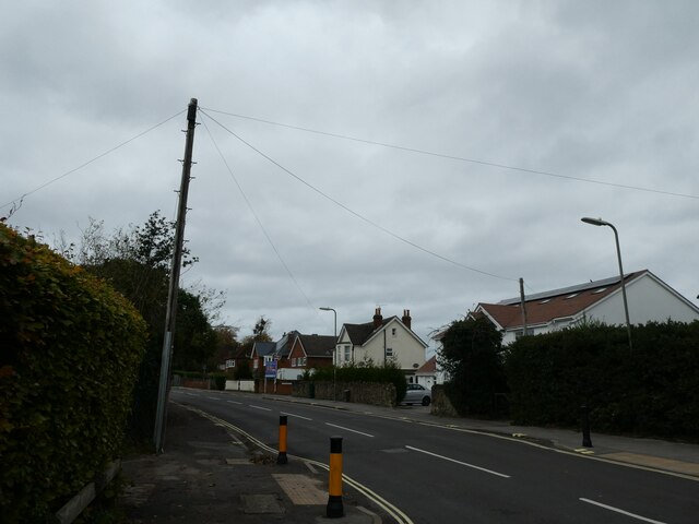
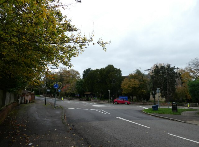
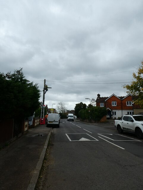
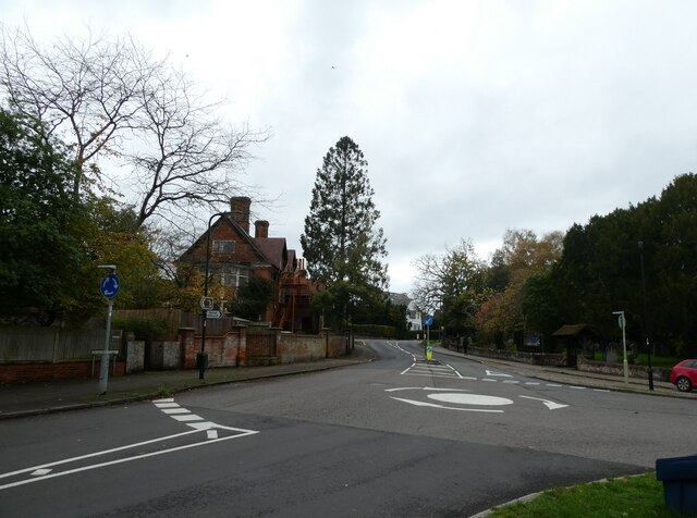
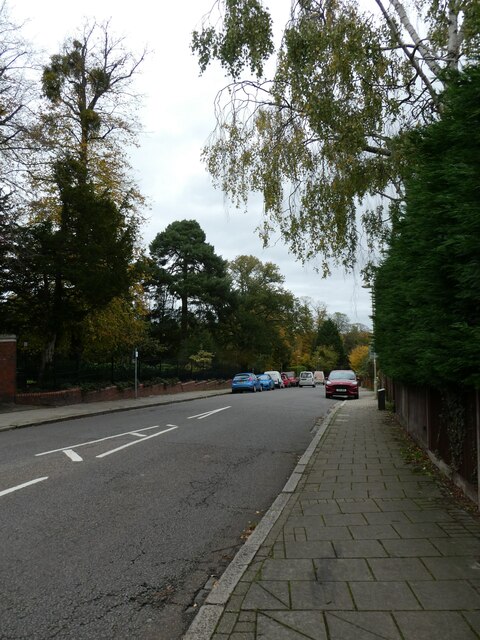
Badshot Lea is a small village located in the county of Surrey, England. Situated approximately 2 miles south of Farnham, the village is nestled amidst the picturesque countryside of the South East.

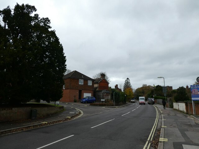
Known for its rural charm and tranquil atmosphere, Badshot Lea offers a peaceful retreat for its residents. The village is primarily residential, with a mix of detached houses and small cottages, giving it a distinct character. The surrounding landscape is dotted with lush green fields, rolling hills, and dense woodlands, making it an ideal place for nature lovers and outdoor enthusiasts.

Despite its rural setting, Badshot Lea benefits from good transport links, with the A31 road running nearby, providing easy access to Farnham and other neighboring towns. The village also has its own railway station, allowing for convenient travel to London and other major cities.

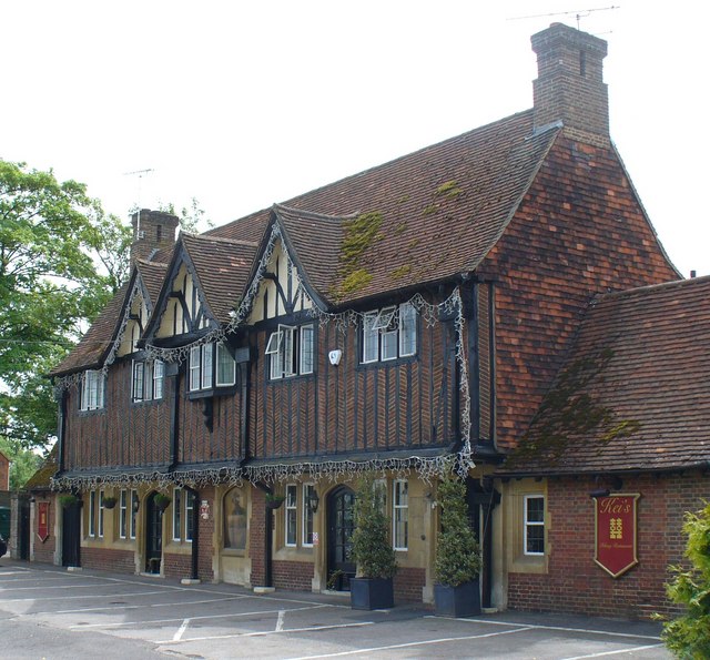
Local amenities in Badshot Lea include a small selection of shops, including a convenience store and a few local businesses. There are also a couple of traditional pubs and restaurants, providing a cozy atmosphere for visitors and residents alike.

For those seeking recreational activities, the village is home to a golf club and a leisure center, offering opportunities for sports and fitness. Additionally, the nearby Alice Holt Forest provides ample space for walking, cycling, and exploring nature trails.

Overall, Badshot Lea's idyllic setting, combined with its convenient location and range of amenities, make it an appealing place to live or visit for those looking for a quiet countryside retreat in Surrey.

If you have any feedback on the listing, please let us know in the comments section below.
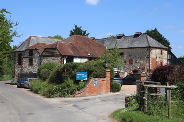
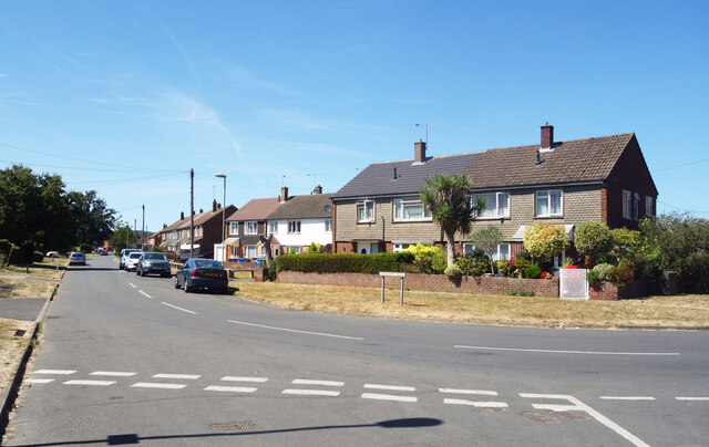
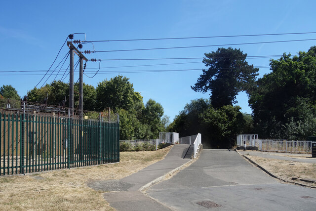
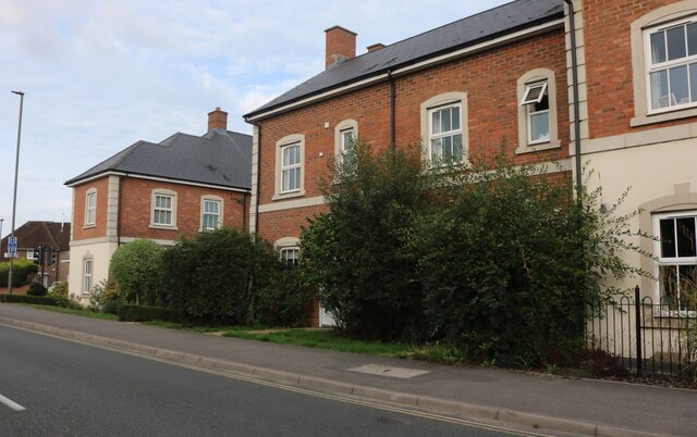
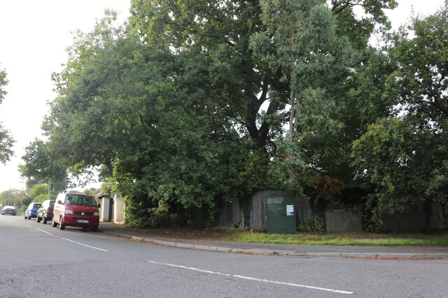
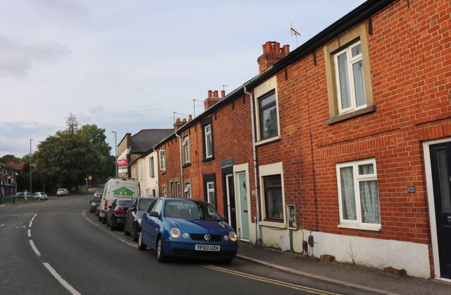
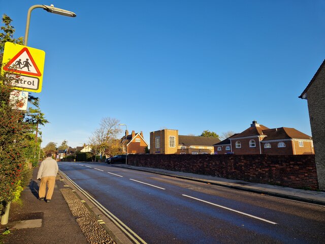
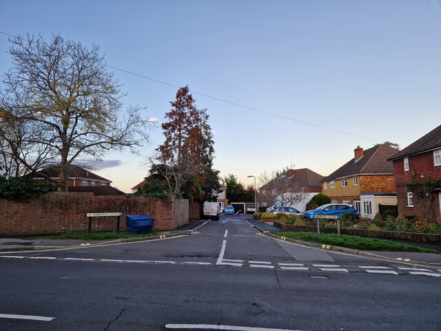
Badshot Lea Images

Images are sourced within 2km of 51.230614/-0.762512 or Grid Reference SU8648. Thanks to Geograph Open Source API. All images are credited.

Oast House -
Oast House
-
Tongham Road, Aldershot
Bridge over the Blackwater This leads to an underpass beneath the A331 and is blocked by bollards at the far end. I would guess it's for emergency vehicles only.
A small electricity sub station is on the left.
Bridge over the Blackwater
This leads to an underpass beneath the A331 and is blocked by bollards at the far end. I would guess it's for emergency vehicles only. A small electricity sub station is on the left.
Hale Road, Farnham
Hale Road, Farnham
South Avenue at the junction of Farnborough Road
South Avenue, Hale
South Avenue, Hale
Farnborough Road, Heath End
Optiplan Kitchens on Farnborough Road, Heath End With a nice ghost sign above it.
Optiplan Kitchens on Farnborough Road, Heath End
With a nice ghost sign above it.
Looking north-west in Church Lane East The pedestrian is just passing St Michael's Junior School, with Park Church just ahead of him on the opposite side of the road
Looking north-west in Church Lane East
The pedestrian is just passing St Michael's Junior School, with Park Church just ahead of him on the opposite side of the road
Looking from Church Lane East into Warwick Close
Looking north-west along Church Lane East
Approaching the junction of Church Lane East and Lee Court
Looking from Church Lane East into Samson Close
Mending a telegraph pole in Church Lane East The very first lines that were hung from poles were telegraph wires. Places was connected to the network with just one or two lines –  very few poles were needed. With the invention of the telephone, this all changed. At first, rival companies did not want to share their poles with one another. Inevitably, legislation was passed to compel it.

Most telegraph poles are about 30ft above the ground with 6 feet planted in the ground.They are tested by a B.T. Openreach  operative after they have been “planted” for twelve years and then at ten yearly intervals. Telegraph poles are still plentiful in the UK and Ireland although they have been completely eradicated in Holland. 

They also have their own web site <span class="nowrap"><a title="https://www.telegraphpoleappreciationsociety.org/" rel="nofollow ugc noopener" href="https://www.telegraphpoleappreciationsociety.org/">Link</a><img style="margin-left:2px;" alt="External link" title="External link - shift click to open in new window" src="https://s1.geograph.org.uk/img/external.png" width="10" height="10"/></span>
Mending a telegraph pole in Church Lane East
The very first lines that were hung from poles were telegraph wires. Places was connected to the network with just one or two lines – very few poles were needed. With the invention of the telephone, this all changed. At first, rival companies did not want to share their poles with one another. Inevitably, legislation was passed to compel it. Most telegraph poles are about 30ft above the ground with 6 feet planted in the ground.They are tested by a B.T. Openreach operative after they have been “planted” for twelve years and then at ten yearly intervals. Telegraph poles are still plentiful in the UK and Ireland although they have been completely eradicated in Holland. They also have their own web site LinkExternal link
Approaching a roundabout in Church Lane East  You know that word association game: black-white; Morecambe-Wise; Milton Keynes-roundabouts. A friend of mine supervises Geography dissertations for the University of Portsmouth. He always gives students two actual titles he has rejected: 'Rivers' (too broad) and 'The Roundabouts of Basingstoke' (too narrow)) But where did the idea for an "island", around which traffic could flow, come from? It was a Frenchman. In 1791 the architect and engineer Pierre L'Enfant proposed a number of circular intersections in Washington, D.C.  Fast forward to 1905 and we have New York City's Columbus Circle, widely considered the country's first circular intersection designed for the automotive era.  Known as rotaries, they certainly sped up traffic- but also the number of collisions . Then in 1966 the UK came up with a marvellous idea: this required vehicles entering a circular intersection to yield to those already on it. As to the two countries that started them, France has the highest roundabout ratio with one roundabout for every 45 intersections and the US one roundabout for every 1,118 intersections.
Approaching a roundabout in Church Lane East
You know that word association game: black-white; Morecambe-Wise; Milton Keynes-roundabouts. A friend of mine supervises Geography dissertations for the University of Portsmouth. He always gives students two actual titles he has rejected: 'Rivers' (too broad) and 'The Roundabouts of Basingstoke' (too narrow)) But where did the idea for an "island", around which traffic could flow, come from? It was a Frenchman. In 1791 the architect and engineer Pierre L'Enfant proposed a number of circular intersections in Washington, D.C. Fast forward to 1905 and we have New York City's Columbus Circle, widely considered the country's first circular intersection designed for the automotive era. Known as rotaries, they certainly sped up traffic- but also the number of collisions . Then in 1966 the UK came up with a marvellous idea: this required vehicles entering a circular intersection to yield to those already on it. As to the two countries that started them, France has the highest roundabout ratio with one roundabout for every 45 intersections and the US one roundabout for every 1,118 intersections.
Looking south-east along Church Lane East
Roundabout in Church Lane East You know that word association game: black-white; Morecambe-Wise; Milton Keynes-roundabouts. A friend of mine supervises Geography dissertations for the University of Portsmouth. He always gives students two actual titles he has rejected: 'Rivers' (too broad) and 'The Roundabouts of Basingstoke' (too narrow)) But where did the idea for an "island", around which traffic could flow, come from? It was a Frenchman. In 1791 the architect and engineer Pierre L'Enfant proposed a number of circular intersections in Washington, D.C.  Fast forward to 1905 and we have New York City's Columbus Circle, widely considered the country's first circular intersection designed for the automotive era.  Known as rotaries, they certainly sped up traffic- but also the number of collisions . Then in 1966 the UK came up with a marvellous idea: this required vehicles entering a circular intersection to yield to those already on it. As to the two countries that started them, France has the highest roundabout ratio with one roundabout for every 45 intersections and the US one roundabout for every 1,118 intersections.
Roundabout in Church Lane East
You know that word association game: black-white; Morecambe-Wise; Milton Keynes-roundabouts. A friend of mine supervises Geography dissertations for the University of Portsmouth. He always gives students two actual titles he has rejected: 'Rivers' (too broad) and 'The Roundabouts of Basingstoke' (too narrow)) But where did the idea for an "island", around which traffic could flow, come from? It was a Frenchman. In 1791 the architect and engineer Pierre L'Enfant proposed a number of circular intersections in Washington, D.C. Fast forward to 1905 and we have New York City's Columbus Circle, widely considered the country's first circular intersection designed for the automotive era. Known as rotaries, they certainly sped up traffic- but also the number of collisions . Then in 1966 the UK came up with a marvellous idea: this required vehicles entering a circular intersection to yield to those already on it. As to the two countries that started them, France has the highest roundabout ratio with one roundabout for every 45 intersections and the US one roundabout for every 1,118 intersections.
Looking north-east along Church Hill
Show me another place!

Badshot Lea is located at Grid Ref: SU8648 (Lat: 51.230614, Lng: -0.762512)

Administrative County: Surrey

District: Waverley

Police Authority: Surrey

What 3 Words

///filled.vivid.throw. Near Hale, Surrey

Nearby Locations

Badshot Lea

Related Wikis

Badshot Lea

Badshot Lea is a small village in Surrey, England, and close to Aldershot. Badshot Lea has access in either direction to the A31 and A331 and is connected...

Badshot Lea Long Barrow

Badshot Lea Long Barrow, also known as Farnham Long Barrow, was an unchambered long barrow located near the village of Badshot Lea in the south-eastern...

Brickfields Country Park

Brickfields Country Park is a park in Aldershot in Hampshire described as one of the smallest country parks in Britain. The park is owned and maintained...

All Hallows Catholic School

All Hallows Catholic School is a mixed, voluntary-aided comprehensive secondary school and Sixth Form in Weybourne, Farnham, Surrey, England. It is a Roman...

Weybourne LNR

Weybourne LNR is a 2.4-hectare (5.9-acre) Local Nature Reserve on the southern outskirts of Weybourne in Surrey. It is owned and managed by Waverley Borough...

Aldershot Ice Rink

Aldershot Ice Rink was an ice rink venue located in Pool Road, Aldershot, Hampshire, England. It was opened on 24 July 1987 and closed on 15 October 1991...

Weybourne, Surrey

Weybourne is a small village in Surrey, England. It lies on the outskirts of Farnham, Surrey and borders onto Aldershot, Hampshire. == Geography == Weybourne...

Runfold

Runfold is a village in Surrey, U.K., about 2 mi (3.2 km) ENE of Farnham. Runfold lies on the ancient trackway known as the Pilgrims' Way and on the former...

Related Videos

Easter VLOG | Rowhill Nature Reserve | Blackwaer Valley | Tice's Meadow | Hiking Family Trip | UK

Watch in my Easter VLOG how we hike at Rowhill Nature Reserve, Blackwater Valley, Tice's Meadow and Aldershot's Ivy Fields.

Wellington to Caesar Camp

Nice walk in the local area of Aldershot. Starting at Wellington Monument. Was a wet and rainy day but the end was worth the ...

Travel with me #beltonlake #texas A dayout with my colleagues.

Travel with me / #beltonlake #texas A day out with my colleagues This video is captured by myself with the camera of ...

Nearby Amenities

Located within 500m of 51.230614,-0.762512
Badshot Lea
Place: village
Source: npe
Wikidata: Q4841155
Lat/Long: 51.2307411/-0.7621063
Turning Circle
Turning Circle: hammer
Lat/Long: 51.2312681/-0.7643698
Bus Stop
Sandown Crescent
Bench: no
Bin: no
Bus: yes
Lit: no
Naptan AtcoCode: 1900HA090279
Naptan Bearing: NE
Naptan CommonName: Sandown Crescent
Naptan Crossing: Andover Way
Naptan NaptanCode: hamgwtwd
Naptan PlusbusZoneRef: ALDRSHT
Naptan Street: Badshot Lea Road
Naptan Verified: no
Public Transport: platform
Shelter: no
Source: naptan_import
Tactile Paving: yes
Lat/Long: 51.234191/-0.7585563
Bus Stop
Crossroads
Bench: no
Bin: no
Bus: yes
Departures Board: timetable
Lit: yes
Naptan AtcoCode: 40004411375A
Naptan Bearing: SW
Naptan CommonName: Crossroads
Naptan Indicator: adj
Naptan Landmark: St. Georges Road
Naptan NaptanCode: surgjgda
Naptan PlusbusZoneRef: ALDRSHT
Naptan Street: Badshot Lea Road
Naptan Verified: no
Public Transport: platform
Shelter: no
Source: naptan_import
Tactile Paving: no
Lat/Long: 51.2302688/-0.7628501
Bus Stop
Crossroads
Bench: no
Bin: no
Bus: yes
Lit: yes
Naptan AtcoCode: 40004411375B
Naptan Bearing: NE
Naptan CommonName: Crossroads
Naptan Indicator: Just after
Naptan Landmark: Lower Weybourne Road
Naptan NaptanCode: surgjgdg
Naptan PlusbusZoneRef: ALDRSHT
Naptan Street: Badshot Lea Road
Naptan Verified: no
Public Transport: platform
Shelter: no
Source: naptan_import
Tactile Paving: no
Lat/Long: 51.2313928/-0.7617962
Bus Stop
Beech Tree Drive
Bench: yes
Bin: yes
Bus: yes
Departures Board: realtime
Lit: yes
Naptan AtcoCode: 40004411555A
Naptan Bearing: SW
Naptan CommonName: Beech Tree Drive
Naptan Indicator: Just Before
Naptan Landmark: Beech Tree Drive
Naptan NaptanCode: surgjtgp
Naptan PlusbusZoneRef: ALDRSHT
Naptan Street: Badshot Lea Road
Naptan Verified: no
Public Transport: platform
Shelter: yes
Source: naptan_import
Tactile Paving: no
Lat/Long: 51.2284017/-0.765011
Crossing
Crossing: unmarked
Crossing Island: no
Crossing Markings: no
Tactile Paving: no
Lat/Long: 51.2295745/-0.7617158
Turning Circle
Lat/Long: 51.2295688/-0.7608207
Turning Circle
Lat/Long: 51.2281699/-0.7671162
Barrier: bollard
Bollard: fixed
Lat/Long: 51.2275387/-0.7585399
Pub
Cricketers
Addr City: Farnham
Addr Housenumber: 22
Addr Postcode: GU9 9LU
Addr Street: Badshot Lea Road
Addr Suburb: Badshot Lea
Contact Website: https://www.thecricketerspub.co.uk/
Fhrs Id: 406888
Source Addr: FHRS Open Data
Lat/Long: 51.2309583/-0.7619208
Pub
The Crown
Addr City: Farnham
Addr County: Surrey
Addr Postcode: GU9 9JS
Addr Street: Pine View Close
Addr Suburb: Badshot Lea
Brand: Fuller's
Brand Wikidata: Q5253950
Fhrs Id: 161241
Source Addr: FHRS Open Data
Website: https://www.crownbadshotlea.co.uk/
Lat/Long: 51.2283057/-0.7660692
Mini Roundabout
Lat/Long: 51.2272646/-0.7661596
Crossing
Crossing: unmarked
Crossing Island: no
Crossing Markings: no
Tactile Paving: no
Lat/Long: 51.2324966/-0.7673029
Post Box
Collection Times: Mo-Fr 17:00; Sa 12:00
Ref: GU9 97
Lat/Long: 51.2270179/-0.7661689
Crossing
Crossing: uncontrolled
Crossing Island: no
Kerb: lowered
Sloped Curb: yes
Tactile Paving: yes
Lat/Long: 51.2306591/-0.7623361
Barrier: swing_gate
Lat/Long: 51.2335263/-0.76198
Crossing
Crossing: unmarked
Crossing Island: no
Kerb: lowered
Sloped Curb: yes
Source: survey
Tactile Paving: no
Lat/Long: 51.2323732/-0.7649063
Barrier: kerb
Kerb: lowered
Tactile Paving: yes
Lat/Long: 51.2278968/-0.7588896
Barrier: kerb
Kerb: lowered
Tactile Paving: yes
Lat/Long: 51.2279849/-0.7589043
Barrier: kerb
Kerb: flush
Tactile Paving: yes
Lat/Long: 51.2300209/-0.760377
Barrier: kerb
Kerb: lowered
Tactile Paving: no
Lat/Long: 51.2277003/-0.7657519
Barrier: kerb
Kerb: raised
Tactile Paving: no
Lat/Long: 51.2280766/-0.7655912
Crossing
Crossing: unmarked
Crossing Island: no
Crossing Markings: no
Tactile Paving: no
Lat/Long: 51.2291319/-0.7645746
Crossing
Crossing: unmarked
Crossing Island: yes
Crossing Markings: no
Kerb: lowered
Tactile Paving: no
Lat/Long: 51.2276238/-0.7658917
Crossing
Crossing: unmarked
Crossing Island: yes
Crossing Markings: no
Kerb: lowered
Tactile Paving: no
Lat/Long: 51.2276782/-0.7657894
Crossing: informal
Lat/Long: 51.2281519/-0.7654931
Crossing
Crossing: unmarked
Crossing Island: no
Crossing Markings: no
Tactile Paving: no
Lat/Long: 51.2282405/-0.7651753
Crossing
Crossing: unmarked
Crossing Island: no
Crossing Markings: no
Tactile Paving: yes
Lat/Long: 51.2300556/-0.7604998
Crossing
Crossing: unmarked
Crossing Island: no
Crossing Markings: no
Kerb: lowered
Tactile Paving: yes
Lat/Long: 51.2279388/-0.7588963
Crossing
Crossing: uncontrolled
Crossing Island: no
Kerb: lowered
Tactile Paving: yes
Lat/Long: 51.2307837/-0.7623573
Barrier: kerb
Kerb: lowered
Tactile Paving: yes
Lat/Long: 51.2307712/-0.7625529
Traffic Signals
Traffic Signals Direction: forward
Lat/Long: 51.2305925/-0.7625601
Barrier: kerb
Kerb: lowered
Tactile Paving: yes
Lat/Long: 51.23065/-0.7625609
Traffic Signals
Traffic Signals Direction: backward
Lat/Long: 51.2308301/-0.7625683
Traffic Signals
Traffic Signals Direction: backward
Lat/Long: 51.2306176/-0.7622046
Traffic Signals
Traffic Signals Direction: backward
Lat/Long: 51.2308644/-0.7622711
Crossing
Crossing: uncontrolled
Crossing Island: no
Kerb: lowered
Sloped Curb: yes
Tactile Paving: yes
Lat/Long: 51.2307915/-0.762517
Barrier: kerb
Kerb: flush
Tactile Paving: yes
Lat/Long: 51.2308146/-0.7624777
Crossing
Crossing: uncontrolled
Crossing Island: no
Kerb: lowered
Tactile Paving: yes
Lat/Long: 51.2306257/-0.7625199
Barrier: kerb
Kerb: lowered
Tactile Paving: yes
Lat/Long: 51.2306937/-0.7623061
Barrier: kerb
Kerb: flush
Tactile Paving: yes
Lat/Long: 51.2307652/-0.7623184
Crossing
Crossing: unmarked
Crossing Island: yes
Crossing Markings: no
Kerb: lowered
Source: Bing
Tactile Paving: yes
Lat/Long: 51.234197/-0.7584222
Barrier: kerb
Kerb: lowered
Tactile Paving: no
Lat/Long: 51.2324242/-0.7648607
Crossing
Crossing: unmarked
Crossing Island: no
Crossing Markings: no
Kerb: lowered
Source: survey
Tactile Paving: no
Lat/Long: 51.2324554/-0.7668802
Barrier: cycle_barrier
Cycle Barrier: double
Cycle Barrier Installation: fixed
Lat/Long: 51.233478/-0.7571121
Barrier: kerb
Kerb: lowered
Tactile Paving: no
Lat/Long: 51.2323387/-0.7649439
Crossing
Crossing: unmarked
Crossing Island: no
Crossing Markings: no
Kerb: lowered
Source: survey
Tactile Paving: no
Lat/Long: 51.2324497/-0.767377
Barrier: kerb
Kerb: lowered
Tactile Paving: no
Lat/Long: 51.2324595/-0.7667329
Crossing
Crossing: unmarked
Crossing Island: no
Crossing Markings: no
Kerb: lowered
Tactile Paving: no
Lat/Long: 51.2326286/-0.7602561
Barrier: kerb
Kerb: flush
Tactile Paving: no
Lat/Long: 51.2318554/-0.7612954
Crossing
Crossing: unmarked
Crossing Island: no
Crossing Markings: no
Kerb: lowered
Tactile Paving: no
Lat/Long: 51.2318814/-0.7612674
Barrier: kerb
Kerb: flush
Tactile Paving: no
Lat/Long: 51.2319082/-0.7612302
Barrier: kerb
Kerb: lowered
Tactile Paving: no
Lat/Long: 51.2326595/-0.7602105
Barrier: kissing_gate
Lat/Long: 51.2329832/-0.7593304
Park Farm
Place: farm
Lat/Long: 51.2287634/-0.7674057
Speed Camera
Lat/Long: 51.2306355/-0.7625891
Bench
Backrest: no
Check Date: 2021-02-13
Lat/Long: 51.2336588/-0.7578785
Bench
Backrest: yes
Check Date: 2021-04-15
Lat/Long: 51.2305969/-0.7624892
Crossing
Crossing: unmarked
Crossing Island: no
Crossing Markings: no
Kerb: lowered
Tactile Paving: yes
Lat/Long: 51.2304021/-0.7613571
Material: wood
Power: pole
Lat/Long: 51.2346228/-0.7612847
Bicycle Parking
Access: customers
Bicycle Parking: front_wheel
Capacity: 10
Covered: yes
Fee: no
Operator: Squires Garden Centres
Lat/Long: 51.2267033/-0.7657508
Give Way
Source: Bing
Lat/Long: 51.229929/-0.7599193
Petal & Stem Florists
Addr City: Farnham
Addr Postcode: GU9 9JX
Addr Street: Badshot Lea Road
Shop: florist
Lat/Long: 51.226952/-0.7665626
SA Car Sales Ltd
Addr Housenumber: 123a
Addr Postcode: GU9 9LS
Addr Street: Badshot Lea Road
Old Name: Arcus cars
Second Hand: yes
Shop: car
Website: http://arcuscars.co.uk
Lat/Long: 51.2327338/-0.7611319
Crossing
Crossing: unmarked
Crossing Markings: no
Lat/Long: 51.232284/-0.7607615
Entrance: main
Wheelchair: yes
Wheelchair Description: ramp into car sales office
Lat/Long: 51.2325558/-0.7610565
Post Box
Collection Times: Mo-Fr 09:00; Sa 07:00
Drive Through: no
Operator: Royal Mail
Operator Wikidata: Q638098
Post Box Type: wall
Ref: GU9 72D
Royal Cypher: EIIR
Royal Cypher Wikidata: Q33102113
Lat/Long: 51.2310772/-0.762164
Addr City: Farnham
Addr Housenumber: 65
Addr Street: Badshot Lea Road
Disused Shop: yes
Lat/Long: 51.2310657/-0.7622232
Brogan's Barber Shop
Male: yes
Opening Hours: Tu,We,Fr 09:00-19:00; Th 10:00-20:00; Sa-Mo off
Shop: hairdresser
Lat/Long: 51.2310284/-0.7622624
Crossing
Crossing: unmarked
Crossing Island: no
Crossing Markings: no
Tactile Paving: yes
Lat/Long: 51.2283298/-0.7589197
Tice's Meadow
Board Type: nature
Centralkey: nks
Contact Website: http://www.ticesmeadow.org/
Information: board
Tourism: information
Lat/Long: 51.2329375/-0.759336
Crossing
Crossing: unmarked
Crossing Markings: no
Kerb: lowered
Source: seen on journey
Lat/Long: 51.2286401/-0.7588656
Crossing
Crossing: unmarked
Crossing Markings: no
Tactile Paving: no
Lat/Long: 51.23048/-0.7618567
Bench
Backrest: yes
Inscription: Dr Clive Andrews 1943 - 2016 Enviromentalist and tireless walk leader, who brought fun into our lives
Material: wood
Lat/Long: 51.2320669/-0.7558689
Direction: 200
Tourism: viewpoint
Lat/Long: 51.2320733/-0.7558795
Material: wood
Power: pole
Lat/Long: 51.2327707/-0.7628511
Material: wood
Power: pole
Lat/Long: 51.2327422/-0.7639293
Material: wood
Power: pole
Lat/Long: 51.2324021/-0.7654729
Location Transition: yes
Material: wood
Power: pole
Lat/Long: 51.2324231/-0.7659128
Location Transition: yes
Material: wood
Power: pole
Lat/Long: 51.2324155/-0.7662387
Material: wood
Power: pole
Lat/Long: 51.2325851/-0.7652999
Material: wood
Power: pole
Lat/Long: 51.2328656/-0.7639682
Material: wood
Power: pole
Lat/Long: 51.2333115/-0.7620263
Material: wood
Power: pole
Lat/Long: 51.233272/-0.7588211
Material: wood
Power: pole
Lat/Long: 51.2327548/-0.757134
Premier
Addr City: Badshot Lea
Addr Housenumber: 57-59
Addr Street: Badshot Lea Road
Brand: Premier
Brand Wikidata: Q7240340
Brand Wikipedia: en:Premier Stores
Opening Hours: Mo-Sa 07:00-23:00; Su 08:00-22:00
Shop: convenience
Website: https://www.premier-stores.co.uk/our-stores/aidans
Lat/Long: 51.2309329/-0.7623478
Beetlelink
Addr City: Badshot Lea
Brand: VW;Porsche
Opening Hours: Mo-Fr 08:30-17:30; Sa "only by appointment"; Su off
Phone: +44 1252 326 767
Service Vehicle Car Repair: yes
Service Vehicle Mot: yes
Service Vehicle Parts: yes
Service Vehicle Servicing: yes
Shop: car_repair
Website: https://www.beetlelink.co.uk/
Lat/Long: 51.2337385/-0.7615795
Farnham Bodyworks
Addr City: Badshot Lea
Shop: car_repair
Website: https://www.farnhambodyworks.co.uk/
Lat/Long: 51.2337155/-0.7619156
Direction: 120
Generator Method: photovoltaic
Generator Output Electricity: yes
Generator Solar Modules: 14
Generator Source: solar
Generator Type: solar_photovoltaic_panel
Power: generator
Lat/Long: 51.2313706/-0.7615175
Bench
Access: private
Backrest: yes
Material: wood
Seats: 3
Lat/Long: 51.2326754/-0.7683455
Man Made: monitoring_station
Monitoring Precipitation: yes
Monitoring Temperature: yes
Monitoring Wind Direction: yes
Monitoring Wind Speed: yes
Lat/Long: 51.2326997/-0.7675203
Allspa
Addr City: Farnham
Addr Housename: Squires Garden Centre
Addr Postcode: GU9 9JX
Addr Street: Badshot Lea Road
Contact Email: info@allspa.co.uk
Contact Phone: +44 333 1210000
Opening Hours: Mo-Sa 09:00-17:00
Shop: garden_furniture
Website: https://allspa.co.uk/
Lat/Long: 51.2273976/-0.7660795
Crossing
Crossing: unmarked
Crossing Markings: no
Tactile Paving: no
Lat/Long: 51.2325491/-0.7672094
Childcare
Leapfrogs Pre-School
Addr City: Farnham
Addr Housename: The Kiln
Addr Place: Badshot Lea
Addr Postcode: GU9 9LX
Addr Street: St Georges Road
Ref Edubase: 120090
Lat/Long: 51.228683/-0.7585312
Barrier: cycle_barrier
Cycle Barrier: double
Cycle Barrier Installation: fixed
Lat/Long: 51.2307564/-0.7644015
Barrier: cycle_barrier
Cycle Barrier: double
Cycle Barrier Installation: fixed
Lat/Long: 51.2309865/-0.7651127
Barrier: kerb
Kerb: lowered
Tactile Paving: no
Lat/Long: 51.2291738/-0.7645433
Barrier: kerb
Kerb: lowered
Tactile Paving: no
Lat/Long: 51.2290922/-0.7646029
Barrier: kerb
Kerb: lowered
Tactile Paving: no
Lat/Long: 51.2325994/-0.7602981
Barrier: kerb
Kerb: lowered
Tactile Paving: yes
Lat/Long: 51.2300849/-0.7606009
Entrance: yes
Lat/Long: 51.2303294/-0.7624721
Crossing
Crossing: unmarked
Crossing Markings: no
Tactile Paving: no
Lat/Long: 51.227826/-0.7656593
Barrier: kerb
Kerb: lowered
Tactile Paving: yes
Lat/Long: 51.228275/-0.7589187
Barrier: kerb
Kerb: lowered
Tactile Paving: yes
Lat/Long: 51.22838/-0.7589204
Barrier: kerb
Kerb: lowered
Tactile Paving: no
Lat/Long: 51.229319/-0.7588914
Barrier: bollard
Bollard: fixed
Lat/Long: 51.2293185/-0.7589591
Barrier: kerb
Kerb: lowered
Tactile Paving: yes
Lat/Long: 51.2286424/-0.7589042
Barrier: kerb
Kerb: lowered
Tactile Paving: no
Lat/Long: 51.2269906/-0.7586517
Barrier: kerb
Kerb: flush
Tactile Paving: no
Lat/Long: 51.2323144/-0.7607294
Barrier: kerb
Kerb: flush
Tactile Paving: no
Lat/Long: 51.2322533/-0.7607983
Bench
Backrest: yes
Lat/Long: 51.2299807/-0.7644626
Bench
Backrest: yes
Lat/Long: 51.2296758/-0.7643571
Waste Basket
Waste: dog_excrement;trash
Lat/Long: 51.229812/-0.7658715
Waste Basket
Waste: dog_excrement;trash
Lat/Long: 51.2297567/-0.7640478
Bench
Backrest: yes
Lat/Long: 51.2297653/-0.7640229
Bus Stop
Beech Tree Drive
Bench: yes
Bin: no
Bus: yes
Departures Board: realtime
Lit: yes
Public Transport: platform
Shelter: yes
Tactile Paving: no
Lat/Long: 51.2284884/-0.7650255
Crossing
Crossing: unmarked
Crossing Markings: no
Lat/Long: 51.228455/-0.7650001
Crossing
Crossing Island: no
Crossing Markings: no
Crossing Signals: no
Tactile Paving: yes
Lat/Long: 51.2277385/-0.7588668
The data included in this document is from www.openstreetmap.org. The data is made available under ODbL.

Have you been to Badshot Lea?

Leave your review of Badshot Lea below (or comments, questions and feedback).