Burnewhall Cliff

Cliff, Slope in Cornwall

England

Burnewhall Cliff

Beach at Porth Curno near Percella Point Looking towards Percella Point from the beach at Porth Curno.
Beach at Porth Curno near Percella Point Credit: Ajay Tegala

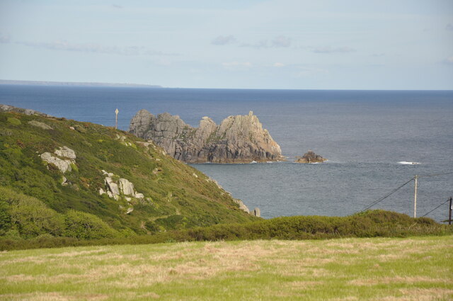
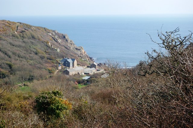
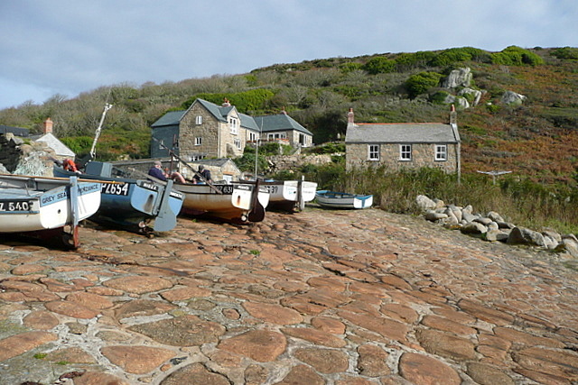
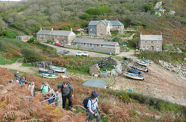
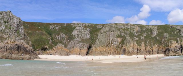
Burnewhall Cliff is a prominent coastal feature located in Cornwall, England. It is situated on the southern coast, overlooking the English Channel. This natural formation is known for its stunning beauty and distinctive geological features.

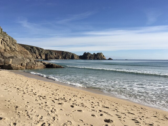
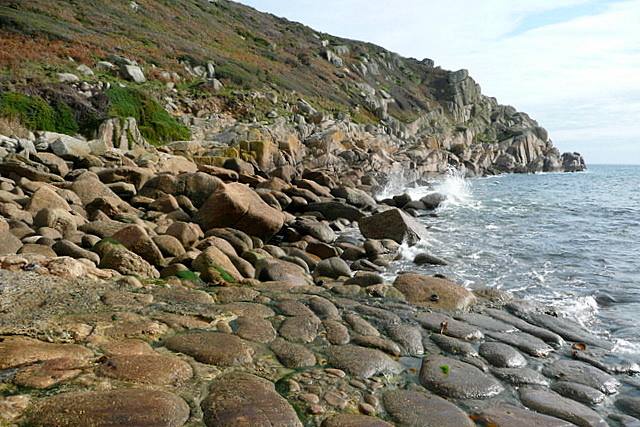
Rising to an impressive height of approximately 100 meters, Burnewhall Cliff is a sheer and rugged cliff face that provides breathtaking views of the surrounding area. The cliff is composed mainly of sedimentary rocks, such as sandstone and shale. Over the years, erosion from the relentless crashing waves has created intricate patterns and shapes in the rock face, adding to its unique allure.

The cliff is flanked by lush greenery, with a variety of plant species clinging to its slopes. Hardy grasses, wildflowers, and shrubs can be seen dotting the cliffside, providing a colorful contrast against the gray and brown hues of the rock. This vegetation also provides habitat for a diverse range of wildlife, including birds, insects, and small mammals.

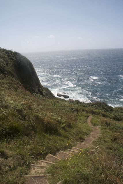
Visitors to Burnewhall Cliff can take in the awe-inspiring views from various vantage points along the cliff top. The sheer drop into the sea below and the expansive horizon stretching out towards the Channel Islands create a sense of tranquility and wonder. The cliff is also a popular spot for birdwatching, as it attracts various seabirds and migratory species.

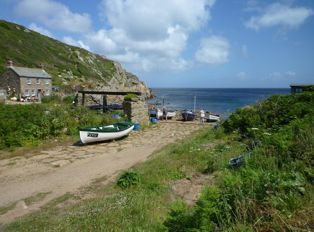
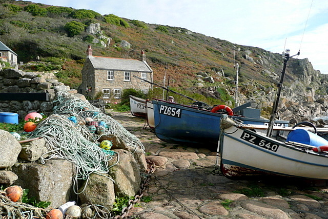
Due to its rugged nature, caution should be exercised when exploring Burnewhall Cliff. Steep slopes and unstable terrain make it important for visitors to stay on designated paths and avoid getting too close to the edge. Nonetheless, those who venture here are rewarded with a truly unforgettable experience of Cornwall's natural beauty.

If you have any feedback on the listing, please let us know in the comments section below.

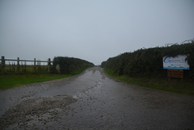
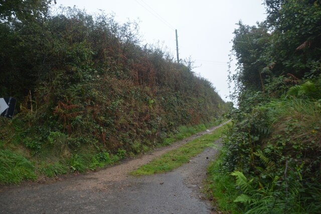
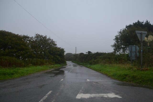
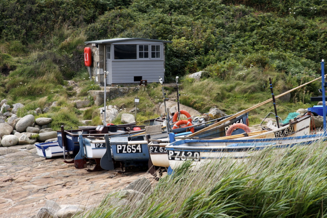
Burnewhall Cliff Images

Images are sourced within 2km of 50.04882/-5.6251369 or Grid Reference SW4022. Thanks to Geograph Open Source API. All images are credited.

Beach at Porth Curno near Percella Point Looking towards Percella Point from the beach at Porth Curno.
Beach at Porth Curno near Percella Point
Looking towards Percella Point from the beach at Porth Curno.
Porthcurno beach facing south west
The B3283 at Sparnon
Treen : Sparnon Farm Looking along a track to Sparnon Farmhouse.
Treen : Sparnon Farm
Looking along a track to Sparnon Farmhouse.
Treen : Penberth River Looking towards the Penberth River in the valley.
Treen : Penberth River
Looking towards the Penberth River in the valley.
Porthcurno : Farm Track A track heads to Trendrennan Farm.
Porthcurno : Farm Track
A track heads to Trendrennan Farm.
Treen : Track A track off St Buryan Hill to Boscean.
Treen : Track
A track off St Buryan Hill to Boscean.
Treen : B3315 Looking along a road.
Treen : B3315
Looking along a road.
Looking towards Logan Rock Looking towards Logan Rock from the footpath near Treen.
Looking towards Logan Rock
Looking towards Logan Rock from the footpath near Treen.
Penberth
Penberth
Penberth Cove
Penberth Cove
Towards Penberth Cove A footpath follows a narrow valley towards the cove.  Because it is sheltered there is an orchard off to our left.
Towards Penberth Cove
A footpath follows a narrow valley towards the cove. Because it is sheltered there is an orchard off to our left.
Fishing boats at Penberth Cove Penzance registered boats use the cove regularly.  The boats are hauled up onto this slipway.  This is still very much a working small harbour.
Fishing boats at Penberth Cove
Penzance registered boats use the cove regularly. The boats are hauled up onto this slipway. This is still very much a working small harbour.
Penberth Cove A lot of these rocks are covered at high tide, with a narrow channel for boats to access the slipway.  We saw seals here.  I spotted one about 50 metres offshore.  A fisherman was adamant it was a buoy.  His eyesight is going, it was a seal.
Penberth Cove
A lot of these rocks are covered at high tide, with a narrow channel for boats to access the slipway. We saw seals here. I spotted one about 50 metres offshore. A fisherman was adamant it was a buoy. His eyesight is going, it was a seal.
Penberth Cove The self-contained fishing hamlet can be seen clearly as we climb the coastal path to the south-west.  Exactly the place where a camera is useful; as an excuse for a blow.
Penberth Cove
The self-contained fishing hamlet can be seen clearly as we climb the coastal path to the south-west. Exactly the place where a camera is useful; as an excuse for a blow.
Porthguarnon Porthguarnon viewed from above on the Cornish coastal path west of Lamorna Cove.
Porthguarnon
Porthguarnon viewed from above on the Cornish coastal path west of Lamorna Cove.
Penberth Cove Penberth Cove on the Cornish Coastal Path.
Penberth Cove
Penberth Cove on the Cornish Coastal Path.
Show me another place!

Burnewhall Cliff is located at Grid Ref: SW4022 (Lat: 50.04882, Lng: -5.6251369)

Unitary Authority: Cornwall

Police Authority: Devon and Cornwall

What 3 Words

///tenure.singled.foods. Near St Buryan, Cornwall

Related Wikis

Penberth

Penberth (Cornish: Benbryhi) is a valley, coastal village and cove on the Penwith peninsula in Cornwall, England. It is approximately 7 miles (11 km) southwest...

Treryn Dinas

Treryn Dinas is a headland near Treen, on the Penwith peninsula between Penberth Cove and Porthcurno in Cornwall, England. It is a scheduled monument,...

Treen Cliff

Treen Cliff is a Site of Special Scientific Interest (SSSI) located on the Penwith Peninsula in Cornwall, England, UK, 6 miles (9.7 km) south-west of Penzance...

Cripp's Cove

Cripp's Cove is a cove on the coast of west Cornwall, England, UK. The inlet is situated on the Logan Rock peninsula one mile (1.6 km) east of Porthcurno...

Nearby Amenities

Located within 500m of 50.04882,-5.6251369
Penberth
Name Kw: Benbryghi
Name Uk: Пенберт
Place: hamlet
Wikidata: Q7162276
Lat/Long: 50.0483785/-5.6303099
Penberth Cove
Place: locality
Lat/Long: 50.0473466/-5.629222
Penberth Capstan
Historic: capstan
Man Made: crane
Lat/Long: 50.0476631/-5.6296324
Telephone
Lat/Long: 50.0492317/-5.6310886
Post Box
Collection Times: Mo-Fr 10:30; Sa 10:30
Operator: Royal Mail
Post Box Type: wall
Ref: TR19 80
Royal Cypher: EIIR
Royal Cypher Wikidata: Q33102113
Source: survey
Survey Date: 2017-10-24
Lat/Long: 50.0492113/-5.6310938
Barrier: kissing_gate
Lat/Long: 50.0473669/-5.6298579
Ford: yes
Lat/Long: 50.0513942/-5.6195799
Bench
Backrest: yes
Survey Date: 2022-05-28
Lat/Long: 50.0477909/-5.6294416
Barrier: stile
Lat/Long: 50.0504519/-5.6212563
Tourism: viewpoint
Lat/Long: 50.0478126/-5.6265506
Ford: yes
Lat/Long: 50.0478671/-5.6298291
Access: permissive
Barrier: stile
Foot: permissive
Lat/Long: 50.0508162/-5.6294725
Barrier: stile
Lat/Long: 50.050766/-5.6310547
The data included in this document is from www.openstreetmap.org. The data is made available under ODbL.

Have you been to Burnewhall Cliff?

Leave your review of Burnewhall Cliff below (or comments, questions and feedback).