Aoineadh nan Clach Mòra

Cliff, Slope in Argyllshire

Scotland

Aoineadh nan Clach Mòra

Abhainn a Mhuilinn draining into the sea In Kiloran Bay.
Abhainn a Mhuilinn draining into the sea Credit: Andrew Abbott

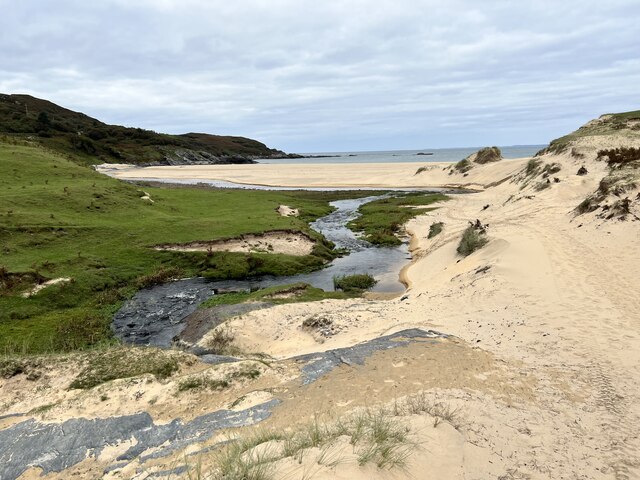
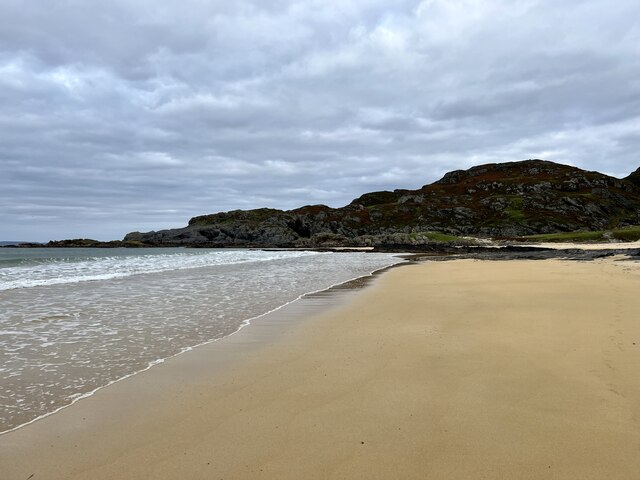
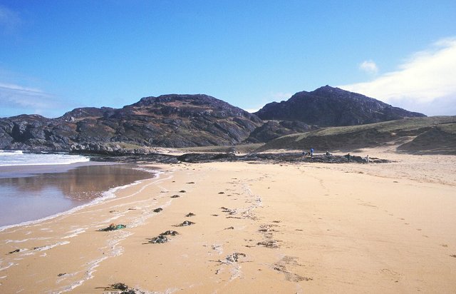
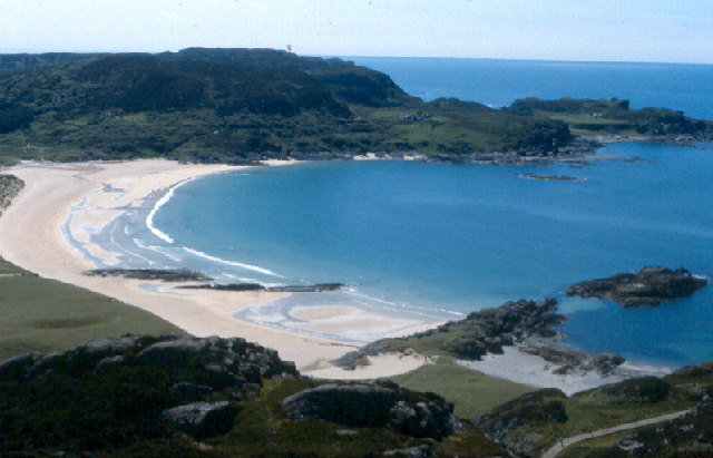
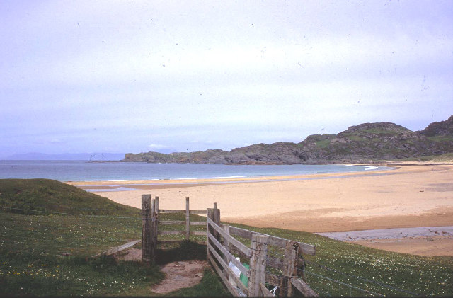
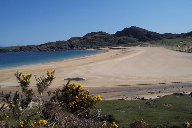
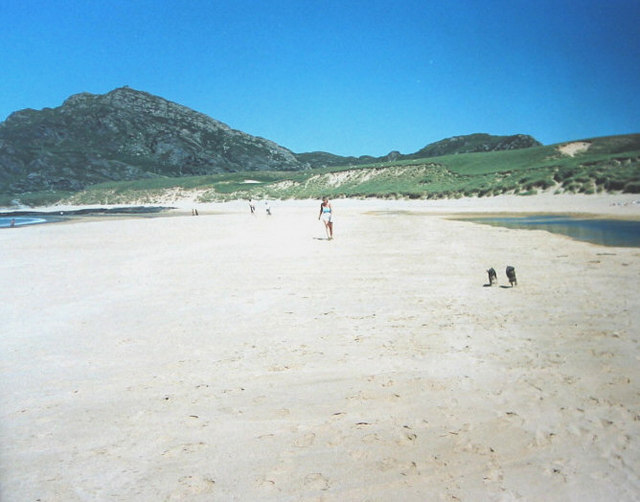
Aoineadh nan Clach Mòra, located in Argyllshire, Scotland, is a remarkable natural feature known for its breathtaking cliffs and slopes. This ancient geological formation spans over a vast expanse, offering visitors a mesmerizing view of the rugged landscape.

The cliffs of Aoineadh nan Clach Mòra are characterized by their sheer height and imposing presence. Rising hundreds of feet above sea level, they create an awe-inspiring sight that has captivated visitors for centuries. These towering cliffs are composed of various types of rock, including sandstone and shale, which have been sculpted by the forces of erosion over millions of years.

Alongside the cliffs, Aoineadh nan Clach Mòra also boasts a series of dramatic slopes. These slopes, formed by the gradual movement of the land and the impact of weathering, add to the overall grandeur of the landscape. Covered in lush vegetation and dotted with colorful wildflowers, the slopes give the area a picturesque charm.

The location of Aoineadh nan Clach Mòra offers visitors the opportunity to immerse themselves in the stunning natural surroundings. It is a popular spot for hiking enthusiasts, who can explore the area and marvel at the incredible vistas from various viewpoints. The site also attracts photographers and nature lovers, who are drawn to its beauty and tranquility.

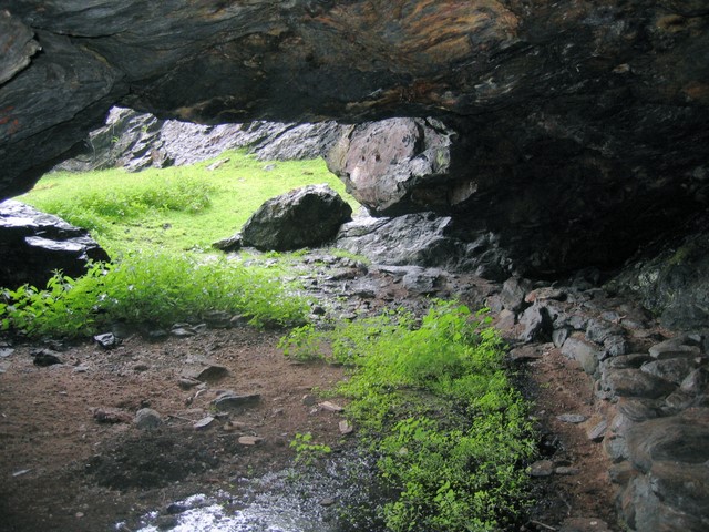
Aoineadh nan Clach Mòra is not only a haven for nature enthusiasts but also a significant geological site. It provides valuable insights into the Earth's history and the processes that have shaped the land over time. As such, it is both a visual spectacle and an educational resource, making it a must-visit destination for those seeking to appreciate the wonders of nature.

If you have any feedback on the listing, please let us know in the comments section below.

Aoineadh nan Clach Mòra Images

Images are sourced within 2km of 56.10603/-6.2070818 or Grid Reference NR3898. Thanks to Geograph Open Source API. All images are credited.

Abhainn a Mhuilinn draining into the sea In Kiloran Bay.
Abhainn a Mhuilinn draining into the sea
In Kiloran Bay.
Kiloran Bay In the north of Colonsay.
Kiloran Bay
In the north of Colonsay.
Traigh Ban The beach of Kiloran Bay backed by the peak of Carn an Eoin.  Carn an Eoin is the highest point of Colonsay, and some idea of the scale of this small hill can be gained by the fact that the summit is in the same square as the beach.
Traigh Ban
The beach of Kiloran Bay backed by the peak of Carn an Eoin. Carn an Eoin is the highest point of Colonsay, and some idea of the scale of this small hill can be gained by the fact that the summit is in the same square as the beach.
Kiloran Bay
Kiloran Bay
Traigh Bàn, Colonsay
Kiloran Bay and Carnan Eoin Kiloran Bay on an idyllic May morning, with not a soul to be seen.
Kiloran Bay and Carnan Eoin
Kiloran Bay on an idyllic May morning, with not a soul to be seen.
Traigh Ban, Kiloran Bay beach and dunes, Colonsay A Viking boat burial was uncovered in Kiloran Bay in 1882. It dates from the 9th-10th century and contained the remains of a man and his horse along with a few other small objects such as coins and weapons.
Traigh Ban, Kiloran Bay beach and dunes, Colonsay
A Viking boat burial was uncovered in Kiloran Bay in 1882. It dates from the 9th-10th century and contained the remains of a man and his horse along with a few other small objects such as coins and weapons.
St Columba’s Well St Columba’s Well (Tobar Challuim-Chille) lies on the slopes above the sea, west of Carnan Eoin. Note the pewter chalice on the rock to the right of the well, which the thirsty traveller can use to quench their thirst. It replaced a silver cup that was here for years. Though the silver cup was taken away for safe-keeping, it is still on the island.
St Columba’s Well
St Columba’s Well (Tobar Challuim-Chille) lies on the slopes above the sea, west of Carnan Eoin. Note the pewter chalice on the rock to the right of the well, which the thirsty traveller can use to quench their thirst. It replaced a silver cup that was here for years. Though the silver cup was taken away for safe-keeping, it is still on the island.
Grazing cattle on the dunes behind Kiloran Bay In early April there was little grass to eat and silage was provided for the cows.
Grazing cattle on the dunes behind Kiloran Bay
In early April there was little grass to eat and silage was provided for the cows.
Tràigh Bàn, Kiloran Bay A wide sandy beach, known as Tràigh Bàn, in Kiloran Bay.
Tràigh Bàn, Kiloran Bay
A wide sandy beach, known as Tràigh Bàn, in Kiloran Bay.
Coastline at Meall na Suiridhe Looking seaward from the summit of Meall na Suiridhe, Colonsay.
Coastline at Meall na Suiridhe
Looking seaward from the summit of Meall na Suiridhe, Colonsay.
Eilean Meall na Suiridhe Looking south-westwards from the summit of Meall na Suiridhe, towards jagged cliffs and the island of the same name.
Eilean Meall na Suiridhe
Looking south-westwards from the summit of Meall na Suiridhe, towards jagged cliffs and the island of the same name.
Feral goats atop the rocky ridge of the Kiloran Bay northern headland These goats were curious and watched me for about 20 minutes as I slowly ascended to a point near the ridgetop. The goats are thought to have descended from animals carried by the Spanish Armada, and were released onto Colonsay as some of the damaged ships limped to Colonsay. Principal vegetation is bracken and heather.
Feral goats atop the rocky ridge of the Kiloran Bay northern headland
These goats were curious and watched me for about 20 minutes as I slowly ascended to a point near the ridgetop. The goats are thought to have descended from animals carried by the Spanish Armada, and were released onto Colonsay as some of the damaged ships limped to Colonsay. Principal vegetation is bracken and heather.
Northern rocky beach of Kiloran Bay
Stabilised dune behind Kiloran Bay This large sand dune formation is stabilised by tuft grasses and bracken.
Stabilised dune behind Kiloran Bay
This large sand dune formation is stabilised by tuft grasses and bracken.
Tràigh Bàn, Kiloran Bay
Flotsam & jetsam, Kiloran Bay
Uamh-A-Baintighearna, Kiloran Bay Uamh-A-Baintighearna - Lady's Cave is a large cave in the face of the cliff above the three other caves on the north of Kiloran Bay. A ruined stairway leads to the cave from the shore and may originally have extended onto the cliffs above where it provided access to Tobar Challuim-chille (St Columba's Well). A stone bench ("sleeping bench") has been built around the inner wall on one side and in the centre there is a large midden composed mainly of limpet shells <span class="nowrap"><a title="http://canmore.rcahms.gov.uk/en/site/38170/details/colonsay+port+easdail+uamh+a+baintighearna/" rel="nofollow ugc noopener" href="http://canmore.rcahms.gov.uk/en/site/38170/details/colonsay+port+easdail+uamh+a+baintighearna/">Link</a><img style="margin-left:2px;" alt="External link" title="External link - shift click to open in new window" src="https://s1.geograph.org.uk/img/external.png" width="10" height="10"/></span>
Uamh-A-Baintighearna, Kiloran Bay
Uamh-A-Baintighearna - Lady's Cave is a large cave in the face of the cliff above the three other caves on the north of Kiloran Bay. A ruined stairway leads to the cave from the shore and may originally have extended onto the cliffs above where it provided access to Tobar Challuim-chille (St Columba's Well). A stone bench ("sleeping bench") has been built around the inner wall on one side and in the centre there is a large midden composed mainly of limpet shells LinkExternal link
Show me another place!

Aoineadh nan Clach Mòra is located at Grid Ref: NR3898 (Lat: 56.10603, Lng: -6.2070818)

Unitary Authority: Argyll and Bute

Police Authority: Argyll and West Dunbartonshire

What 3 Words

///firebird.manly.physical. Near Scalasaig, Argyll & Bute

Related Wikis

Dùn Uragaig

Dùn Uragaig is a clifftop promontory fort located on the Inner Hebridean island of Colonsay, Scotland. The site is located at grid reference NR38169826...

Dùn Tealtaig

Dùn Tealtaig is a promontory fort located on the Inner Hebridean island of Colonsay, Scotland. The site is located at grid reference NR38909839.The fort...

Loch an Sgoltaire

Loch an Sgoltaire is an impounding reservoir located on the Inner Hebridean island of Colonsay, Scotland. It is located at grid reference NR386972, northwest...

Colonsay House

Colonsay House is a Georgian country house on the island of Colonsay, in the Scottish Inner Hebrides. It is a Category B listed building, and is now in...

Nearby Amenities

Located within 500m of 56.10603,-6.2070818
Power: pole
Lat/Long: 56.1037155/-6.2018681
Power: pole
Lat/Long: 56.1043505/-6.2018962
Duntealtaig
Place: isolated_dwelling
Lat/Long: 56.1057093/-6.2024191
Power: pole
Lat/Long: 56.1032732/-6.2011406
The data included in this document is from www.openstreetmap.org. The data is made available under ODbL.

Have you been to Aoineadh nan Clach Mòra?

Leave your review of Aoineadh nan Clach Mòra below (or comments, questions and feedback).