Cox Cliff

Cliff, Slope in Cornwall

England

Cox Cliff

The Minack Theatre The Minack Theatre, filling up before a performance.
The Minack Theatre Credit: Kevin Pearson

Cox Cliff is a prominent natural feature located in Cornwall, England. This cliff, also known as Cox Tor, is situated in the western part of the county, near the village of St. Cleer. Rising to an elevation of approximately 442 meters (1,450 feet), it offers breathtaking panoramic views of the surrounding landscape.

The cliff is formed from granite, a common rock type in Cornwall, and its rugged and steep slopes make it a popular destination for hikers and rock climbers. The summit of Cox Cliff is accessible via various footpaths, offering a challenging yet rewarding ascent. From the top, visitors can enjoy stunning vistas of the nearby Bodmin Moor, with its rolling hills, moorlands, and scattered ancient ruins.

Cox Cliff is not only renowned for its natural beauty but also for its rich historical significance. The area is home to ancient archaeological remains, including Bronze Age hut circles and stone circles, serving as a testament to the region's long and fascinating history. These prehistoric sites provide a glimpse into the lives of the early inhabitants of Cornwall.

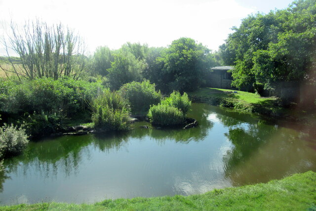
In addition to its scenic and historical value, Cox Cliff also supports a diverse array of flora and fauna. The surrounding area is covered in heather, gorse, and other hardy moorland vegetation, providing habitats for various bird species, including the iconic red grouse. Wildlife enthusiasts can often spot rabbits, deer, and even ponies grazing in the vicinity.

Overall, Cox Cliff in Cornwall offers a captivating blend of natural beauty, historical significance, and ecological diversity, making it an attractive destination for nature lovers, hikers, and history enthusiasts alike.

If you have any feedback on the listing, please let us know in the comments section below.
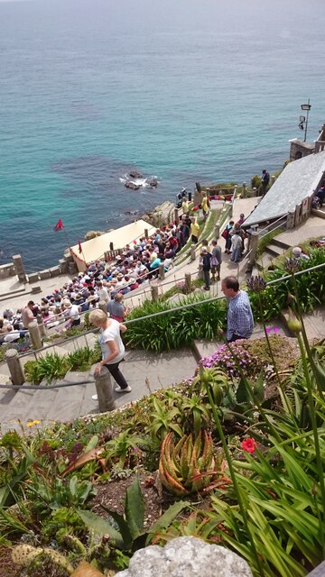
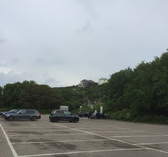
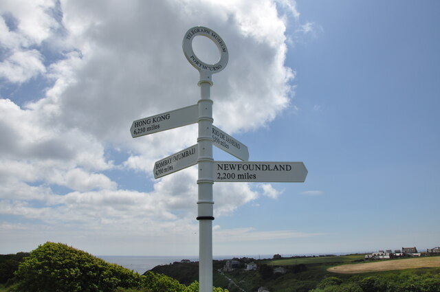
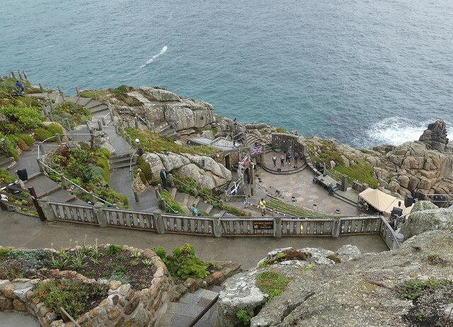
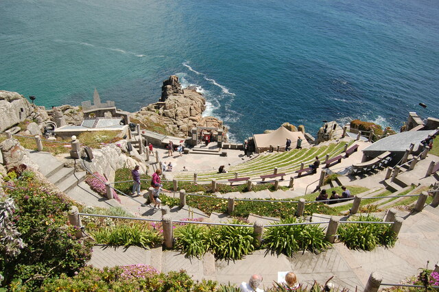
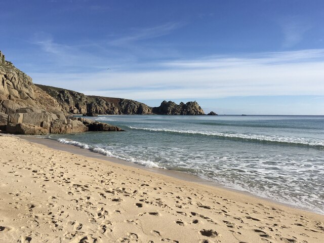
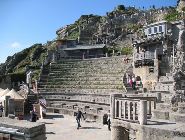
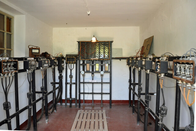
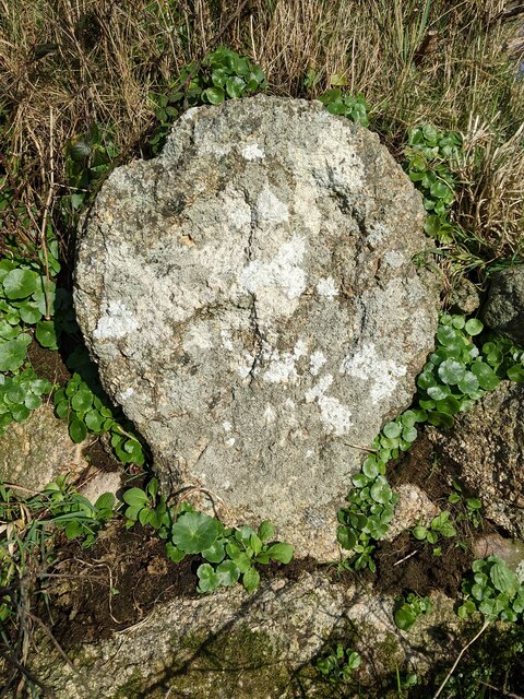
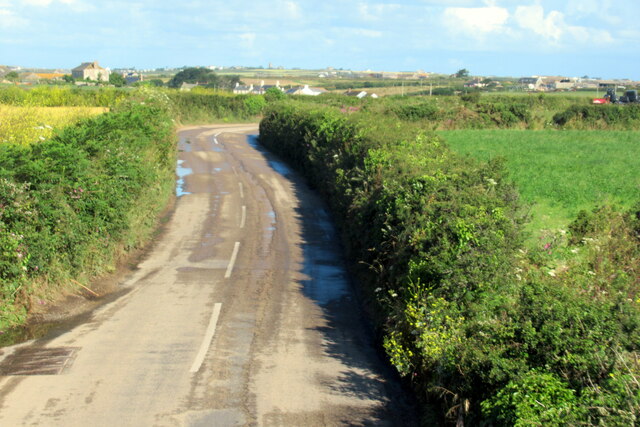
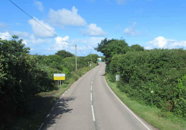
Cox Cliff Images

Images are sourced within 2km of 50.038469/-5.662478 or Grid Reference SW3721. Thanks to Geograph Open Source API. All images are credited.

The Minack Theatre The Minack Theatre, filling up before a performance.
The Minack Theatre
The Minack Theatre, filling up before a performance.
Porthcurno car park
Porthcurno car park
Signpost above the Telegraph Museum This post is on the top of the cliff above Porthcurno where the exit from the Telegraph Museum emerges.
Signpost above the Telegraph Museum
This post is on the top of the cliff above Porthcurno where the exit from the Telegraph Museum emerges.
Minack Theatre - Looking down to the stage Taken from high up, above the top row of seating at the Minack Theatre.
The four performers on the stage were rehearsing for the 'Last Night of the Proms'.
Minack Theatre - Looking down to the stage
Taken from high up, above the top row of seating at the Minack Theatre. The four performers on the stage were rehearsing for the 'Last Night of the Proms'.
Minack Open Air Theatre A view of the steeply descending amphitheatre at Minack Open Air Theatre.
Minack Open Air Theatre
A view of the steeply descending amphitheatre at Minack Open Air Theatre.
Beach at Porth Curno near Percella Point Looking towards Percella Point from the beach at Porth Curno.
Beach at Porth Curno near Percella Point
Looking towards Percella Point from the beach at Porth Curno.
Minack Theatre With the potential to be the most uncomfortable theatre in the country for those who come unprepared for what the Atlantic weather can throw across the stage; the spectacular location of the Minack Theatre set on granite cliffs overlooking Porthcurno bay guarantees it as a top tourist attraction.  Here we see the theatre on a benign September day with a handful of tourists enjoying a leisurely look around this unique venue.
Minack Theatre
With the potential to be the most uncomfortable theatre in the country for those who come unprepared for what the Atlantic weather can throw across the stage; the spectacular location of the Minack Theatre set on granite cliffs overlooking Porthcurno bay guarantees it as a top tourist attraction. Here we see the theatre on a benign September day with a handful of tourists enjoying a leisurely look around this unique venue.
Inside Porthcurno Cable Hut Porthcurno Cable Hut is where telegraph cables from all over the world terminated to be routed to UK destinations.  Equipment in this hut enabled engineers to test the various cable circuits before they were routed to the Cable Station on the cliff behind.
Inside Porthcurno Cable Hut
Porthcurno Cable Hut is where telegraph cables from all over the world terminated to be routed to UK destinations. Equipment in this hut enabled engineers to test the various cable circuits before they were routed to the Cable Station on the cliff behind.
Porthcurno beach facing south west
Old Wayside Cross towards Ardensawah in St Levan parish Ardensawah or Ardensaweth Cross, the old head and neck of a wayside cross. Set beside a stone stile on a footpath northwest of St Levan church in St Levan parish. Grade II Listed <span class="nowrap"><a title="https://historicengland.org.uk/listing/the-list/list-entry/1146492" rel="nofollow ugc noopener" href="https://historicengland.org.uk/listing/the-list/list-entry/1146492">Link</a><img style="margin-left:2px;" alt="External link" title="External link - shift click to open in new window" src="https://s1.geograph.org.uk/img/external.png" width="10" height="10"/></span>. See also <span class="nowrap"><a title="http://www.flickr.com/photos/ocifant/412959521" rel="nofollow ugc noopener" href="http://www.flickr.com/photos/ocifant/412959521">Link</a><img style="margin-left:2px;" alt="External link" title="External link - shift click to open in new window" src="https://s1.geograph.org.uk/img/external.png" width="10" height="10"/></span>.

Milestone Society National ID: CWPW_SLE01
Old Wayside Cross towards Ardensawah in St Levan parish
Ardensawah or Ardensaweth Cross, the old head and neck of a wayside cross. Set beside a stone stile on a footpath northwest of St Levan church in St Levan parish. Grade II Listed LinkExternal link. See also LinkExternal link. Milestone Society National ID: CWPW_SLE01
Looking down on the stage at the Minack Theatre at the end of the show
The B3315 near Trethewey
The B3315 at Polgigga village sign
Polgigga village pond
Museum of Global Communications, Porthcurno
Treen : Tretheway A house off Treen Hill.
Treen : Tretheway
A house off Treen Hill.
Tretheway : B3315 Looking along the B3315 from the junction at The Valley.
Tretheway : B3315
Looking along the B3315 from the junction at The Valley.
Porthcurno : Track A track to Highfield.
Porthcurno : Track
A track to Highfield.
Show me another place!

Cox Cliff is located at Grid Ref: SW3721 (Lat: 50.038469, Lng: -5.662478)

Unitary Authority: Cornwall

Police Authority: Devon and Cornwall

What 3 Words

///selection.every.officers. Near St Buryan, Cornwall

Related Wikis

St Levan

St Levan (Cornish: Selevan) is a civil parish in Cornwall, England, United Kingdom. The parish is rural with a number of hamlets of varying size with Porthcurno...

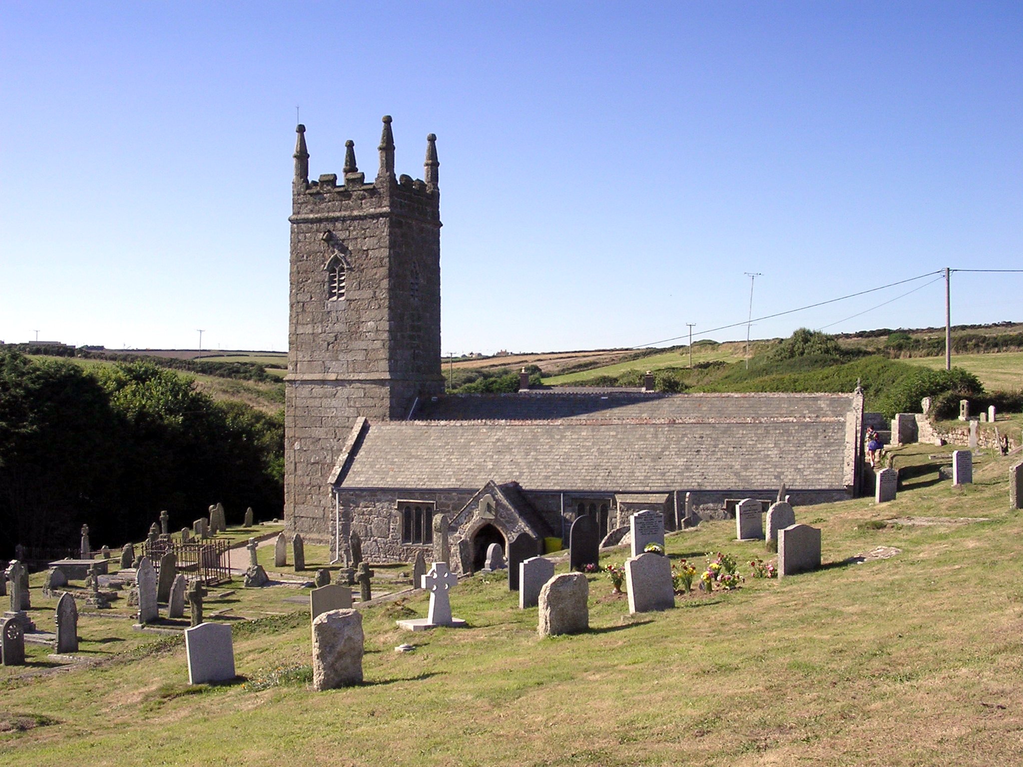
St Levan's Church, St Levan

St Levan Church, St Levan is a parish church in the Church of England located in St Levan, Cornwall, United Kingdom. Until 1864 the church was a chapelry...
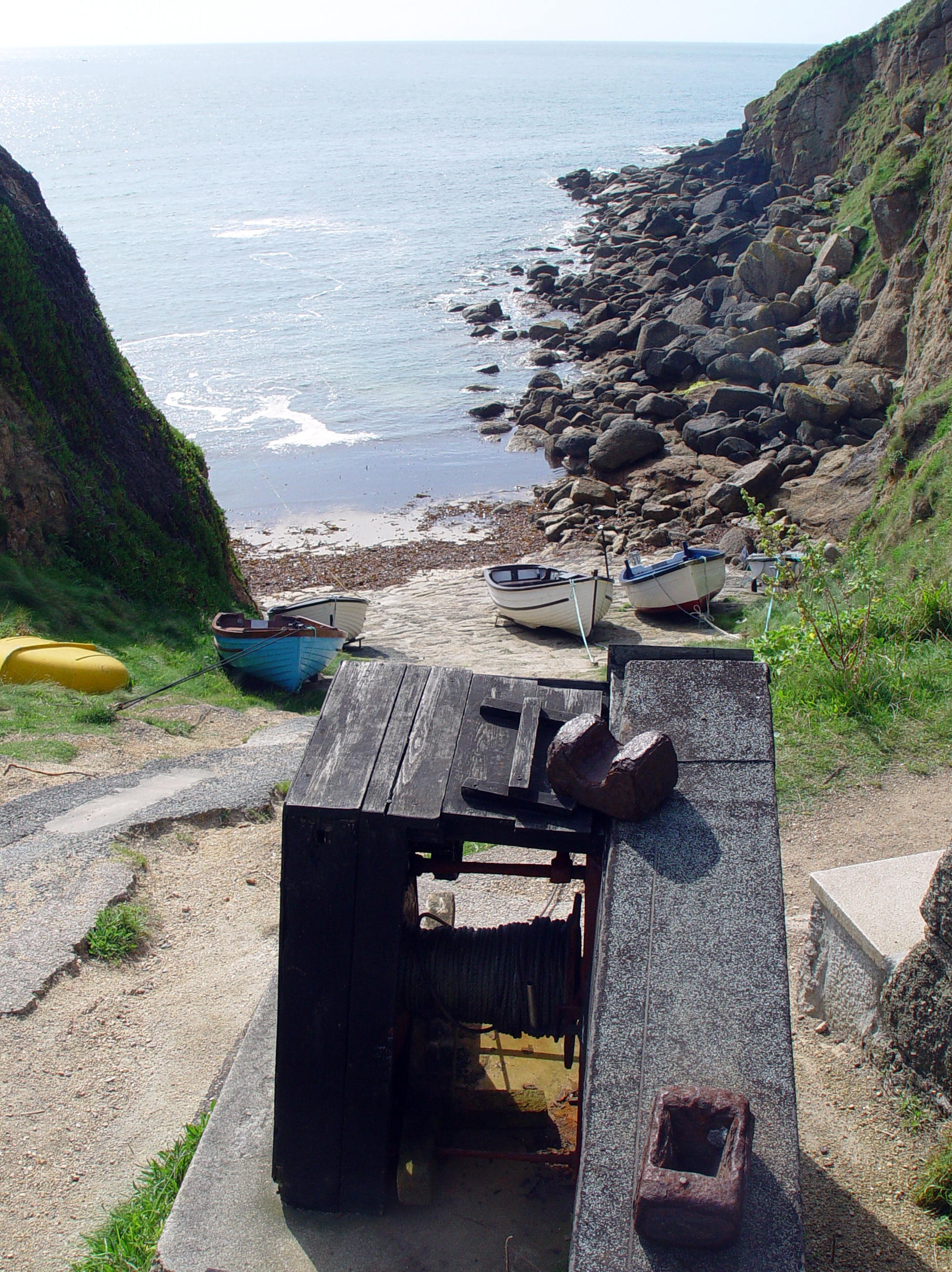
Porthgwarra

Porthgwarra (Cornish: Porth Gorwedhow, meaning very wooded cove) is a small coastal village in the civil parish of St Levan, Cornwall, England, United...
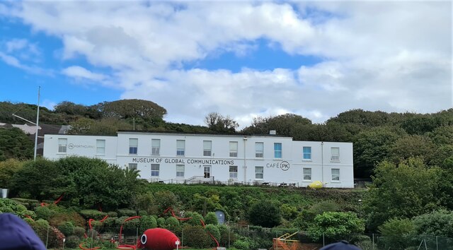
PK Porthcurno

PK Porthcurno is a museum located in the small coastal village of Porthcurno Cornwall, UK. Porthcurno was the point at which many submarine telegraph cables...

Nearby Amenities

Located within 500m of 50.038469,-5.662478
Created By: almien_coastlines
Source: PGS
Lat/Long: 50.037248/-5.669163
Created By: almien_coastlines
Source: PGS
Lat/Long: 50.037257/-5.668765
Created By: almien_coastlines
Source: PGS
Lat/Long: 50.037266/-5.668367
Created By: almien_coastlines
Source: PGS
Lat/Long: 50.037275/-5.66797
Created By: almien_coastlines
Source: PGS
Lat/Long: 50.037293/-5.667175
Created By: almien_coastlines
Source: PGS
Lat/Long: 50.037568/-5.666394
Created By: almien_coastlines
Source: PGS
Lat/Long: 50.037586/-5.665599
Created By: almien_coastlines
Source: PGS
Lat/Long: 50.037641/-5.663213
Source: PGS
Lat/Long: 50.0377757/-5.6628617
Source: PGS
Lat/Long: 50.0376251/-5.6624188
Created By: almien_coastlines
Source: PGS
Lat/Long: 50.037806/-5.66163
Created By: almien_coastlines
Source: PGS
Lat/Long: 50.037952/-5.660842
Created By: almien_coastlines
Source: PGS
Lat/Long: 50.038085/-5.660651
Created By: almien_coastlines
Source: PGS
Lat/Long: 50.038217/-5.660459
Source: PGS
Lat/Long: 50.0382276/-5.6594357
Created By: almien_coastlines
Source: PGS
Lat/Long: 50.038889/-5.659104
Source: PGS
Lat/Long: 50.0389624/-5.65886
Source: PGS
Lat/Long: 50.0391183/-5.6566832
St. Levan
Is In: Cornwall, England, UK
Name Kw: Selevan
Name Uk: Сейнт-Льюван
Place: hamlet
Postal Code: TR19 6
Source: NPE
Lat/Long: 50.0421534/-5.660741
St. Levan's Well
Natural: spring
Lat/Long: 50.039728/-5.6594182
Pol Ledan
Place: locality
Wikimedia Commons: File:Carn Scathe and Pol Ledan - geograph.org.uk - 1404190.jpg
Lat/Long: 50.0374448/-5.6691193
Phone
Check Date: 2022-06-13
Emergency: phone
Lat/Long: 50.039637/-5.6589311
Cox Cliff
Place: locality
Lat/Long: 50.0391306/-5.6628233
Barrier: lift_gate
Lat/Long: 50.0424041/-5.6617629
Cafe
Porthchapel Cream Teas
Addr City: Penzance
Addr Country: GB
Addr Place: St Levan
Addr Postcode: TR19 6JT
Addr Unit: Grey Gables
Contact Facebook: https://www.facebook.com/pg/porthchapelcreamteas
Fhrs Id: 783800
Source Addr: FHRS Open Data
Lat/Long: 50.0415475/-5.6617825
Barrier: stile
Lat/Long: 50.042878/-5.6628705
Direction: 160
Tourism: viewpoint
Lat/Long: 50.0385402/-5.6664738
Source: PGS
Lat/Long: 50.0394058/-5.6586064
WW2 Pillbox (site of)
Building: bunker
Bunker Type: pillbox
Military: bunker
Lat/Long: 50.0408116/-5.6596286
Life Ring
Emergency: life_ring
Survey Date: 2022-06-13
Lat/Long: 50.0396262/-5.6589372
Survey Date: 2022-06-13
Tourism: viewpoint
Lat/Long: 50.039383/-5.6605979
Power: pole
Transformer: distribution
Lat/Long: 50.0411401/-5.6587261
Location Transition: yes
Power: pole
Lat/Long: 50.0415104/-5.6589541
Power: pole
Lat/Long: 50.0420315/-5.6591713
Vesacks Holiday Rental
Operator: VRBO
Tourism: chalet
Lat/Long: 50.0406596/-5.6587934
The data included in this document is from www.openstreetmap.org. The data is made available under ODbL.

Have you been to Cox Cliff?

Leave your review of Cox Cliff below (or comments, questions and feedback).