Sgùrr Buidhe

Cliff, Slope in Inverness-shire

Scotland

Sgùrr Buidhe

Waterfall Start of a 200m plunge off the edge of Skye.
Waterfall Credit: Richard Webb

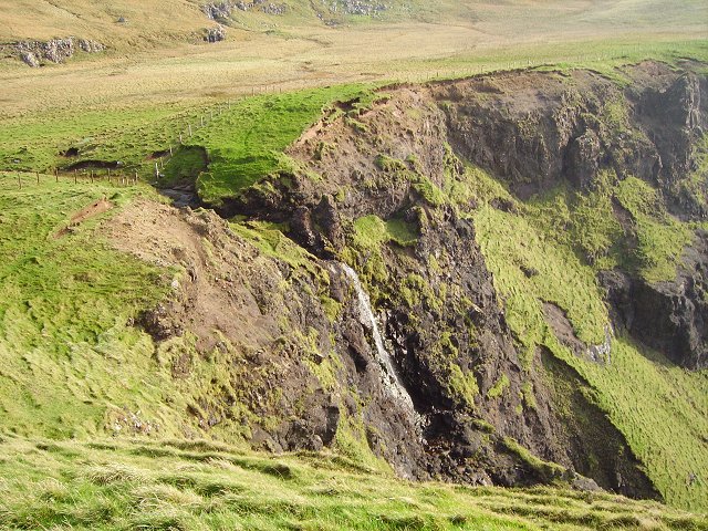
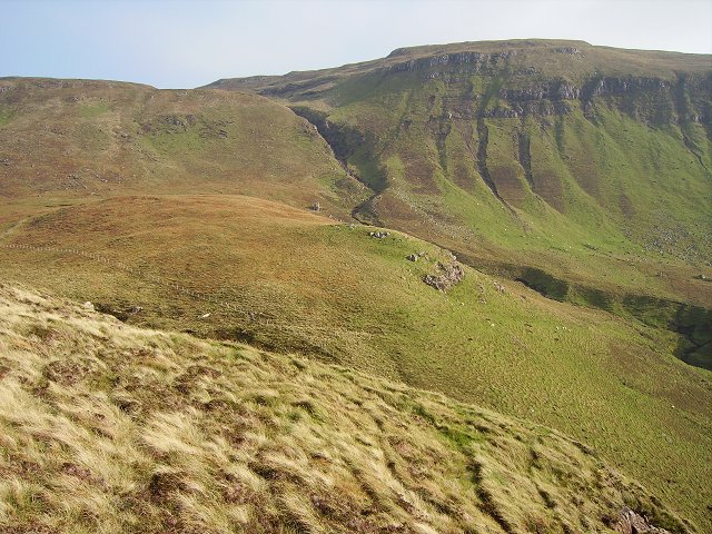
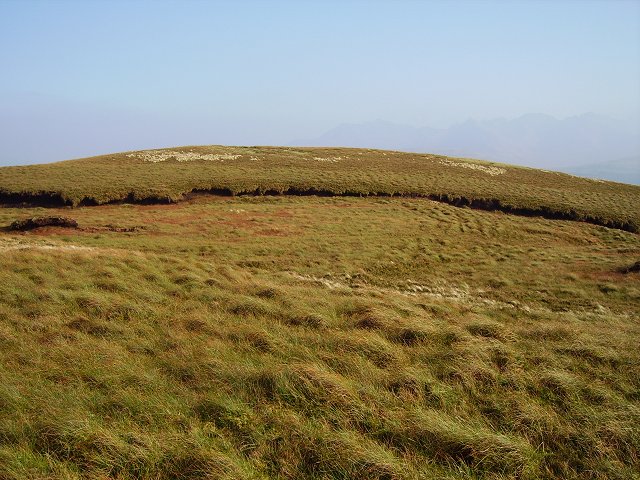
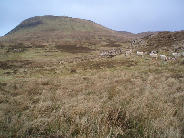
Sgùrr Buidhe is a prominent mountain located in the Inverness-shire region of Scotland. It is part of the Glen Affric mountain range, which is known for its stunning scenery and rugged landscapes. Standing at an impressive height of 946 meters (3,104 feet), Sgùrr Buidhe offers breathtaking views of the surrounding area.

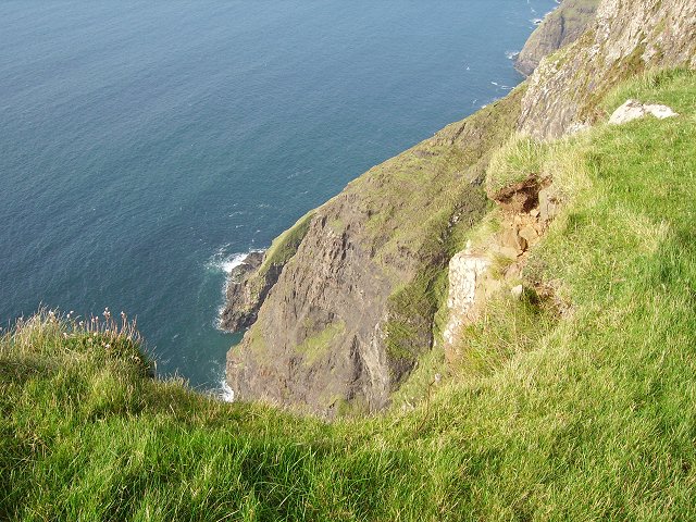
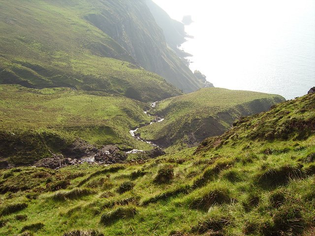
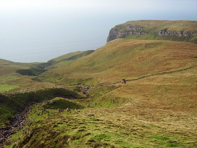
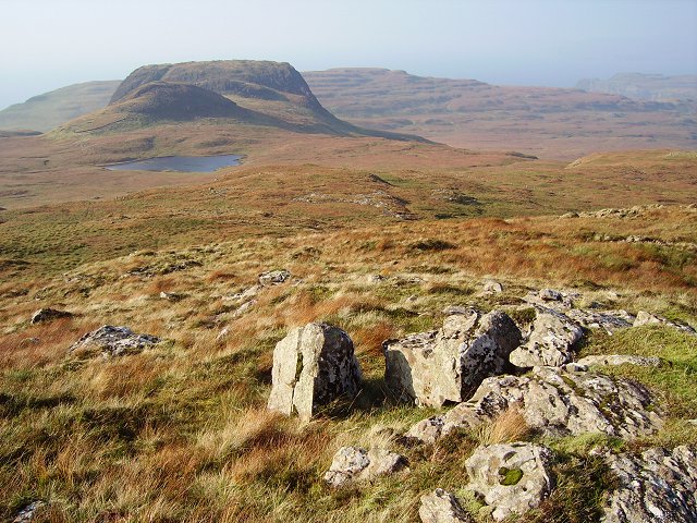
The mountain is characterized by its steep cliffs and slopes, which make it a challenging yet rewarding destination for hikers and mountaineers. The ascent to the summit involves traversing rocky terrain and negotiating narrow ridges, providing an exhilarating experience for outdoor enthusiasts.

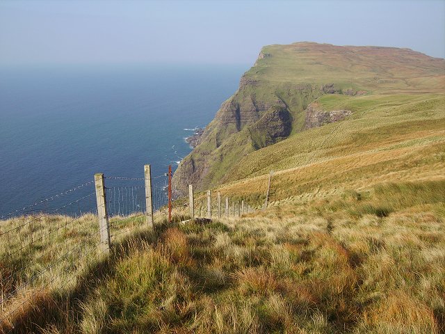
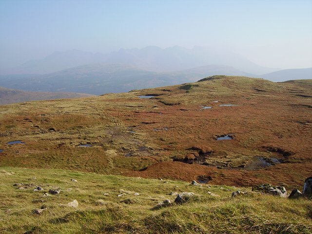
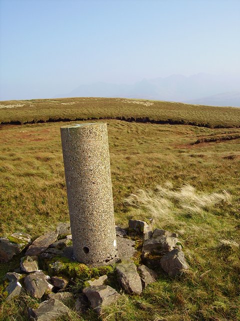
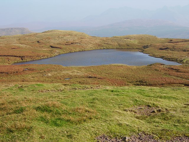
On a clear day, from the summit of Sgùrr Buidhe, one can enjoy panoramic views of the surrounding Scottish Highlands, including the nearby Loch Mullardoch and the peaks of the Glen Affric range. The mountain is also home to a variety of wildlife, including golden eagles, red deer, and mountain hares, adding to its natural beauty.

Access to Sgùrr Buidhe can be gained from different starting points, including the Glen Strathfarrar and Glen Cannich areas. It is advisable to plan the hike with proper equipment and suitable clothing, as the weather conditions can change rapidly, and the mountain can be challenging to navigate in poor visibility.

Sgùrr Buidhe is a must-visit destination for those seeking adventure and stunning views in the Inverness-shire area. Its dramatic cliffs, challenging slopes, and breathtaking vistas make it a memorable experience for outdoor enthusiasts and nature lovers alike.

If you have any feedback on the listing, please let us know in the comments section below.

Sgùrr Buidhe Images

Images are sourced within 2km of 57.244814/-6.42441 or Grid Reference NG3325. Thanks to Geograph Open Source API. All images are credited.

Waterfall Start of a 200m plunge off the edge of Skye.
Waterfall
Start of a 200m plunge off the edge of Skye.
Sgùrr nam Fiadh Shame there is not a "down" in the view direction box.  Looking down the crags at Sgùrr nam Fiadh, still in excess of 200m drop.
Sgùrr nam Fiadh
Shame there is not a "down" in the view direction box. Looking down the crags at Sgùrr nam Fiadh, still in excess of 200m drop.
Sgùrr nam Fiadh The fence is an attempt to deter base jumping sheep. Not successful, I had to take a big detour inland so as not to fatally frighten a ewe and lamb on the wrong side of the fence. View along the coast towards Biod Ruadh
Sgùrr nam Fiadh
The fence is an attempt to deter base jumping sheep. Not successful, I had to take a big detour inland so as not to fatally frighten a ewe and lamb on the wrong side of the fence. View along the coast towards Biod Ruadh
Over you go A burn before its 200m leap off the crags beneath Sgùrr nam Fiadh. As you descend into this fertile glen beneath Beinn Bhreac, it's easy to forget how high up you still are.
Over you go
A burn before its 200m leap off the crags beneath Sgùrr nam Fiadh. As you descend into this fertile glen beneath Beinn Bhreac, it's easy to forget how high up you still are.
Beinn Bhreac The western side from Sgùrr nam Fiadh
Beinn Bhreac
The western side from Sgùrr nam Fiadh
Sgùrr nam Fiadh Sgùrr nam Fiadh as seen from the gorge in the west side of Beinn Bhreac.
Sgùrr nam Fiadh
Sgùrr nam Fiadh as seen from the gorge in the west side of Beinn Bhreac.
Beinn Bhreac The summit plateau: boggs, pools and rocks.  View over to the Black Cuillin.
Beinn Bhreac
The summit plateau: boggs, pools and rocks. View over to the Black Cuillin.
Beinn Bhreac The trig point, with one of the summit candidates beyond.
Beinn Bhreac
The trig point, with one of the summit candidates beyond.
Beinn Bhreac The northern of the two marked 448m summits.
Beinn Bhreac
The northern of the two marked 448m summits.
Beinn Bhreac The southernmost of the two 448m summits.
Beinn Bhreac
The southernmost of the two 448m summits.
Lochan on Beinn Bhreac Lochan at the head of the Tusdale Burn.
Lochan on Beinn Bhreac
Lochan at the head of the Tusdale Burn.
Lochan turning to marshland A wet margin to one of the Beinn Bhreac summit lochans.
Lochan turning to marshland
A wet margin to one of the Beinn Bhreac summit lochans.
Beinn Bhreac summit plateau More of the vast plateau.
Beinn Bhreac summit plateau
More of the vast plateau.
Preshal Beg The SE side of Preshal Beg, the only easy approach, from Beinn Bhreac.
Preshal Beg
The SE side of Preshal Beg, the only easy approach, from Beinn Bhreac.
Curious Sheep Looking towards Ben Scaalaan from the Minginish Coast these sheep seemed quite curious as to our presence.
Curious Sheep
Looking towards Ben Scaalaan from the Minginish Coast these sheep seemed quite curious as to our presence.
Glen Caladale Lovely little steep sided glen in the Minginish peninsula, Isle of Skye.
Glen Caladale
Lovely little steep sided glen in the Minginish peninsula, Isle of Skye.
Waterfall Ahead Burn in Glen Caladale just before it plunges to the sea - Minginish peninsula, Isle of Skye
Waterfall Ahead
Burn in Glen Caladale just before it plunges to the sea - Minginish peninsula, Isle of Skye
Coastline and Canna Coastal scenery of the Minginish peninsula with a dramatic sky above Canna. You can just see An Dubh-sgeir at left.
Coastline and Canna
Coastal scenery of the Minginish peninsula with a dramatic sky above Canna. You can just see An Dubh-sgeir at left.
Show me another place!

Sgùrr Buidhe is located at Grid Ref: NG3325 (Lat: 57.244814, Lng: -6.42441)

Unitary Authority: Highland

Police Authority: Highlands and Islands

What 3 Words

///clauses.bonfires.prepared. Near Carbost, Highland

Related Wikis

Talisker

Talisker (Scottish Gaelic: Talasgair) is a settlement on the Minginish peninsula in the Isle of Skye, Scotland. == History == Talisker was for centuries...

Eynort

Eynort (Scottish Gaelic: Aoineart) is a small remote hamlet, situated at the head of Loch Eynort, on the west coast of the Isle of Skye, Scottish Highlands...

Minginish

Minginish (Scottish Gaelic: Minginis) is a peninsula on the Isle of Skye in Scotland. It is situated on the west coast of the island and runs from Loch...
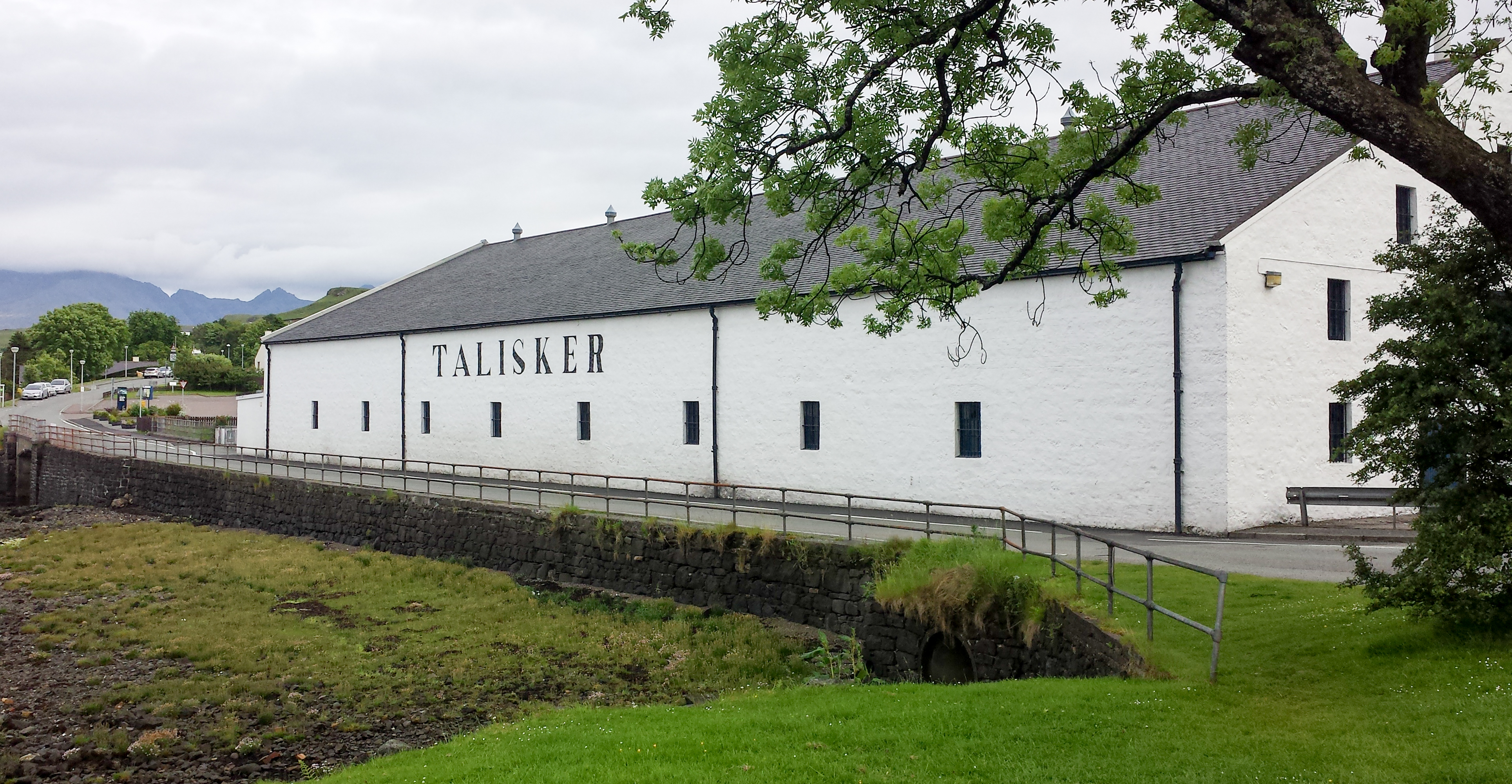
Talisker distillery

Talisker distillery is an island single malt Scotch whisky distillery based in Carbost, Scotland on the Minginish Peninsula on the Isle of Skye. The distillery...

Nearby Amenities

Located within 500m of 57.244814,-6.42441
Source: PGS
Lat/Long: 57.2408984/-6.4274882
Source: PGS
Lat/Long: 57.2412442/-6.4273843
Source: PGS
Lat/Long: 57.2413874/-6.4268641
Source: PGS
Lat/Long: 57.2411592/-6.4266444
Source: PGS
Lat/Long: 57.240802/-6.4264471
Source: PGS
Lat/Long: 57.2407422/-6.4266972
Source: PGS
Lat/Long: 57.2407333/-6.4270686
Created By: dmgroom_coastlines
Source: PGS
Lat/Long: 57.24782/-6.42698
Created By: dmgroom_coastlines
Source: PGS
Lat/Long: 57.24706/-6.42727
Created By: dmgroom_coastlines
Source: PGS
Lat/Long: 57.24704/-6.42632
Created By: dmgroom_coastlines
Source: PGS
Lat/Long: 57.24679/-6.42658
Created By: dmgroom_coastlines
Source: PGS
Lat/Long: 57.24652/-6.4266
Created By: dmgroom_coastlines
Source: PGS
Lat/Long: 57.24524/-6.42622
Created By: dmgroom_coastlines
Source: PGS
Lat/Long: 57.24447/-6.42627
Created By: dmgroom_coastlines
Source: PGS
Lat/Long: 57.24396/-6.4263
Created By: dmgroom_coastlines
Source: PGS
Lat/Long: 57.24319/-6.42635
Created By: dmgroom_coastlines
Source: PGS
Lat/Long: 57.24269/-6.42663
Created By: dmgroom_coastlines
Source: PGS
Lat/Long: 57.24267/-6.42568
Created By: dmgroom_coastlines
Source: PGS
Lat/Long: 57.24242/-6.42594
Created By: dmgroom_coastlines
Source: PGS
Lat/Long: 57.24191/-6.42622
Created By: dmgroom_coastlines
Source: PGS
Lat/Long: 57.24189/-6.42527
Created By: dmgroom_coastlines
Source: PGS
Lat/Long: 57.24138/-6.4253
Created By: dmgroom_coastlines
Source: PGS
Lat/Long: 57.24148/-6.42389
Created By: dmgroom_coastlines
Source: PGS
Lat/Long: 57.24147/-6.42341
Created By: dmgroom_coastlines
Source: PGS
Lat/Long: 57.24134/-6.42318
Created By: dmgroom_coastlines
Source: PGS
Lat/Long: 57.2412/-6.42295
Created By: dmgroom_coastlines
Source: PGS
Lat/Long: 57.2409/-6.42061
The data included in this document is from www.openstreetmap.org. The data is made available under ODbL.

Have you been to Sgùrr Buidhe?

Leave your review of Sgùrr Buidhe below (or comments, questions and feedback).