Am Beannan

Cliff, Slope in Argyllshire

Scotland

Am Beannan

Tarbert Bay, Isle of Canna Tarbert Bay has good exposures of columnar basalt at the head of the beach as does the coastline beyond. The image was taken while sheltering from hail showers on an extremely windy day. The southern coastline of Canna and Bloodstone Hill and other mountains on Rum are visible in the background.
Tarbert Bay, Isle of Canna Credit: Julian Paren

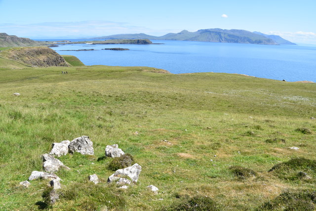
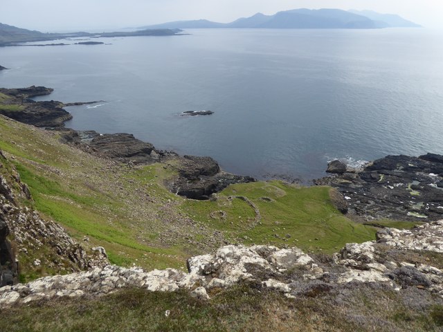
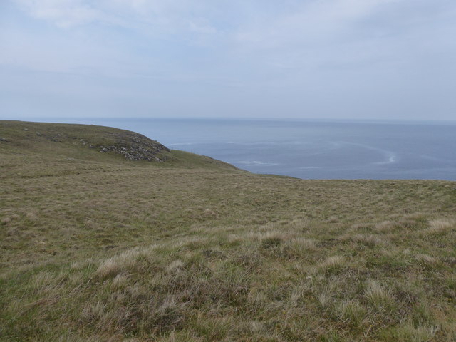
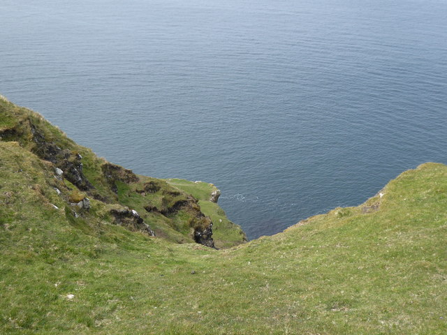
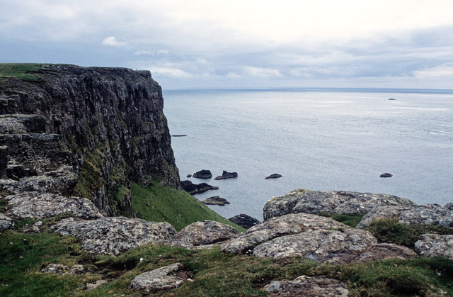
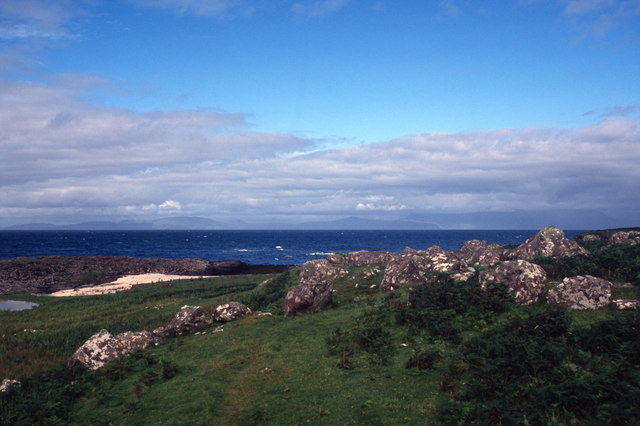
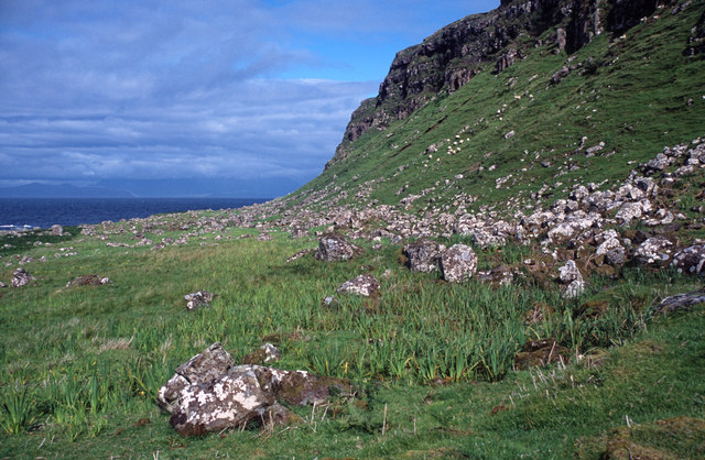
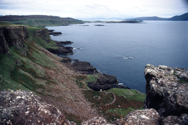
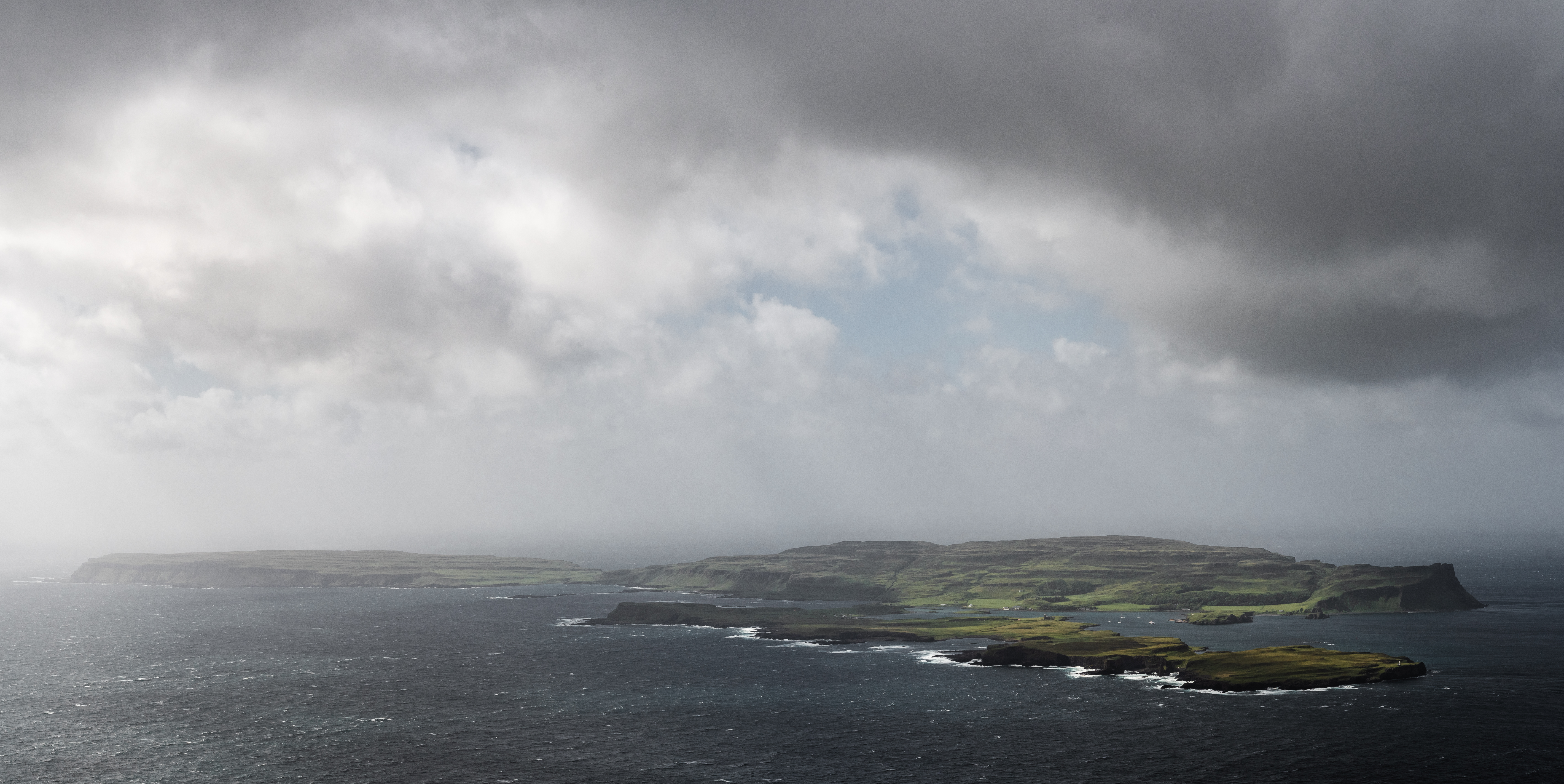
Am Beannan is a picturesque cliff located in Argyllshire, Scotland. Situated along the west coast of the country, it boasts stunning views of the Atlantic Ocean. The cliff is characterized by its steep slope, which drops dramatically into the crashing waves below.

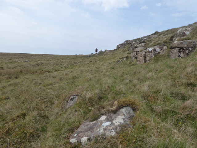
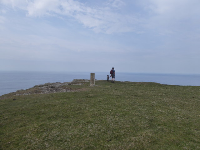
Standing at an impressive height, Am Beannan is a popular spot for nature enthusiasts and photographers alike. Its rugged and rocky terrain, along with the surrounding lush greenery, creates a breathtaking backdrop for visitors to enjoy. The cliff offers a unique vantage point to observe the power and beauty of the ocean, as well as the diverse wildlife that inhabits the area.

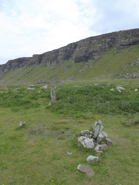
The geological formation of Am Beannan is fascinating, with layers of sedimentary rock, formed over millions of years, visible along its face. These layers tell the story of the area's ancient history, offering a glimpse into the dynamic geological processes that shaped the landscape.

Due to its remote location, Am Beannan provides a tranquil and serene atmosphere, away from the hustle and bustle of city life. Its natural beauty and peaceful surroundings make it an ideal spot for hiking and exploring. Visitors can embark on scenic walks along the cliff's edge, taking in the panoramic views and immersing themselves in the raw beauty of the Scottish coast.

Overall, Am Beannan is a captivating cliff in Argyllshire, offering a glimpse into Scotland's rugged and awe-inspiring natural landscapes. It is a must-visit destination for anyone seeking a memorable and immersive outdoor experience.

If you have any feedback on the listing, please let us know in the comments section below.

Am Beannan Images

Images are sourced within 2km of 57.046161/-6.5736278 or Grid Reference NG2204. Thanks to Geograph Open Source API. All images are credited.

Tarbert Bay, Isle of Canna Tarbert Bay has good exposures of columnar basalt at the head of the beach as does the coastline beyond. The image was taken while sheltering from hail showers on an extremely windy day. The southern coastline of Canna and Bloodstone Hill and other mountains on Rum are visible in the background.
Tarbert Bay, Isle of Canna
Tarbert Bay has good exposures of columnar basalt at the head of the beach as does the coastline beyond. The image was taken while sheltering from hail showers on an extremely windy day. The southern coastline of Canna and Bloodstone Hill and other mountains on Rum are visible in the background.
Possible Cist? Is this an old stone cist or just some stones that happen to be arranged in a rectangle.  Seen with Sanday and Rum in the background.
Possible Cist?
Is this an old stone cist or just some stones that happen to be arranged in a rectangle. Seen with Sanday and Rum in the background.
Inlets on the south coast of Canna
Old wall at Tarbert, Isle of Canna
Sgorr nam Bàn-naomha, Isle of Canna These ruins are thought to be the remains of a nunnery of the Columban or post-Columban era.
Sgorr nam Bàn-naomha, Isle of Canna
These ruins are thought to be the remains of a nunnery of the Columban or post-Columban era.
Rocks and grass in the west of Canna
Trig point at the west end of Canna
Grassland at Garrisdale, Isle of Canna
Grave and standing stone, Congearaidh
Ruadh-sgorr, Isle of Canna Not an easy place to get to, but someone made the journey down the cliffs to work these lazy beds on the north of Canna.
Ruadh-sgorr, Isle of Canna
Not an easy place to get to, but someone made the journey down the cliffs to work these lazy beds on the north of Canna.
Steep slopes on the north coast of Canna
Looking westward from Tarbet, Isle of Canna
Farm building at Tarbert, Isle of Canna
Small inlet on Tarbert Bay, Isle of Canna
The cliffs of Garrisdale Point, Isle of Canna The pillar of the OS Trig Station can be seen beyond the headland.
The cliffs of Garrisdale Point, Isle of Canna
The pillar of the OS Trig Station can be seen beyond the headland.
Close to the beach below Conagearaidh A scramble down the cliff leads to some very fine grass enjoyed by the farm animals of Canna.
Close to the beach below Conagearaidh
A scramble down the cliff leads to some very fine grass enjoyed by the farm animals of Canna.
Under the Conagearaidh cliffs, Isle of Canna An unexpected find on the north coast of Canna.  Better concentration on map reading should have identified the area as worthy of exploration.  It does mean losing considerable height to visit when walking the perimeter cliffs of Canna.
Under the Conagearaidh cliffs, Isle of Canna
An unexpected find on the north coast of Canna. Better concentration on map reading should have identified the area as worthy of exploration. It does mean losing considerable height to visit when walking the perimeter cliffs of Canna.
The Nunnery, Canna Below the steep cliffs is an ancient site seen from above as two circular rings. Originally it would have been accessed from the sea. The construction comprises an enclosure, the drystone walling of which is 5ft thick. Within the enclosure, four structures are built against the outer wall, while three others are free standing. Of these, only a well-house and mill have so far been determined.
The Nunnery, Canna
Below the steep cliffs is an ancient site seen from above as two circular rings. Originally it would have been accessed from the sea. The construction comprises an enclosure, the drystone walling of which is 5ft thick. Within the enclosure, four structures are built against the outer wall, while three others are free standing. Of these, only a well-house and mill have so far been determined.
Show me another place!

Am Beannan is located at Grid Ref: NG2204 (Lat: 57.046161, Lng: -6.5736278)

Unitary Authority: Highland

Police Authority: Highlands and Islands

What 3 Words

///weeknight.abolish.saloons. Near Carbost, Highland

Related Wikis

Canna, Scotland

Canna (; Scottish Gaelic: Canaigh, Eilean Chanaigh) is the westernmost of the Small Isles archipelago, in the Scottish Inner Hebrides. It is linked to...

A' Chill

A' Chill was a village on Canna, in the Scottish Small Isles. The name means "the cell", referring to a Culdee church, and is often anglicised as "Kil...

St Edward's Church, Sanday

St Edward's Church, Sanday, is a deconsecrated, and now disused church on the small isle of Sanday, Inner Hebrides, Scotland. The church was a gift to...

St Columba's Church, Canna

St Columba's Church is a Category B listed building on the isle of Canna, in the Small Isles, Highland, Scotland. == History == Prior to the building of...

Nearby Amenities

Located within 500m of 57.046161,-6.5736278
Source: PGS
Lat/Long: 57.048/-6.56628
Source: PGS
Lat/Long: 57.04776/-6.56678
Source: PGS
Lat/Long: 57.04762/-6.56701
Source: PGS
Lat/Long: 57.04751/-6.56727
Source: PGS
Lat/Long: 57.04739/-6.56751
Source: PGS
Lat/Long: 57.04726/-6.56774
Source: PGS
Lat/Long: 57.0467844/-6.5687147
Source: PGS
Lat/Long: 57.04599/-6.5683
Source: PGS
Lat/Long: 57.04573/-6.56832
Source: PGS
Lat/Long: 57.04538/-6.56952
Source: PGS
Lat/Long: 57.04541/-6.57093
Source: PGS
Lat/Long: 57.04541/-6.5714
Source: PGS
Lat/Long: 57.04492/-6.57237
Source: PGS
Lat/Long: 57.0448/-6.57285
Source: PGS
Lat/Long: 57.04583/-6.57278
Source: PGS
Lat/Long: 57.04572/-6.57373
Source: PGS
Lat/Long: 57.04558/-6.57397
Source: PGS
Lat/Long: 57.04547/-6.57421
Source: PGS
Lat/Long: 57.04548/-6.57468
Source: PGS
Lat/Long: 57.04561/-6.57491
Source: PGS
Lat/Long: 57.04573/-6.57513
Source: PGS
Lat/Long: 57.04589/-6.57559
Source: PGS
Lat/Long: 57.04537/-6.57563
Source: PGS
Lat/Long: 57.04553/-6.57751
Source: PGS
Lat/Long: 57.04554/-6.57797
Source: PGS
Lat/Long: 57.04542/-6.57821
Source: PGS
Lat/Long: 57.0444/-6.57851
Source: PGS
Lat/Long: 57.04441/-6.57898
Source: PGS
Lat/Long: 57.04493/-6.57918
Source: PGS
Lat/Long: 57.04545/-6.57938
Source: PGS
Lat/Long: 57.04532/-6.57986
Source: PGS
Lat/Long: 57.04521/-6.58081
Source: PGS
Lat/Long: 57.04546/-6.58055
Source: PGS
Lat/Long: 57.04597/-6.58029
Source: PGS
Lat/Long: 57.04585/-6.58077
Am Beannan
Place: locality
Source: OS_OpenData_StreetView
Lat/Long: 57.0462314/-6.5742717
Cnon Loisgte
Place: locality
Source: OS_OpenData_StreetView
Lat/Long: 57.0506372/-6.5737425
Rubha Sgorr nam Ban-naomha
Place: locality
Source: OS_OpenData_StreetView
Lat/Long: 57.0455756/-6.5681103
Sgorr nam Ban-naomha
Place: locality
Source: OS_OpenData_StreetView
Lat/Long: 57.0477054/-6.5699236
The data included in this document is from www.openstreetmap.org. The data is made available under ODbL.

Have you been to Am Beannan?

Leave your review of Am Beannan below (or comments, questions and feedback).