Sliabh Meadhonach

Downs, Moorland in Argyllshire

Scotland

Sliabh Meadhonach

Possible Cist? Is this an old stone cist or just some stones that happen to be arranged in a rectangle.  Seen with Sanday and Rum in the background.
Possible Cist? Credit: Jonathan Long

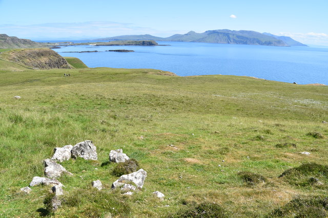
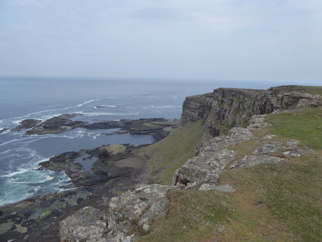
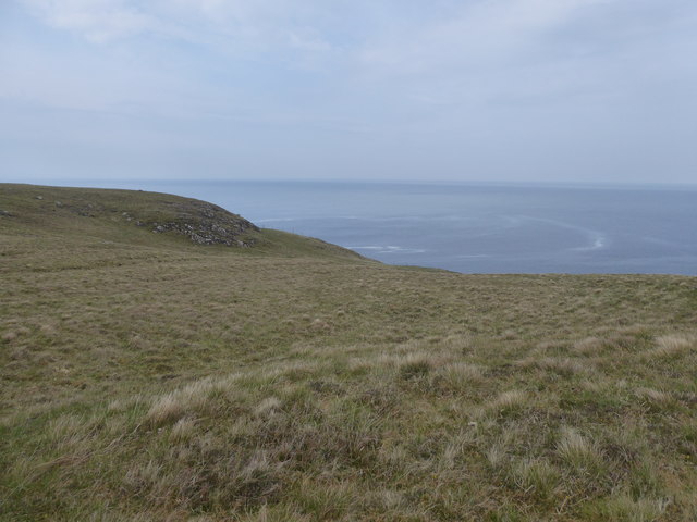
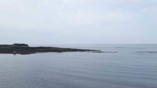
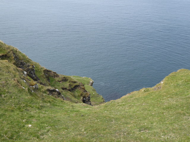
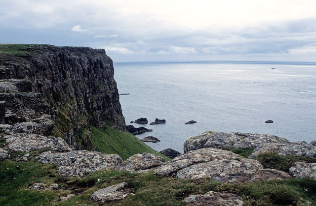
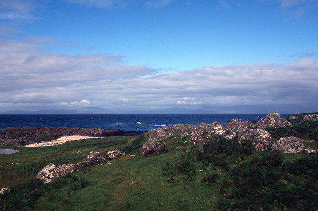
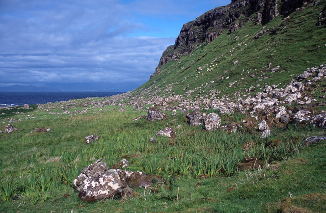
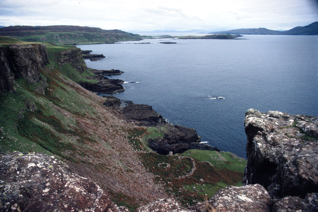
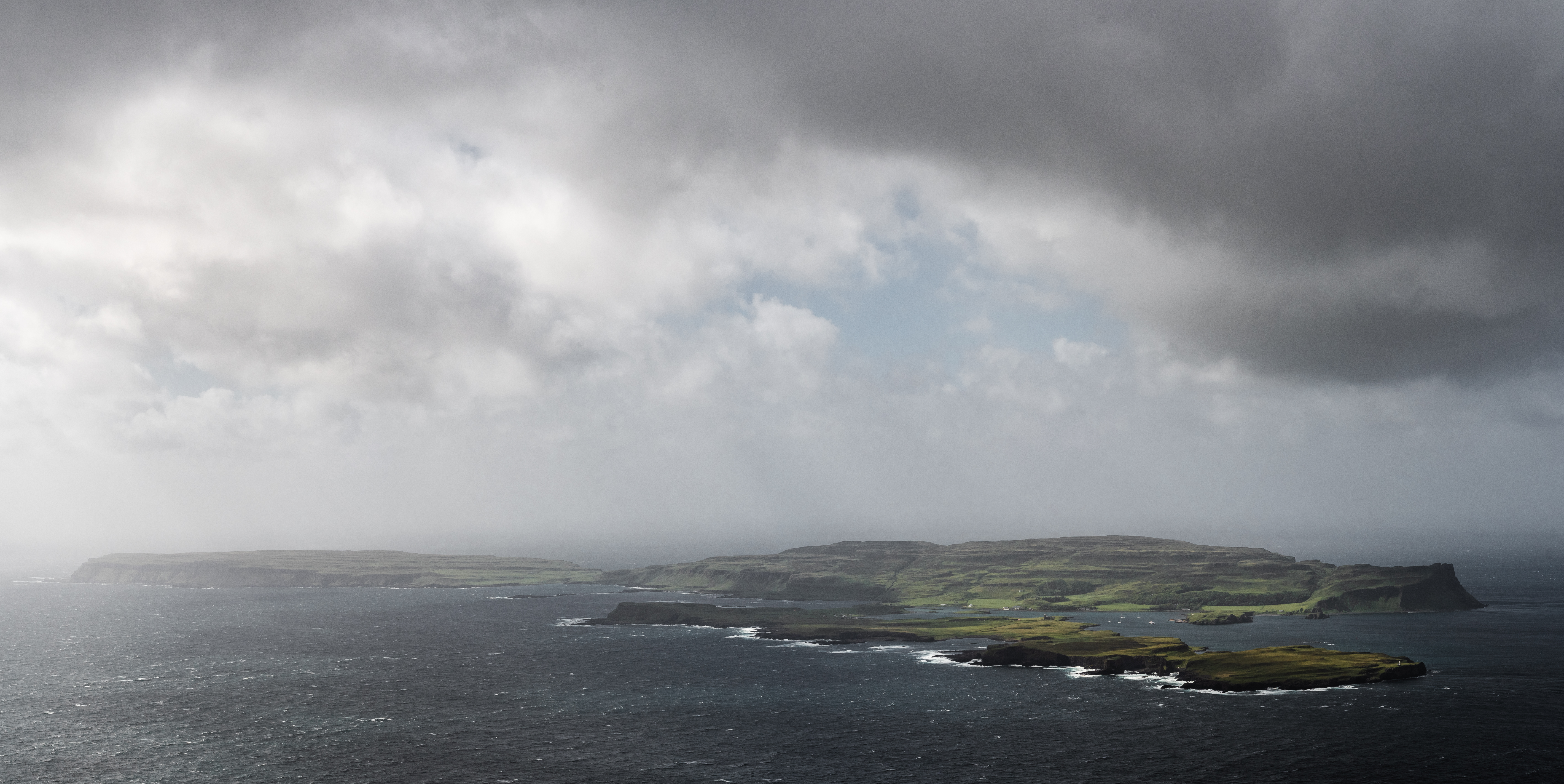
Sliabh Meadhonach, located in Argyllshire, Scotland, is a picturesque and expansive area of downs and moorland. Situated in the western part of the country, it stretches across rolling hills and vast open spaces, offering breathtaking views and a sense of tranquility to all who visit.

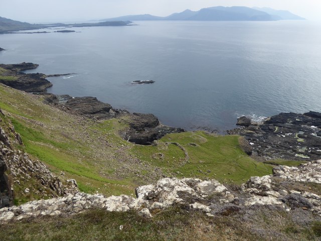
The landscape of Sliabh Meadhonach is characterized by its diverse topography. It features gentle slopes, heather-covered moorlands, and scattered rocky outcrops. The downs provide a unique habitat for a variety of plant and animal species, including an array of wildflowers and birds, making it a haven for nature enthusiasts and birdwatchers.

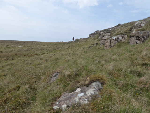
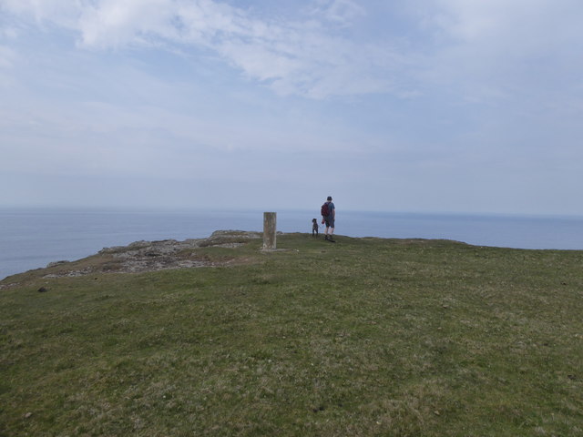
The area is renowned for its walking and hiking opportunities, with numerous trails and paths crisscrossing the downs and moorland. These trails cater to different skill levels, allowing both beginners and experienced hikers to explore the area at their own pace. Along the way, visitors can enjoy the stunning scenery, breathe in the fresh air, and immerse themselves in the serenity of the surroundings.

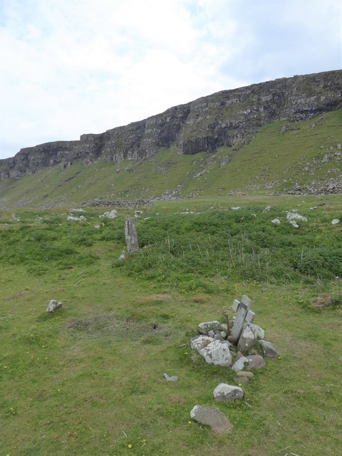
Sliabh Meadhonach is also known for its historical significance. It is home to ancient remains, including burial cairns and standing stones, which provide a glimpse into the area's rich archaeological heritage. Exploring these sites can offer a fascinating insight into the lives of the people who once inhabited this land.

Overall, Sliabh Meadhonach in Argyllshire offers a captivating blend of natural beauty, outdoor activities, and historical intrigue. Whether one seeks solitude in the vast moorlands or seeks adventure on the hiking trails, this area is a true gem for those seeking an escape to nature.

If you have any feedback on the listing, please let us know in the comments section below.

Sliabh Meadhonach Images

Images are sourced within 2km of 57.048936/-6.585803 or Grid Reference NG2204. Thanks to Geograph Open Source API. All images are credited.

Possible Cist? Is this an old stone cist or just some stones that happen to be arranged in a rectangle.  Seen with Sanday and Rum in the background.
Possible Cist?
Is this an old stone cist or just some stones that happen to be arranged in a rectangle. Seen with Sanday and Rum in the background.
Inlets on the south coast of Canna
Old wall at Tarbert, Isle of Canna
Sgorr nam Bàn-naomha, Isle of Canna These ruins are thought to be the remains of a nunnery of the Columban or post-Columban era.
Sgorr nam Bàn-naomha, Isle of Canna
These ruins are thought to be the remains of a nunnery of the Columban or post-Columban era.
Rocks and grass in the west of Canna
Trig point at the west end of Canna
Looking to Garrisdale Point, Isle of Canna
Grassland at Garrisdale, Isle of Canna
Rocks by Sgeir nan Sgarbh, Isle of Canna
Grave and standing stone, Congearaidh
Ruadh-sgorr, Isle of Canna Not an easy place to get to, but someone made the journey down the cliffs to work these lazy beds on the north of Canna.
Ruadh-sgorr, Isle of Canna
Not an easy place to get to, but someone made the journey down the cliffs to work these lazy beds on the north of Canna.
Steep slopes on the north coast of Canna
Farm building at Tarbert, Isle of Canna
The cliffs of Garrisdale Point, Isle of Canna The pillar of the OS Trig Station can be seen beyond the headland.
The cliffs of Garrisdale Point, Isle of Canna
The pillar of the OS Trig Station can be seen beyond the headland.
Close to the beach below Conagearaidh A scramble down the cliff leads to some very fine grass enjoyed by the farm animals of Canna.
Close to the beach below Conagearaidh
A scramble down the cliff leads to some very fine grass enjoyed by the farm animals of Canna.
Under the Conagearaidh cliffs, Isle of Canna An unexpected find on the north coast of Canna.  Better concentration on map reading should have identified the area as worthy of exploration.  It does mean losing considerable height to visit when walking the perimeter cliffs of Canna.
Under the Conagearaidh cliffs, Isle of Canna
An unexpected find on the north coast of Canna. Better concentration on map reading should have identified the area as worthy of exploration. It does mean losing considerable height to visit when walking the perimeter cliffs of Canna.
The Nunnery, Canna Below the steep cliffs is an ancient site seen from above as two circular rings. Originally it would have been accessed from the sea. The construction comprises an enclosure, the drystone walling of which is 5ft thick. Within the enclosure, four structures are built against the outer wall, while three others are free standing. Of these, only a well-house and mill have so far been determined.
The Nunnery, Canna
Below the steep cliffs is an ancient site seen from above as two circular rings. Originally it would have been accessed from the sea. The construction comprises an enclosure, the drystone walling of which is 5ft thick. Within the enclosure, four structures are built against the outer wall, while three others are free standing. Of these, only a well-house and mill have so far been determined.
Druim na Tire, Isle of Canna View East to Rum from Druim na Tire on Canna.
Druim na Tire, Isle of Canna
View East to Rum from Druim na Tire on Canna.
Show me another place!

Sliabh Meadhonach is located at Grid Ref: NG2204 (Lat: 57.048936, Lng: -6.585803)

Unitary Authority: Highland

Police Authority: Highlands and Islands

What 3 Words

///blushes.defectors.deduct. Near Carbost, Highland

Related Wikis

Canna, Scotland

Canna (; Scottish Gaelic: Canaigh, Eilean Chanaigh) is the westernmost of the Small Isles archipelago, in the Scottish Inner Hebrides. It is linked to...

A' Chill

A' Chill was a village on Canna, in the Scottish Small Isles. The name means "the cell", referring to a Culdee church, and is often anglicised as "Kil...

St Edward's Church, Sanday

St Edward's Church, Sanday, is a deconsecrated, and now disused church on the small isle of Sanday, Inner Hebrides, Scotland. The church was a gift to...

St Columba's Church, Canna

St Columba's Church is a Category B listed building on the isle of Canna, in the Small Isles, Highland, Scotland. == History == Prior to the building of...

Nearby Amenities

Located within 500m of 57.048936,-6.585803
Source: PGS
Lat/Long: 57.04546/-6.58055
Source: PGS
Lat/Long: 57.04597/-6.58029
Source: PGS
Lat/Long: 57.04585/-6.58077
Source: PGS
Lat/Long: 57.04575/-6.58218
Source: PGS
Lat/Long: 57.04524/-6.58221
Source: PGS
Lat/Long: 57.04513/-6.58316
Source: PGS
Lat/Long: 57.04464/-6.58413
Sliabh Meadhonach
Corbett: no
Ele: 149
Graham: no
Munro: no
Natural: peak
Lat/Long: 57.0508454/-6.5846256
Glac Bhre-sgorr
Place: locality
Source: OS_OpenData_StreetView
Lat/Long: 57.045291/-6.5888576
Beul an Iola-sgoir
Place: locality
Source: OS_OpenData_StreetView
Lat/Long: 57.0472061/-6.5837152
Druim na Tire
Place: locality
Source: OS_OpenData_StreetView
Lat/Long: 57.0527739/-6.5833699
Iola-Sgorr
Place: locality
Source: OS_OpenData_StreetView
Lat/Long: 57.0455808/-6.58422
Leob on Fhionnaidh
Ele: 134
Natural: peak
Lat/Long: 57.0493368/-6.5934023
The data included in this document is from www.openstreetmap.org. The data is made available under ODbL.

Have you been to Sliabh Meadhonach?

Leave your review of Sliabh Meadhonach below (or comments, questions and feedback).