Back Sand Point
Coastal Feature, Headland, Point in Kent Dover
England
Back Sand Point

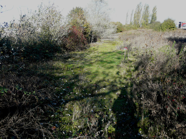
Black Sand Point is a prominent coastal feature located in Kent, England. It is a headland that juts out into the English Channel, forming a point that is often referred to as Black Sand Point.
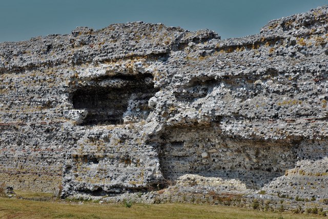
The point gets its name from the distinctive black sand that can be found along its shoreline. This sand is the result of a mix of volcanic and sedimentary rock formations in the area. The black sand creates a striking contrast against the white cliffs and blue waters of the English Channel, making Black Sand Point a visually stunning location.
The headland itself is a popular spot for visitors, offering breathtaking views of the surrounding coastline. It is also a haven for birdwatchers, as it provides a habitat for various species of seabirds, including gulls, cormorants, and fulmars. These birds can often be seen soaring above the cliffs or nesting in the crevices.
Black Sand Point is also known for its historical significance. It was once a strategic location for coastal defense, with remnants of military fortifications still visible today. These fortifications were built during World War II to protect against potential enemy invasions. Today, they serve as a reminder of the area's wartime past.
Overall, Black Sand Point is a beautiful and historically significant coastal feature in Kent. Its black sand, stunning views, and rich wildlife make it a must-visit destination for nature enthusiasts and history buffs alike.
If you have any feedback on the listing, please let us know in the comments section below.
Back Sand Point Images
Images are sourced within 2km of 51.297008/1.3543665 or Grid Reference TR3360. Thanks to Geograph Open Source API. All images are credited.


Back Sand Point is located at Grid Ref: TR3360 (Lat: 51.297008, Lng: 1.3543665)
Administrative County: Kent
District: Dover
Police Authority: Kent
What 3 Words
///restores.visions.punchy. Near Sandwich, Kent
Nearby Locations
Related Wikis

Richboro Port railway station
Richboro Port railway station was constructed by the East Kent Light Railway, as part of its branch to Richborough Port, which never opened to passengers...

South Thanet (UK Parliament constituency)
South Thanet is a constituency in Kent represented in the House of Commons of the UK Parliament since 2015 by Craig Mackinlay, a Conservative.Further to...
1932 Open Championship
The 1932 Open Championship was the 67th Open Championship, held 8–10 June at Prince's Golf Club in Sandwich, England. Gene Sarazen won his only Open title...
1956 Curtis Cup
The 9th Curtis Cup Match was played on 8 and 9 June 1956 at Prince's Golf Club in Sandwich, Kent, England. The British Isles won by 5 matches to 4, to...

Prince's Beachlands
Prince's Beachlands is a 6-hectare (15-acre) Local Nature Reserve north of Sandwich in Kent. It is owned by Dover Town Council and managed by Kent Wildlife...
Prince's Golf Club, Sandwich
Prince's Golf Club, Sandwich is a links golf course located in Sandwich in Kent in South East England. Prince's is immediately adjacent to the more famous...
Richborough Castle Halt railway station
Richborough Castle Halt was a minor station on the Kent Coast Line named after the nearby Richborough Castle. It opened in 1918 for military use. Public...
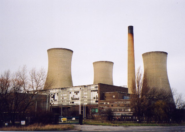
Richborough Power Station
Richborough power station was a 336 MW power station close to the mouth of the River Stour near Sandwich, on the east coast of Kent. It was built on land...
Nearby Amenities
Located within 500m of 51.297008,1.3543665Have you been to Back Sand Point?
Leave your review of Back Sand Point below (or comments, questions and feedback).