Ledge Point
Coastal Feature, Headland, Point in Kent Thanet
England
Ledge Point

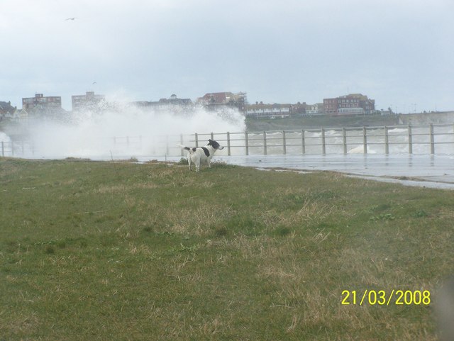
Ledge Point is a prominent coastal feature located in Kent, England. Situated along the southeastern coast of the country, specifically in the district of Dover, it is classified as a headland or a point due to its unique geographical formation. Ledge Point is positioned between the coastal towns of St Margaret's Bay and Kingsdown, overlooking the English Channel.
This headland is characterized by its towering cliffs that rise majestically above the sea. The cliffs are composed of chalk, a distinctive feature of the area, which gives them a bright white appearance. These cliffs not only serve as a defining characteristic of Ledge Point but also provide a natural defense against coastal erosion.
Visitors to Ledge Point are treated to breathtaking views of the English Channel and the rugged coastline. The headland also offers a vantage point for observing passing ships and boats, making it a popular spot for locals and tourists alike. Additionally, Ledge Point is home to a variety of bird species, making it a haven for birdwatchers.
While the cliffs can be awe-inspiring, caution is advised when exploring Ledge Point due to its steep and potentially unstable terrain. Visitors are encouraged to adhere to safety guidelines and avoid venturing too close to the cliff edges.
Overall, Ledge Point is a striking coastal feature that showcases the natural beauty of the Kent coast. Its picturesque cliffs, panoramic views, and diverse wildlife make it a must-visit destination for nature enthusiasts and those seeking a glimpse of the stunning English coastline.
If you have any feedback on the listing, please let us know in the comments section below.
Ledge Point Images
Images are sourced within 2km of 51.38583/1.3346992 or Grid Reference TR3270. Thanks to Geograph Open Source API. All images are credited.


Ledge Point is located at Grid Ref: TR3270 (Lat: 51.38583, Lng: 1.3346992)
Administrative County: Kent
District: Thanet
Police Authority: Kent
What 3 Words
///cashiers.conjured.geologist. Near Westgate on Sea, Kent
Nearby Locations
Related Wikis
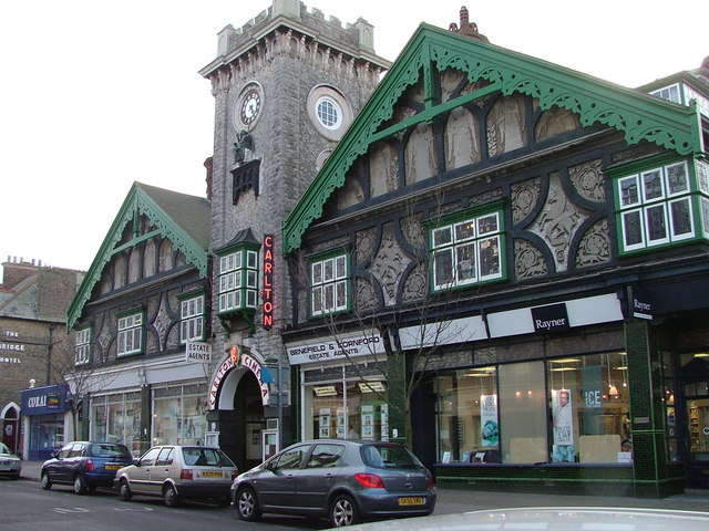
Carlton Cinema, Westgate-on-Sea
The Carlton Cinema, in Westgate-on-Sea, Kent, England dates from 1910. The extension of the railway into East Kent in 1871 led to the creation of a number...
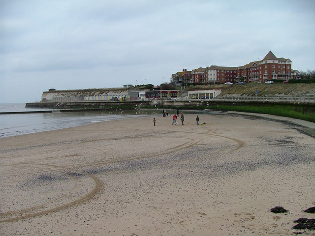
Westgate-on-Sea
Westgate-on-Sea is a seaside town and civil parish on the north-east coast of Kent, England. It is within the Thanet local government district and borders...
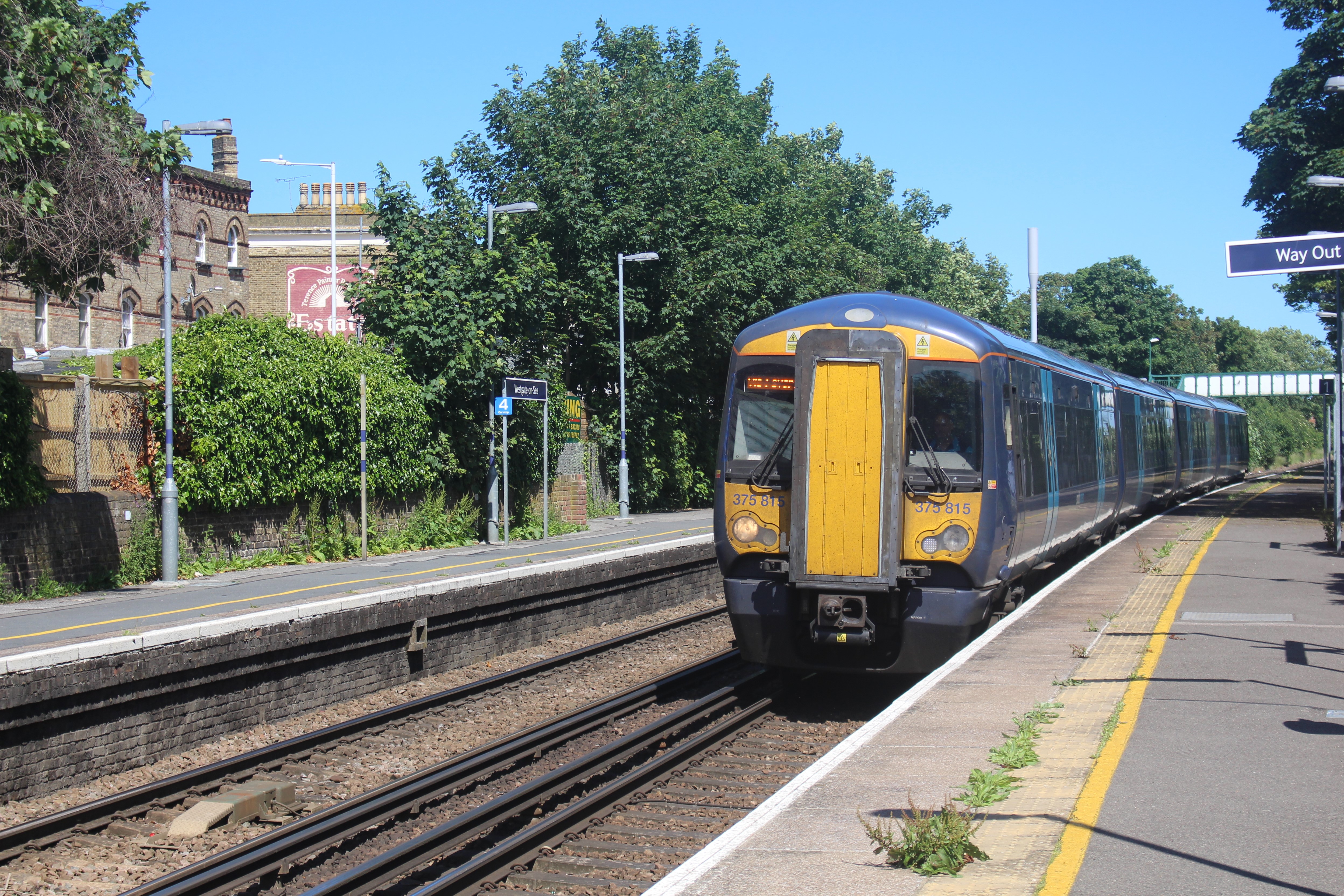
Westgate-on-Sea railway station
Westgate-on-Sea railway station is on the Chatham Main Line in England, serving the town of Westgate-on-Sea, Kent. It is 72 miles 35 chains (116.6 km)...

Ursuline College, Westgate-on-Sea
Ursuline College (formerly Ursuline Convent School) is a Catholic comprehensive secondary school with academy status, located in Westgate-on-Sea, in north...
Related Videos

Minnis Bay & Birchington on Sea, a Walking History Tour Guide Using Postcards Kent UK
Minnis Bay & Birchington on Sea, Kent, UK, A walking history tour guide using old postcards. Would really appreciate it if you ...


Holiday at Birchington on sea
Park holidays at Birchington on sea Please like and subscribe thank you.

Birchington to Margate Beach Walk: Exploring the Coastal Beauty of England | Walk Guide 🇬🇧
Discover the scenic beauty of the Birchington to Margate Beach walk along the stunning coastline of England. This walk guide ...
Nearby Amenities
Located within 500m of 51.38583,1.3346992Have you been to Ledge Point?
Leave your review of Ledge Point below (or comments, questions and feedback).