Peter's Point

Coastal Feature, Headland, Point in Essex Tendring

England

Peter's Point

Skippers Island; 2010
Skippers Island; 2010 Credit: Mr James D

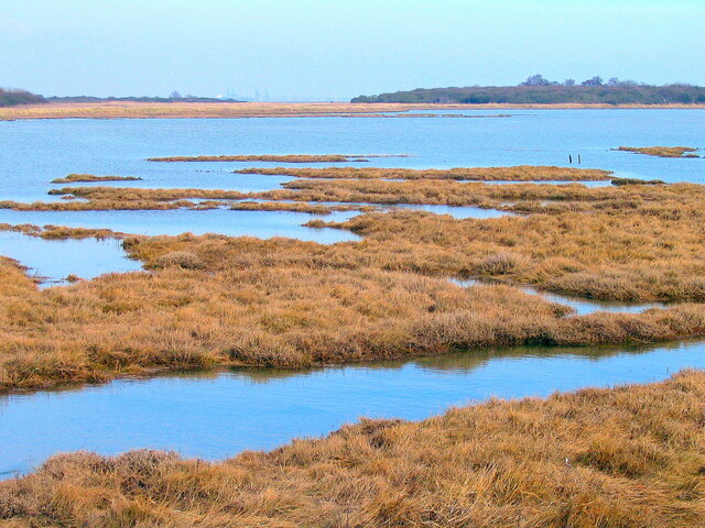
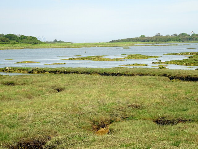
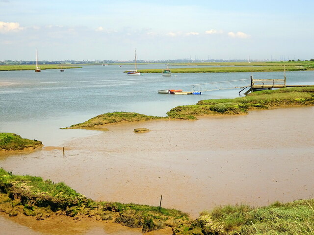
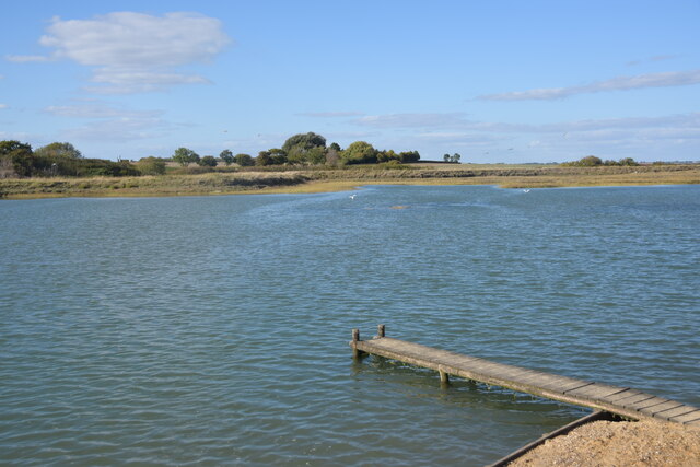
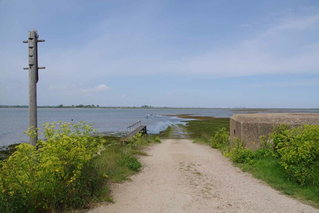
Peter's Point is a prominent coastal feature located in the county of Essex, in southeastern England. It is a headland that juts out into the North Sea, forming a distinct point along the coastline. The point is named after Peter, a local fisherman who used to frequent the area in the past.

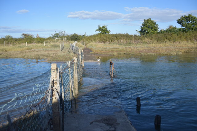
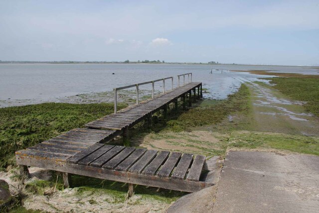
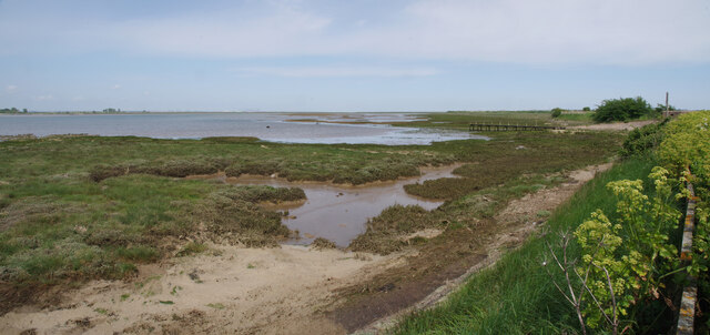
The headland is characterized by its rugged cliffs, which are composed of sedimentary rocks such as sandstone and chalk. These cliffs provide a stunning backdrop to the point and offer panoramic views of the surrounding area. The point itself is a popular spot for tourists and locals alike, who come to enjoy the natural beauty of the coastline and take in the fresh sea air.

The area surrounding Peter's Point is rich in biodiversity, with a variety of plant and animal species calling it home. Seabirds such as gulls and cormorants can often be seen nesting on the cliffs, while marine life such as seals and dolphins can sometimes be spotted in the waters below.

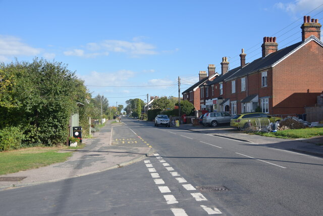
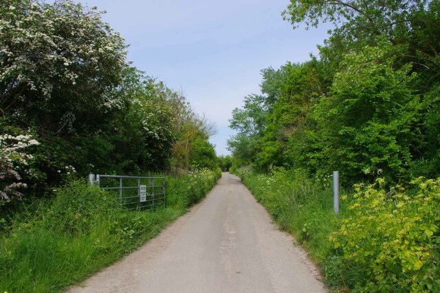
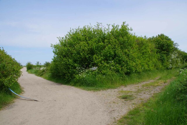
Access to Peter's Point is relatively easy, with a well-maintained footpath leading to the headland. There are also facilities nearby, including a car park and a small café where visitors can grab a bite to eat or a hot beverage.

Overall, Peter's Point is a stunning coastal feature that offers visitors the opportunity to experience the natural beauty of the Essex coastline. Its rugged cliffs, diverse wildlife, and breathtaking views make it a must-visit destination for nature lovers and outdoor enthusiasts.

If you have any feedback on the listing, please let us know in the comments section below.

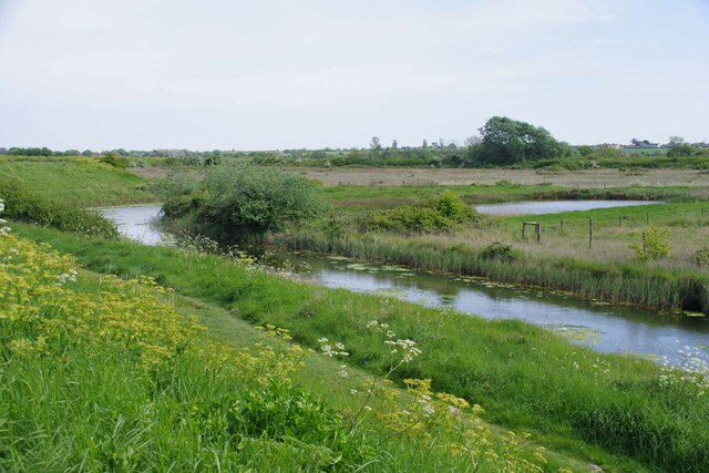
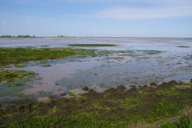
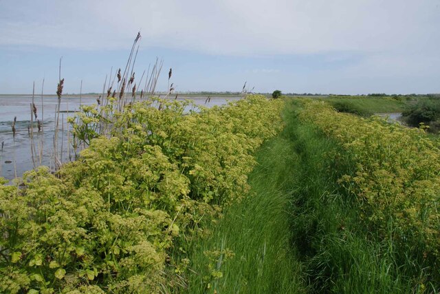
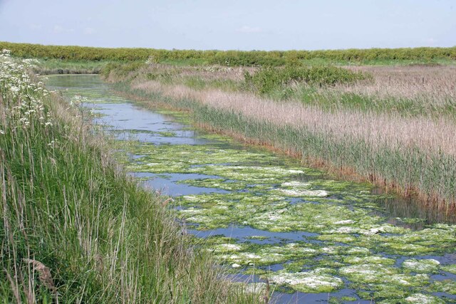
Peter's Point Images

Images are sourced within 2km of 51.860792/1.2361469 or Grid Reference TM2222. Thanks to Geograph Open Source API. All images are credited.

Skippers Island; 2010
Skippers Island; 2021
Hamford Water; near Skippers Island
Walton Road, Kirby-le-Soken Looking east along this main road through Kirby-le-Soken, taken from the end of Quay Lane.
Walton Road, Kirby-le-Soken
Looking east along this main road through Kirby-le-Soken, taken from the end of Quay Lane.
Part of Hamford Water National Nature Reserve Near the Quay, Kirby-le-Soken, is this small jetty used by swimmers in the tidal water.
Part of Hamford Water National Nature Reserve
Near the Quay, Kirby-le-Soken, is this small jetty used by swimmers in the tidal water.
High tide thwarts points-bagger I had intended to walk this path to access three more squares I haven't visited but didn't have suitable footwear for the high tide.
High tide thwarts points-bagger
I had intended to walk this path to access three more squares I haven't visited but didn't have suitable footwear for the high tide.
Bollard on Turpins Lane The no cycling sign on the right sends out <a href="https://www.geograph.org.uk/photo/7490406">TM2321 : Mixed Messages</a>
Bollard on Turpins Lane
The no cycling sign on the right sends out TM2321 : Mixed Messages
Mixed Messages Who's bright idea was it to put a cycle path logo on a no cycling sign?
Mixed Messages
Who's bright idea was it to put a cycle path logo on a no cycling sign?
Samphire Meadows Humm..... with a name like that it might be fun trying to get flood insurance! Just one of what appear to be dozens of building sites all over Tendering.
Samphire Meadows
Humm..... with a name like that it might be fun trying to get flood insurance! Just one of what appear to be dozens of building sites all over Tendering.
Island Lane Before the lane to Horsey Island is designated as a footpath.
Island Lane
Before the lane to Horsey Island is designated as a footpath.
The Way to Horsey Island The old Island Lane and footpath is out of shot to the left.
The Way to Horsey Island
The old Island Lane and footpath is out of shot to the left.
Pillbox and Horsey Causeway Looking across Hamford Water towards Horsey Island <span class="nowrap"><a title="https://en.wikipedia.org/wiki/Horsey_Island" rel="nofollow ugc noopener" href="https://en.wikipedia.org/wiki/Horsey_Island">Link</a><img style="margin-left:2px;" alt="External link" title="External link - shift click to open in new window" src="https://s1.geograph.org.uk/img/external.png" width="10" height="10"/></span>
Pillbox and Horsey Causeway
Looking across Hamford Water towards Horsey Island LinkExternal link
Jetty For Horsey Island A receding tide on Hamford Water <span class="nowrap"><a title="https://en.wikipedia.org/wiki/Horsey_Island" rel="nofollow ugc noopener" href="https://en.wikipedia.org/wiki/Horsey_Island">Link</a><img style="margin-left:2px;" alt="External link" title="External link - shift click to open in new window" src="https://s1.geograph.org.uk/img/external.png" width="10" height="10"/></span>
Jetty For Horsey Island
A receding tide on Hamford Water LinkExternal link
Horsey Jetty Panorama Looking along the sea wall back towards the <a href="https://www.geograph.org.uk/photo/7490432">TM2322 : Jetty For Horsey Island</a>.
Horsey Jetty Panorama
Looking along the sea wall back towards the TM2322 : Jetty For Horsey Island.
Borrow Dike Near St Peters Point The Alexanders in the foreground are prolific on the sea wall.
Borrow Dike Near St Peters Point
The Alexanders in the foreground are prolific on the sea wall.
Saltmarsh in the Wade Looking across Hamford Water.
Saltmarsh in the Wade
Looking across Hamford Water.
Alexanders On the Sea Wall Looking along Frinton & Walton Footpath 36 that follows the seawall.
Alexanders On the Sea Wall
Looking along Frinton & Walton Footpath 36 that follows the seawall.
Algae on the Borrow Dike Looking towards St Peters Point.
Algae on the Borrow Dike
Looking towards St Peters Point.
Show me another place!

Peter's Point is located at Grid Ref: TM2222 (Lat: 51.860792, Lng: 1.2361469)

Administrative County: Essex

District: Tendring

Police Authority: Essex

What 3 Words

///door.chucks.typed. Near Walton-on-the-Naze, Essex

Nearby Locations

Peter's Point

Related Wikis

Harwich (UK Parliament constituency)

Harwich was a parliamentary constituency represented in the House of Commons of the Parliament of the United Kingdom until its abolition for the 2010...

The Sokens

The Sokens is a name often used to describe the area containing the traditional parishes of Thorpe, Kirby and Walton, which now lie in Tendring district...
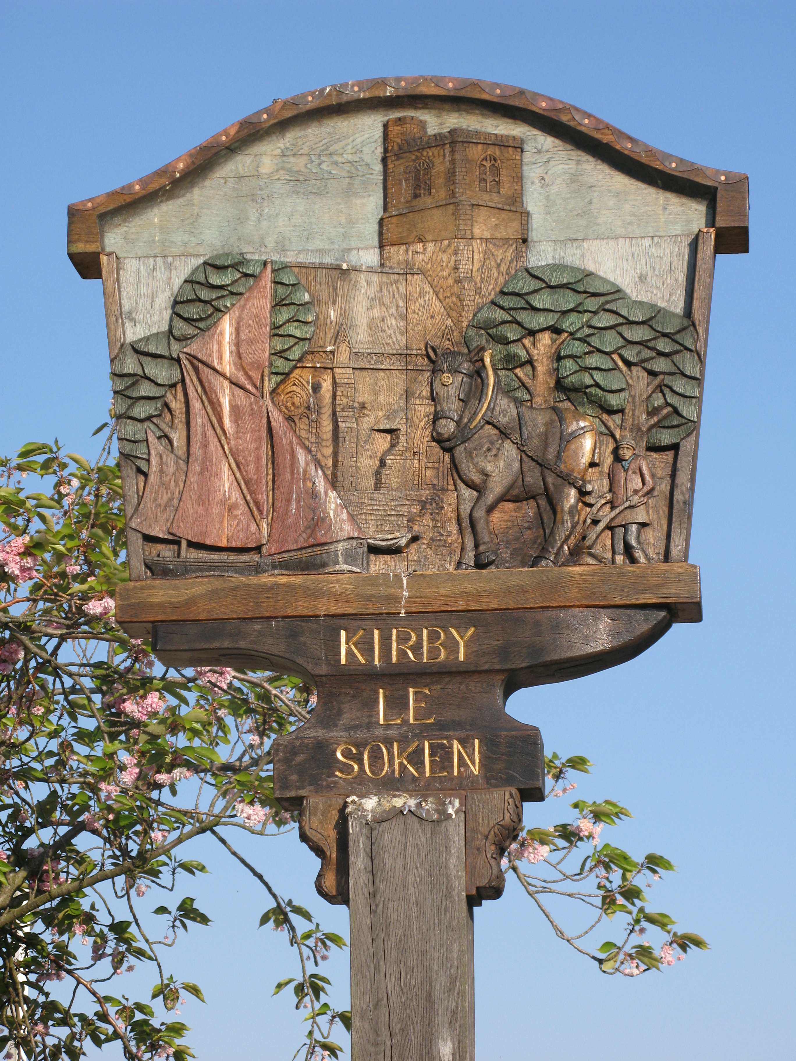
Kirby-le-Soken

Kirby-le-Soken is a village and former civil parish, now in the parish of Frinton and Walton, in the Tendring district of North East Essex, England, which...

Skipper's Island

Skipper's Island is a 94.3-hectare (233-acre) nature reserve north of Kirby-le-Soken in Essex, England. It is owned and managed by the Essex Wildlife Trust...

Have you been to Peter's Point?

Leave your review of Peter's Point below (or comments, questions and feedback).