Grendon

Settlement in Warwickshire North Warwickshire

England

Grendon

Canal boat Mabel Stark, Coventry Canal
Canal boat Mabel Stark, Coventry Canal Credit: Ian S

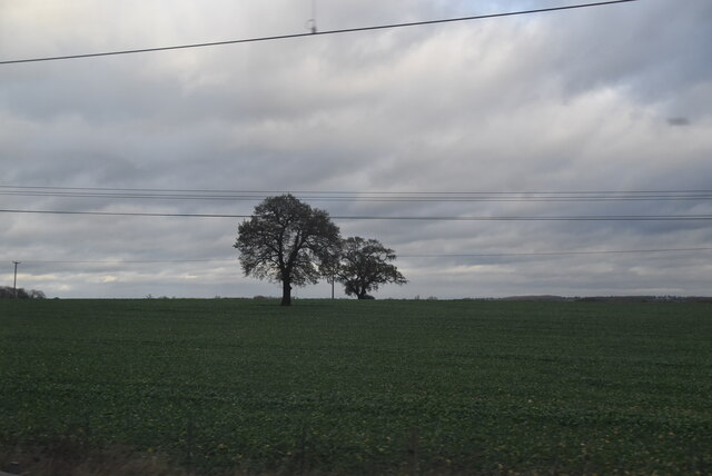
Grendon is a small village located in the county of Warwickshire, England. Situated approximately three miles southeast of the town of Atherstone, Grendon is home to a population of around 1,000 residents. The village is situated in a rural setting, surrounded by picturesque countryside and farmland.

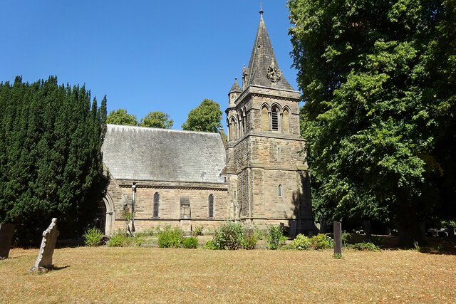
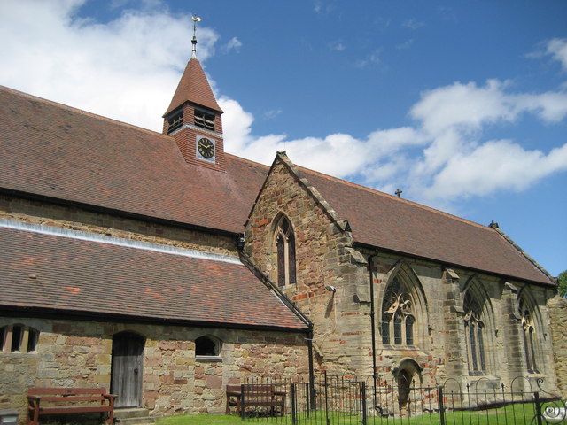
Grendon has a rich history dating back to medieval times, with evidence of settlement in the area since the 12th century. The village is known for its charming thatched cottages and historic buildings, including the Grade II listed St. Mary's Church, which dates back to the 14th century. The church features beautiful stained glass windows and an ancient yew tree in its churchyard.

Despite its small size, Grendon offers some amenities to its residents and visitors. The village has a local pub, The Bull Inn, which serves traditional English food and drinks. Additionally, there is a primary school, Grendon Primary School, providing education for children in the area.

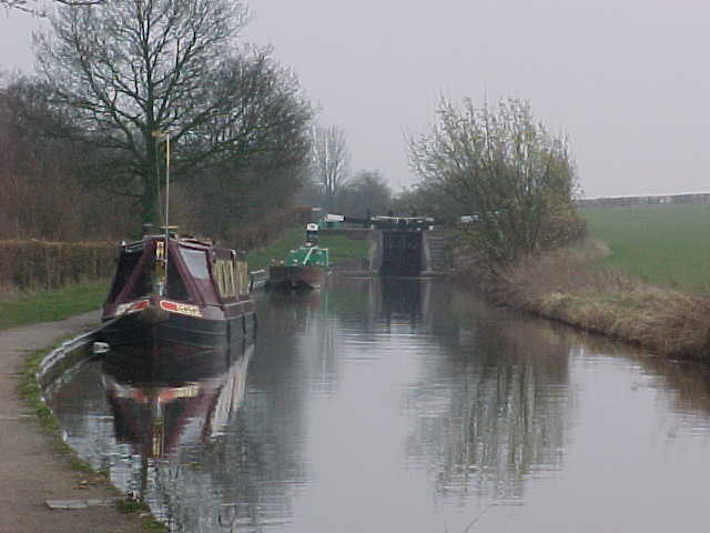
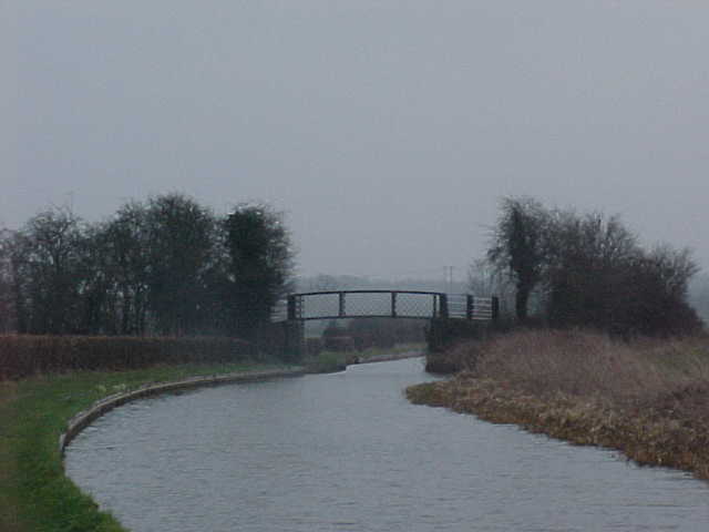
The surrounding countryside provides ample opportunities for outdoor activities, such as walking, cycling, and horse riding. Grendon is also located near the Ashby Canal, a popular spot for boating and fishing enthusiasts.

Overall, Grendon is a peaceful and picturesque village, offering a tranquil lifestyle away from the hustle and bustle of larger towns and cities. Its historical charm and natural beauty make it an attractive destination for visitors seeking a glimpse into rural Warwickshire life.

If you have any feedback on the listing, please let us know in the comments section below.

Grendon Images

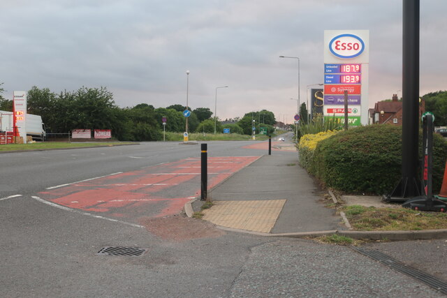
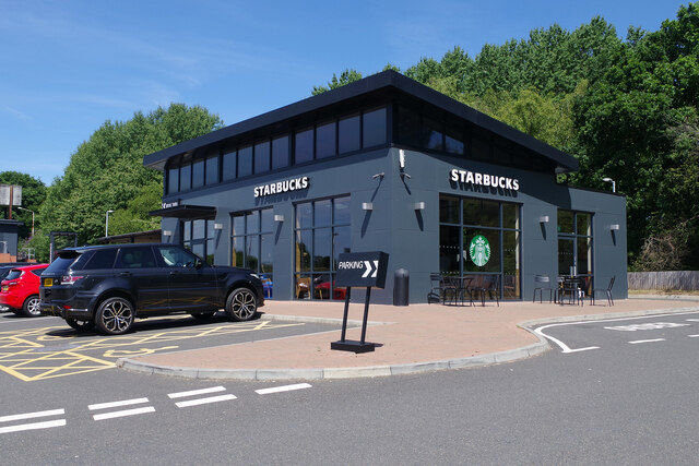
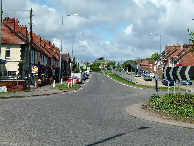
Images are sourced within 2km of 52.592644/-1.595927 or Grid Reference SP2799. Thanks to Geograph Open Source API. All images are credited.

Canal boat Mabel Stark, Coventry Canal
Coventry Canal at Atherstone Bottom Lock, lock #9
Moored boats On the Coventry Canal, below Atherstone Bottom Lock.
Moored boats
On the Coventry Canal, below Atherstone Bottom Lock.
Coventry Canal Approaching Whitley Bridge, number 47.
Coventry Canal
Approaching Whitley Bridge, number 47.
Isolated trees
Isolated trees
Essar petrol station on Watling Street, Dordon
Watling Street, Dordon
Parking area on Watling Street, Grendon
Starbucks, Dordon Dordon has acquired a Starbucks coffee house in this striking building at the rear of the Centurion Service Station site.
Starbucks, Dordon
Dordon has acquired a Starbucks coffee house in this striking building at the rear of the Centurion Service Station site.
Baddesley Ensor Church St Nicholas.
Baddesley Ensor Church
St Nicholas.
Fields near Dairy House Farm
Atherstone Bottom Lock east of Grendon, Staffordshire This shows the Coventry Canal, looking south-east towards Atherstone Bottom Lock, No 11. The flight of eleven raises (or lowers) the water level by eighty feet (24·4 metres) over about two miles (three kilometres). Nearby and off to the left is the River Anker.
Atherstone Bottom Lock east of Grendon, Staffordshire
This shows the Coventry Canal, looking south-east towards Atherstone Bottom Lock, No 11. The flight of eleven raises (or lowers) the water level by eighty feet (24·4 metres) over about two miles (three kilometres). Nearby and off to the left is the River Anker.
Canal at Atherstone Locks in Warwickshire Looking south-east towards Atherstone Locks no 10, the second one up in the flight of eleven, which  raises (or lowers) the water level by eighty feet (24·4 metres) over about two miles (three kilometres).
Canal at Atherstone Locks in Warwickshire
Looking south-east towards Atherstone Locks no 10, the second one up in the flight of eleven, which raises (or lowers) the water level by eighty feet (24·4 metres) over about two miles (three kilometres).
Canal at Atherstone Locks in Warwickshire Looking south-east towards Atherstone Locks No 10, the second one up in the flight of eleven, which  raises (or lowers) the water level by eighty feet (24·4 metres) over about two miles (three kilometres).
Canal at Atherstone Locks in Warwickshire
Looking south-east towards Atherstone Locks No 10, the second one up in the flight of eleven, which raises (or lowers) the water level by eighty feet (24·4 metres) over about two miles (three kilometres).
Railway north-west of Atherstone in Warwickshire This is the West Coast Main Line (Trent Valley), looking north-west towards Tamworth (six miles) from Whittington Lane Bridge.
Railway north-west of Atherstone in Warwickshire
This is the West Coast Main Line (Trent Valley), looking north-west towards Tamworth (six miles) from Whittington Lane Bridge.
Farmland and railway north-west of Atherstone, Warwickshire Looking north-west, this is the West Coast Main Line (Trent Valley), seen from close by the Whittington Lane Bridge.

Same view with train: <a href="https://www.geograph.org.uk/photo/7425695">SP2998 : West Coast Main Line (Trent Valley) near Atherstone</a>
and three trains <a href="https://www.geograph.org.uk/photo/7425718">SP2998 : Three trains on the West Coast Main Line (Trent Valley)</a>
Farmland and railway north-west of Atherstone, Warwickshire
Looking north-west, this is the West Coast Main Line (Trent Valley), seen from close by the Whittington Lane Bridge. Same view with train: SP2998 : West Coast Main Line (Trent Valley) near Atherstone and three trains SP2998 : Three trains on the West Coast Main Line (Trent Valley)
Warwickshire farmland north-west of Atherstone Looking north-west towards Grendon and Tamworth from Whittington Lane.
The West Coast Main Line (Trent Valley) is on the left.
Warwickshire farmland north-west of Atherstone
Looking north-west towards Grendon and Tamworth from Whittington Lane. The West Coast Main Line (Trent Valley) is on the left.
Show me another place!

Grendon is located at Grid Ref: SP2799 (Lat: 52.592644, Lng: -1.595927)

Administrative County: Warwickshire

District: North Warwickshire

Police Authority: Warwickshire

What 3 Words

///unpainted.exporters.signature. Near Polesworth, Warwickshire

Nearby Locations

Suckle Green Grendon

Related Wikis

Mercia

Mercia (, Old English: Miercna rīċe; Latin: Merciorum regnum) was one of the three main Anglic kingdoms founded after Sub-Roman Britain was settled by...

Dordon

Dordon is a village and civil parish in the North Warwickshire district of the county of Warwickshire in England and close to the border with Staffordshire...

St Mary The Church of Our Lady, Merevale

St. Mary The Church of Our Lady Merevale, is a historic parish church in Merevale, Warwickshire is known for its Jesse window. Originally, it was part...

Merevale

Merevale is a small village and civil parish in the North Warwickshire district of the county of Warwickshire in England. Located about one and a half...

Nearby Amenities

Located within 500m of 52.592644,-1.595927
Grendon
Place: village
Source: survey
Wikidata: Q724433
Lat/Long: 52.5924721/-1.5941759
Post Box
Brand: Royal Mail
Brand Wikidata: Q638098
Mapillary: 966116493952721
Operator: Royal Mail
Operator Wikidata: Q638098
Post Box Type: pillar
Ref: CV9 29
Source: GPS drive-by
Survey Date: 2021-07-17
Lat/Long: 52.5914695/-1.5937082
Bus Stop
Black Swan
Bus: yes
Naptan AtcoCode: 4200F024600
Naptan Bearing: NW
Naptan CommonName: Black Swan
Naptan Indicator: Adj
Naptan NaptanCode: wardgjga
Naptan Street: Watling Street
Naptan Verified: no
Public Transport: platform
Source: naptan_import
Lat/Long: 52.5923656/-1.5971253
Bus Stop
Boot Inn
Bus: yes
Naptan AtcoCode: 4200F024700
Naptan Bearing: NW
Naptan CommonName: Boot Inn
Naptan Indicator: Adj
Naptan NaptanCode: wardgjgd
Naptan Street: Watling Street
Naptan Verified: no
Public Transport: platform
Source: naptan_import
Lat/Long: 52.5916096/-1.5948878
Bus Stop
The Crescent
Bus: yes
Naptan AtcoCode: 4200F024901
Naptan Bearing: NE
Naptan CommonName: The Crescent
Naptan Crossing: The Crescent
Naptan Indicator: Adj
Naptan NaptanCode: wardgjgp
Naptan Street: Boot Hill
Naptan Verified: no
Public Transport: platform
Source: naptan_import
Lat/Long: 52.5889995/-1.598647
Bus Stop
The Crescent
Bus: yes
Naptan AtcoCode: 4200F024902
Naptan Bearing: S
Naptan CommonName: The Crescent
Naptan Crossing: The Crescent
Naptan Indicator: Opp
Naptan NaptanCode: wardgjgt
Naptan Street: Boot Hill
Naptan Verified: no
Public Transport: platform
Source: naptan_import
Lat/Long: 52.588891/-1.5984709
Bus Stop
Swan Farm
Bus: yes
Naptan AtcoCode: 4200F170501
Naptan Bearing: SE
Naptan CommonName: Swan Farm
Naptan Indicator: Adj
Naptan NaptanCode: wardgjwm
Naptan Street: Watling Street
Naptan Verified: no
Public Transport: platform
Source: naptan_import
Lat/Long: 52.5942452/-1.6026441
Bus Stop
Swan Farm
Bus: yes
Naptan AtcoCode: 4200F170502
Naptan Bearing: NW
Naptan CommonName: Swan Farm
Naptan Indicator: Opp
Naptan NaptanCode: wardgjwp
Naptan Street: Watling Street
Naptan Verified: no
Public Transport: platform
Source: naptan_import
Lat/Long: 52.5938938/-1.6024111
Bus Stop
Post Office
Bus: yes
Layby: yes
Naptan AtcoCode: 4200F170601
Naptan Bearing: SE
Naptan CommonName: Post Office
Naptan Indicator: Adj
Naptan NaptanCode: wardgjwt
Naptan Street: A5
Public Transport: platform
Source: naptan_import
Lat/Long: 52.5915341/-1.5939657
Bus Stop
Post Office
Bus: yes
Naptan AtcoCode: 4200F170602
Naptan Bearing: NW
Naptan CommonName: Post Office
Naptan Indicator: Opp
Naptan NaptanCode: wardgmad
Naptan Street: Watling Street
Naptan Verified: no
Public Transport: platform
Source: naptan_import
Lat/Long: 52.5915934/-1.5947998
Bus Stop
Penmire Road
Bench: no
Bus: yes
Naptan AtcoCode: 4200F170901
Naptan Bearing: S
Naptan CommonName: Penmire Road
Naptan Indicator: Nr
Naptan NaptanCode: wardgmat
Naptan Street: Boot Hill
Naptan Verified: yes
Public Transport: platform
Shelter: no
Source: naptan_import;survey
Lat/Long: 52.5910255/-1.5967178
Bus Stop
Penmire Road
Bench: yes
Bus: yes
Naptan AtcoCode: 4200F170902
Naptan Bearing: N
Naptan CommonName: Penmire Road
Naptan Indicator: Nr
Naptan NaptanCode: wardgmaw
Naptan Street: Boot Hill
Naptan Verified: yes
Public Transport: platform
Shelter: yes
Source: naptan_import;survey
Lat/Long: 52.591437/-1.5968545
Turning Circle
Lat/Long: 52.5895059/-1.5991511
Source: Warwicks CC Aerial Imagery 2013
Traffic Calming: bump
Lat/Long: 52.591182/-1.5967863
Post Box
Postal Code: CV9
Ref: CV9 28
Source: GPS Survey
Lat/Long: 52.5910667/-1.596525
Grendon News
Shop: convenience
Lat/Long: 52.591648/-1.5940059
Addr City: Grendon
Addr Housenumber: 1-6
Addr Street: Church Hall Gardens
Lat/Long: 52.5924277/-1.5928205
Noexit: yes
Lat/Long: 52.59158/-1.5938298
Source: Warwicks CC Aerial Imagery 2013
Traffic Calming: bump
Lat/Long: 52.5890171/-1.598455
Source: Warwicks CC Aerial Imagery 2013
Traffic Calming: bump
Lat/Long: 52.5895085/-1.5979761
Check Date: 2023-04-25
Source: Warwicks CC Aerial Imagery 2013
Traffic Calming: bump
Lat/Long: 52.590161/-1.5973554
Crossing
Crossing: marked
Kerb: lowered
Tactile Paving: yes
Lat/Long: 52.5921195/-1.59669
Crossing
Crossing: marked
Lat/Long: 52.5919933/-1.5967922
Colour: red and white
Marker: aerial
Material: plastic
Utility: gas
Lat/Long: 52.5941959/-1.6024485
The data included in this document is from www.openstreetmap.org. The data is made available under ODbL.

Have you been to Grendon?

Leave your review of Grendon below (or comments, questions and feedback).