Tentsmuir Point

Coastal Feature, Headland, Point in Fife

Scotland

Tentsmuir Point

Mixed woodland, Tentsmuir Forest
Mixed woodland, Tentsmuir Forest Credit: JThomas

Tentsmuir Point, located in Fife, Scotland, is a prominent coastal feature that serves as a headland and point. Situated at the northernmost tip of Tentsmuir Forest and Nature Reserve, it is a popular destination for nature enthusiasts and outdoor lovers.

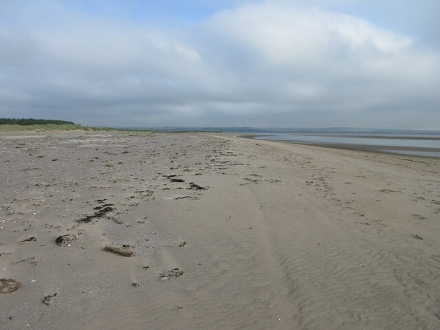
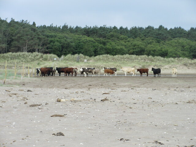
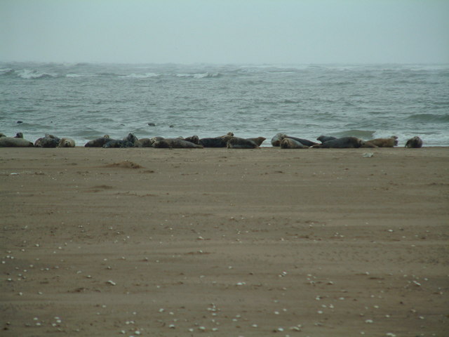
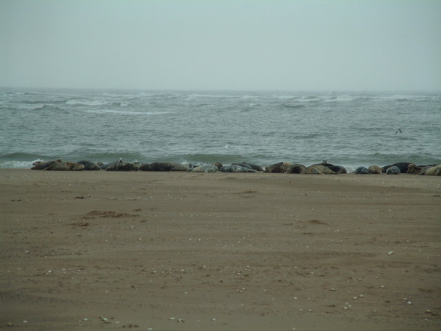
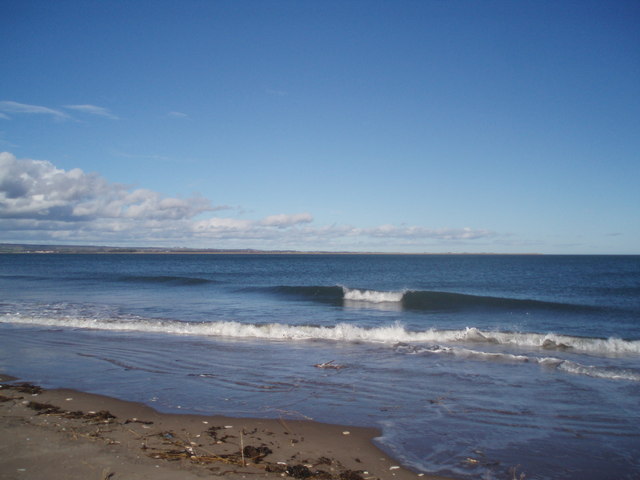
This picturesque headland offers stunning panoramic views of the surrounding area, including the vast expanse of the North Sea and the beautiful coastline of Fife. Its strategic location provides visitors with an ideal vantage point to observe local wildlife, such as seals, dolphins, and various seabird species, including gannets and puffins.

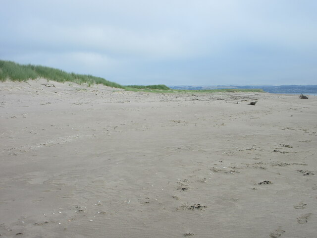
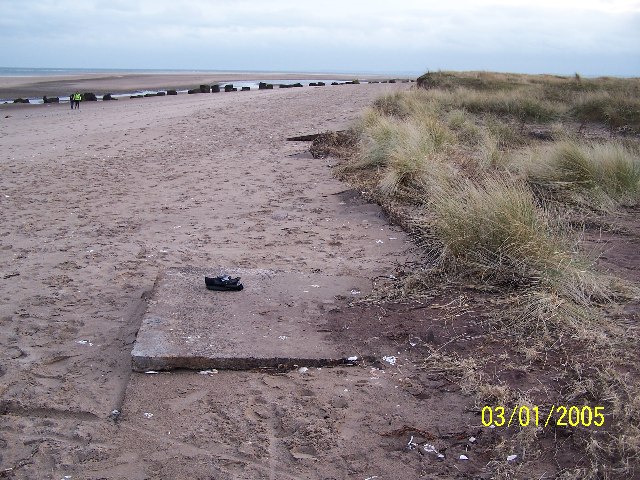
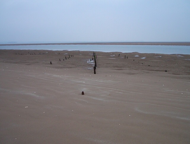
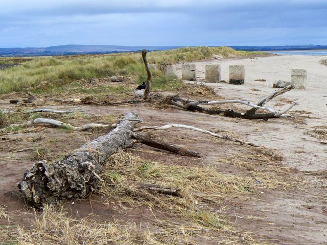
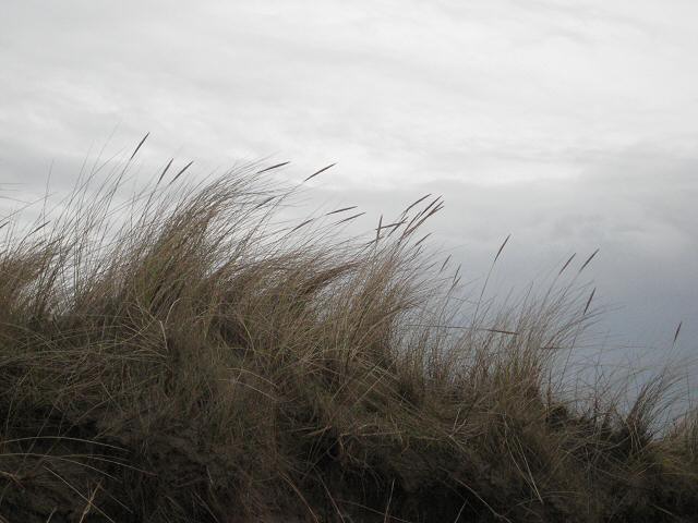
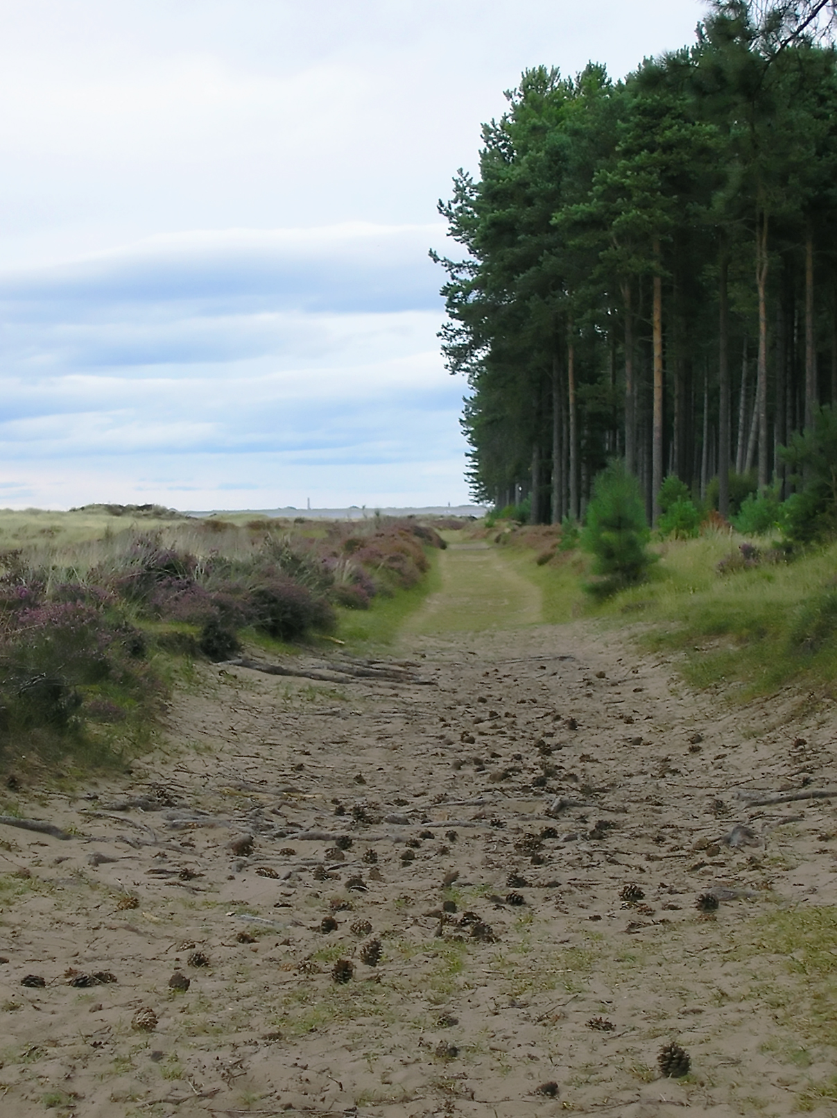
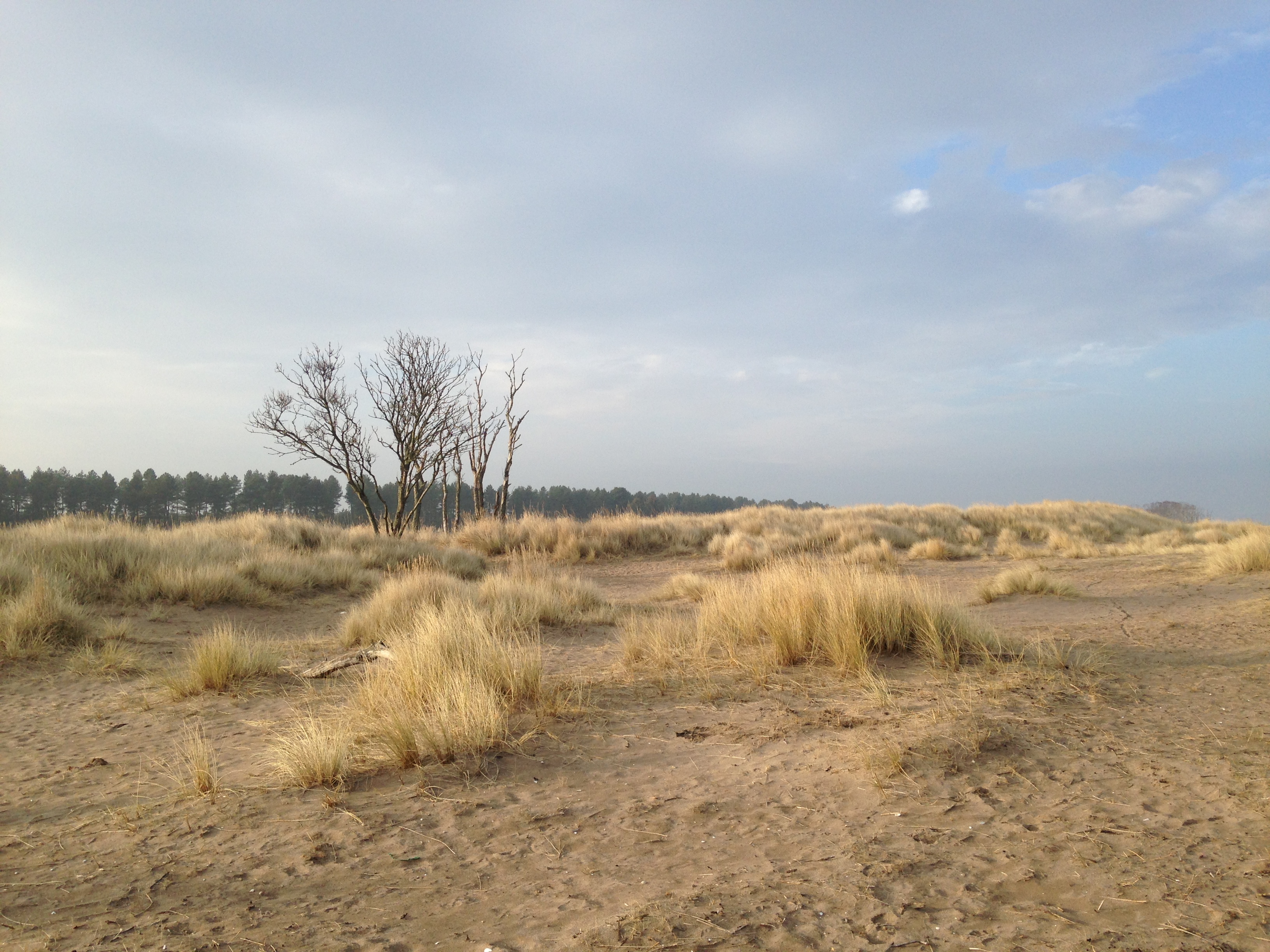
Tentsmuir Point is characterized by its long, sandy beaches, which are backed by dunes and bordered by dense pine forests. The sandy shores are perfect for long walks, beachcombing, and picnicking, while the dunes provide a habitat for unique plant species.

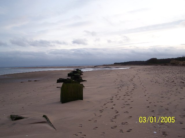
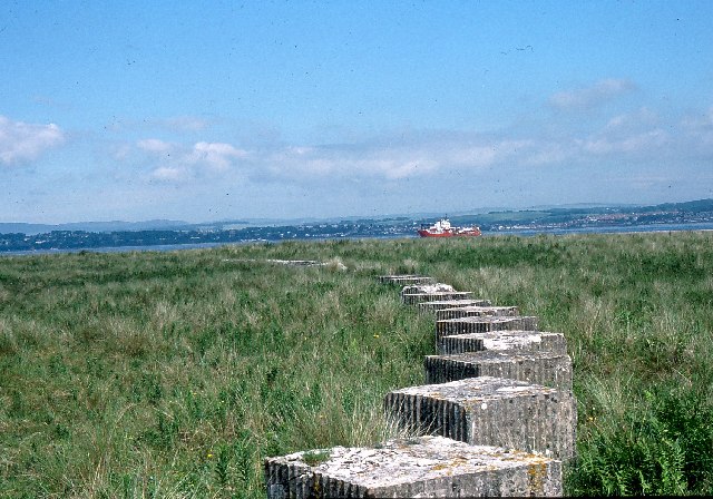
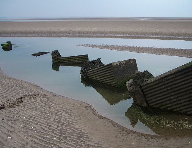
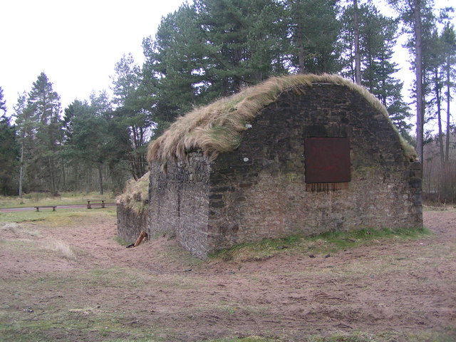
Aside from its natural beauty, Tentsmuir Point also has historical significance. It was once home to a World War II military installation, with remnants of concrete bunkers and gun emplacements still visible today. These remnants serve as a reminder of the area's past and add to the intrigue and allure of the site.

Accessible via a network of well-maintained walking trails, Tentsmuir Point offers visitors the opportunity to explore its diverse landscapes and discover the rich biodiversity of the area. Whether it's enjoying a leisurely walk along the coast, observing wildlife, or immersing oneself in the natural surroundings, Tentsmuir Point is a captivating destination for nature enthusiasts and those seeking tranquility amidst stunning coastal scenery.

If you have any feedback on the listing, please let us know in the comments section below.

Tentsmuir Point Images

Images are sourced within 2km of 56.442955/-2.8122258 or Grid Reference NO5028. Thanks to Geograph Open Source API. All images are credited.

Mixed woodland, Tentsmuir Forest
Ditch in Tentsmuir Forest
Sands near Tentsmuir Point Looking north-westwards over the sands towards Tentsmuir Point
Sands near Tentsmuir Point
Looking north-westwards over the sands towards Tentsmuir Point
Tentsmuir Beach Looking northwards up Tentsmuir Beach.
Tentsmuir Beach
Looking northwards up Tentsmuir Beach.
Cattle on the beach Looking west to cattle on Tentsmuir Beach.
Cattle on the beach
Looking west to cattle on Tentsmuir Beach.
Tentsmuir Sands Looking SSE. WWII Anti-tank cubes
Tentsmuir Sands
Looking SSE. WWII Anti-tank cubes
Tentsmuir Sands Looking SSE. WWII antitank cubes
Tentsmuir Sands
Looking SSE. WWII antitank cubes
Tank traps, Tentsmuir These tank traps were put in place on the beach in 1940. Since then the sand dune system at Tentsmuir has grown seawards by about five metres a year!
Tank traps, Tentsmuir
These tank traps were put in place on the beach in 1940. Since then the sand dune system at Tentsmuir has grown seawards by about five metres a year!
Seals on a sand bank A colony of seals hauled out on a stretch of sand in Tentsmuir Nature Reserve
Seals on a sand bank
A colony of seals hauled out on a stretch of sand in Tentsmuir Nature Reserve
So that's where all the fish have gone? A group of grey seals (including to or three pups, light coloured, near the centre of the photo) hauled up out of a wintry sea onto a sandbank near Abertay Sands, where the river Tay reaches the North Sea
So that's where all the fish have gone?
A group of grey seals (including to or three pups, light coloured, near the centre of the photo) hauled up out of a wintry sea onto a sandbank near Abertay Sands, where the river Tay reaches the North Sea
Tentsmuir Ice House
Tentsmuir Ice House
As far as you can walk to the East Taken at high tide
As far as you can walk to the East
Taken at high tide
Tank Traps,Tentsmuir Sands This section of the wartime defences seems to have been undermined by shifting sands.
Tank Traps,Tentsmuir Sands
This section of the wartime defences seems to have been undermined by shifting sands.
Tentsmuir Sands These posts were probably connected with salmon fishing. There are marker posts in the forest for different fishing beats as well as an ice house <a href="https://www.geograph.org.uk/photo/324012">NO5026 : Tentsmuir Ice House</a> to keep the catch fresh.
Tentsmuir Sands
These posts were probably connected with salmon fishing. There are marker posts in the forest for different fishing beats as well as an ice house NO5026 : Tentsmuir Ice House to keep the catch fresh.
Driftwood and Dragon's Teeth The anti-tank concrete blocks were erected in 1940 along the then shoreline. Since that time, the shoreline has retreated into the North Sea at an average rate of five metres each year.
Driftwood and Dragon's Teeth
The anti-tank concrete blocks were erected in 1940 along the then shoreline. Since that time, the shoreline has retreated into the North Sea at an average rate of five metres each year.
Ice House Near Tentsmuir Point
Ice House
Near Tentsmuir Point
Tentsmuir Icehouse This large icehouse  was used for the storage of salmon caught in nets in the Tay estuary before being transported to the railway station at Tayport for the nightly fish train to Billingsgate. The shallow ice ponds are situated just past the picnic tables and roadway.
Tentsmuir Icehouse
This large icehouse was used for the storage of salmon caught in nets in the Tay estuary before being transported to the railway station at Tayport for the nightly fish train to Billingsgate. The shallow ice ponds are situated just past the picnic tables and roadway.
Dunes' edge Walking along the beach above the high tide mark we were sheltered from the biting wind by the overhanging edge of the dunes.
Dunes' edge
Walking along the beach above the high tide mark we were sheltered from the biting wind by the overhanging edge of the dunes.
Show me another place!

Tentsmuir Point is located at Grid Ref: NO5028 (Lat: 56.442955, Lng: -2.8122258)

Unitary Authority: Fife

Police Authority: Fife

What 3 Words

///estuaries.flap.premature. Near Tayport, Fife

Related Wikis

Tentsmuir Forest

Tentsmuir Forest is in north east Fife, Scotland. Covering some 5 square miles (13 km2), the forest was originally sand dunes and moorland before acquisition...

Tentsmuir National Nature Reserve

Tentsmuir National Nature Reserve (NNR) is located southeast of Tayport in Fife, Scotland. The reserve is made up of three parts, encompassing Morton Lochs...

Tayport F.C.

Tayport Football Club are a Scottish football club from Tayport, Fife. Formed in 1947, they play their home games at The Canniepairt. Nicknamed the Port...

Dighty Burn

The Dighty Burn, also known as Dighty Water or Dichty Water, is a burn or stream 20 kilometres (12 mi) in length that flows through the north and east...

Nearby Amenities

Located within 500m of 56.442955,-2.8122258
Bunker Type: pillbox
Historic: yes
Military: bunker
Lat/Long: 56.4405699/-2.8138308
The data included in this document is from www.openstreetmap.org. The data is made available under ODbL.

Have you been to Tentsmuir Point?

Leave your review of Tentsmuir Point below (or comments, questions and feedback).