Sròn Bhorrach

Landscape Feature in Angus

Scotland

Sròn Bhorrach

Cliffs on Druim Mor Looking down to Caenlochan Glen 450m below
Cliffs on Druim Mor Credit: wrobison

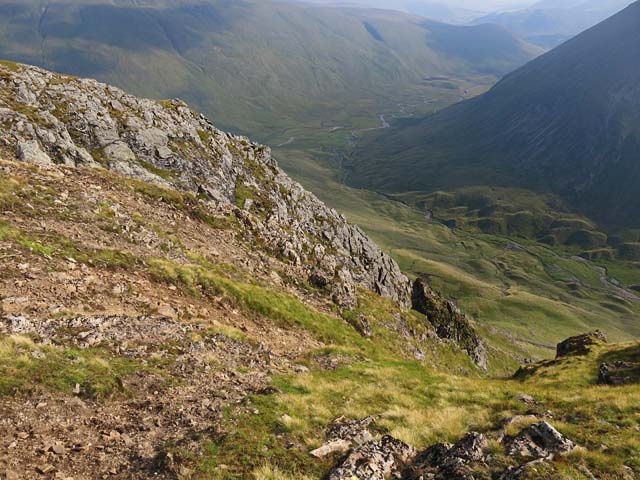
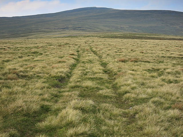
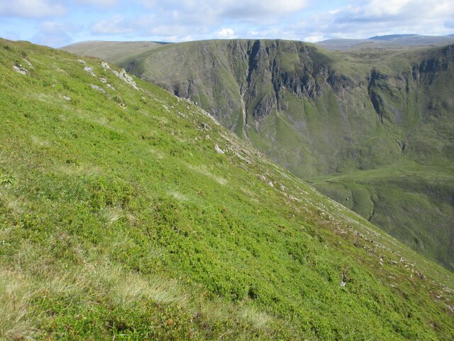
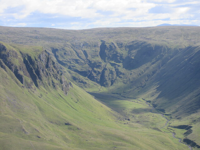
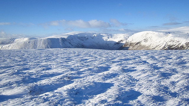
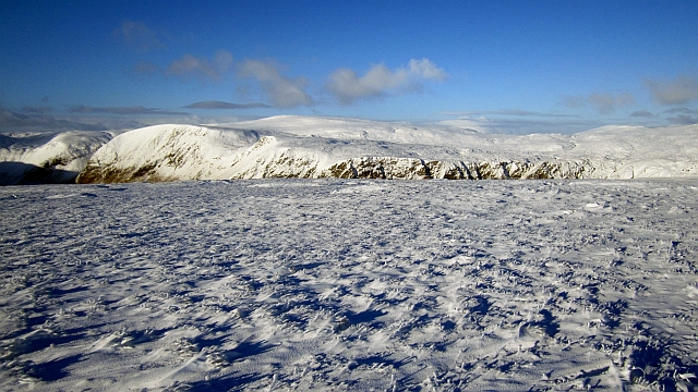
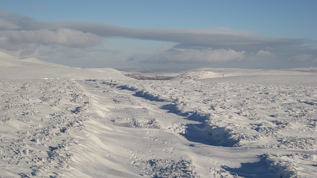
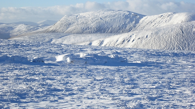
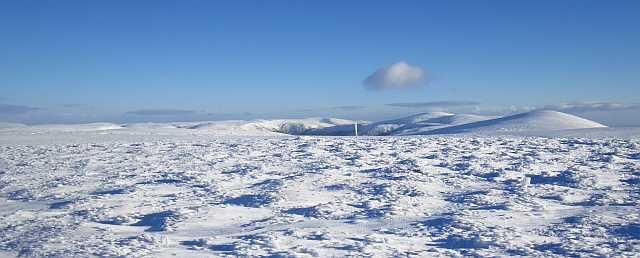
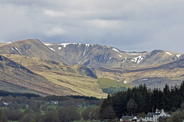
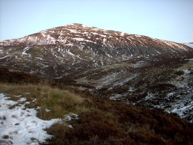
Sròn Bhorrach is a prominent landscape feature located in the county of Angus, Scotland. It is situated in the eastern part of the county, near the town of Kirriemuir. Sròn Bhorrach is a distinctive hill that rises to an elevation of approximately 347 meters (1,138 feet) above sea level.

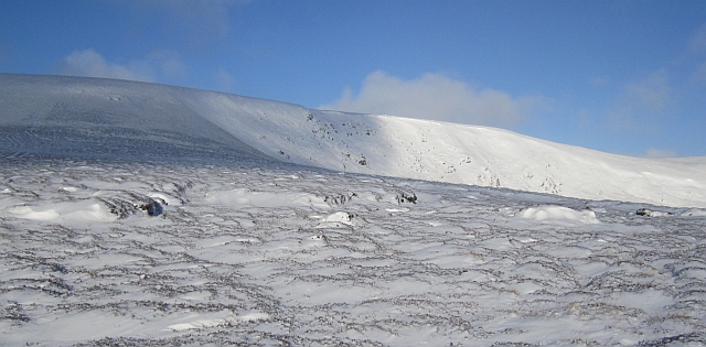
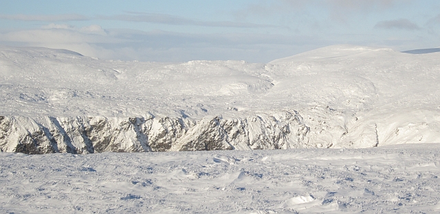
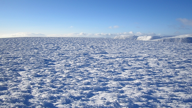
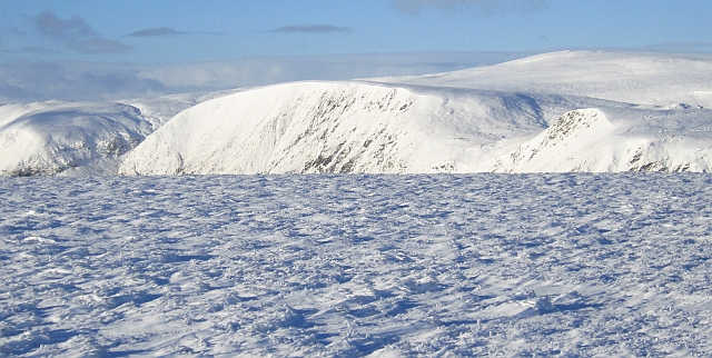
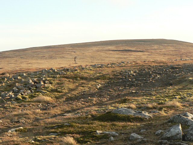
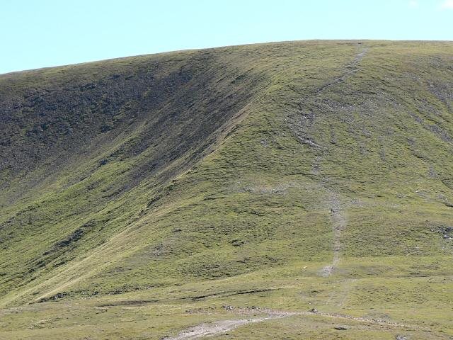
The hill is characterized by its steep and rugged slopes, which are covered with heather and grasses. It is composed mainly of sandstone, giving it a distinctive reddish-brown color. The summit of Sròn Bhorrach offers panoramic views of the surrounding countryside, including the Angus Glens, the Sidlaw Hills, and the Grampian Mountains.

The hill is a popular destination for hikers and nature enthusiasts due to its scenic beauty and the variety of flora and fauna found in the area. Rare plant species, such as the purple saxifrage, can be spotted on the slopes of Sròn Bhorrach during the summer months. The hill is also home to several bird species, including the red grouse and the golden eagle.

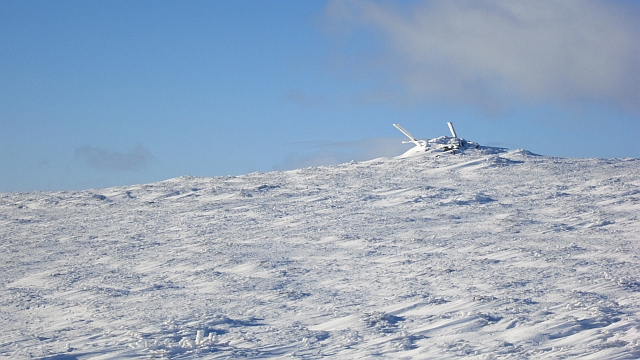
In addition to its natural beauty, Sròn Bhorrach holds historical significance. The hill is believed to have been used as a lookout point during ancient times, providing strategic advantages for local clans. Ruins of an old hill fort can still be seen on its slopes, serving as a reminder of its historical importance.

Overall, Sròn Bhorrach is a captivating landscape feature in Angus, offering breathtaking views, diverse wildlife, and a glimpse into Scotland's rich history.

If you have any feedback on the listing, please let us know in the comments section below.

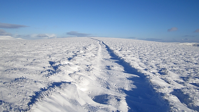
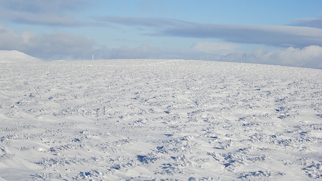
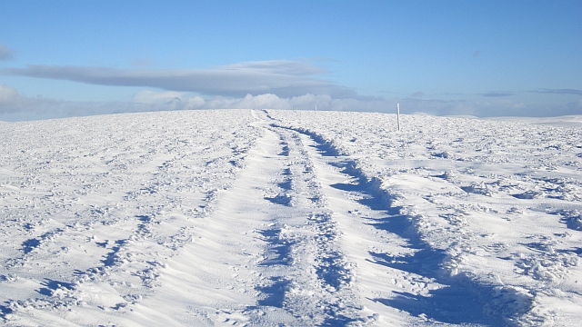
Sròn Bhorrach Images

Images are sourced within 2km of 56.873699/-3.310823 or Grid Reference NO2076. Thanks to Geograph Open Source API. All images are credited.

Cliffs on Druim Mor Looking down to Caenlochan Glen 450m below
Cliffs on Druim Mor
Looking down to Caenlochan Glen 450m below
Moorland Track on Druim Mor Looking towards Cairn of Claise
Moorland Track on Druim Mor
Looking towards Cairn of Claise
Eastern edge of Monega Hill Top of the eastern escarpment of Monega Hill, with the Caenlochan glen beyond.
Eastern edge of Monega Hill
Top of the eastern escarpment of Monega Hill, with the Caenlochan glen beyond.
Caenlochan Glen Looking up Caenlochan Glen from the southern slope of Monega Hill.
Caenlochan Glen
Looking up Caenlochan Glen from the southern slope of Monega Hill.
Summit area, Finalty Hill Like many Mounth tops, the summit of Finalty Hill is hard to define. There is a road running over it which now goes beyond the ruins of the hut that was here in 1981 when I passed nearby when walking out from Glen Doll Youth Hostel (now closed).

The view is across the far more interesting Caenlochan Glen towards Glas Maol.
Summit area, Finalty Hill
Like many Mounth tops, the summit of Finalty Hill is hard to define. There is a road running over it which now goes beyond the ruins of the hut that was here in 1981 when I passed nearby when walking out from Glen Doll Youth Hostel (now closed). The view is across the far more interesting Caenlochan Glen towards Glas Maol.
On Finalty Hill Near the summit with a view towards the top of Learmour Crag across the Canness Glen.
On Finalty Hill
Near the summit with a view towards the top of Learmour Crag across the Canness Glen.
Summit, Finalty Hill A road runs across the vague summit plateau of Finalty Hill. There used to be a hut up here, now long gone.
Summit, Finalty Hill
A road runs across the vague summit plateau of Finalty Hill. There used to be a hut up here, now long gone.
Bogs on Finalty Hill A view over peat hags towards Creag Leacach.
Bogs on Finalty Hill
A view over peat hags towards Creag Leacach.
Road on Finalty Hill A bulldozed road across the plateau, looking towards the summit.
Road on Finalty Hill
A bulldozed road across the plateau, looking towards the summit.
Corrie on Finalty Hill Finalty Hill is a swelling on the Mounth Plateau and this is one of its few distinct features: a corrie at the head of Glen Cally with some broken crags.
Corrie on Finalty Hill
Finalty Hill is a swelling on the Mounth Plateau and this is one of its few distinct features: a corrie at the head of Glen Cally with some broken crags.
Finalty Hill A line of posts marks the course of a road across the plateau.
Finalty Hill
A line of posts marks the course of a road across the plateau.
Road on Finalty Hill A road runs over moorland to the summit and beyond. A summer view:<a href="https://www.geograph.org.uk/photo/1468013">NO2174 : Finalty Hill track</a>
Road on Finalty Hill
A road runs over moorland to the summit and beyond. A summer view:NO2174 : Finalty Hill track
View down Glen Doll Looking down Glen Doll from Finalty Hill with Mayar and Driesh on the right.
View down Glen Doll
Looking down Glen Doll from Finalty Hill with Mayar and Driesh on the right.
Head of the Canness Burn A hanging valley with the Canness Burn flowing towards a plunge into the glacially deepened Canness Glen. Tom Buidhe is on the right of the picture.
Head of the Canness Burn
A hanging valley with the Canness Burn flowing towards a plunge into the glacially deepened Canness Glen. Tom Buidhe is on the right of the picture.
On Finalty Hill The fertile and grassy plateau above Glen Isla.
On Finalty Hill
The fertile and grassy plateau above Glen Isla.
Cairn, Finalty Hill Road marker posts bristle from a cairn on the southern edge of the Finalty Hill plateau.
Cairn, Finalty Hill
Road marker posts bristle from a cairn on the southern edge of the Finalty Hill plateau.
Caenlochan Glen from near Brewlands (telephoto) Caenlochan's status as a nature reserve has recently been threatened through over-grazing by red deer.
Caenlochan Glen from near Brewlands (telephoto)
Caenlochan's status as a nature reserve has recently been threatened through over-grazing by red deer.
Creag Caorach The steep Glen Isla face of Druim Mòr with Cairn of Claise beyond. These are some of the important plant habitats in the Caenlochan National Nature Reserve.
Creag Caorach
The steep Glen Isla face of Druim Mòr with Cairn of Claise beyond. These are some of the important plant habitats in the Caenlochan National Nature Reserve.
Show me another place!

Sròn Bhorrach is located at Grid Ref: NO2076 (Lat: 56.873699, Lng: -3.310823)

Unitary Authority: Angus

Police Authority: Tayside

What 3 Words

///answers.imply.void. Near Inverey, Aberdeenshire

Related Wikis

Caenlochan

Caenlochan (Scottish Gaelic: Cadha an Lochain) is a glen in the Grampian Mountains of Scotland. Under EU Natura 2000 legislation it is a Special Area of...

Cairn of Claise

Cairn of Claise is a mountain in the Grampians of Scotland, located about three miles from the Glenshee Ski Center near Braemar. == References ==

Glas Maol

Glas Maol (Scottish Gaelic: A' Ghlas-Mheall) is a mountain in the Mounth, in the southeastern part of the Highlands of Scotland. The broad, flat summit...

Carn an Tuirc

Carn an Tuirc (Scottish Gaelic: Càrn an Tuirc, 'hill of the wild boar') is a mountain in the Mounth region of the Grampian Mountains, in the Scottish Highlands...

Nearby Amenities

Located within 500m of 56.873699,-3.310823
Caderg
Ele: 890
Name Gd: An Cadha Dearg
Natural: peak
Lat/Long: 56.8765036/-3.3168843
Sròn Reidhe
Natural: hill
Place: locality
Lat/Long: 56.874006/-3.3163908
Sròn Bhorrach
Natural: hill
Place: locality
Lat/Long: 56.8743812/-3.3110478
The data included in this document is from www.openstreetmap.org. The data is made available under ODbL.

Have you been to Sròn Bhorrach?

Leave your review of Sròn Bhorrach below (or comments, questions and feedback).