Sròn an Aìdeal

Landscape Feature in Sutherland

Scotland

Sròn an Aìdeal

Allt a' Mhuiseil descending to Mhuiseil The Allt a' Mhuiseil reaching the minor road close to the farm buildings at Mhuiseil where it will join the Strathmore River. There's a car park at the location from which ascents to Ben Hope, the obvious rugged mountain, are made.
Allt a' Mhuiseil descending to Mhuiseil Credit: Trevor Littlewood

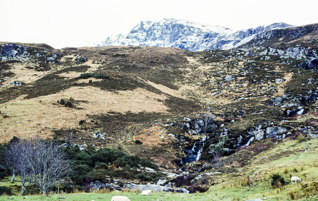
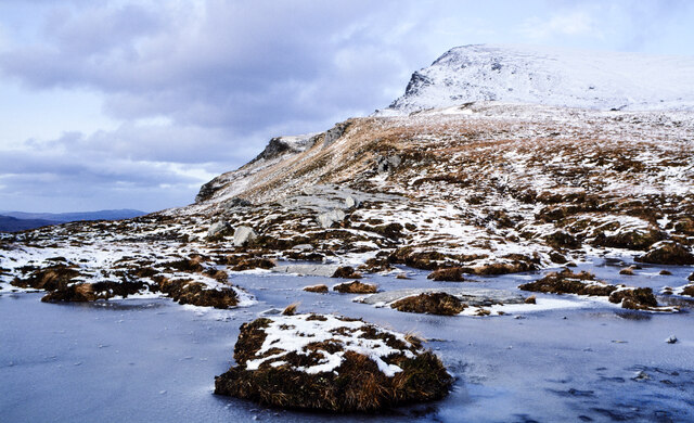
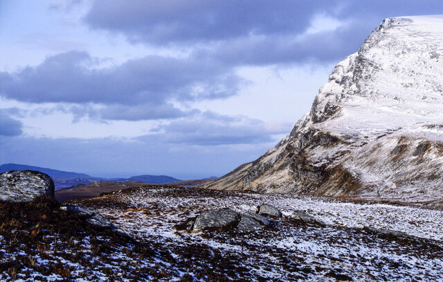
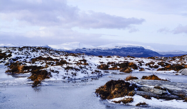
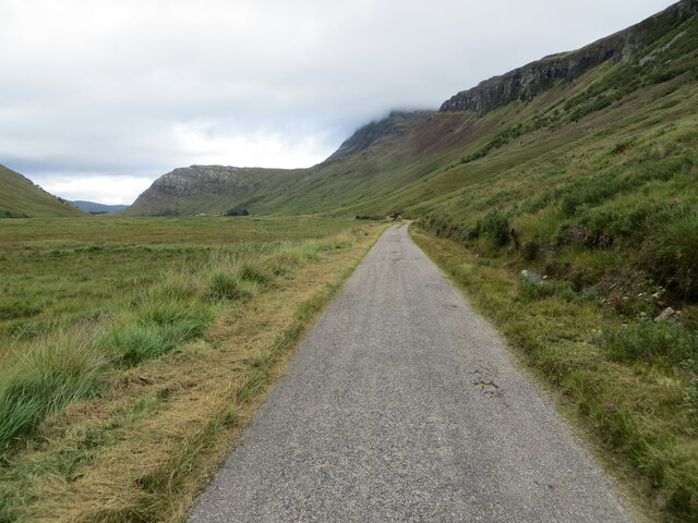
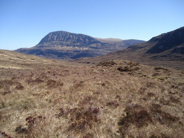
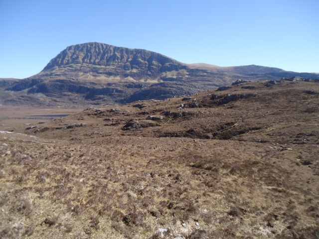
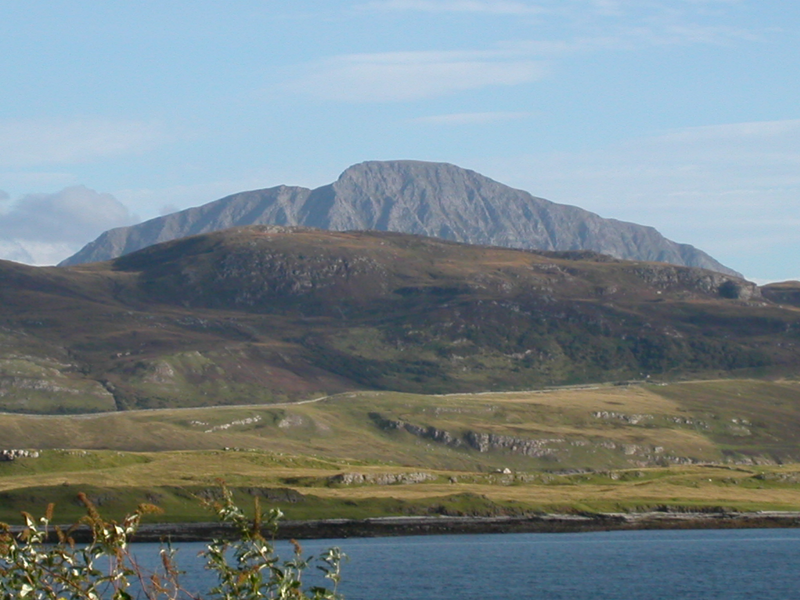
Sròn an Aìdeal is a prominent landscape feature located in the region of Sutherland in the Scottish Highlands. This distinct landform is characterized by its steep and rugged nature, making it a visually striking feature in the area.

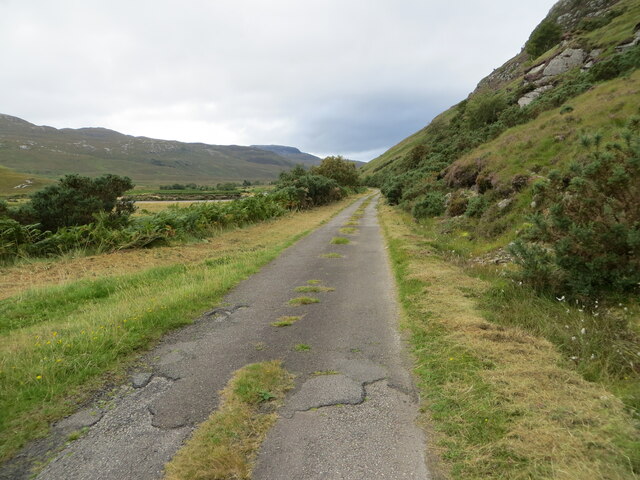
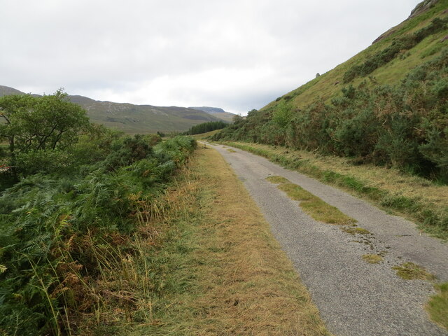
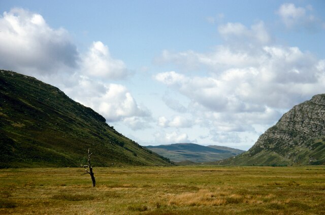
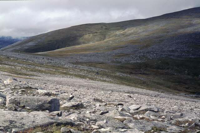
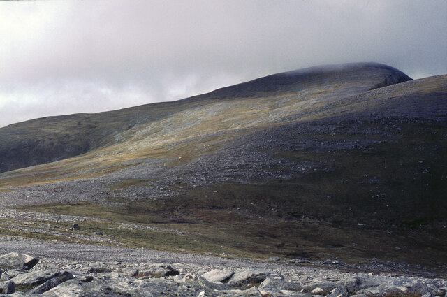
Situated in the northern part of Scotland, Sròn an Aìdeal is part of a larger mountain range known as the Northwest Highlands. It is surrounded by a breathtaking natural environment, including vast expanses of moorland, lochs, and rolling hills. The landscape is rich in diverse flora and fauna, with heather and grasses covering the lower slopes and hardy mountain plants found higher up.

The main attraction of Sròn an Aìdeal is its distinctive shape and elevation. Rising to a height of approximately 650 meters (2,133 feet), the peak of the landform offers panoramic views of the surrounding countryside. The slopes are characterized by steep inclines, making it a challenging but rewarding climb for outdoor enthusiasts.

The area surrounding Sròn an Aìdeal is also known for its historical significance. There are ancient settlements and archaeological remains scattered across the landscape, providing insight into the lives of past inhabitants. Additionally, the landform has been a subject of inspiration for artists and writers, who have captured its beauty in various forms.

Overall, Sròn an Aìdeal stands as a remarkable landscape feature in Sutherland, offering a combination of rugged natural beauty, breathtaking views, and historical significance. It is a destination that attracts adventurers, nature lovers, and those seeking a glimpse into Scotland's rich cultural heritage.

If you have any feedback on the listing, please let us know in the comments section below.

Sròn an Aìdeal Images

Images are sourced within 2km of 58.392305/-4.6453662 or Grid Reference NC4547. Thanks to Geograph Open Source API. All images are credited.

Allt a' Mhuiseil descending to Mhuiseil The Allt a' Mhuiseil reaching the minor road close to the farm buildings at Mhuiseil where it will join the Strathmore River. There's a car park at the location from which ascents to Ben Hope, the obvious rugged mountain, are made.
Allt a' Mhuiseil descending to Mhuiseil
The Allt a' Mhuiseil reaching the minor road close to the farm buildings at Mhuiseil where it will join the Strathmore River. There's a car park at the location from which ascents to Ben Hope, the obvious rugged mountain, are made.
Valley of Allt na Caillich The shallow valley descending on the south side of Ben Hope is contained by the steep slope of Creag Riabhach to the left, and a gentle slope to the right which terminates at a steep downfall overlooking Strath More.
Ben Hee is the distant high mountain right of centre, rather dimly seen through mistiness.
Valley of Allt na Caillich
The shallow valley descending on the south side of Ben Hope is contained by the steep slope of Creag Riabhach to the left, and a gentle slope to the right which terminates at a steep downfall overlooking Strath More. Ben Hee is the distant high mountain right of centre, rather dimly seen through mistiness.
Frozen lochan along south ridge of Ben Hope There are two parts to the south ridge of Ben Hope separated by the shallow valley of the Allt na Caillich; this is the lesser, western part which runs above steep ground falling to Strath More. The lochan is near to a dip along the ridge north of Leitir Mhuiseil.
Frozen lochan along south ridge of Ben Hope
There are two parts to the south ridge of Ben Hope separated by the shallow valley of the Allt na Caillich; this is the lesser, western part which runs above steep ground falling to Strath More. The lochan is near to a dip along the ridge north of Leitir Mhuiseil.
Ridge beyond highest point of Leitir Mhuiseil Leitir Mhuiseil is a ridge south of Ben Hope with a steep, broken slope descending to Strath More on its west side and the shallow valley of Allt na Caillich to the east, (right in the image and unseen). The boulders are at its highest point.
A crag line out of view to the left continues into the west face of Ben Hope which is ahead in the image and where there is additional cragginess.
Ridge beyond highest point of Leitir Mhuiseil
Leitir Mhuiseil is a ridge south of Ben Hope with a steep, broken slope descending to Strath More on its west side and the shallow valley of Allt na Caillich to the east, (right in the image and unseen). The boulders are at its highest point. A crag line out of view to the left continues into the west face of Ben Hope which is ahead in the image and where there is additional cragginess.
Frozen lochan along south ridge of Ben Hope There are two parts to the south ridge of Ben Hope separated by the shallow valley of the Allt na Caillich; this is the lesser, western part which runs above steep ground falling to Strath More. The lochan at a dip along the ridge north of Leitir Mhuiseil as it reaches the bulk of the main mountain.
The snowed mountains in the distance are both Corbetts, Cranstackie and Beinn Spionnaidh.
Frozen lochan along south ridge of Ben Hope
There are two parts to the south ridge of Ben Hope separated by the shallow valley of the Allt na Caillich; this is the lesser, western part which runs above steep ground falling to Strath More. The lochan at a dip along the ridge north of Leitir Mhuiseil as it reaches the bulk of the main mountain. The snowed mountains in the distance are both Corbetts, Cranstackie and Beinn Spionnaidh.
Strath More - Minor road between Alltnacaillich and Muiseal Looking north-westward.
Strath More - Minor road between Alltnacaillich and Muiseal
Looking north-westward.
Strath More - Minor road approaching Muiseal Looking northward.
Strath More - Minor road approaching Muiseal
Looking northward.
Strath More - Minor road passing beneath the flank of Càrn a' Phiobaire Looking north-westward.
Strath More - Minor road passing beneath the flank of Càrn a' Phiobaire
Looking north-westward.
Strath More - Minor road confined by Càrn a' Phiobaire and Strathmore River Looking north-westward.
Strath More - Minor road confined by Càrn a' Phiobaire and Strathmore River
Looking north-westward.
Pass between Ben Hope and Creag na Lùibe Bàine Through which a minor road and the Strathmore River flow. Taken with a long lens.
Pass between Ben Hope and Creag na Lùibe Bàine
Through which a minor road and the Strathmore River flow. Taken with a long lens.
The valley of Allt a' Chaiseil Dubh With Ben Hope, on the far side of Strath More, reigning over all.
The valley of Allt a' Chaiseil Dubh
With Ben Hope, on the far side of Strath More, reigning over all.
Across the Allt a' Chaiseil Duibh With Ben More, as it usually does in this part of the world, looming over all.
Across the Allt a' Chaiseil Duibh
With Ben More, as it usually does in this part of the world, looming over all.
Approaching Loch Hope from the south This is the head of the loch, and the line of Strathmore River which feeds it is clearly seen crossing the photo.
Approaching Loch Hope from the south
This is the head of the loch, and the line of Strathmore River which feeds it is clearly seen crossing the photo.
Old house at Cashel Dhu Many years ago, the road from Strath More to Eriboll crossed the Strathmore River about 300 metres north-east of here.  There was never a bridge, but at one time there was a passenger ferry (long since gone).  In favourable conditions (i.e. when the river is low) it is still possible to ford the crossing.
Old house at Cashel Dhu
Many years ago, the road from Strath More to Eriboll crossed the Strathmore River about 300 metres north-east of here. There was never a bridge, but at one time there was a passenger ferry (long since gone). In favourable conditions (i.e. when the river is low) it is still possible to ford the crossing.
Climbing Ben Hope Half way up, I encountered this herd of deer. They did not seem too perturbed by my presence, though as I continued they moved away. Perhaps, given the month, I should not have been there at all:  but 56 years later, this is not going to cause me any loss of sleep!
Climbing Ben Hope
Half way up, I encountered this herd of deer. They did not seem too perturbed by my presence, though as I continued they moved away. Perhaps, given the month, I should not have been there at all: but 56 years later, this is not going to cause me any loss of sleep!
Climbing Ben Hope from the south The summit dome is now in view:  the cloud layer is very little higher. The rest of the walk is easy - just hard work!

Ben Hope was my second Munro, now 56 years ago.
Climbing Ben Hope from the south
The summit dome is now in view: the cloud layer is very little higher. The rest of the walk is easy - just hard work! Ben Hope was my second Munro, now 56 years ago.
"Mud, mud....." Red deer enjoying a mudbath By the Hope Road, near Alltnacaillich, on a warm Spring day. Perhaps the deer were preparing for midge season.
"Mud, mud....." Red deer enjoying a mudbath
By the Hope Road, near Alltnacaillich, on a warm Spring day. Perhaps the deer were preparing for midge season.
Track and boulder
Track and boulder
Show me another place!

Sròn an Aìdeal is located at Grid Ref: NC4547 (Lat: 58.392305, Lng: -4.6453662)

Unitary Authority: Highland

Police Authority: Highlands and Islands

What 3 Words

///simmer.nosedive.hardly. Near Altnaharra, Highland

Related Wikis

Strathmore, Sutherland

Strathmore or An Srath Mòr is a strath or wide valley in Sutherland in northern Scotland. The strath is in the parish of Durness to the south-east of Loch...
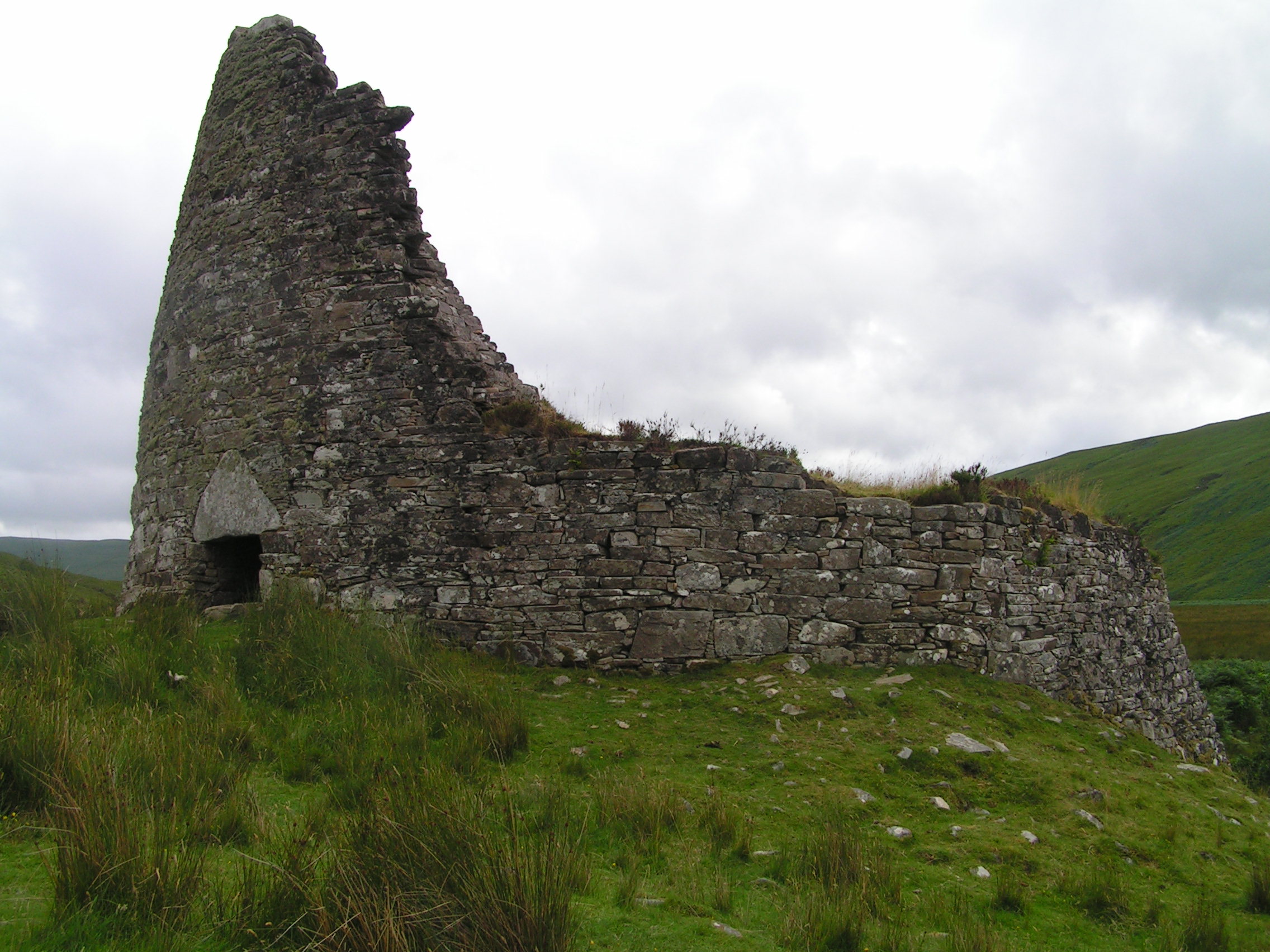
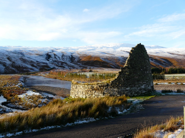
Dun Dornaigil

Dun Dornaigil is an Iron Age broch in Sutherland in the Scottish Highlands (grid reference NC45714501). It is in Strathmore on the eastern bank of the...

Ben Hope

Ben Hope (Scottish Gaelic: Beinn Hòb) is a mountain in northern Scotland. It is the most northerly Munro, standing alone in the Flow Country (a region...

Loch Hope

Loch Hope is a loch in the Durness parish in Sutherland in the Highland Council Area of northern Scotland. It is located on the A838 main road. The settlements...

Nearby Amenities

Located within 500m of 58.392305,-4.6453662
Sron an Aideal
Natural: peak
Lat/Long: 58.3928955/-4.6450144
Creag na Luibe Baine
Ele: 262
Natural: peak
Lat/Long: 58.3879911/-4.6464513
Creag na h-lolaire
Natural: peak
Lat/Long: 58.3928831/-4.6531114
The data included in this document is from www.openstreetmap.org. The data is made available under ODbL.

Have you been to Sròn an Aìdeal?

Leave your review of Sròn an Aìdeal below (or comments, questions and feedback).