Sròn Phrine

Landscape Feature in Perthshire

Scotland

Sròn Phrine

Grassy slopes above Glen Coralan
Grassy slopes above Glen Coralan Credit: Steven Brown

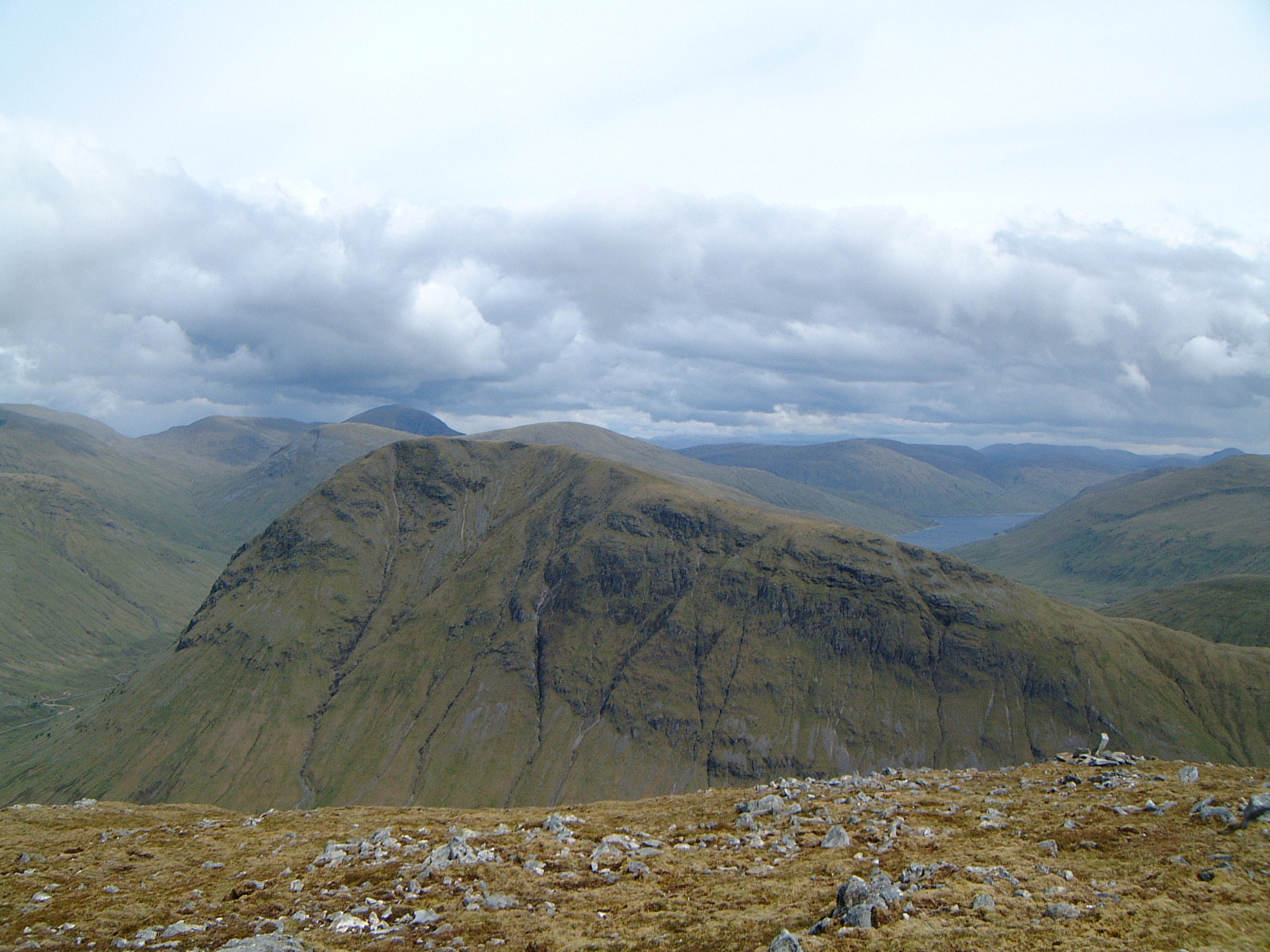
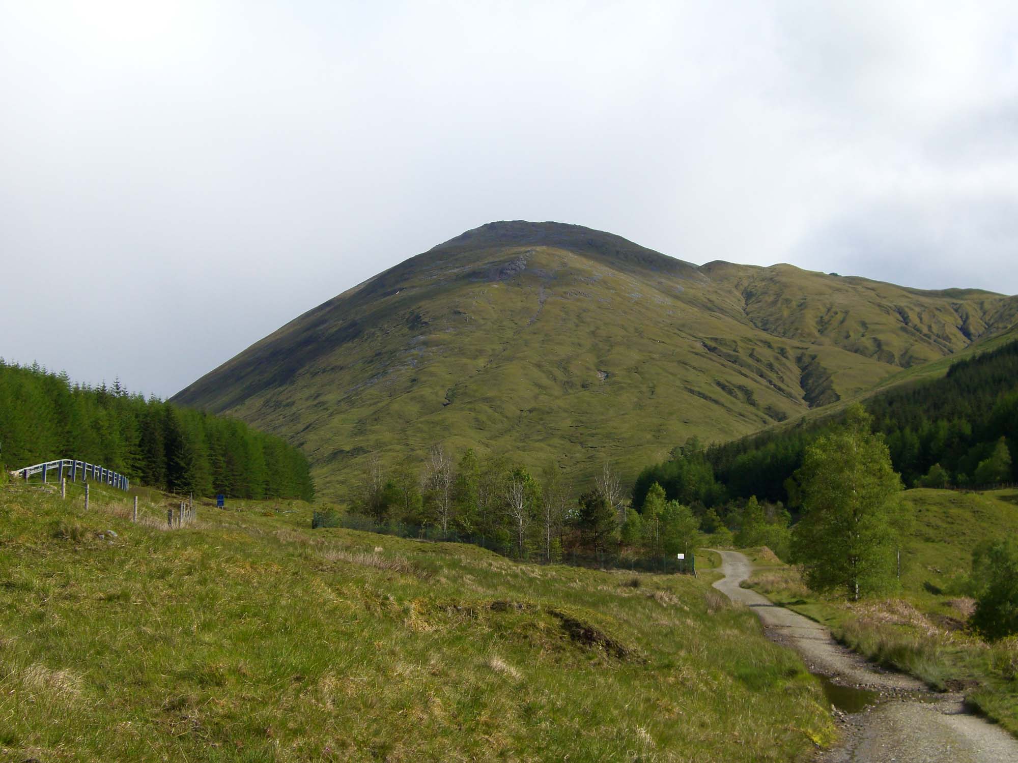
Sròn Phrine, located in Perthshire, Scotland, is a prominent and picturesque landscape feature that attracts both locals and tourists alike. This magnificent geographical formation is a hill located in the southern part of the Cairngorms National Park.

Rising to an elevation of approximately 671 meters (2,201 feet), Sròn Phrine offers breathtaking panoramic views of the surrounding landscape. Its distinct shape and rugged terrain make it a popular destination for hikers, climbers, and nature enthusiasts seeking adventure and stunning vistas.

The hill is characterized by its rocky slopes, covered in heather and scattered with boulders, which add to its wild and untamed charm. The summit of Sròn Phrine provides an excellent vantage point to admire the vast expanse of the Cairngorms National Park, with its rolling hills, deep glens, and sparkling lochs.

The diverse flora and fauna found on Sròn Phrine further contribute to its appeal. The hill is home to a variety of plant species, including mosses, lichens, and wildflowers, which add vibrant colors to the landscape. It is also an ideal habitat for numerous bird species, such as red grouse and golden eagles, as well as mammals like red deer and mountain hares.

Due to its location within the national park, Sròn Phrine benefits from a well-maintained network of trails, making it accessible to both experienced hikers and casual walkers. The hill offers a range of routes, catering to different levels of fitness and outdoor experience.

In conclusion, Sròn Phrine in Perthshire is a captivating landscape feature renowned for its stunning views, rugged terrain, and rich biodiversity. It presents a perfect opportunity for visitors to connect with nature and experience the untamed beauty of the Scottish Highlands.

If you have any feedback on the listing, please let us know in the comments section below.

Sròn Phrine Images

Images are sourced within 2km of 56.481338/-4.6498674 or Grid Reference NN3635. Thanks to Geograph Open Source API. All images are credited.

Grassy slopes above Glen Coralan
Slopes of Beinn a’ Chaisteil
Upper southern slopes of Cam Chreag Looking over the upper southern slopes of Cam Chreag from the summit. 

In the middle ground to the left are the southwestern slopes of Ben Challum and to the right the southeastern slopes of Beinn Chaorach. In the background to the left are three munros in close proximity, Beinn a' Chroin, An Caisteal and Beinn Chabhair.
Upper southern slopes of Cam Chreag
Looking over the upper southern slopes of Cam Chreag from the summit. In the middle ground to the left are the southwestern slopes of Ben Challum and to the right the southeastern slopes of Beinn Chaorach. In the background to the left are three munros in close proximity, Beinn a' Chroin, An Caisteal and Beinn Chabhair.
Frith a' Choirean The ridge connecting Stob nan Clach with Creag Mhor.
Frith a' Choirean
The ridge connecting Stob nan Clach with Creag Mhor.
Allt a' Mhaim and Glen Lyon A burn running of Beinn Fuaran and Beinn a' Chaisteil into the upper reaches of Glen Lyon> Glen Lyon continues for some way beyond the loch as a grassy and wet glen, almost as far as Auch near Bridge of Orchy.
Allt a' Mhaim and Glen Lyon
A burn running of Beinn Fuaran and Beinn a' Chaisteil into the upper reaches of Glen Lyon> Glen Lyon continues for some way beyond the loch as a grassy and wet glen, almost as far as Auch near Bridge of Orchy.
The Allt Coralan This stream has a very rocky course.
The Allt Coralan
This stream has a very rocky course.
Eas Nam Beatach When this was taken, excavators were working just above the falls on a hydro power scheme.
Eas Nam Beatach
When this was taken, excavators were working just above the falls on a hydro power scheme.
The upper Allt Coralan An interesting area geomorphologically, with gullies on the hillside and recessional moraines below.
The upper Allt Coralan
An interesting area geomorphologically, with gullies on the hillside and recessional moraines below.
The Allt Coralan This gorge is just above the waterfall. The day after the photo was taken, excavators were working in the area on a hydro power scheme. It remains to be seen if the spot is unaffected.
The Allt Coralan
This gorge is just above the waterfall. The day after the photo was taken, excavators were working in the area on a hydro power scheme. It remains to be seen if the spot is unaffected.
Heading towards Stob nan Clach with Creag Mhor to right To reach this ridge from the hydro track it is easier to skirt around the southern side of Sail Dhubh before making the steep ascent.
Heading towards Stob nan Clach with Creag Mhor to right
To reach this ridge from the hydro track it is easier to skirt around the southern side of Sail Dhubh before making the steep ascent.
Cam Chreag (summit cairn) The summit cairn on Cam Chreag.
Cam Chreag (summit cairn)
The summit cairn on Cam Chreag.
Electric fence (disused) The remains of an electric generator used to power the electric fence at the bealach between Beinn  Chaorach and Cam Chreag.
Electric fence (disused)
The remains of an electric generator used to power the electric fence at the bealach between Beinn Chaorach and Cam Chreag.
Fence, Gate and Stile in Coreheynan The area enclosed is a mountain woodland regeneration project
Fence, Gate and Stile in Coreheynan
The area enclosed is a mountain woodland regeneration project
Ridge on Cam Chreag Looking to the col between Beinn a' Chaisteil and Beinn nam Fuaran with Beinn Dorain, Beinn an Dothaidh and Beinn Achaladair beyond
Ridge on Cam Chreag
Looking to the col between Beinn a' Chaisteil and Beinn nam Fuaran with Beinn Dorain, Beinn an Dothaidh and Beinn Achaladair beyond
Abhainn Ghlas The river flows into Loch Lyon at the top of the photo
Abhainn Ghlas
The river flows into Loch Lyon at the top of the photo
Allt Mhic Bhaidein between Cam Chreag and Creag Mhor It joins the Abhainn Ghlas and flows into Loch Lyon which is in the distance
Allt Mhic Bhaidein between Cam Chreag and Creag Mhor
It joins the Abhainn Ghlas and flows into Loch Lyon which is in the distance
Allt Mhic Bhaidein between Cam Chreag and Creag Mhor The river flows into Loch Lyon
Allt Mhic Bhaidein between Cam Chreag and Creag Mhor
The river flows into Loch Lyon
Fence in Coreheynan The fence encloses a mountain woodland regeneration project
Fence in Coreheynan
The fence encloses a mountain woodland regeneration project
Show me another place!

Sròn Phrine is located at Grid Ref: NN3635 (Lat: 56.481338, Lng: -4.6498674)

Unitary Authority: Perth and Kinross

Police Authority: Tayside

What 3 Words

///diplomas.families.social. Near Tyndrum, Stirling

Nearby Locations

Sròn Phrine

Related Wikis

Creag Mhòr

Creag Mhòr is a mountain in the Breadalbane region of the Scottish Highlands. It is in the Forest of Mamlorn, ten kilometres northeast of Tyndrum, and...

Beinn a' Chaisteil

Beinn a' Chaisteil is a mountain in the southern Highlands of Scotland, it is located 6.25 km north of Tyndrum on the border of Perth and Kinross and Argyll...

Beinn Odhar

Beinn Odhar is a Scottish mountain situated at the northern extremity of the Loch Lomond and the Trossachs National Park. It stands four km (2.5 mi) north...

Beinn Challuim

Beinn Challuim (English: Ben Challum) is a mountain in the Breadalbane region of the Scottish Highlands. It is east of the village of Tyndrum, in the Forest...

Have you been to Sròn Phrine?

Leave your review of Sròn Phrine below (or comments, questions and feedback).