Sròn a' Bhuiridh
Landscape Feature in Inverness-shire
Scotland
Sròn a' Bhuiridh

The requested URL returned error: 429 Too Many Requests
If you have any feedback on the listing, please let us know in the comments section below.
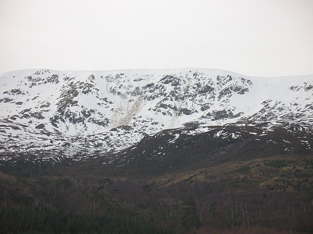
Sròn a' Bhuiridh Images
Images are sourced within 2km of 56.931182/-5.0738699 or Grid Reference NN1386. Thanks to Geograph Open Source API. All images are credited.


Sròn a' Bhuiridh is located at Grid Ref: NN1386 (Lat: 56.931182, Lng: -5.0738699)
Unitary Authority: Highland
Police Authority: Highlands and Islands
What 3 Words
///ballooned.bravo.asleep. Near Gairlochy, Highland
Nearby Locations
Related Wikis

Beinn Bhàn (Arkaig)
Beinn Bhàn is a Scottish mountain situated in the Lochaber region of the Highland Council Area. It stands 6 miles (10 km) north-west of Spean Bridge. The...

Glen Loy
Glen Loy is a glen or valley in the Northwest Highlands of Scotland which opens onto the Great Glen at its eastern end. It is drained by the River Loy...
Achnasaul
Achnasaul (Scottish Gaelic: Achadh nan Sabhal) is a village, located on the shores of Loch Arkaig, close to Spean Bridge, Inverness-shire, Scotland, within...

Ardechive
Ardechive (Scottish Gaelic: Àird Eachbhaidh) is a small crofting hamlet, located on the shores of Loch Arkaig, close to Achnasaul and Spean Bridge, county...
Have you been to Sròn a' Bhuiridh?
Leave your review of Sròn a' Bhuiridh below (or comments, questions and feedback).