Àird Bheag

Landscape Feature in Ross-shire

Scotland

Àird Bheag

The northern side of Loch Kernsary Looking towards a small bay formed by a small but distinct promontory, with  Beinn Airigh Charr dominating the skyline.  I thank Nigel Brown and <a href="https://www.geograph.org.uk/photo/1506874">NG8880 : The northern side of Loch Kernsary</a> for locating the image.
The northern side of Loch Kernsary Credit: Julian Paren

Àird Bheag is a stunning landscape feature located in Ross-shire, Scotland. Situated on the western coast of the Highlands, it offers breathtaking views of the surrounding area. The name Àird Bheag translates to "small headland" in Scottish Gaelic, which accurately describes the geographical characteristics of the site.

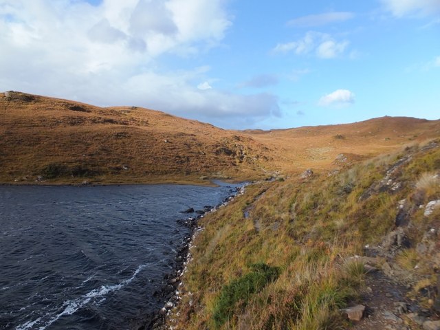
The most prominent aspect of Àird Bheag is its rugged coastline. The headland is formed by sheer cliffs that rise dramatically from the Atlantic Ocean. These cliffs are composed of ancient rock formations, which have been shaped by centuries of erosion and weathering. The result is a landscape that is both imposing and awe-inspiring.

In addition to the cliffs, Àird Bheag also boasts a diverse range of flora and fauna. The headland is home to a variety of plant species, including heather, gorse, and sea thrift. These plants thrive in the coastal environment, adding vibrant colors to the landscape. The area is also a haven for birdwatchers, as it attracts a wide array of seabirds, such as gannets, puffins, and guillemots.

Visitors to Àird Bheag can enjoy the breathtaking views from the top of the cliffs or take a walk along the coastal path that winds its way around the headland. The path offers numerous vantage points to admire the scenery and observe the wildlife. It is also a popular spot for photographers, who are drawn to the dramatic cliffs and the ever-changing light that illuminates the landscape.

Overall, Àird Bheag is a remarkable landscape feature that showcases the beauty and diversity of the Scottish Highlands. Its rugged cliffs, abundant flora and fauna, and stunning views make it a must-visit destination for nature lovers and outdoor enthusiasts.

If you have any feedback on the listing, please let us know in the comments section below.

Àird Bheag Images

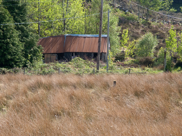
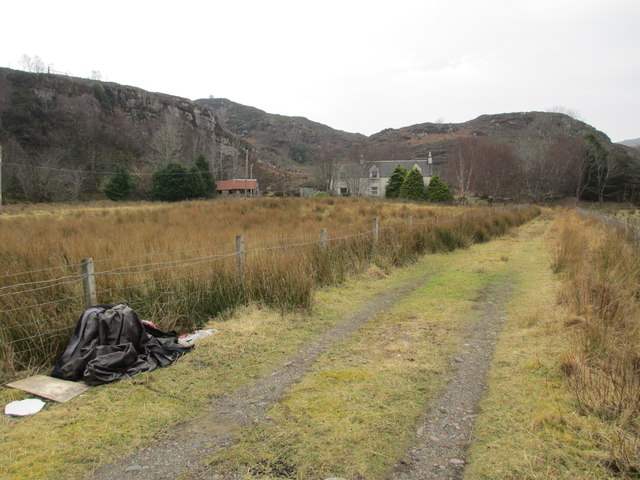
Images are sourced within 2km of 57.758261/-5.5679321 or Grid Reference NG8779. Thanks to Geograph Open Source API. All images are credited.

The northern side of Loch Kernsary Looking towards a small bay formed by a small but distinct promontory, with  Beinn Airigh Charr dominating the skyline.  I thank Nigel Brown and <a href="https://www.geograph.org.uk/photo/1506874">NG8880 : The northern side of Loch Kernsary</a> for locating the image.
The northern side of Loch Kernsary
Looking towards a small bay formed by a small but distinct promontory, with Beinn Airigh Charr dominating the skyline. I thank Nigel Brown and NG8880 : The northern side of Loch Kernsary for locating the image.
South over Loch Kernsary The end of a long day's walk towards Carnmore leaving Loch Kernsary behind on the way back to Poolewe. Looking towards the mountains of Torridon.
South over Loch Kernsary
The end of a long day's walk towards Carnmore leaving Loch Kernsary behind on the way back to Poolewe. Looking towards the mountains of Torridon.
The start of the path round Loch Kernsary Looking towards the house at Londubh.
The start of the path round Loch Kernsary
Looking towards the house at Londubh.
On the Loch Kernsary circuit The central peaks in the distance are Beinn Airigh Charr (791m) and to the right the Munro, Slioch (980m).
On the Loch Kernsary circuit
The central peaks in the distance are Beinn Airigh Charr (791m) and to the right the Munro, Slioch (980m).
On the Loch Kernsary circuit Showing Loch Kernsary itself with its crannog to the left.  The central peaks in the distance are Beinn Airigh Charr (791m) and to the right the Munro, Slioch (980m).
On the Loch Kernsary circuit
Showing Loch Kernsary itself with its crannog to the left. The central peaks in the distance are Beinn Airigh Charr (791m) and to the right the Munro, Slioch (980m).
On the Loch Kernsary circuit A small un-named stream entering Loch Kernsary.
On the Loch Kernsary circuit
A small un-named stream entering Loch Kernsary.
On the Loch Kernsary circuit The path at times rises quite high above the loch.
On the Loch Kernsary circuit
The path at times rises quite high above the loch.
On the Loch Kernsary circuit The path is mainly good but can deteriorate in places.  The distant central peak is the Munro, Slioch.
On the Loch Kernsary circuit
The path is mainly good but can deteriorate in places. The distant central peak is the Munro, Slioch.
On the Loch Kernsary circuit Looking across Loch Kernsary to the crannog.
On the Loch Kernsary circuit
Looking across Loch Kernsary to the crannog.
The River Ewe near Poolewe
Loch Kernsary Looking south across the loch; the track to Kernsary can just be made out on the other side. The small islet in the picture isn't the crannog marked on the map, but does have a bit of an artificial look about it.
Loch Kernsary
Looking south across the loch; the track to Kernsary can just be made out on the other side. The small islet in the picture isn't the crannog marked on the map, but does have a bit of an artificial look about it.
Loch Kernsary from path below Meall an Leathaid Dharaich Loch Kernsary is viewed to the south from a path on its northern side; the very rocky but relatively low mountain, Creag Mhor Thollaidh, is seen distantly.
Loch Kernsary from path below Meall an Leathaid Dharaich
Loch Kernsary is viewed to the south from a path on its northern side; the very rocky but relatively low mountain, Creag Mhor Thollaidh, is seen distantly.
Loch Kernsary Creag Mhor Thollaidh is the rocky peak seen across the eastern end of Loch Kernsary from the path on its north side.
Loch Kernsary
Creag Mhor Thollaidh is the rocky peak seen across the eastern end of Loch Kernsary from the path on its north side.
Ruined building at Londubh Londubh is part of the small village of Poolewe; it's reached by a minor road leaving the A832. The ruin is seen across a field of deep grass from close to the road end.
Ruined building at Londubh
Londubh is part of the small village of Poolewe; it's reached by a minor road leaving the A832. The ruin is seen across a field of deep grass from close to the road end.
Farm at Londubh
Farm at Londubh
Rocky outcrop by Loch Kernsary The hill behind is Meall an Leathaid Dharaich.
Rocky outcrop by Loch Kernsary
The hill behind is Meall an Leathaid Dharaich.
Path by Loch Kernsary
Crannog, Loch Kernsary
Show me another place!

Àird Bheag is located at Grid Ref: NG8779 (Lat: 57.758261, Lng: -5.5679321)

Unitary Authority: Highland

Police Authority: Highlands and Islands

What 3 Words

///melons.every.wasps. Near Gairloch, Highland

Related Wikis

Londubh

Londubh (Scottish Gaelic: An Lòn Dubh) is a village on the south shore of Loch Ewe in Poolewe, Ross-shire, Scottish Highlands and is in the Scottish council...

Poolewe

Poolewe (Scottish Gaelic: Poll Iù) is a small village in Wester Ross in the North West Highlands of Scotland, about 75 miles (120 kilometres) northwest...

Poolewe Stone

The Poolewe Stone is a Class-I Pictish stone discovered in 1992 in the cemetery at Poolewe (Poll Iùbh) in Wester Ross. The stone carries the common Pictish...

Inverewe Garden

Inverewe Garden (Scottish Gaelic: Gàradh Inbhir Iù) is a botanical garden in Wester Ross in the Scottish Highlands. It is located just to the north of...

Nearby Amenities

Located within 500m of 57.758261,-5.5679321
Àird Bheag
Place: locality
Lat/Long: 57.7581063/-5.5679539
Àird Mhòr
Place: locality
Lat/Long: 57.7608293/-5.5659078
The data included in this document is from www.openstreetmap.org. The data is made available under ODbL.

Have you been to Àird Bheag?

Leave your review of Àird Bheag below (or comments, questions and feedback).