Sròn an Aighe
Landscape Feature in Inverness-shire
Scotland
Sròn an Aighe

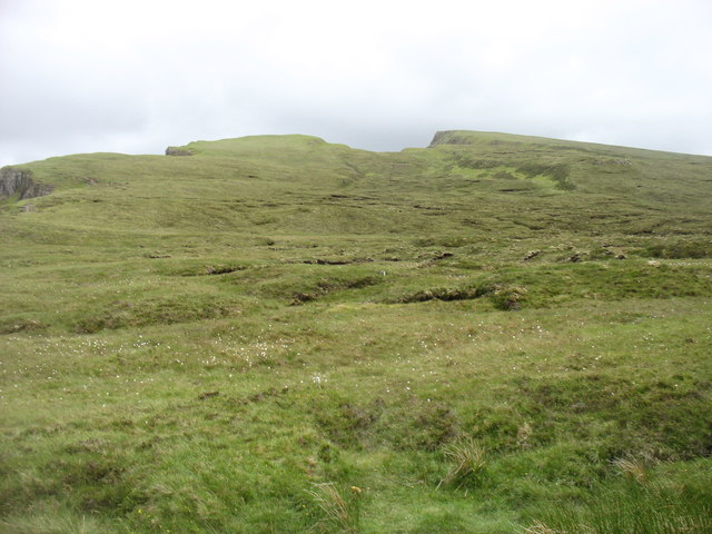
Sròn an Aighe is a prominent landscape feature located in Inverness-shire, Scotland. Situated near the eastern shore of Loch Ness, it is a high, rocky ridge that extends for approximately 3 kilometers. The name Sròn an Aighe translates to "nose of the water" in English, which is fitting considering its proximity to the loch.
The ridge itself is composed of rugged, weathered rocks and is characterized by steep slopes and craggy outcrops. Its elevation reaches a maximum height of around 400 meters, providing breathtaking panoramic views of the surrounding landscape. From the top, one can observe the vast expanse of Loch Ness, the rolling hills of the Scottish Highlands, and the nearby forests.
The diverse flora and fauna found on Sròn an Aighe add to its natural beauty. The rocky terrain supports a variety of plant species, including heathers, mosses, and lichens. Peregrine falcons, golden eagles, and other bird species can often be spotted soaring above the ridge, while red deer and Scottish wildcats roam the lower slopes.
Due to its scenic qualities and accessibility, Sròn an Aighe is a popular destination for outdoor enthusiasts and hikers. Several walking trails traverse the ridge, providing opportunities for both leisurely walks and more challenging hikes. Additionally, the ridge is a prime location for rock climbing, attracting climbers from near and far.
Overall, Sròn an Aighe is a striking landscape feature in Inverness-shire, offering stunning views, diverse wildlife, and recreational opportunities for visitors to enjoy.
If you have any feedback on the listing, please let us know in the comments section below.
Sròn an Aighe Images
Images are sourced within 2km of 57.615985/-6.3123937 or Grid Reference NG4266. Thanks to Geograph Open Source API. All images are credited.


Sròn an Aighe is located at Grid Ref: NG4266 (Lat: 57.615985, Lng: -6.3123937)
Unitary Authority: Highland
Police Authority: Highlands and Islands
What 3 Words
///remotest.jungle.guests. Near Uig, Highland
Nearby Locations
Related Wikis

Hebridean Light Railway Company
The Hebridean Light Railway Company proposed to operate on the Scottish islands of Skye and Lewis. The Skye line was to have connected the port of Isleornsay...

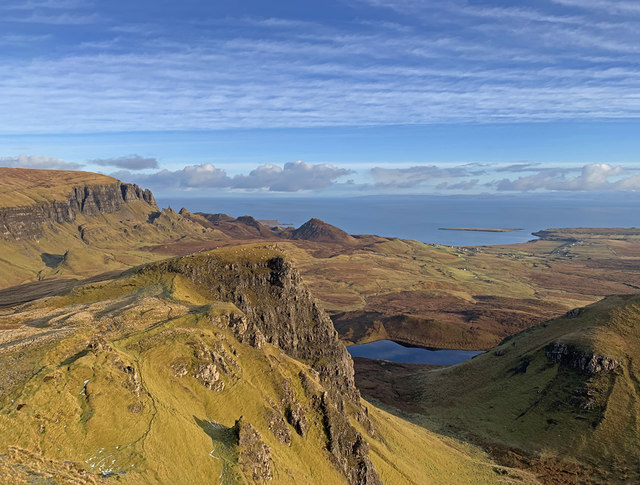
Quiraing
The Quiraing (Scottish Gaelic: A' Chuith-Raing) is a landslip on the eastern face of Meall na Suiramach, the northernmost summit of the Trotternish on...
Trotternish
Trotternish or Tròndairnis (Scottish Gaelic) is the northernmost peninsula of the Isle of Skye, in Scotland. Its most northerly point, Rubha Hùinis, is...

Uig, Snizort
Uig (Scottish Gaelic: Ùige [ˈuːkʲə]) is a village at the head of Uig Bay on the west coast of the Trotternish peninsula on the Isle of Skye, Scotland....
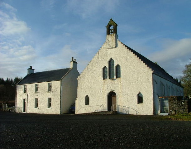
Snizort Free Church
The Snizort Free Church, is a place of worship of the Free Church of Scotland (Continuing) in the township of Skeabost in Snizort on the island of Skye...
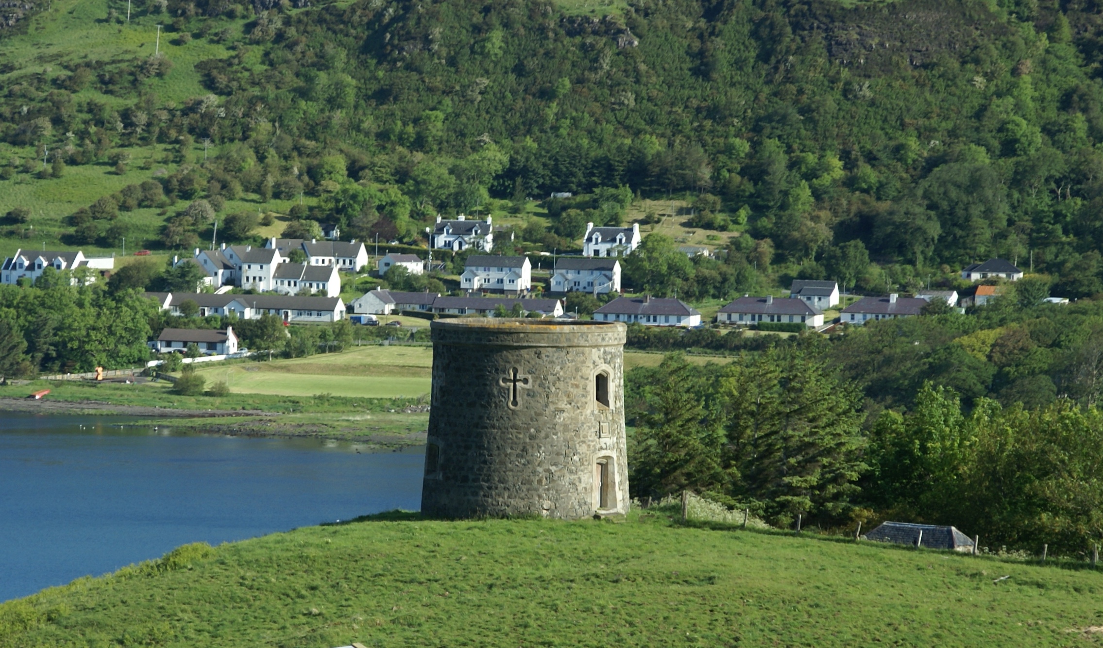
Uig Tower
The Uig Tower, also known as Captain Fraser's Folly, is a nineteenth century folly located in Uig on the island of Skye in the Highlands of Scotland. It...
Kilvaxter
Kilvaxter (Scottish Gaelic: Cille Bhacastair) is a crofting township on the Trotternish peninsula of the Isle of Skye in the Highlands of Scotland. It...

Idrigill
Idrigill is a small crofting village, on the coast of Uig Bay, on the west side of the Trotternish Peninsula, near Uig, in Portree, Isle of Skye, Scottish...
Nearby Amenities
Located within 500m of 57.615985,-6.3123937Have you been to Sròn an Aighe?
Leave your review of Sròn an Aighe below (or comments, questions and feedback).