Àird Mholach

Landscape Feature in Ross-shire

Scotland

Àird Mholach

Loch Eisgean and the houses at Eisgein
Loch Eisgean and the houses at Eisgein Credit: Mike Dunn

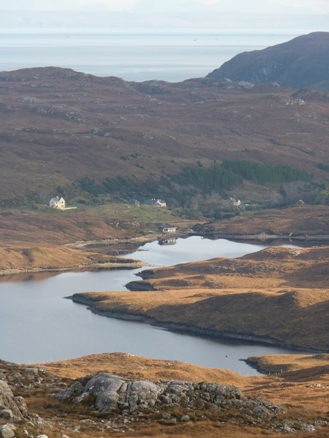
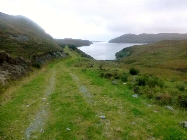
Àird Mholach is a picturesque landscape feature situated in Ross-shire, Scotland. Nestled between the rugged mountains of the Highlands and the tranquil shores of Loch Carron, this area offers breathtaking views and a rich natural environment.

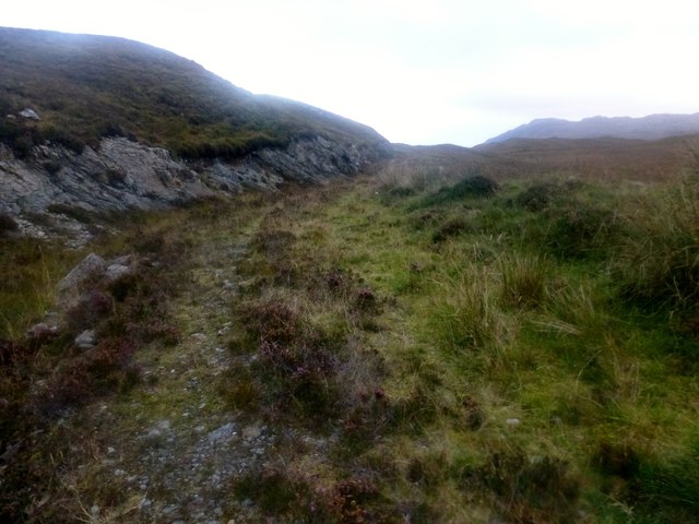
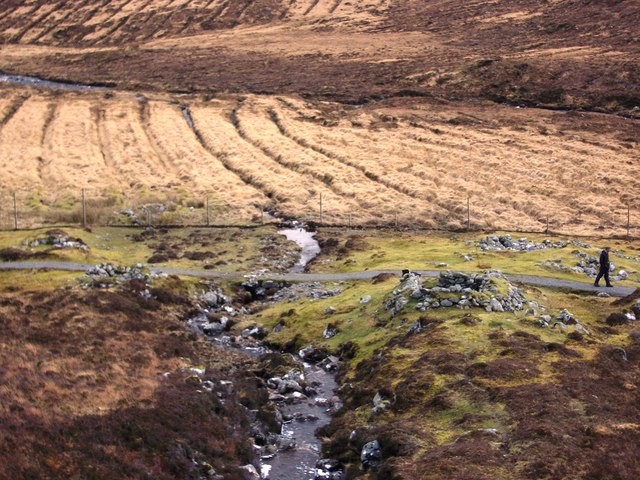
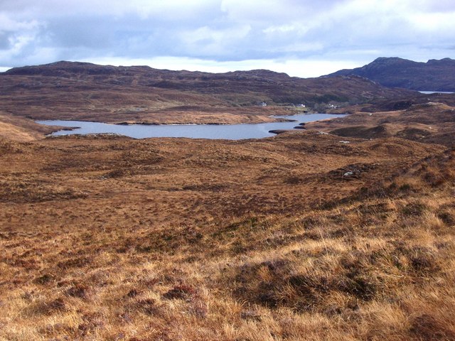
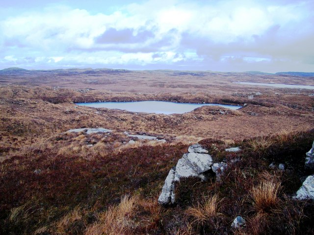
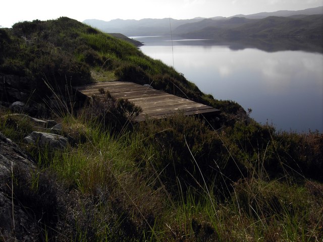
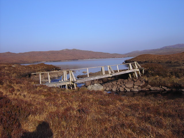
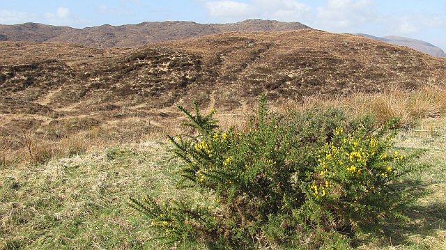
The main characteristic of Àird Mholach is its distinct topography. It is defined by rolling hills and expansive moorland, covered in a patchwork of heather and grasses. This terrain creates a peaceful and serene atmosphere, perfect for nature enthusiasts and those seeking a peaceful retreat.

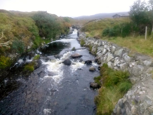
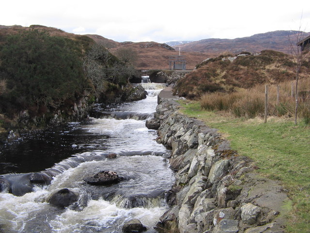
The area is also home to numerous freshwater lochs, adding to its scenic beauty. These lochs, such as Loch Calavie and Loch a’ Bhraoin, provide habitats for a variety of bird species, including golden eagles and ospreys. Anglers are also drawn to Àird Mholach for its fishing opportunities, with the lochs being renowned for their trout and salmon populations.

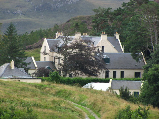
In addition to its natural beauty, Àird Mholach has a rich cultural heritage. The surrounding area is scattered with ancient ruins, including stone circles and burial cairns, which offer a glimpse into the area's history and the lives of its early inhabitants.

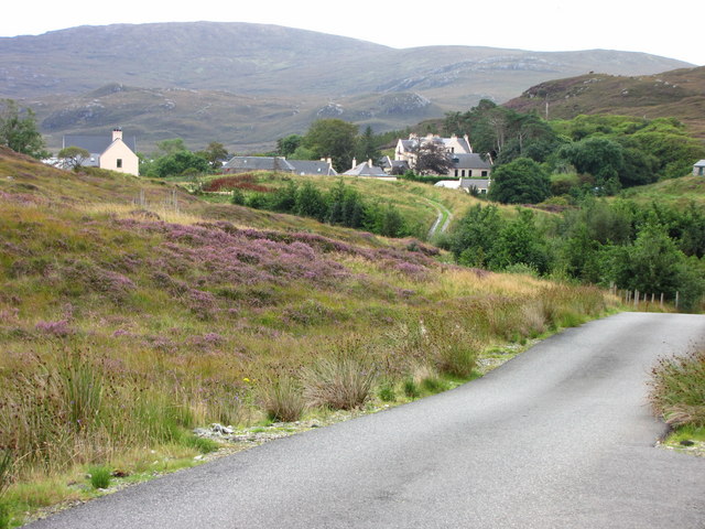
The accessibility of this landscape feature is another notable aspect. Visitors can explore the area via well-maintained footpaths and trails, allowing them to immerse themselves in the stunning scenery and enjoy activities such as hiking, cycling, and wildlife spotting.

In summary, Àird Mholach is a landscape feature in Ross-shire, Scotland, renowned for its rolling hills, moorland, freshwater lochs, and cultural heritage. It offers visitors a chance to experience the beauty of the Scottish Highlands and engage with its diverse natural environment.

If you have any feedback on the listing, please let us know in the comments section below.

Àird Mholach Images

Images are sourced within 2km of 58.019523/-6.5352533 or Grid Reference NB3212. Thanks to Geograph Open Source API. All images are credited.

Loch Eisgean and the houses at Eisgein
Rough Overgrown Track This rough overgrown track still fails to confirm that we are nearing the end of our walk out of the Park/Pairc.
Rough Overgrown Track
This rough overgrown track still fails to confirm that we are nearing the end of our walk out of the Park/Pairc.
Coastal View Near Tòb Eisgein The track is looking better maintained as a coastal view opens up on our route to Eisgein.
Coastal View Near Tòb Eisgein
The track is looking better maintained as a coastal view opens up on our route to Eisgein.
Loch Eisgean River Loch Eisgean River has a very short journey to the sea.  This is were I met my lift back to Tarbert.
Loch Eisgean River
Loch Eisgean River has a very short journey to the sea. This is were I met my lift back to Tarbert.
Looking towards Loch Mor Stiomrabhaigh
Tob Eisgein, Isle of Lewis View of boats on Tob Eisgein from the jetty at Eisgein on Loch Sealg
Tob Eisgein, Isle of Lewis
View of boats on Tob Eisgein from the jetty at Eisgein on Loch Sealg
Loch Eisgean River The outlet stream from Loch Eisgean on its short journey to the sea
Loch Eisgean River
The outlet stream from Loch Eisgean on its short journey to the sea
Gates at Eisgein, Isle of Lewis Gates to Eisgein about 2km north of Eisgen Lodge. Photo taken looking north.
Gates at Eisgein, Isle of Lewis
Gates to Eisgein about 2km north of Eisgen Lodge. Photo taken looking north.
Shielings in Gleann Cheothadail, Isle of Lewis A group of six (perhaps seven) ruined shielings in a remote area of the Isle of Lewis. Photo taken looking south towards the Abhainn Cheothadail which flows to Loch Feoir
Shielings in Gleann Cheothadail, Isle of Lewis
A group of six (perhaps seven) ruined shielings in a remote area of the Isle of Lewis. Photo taken looking south towards the Abhainn Cheothadail which flows to Loch Feoir
Blanket bog and lochan, Isle of Lewis
Loch Eisgean, Isle of Lewis Photo taken looking southeast across Loch Eisgean. Eisgein Estate houses in the distance with the summit of Mullach na ron beyond.
Loch Eisgean, Isle of Lewis
Photo taken looking southeast across Loch Eisgean. Eisgein Estate houses in the distance with the summit of Mullach na ron beyond.
Lochan and blanket bog, Isle of Lewis Photo taken looking east of unnamed lochan and part of Loch an Eilein (a very common name) showing to right of picture.
Lochan and blanket bog, Isle of Lewis
Photo taken looking east of unnamed lochan and part of Loch an Eilein (a very common name) showing to right of picture.
New Bridge A new bridge over a stream flowing in to Loch Sealg.
New Bridge
A new bridge over a stream flowing in to Loch Sealg.
Track to small quarry Stones from the quarry were probably used to build the road.
Track to small quarry
Stones from the quarry were probably used to build the road.
The not very safe bridge at the west end of Loch Eisgein
Eisgein Lodge Eisgein Lodge is deep in the Parc region. Viewed here from the estate road you get a good picture of the setting of the lodge. Once you reach the gates to the lodge the road is private and buildings are secluded by trees.
Eisgein Lodge
Eisgein Lodge is deep in the Parc region. Viewed here from the estate road you get a good picture of the setting of the lodge. Once you reach the gates to the lodge the road is private and buildings are secluded by trees.
Eisgein Lodge View from the estate road approaching the lodge.
Eisgein Lodge
View from the estate road approaching the lodge.
Moorland, Eisgein Moorland seen from the road shortly before its end at Eisgein. There has been some recent woodland planting near here.
Moorland, Eisgein
Moorland seen from the road shortly before its end at Eisgein. There has been some recent woodland planting near here.
Show me another place!

Àird Mholach is located at Grid Ref: NB3212 (Lat: 58.019523, Lng: -6.5352533)

Unitary Authority: Na h-Eileanan an Iar

Police Authority: Highlands and Islands

What 3 Words

///mailers.flame.gangs. Near Leurbost, Na h-Eileanan Siar

Related Wikis

Stiomrabhaig

Stiomrabhaig is an abandoned crofter's village on the Isle of Lewis in the Outer Hebrides. == History == The United Kingdom Census 1851 shows that the...

Park, Lewis

Park (Scottish Gaelic: A' Phàirc), also known as South Lochs, is a huge area of land connected to the rest of Lewis only by a narrow neck between Loch...

Orinsay

Orinsay (Scottish Gaelic: Orasaigh) is a crofting village on the Isle of Lewis in the district of Pairc, in the Outer Hebrides, Scotland. The settlement...

Gravir

Gravir (Scottish Gaelic: Grabhair), is a village on the shore of Loch Odhairn (a sea loch) in the Park district of the Isle of Lewis. Gravir is within...

Nearby Amenities

Located within 500m of 58.019523,-6.5352533
Eisgein
Name En: Eishken
Name Gd: Eisgein
Place: hamlet
Lat/Long: 58.016246/-6.5300158
Ford: yes
Lat/Long: 58.0226134/-6.5410051
The data included in this document is from www.openstreetmap.org. The data is made available under ODbL.

Have you been to Àird Mholach?

Leave your review of Àird Mholach below (or comments, questions and feedback).