Àird Mholach

Landscape Feature in Ross-shire

Scotland

Àird Mholach

Loch Sgoibacleit from Creag na h-Uamha
Loch Sgoibacleit from Creag na h-Uamha Credit: Mike Dunn

Àird Mholach is a distinctive landscape feature located in Ross-shire, Scotland. Situated on the northwestern coast of the country, it is characterized by its rugged terrain and breathtaking views of the surrounding area.

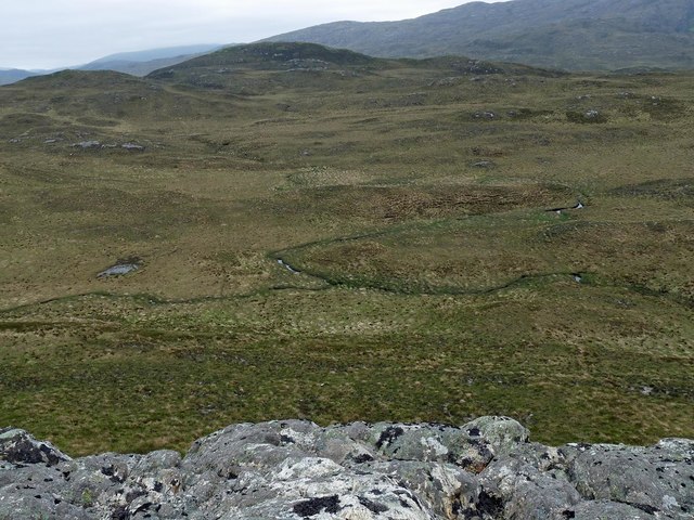
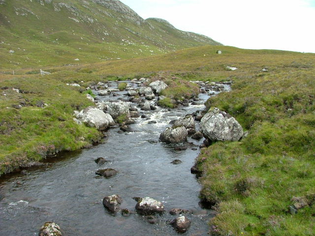
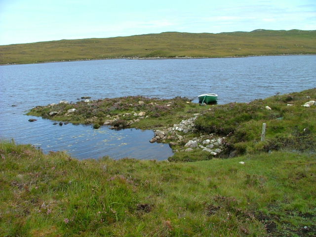
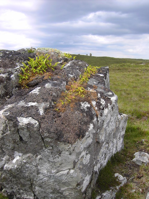
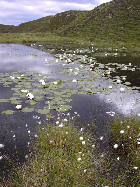
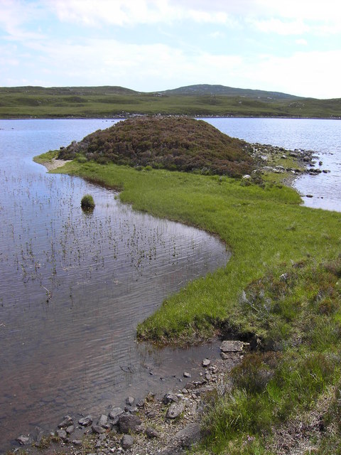
Covering an area of approximately 10 square kilometers, Àird Mholach is primarily composed of rocky cliffs and steep slopes, with an elevation ranging from sea level to around 200 meters. The terrain is dominated by a mix of heather moorland, grassy patches, and scattered pockets of woodland.

The coastline of Àird Mholach is particularly notable, with its dramatic cliffs and rocky outcrops providing a natural boundary between the land and the sea. The area is often subject to strong winds and rough seas, creating a dynamic and ever-changing environment.

Flora and fauna thrive in this unique landscape. The heather moorland is home to a variety of plant species, including bell heather, cross-leaved heath, and bog cotton. This diverse vegetation provides habitats for numerous animal species, such as red grouse, golden eagles, and red deer.

Àird Mholach is a popular destination for outdoor enthusiasts, offering opportunities for hiking, birdwatching, and photography. Its remote location and rugged beauty make it an ideal place to escape the hustle and bustle of everyday life and connect with nature.

In conclusion, Àird Mholach is a stunning landscape feature in Ross-shire, Scotland, known for its rocky cliffs, heather moorland, and breathtaking coastal views. It is a haven for wildlife and a popular destination for outdoor activities.

If you have any feedback on the listing, please let us know in the comments section below.

Àird Mholach Images

Images are sourced within 2km of 58.057683/-6.5471571 or Grid Reference NB3116. Thanks to Geograph Open Source API. All images are credited.

Loch Sgoibacleit from Creag na h-Uamha
Fence above Loch Ealaidh, Isle of Lewis The fence doesn't currently show on the OS 1:25,000 map (as viewed on OS Maps 26/06/16).

Part of the loch lies within the grid square.
Fence above Loch Ealaidh, Isle of Lewis
The fence doesn't currently show on the OS 1:25,000 map (as viewed on OS Maps 26/06/16). Part of the loch lies within the grid square.
View from Beinn Bhuidhe, Isle of Lewis Left is Loch na h-Inghinn, the section of which in the photo lies within the grid square.  Right is Loch na Cartach, all of which is within the grid square.  Beyond is Loch na h-Àirigh Meadhonach. Loch Odhairn on the coast can be seen in the gap on the horizon.
View from Beinn Bhuidhe, Isle of Lewis
Left is Loch na h-Inghinn, the section of which in the photo lies within the grid square. Right is Loch na Cartach, all of which is within the grid square. Beyond is Loch na h-Àirigh Meadhonach. Loch Odhairn on the coast can be seen in the gap on the horizon.
Confluence of the Allt Eitneach with a tributary, Isle of Lewis Taken from Cnoc an Uillt Eitnich.
Confluence of the Allt Eitneach with a tributary, Isle of Lewis
Taken from Cnoc an Uillt Eitnich.
Outflow from Loch Sgiobacleit
Highland Horses, Isle of Lewis Horses on Eisgein Estate at Loch an Eilein Liatha
Highland Horses, Isle of Lewis
Horses on Eisgein Estate at Loch an Eilein Liatha
Creag na h-Uamha, Isle of Lewis Photo taken from the Eisgein road in evening light looking southeast onto Creag na h-Uamha.
Creag na h-Uamha, Isle of Lewis
Photo taken from the Eisgein road in evening light looking southeast onto Creag na h-Uamha.
Mullach Breac Mhalasgair, Isle of Lewis Photo looking north to Mullach Breac Mhalasgair (172mAOD) and the western end of Loch Sgiobacleit.
Mullach Breac Mhalasgair, Isle of Lewis
Photo looking north to Mullach Breac Mhalasgair (172mAOD) and the western end of Loch Sgiobacleit.
Loch Sgiobacleit Looking east from the Eisgein road.
Loch Sgiobacleit
Looking east from the Eisgein road.
Loch Sgiobacleit Looking west from the Eisgein road.
Loch Sgiobacleit
Looking west from the Eisgein road.
Boat on Loch Sgiobacleit.
Loch Sgiobacleit
Loch Sgiobacleit
Moorland with an unnamed loch on the slopes of Malasgair
A boulder with lichen, moss and ferns Note the standing stone like boulders on the horizon.
A boulder with lichen, moss and ferns
Note the standing stone like boulders on the horizon.
Water lilies on an unnamed lochan
An interesting shoreline feature on Loch Seiobacleit
Loch na Cartach
Loch na Cartach
Moorland between Beinn Bhuidhe and Cnoc a Charnain
Show me another place!

Àird Mholach is located at Grid Ref: NB3116 (Lat: 58.057683, Lng: -6.5471571)

Unitary Authority: Na h-Eileanan an Iar

Police Authority: Highlands and Islands

What 3 Words

///goodbye.exclusive.condition. Near Leurbost, Na h-Eileanan Siar

Related Wikis

Loch Erisort

Loch Erisort (Scottish Gaelic: Èireasort) is an 8-mile-long narrow sea inlet on the east coast of the Isle of Lewis in the Outer Hebrides off the west...

Balallan

Balallan (Scottish Gaelic: Baile Ailein, Bail' Ailein), meaning "Allan's Town", is a crofting township on the Isle of Lewis, in the Outer Hebrides, Scotland...

Cabharstadh

Cabharstadh or Caversta (Scottish Gaelic: Cabharstaigh) is a village on the Isle of Lewis in the Outer Hebrides, Scotland. Caversta is situated in the...

Stiomrabhaig

Stiomrabhaig is an abandoned crofter's village on the Isle of Lewis in the Outer Hebrides. == History == The United Kingdom Census 1851 shows that the...

Have you been to Àird Mholach?

Leave your review of Àird Mholach below (or comments, questions and feedback).